Reflections on the Year – 2011

I thought that when I pedaled 5,000 miles in 2010 that that would become my new annual goal – the base by which all future years were measured. I now realize that 5,000 miles are a lot of miles for someone who works full time.

I fell short. Way short. Just 3,700 miles this year. And I really haven’t analyzed why. Some things stand out such as I biked home from work 14 times last year. This year, just three. That’s about 450 miles or so. But where are the other 800-900 miles?

Sometimes I ride to remember. Sometimes I ride to forget. But last year I just rode. I guess this year I just didn’t have as much to remember. Or to forget.

Ironically, last year my total mileage was never a goal and in some ways, I was wrong to think of it as the goal for every year. Just ride. Enjoy the air. The sun. Even the rain. But most of all, enjoy the ride.

It is said this monument on the Col du Tourmalet, is for any cyclist who can bike to the top. I have a monument.

My Top Ten Rides (in no particular order)

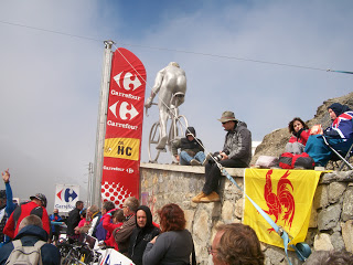
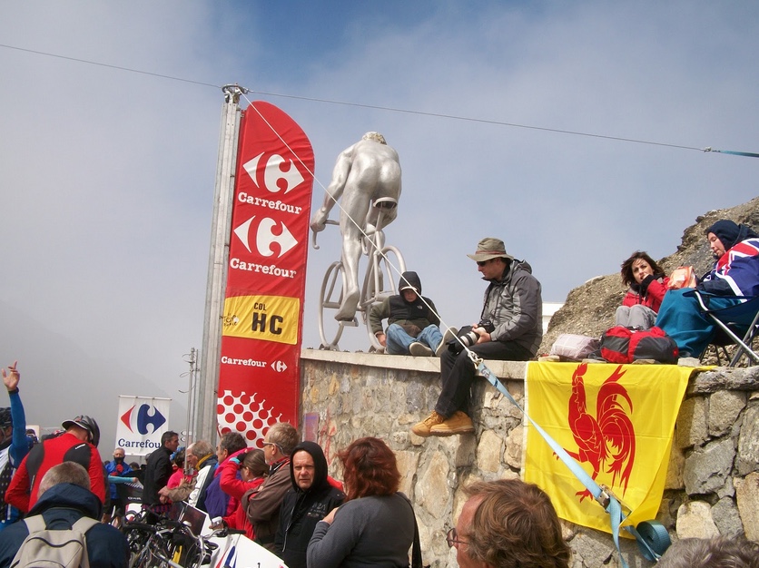
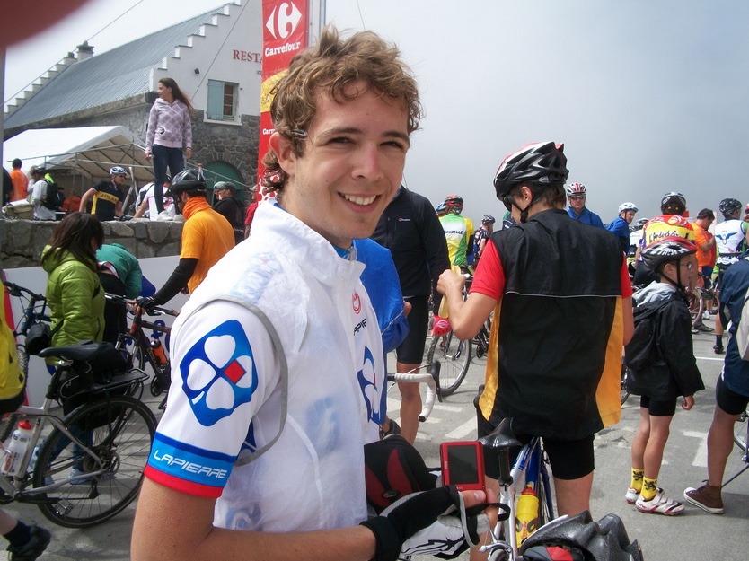
  1. Col du Tourmalet. We never made it to the summit last year because we were blocked by the Tour de France. Twice. This year, riding with Adrian Register, I made it. Added bonus: I handed Stuart O’Grady a newspaper while he rode by (so that he could insert it in his jersey for warmth).
Adrian Register

2. Civil War Century. Rode slower than last year. And cramped. But this route is special. How can one not be moved when riding through Gettysburg?

Two of us wearing the same Alp d’Huez Jersey. How embarrassing.

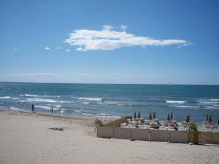
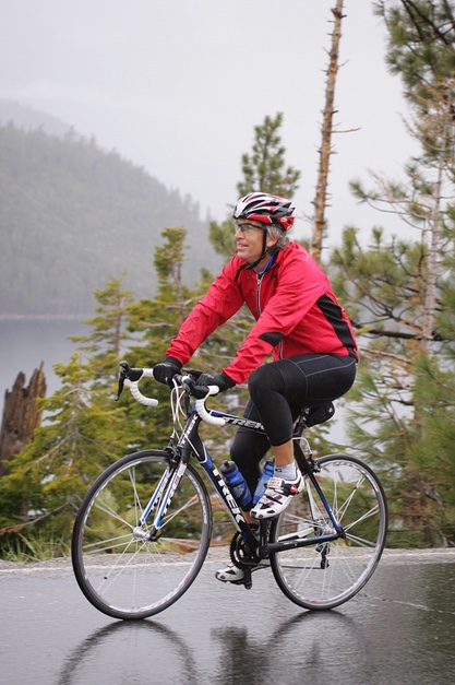
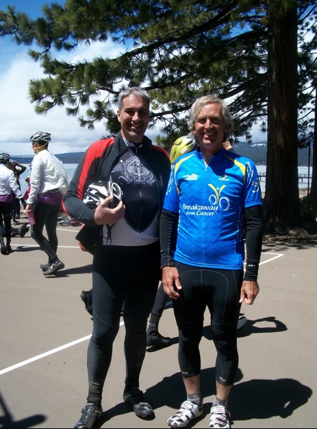
3. America’s Most Beautiful Ride. Thirty-eight degrees and raining at the start at Lake Tahoe. Never higher than 50°. But the best I ever felt on a bike for 100 miles. And it was beautiful.

Emerald Point, Lake Tahoe

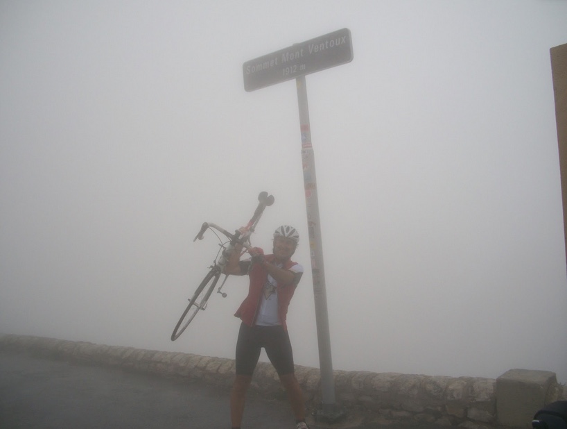
4. Mont Ventoux. Cold and rainy. And windy – 50 mph at the top. But cross one off the bucket list.

Mont Ventoux

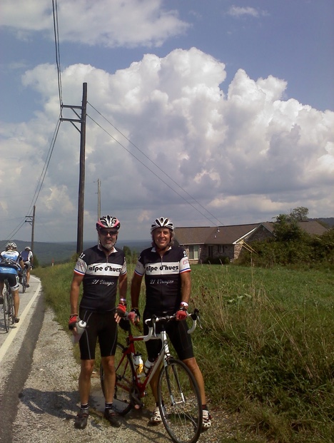
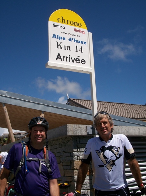
5. Alpe d’Huez. The nicest day I had in France and I was joined by my friend, Brian Hutchins, for the climb up this iconic mountain.

Brian Hutchins, Barry Sherry

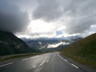
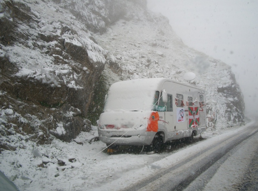
6. Col du Galibier. I did not make it and am not ashamed to admit it. Cold and rainy at the start, it got colder and wetter the farther up I went, to the summit of the Col du Lautaret. It was simply the coldest I have ever been on a bike. I turned around and went hypothermic on the descent. After drying off and changing clothes, I drove to the top – through 3-4″ of snow. I later learned 200 cyclists had to be rescued from here two days earlier. It was July 19.

Going up Galibier

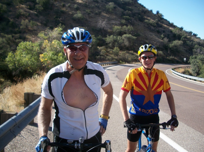
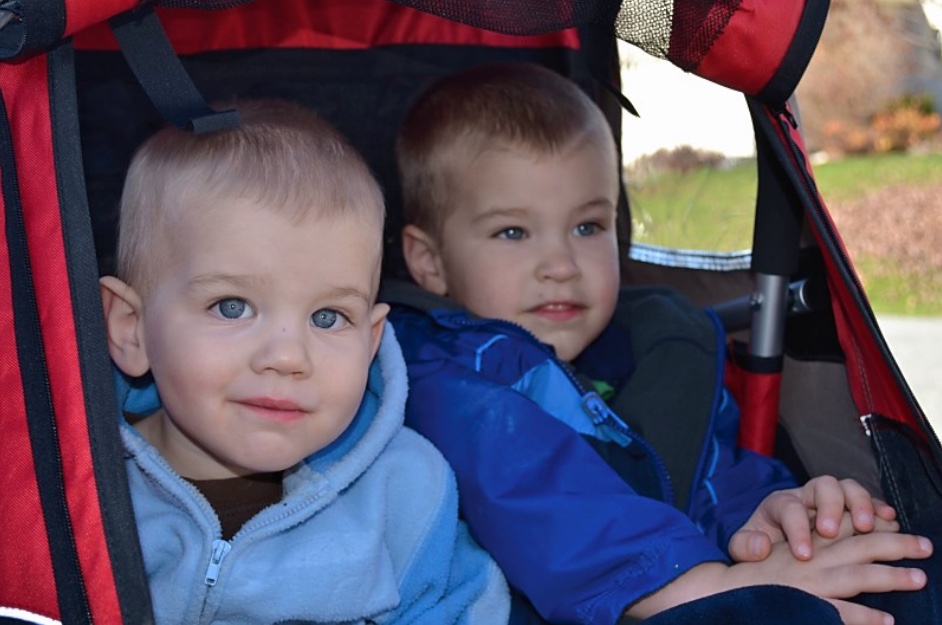
7. Pulling the Grandkids. I bought a child’s trailer for the bike and was able to take grandsons Andy and Aiden for a few loops of their neighborhood on Thanksgiving Day. And on Christmas Day at our house, the kids wanted — to go for a ride with Grandpa.

Grandkids

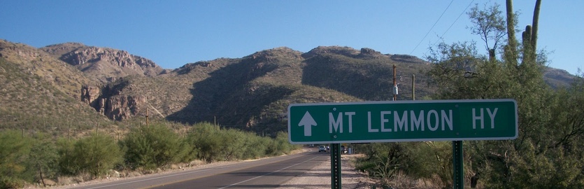
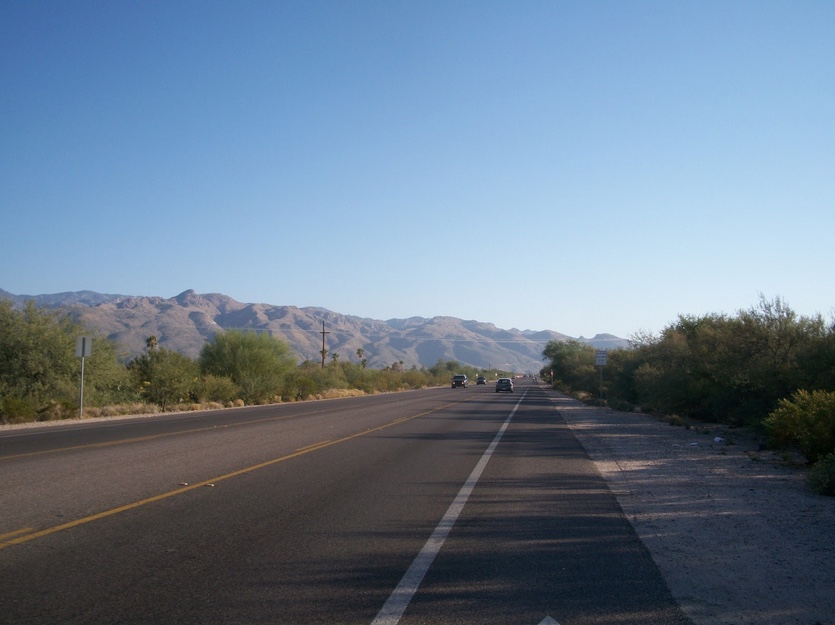
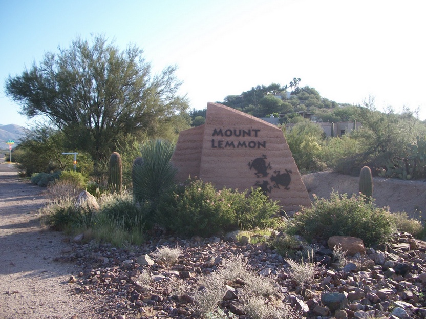
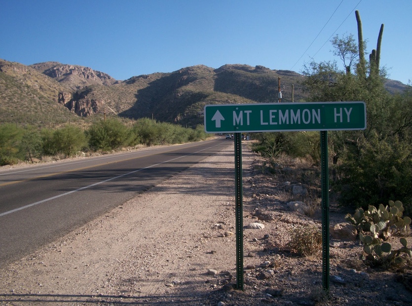
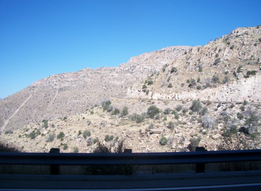
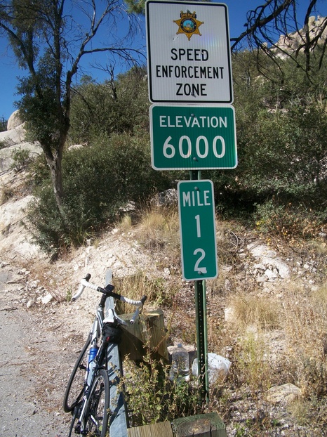
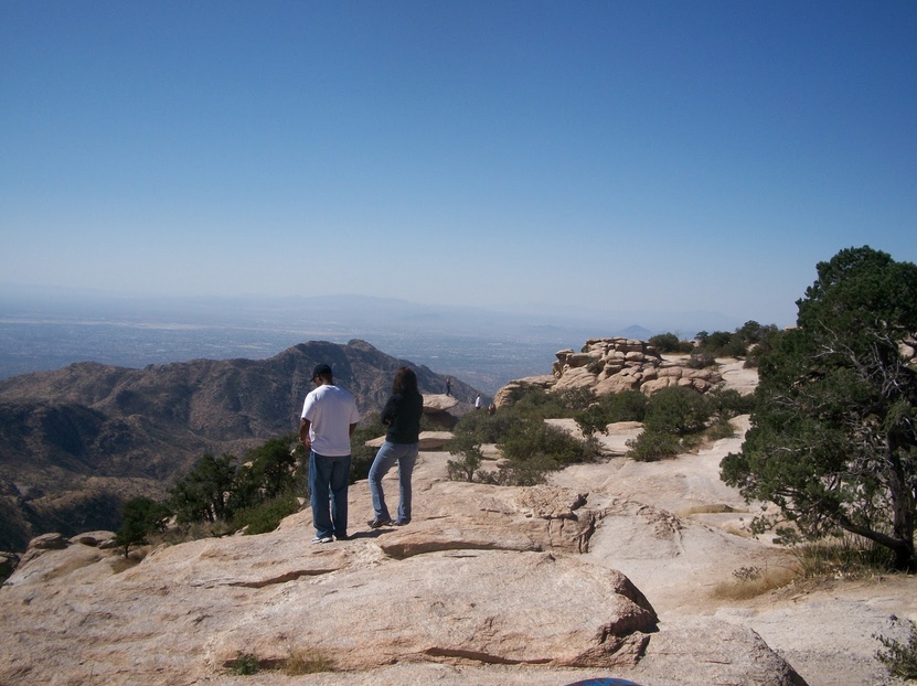
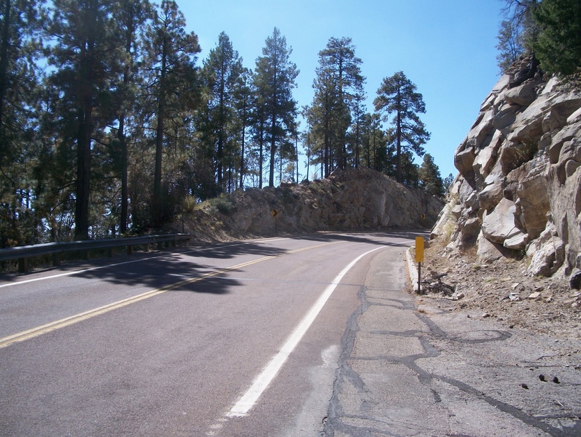
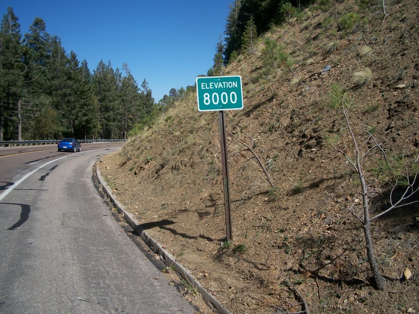
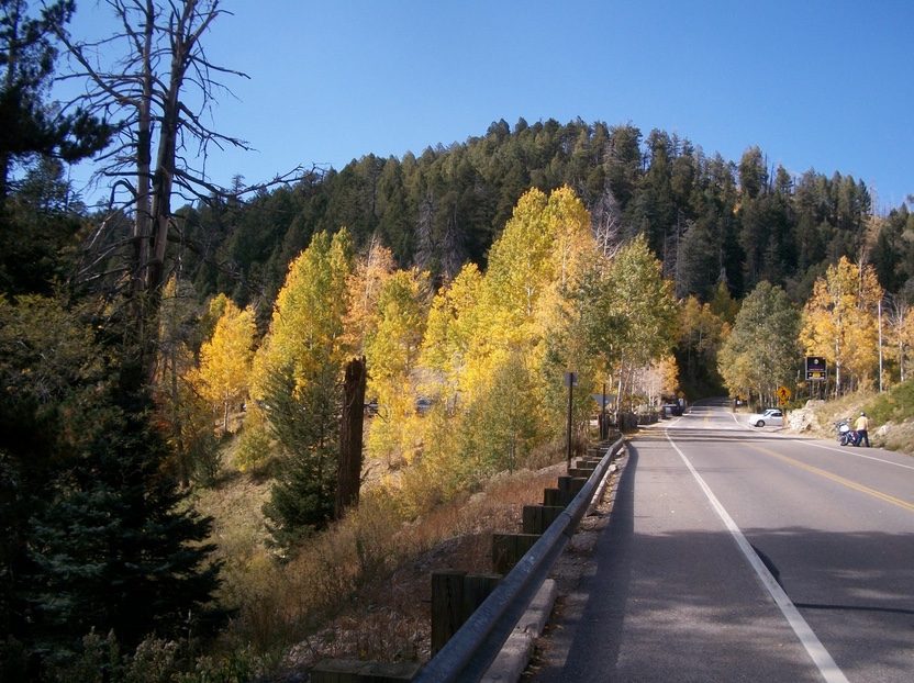
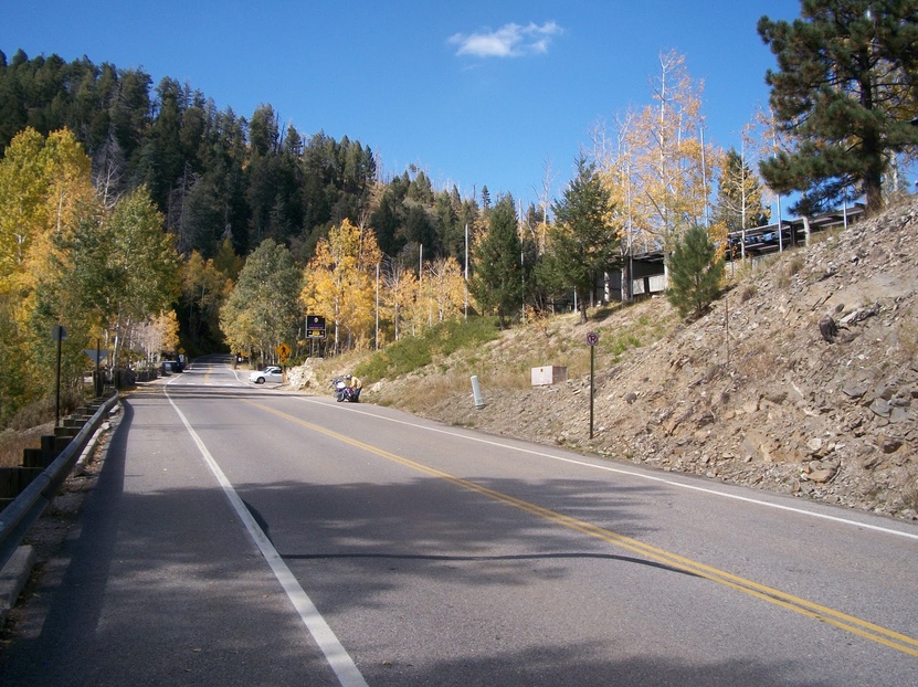
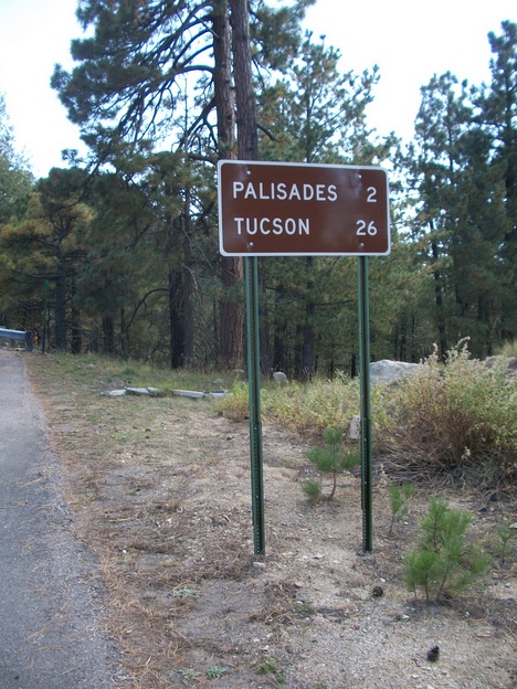
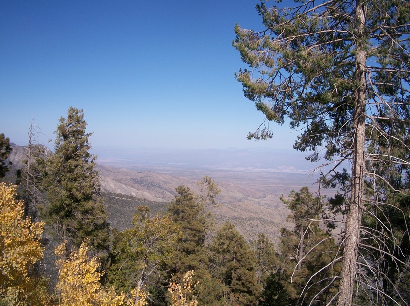
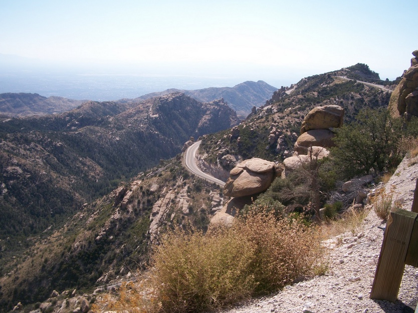
8. Mount Lemmon. A 26-mile climb in the heat from 2,500′ to 9,000′ through six different ecosystems. Tucson, Arizona.

The road to Mt Lemmon

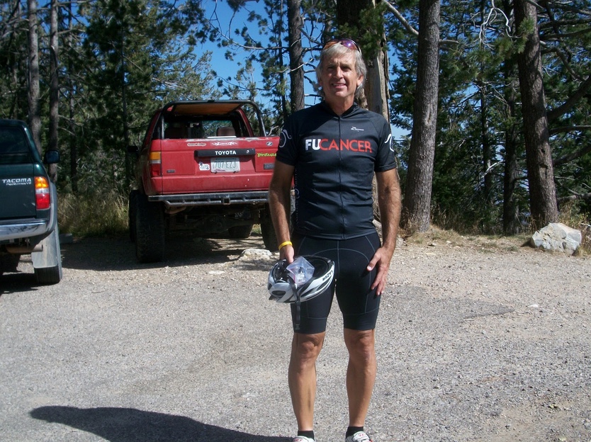
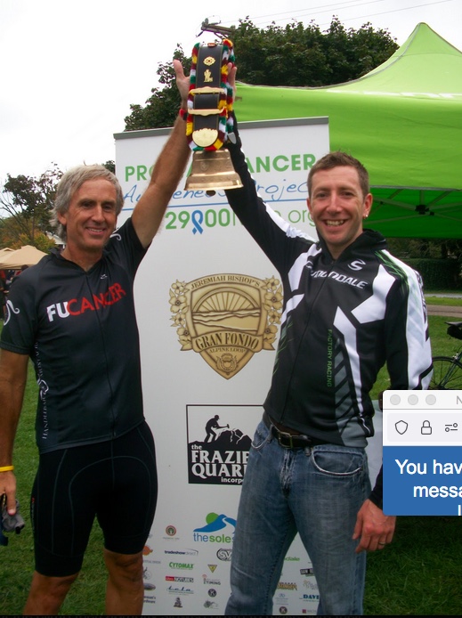
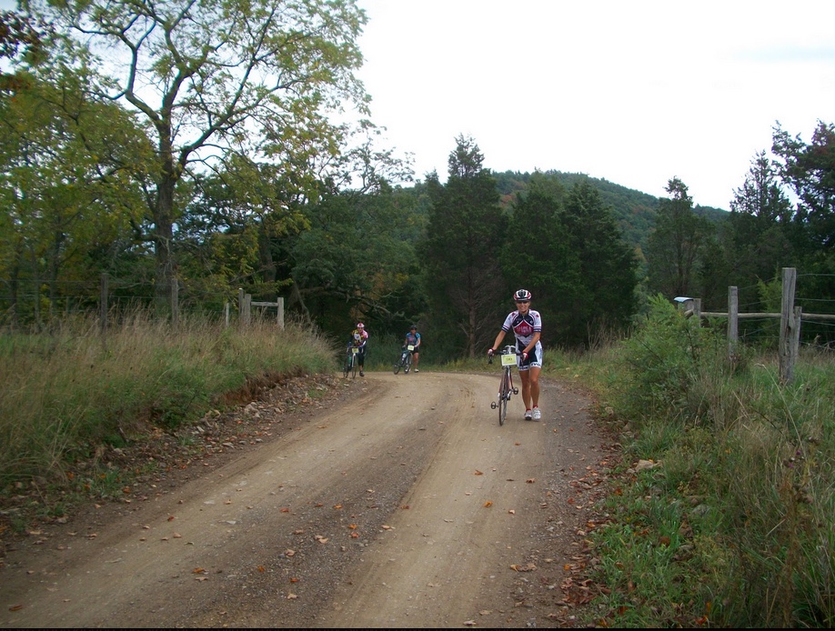
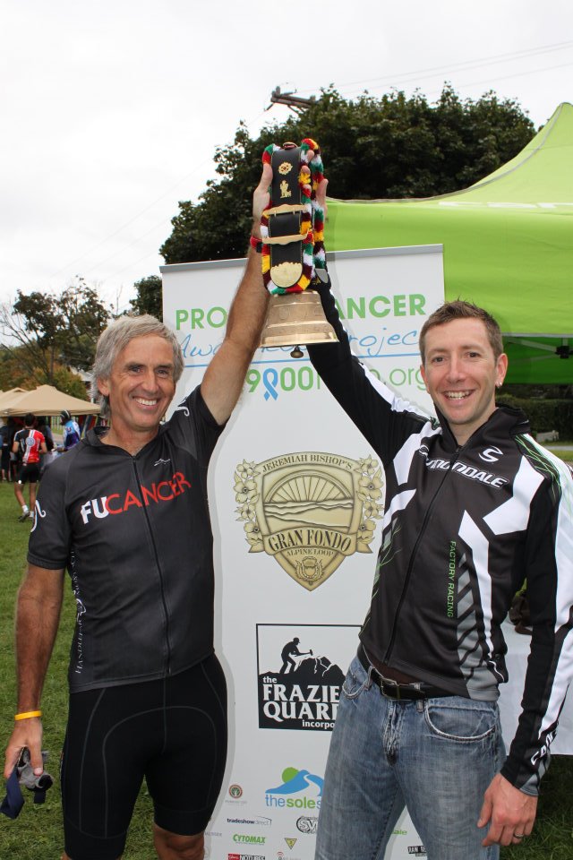
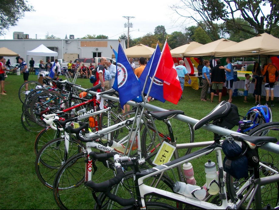
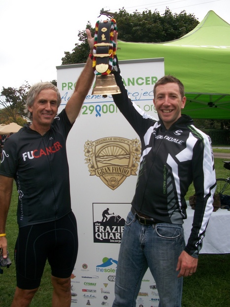
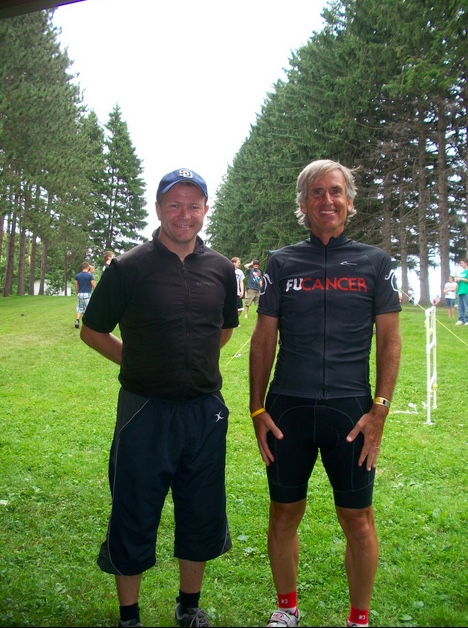
9. Jeremiah Bishop’s Alpine Loop Gran Fondo. The first hill I ever walked, 18% grade and mud. Just mud. (Gravel) But finally, a charity ride for prostate cancer.

Barry Sherry, Jeremiah Bishop

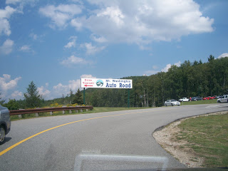
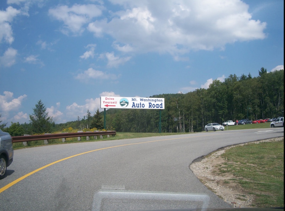
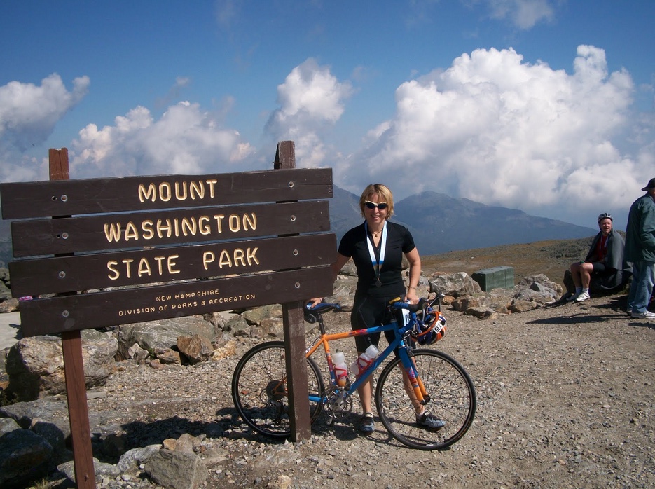
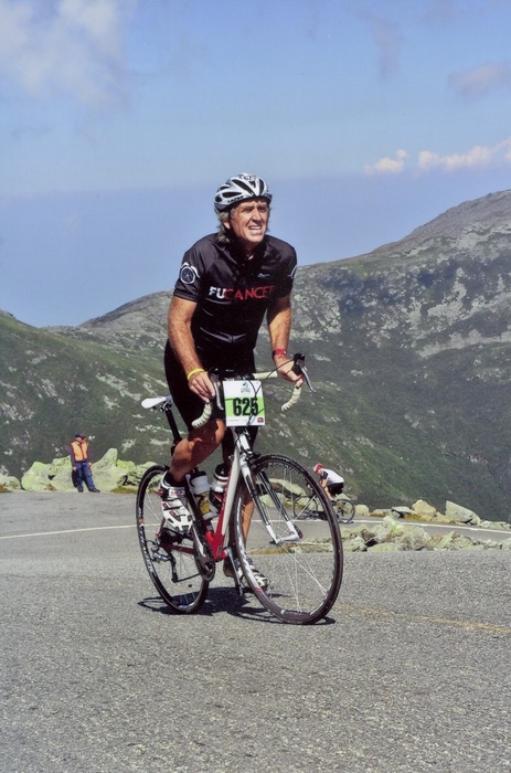
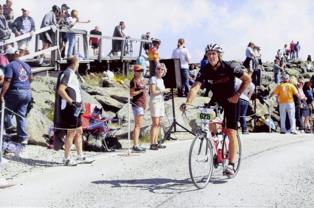
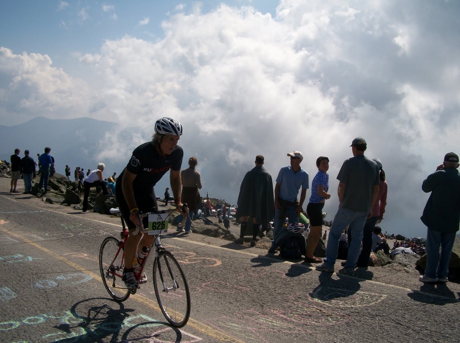
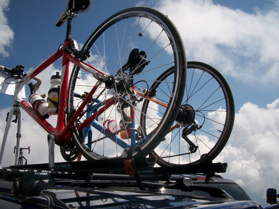
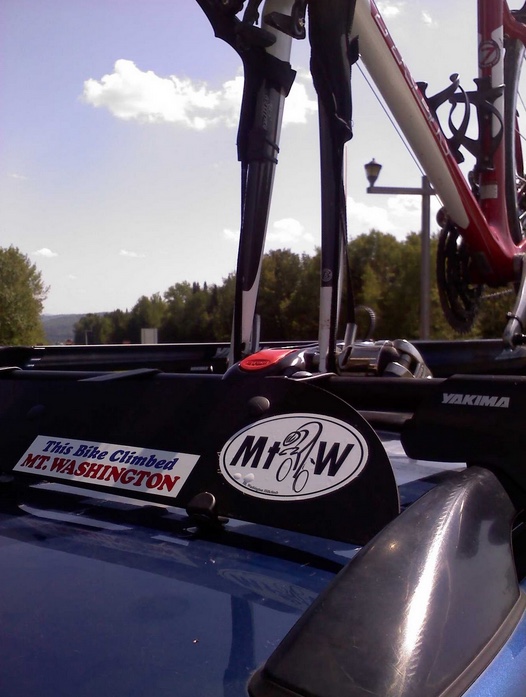
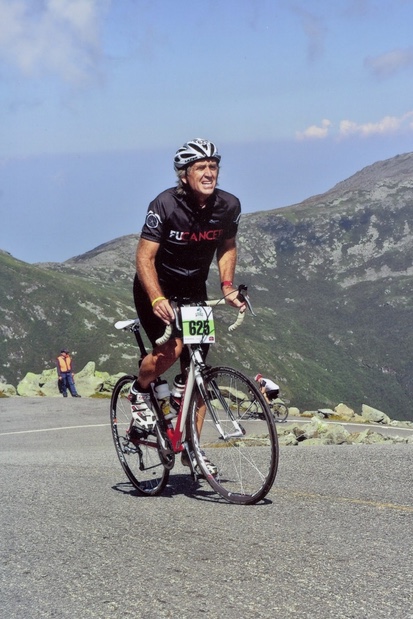
10. Mount Washington Auto Road Bicycle Hillclimb. My fourth climb up this iconic mountain, this was the first time my wife, Cheri, joined me. She was impressed by my suffering.

At Six-Mile Curve

In addition to the riding, I met some very nice people along the way. At Lake Tahoe I met Rodrigo Garcia Brito — he and I would be riding partners for the entire 100 miles (or 98).

Rodrigo, Barry

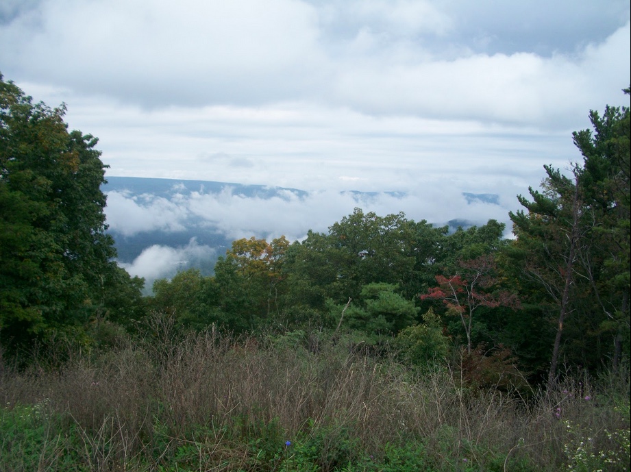
Along Rte 31 on the Allegheny Plateau near Somerset, Pa., I met Rolf, from Denmark, who was exploring part of the U.S. I invited him to my niece’s graduation party to feed him. (I called first to make sure it was OK, OK?)

Rolf from Denmark, Barry

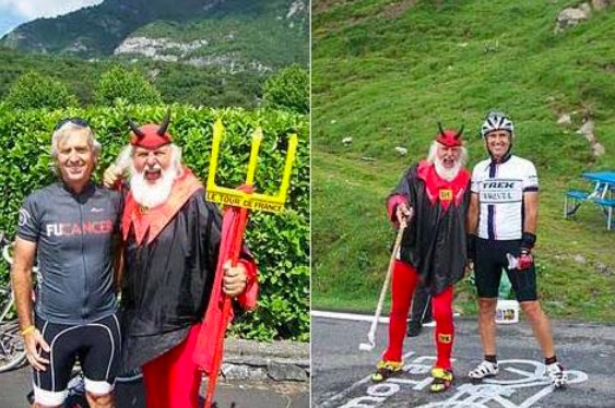
Many people go to the Tour de France and hope to see “The Devil,” a Tour fixture for years. Most never see him. I saw him twice and was photographed both times.

L-Near Lourdes; R-Col du Tourmalet

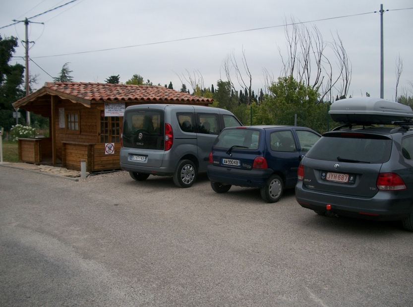
But it’s a random act of kindness I will most remember. Near Carpentras, France, I had been locked out of my prepaid B&B. All the hotels in the city were full. I had no place to go. I found a campground, Camping Les Fontaines, just as they were closing at midnight, or was it 1:00 a.m.? They were sold out. But I didn’t have a tent anyhow.

Camping les Fontaines

The owners graciously allowed me to park in their lot – which was all that I wanted. And brought me a pillow and blanket. And offered me a towel. It wasn’t the most pleasant night I had sleeping – in fact it was pretty awful – but when I slept I knew I was safe.

Camping les Fontaines

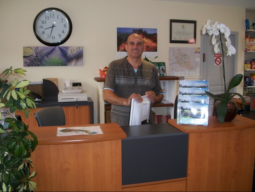
I would have gladly paid for a space but they didn’t charge me.


In 2011 I missed my mileage goal and I will have to rethink whether I want that to be a goal for 2012. Some of my best rides (Mount Washington – 8 miles) weren’t about the mileage. But at the end of the day, or at the end of the year, I should not be disappointed where the road took me.

Who knows where the road leads in 2012?


EDIT (2020) – In looking back at this post some nine years later, I was fretting about only riding 3,700 miles while saying it’s not about the miles. In retrospect, this was one of my favorite years. It really isn’t about the miles but the experiences can be anywhere.

A Perfect Fall Day for a Ride

THE PLAINS, VIRGINIA

With a forecast of 68° (it didn’t materialize but it did get to 62°) it was a perfect day to ignore the leaves piling up in the lawn and go for a ride.

I found a “CC” ride and decided I would jump in. But I arrived at 9:58 a.m. and decided not to rush but just leave on my schedule although the group was rolling out at 10:00 a.m.

There is something about pulling up with license plate marked UPDHEZ and wearing a jersey from Alpe d’Huez. It’s like a target on my back — I am expected to be better than anyone else.

ALPDHZ was taken so I got this plate to commemorate climbing L’Alpe d’Huez. Intimidating, huh?

As the group rolled out there was one other person who was getting ready. He looked at me and said “You don’t look like you’ll have any problem catching the group. Yea, a big ego stroke. So I waited for him to get ready.

Caught our group in Aldie

We were “wheels down” at 10:10 a.m. We rode at a sensible pace — never hammering it to catch the group because we knew with our pace we would catch them. And we did just 7.5 miles into the ride. But the group was already strung out so we rode through the group, overtaking 10-12 more riders, one each at a time.

Like many group rides, we’re not much on formality. I never did catch the name of the guy I rode with. You never know if you’re going to ride with someone for 10 minutes or 10 miles.
At times as we rode I thought he might drop me then other times I was stronger, but as we approached Aldie I did pull away. For good.

Break time – in Aldie

At the Aldie rest stop, I was anxious to keep moving. I’m not a fan of rest stops unless it’s 100° and the lower level the ride the longer the rest stops are and just drag on. As soon as the first three guys left I jumped in and joined them. Greg, Adam, and John. The guy I first rode with was still resting. (I only know these guys names because they asked me mine with about five miles to go after we had ridden together for 30 miles.)

New ride partners

They had been riding together for the first 15 miles and I jumped in without a word. I sort of had to prove that I belonged. I stayed with them until the next hill and then took off. First up the hill. Then I soft-pedaled. I belonged.

A “selfie”

After the rest stop at Atoka, and I tried to convince them not to stop, I set the pace for the next two miles. Then I quietly pulled off and moved to the back. Without a word, they were all experienced enough to recognize that we should ride in a paceline with each rider taking turns at the front.

And we did. My last two pulls ended up with me pulling away so I simply backed off the pace. I never thought of hammering home solo today although I knew I could pull away by myself.

This is horse country, lots of money here, and I saw deer running through the woods and jumping over the fences. So graceful. So beautiful. And I thought how differently I see them from some of my Facebook friends who see them only as a target.

Near the end, we were adjacent to Great Meadows at The Plains, Va., home of the Gold Cup races. It was a beautiful four miles back to start. We passed a farm stand with fresh produce and apple cider. It is definitely Fall in Virginia.

As we pulled back into town I went to the front, but not attacking and being a jerk, just enough so I could say “last to start, first to finish.” I had no problem with the pace today — we rode at a BB clip and may have been one of the last good days of the year for a long ride.

I left the parking lot, then stopped by the farm stand and bought their two remaining jugs of cider. I love riding. I love Fall. I love cider.


Distance: 50.8 miles
Average Speed: 16.1 mph

Mt Lemmon – A 30-Mile Climb

TUCSON, ARIZONA

Peter Jenkins, author of a A Walk Across America, wrote something to the effect that if two strangers told him he should see something he took notice but if three did, he had to do it. I have made that sort of my mantra in life too.

Traveling last May from Oakland to Phoenix I flew with Dr. Paul Mittman who told me I should come out and ride Mt. Lemmon. I had never heard of Mt. Lemmon. Then one of the riders on last year’s Tour de France trip, Deirdre Mullaly, told me about riding Mt. Lemmon. That was two.

Last Christmas, Adrian Register from Great Britain was visiting his grandmother in Arizona and rode Mt. Lemmon. And he also told me that I must do it. 

That was it. Three recommendations from three people who don’t know one another.

Mt. Lemmon, it is.

Broadway Bikes

Although I have a nice bike crate, it is still such a pain to fly with a bike that for one day I decided to rent. I located Broadway Bikes, online, and made a reservation. I picked up the bike Friday at 5:00 p.m., found an In N Out Burger for dinner, then went back to the hotel.

Dinner of Champions

Wheels down at 8:00 a.m. I was at the Safeway at E. Tanque Verde and Catalina Hwy, it was 66°. 

The first four miles were on Catalina Highway a straight-as-an-arrow road that leads to the base of the climb. Then the road kicks up.

Catalina Highway

I rode for a little while with a man and his exchange student son from Madrid. Like many cyclists, he was very nice but we didn’t hang around long enough to exchange names. In many ways, cyclists are just two ships just passing in the night and there usually isn’t any attempt to become personal. I may be the exception because I enjoy meeting people.

A Man and his Madrid exchange student

But we rode and talked and I found they were only going to Mile 5 or 6. He asked if I was going to Mile 10 and seemed surprised when I told him I was going all the way to Mount Lemmon. I didn’t have a good feel for where the road would lead me – I just knew the road signs pointed to Summerhaven, some 25 more miles ahead. And up.

At Mile 5, or 6, they pulled over and I kept going. At first. As we said goodbye he turned and offered me his water. I said no. As I rode away I thought differently, turned around, and told him that I would take him up on the offer. 

He told he I didn’t have enough water to make it to the top and he was right. I finished off one bottle then refilled it. It was like having three bottles instead of two. But I would want four.

Catalina Highway

At the base of the climb you are in the desert with tall Sagura catci all around. The Tucson valley is at approximately 2,500 feet. I’ve read there are six different eco systems; it’s like driving from Mexico to Canada in a span of 30 miles. I can point out four and I’m no biologist.

At 5,000 feet,  the cacti are gone and you are in a barren area with lots of rock croppings. Yet higher about 7,000 feet, you’re in a fir forest and at 8,000 feet there are Aspins. 

I don’t think there were many cyclists on the road. I would guess less than 50. I do think at 8:00 a.m. I was one of the last to start the climb. And for good reason. It gets friggin hot in the desert, even in late October. But what goes up must come down and most cyclists seemed to be coming down while I was going up.

Look carefully. Someone left water in a jug by the pole. It was hard but I resisted the urge to fill up from this jug. Actually, I should have but maybe it was hot water.

Notice the retaining wall for this highway at the top of the picture

At Safeway, as I was getting ready, a couple was also getting ready to go and I thought I might jump in with them but decided not to. They were never far ahead of me and I sawe them turn around about Mile 10.

This couple thought the views were nice. They were overdressed.

The road seemed to average 5-6% which makes it the equivalent of the first seven miles of Skyline Drive coming out of Front Royal, Va. Except this would be for 30 miles. In the heat.

Looking back, and down, at the road just climbed

As I saw people going back down I was beginning to wonder if I should do this. Or if I should go all the way to Mount Lemmon. Yet I came for this purpose and there would be no turning back.

No water for you. (In fairness, I may have looked parched but neither did I ask for any.)

Halfway up I was passed by four guys with Carmichael Training Systems. This is a training camp that cyclists can go to. They were in their 30s and 40s and I thought about riding with them but wisely decided not to. Running out of water, I passed their support person. He was holding out new water bottles for the paying customers. I wanted him to offer me some water but he did not.

I was allocating my water — one sip/gulp every mile, when I came to the Palisades Campground around Mile 25 and saw the one source of water on the ride. I pulled over and filled my bottles from the faucet.

Water! at Palisades Campground. I hope it was free.

Back on the climb the four guys came whizzing down past me. I thought it strange they didn’t go to the top but in 200 meters or so I was at a summit. It was clear this was where they turned around but where was Mt. Lemmon? I kept going.

I was flying downhill over the top and wondering where the heck I was going. The only thing for sure was I was getting there fast and eventually, I would have to turn around and climb this on the way back.

Three miles later I was in Summerhaven, and after missing the turn and righting myself by talking to a local, or at least a local tourist from Tucson, I started the climb up the ski road. After almost 30 miles of climbing at 5-6%, the road kicked up to 8-9% with grades of 12%. I was hurting.

Aspens

I passed a famous pie restaurant (I know because it said “famous pie restaurant”)* and entered a section beyond a gate. I saw a sign for “next two miles” and wondered how I could finish this climb after having climbed for 30. But I must. It’s one time. It’s Mount Lemmon.

I’m not the strongest climber – just enthusiastic, and my bike is made from carbon fiber (light) with a triple front ring (low of 30 teeth) and a pretty helpful 27 or 28 tooth cassette on the rear. I rented an aluminum bike (not as light) with compact crank (low of 34 teeth — harder than 30) and a rear cassette of 23 (much harder than 27 or 28). I divided one number by another and I calculate that it was 38% harder with this gear setup than the one at home. I may be grossly wrong because it didn’t feel any harder than maybe 35%.

At top of Mount Lemmon

I really did not look ahead at the road – just kept turning over the pedals. At the end of the two miles I came to a small parking lot and the road was fenced off with a no trespassing sign. The end.

The Summit. I guess.

There was no summit sign. In fact, I don’t think this was the true summit if there is a true summit. But it’s as far as the road allowed. I met three women from Germany having a picnic in the back of a pickup truck. They were gracious enough to take my picture and offered me a tomato. I declined the tomato.

Barry meets Mt. Lemmon

I headed back down the road, and came to a hairpin curve and pulled over for another photo op. None up here offered a clear view but this was one of the best. Two women had pulled over and were picnicking by the drop off. They offered me a nectarine and strawberries. I accepted.

Just don’t hit a bear

Back on the road, I hit 45 mph, disappointed that I didn’t hit 50, but I wasn’t on my own bike and the road didn’t allow for more. At Summerhaven, I began the three-mile climb back up to Palisades. Shut up Legs!

All downhill to Tucson

Once I crested at Palisades I began the 30-mile descent to my car. And it was sweet. While many curves were marked at 20 mph for cars, I never had to brake. Not once. I even went through one at 40 mph.

Reaching the valley floor it was hot – it hot 100° – and I regretted not having stopped for more water before my descent. I was parched, again, but the car was only 5-6 miles away.

I reached the car satisfied. Mount Lemmon is a beautiful ride. Water is probably the hardest thing to prepare for. If I did it again I would probably carry a couple of water bottles in my jersey as well as on the bike. Or a Camelbak.

Dr. Mittman. Deirdre. Adrian. You were right. This was one super ride.

___
*This was the Sawmill Run Restaurant

Alpine Gran Fondo

This was two events in one. Or at least that was my expectation. It was the inaugural Jeremiah Bishop’s Alpine Gran Fondo and a fundraiser for the Prostate Cancer Awareness Project. The cycling event was pretty neat. The fundraising portion was disappointing.

First the cycling.

Jeremiah Bishop told me last night that he planned to call all the fundraisers upfront for the rollout. However, when we started, he got in position behind the police car and he called for bib numbers 1-15 to join him. Instead, a number of jerks simply move to the front. So most top fundraisers were pushed aside. Maybe they didn’t hear? I had Bib #3.

An Alpenhorn signaled the start

We rolled out and I was quickly in about 10th position. I think for at least the Gran Fondo riders (there were two other routes as well) we stayed together as a peloton for the first 11 miles. Once we got on US 33 the pace picked up or I started to drop back. Doesn’t matter. I was wearing four bibs on my back, the only person to honor or remember those fighting cancer, and I decided that no one would see them if I stayed in 10th position. So I drifted back.

Although not a race, we had two timed King of the Mountain climbs. The first one was on US33 and the peloton sped up as we approached the start of the climb then abruptly slowed down to make sure their timing chips were read. I stayed in the back. I was the last to go through although I think at this point we had a major split in the peloton and I foolishly had been hanging with the first group led out by Jeremiah Bishop.

The climb on the lower slopes of 33 was pretty easy but I thought I would catch and pass someone. Anyone. Nope, no one. Then about halfway up the climb some riders from the second group began to catch and pass me. In all, I was probably passed by 20 riders and passed no one. Nada. It’s the first time on a climb with other riders I don’t remember catching anyone. That’s what I get for hanging at the front.

View of West Virginia from the top of US 33

After a screaming descent where I caught some other riders, followed by a brief rest stop, we rolled out to our next turn and this warning sign: “Gravel.” If only it had just been gravel. It was a mud road. The GPS quickly registered 12% and I tried to find a line where I could sit and pedal. I made it up the first mile and a half then saw everybody ahead had dismounted and were pushing their bikes. The GPS registered 25%. I was determined to pass them all. Until all I did was spin. Then I joined them.

I thought I could go where no one had gone before but it was the wise decision to dismount before I fell. It would be fun to tackle this section on a day the road was dry.

I was wise enough to have brought cleat covers which I used while walking in the mud and dirt. Others weren’t so lucky as they reached the top of the climb and found their cleats wouldn’t clip in because of the grit.

Part of the mud climb. This section was good enough to ride.

The profile of the route shows four major climbs. The first, basically the first 23 miles, was on US 33 and had good pavement. The second, around mile 34, was the mud section. All of it. The third section, around mile 47, was on paved roads coming out of Franklin. The fourth, mile 62, was all dirt. Again.

Summit of the first dirt (mud) section. Lots of people walking.

Leaving the rest area at Franklin, West Virginia, was a short climb where I was passed by four riders. I was getting passed by everybody and had no response. It may have been my nutrition. Or just my suckage. I planned to take some gels, one for every 15 miles but left them in the van. Damn.

At the top of the climb coming out of Franklin, I summited then hit a four-mile descent. I took off and passed a couple of riders. My descending was excellent today. Then a six-mile climb began. And a partial transformation. About halfway up three men and a woman caught me. I stayed with them for half a mile then dropped off.

Riding by myself I was caught by Jim Mortson. Although he should have dropped me he either eased up or I picked it up but we rode together. About one mile from the top we passed the woman who had been dropped from their group. Then near the top in a 13-14% section, we passed the three men. All walking! I mentioned to them the story of the tortoise and the hair. Fear the Turtle! I hope they weren’t offended.

Jim and I rode to the rest stop at Moyers Gap Road. When we left there were five of us soft pedaling as the road turned to dirt. Unlike the first climb, this road wasn’t mud and one could ride it without spinning out. This was the road up to Reddish Knob.

There were a couple of cones off to the side of the road and a sign “KOM Start.” The King of the Mountain competition. We all kept pedaling. No attacks. Nothing hard. Someone mentioned they’d see us at the top.

I was the oldest of the five and had just been hanging with Jim and had no expectation of staying with him. As we climbed higher the road went from dirt to rocks. Not the loose rocks or heavy gravel but the rocks that were simply part of the road perhaps when the road was grated years ago they were just sheered off. Trying to find a line to ride without running over rocks was impossible.

One guy dropped behind us while two went ahead. Jim and I kept pedaling. I had no idea of the length and it was hard to judge from the trees. Each time I looked up I could see daylight through the trees and thought I was near the summit. I wasn’t. The two guys in front of us pulled over, the relentless climb getting to them.

Jim and I stayed together although at perhaps two miles from the summit he dropped behind me. I never looked back to see where he was.

Summit at Reddish Knob. End of the Dirt Road.

The road was tough to pedal and many times the grade was 11 and 12%. But it wasn’t a 12% average like Mount Washington. I calculated it to be an average 8.1% which is pretty formidable, especially with that road surface.

I continued on alone just wondering where the summit was. And I felt that I was getting stronger. Having already dropped everyone in my group (after believing it would be me who got dropped) I soon caught one of the riders who left the rest stop five minutes before we did. I continued on and the road started to flatten out with 1K to go. I picked up my speed and blew by a rider trying to sprint my way to the finish line although I knew I had no hope of an age group podium.

I went from feeling crappy to passing everyone I rode with. I could have continued on but waited for Jim to come over the top. He was five minutes back of me.

What was most refreshing was there was no cramping. Often at mile 50 or 60 if I have a long climb the “cramp monster” finds me. Today I felt good. And with Mount Washington type grades I did not have Mount Washington type gearing – just my normal gearing.

The descent was foggy and a little chilly but nothing like France prepared me for in July. Again I bombed it then waited to ride with Jim.

I gave up five minutes waiting at the summit and after the last rest stop maybe as much as 20 minutes more sweeping, waiting for a rider battling asthma. It’s not about the time of the ride – it’s just a ride – and there’s no way I was going to leave a struggling rider behind. Besides, I accomplished what I wanted to.

Having dropped all the climbers in my group on Reddish Knob I was feeling good. We hit some pretty steep rollers and I had drifted to the back to help our struggling rider. Then I made my way up the climb, catching and passing everyone in my group. One guy said, “I hate you.” I smiled. With that, I soft-pedaled then let them go and dropped back to sweep.

I didn’t post a great time but I enjoyed the ride. I didn’t understand the KOM was cumulative with two climbs and took my time on the first one – 14th out of 14 in my age group. On the second climb, I was 8th out of 14.

On the day I say it was 10% fun, 90% suffering and 100% satisfying.

Barry and Jeremiah
Source: Alpine Loop Gran Fondo Facebook Page

Now the fundraising.

My expectation was this was a cycling event/fundraiser which ultimately turned into a neat cycling event. Jeremiah talked of recognizing the fundraising teams but none was made. I spoke briefly with Robert Hess, the founder and president of PCAP after the event and shared with him better ways to improve participation and to get the message out. I think I was the top fundraiser with $1,000.29 but will never know. The 29 cents paying homage to the organization 29,000men.org.

Bike parking at the finish

Donating to this event was complicated compared to the sites at LIVESTRONG, Team in Training, and the MS Society. There, people can search for a participant and donate in their name. Their apps show the top fundraiser giving incentive to others chasing to recruit more donations. Donors like to see their names in the scroll. And maybe more importantly, while waiting at the finish for official results, the top fundraisers could have recognized, perhaps with prizes for certain thresholds.

I took all their Blue Ribbon cookies. Was that wrong?

This was a first-time event and they look forward to doing it again. Hard to improve on the awesome cycling but maybe they can improve the fundraising. 


A Rough Rappahannock Ride

WASHINGTON, VIRGINIA

In the end, it was a rough day. It was a small group that attended this event perhaps kept away by cool, wet weather. The temperature was in the high 50s and there was rain on the first part of the route.

Rest Stop #1

Of the three routes on the Rappahannock Rough Ride, the 60-mile ride being the longest, riders were loosely lined up at the start with the longer distance riders at the front. When we rolled out there was a group of four, me, then perhaps 10-12 more riders.

The group of four was about 200 meters in front of me for the first half mile or so and I decided to bridge up to them. That worked well. A group of five. In the first 4-5 miles I pulled a lot then moved over to sit back. We stayed together although the shark’s teeth profile was challenging — just a series of ups and downs, nothing too long, just short steep climbs.

After averaging almost 19 mph for the first 15 miles I lost contact with my group on one of the hills and was caught by eight other riders. They went by me too.

Rest Stop #1

Then in the next mile, I caught and passed them and joined up with my original group. Strange how this happened. I didn’t turn myself inside out to get back up to the front. Just riding at my pace, so I thought, I rejoined them. The body reacts so strangely sometimes.

We stopped at rest stop one (of two) and got soaked from the steady rain.

Ready to roll, I headed out on my own and thought I rode 20 miles without seeing another rider, front or back. I knew I was on course because of the road markings, the occasional volunteer I’d see at an intersection, and my GPS had been uploaded with the course from last year.

Near Hume, I stopped to take a picture of a house I’d like to own and was passed by four riders who had probably been gaining on me the entire time.

Pretty nice house I’d say

After the Marriott Ranch rest stop, it seemed a number of us rolled out together although on the first hill my chain came off the inner ring, and turning around to pedal it back into place was enough to make me lose contact. I soloed home after that.

Marriott Ranch Rest Stop

I was tired and sore and just not feeling the same as I did last year. I checked my Garmin stats and confirmed, I was slower than last year. A lot. Riding time last year was 3:20 while this year it was 3:40 despite riding the first third of the course at almost 20 mph. Maybe I went out too fast. I did go out fast.

This was the fifth timed course that I rode this year that I could compare to last year. Beginning with SkyMass in the spring, then the Air Force Crystal Ride, Mount Washington Auto Road Hillclimb, then the Civil War Century, I have been slower on each and every event.

I can understand being slower on one or two but not all five. This is very discouraging. Father Time knows where I live and has found me.


Contemplation

GORHAM, NEW HAMPSHIRE

CONFUSED AND A LITTLE BIT DAZED, I AM CONTEMPLATING MY FUTURE IN THIS RACE.

“The U.S. also has a select group of climbs that are among the most difficult in the world including Onion Valley Road in California, several Hawaiian giants, unique in that they gain up to and beyond 10,000 vertical feet of continuous climbing, and the incomparable Mount Washington in New Hampshire, which may be the toughest of them all.” – The Complete Guide to Climbing (Summerson)

I’m not sure what is next. Each year I did this race it was with a reason. In 2007 (canceled) then 2008 my goal was simply to climb the mountain. I did that but really suffered.

In 2009 I wanted to try it one more time with easier gearing. But I went while battling cancer.

Last year I wanted to go back cancer-free. And I did.

After last year’s ride, I told the event director, Mary Power, that I thought it was my last time up the mountain. She asked why. I told her she did not know how hard it was to drag one’s butt up that mountain. She said not to make that decision right away but wait until February 1. On February 1 I signed up for this year.

As the race got closer I got thinking that this would be it. It definitely would be it if I didn’t improve my time. Each year my time got marginally faster and with riding last month in France, especially climbing the Col du Tourmalet, Mont Ventoux, and Alpe d’Huez, I thought I might get a little bit faster. I resigned myself to the time that when I didn’t improve I would retire from this climb.

Entrance to Mount Washington Auto Road (as you exit)

My time did not improve. In fact, it was my worst time ever, 20 seconds worse than 2008 when I had normal gearing and crashed. At least then I lost at least 3-4 minutes in the crash with getting straightened up and walking 100 yards past a steep dirt section to get going again.

I’m not sure if I can retire when I sucked this bad.

I am trying to make sense of some factors that may have affected my time.

  • I weigh about 10 pounds heavier than last year
  • I did not ride the day before the race
  • Crappy breakfast at the Hampton Inn at 6:00 a.m.
  • Forgot my gels for the race
  • Screwed up the Garmin and had no sense of pace
  • Warmer than usual on the mountain

On the riders’ forum the night before I had met a rider who needed a ride. I told Jennisse Schule that we would meet at the tent at 7:30 a.m. After gathering Jennisse’s belongings, Cheri headed up the mountain and I decided to go for a warm-up ride.

Jennisse Schule

These things I don’t know about. Does it help me or hurt me to do a climb or ride 5-6 miles before this event? I rode seven but they were easy. I think.

It was then I realized I didn’t bring any food. Though tearing open a packet of gel is a difficult task on the bike on this climb, even ingesting one right before the race would have helped.

I was in the last group to go. We left at five-minute intervals. First the reds, then the yellows, followed by blue, purple, then green. I was nearly at the back of the green. Starting dead last. Again.

There was a pretty quick sorting out on the mountain. I seemed to fall in at the back of the split in our group.

It is tough. It is effin tough. The road is steep in the first two miles and the legs hurt. Breathing is heavy and you see riders falling. The mountain teases you to continue. The mind begs you to quit.

By the end of two miles, it seemed that no one was passing me. And I wasn’t passing too many people except for 23 people I saw off their bikes walking or resting. Occasionally I would pass someone who was pedaling.

The dirt section always haunts me since it was here that I crashed in 2008. I tell myself to remain seated so the rear wheel doesn’t spin out but the road seems packed hard enough to allow me to stand in a couple of sections.

Dirt Section (headed down after the race)

At Six-mile Curve the road really turns up. I remembered a sharp and steep curve but not the hill that follows.

The last couple of miles I passed a number of riders. Not quickly, but just slowly clawed my way past them.

Six-Mile Curve

In the second mile, I intended to press the “lap” button on my Garmin to record when I first stood while pedaling. Instead, I unknowingly pressed stop on the GPS unit completely ruining my recording of the race. Damn. I didn’t realize this until one mile later when I tried to check the percent grade of the section I was on and I saw it wasn’t recording.

At first, I was very disappointed in myself but then realized that it left me free to ride without thinking about elapsed time. Just pedal.

I felt pretty good for not having eaten in almost five hours and not having nutrition on the bike. Still, when I reached Mile 7 I checked the time and saw it was already 10:30 or so. I knew I was toast although how bad I wasn’t sure.

I turned the corner to the 22% wall and at first, stood then sat to climb it. I saw the time – 2:11 and about threw up. Although I started 20 minutes last I knew 1:51 was what I did three years ago. Oh well.

Approaching the finish line resigned with a crappy time

I stood one more time. For the camera. Then I crossed the finish line, collected my medal and blanket although I really didn’t need the blanket. The high temperature reached 59°  (15 C) and it seemed almost hot on the summit.

Almost at the top

Cheri parked as second to last car in so we were the second car from the parking lot down the mountain. And first in the Harts Turkey Farms food line.

We weren’t able to stay long at the post-race ceremony because we had to drive to Allentown, Pa. for the night. But the contemplation begins. Can I end my run of Mt. Washington rides with such a bad time? I have until February 1 to make a decision but I think I will be back for one more.

Getting ready for the drive home

And that will be it.

Promise.


No Dogs This Year

PUNXSUTAWNEY, PENNSYLVANIA

Last year I biked from Somerset to Punxsutawney on consecutive weekends for family reunions. The lowlight was being attacked by Rottweilers and it has always made for some scary riding since. And the truth is, I have avoided that section of road ever since.

Today was a near-perfect day. Rain at the very start (I didn’t say it was a perfect day), cool enough to be comfortable although the sun eventually came out around Johnstown.

Coming out of Davidsville on Pa. Rte 403 there is a wonderful three-mile descent. The grade averages 6-7% and one can simply coast. In preparation for Mount Washington, I had removed the big ring off my bike so there was no pushing the speed to extreme heights. Traffic was light and respectful until some jerk came up behind me and laid on the horn. After he passed we approached a light and he stopped. He was very angry. He reached over to wind down his window (loser) and started screaming. “GET OFF THE F___ING ROAD!” I smiled and asked him why he was so angry. Just another day in the paradise of riding.

Arriving Johnstown I was passed by a large truck, slightly smaller than a dump truck. Just after passing me, it rounded a curve and a large piece of rebar came flying off the truck, crashing to the sidewalk and smashing into a telephone pole. A few seconds earlier that would have been me. Ouch.

In Johnstown, I passed Coney Island Hot Dogs. It was 8:30 a.m. I looked in the window and thought maybe they’d be serving breakfast but I saw a worker serving hot dogs. Who eats hot dogs at 8:30 a.m.? People in Johnstown, that’s who.

Conemaugh River Valley outside of Johnstown

The climb out of Johnstown on Pa. Rte 271 was nice. I could hear trains creeping in the valley. The cool air still enjoyable.

Twin Rocks

I followed 271 through Mundys Corners, Nanty-Glo, Twin Rocks, and Belsano Shortly after Belsano, I tried a new route – Snake Road. I thought at first it was named for serpents it soon became apparent that it was named for the way it snakes through the forest.

I came back to 271 and at Nicktown, followed it to Northern Cambria. I wasn’t going to take the shorter route through Marstellar and risk seeing those dogs again.

After Northern Cambria, I stayed on Rte 219 despite the warnings a bridge was out three miles ahead at Emeigh. It was. I simply took my bike and walked over it.

Bridge out on 291

After Cherry Tree, I used the Garmin for the first time to direct me. Each time I ride through here I seem to take different roads and I found some today. Once I got to Smithport, I knew exactly where I was going but there was one problem. Fresh oil/tar on the road. The last four miles had the tar and chip surface. Gravel is not a friend of road bikes and neither is tar. I arrived but the bike wasn’t in such good shape.

The worse sign a cyclist can see

Outside of the messy tar, it was a very enjoyable day on the bike. And no dogs.

Reunion Photo – Kay Walborn (far left), next to Barry Sherry

Some Final Thoughts about France

TOULOUSE, FRANCE

I began the day having to find the beach and swim in the Mediterranean. Monday on Alpe d’Huez and today would be the only two really nice weather days I had in France.

I found the beach and went for a brief swim. The water was much colder than I expected. It was the Mediterranean Sea, after all.

I parked along a beach access road and decided I would follow a bike path to the town I could see about 4-5 miles away. I followed the path until it came to a small town and then to a harbor.


I turned and went back and flew right past the car without realizing it. The path ended and I entered a town and spent 30-40 minutes wandering about the small beach town, enjoying seeing the carnival atmosphere and wondering where in the heck I was.
I was lost. I stayed in the town looking for a way out and couldn’t find any. Three or four times I thought I found an exit only to be fooled. The entire time I had believed that that I was on the right beach road but had yet to come back to the car. Along the beach with hundreds of cars parked along the road, they tend to all look alike. I finally decided that I had passed the car so I would have to turn around and find it. 

I remember a private tent or building on the beach and could spot it in the distance. I went by it and figured I was close to the car.

I passed the car. I didn’t see it.

I just went by the car again. Two kids on bikes were on the bike path, which was next to the road, blocking my path and laughing. They were about 11-12 years old and were challenging me to a race. I didn’t know French but I knew they wanted to race. I guess all Frenchmen race. I gestured back and pointed to my grey hair. They continued.

 Then I came to an opening in the barrier which separated the bike path from the road. I went through the opening and just took off. The kids never had a chance. I was gone.

Inside I laughed but I still had to find the car. I soon realized I had been here before, turned around, and found the car. Thoughts of spending extra time in France because I lost the rental car now left me. I drove on to Toulouse.

At the airport Novotel I watched the TdF on French TV. Then I went to return the rental car to the airport. I removed everything from the car except my bike as I would bike back. I followed the signs to the airport and a big “oh shit” moment hit me. I didn’t have the car’s Garmin with its French maps. And I was on a limited access highway that did not permit bikes. I hoped it wasn’t far but soon went 7 km and made many turns then three or four roundabouts. And there was no way I could find my hotel using surface streets. And it was getting dark.

When the women working at Hertz couldn’t help me I went inside the airport to the information counter and called the hotel and had them come pick me up. I took the wheels off and sheepishly put the bike in the hotel van. What a way to end cycling in France.
Back at the hotel I carefully packed the bike and then my two suitcases. My 4:30 a.m. wake up call would come soon. And although I was first on the shuttle at 5:30 a.m., I needed all that time to catch my 7:30 a.m. flight to Madrid. Only once I boarded the plane could I really relax.

In the airport at Madrid I was in my comfort zone. After all, Ashley and I ran through this airport one year ago only to miss our international flight by five minutes. Or less. I got this.

I found the Iberia Business Class lounge with their wonderful spread of free food. What a nice way to end this trip.


This is the best ice cream in the world.


I came to France thinking that I would ride perhaps 500 miles. I rode 276. But I did climb up the famous Col du Tourmalet, Mont Ventoux, and Alpe d’Huez. Now I don’t know if I will ever return. I hope I do but if I don’t I have great memories, both with Trek Travel last year and with my solo venture this year.

Vive le France!


Goodbye Mountains

MONTPELLIER, FRANCE
It was cold and rainy at the Col du Lautaret which is the last Col before Galibier. I knew my options were to either climb Galibier in absolutely miserable weather without knowing if more snow was falling like yesterday, or to go over to Italy and ride the climb to Sestriere and watch the Tour go by. So I left.

I figured I didn’t really need to climb the highest finishing climb in the Tour de France (2645 m, 8678 ft) in these conditions. Besides, I have climbed America’s highest paved road, Mt. Evans, Colorado (4300 m, 14,000 ft). Take that, France!

I borrowed a spoke tool from Trek Travel on the Tourmalet and returned it here

I got so chilled yesterday I didn’t want to risk doing it again, especially with a 5-hour drive ahead of me. On Sunday, 200 cyclists had to be rescued off Galibier when the snows blew in and they weren’t prepared. I left Lautaret in the cold rain and first drove down towards Briançon and saw many cyclists headed up the mountain.

Partway down the mountain I abandoned the idea of watching this stage of the Tour in Italy. I knew traffic coming back through Briançon would be a nightmare and I was just too tired to stay that late. Garmin’s ETA was never close to reality in the Alps because the roads are not conducive to traveling 90 kmh which is what Garmin uses to calculate time.

If I could do it over I would have stayed one more night in the Alps (tonight) then used tomorrow as an all-day drive day (7-8 hours). Or paid more for a connecting flight from Grenoble instead of returning from Toulouse.

When I turned around to head back to Montpellier I went back up the mountain. I saw many of the same cyclists I passed headed back down. I think they realized how nasty the conditions would be.

On the way back to Bourg d’Osians I saw and talked with one of the riders from Evolution Cycling Club in Reston. Seems they had a group of six riders here this week.

Turtle. I remember him from a group ride two years ago.

Near Grenoble I saw a man fixing a flat (bike) in the rain. I did a U-turn and pulled up with a floor pump. He knew no English but gestures said it all. He was happy to have someone stop with a real pump.

Just helped this Frenchman by lending him my floor pump

So I left the Alps behind today and am now on the Mediterranean coast of France in Montpellier. I am staying in a 15th century building. A Best Western.

Actually, my room was part of the old butcher shop.

This entrance is just to the right of the main entrance to the hotel

I went for an afternoon ride trying to find the sea but couldn’t. How big is it anyway if I can’t find it?

I’m sure close but don’t know the connecting roads

On the map it appears that I was close but so far away. It looks like only a highway which does not permit bikes, crosses over to the beaches. I’m probably wrong.

Montpellier is the fifth largest city in France. Not sure why I wanted to come to a city. With tram construction and a traffic pattern that predates city blocks, it is pretty difficult to navigate. It gave both my car Garmin and my bike Garmin fits trying to route me to my hotel. But it is a nice city.

Interesting grass in the trolley tracks

Reflecting, I climbed the Tourmalet, to the summit this year, and from both sides as I went down to the point I had come up from the other side last year. I got chased by the Devil. Twice. And cows. And llamas. I climbed Mont Ventoux in 50 mph winds at the summit. And I climbed Alpe d’Huez. That’s a pretty complete week.

Last year when I signed up for the Trek Travel tour of France I was glad to bike Pla d’Adet, Aspin, Tourmalet, Azet, and Peyresourde. But I always felt that I haven’t been to France until I biked up Alpe d’Huez. Now I have.

This has been a great trip although I have ridden far less than I planned as I have driven far more than I planned. But the great climbs made it worth it even if I left one on the table. It can stay there.

Verified by MonsterInsights