Some days things work out as a surprise. Today was one of those.
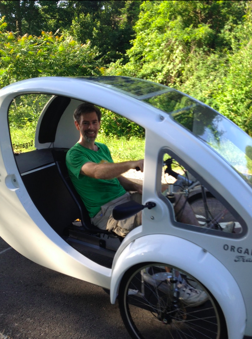
I love the Airport Loop. Early in the morning, the summer temperatures are still pleasant, the route shaded, and one sees a lot of cyclists, runners, and walkers along the trail. Some are unusual, like the $4,000 organic transportation pedal car I saw at Gallows Road.
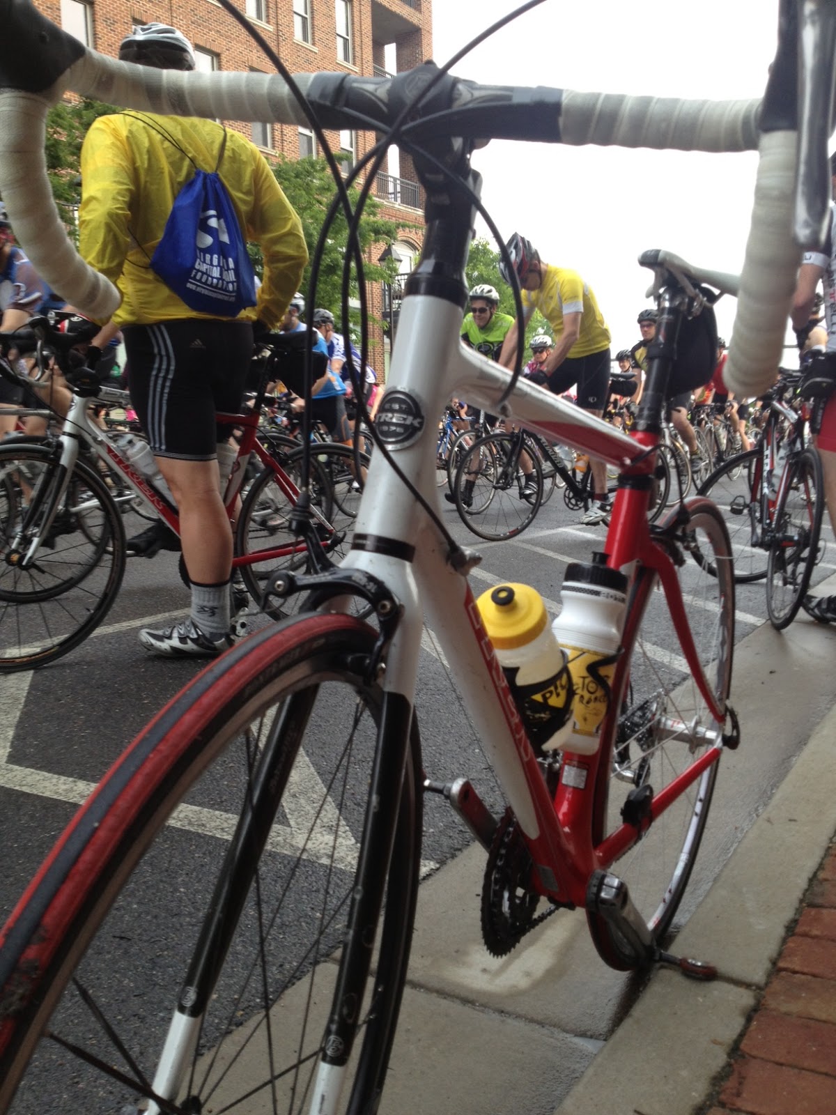
While riding inbound on the Custis Trail I was passed in the opposite direction by four riders wearing the same orange and blue jersey. A few minutes later I was passed again by four other riders. And then a third time.
I didn’t catch much except “Trek” was on the jersey and I thought “Illini” may have been on the front of these orange jerseys. I did not think much else about them as I continued my ride.
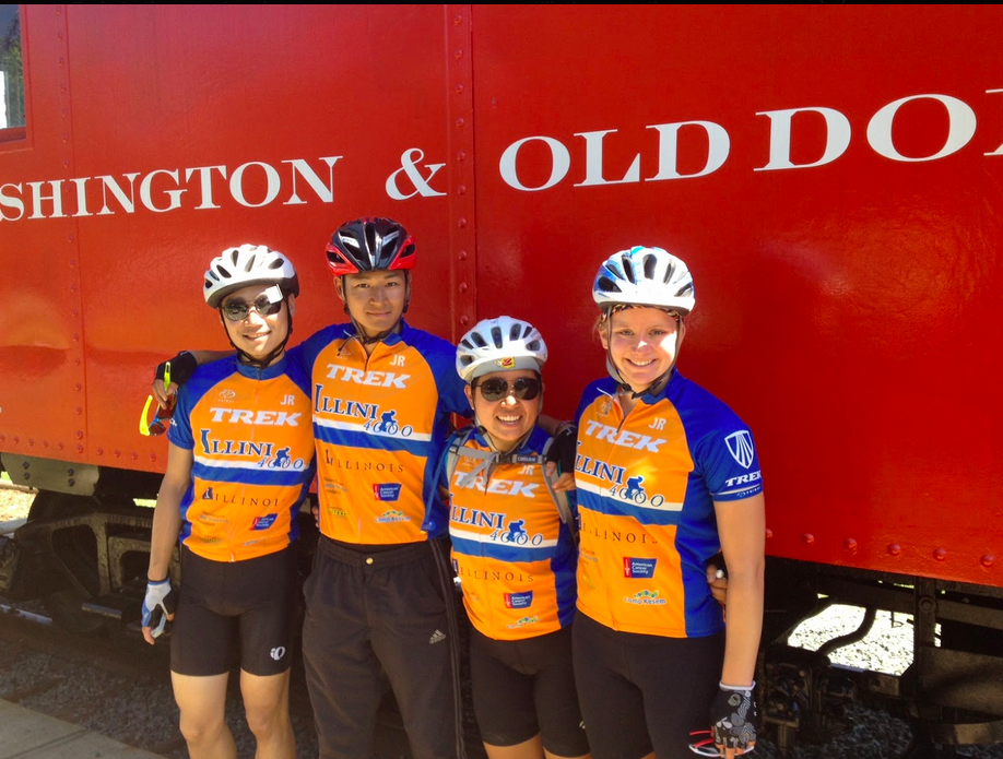
Yang Song, Je Won Hong, Meiling Liu, Jordan Orr
After completing the loop and heading back to my start at Gallows Road, I caught four of these riders. And so I talked with them. They’re with the Illini for Cancer 4000. The Illini 4000 is much like the Texas 4000. Only their starting location was New York City and their destination this year is San Francisco.
I rode for a while with Yang Song, Je Won Hong, Meiling Liu, and Jordan Orr. I was glad to be their guide for a while. Today they were riding from Washington, D.C. to Boonsboro, Maryland. This first section was the W&OD out to Purcellville before jumping on real roads.
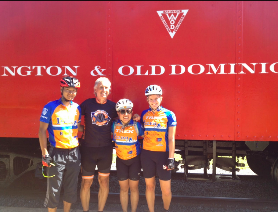
Je Won, Barry, Meiling, Jordan
What was to be a nothing day turned into something special because I met four cancer fighters.
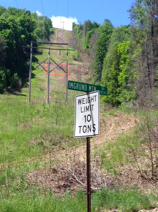
I came to Pennsylvania on a scouting trip for some friends preparing a charity ride across the country. Google Maps show the most direct route from Bedford to Ligonier is through New Baltimore then up Imgrund Mountain Road. The problem was I wasn’t finding anyone who knew much about the road. (Or perhaps people knew and were unwilling to talk. Imgrund Mountain Road is believed by some to be the real crash site of Flight 93 and, as the lore goes, no outsiders are supposed to know since Flight 93 has put this area on the map.)
My dad drove the upper portion for me last week and told me it was “red dog” (look it up). But he never saw the nasty lower portion. I called the supervisor for the township and when I told him we were thinking about biking up it, he recommended against driving up it.
Non-cyclists view many hills, if not all hills, as something they wouldn’t ride on a bike. I knew that I could not rely on outside intel to make the determination if this was a safe route for my friends’ ride. I had to see it, and ride it, for myself.
Imgrund Mountain Road, the lower section
I went exploring and first started up Wambaugh Hollow Road, part of the Pennsylvania Bike S Route over the mountain. I remembered on Google Maps that near the top of the climb a road connected with Imgrund Mountain Road. Except that it didn’t.
I met a local and when I asked about the road that connected to Imgrund Mountain Road he told me there may have been an old hunting trail through there but assured me the only road over the mountain started back at the base off of New Baltimore Road. And then he looked at me in disbelief when I told him I was going to ride up it. Not to be outdone, then his “friendly” dog chased me, nipping at my heels.
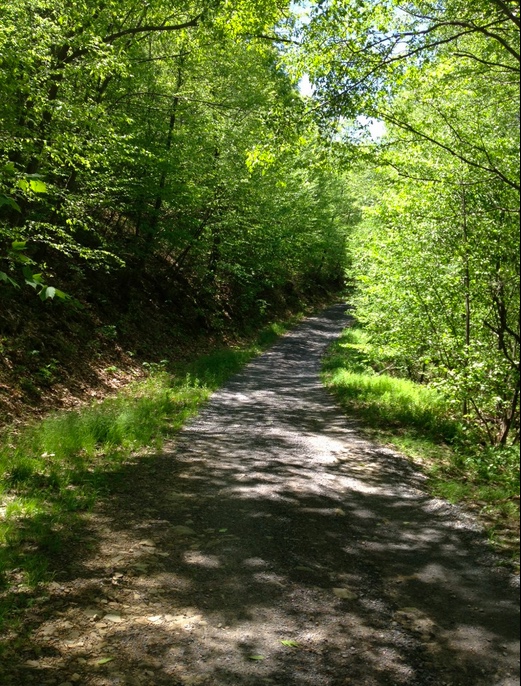
Imgrund Mountain Road
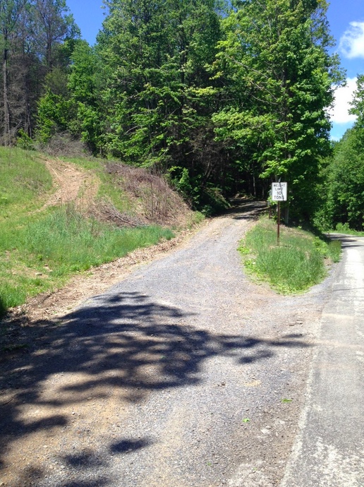
I descended back to New Baltimore Road and found the entrance to Imgrund Mountain Road. I saw gravel. Dirt. Rocks. And a forest floor. My immediate thought was “no way.” I almost turned back knowing the answer.
Red dog road part of Imgrund Mountain Road
But my next thought was to see just how far I could go. So I started up the road. The first half-mile was rough. By rough I mean hard. The surface was mixed stones and dirt and even some water flowing down it creating gullies, so I couldn’t get any rhythm pedaling. I was trying to find a line that would do the least damage to my wheels.
I would not recommend a car travel up this road. Big enough for one car it has a very uneven surface and some rocks protruding from the surface. It is, however, perfect for a 4×4. And an adventurous spirit.
I kept climbing, at times getting out of the saddle but always finding the rear wheel would slip with each pedal stroke. After the first half-mile, the grade lessened some but still was considerable.
Power line. Google maps recommended this route instead of Imgrund Mountain Road.
The road threw everything it had at me for two and one-half miles. Just when it seemed I was at the top I saw a curve to the left and another climb. There was heavy gravel on the curve and my GPS showed a 22% grade.
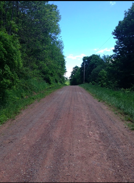
I made it and the road leveled off. The surface got better – all packed dirt or gravel and flattened out and even trended down.
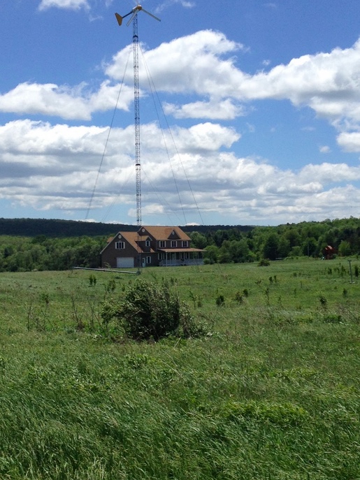
House powered by wind-power generator
But the other factor was the wind. Heavy winds were blowing and it was cold. Memorial Day weekend it was 45 degrees at the start, never getting higher than the low 50s.
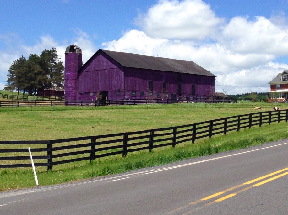
Purple barn. Why Pennsylvania, why?
I wanted to ride 10 miles over to Friedens and surprise my parents but felt uncomfortable controlling the bike in the winds. Instead, I headed to US 30 and rode back to New Baltimore.
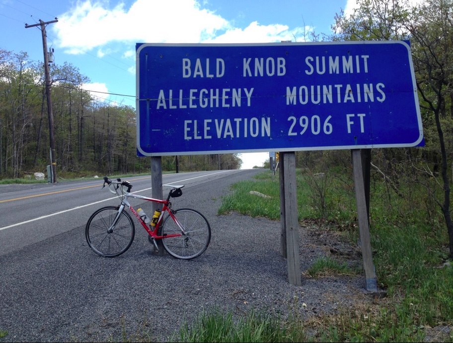
Bald Knob Summit – U.S. 30
I could not recommend this ride for anyone on a road bike. Yet a huge sense of accomplishment swelled over me. I even thought of recommending the route to my friends just so I could chide them knowing I did it and some of them couldn’t. But that would be foolish. Real foolish. I’ll find them another way over the mountain.
___ EPILOGUE (April 13, 2014) – I contacted Google and they have since corrected the hunting trail and the power line which showed as connecting to Imgrund Mountain Road. I still wouldn’t recommend it on a bike
A few hours after this ride and I must say that I’m happy. That wasn’t the case seven hours ago.
I was looking forward to riding with Ben Jones and Brian Moelk in their first century and wanted to set the example of fitness. Instead it was me who had difficulty. Following a cool spring, this was the first test of sweating on a bike and I failed the test.
Ben Jones
But, I am reminded by the picture that back of the pace line is still part of the pace line.
We pushed off seven minutes after the start of the ride for century riders depriving ourselves of riding in a pace line. Or in a large group. On a windy day that would have helped.
But we were treated to gorgeous riding skirting Richmond Battlefield Park. Tree covered roads would be the norm for the first 25 miles. We averaged 18 mph for those first 52 miles in windy conditions – mostly cross winds. At times we were on wet roads but not in the rain. We must have just missed some storms.
On the road while Ben changed his flat
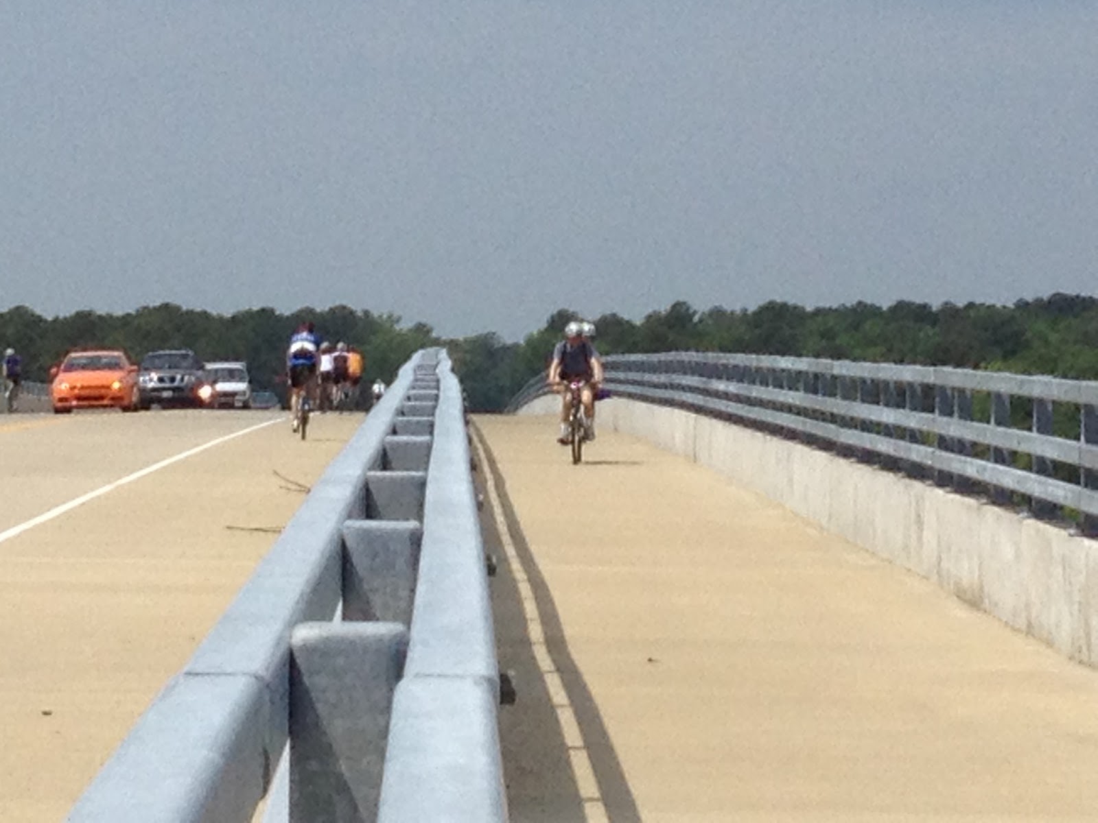
At Mile 52 we crossed the high bridge over the Chickahominy River. On the climb I cramped briefly and eased up letting Brad and Brian to fly over the top. After a brief lunch at Chickahominy River Park we climbed back over the bridge.
Bridge over Chickahominy River
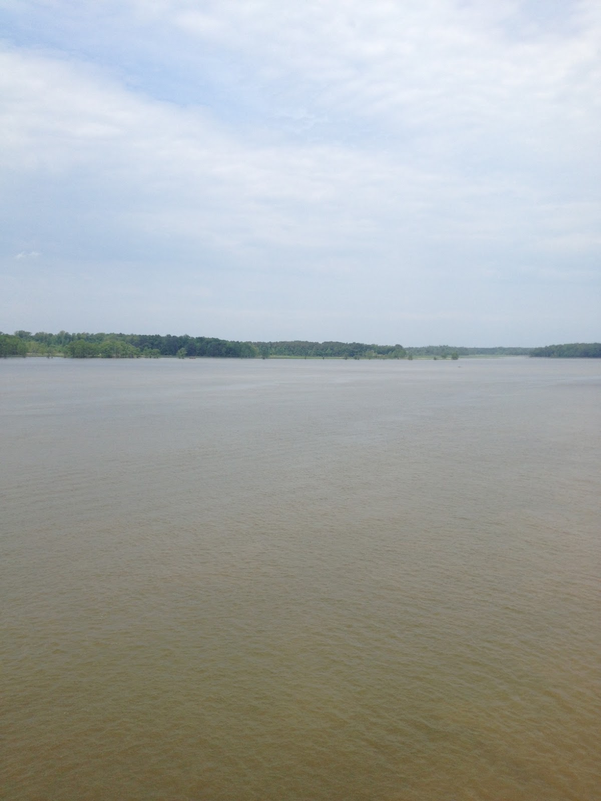
I announced I was going to use the trail instead of the shoulder so that I could stop at the top at take some pictures. While I was honest in stating that, I was also a little concerned that we would hit the climb up the bridge hard and I might cramp. I knew I could soft pedal in the bike lane. It was uneventful until the rest stop at Mile 62.
Chickahominy River
Once we left the rest stop we had a little bit of rise and I cramped. Big time. I had to dismount and stand. For the next 40 miles I would pedal and, at times, cramp. I was taking on a lot of water and Powerade as I rode but it wasn’t enough.
I had good moments though. Around Mile 90 we were following a guy for about two miles and I felt bad we were wheel sucking. Ben and Brian were content to let me follow their wheels but I came from 4th wheel to the front and pulled. Things worked well for a mile or so until we came to an overpass. It was just enough of a power demand that I cramped again.
I just needed to find my “happy place” where I could pedal without exerting too much effort. And at times, I did. After a brief stop long enough just to foot my feet down. I got back on and regrouped. I went by again and opened up a 100 yard gap as it was the most comfortable pace for me to ride. But eventually they caught me and eventually I cramped.
Ben Jones, Barry Sherry
The wind coming back was strong and mostly a head wind. Despite the relative flatness of the course the wind made it a big effort. But the rain which threatened all day, held off. At the end of the day, Ben and Brian finished their first century and we averaged just under 17 mph.
Ben, Brian, Barry
What was disappointing and painful for 40 miles ended up being a positive. I fought off quitting and continued on. It’s not the way I wanted to lead my friends but still I was part of the pace line.