Three Mountains

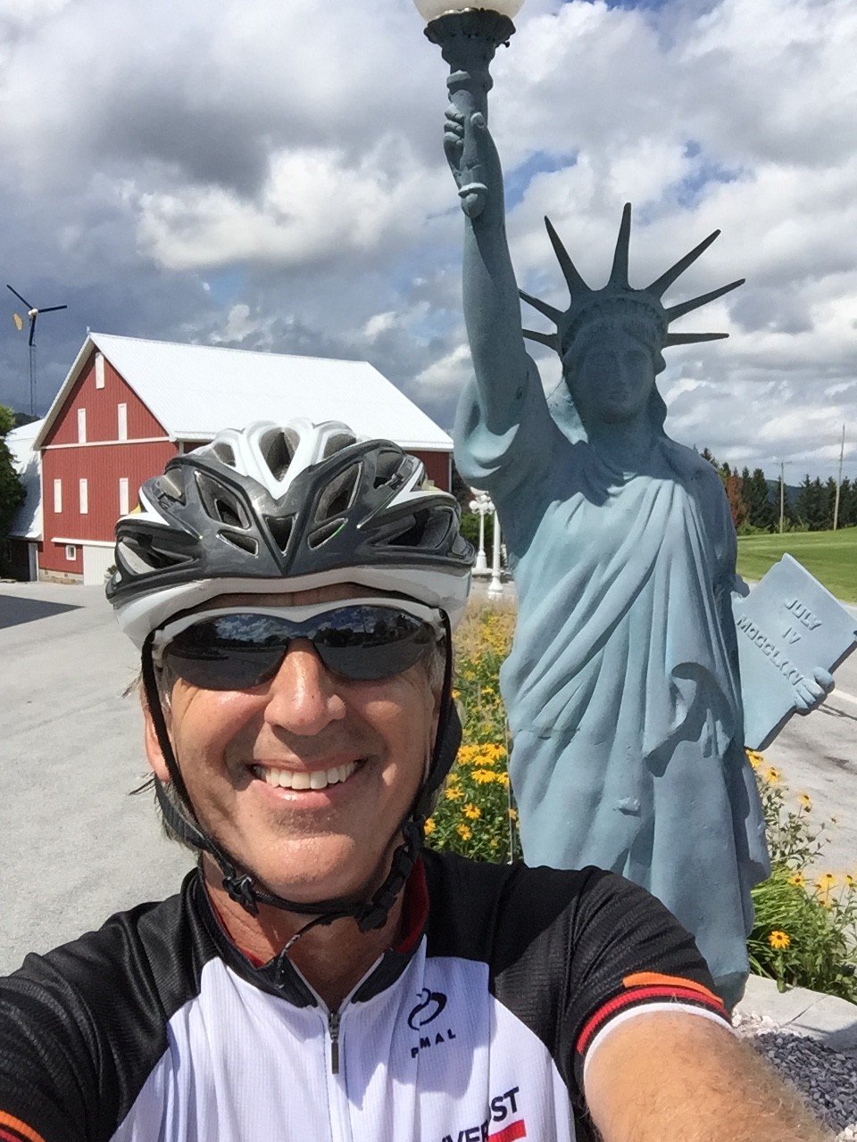
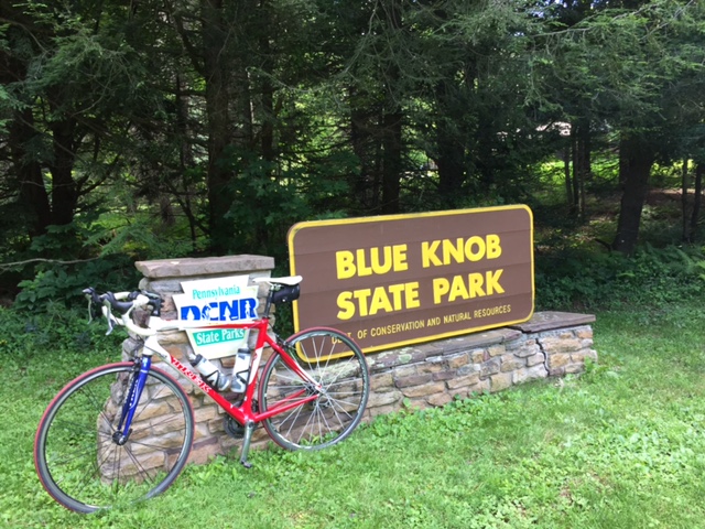
CLAYSBURG, PENNSYLVANIA

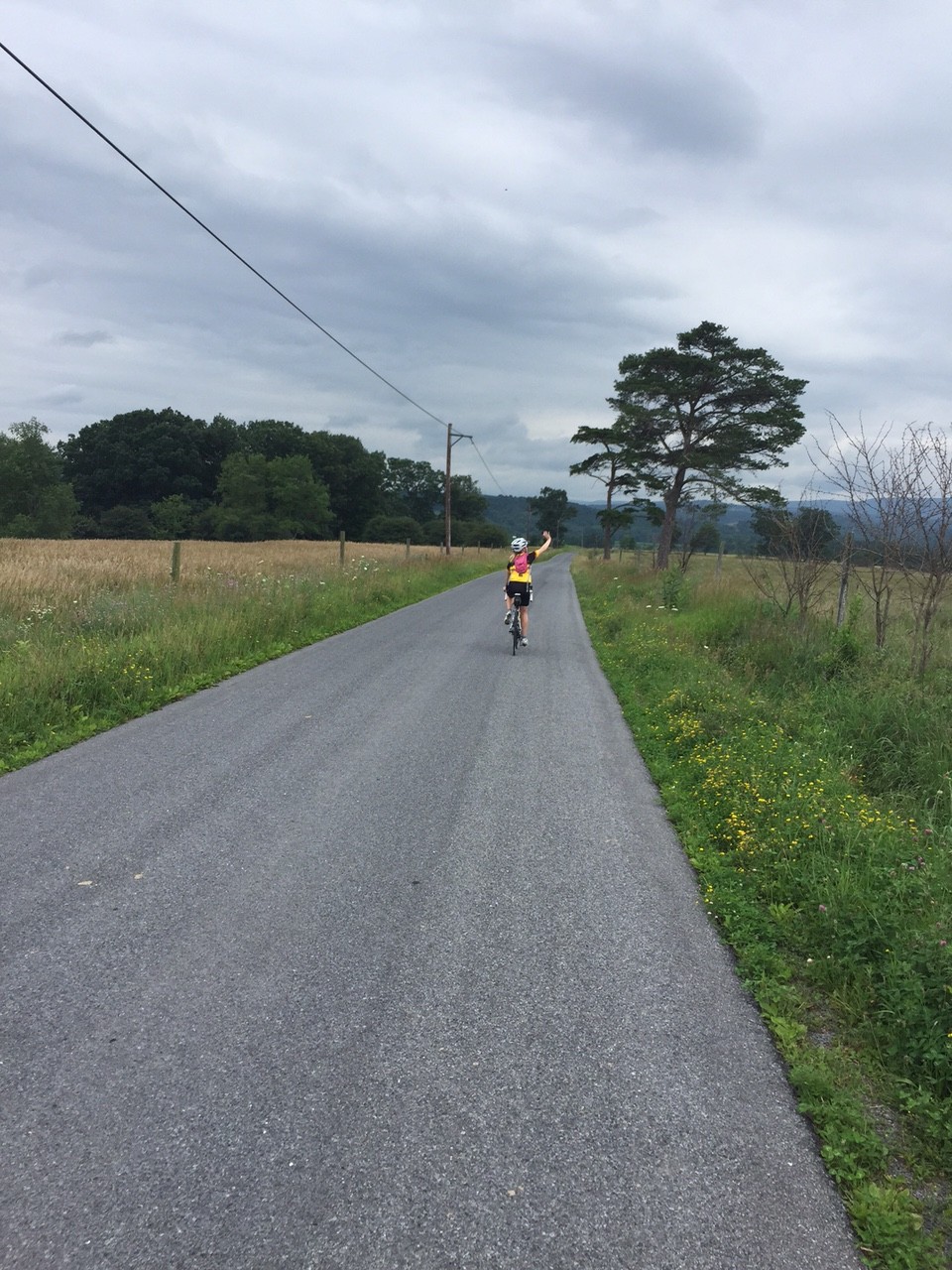
Exploring. I enjoy riding new roads and sometimes just will map out a new ride and go exploring.

Starting in Sproul, Pa., which I guess is a suburb of Claysburg (this is humor, folks), I mapped out a route over Blue Knob, down to Newry, then over Locke Mountain, through Martinsburg, then back over Sproul Mountain. I knew the course over Blue Knob then down through the valley. In all, I was familiar with 24 of the 57 miles so 33 of the miles would be exploring.

I started at Sheetz. (Where else?) I requested and received permission to park my car to go for a bike ride. I was hoping for four and a half hours.

BlueKnob01

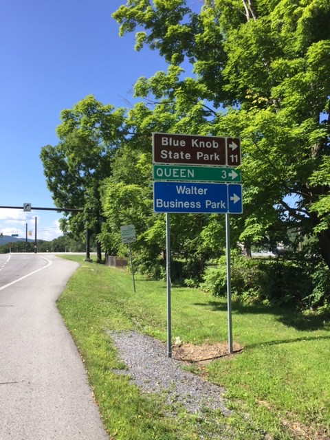
I left Sproul, went through Queen and into Blue Knob State Park. This route was new to me. There was a nifty little 1/2 mile climb at 15-17% at Mile 5. Unexpected.

BlueKnob02
This was followed by a one mile climb into the forest and Blue Knob State Park. Then there was a one mile descent to Pavia at which time I realized my brakes need changed. Oops.

BlueKnob03

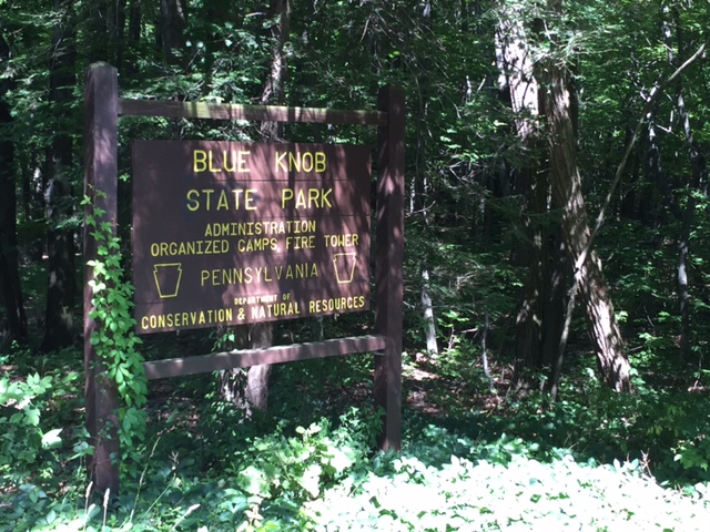
In Pavia I turned right and was back in familiar territory – the climb to Blue Knob. There were long sections of 12% grade and it was buggy. In the shade, which was plentiful, there were flies and gnats around my eyes. Damn insects.

BlueKnob04

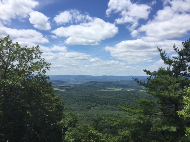
I had mapped my ride to continue to Knob Run Road but at the last moment, turned right to climb all the way to the ski area. It was very windy at the summit, in fact, even at 70 degrees, I was starting to get cold since I was in a soaking wet kit (with sweat).

BlueKnob06

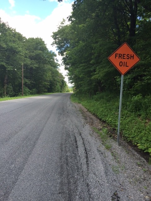
Back on course I saw the sign – “Fresh Oil.” Oh boy. A fresh tar and chip road. It wasn’t bad and ended when I crossed Johnstown Road (164).

BlueKnob09

I descended Knob Run Road, the same road that Chelsea Johnson, Chey Hillsgrove, and I climbed last week, being chased by a storm. I had better weather today and I was going down – not up.

BlueKnob10

I turned on Tel-Power Road and was surprised when I passed Winsome – a gated house, which is really, a gated horse farm. Sorry, no pictures.

I came to Locke Mountain Road and looked at the ridge which I knew I would cross. I could see a tower at the top and a cut in the mountain which I knew was the road. OK.

BlueKnob12

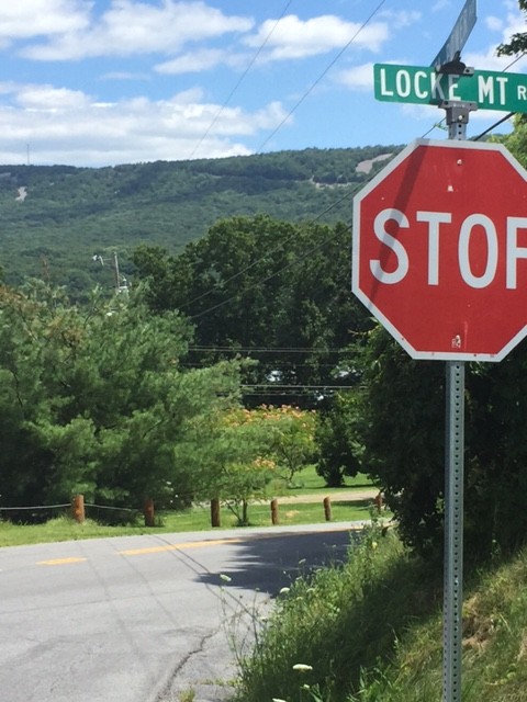
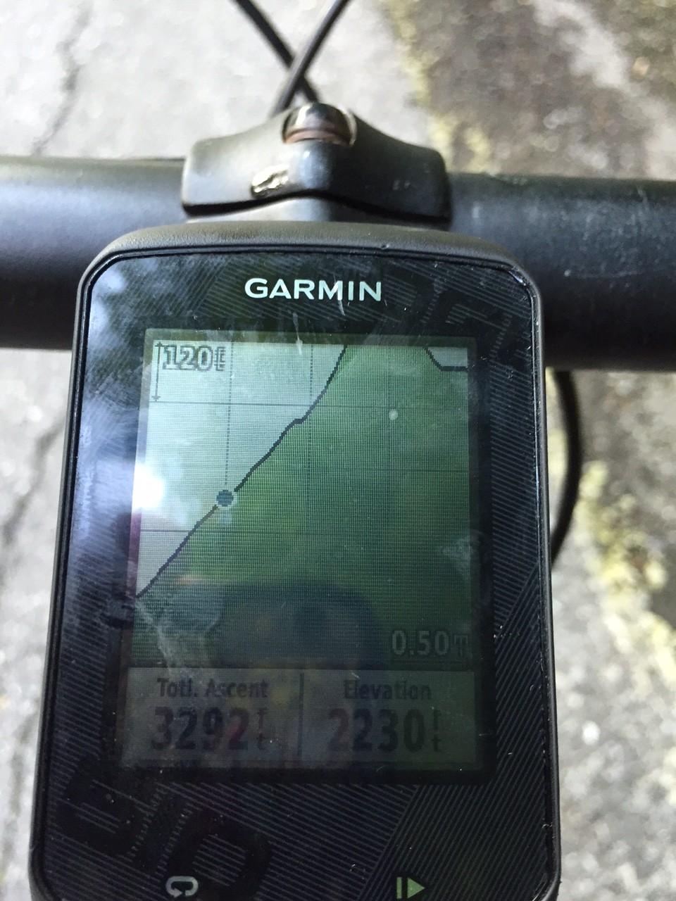
Once the climb began in earnest, my GPS was sort of stuck on 12% for two miles. And using numbers from the road itself I calculate the climb was 10.2%.

BlueKnob13

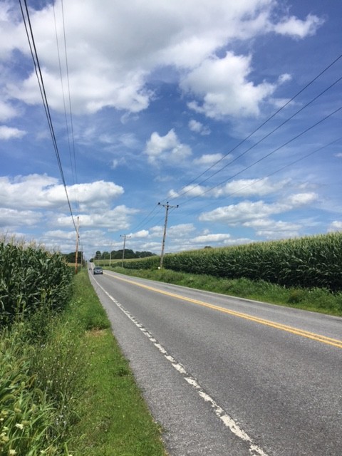
Over the top it was a nice descent, although with squishy brakes. I turned on Pa. 866 which was a signed Pa. Bike Route. No shoulders but light traffic. It was a seven mile run-in to Martinsburg, sort of lumpy, passing corn fields most of the way.

BlueKnob17

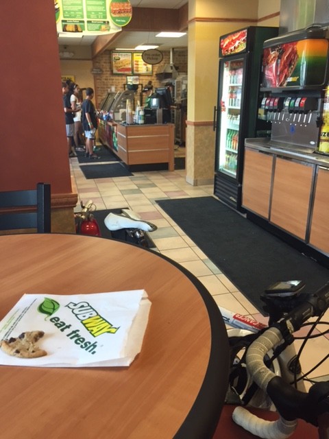
In Martinsburg, I stopped at Subway, mainly to refill my water bottles but I also bought a Coke and a cookie and sat down to eat it. The “water” lever on the soft drink machine is shared with Lemonade. I think the line had Lemonade in it because one bottle tasted more like Lemonade than water. And I didn’t want Lemonade, but I’m not mad.

BlueKnob14

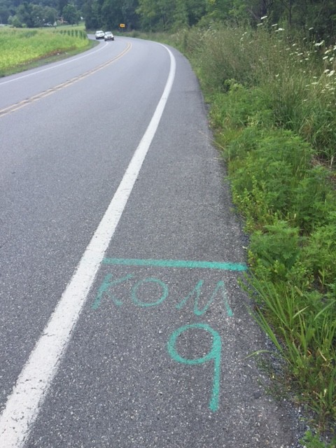
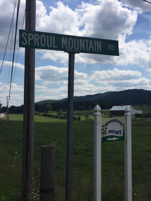
I watched my Garmin as I navigated to Sproul Mountain, swearing every time I saw a rise ahead. Sproul Mountain wasn’t long but it was steep, especially the lower slopes. I passed the KOM-9 start, assume it was there from the Central Pa. Century Challenge, run by my friend, Richard Fiore.

BlueKnob19

The climb is one mile in length. I calculate it to be 7.6% with the lower section steeper than the upper portion. Over the top I got in a tuck and hit 48 mph (47.95). I probably could have pushed it to 50 but remember the advice of Wayne Stetina who told me two years ago he never bombs a descent he doesn’t know. Speed was not an issue today.

BlueKnob18

I finished at Sheetz and my legs felt like they have been through the wringer. Either 5800 or 5900′ of gain over 57 miles. Only Grand Mesa, in Colorado, was harder this year. This ride, simply, was a good challenge.

BlueKnob15


Purcellville Home

PURCELLVILLE, VIRGINIA

P01

Andrew’s car was in the shop and wanted to borrow mine to go to Purcellville. I told him I’d drive him there with a bike and he could choose to bike or drive home. He chose poorly.

P02

What a beautiful summer day. I took the W&OD, a route I am well familiar with. Peaceful. And mostly downhill in this section.

P03

I stopped at Carolina Brother BBQ in Ashburn which is my go-to pit stop when I’m on the W&OD. I never paid attention to their actual food menu but today I did. And someday I will try it.

P04

My route on the W&OD took me 25 miles to Reston at which point I picked up the bike trail next to the Fairfax County Parkway. I followed that until I completely lost any scent of the trail. I was meandering near Fair Oaks Mall.

P06

Eventually I ended up on Clifton Road and rode down to Clifton. I took Chapel Road back up to Rte 123. Once, trying to meet a Potomac Pedalers ride, the ride leader told us to meet him on “Chopper” Road. We searched and search that day, never finding them, only realizing later he was saying Chapel.

P05


At Rte 123 I followed that to Occoquan. It’s always nice crossing the pedestrian bridge at the far end of town.

P07


I took Occoquan Road over to Hylton Ave. and snaked my way through old Woodbridge. I had to ride on the Prince William Parkway but only long enough to cross I-95.

P08


Heating up I stopped at Chick-fil-A for a brief refreshment, mainly filling my water bottles. I then followed the Prince William Parkway bike trail to Hillendale Road which was three miles out of the way but worth it to avoid Minnieville Road. I took back streets the rest of the way home.

P09

It was a fun route. I hope Andrew asks me to take him to Purcellcille more often. And doesn’t want the bike.


The Wall

ALTOONA, PENNSYLVANIA

It was June, 2008, when I first rode “The Wall” in Altoona. I knew it was special then and in 2009, it became my “escape from cancer” place to ride.

Altoona2015_12
Horseshoe Curve

I have ridden it in spring, summer, and winter – but not fall. Interesting.

Chey, Chelsea, Barry

We had been planning for Jacob’s Hero Ride, a charity ride across Pennsylvania to benefit children’s cancer research and to honor Jacob Grecco. However, that did not materialize. But I promised two of the riders, Chey Hillsgrove and Chelsea Johnson, that we could still ride some in Pennsylvania.

Horseshoe Curve
Horseshoe Curve

Yesterday we rode in the Bedford Valley, now today it was our turn in the high mountains. I mapped out directions to Beale Ave. and Kittanning Point Road and we started riding.

Horseshoe Curve Tunnel

It was an easy ride up to Horseshoe Curve where we stopped for a photo op. Chey and Chelsea hiked the steps up to the curve where the trains go by while I stayed behind with the bikes. They got to ride the funicular back down.

As we rolled out from the visitor center we had to wait at the tunnel for the light. A big truck pulled behind us and we motioned for him to move up. When the light turned green, he went ahead and we followed. He blocked any vision of the other end of the tunnel. Literally, we could not see the light at the end of the tunnel. For 15 seconds or so we were riding in pitch black as our eyes hadn’t adjusted and wearing sunglasses made it worse.

We did great on the climb and then – The Wall. I was worried about Chey’s bike – he was running a 39:23 setup. And Chelsea was simply worried. She stopped to start some music then made it all the way up. Bravo!!

Chelsea Johnson on Valley Forge Road

At the top, by the old Forest Zoo, we met a kitten with no collar. It may have been a feral kitten and I couldn’t quite tell if it wanted to be friendly with us or attack us. We left.

Credit: Chelsea Johnson

We went down into Gallitzin and viewed the tunnels where the trains headed to or coming from the Horseshoe Curve pass through.

Chey and Chelsea on railroad bridge

Then we headed through the Allegheny Portage Railroad National Site. We stopped at the stone arch bridge at “Six of Ten.” This was a bridge built for the Hollidaysburg – Blairsville Turn Pike over the Portage Railroad in the 19th Century.

CSX Train in Gallitzin Tunnel

The descent down Old U.S. 22 was great and we turned off onto Foot of Ten Road then onto Valley Forge Road. I had ridden Valley Forge Road two to three times prior but always in the other direction. This direction was definitely harder. There were two steep hills in succession.

Stone Arch Bridge
Stone Arch Bridge

It was only one mile to the top of the first “boob” (because that is what Chey thought they looked like on the profile – and they did). And it was another mile to the top of the second one with a 14% kicker near the top. And although it was about a two mile descent to Puzzletown, that didn’t seem to be enough to recover.

Chey, Chelsea, Barry

I probably should have read the look in Chey and Chelsea’s faces, but I did not. It would have been good to turn onto Puzzeltown Road and head back towards Altoona. Instead, I made us climb.

We turned onto Old Knob Road. We began a 4.5 mile climb to the top where it intersected with Johnstown Road, aka 164. It started as a low percentage grade climb, mostly 2-3%, but grew as we went.

Chey Hillsgrove
Chey Hillsgrove

I had slipped ahead of my riding partners and passed a house with two people outside. I greeted them and asked if I could get water. Karen Sell obliged and got me water. Then she saw Chey and Chelsea too. She got us all water and offered a water hose to cool down with. I cannot imagine finishing the day without this water stop.

Chey and Chelsea
Chey and Chelsea

As we went up the road, again I pulled ahead. And then I saw it – a natural spring on the side of the road. Acting like a child, I put my head under the cold water. Three times. I waited for Chey and Chelsea to enjoy it too.

Garmin
Garmin

As we continued I again pulled ahead. I looked at the profile on Garmin of the route I mapped and it wasn’t pretty. It kept going up and I knew near the end it really ramped up – to at least 14%.

Chelsea and Chey at spring

I arrived at the top and waited. I talked to a woman across the road. I talked to drivers who had come up the road. One told me my friends were “just around the corner.” I descended almost half a mile to find that corner.

Steeper than I thought

As they reached the summit we heard thunder and saw lightning. Oh oh! But we had a seven mile descent to East Freedom. We could see the mountains where it was raining but managed to avoid it. Until..

…We reached East Freedom and the skies opened up. I rode ahead hoping Chey and Chelsea would follow. I knew there was a Sheetz just ahead where we could seek shelter.

Chey and Chelsea
Chey and Chelsea

We got in and Chey and Chelsea ordered real food. I grabbed a Snickers and Chelsea chastised me about getting real food. I told her a Snickers was real food – hadn’t she seen their commercials?

It was storming and I didn’t see the need to expose three of us to lightning. I offered to ride back to start and get the car. Chelsea and Chey readily agreed.

I started out to find Reservoir Road – which was closed. It was barricaded and I didn’t see it in the rain. I went ahead to Plum Creek Road and hoped it would take me there. I checked my maps and knew I had to retrace my route. Damn. I just added three miles.

In fact, without worrying about other riders, I probably should have found Rte 36 which was the shortest way back. But I still don’t know how safe it was. Especially in the rain.

I was in and out of two more storms before reaching Altoona. But I made it back safely, retrieved the car, then retrieved Chelsea and Chey from Sheetz in East Freedom and we all headed back to Maryland, Delaware, and Virginia.

I am proud of my friends’ efforts today. It took longer than we planned but we enjoyed the Horseshoe Curve, the Gallitzin train tunnels, talking to a woman about the Portage Railroad, and having Karen rescue all of us with a water stop.

Barry after a climb
Barry after a climb

I had not ridden this direction before, and if I had thought about it more, we would not have gone in this direction. I made the decision in part because I wanted to tackle The Wall first while the weather was good.

But it comes down to paint on the road. Even in the mountains, these roads kick up, but if they have paint on them (lane markings) they rarely go beyond 12% and usually no more than 10%. Johnstown Road (164) out of East Freedom is a road with paint. We rode down it. Likewise, Old Rte 22 is a road with paint. We rode down it. (I have ridden up them before.)

The back country roads don’t have paint. They’re not graded for heavy traffic. Glenwhite Road (Horseshoe Curve), Valley Forge Road, and Knob Run Road don’t have paint. Or if they do they just have center line paint and not edge of road paint. They also have ramps of 14-19% grade. We rode up those. But now I know – it’s about the paint.

Correction: See that 14% grade? It has center yellow line paint. A major road. Yikes!


It was a tough day. But we all made it. And had fun.

Covered Bridges

BEDFORD, PENNSYLVANIA

It was bittersweet day as we had been planning for Jacob’s Hero Ride across Pennsylvania for children’s cancer research and to honor Jacob Grecco. Although that didn’t work out, I was able to bring a couple riders on the team, Chey Hillsgrove and Chelsea Johnson, to Pennsylvania for some riding.

I promised them mountains then delivered bridges. Without a word (at first) about my goal, we headed up Business U.S. 220. I mapped the route, loaded it to my Garmin, and off we rode. I really only really knew the last 10 miles of the 50-mile route – the run-in back to Bedford.

I had planned to start at Old Bedford Village, where we saw our first covered bridge, but there was an admission fee of $11 per person and I wasn’t sure we could leave the car there without admission. We parked at the Fairfield Inn (with permission).

The first four miles consisted of rollers then we hit a nifty two-mile climb. I didn’t know it was here but it was very nice. I told them we weren’t riding in the mountains, and we weren’t, but I’m not sure they believed me.

IMG_1243

We rolled through Osterburg and out into the country. Chelsea seemed to love riding among the corn then my GPS beeped for an upcoming turn. As I looked at the upcoming left turn I saw it – the first covered bridge.

Bowser Covered Bridge

We stopped and took it in. And although it was no longer in service, we rode across the Bowser Covered Bridge.

Chelsea crossing Bowser Bridge
Snook's Covered Bridge
Snook’s Covered Bridge

We didn’t travel much farther until we found Snook’s Covered Bridge followed by Kniseley Covered Bridge. Here we stopped for a brief water/snack break.

Kniseley Bridge
Kniseley Bridge
Ryot Covered Bridge
Ryot Covered Bridge

And so it went. We stayed mostly in the valley and visited covered bridges, the next being Ryot Covered Bridge. Chelsea said she would call it the bridge ride and eventually I told her she could call it the Coverage Bridge Ride.

Cuppet Bridge
Cuppet Bridge

We passed the Cuppet Covered Bridge just off the side of Pa. Rt. 96. It is very weathered, unpainted, and looks to be in need of repair but there were some people who looked like they were working on it.

As we entered New Paris it started raining. I stopped to put my valuables in a Ziplock bag.

A real sign to Gravity Hill

After New Paris headed south on Pa. 96, we turned right and started a 2 1/2 mile climb in the forest. It wasn’t too difficult although we were climbing. And I saw painted on the back of a road sign “G Hill..” Chelsea asked “Did that say hill?”

Chey and Chelsea ready to turnaround on Gravity Hill

We got to a false flat and I saw painted on the asphalt, “GH End.” I then had to find “GH Start” which I did. Confused, Chey and Chelsea looked at me and I explained we could coast up Gravity Hill.

Chelsea and Chey
Chelsea and Chey

I didn’t get it and still don’t. This is a Bedford County Tourist attraction but there’s nothing there other than a section of asphalt. No souvenir stand selling “I survived Gravity Hill T-shirts.” Just some paint on the road. After coasting uphill, we headed back to Rte. 96.

Headed to Shellsburg, but out of the rain, we hit a climb just over one mile long. No, we weren’t in the mountains – just Pennsylvania. The view from the top was great but we were in a light rain and I couldn’t capture a good photo moment. We laughed about an orchard selling “Transparent apples.” How would you know how many you bought if you can’t see them? OK, that was dumb.

The sign for Pleasantville, was appropriately, black and white

(White Transparent – also known as Yellow Transparent in the USA – is an early-season cultivar of apple which is usually used for cooking due to its sharp taste.  Source: Wikipedia)


Vincent Van Gas
Chelsea and Chey with Vincent Van Gas

We stopped briefly in Shellsburg and admired Vincent Van Gas, a 1930s gas pump artfully painted in 2008 to celebrate “Pennsylvania 250.” We left and headed south finding Colvin Covered Bridge. By this time, Chey and Chelsea had quit taking pictures of bridges.

Chelsea Johnson
Chelsea Johnson

Out in the country Chelsea saw some huge bales of hay which she had to climb. And why not, right?

Chelsea Johnson
Chelsea Johnson

We came to Pa. Rte 31 which is signed as Pa. Bike Route South. It has about a two-foot shoulder which, mostly, was enough. But then the rain. It opened up on us and we got soaked. But we were in it for no more than three minutes.

Colvin Bridge
Colvin Bridge

We slowed for a minute alongside the rode and I pointed out a gravel road to Turner’s Covered Bridge off in the distance. They told me they would wait for me if I wanted to go look at it. Anyone getting tired? Anyone? We rolled on.

We followed 31 back to US 30. I pointed out we passed the road to Herline Covered Bridge. I don’t think anyone heard me. We could have crossed it and come back and continued with a steep climb to US 30. But best to continue the shortest way back.

Just outside of Bedford we turned on Weber Lane and took it over to Business 220. There was a bit of a ramp back up to 220 and Chelsea walked the last 10 yards saying “I can’t believe I have to walk this.” I think she was caught out in the wrong gear. It happens.

Tired
Tired

We arrived back, maybe a little tired, and a lot wet. Time for refueling before tomorrow’s ride.


A day of bridges was wonderful. The rain, not so much, but mountains tomorrow!

Finally a Fast Ride

LEESBURG, VIRGINIA

I don’t (normally) ride for speed but it’s nice to go fast. And it’s a nice metric to measure oneself against Father Time. I haven’t had any real fast rides this year and I’m not counting rides where I jump in a pace line. This is just me against the “clock.”

Yesterday I rode on the W&OD for almost 40 miles. Sometimes goals are simple ones and I was 40 miles short of 300 for the week so my goal today was 40 miles, go slow, no sweat.

Wheels down shortly after 7:00 a.m., it was around 60 degrees and super comfortable. I got on the trail at Reston shortly after a rider in a hi-res green jacket went by. Once the legs got warmed up I noticed I was 100 yards behind him and holding steady.

He had passed a woman on a bike with aerobars. I was about 40 yards behind her and holding steady. Near Sterling there is a personal sprint point for me in which I put the bike in the big gear and push it as hard as I could. I did and I flew by her.

Early morning long shadows

I used the green jacket guy simply as a rabbit. I did not sit on his wheel – I stayed back 20-30 yards. I could have passed him but wasn’t real sure I could go faster. I think he knew I was hanging back or just lost his legs because at the Clairorne Parkway he pulled over. I didn’t see him again.

As I entered Leesburg I slotted in behind a couple and rode at their speed. We passed a massed group at Harrison Street. There wasn’t much room to pass although one rider did here so I jumped on his wheel. He quickly turned off.

I began the climb up West Leesburg and felt good. I was going for a personal record which I got. I could have done better because I thought the climb ended before it actually did. I rode over to Simpson Circle, did a little climb then turned around.

As I came to the overpass on Dry Mill Road I saw the group of riders that had been in Leesburg. They were just at the top of the climb. I was surprised how far I had gone since I last saw them but maybe they waited for the slowest rider.

I turned back on the trail and was caught off guard when I saw this group on Dry Mill. I went around a fence and jumped in about 300-400 yards behind them. I caught and passed three of them before turning off onto Catoctin Circle.

At 7:00 a.m. there were lots of runners out in force. By 9:00 there were a lot of cyclists. Families with small children were on the trail and many times I came to a near stop, waiting for a safe place to pass. I was always courteous and encouraging.

In 80 miles, 40 yesterday and 40 today, I had only been passed by the one guy in Leesburg. And to be fair, this was a slow-down area where he passed. Maybe on the open road he wouldn’t. I don’t know.

I still had to pick my way through some riders but felt good. Nearing Reston I slotted in behind two guys, almost comfortable to ride with them. But I knew I was faster and, when there was a safe opening, I went.

When I got back to my car I had already loaded the bike when those two guys came by. I’m glad I went.

At almost 18 mph, I was pleased. Then looked back and thought without the crowding on the trail, I could have gone over 18. Oh well. I set a PR on the climb and it was my fastest ride of the year (no pace lines).

What made it different? I don’t know. I took two bottles with me and only drank one for 40 miles. Maybe I started slowly enough and gained speed. I grabbed a sausage bagel sandwich at Sheetz an hour earlier. I took no food with me. I don’t think there was much wind either way. Not sure what made it good but it was a good ride today.


Verified by MonsterInsights