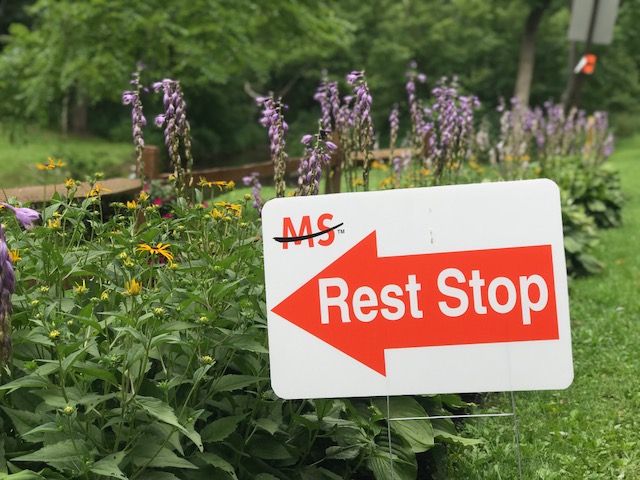
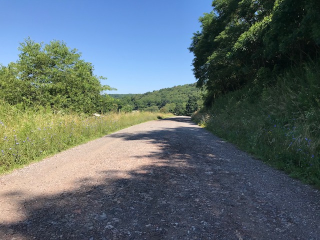
I need to rethink the sleepover component of this event. I stayed at home and got up at 4:30 a.m. to drive to Harrisonburg. Four hours of sleep is not enough.
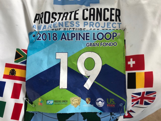
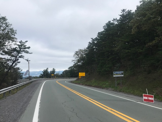
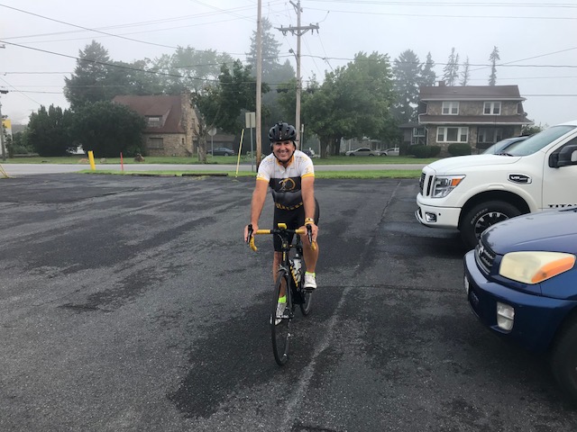
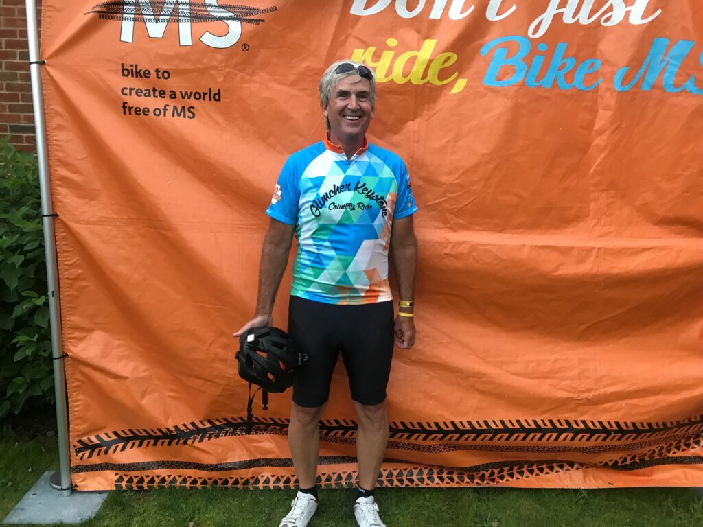
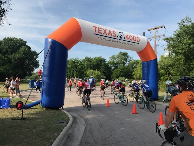
Bib 19 – pretty cool
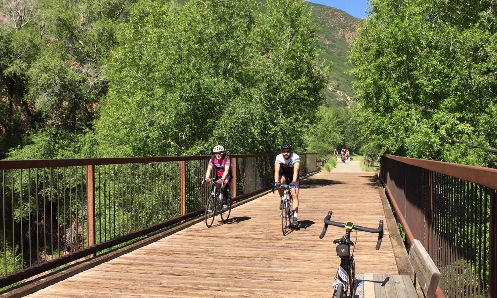
I arrived at 7:20 a.m. thinking I had plenty of time. I did not. Registration was slower than expected (efficient but there were a lot of people checking in at 7:30 a.m.). Each time I was ready to roll out from the car I seemed to be missing something. Glasses. A spare rear light. Arm warmers.
We were given timing chips to attach to the fork. I took mine to the start then wrapped it around the fork. Around the fork and a spoke. I didn’t notice. There was two minutes before the start. A rider next to me said, “Do you know you have that wrapped around a spoke?” Damn. I had nail clippers to trim the zip ties and cut them off. I simply put the guy in my pocket and off we went through downtown Harrisonburg.
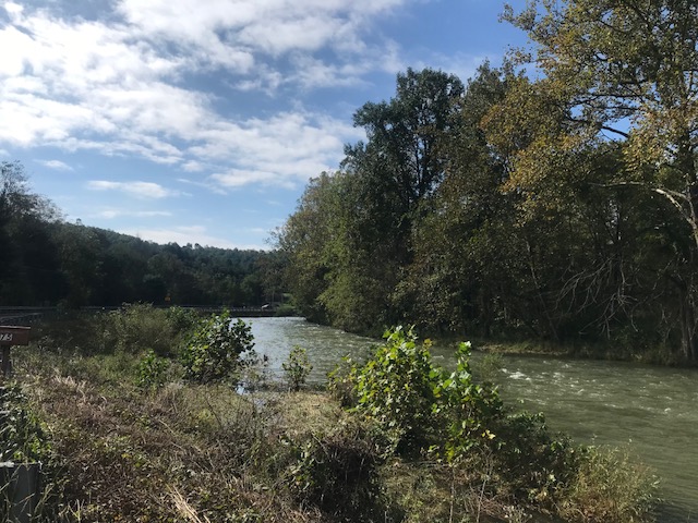
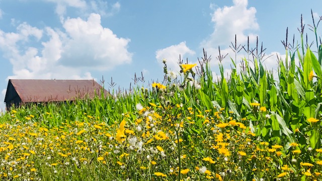
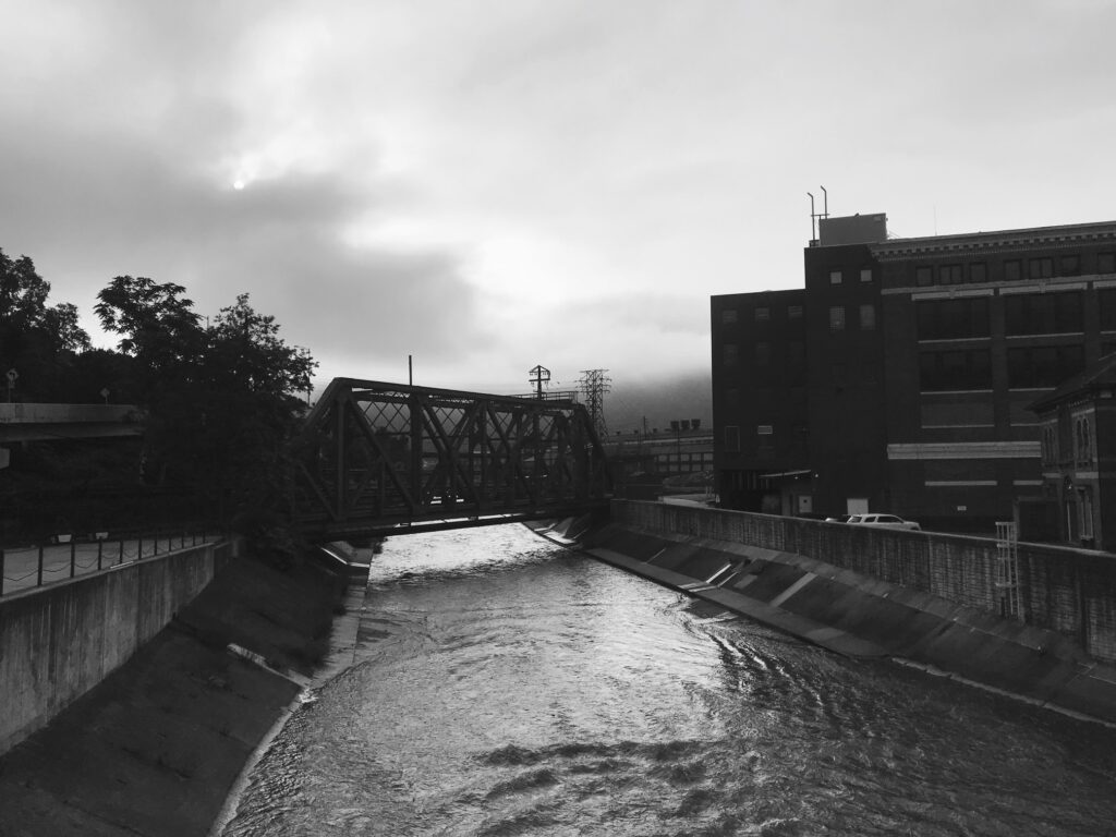
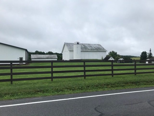
South Fork South Branch Potomac River (WV)
We circled the block then as the group was headed out of town I went back to start and picked up two new zip ties. I then headed through town and saw the tail of the group up the road. I quickly made my way to the end of the group and found Robert Hess. Once I caught Robert we pedaled a little faster and we moved up through the group.
Kathy Mitchell
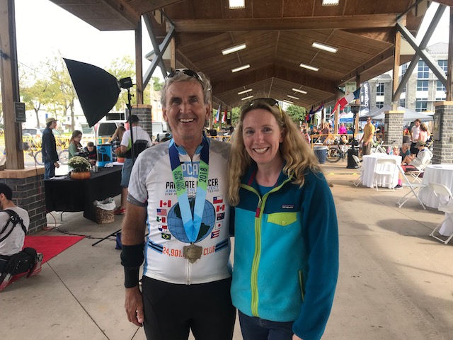
I caught a woman wearing a Spokes of Hope cycling jacket. I told her my other kit was Spokes of Hope and asked her what she knew about Spokes of Hope. She told me the jacket belonged to her father-in-law and “we’re from Pittsburgh.” I asked her if her father-in-law was Dave Mitchell. She was blown away that I knew, or knew of, her father-in-law. We stopped for a photo before the routes would split.
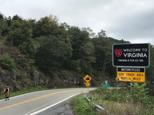
Welcome to West Virginia
Robert and I rode ahead to the split (Mile 8) where he would turn left (35 miles route) and I would turn right (100 miles route). Because I had to ride to catch the back of the group I was pretty certain I was the last on the road headed to the century route. I wondered if I would catch anyone.
I did catch a few riders before U.S. 33 and the climb over the mountain. I still had not stopped to properly attach my timing chip and decided it wasn’t worth it.* I am still recovering fitness from my knee replacement surgery and I wasn’t going for any KOM (King of the Mountain) segments. Still, I moved the chip from my jersey pocket to the seam in my shorts just above the knee. Maybe it would work.
Looking back at the climb out of Virginia
The descent off the mountain was fast. I made up for my slow ride up with a quick descent. Still, I felt I was more cautious than I had been before May 16. The risk/reward of a couple extra MPH wasn’t worth it.
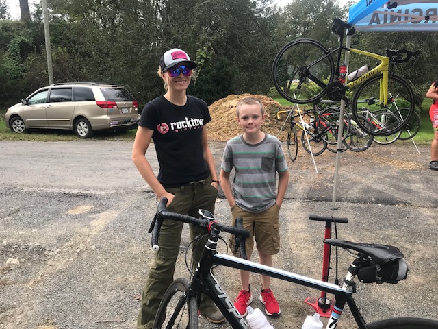
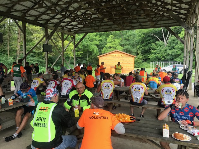
My shoe didn’t feel right and at the second rest stop, also the base of the Reddish Knob, Kelly, from Rocktown BIcycles in Harrisonburg, fixed my cleat the best she could. She also took a photo of me going up the 18% climb.
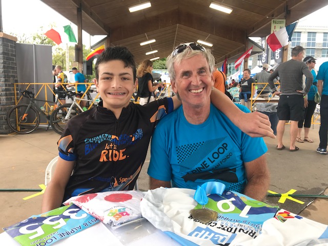
As I pulled out of the rest stop, I was side by side with a 15 year old, Ben, from Winchester. He asked me about the climb, having been told it’s not has hard as the climb we did on U.S. 33. I told him it was much harder. Someone lied to him.
Kelly from Rocktown Bicycles and a young volunteer
We kept talking and stayed together for much of the climb. Perhaps two-thirds of the way up I was going faster and did not want to stop. I didn’t know if he stopped or was going slower but eventually I did not see him any longer.
And I felt cramping coming on. This is where a lack of serious riding since my knee surgery was catching up to me. I shouldn’t be cramping and yet I was. When I reached the summit I looked down the road and so no one. There was another rider waiting and he asked if I knew about a scenic overlook. I did not but decided to go up a narrow access road that might lead to one. I had gone about 1/4 mile and was cramping worse. I turned around.
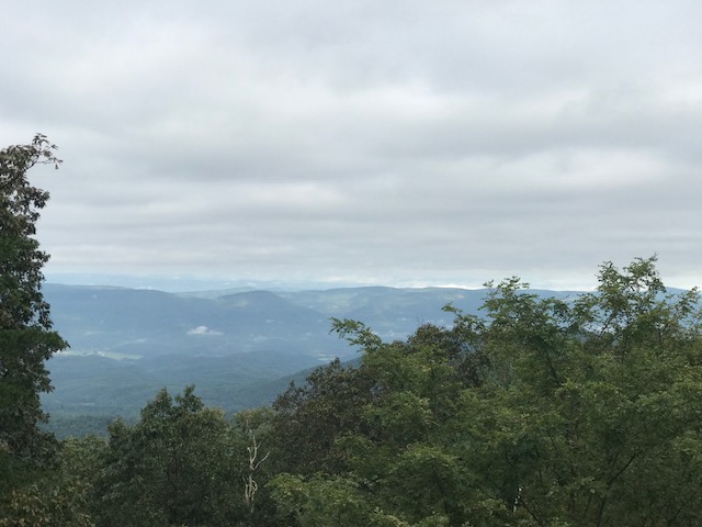
View from WV/VA state line
The descent off the mountain was sketchy, Soaked with sweat, I had nothing to clean my glasses. They were foggy and with the rough pavement, I took the descent cautiously.
Reaching the next rest stop, I had a decision to make. Head on home or do a 20-mile loop to finish the century ride. Cramping is a sign of body fatigue and I thought on a day I was cramping it would be dumb to add what was now an optional loop. If I had 40 miles to finish I would suffer but I was 20 miles from the finish and didn’t need to add the loop. Also, Ben was doing the 80 (or 75, whatever it was) and we would stay together.
Barry and Event Director, Erin Bishop
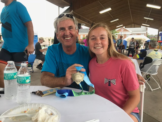
At the finish, we were greeted by cheerleaders from JMU. Katie Yates, one of my referees who attends JMU, came over and joined us for a post-ride meal. A real surprise was Robert called Ben up to the podium. He had won the KOM for his age group. Since I took him over the mountains I think he owes me one of his polka dots.
Youth KOM winner, Ben
After our dinner, I went to stand up. Ouch. The legs hurt. It was a hard day on the bike and without a good fitness base, I made the right decision not to finish the century. Next year!
With Katie Yates
*Perhaps not the exact measured climb but on RideWithGPS my time in the past has been 30 or 31 minutes. Yesterday it was 40 minutes. Reddish Knob I’ve done in 45 minutes, today was 1:02. I was right. It was not worth race timing.
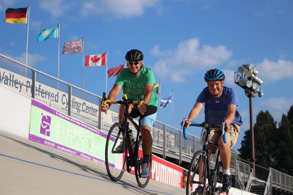
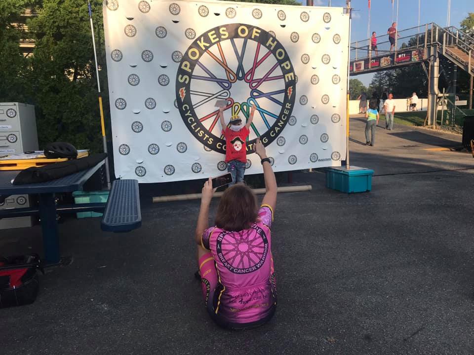
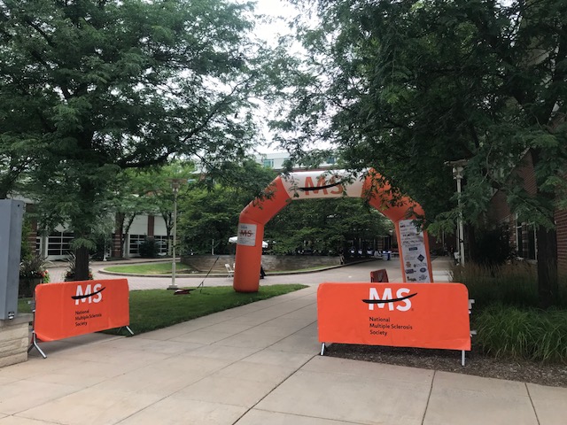
This was the 10th year that Spokes of Hope was invited to Valley Preferred Velodrome in Trexlertown, Pa. In previous years, we had childhood cancer survivors “take a lap” against cancer sometime during the evening races.
We were the pee-wee football team that gets to play on the big field for five minutes of the half-time of an NFL game. Or the midget hockey team that gets five minutes between periods at an NHL game. There is also some down-time between races at the velodrome and Spokes of Hope filled the gap by introducing the childhood cancer survivors.
Take a lap against cancer – Barry and Branon Cooper getting some laps in on the track. PHOTO CREDIT: Kathy Robinson
But it was always a blast for us. For Cindi Hart, she just glowed when she could teach the young kids how to ride on the track even if it was the flat ground-level apron. But that would not happen this year.
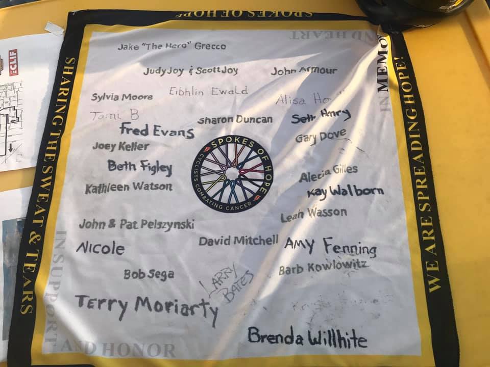
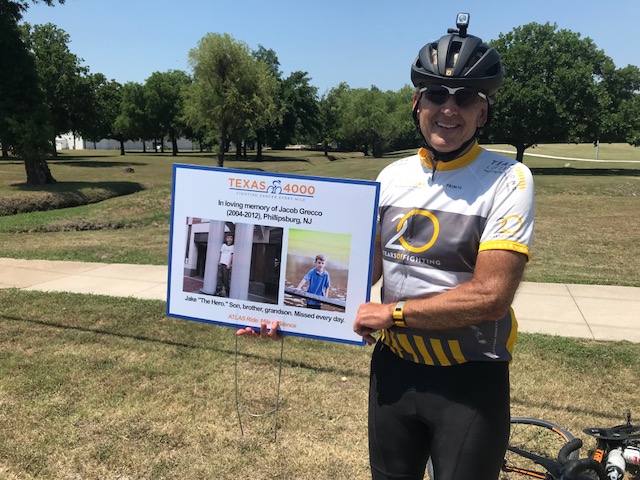
Spokes of Hope Memory scarf – Jake “The Hero” Grecco is the first name in the upper left corner
In the past it has never been smooth. We usually didn’t find out until an hour or so before the program when we would go on. But riding the track was only half of it. Spokes of Hope loaded up a trailer and brought a full display and store from Indiana to sell at the velodrome. And some of the mission was just support for people coming by.
Barry Sherry, Linda Baun, Lexi, John Baun
Call it a miscommunication, but we arrived only to be told that we would not be riding on the track. Uh-oh. No worries. We still had the tent plus there was an entire evening of bike races.
In Memory – Alex Shepherd
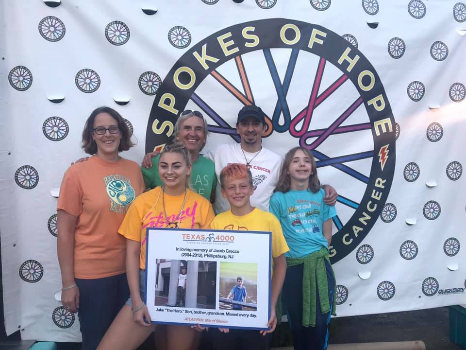
My cousins from New Jersey, Stacey Gravina and her family, always come over to see me. That always makes it special. Stacey was the mother of Jake “The Hero” Grecco, one of our heroes.
Stacey Gravina, Raeann Peters, Barry Sherry, Josh Grecco, Gary Gravina, Logan Gravina
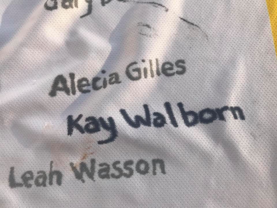
But this year was especially hard. I had hoped that my cousin, Kay Walborn, would join us as a cancer warrior. Instead, her name was the latest to be added to the Spokes of Hope banner that Cindi carries with her on rides. Kay lost her battle five days earlier.
Kay Walborn’s name added to the scarf. This sucks.
One of the people that came through was young Lexi. She was diagnosed with Acute lymphocytic leukemia (A.L.L.) in February, 2015, finished treatment May, 2017, and relapsed December, 2017. Lexi – we ride for you!
Cindi coaching Lexi
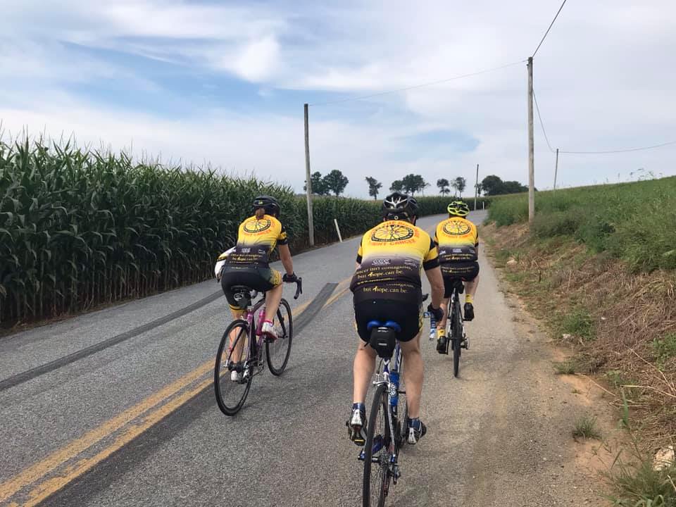
If Friday is all work, especially if we don’t get to ride), then Saturday is all play. Each year we meet for a group ride out to Topton and back. We meet at The Market Cafe which is quite a neat place situated right next to two train tracks. Unless you’re a railfan, which I am, you probably don’t want to be sipping on a cold drink when a train rumbles by.
On the road to Topton
The ride is truly one of my favorite rides of the year. It is just fun. But it is also a ride with other warriors – a brotherhood, and sisterhood, that can’t be explained and we don’t want others to join. But if you are diagnosed then we welcome you.
Front: Ken Hart, Cindi Hart. Rear: Barry Sherry, Jay Bodkin, Kathy Robinson, Andrew Werner
We had another great Saturday morning ride. Weather was perfect. Company was superb. I love my Spokes of Hope family.
Each year I look forward to my ride from Somerset to the family reunion near Punxsutawney (which is actually Winebark Park in Canoe Twp., near Rossiter). When my parents lived in Friedens, I barely had enough time to get there. But when they moved to Somerset I just didn’t have enough time to travel there safely before the noon meal. The road from Somerset to Friedens at 6:00 a.m. is just too sketchy.
Leaving Team Kia in Richland
Rather than leave in the dark, I checked with my nephew, Josh Reese, and parked at the Kia dealership in Richland. It was easy-off, easy-on for access from US Rte 219. When I arrived there was a heavy fog and I delayed my start until I felt safe enough.
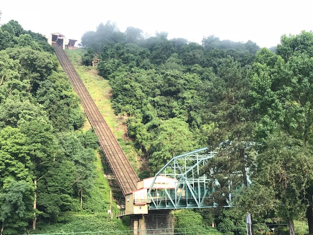
Good morning Johnstown! The Inclined Plane.
Leaving the Kia parking lot is a little like riding the Thunderbolt roller coaster at Kennywood Park in Pittsburgh for the first time. Rather than start by pedaling, I almost could take a half pedal turn then coast for three and one-half miles.
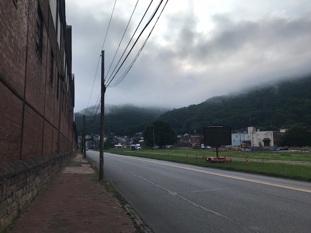
The fog in Johnstown on Clinton Street
Of course, I didn’t do that. It was all downhill and I pedaled most of the way, only occasionally dropping into a tuck and coasting. What a great way to begin a trip. Rather than go through Johnstown as fast as I could I went sight-seeing, mainly taking some photos of the Inclined Plane.
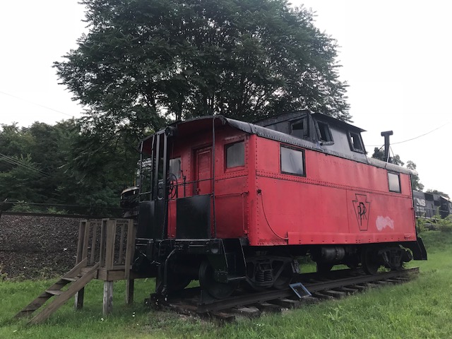
Who doesn’t like a picture of a caboose? (Walnut Street at William Penn Ave.)
The road (Pa. Rte 271) out of Johnstown is through East Conemaugh and up a mountain. But it seems to be graded at a consistent grade, I would guess around 4%, and I always find it easy (although my climb data may disagree). Traffic was mostly good as I went through Mundy’s Corner, Nanty Glo and Twin Rocks up to US 422 at Belsano.
Ghost Town Trail
I was on US 422 for less than half a mile then turned on (and stayed on Rte 271). I was surprised about a mile in to pass a bike trail crossing. This was an extension of the Ghost Town Trail. It looks like a nice trail, very lightly traveled, but best for bigger tires and not this road bike. At least for long distances.
Rte 271 north of Belsano
This is always my favorite part of the trip – the 13 miles to Northern Cambria. Rte 271 has good pavement, little traffic, and is easy pedaling, with only one climb along the way (up to Nicktown). I could smell the corn in the field. And occasionally, manure.
Rte 271 near Duman Lake Park
I stopped at Duman Lake to use a porta-john and also for a photo op. There is a climb to Nicktown which I only later learned was a Strava Segment. I didn’t know I was racing. I will have to come back tomorrow and put up a decent time.*
Duman Lake County Park
At Nicktown is a four mile descent to Northern Cambria. On past rides, I have hit 49 mph but today only went to 44 mph and got in a tuck. That was fast enough (and was also the speed limit – 45 mph). I have found that since my crash in Ohio I am more cautious than I have been and I have never been careless.
On the climb up 271 (Blue Goose) towards Nicktown
I stopped in Northern Cambria and saw my cousins, Don and Nancy Lowmaster, and their daughter. I couldn’t stay long but enjoyed the short time we had.
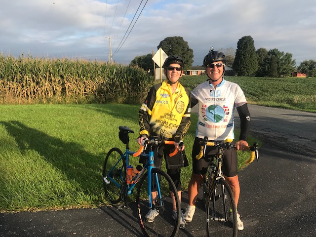
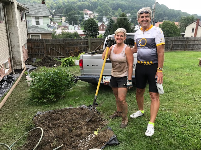
Tracy and Barry
As I was leaving Northern Cambria, I was passed by a truck pulling a trailer with a small tractor on it. The driver got out and as I approached, motioned for me to pull over. This did not feel like an angry setup and I complied. Then he asked if I was “the Barry Sherry.” Well, I admitted as much. But who was that stranger?
Mike Perrone
The driver was Mike Peronne, the former postmaster in Cherry Tree, Pa. We had never met but we had talked and he knew once a year I rode through here. And he said “and I saw your hair and figured it was you.” LOL. We talked for about five minutes before we both headed up 219 towards Cherry Tree.
Bridge at Winebark Park
The rest of the trip I thought about that interaction with the stranger. Those last 20 miles are the hardest as the road turns heavy and there is a lot of climbing. Steep climbing and grades that don’t remain constant.
Johnstown, Pa.
The last couple miles are on Porterfield/Canoe Ridge Road and pass a few Amish homes. A little girl in a blue dress excitedly waved to me. Of course, I waved back. As did a boy about 10-12 years old. And a man climbing a ladder. It is always enjoyable riding through this stretch because the Amish are always so friendly to me. I think they relate to cyclists as they ride bikes and we face the same dangers on the road they do whether it’s by bike or by horse. And I am the stranger to all of them.
_____ EDIT/EPILOGUE – I did go back on Sunday. Can’t believe a crappy time on Strava would bug me enough but I could not leave those two climbs (the other Station Road coming out of Twin Rocks) with such bad times. So on Sunday, I went hard, first on Station Road Climb. Since I started at Krispy Kream and basically went downhill to Twin Rocks, the “engine” wasn’t warmed up. Still, I lowered my time from 7:38 to 5:30, a reduction of 23%. When I got to Blue Goose Climb I was warmed up. I went hard and lowered my time from 8:26 to 7:10 which was only a reduction of 15%. Aaah. I’ll never get KOMs on these climbs but at least my name isn’t associated with sucky times anymore. And on my way back, I went through a new segment that I wasn’t aware of. My time sucked. Must go back again.
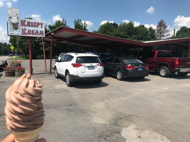
Krispy Kream in Belsano
At least I finished with a good recovery drink. In a cone.
Bicycling Magazine just published The 30 Hardest Hill Climbs in the World. I have always been more enthusiastic than talented but let me see about this list. Some I have done. Some I will never do (logistics mostly). And some I would like to do or do again.
The list:
Mount Evans, Colorado
Mount Lemmon, Arizona
Onion Valley, California
Whiteface Mountain, New York
Mount Mitchell, North Carolina
Mount Washington, New Hampshire
Le Mauna Kea, Hawaii
Passo Del Mortirolo, Italy
Mont Ventoux, France
Rila, Bulgaria
Passo dello Stelvio, Italy
Passo Gavia, Italy
Alto de Letras, Columbia
Alto de l’Angliru, Spain
Col du Galibier, France*
Mount Baldy, California
Haleakala, Hawaii
Col du Tourmalet, France
Alto de la Lenia, Columbia
Hardknott Pass, United Kingdom
Alpe d’Huez, France
Powder Mountain, Utah
Pico el Aguila, Venezuela
Wuling Mountain, Taiwan
Tong La Pass, Tibet
Grimsel Pass, Switzerland
EL Teide, Canary Islands
Monte Zoncolan, Italy
Grossglockner, Austria
Muro di Sormano, Italy
The ones I’ve summited:
1, 2, 6, 9, 11, 12, 18, 21
Mount Evans, Colorado. First went up in 2007 on a straight bar rental road bike. Then again in 2016 on my own bike – I saw a bear! It was easier on my own bike after 400 miles of riding in the Rockies.
Mount Lemmon, Arizona. Absolutely beautiful. Just make sure you carry enough water. Camelbaks work.
Mount Washington, New Hampshire. The hardest of them all. I have ridden it seven times; once without changing my gearing. I won’t make that mistake again. Heck, I won’t ride it again.
Mont Ventoux, France. Became rainy and very windy but I had one chance to get to the summit so I did.
Passo Stelvio, Italy. Her 48 switchbacks are calling me back. First rode it in 2014 and planned a side trip while in Switzerland in 2017 but warm turned to cold and sun turned to rain and snow on the beautiful pass.
Passo Gavia, Italy. A cold, wet day in June, 2014, my iconic image is seeing a bunch a teenage boys pushing their bikes up the climb where we rode.
Col du Tourmalet, France. In 2011 I went up and over the summit and back up again to watch the Tour de France. In 2010 I climbed it from both sides but was stopped 4km from the summit by the police for the Tour de France. It’s tough.
L’Alpe d’Huez, France. Another iconic climb. Probably the second most one I would repeat (after Stelvio).
The ones I’ll never do:
13, 19, 23, 24, 25
South America, Asia. Probably include Bulgaria (10). Doubt that I ever get to those places with or without a bike and none are calling me.
Most likely will:
5, 16
Mount Mitchell isn’t that far from Virginia. Why not make a road trip for the climb? And Mount Baldy is an iconic climb in southern California. It’s doable (from a logistics standpoint).
So what’s left? Doubtful I get to Hawaii to climb although it would be fun. I could drive to Whiteface, NY. Mortirolo was high on my list in 2014 but we were rained out (couldn’t get the support vans up there) and really never felt the need to get there. I should look at Grimsel Pass in Switzerland and Grossglockner in Austria. Plus there are a ton of climbs in France. I’ll keep climbing as long as I am able.
*And a special mention to Galibier. On July 19, 2011, I left LaGrave in a light rain and 50 degrees. The forecast called for heavier rain but I thought I was ahead of it. I wasn’t. It was seven miles to the pass at the Col du Lautaret. When I reached it, it was snowing. I did not have winter cycling apparel. It was another seven miles to the summit of Galibier but I wisely turned around. Probably a one-time attempt but wisely abandoned. Later I read that 200 British cyclists had to be rescued off Galibier.
EDIT/EPILOGUE – Since I made this post, I was able to ride up Mount Baldy, California (16) in 2018. The next day I rode up Gibraltor Road in Santa Barbara, California for the 2018 Hillclimb Championships Worlds. If I was serious about it, I would not have ridden up Mount Baldy the day before. DFL.
On November 4, 2020, I rode up Mount Mitchell (5).
The list is subjective and in my list, I would find a place for St. Gotthard Pass in Switzerland and its cobbled eight-mile climb. I rode that in July 2019. And I want to ride it again.
Yesterday was a day of riding solo. My one attempt at riding in a group had a brief discussion that I initiated.
“Where’s your group from?” (To the Old Men on Bikes)
“Bedford County”
“Well you know these roads. Have you ridden over Locke Mountain?”
“No”
End of discussion. It was going nowhere.
So I ended up riding solo. Knowing I should let a group catch me, part of me thought what was the use. No one was talking except to their friends and I brought no one.
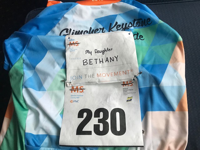
No one asked me about my bib for Bethany, although at the finish I did talk with Ellen Kovacevic about her. We also talked about her and her husband’s recent trip to France with Trek Travel.
Today I started DFL (that means last). Actually, I was last of the riders lined up at 7:00 a.m. to ride. A few may have jumped in after the 7:00 start.
We had rain from 4:00 p.m. yesterday until about 6:00 a.m. this morning. While the forecast was hopeful (15% chance of rain), the roads were wet at 7:00 a.m. It was 55 degrees and I didn’t even think to bring arm warmers. It’s summer. I did have a rain jacket which I put on though.
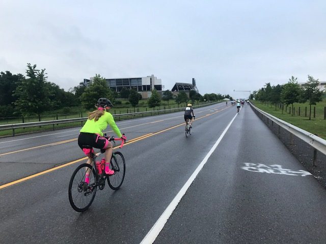
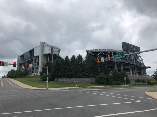
Beaver Stadium in the distance
At the back the group spread out. I “sat in” for four miles until I was finally able to make my way to the front of this back group and go off the front. Of course, all the fast riders and groups were already gone.
Wet roads
I rode on the wet roads, a bit fearful at times. I passed the first rest stop, motoring on to the second one at Camp Kanesatake outside of Spruce Creek. It was 18 miles in before I saw the first section of dry pavement. It would be cloudy, and windy, the rest of the ride, but we were done with the rain.
Pretty countryside
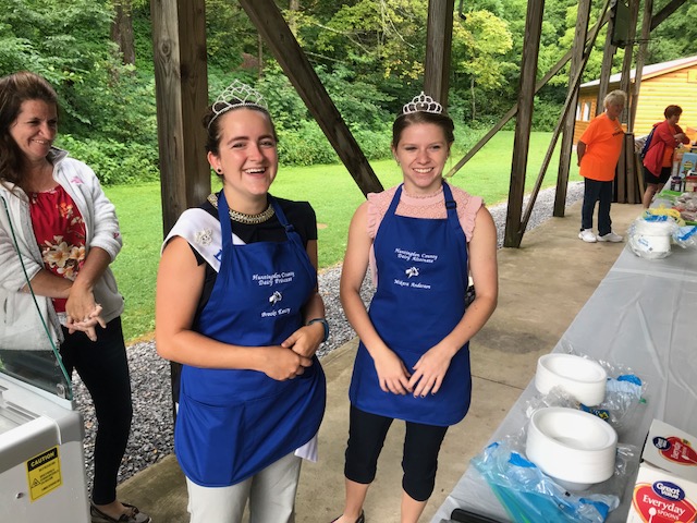
At the rest stop I was served ice cream by the two Dairy Princesses from Huntingdon County, Brooke Emery and Mikara Anderson. I really enjoy seeing the kids (although Brooke is 21) supporting agriculture. The ice cream, mint chocolate chip, was delicious.
Brooke Emery (L), Mikara Anderson (R)
On the road I was solo again. Shortly after leaving camp, I caught and passed five riders then settled in. I was catching no one and no one was passing me.
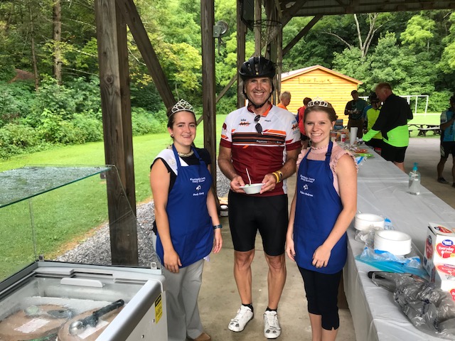
A thorn between two roses. Brooke Emery (L), Mikara Anderson (R)
I rolled by the lunch stop and saw no one ahead of me the rest of the day. It was almost my personal ride. In truth, there had to have been riders in the first group that weren’t delayed for four miles that did the same thing and were already finishing.
When I was in Altoona, I saw three riders come from another street and get ahead of me. “They cut the course,” I said to myself. I didn’t understand it but when it was raining I thought about the short way to Tyrone to just get to the finish. Ultimately I decided to ride the course as designed, in part so the volunteers didn’t lose track of helping us if we needed it.
Our “normal” return in Hollidaysburg was blocked off by road construction. We were diverted for a mini Tour de Hollidaysburg. It didn’t seem we had to see the downtown but I wonder if the organization wanted us to see Hollidaysburg or for Hollidaysburg to see us. Either way, it was a great choice.
Hollidaysburg
At the finish it was shower, eat (alone) then hit the road. Another MS ride done but I will seriously consider other (closer) events for the future. It was strange connecting with no one.
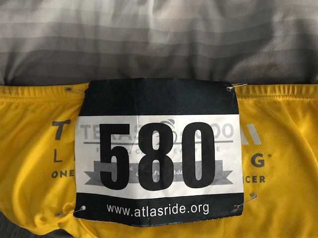
First, they had plenty of bibs “I Ride For…” at the start. I had made one ahead of time for Bethany and added one for Kristi Wallace and Kayla Bracken. I was the only one I saw wearing a bib and no one asked me about my daughter from seeing it.
My Bibs for the weekend
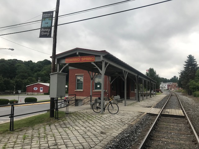
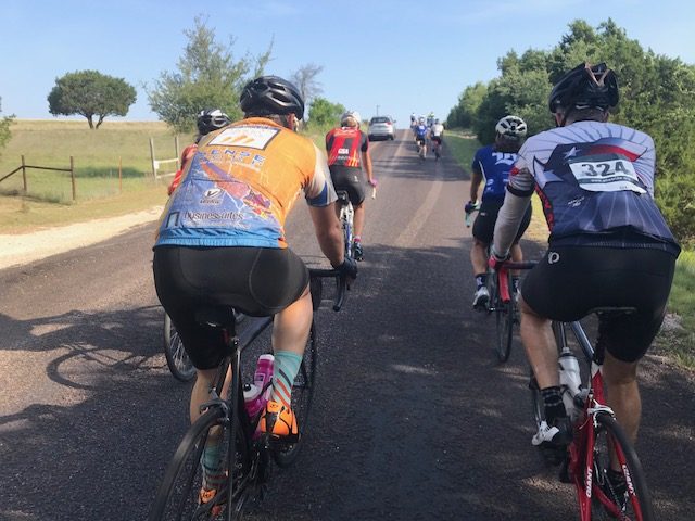
SEGMENT ONE – Hollidaysburg to Roaring Spring (19 miles)
I rolled out in the front group. I don’t know if it was the first 100 (ish) or the entire ride. I settled in and we dropped some slow riders but were going at a steady pace. Each time the group was splitting, usually on a hill, I was able to stay with the front group.
Riders at the start
Two riders wearing kits from Spokes and Skis (a sponsor) joined us. I recognized one as Bryan Caporuscio, the owner. It was six years ago I jumped into their group ride and when I asked “Bryan?” he said “Barry!” He had remembered me from that one brief half-ride. I knew that he and his friend, Jeff, would be looking to hammer it today. They moved towards the front but I stayed with them until they caused a split. I was too far back to try to bridge, nor was I up to the effort it would take.
In the group on Reservoir Road
I did find myself at the front of the main group and stayed there until finding a train station in Roaring Spring. It is a ride, not a race, and I went off the front then stopped and grabbed my photo. I was happy I stayed with the group all the way to the first stop until the photo.
My train station photo in Roaring Spring
SEGMENT TWO – Roaring Spring to Williamsburg (15 miles)
I rolled out alone (I rolled out of every stop alone today except for the mass start) and caught seven riders in Martinsburg. I sat on the back for a while. It appeared three (wearing yellow/white) were working and four (wearing blue and black and green) were getting a free ride.
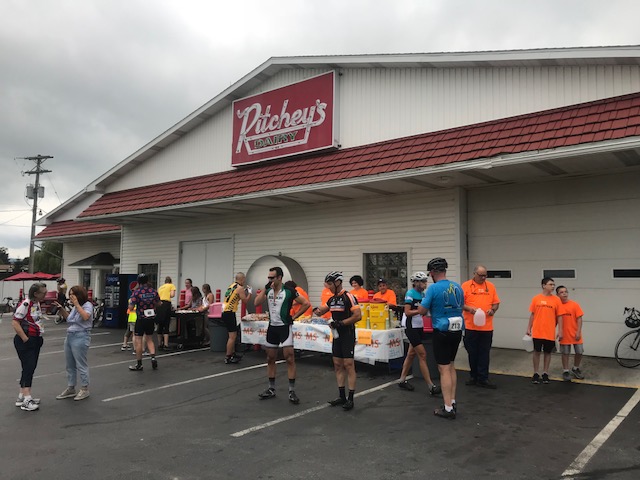
Ritcheys – First Rest Stop
I moved to the front and helped work. In fact, I was afraid I rode them off my wheel but after two miles I discovered they were with me. So now there were four of us. I took my turn until, a photo. Again, I went off the front, exited safely, and went back for the picture.
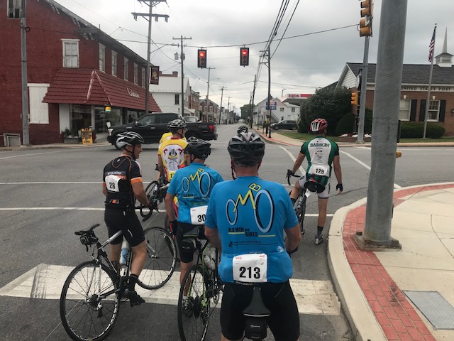
Martinsburg, Pa. – The blue jerseys are from OMBO – Old Men on Bikes
Back on the road a group (with momentum) passed me. I joined them, eventually went to the front and dropped them. Damn me.
Worth a photo
SEGMENT THREE – Williamsburg to Camp Kanesatake (17 miles)
I rolled out alone. The yellow/white group had grown and looked like they were ready to roll. I decided to soft pedal until they caught me then I would join them. They went by and it appeared there were 15 of them plus about five others. I jumped in.
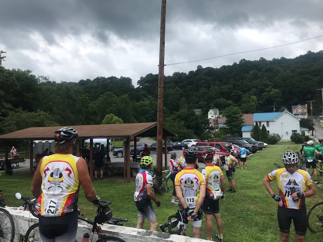
Rest Two – Williamsburg, Pa.
We got blown apart on the first big climb, and I stayed with their three leaders. I found they were not a friendly bunch, at least to this stranger, I eventually let them go and the remnants of their original group came by. I jumped in. I moved to the front to Camp Kanesatake for lunch.
Lunch was at the camp. I got the feeling I was the only one on the ride that wasn’t riding with a friend or partner. I sat with some volunteers. A couple of the white/yellow group had rolled out and when lunch was over, I took off.
Camp Kanesatake is a Christian church camp located in Spruce Creek, Pa.
SEGMENT FOUR – Camp Kanesatake to the famous Cookie Stop (14 miles)
I cleaned up my trash and looked around. It did not appear anyone was leaving that I could join so I took off. My plan was to soft pedal until the group caught me then join them. Here is where two competing aspects of my brain kicked in.
Maze Church, Warriors Mark, Pa.
Logical Brain: Soft pedal and they will catch you and you can ride with them
Macho Brain: Don’t let them catch you. You are better than them.
Logical Brain: Let them catch you – you can save 30% of your energy by sitting in the group instead of riding alone
Macho Brain: Don’t you dare let them catch you. Hammer it!
Macho Brain won. Sigh. It’s a struggle I often have.
Camp Kanesatake
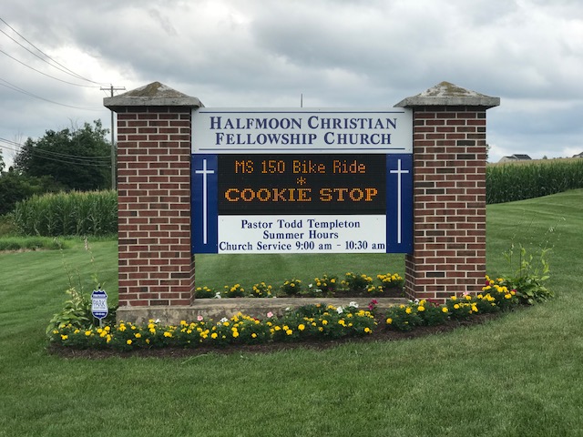
It was 15 miles and I did not want to get caught. In fact, I ended up catching two riders who had left about five minutes before me. And then was able to enjoy the famous cookie stop. (Truth: I had one chocolate chip cookie given to me by a young girl whose mother had baked it.)
The traditional cookie stop, the parishioners are all in at Halfmoom Christian Fellowship Church, Port Matilda, Pa.
SEGMENT FIVE – Cookie stop to State College (13 miles)
I stopped to talk to the volunteers at the entrance/exit and the four young kids. I left the message with the kids to always wear a helmet when they ride. In the meantime, a group of five or six guys took off. They were one minute up the road.
Beaver Stadium, State College, Pa.
I thought about going full in to try to catch their group but decided to ride my own pace. Their group dropped two (blue riders) and I had them in sight. For a couple of miles I could see I was 35 seconds behind. And then it came down quickly. Twenty seconds. Ten seconds. And a catch. I joined them, stayed with them for about a minute, then went to the front to work. I dropped them. Rode solo to the Penn Stater.
The finish line at the Penn Stater
I beat the rain although it doesn’t look I will be so fortunate tomorrow. This was my longest ride of the year, derailed first by knee replacement and then by a memory-loss crash and concussion. So I am happy. Very happy.
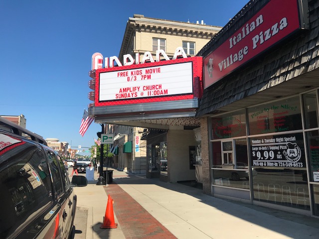
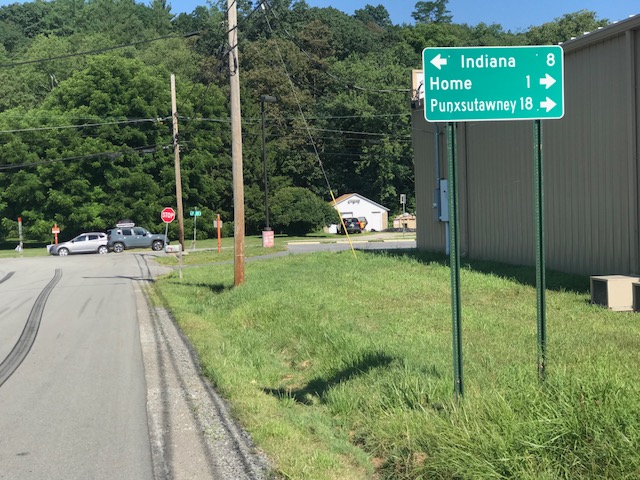
No, not Hooisers. But Indiana, Pa. Home of Jimmy Stewart of 1940s-50s movie fame.
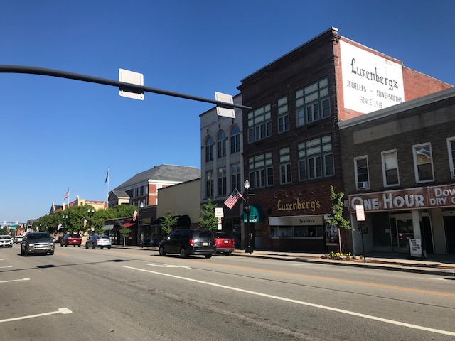
Downtown Indiana, Pa.
I had gone online, found four covered bridges, and then using RideWithGPS.com, mapped a 35 mile ride which would take me to the four bridges. Today was a great day to ride.
Downtown Indiana
I parked at the Indiana Mall and then took Rte 286 (Oakland Avenue to Philadelphia Avenue) out through town. Indiana has a beautiful downtown, even prettier in the early morning sunlight.
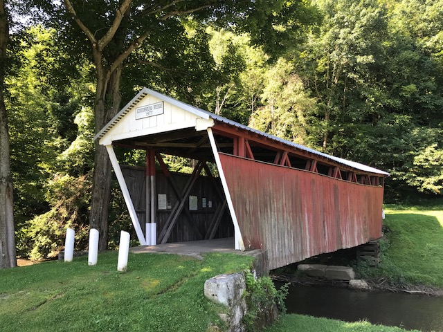
Kintersburg Bridge
The first 8.5 miles, towards Clymer, was on Pa. Rte. 286. It was sketchy at times. Not a major highway but it is the major road between Indiana and Clymer. Despite a 4-foot law, some cars came much closer when passing, the closest of which was a Pennsylvania State Policeman. Seriously.
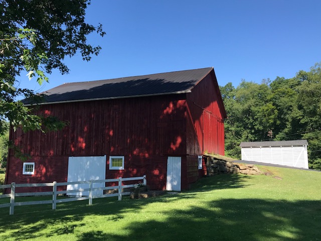
Barn on Tanoma Road
When I turned on Rayne Church Road I was glad to be on a country road and stay on country roads the rest of the ride. I first came to the Kintersburg Bridge which surprised me. I was enjoying the day and temporarily, had forgotten this was a covered bridge ride.
Yes, I was almost to Home
I passed the most beautiful farmhouse (but did not take a picture) next to a pretty barn. I hesitated turning onto U.S. Rte 119 but was on it for less than .25 mile and saw no cars on it for the 1:00 or so I was there.
Crossing the Buffalo and Pittsburgh Railroad
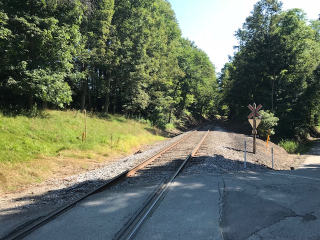
What I didn’t know: Rte 119 is also marked as Pittsburgh-Buffalo Road. I turned onto Chambersville Road and came upon three at grade crossings with a railroad. None had any signals, just a “Railroad” sign.
Gravel on Black Road
I didn’t see the railroad but I am 99% sure the single track belonged to the Pittsburgh and Buffalo Railroad. This would be the line from Punxsutawney to Homer City, a line which goes past my uncle, Don Sherry’s house in Juneau.
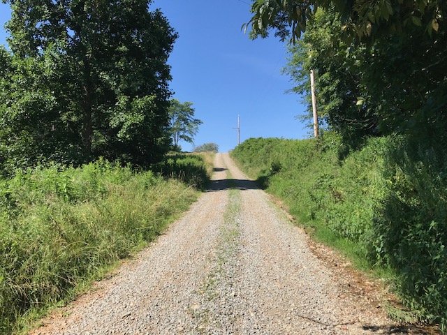
Black Road. Downhill.
I didn’t know where I was going (which was part of the fun of this type of ride). I was following my Garmin cues when it told me to turn left (Black Road). I turned and after 75 yards it turned to gravel. I stopped. I thought I could check where I was on Maps but was in a no service area. I decided to push on.
Looks like red dog under the surface
It was rough riding. It wasn’t impossibly hard but I was worried for the bike and wheels. At the top of the first climb I had a great view and saw the road continued as gravel. I walked. I did not want to be on the bike on a steep descent as I was afraid I might slide out.
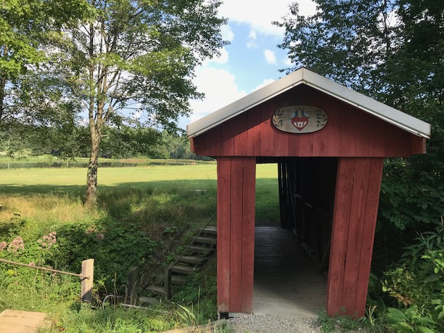
Harmon’s Bridge
Although it felt like four miles, it was two miles. The road appeared to be an old “red dog” road (mine waste). These were supposed to be removed years ago and it appeared to my eyes that this was not fully removed.
Trusal Covered Bridge. I rode in the field instead of the gravel.
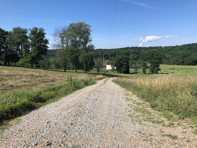
I came upon the second bridge, the Harmon’s Bridge. Shortly after seeing this bridge I jumped on Five Points Road. If I had stayed on Davis Road instead of turning onto the gravel, I would have come to Five Points Road. In fact, it was probably the same distance. But when I mapped it out I chose the route because I wanted to ride over the bridge and not divert from my route (Five Points Road). If I did this again, it’s an easy change to the route.
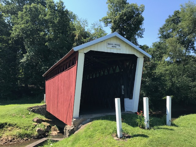
Trusal Covered Bridge
Only half mile away was the Trusal Bridge. It was also off Five Points Road. The road to the bridge was gravel. I chose to ride in a field next to the road rather than on the road.
Bridge under B&P RR
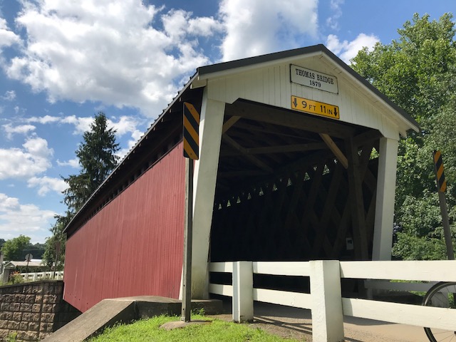
I rode to Creekside and over to the Thomas Bridge. As I left Thomas Bridge, Garmin had me going up Jamison Road. It turned to gravel. I turned around. I rerouted over to Fleming Road. I got on N. Ben Franklin Road and had my biggest climb of the day.
Thomas Bridge
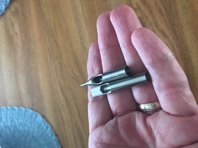
Partway up I saw what I thought was a sleeve of drill bits. I stopped, picked them up, and saw they weren’t drill bits. Later I posted a photo of them on Facebook and offered them to anyone who wanted them. Guesses were calligraphy tips, leather punches (and there are Amish in the area), and tattoo needle guides. The winner was tattoo needle guides. I discarded them.
Tattoo needle guides
If I ride this again, I would look for an alternative to 286 towards Clymer, stay on Davis Road to Five Points Road, and erase Jamison Road which I did as I rode. And I may ride it clockwise to get the Ben Franklin road climb out of the way at the beginning.
Covered Bridge Facts
Harmon Bridge, which was built in 1910 at a cost of $525, is 45 feet long and was named after Civil War veteran J.S. Harmon
Kintersburg Bridge was built in 1877 and named for Isaac Kinter, a local shopkeeper. J.S. Fleming erected the bridge over Crooked Creek at a cost of $893.
The Thomas Bridge was built in 1879 at a cost of $545 and completely reconstructed in 1998 at a cost of slightly more than $1 million dollars.
Trusal Bridge, built in 1870 (also known as Dice’s Bridge). At 41 feet long, the Trusal Bridge is the shortest of Indiana County’s covered bridges. It was named after Robert Trusal, a nearby property owner. The preceding facts and more information can be found at the Indiana County tourism website.
I pulled into the parking lot at Hanna Springs Elementary school and got my bike from the truck of the Kia Optima I had rented. Not an ideal rental car but I could lower the two back seats and the trunk was roomy enough that the bike would fit, minus the front wheel.
Although I was at least 20 minutes early, I was in a hurry to find my “teammates” for the day. I did not anticipate meeting Vanessa and her friends because they were departing at 9:00 a.m. and not rolling out at 8:00 a.m., the start of the 50-mile ride. I got on my bike and went 20 yards before returning to the car. Lights.
I had brought a rear tail light for the bike and flashing helmet lights. I have found myself much more antsy on the bike since my crash, even though I was near no one. No riders. No walkers. And especially no cars but I found in the last week as I returned to riding that cars especially made me antsy. Those lights would do no good locked in the car for the day.
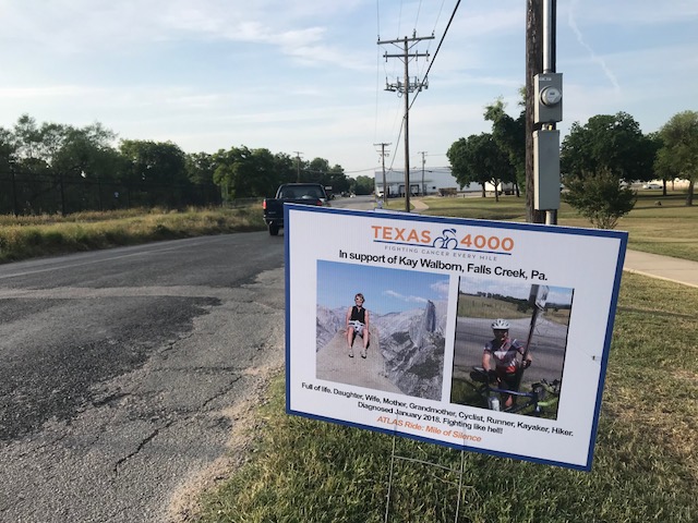
In honor of my cousin, Kay Walborn, fighting a good fight
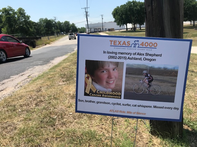
Properly lit up, I rode down Hackberry Street and was directed to the Atlas start – I followed others via sidewalks or just cutting through the park’s grass. I wanted to get a look at the Mile of Silence, a mile (or quarter-mile) of signs dedicated to people fighting or have fought cancer. I found the sign dedicated to my cousin, Kay Walborn. To see the others would have to wait until we rode this stretch at the end of the ride.
Roll out at the start of the 50-mile group
I had two ride options today: a 25 mile loop or a 50 mile loop. I did not come to Texas to ride 25 miles. So I was committed to 50. While normally I can ride 50 with almost no effort, since knee surgery in February, I only had ridden 50 miles once. That was three weeks ago from Reston to Purcellville when I discovered Scott and Nichole had sold their bike shop and moved to France.
But after the crash and concussion, I was off the bike completely for 10 days and then allowed to slowly introduce “light activity.” I rode 10-12 miles three of four times although I rode 26 miles once. The day I rode 26 miles I cut it short and thought then about changing all my reservations from this weekend to the Livestrong Challenge in October instead. But I didn’t.
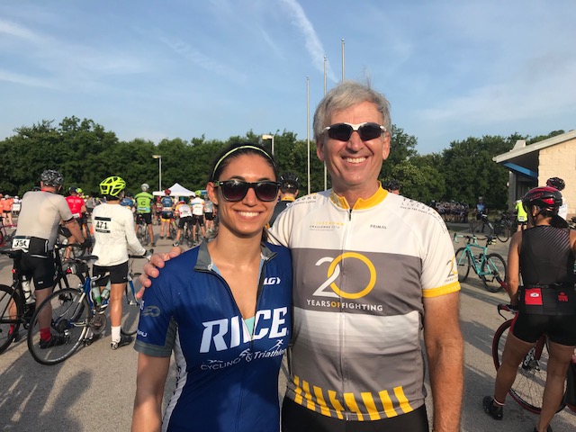
I looked for Mary. She is the president of the Rice University Cycling and Triathlon team and a friend of mine who I met five years ago. I saw the Rice jerseys lining up at the start and asked Cat, one of their riders, if she could hold my bike long enough so I could hug Mary. She obliged.
Mary, Barry Sherry
Mary introduced me to Cat and Caitlyn. And Brian, who was a 2009 alum of the T4K. She said we could ride together, they would probably go 16-18 mph and I thought I could handle that.
We rolled out and quickly Brian was off the front and Mary and I had to bridge up to his group. His fiancé (?) was with him as well as another rider. If they introduced me then I suck at remembering (which is true). This is especially true since my brain injury. My short-term memory, especially involving names, is lacking.
Rest Stop 1
I don’t know how it happened but we organized and Brian and I were on the front, setting a nice easy (so I thought) pace, although a couple of times we were asked to slow down.
The thought that “an easy 50 miles” would be my first effort since the concussion and that I should save myself did not exist. In reality, I was burning matches that I would need at the end, without even realizing it because the pace we were going is one I maintain when I am in “bike shape.” With Brian and me at the front, we averaged 17 mph over 13 miles, our fastest segment of the day.
At one point I even told Brian that I probably shouldn’t be up here setting the pace the entire time and should drop back and sit in. But I didn’t.
Brian (left), Mary farther up on right
There were four rest stops on this course which made for an easy day. My group stopped at all four. Because I anticipated getting a complimentary bottle from Mellow Johnny’s with my rental, I had brought just one water bottle. A sponsor, Bush’s Chicken, had some bottles, not necessarily for the bike, but I was offered one and put it on my bike.
Rest stop 3 – We were about to start the oil section
The roads were mostly “heavy” roads. Those are of the chip and seal variety and don’t present a smooth riding surface. They didn’t affect my ride or comfort, but I was working harder than if I was on smooth pavement.
At Mile 27 we had a rest stop just as we turned onto a newly surfaced road. By new I mean yesterday. Literally yesterday. Fresh oil. I was very glad I was not on my bike but was on a rental. Our group stayed together but after five miles or so I noticed that I had gapped Mary. I slowed a little for her to stay with me and we joined a teammate. We had 11 miles on that tar and chip mess.
With the sign for Cousin Kay
At our last stop, Mile 38, the star seemed to be this 9-week old German Shepherd puppy named Murphy. Everyone wanted to pet him and he only wanted relief on the ground under a table in the shade. I was hoping his owner was getting him enough water as I was finding my own.
This is a supported ride and at every stop they had bags of ice. One did not have to settle for lukewarm water in your bottle but always could add ice and make it ice old. I refilled my bottle (the second one stayed on my bike with 100 degree water in it) and went to tell Mary that I couldn’t wait for everyone to finish eating fruit and filling bottles before rolling out.
I could feel my body shutting down and I didn’t want to spend more time at this stop than necessary. But Mary’s group didn’t linger and we were soon on the road. We were off that new chip and seal road but it looked like we had a half-mile climb right out of our stop.
Brian and his couple of riders went. Mary hadn’t yet clipped in so I went at a slower pace determined to let her catch me. I looked back and could see her but also saw a couple gaining on me. First the man passed me then his wife passed me. And I felt a twinge.
Strangely enough, whether the road got steeper or leveled out a bit I couldn’t tell you, but I found myself passing this couple. We were all riding at our own pace.
About a quarter-mile later, Mary caught up, along with a friend. We had talked for most of 38 miles but said nothing the last 10. It was a sign to me that I was beat.
There was a strong headwind. A strong, hot headwind. It seemed every time I looked up the road was going up. There were no major climbs just a gradual slog into the winds.
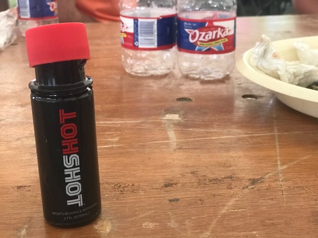
The twinge was a warning. My body was shutting down. I carried a bottle of Hot Shot designed to eliminate cramping. I had never needed it before but was able to unseal it and drink about 1/3 of it at once. And just like that, the cramping went away.
Hot Shot to eliminate cramps
We continued on, without talking. As the road turned up again Mary pulled away. Earlier in the day I would have gone with her but I knew better than to try. I was light-headed. And I was watching my heart rate monitor. It seemed to record a higher than believable rate. I was pushing 170 bpm yet I wasn’t breathing heavy.
I also thought, in no particular order, that maybe my blood pressure was way off. I couldn’t feel my heartbeat at 170 bpm but maybe I was ready to have a stroke. I saw one SAG vehicle go by and lamented they had room for three bikes on the back and they had three bikes on the back. I thought maybe I would pull over and call for a SAG but sitting on the side of a shade-less road seemed more punishment than moving forward.
In Memory of Alex Shepherd
With Mary up the road, I was keeping pace with her friend, neither of us saying a word. I changed my Garmin screen and could see I had 5.2 miles left. Then 4.5. Then 4.0. Mary’s friend seemed to be struggling and it was all I could do to tell her “3 miles to go – we got this.” I counted down 2.5 then 2. Then we passed a couple of riders coming in from their 25-mile ride which unconsciously may have given us a boost. And we saw Mary.
With one mile to go, we caught Mary and soon turned down the street to make the Mile of Silence. I asked Mary to stop with me so I could get a picture of Kay’s sign. And then I sought out signs for Jake and Alex (Jacob Grecco and Alex Shepherd).
In memory of Jake Grecco. I repositioned his sign to a better location.
Mary and I rode the last half mile together, with Mary, not me, wanting to stop and take some pictures of the old downtown. Another sign I wasn’t thinking straight.
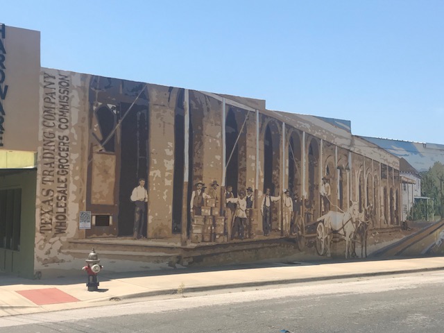
Lampasas, Texas – the town of murals
We parked our bikes and I called Vanessa. She had texted and wondered if I was there and I wasn’t going to mess around with texts. She asked if I was OK and told me I didn’t sound good. Her group was in the food line and allowed me to cut in. I was so cramped and tired that social norms (not cutting line) were not going to be obeyed.
I met her friend, Kevin Hellgren, and then a big surprise to me, Kristina Schommer. She was my bicycle buddy (pen pal) four years ago with the Ozarks team in 2014. It was great to finally meet her.
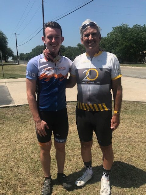
We found someone who found this year’s bicycle buddy, Grant McFarlin. After meeting we talked about the day’s ride. He had done the 25-mile route. I am a big supporter of the T4K program including their safety and training. They have a required metric that all riders must meet – a 10-hour century ride. Grant told me one of the riders had crashed at Mile 90 in April and never finished his requirement.
Grant McFarlin, Barry Sherry
So on Thursday, the day before they were to leave, Grant and two other riders, joined this rider so he would finish his test and ride the T4K. Grant had ridden a century on Thursday, 70 mile roll out yesterday, so he was to be excused for a 25-mile ride today.
Grant couldn’t stay and talk much as they were getting ready to present. After this year’s T4K teams presented, music started playing and everyone sort of scattered. I was told that Grant walked “that way.” And pointed to the horizon.
Although I had cramped even while sitting and eating under the big tent, I needed 1.5 miles to make 50. I would have quit at 49.99 two hours earlier but thought I would take “the long way” back to my car. As I arrived, there were just two cars left in the lot. Mine and a pickup truck next to mine. And Grant was talking to the driver.
Grant and his girlfriend, Lizzie Hill, had walked over to the school and I was able to see him before they would depart. That warmed my heart I could say goodbye.
They walked back to the event and I drove off into the horizon. Or sunset. Or to the nearest In-N-Out Burger for dinner. Yea, I think that was it.
EDIT/EPILOGUE – I still had the effects of my concussion and should not have traveled to Texas for this ride. My body was not in shape (see photos) and certainly could not handle a 50-mile ride in Texas heat. But the next night, in Houston, was the last night that I had headaches from the crash so I was healing. Slowly.
I began the day at Bicycle World in Austin. Here is one thing to know when visiting Austin: There is no such thing as a free lunch and there is no such thing as free parking. Well, maybe that’s two things.
Inside Mellow Johnny’s
I found a parking lot next to Bicycle World with very imposing signs – “We Tow. We have cameras.” I didn’t park there. Not even sure what kind of lot it was. It may have been for a hamburger place. But it wasn’t friendly.
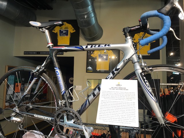
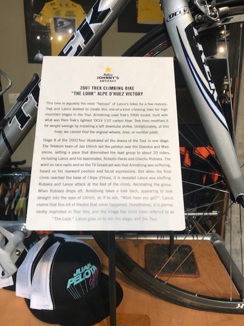
Ridden by Lance Armstrong in 2001
Instead Schlotsky’s Deli is right across the street. Imposing signs there too – “Parking for Customers Only.” But I went in, enjoyed a sandwich and a drink, then ran across the street to Bicycle World where I checked in for tomorrow’s Atlas Ride. I noticed they had a sign for bicycle rentals and thought maybe I should have gone there. Or maybe next time.
“The Look” – Notice the Juan Pelota Cafe cap. Pelota is Spanish for ball; Juan sounds like One
After checking in and going back to the Schlotsky’s parking lot, where my rental car had not been towed or booted, I drove over to Mellow Johnny’s. There is a parking lot for Mellow Johnny’s. But a couple years ago, the city noticed somehow MJ’s customers were allowed to shop without paying the city. So they put an end to that. This is Austin.
Imposing sign – You Must Pay to Shop here. I went to the pay kiosk, registered my car. Parking was $2 for one hour; $9 for two hours. I wonder what what happen if after 59 minutes, or 60, one would go back and pay for a second hour of parking. This city needs some grown ups in charge.
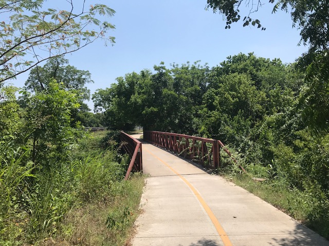
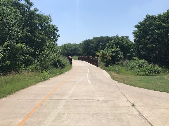
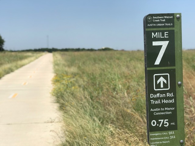
Southern Walnut Creek
I went in and re-introduced myself to Peter Finklea, the rentals manager at MJ’s. This was the third or fourth time I rented here. Peter is a very nice guy and I have really enjoyed renting bikes here in the past. This one was a last-minute decision.
I had budgeted $50 /day for a quality bike rental. I thought I would ride some on Thursday when I arrived, plus Friday, and of course, the Atlas ride on Saturday and something, somewhere on Sunday.
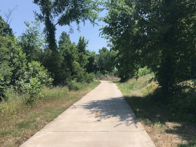
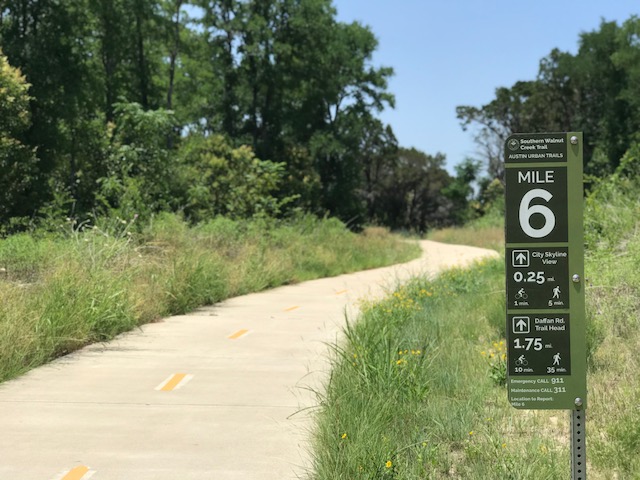
Southern Walnut Creek Trail
Never one to get anxious, I think I was being affected by the concussion I sustained in Ohio. The thought of tearing down my bike, delicately packing it, then flying with it was weighing on my mind. And there is the cost component. The “full fare” airlines charge $150 to check your bike as luggage. In a bike crate or bag. Each way. So flying my preferred airline, American Airlines, was basically out of the question from the start. I booked on Southwest Airlines because their bike fee was friendlier – $75 each way.
Southern Walnut Creek Trail
Without considering the hassle of tearing down the bike, rebuilding it at the destination, and worrying about whether it will make it undamaged, just the cost factor meant a 3-day rental was the same price as taking my bike. Then will I want my bike? For 100 miles, the answer is probably yes. For extreme climbing, the answer is definitely yes. But for 50 miles without a significant climb, it really didn’t matter. So I went online and found my size and reserved at Mellow Johnny’s.
Southern Walnut Creek Trail
Peter knows what he’s doing. He did a quick but thorough bike fit – as much as one can do for someone about to go out the door on a rental bike. He adjusted the seat, twice. The stem and handlebars were OK. He affixed the computer mount that I just bought and I asked him for a recommendation of a ride.
Southern Walnut Creek Trail
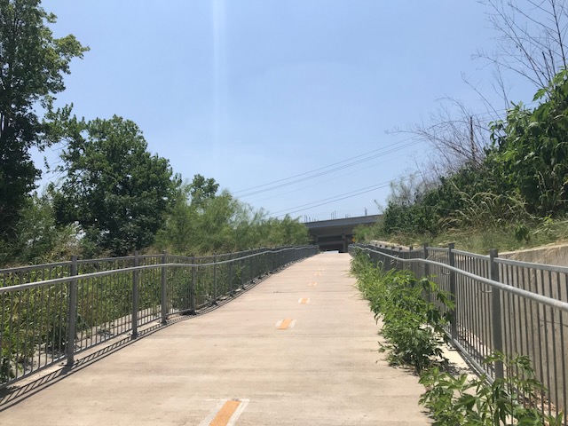
Unlike past years where it was OK to leave the car in the MJ’s parking lot and go ride, I had to be gone by 12:53 p.m. Peter offered up “hilly and long” to the west and “shorter and flatter” to the east. With the temperature pushing 100 degrees, I opted for shorter, and flatter.
Southern Walnut Creek Trail
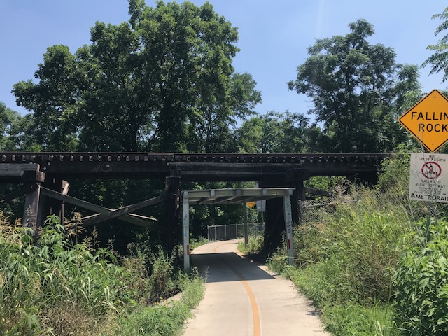
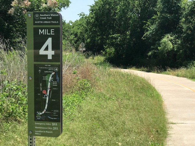
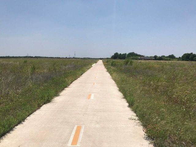
Although Peter pulled out a map, he talked about the Southern Walnut Creek Trail and I realized that I had ridden it before. And it would be perfect. After figuring out it didn’t start at “Go-Valley” Park (but Govalle), I drove out to the park.
Southern Walnut Creek Trail
The Southern Walnut Creek Path is relatively new. It is a 10’ (3 meters) wide concrete trail. And I saw virtually no one other than a family walking their dogs at the beginning. Peter had said the trail was 10 miles and I had remembered a plateau after eight miles or so and then a descent across a road. I had decided that I would ride to the plateau but not the descent. I was afraid of going too far and I didn’t want to ride the descent knowing I’d have to turn around and come back up.
Southern Walnut Creek Trail
Strange it seems. I love to ride and I can go 100 miles or more with no problems. But with knee surgery and a long recovery in February, I was just starting to get outside on the bike. The trip to Ohio was to get in some long miles but that didn’t work out. Actually, I got some of the miles I wanted but was planning another long ride on my day home. That ended with the concussion.
Southern Walnut Creek Trail
Now I worried about getting light headed. Running out of water. Or simply going too far for too long in this heat. So twenty miles would be enough.
Southern Walnut Creek Trail
At the plateau it was windy. Here the trail left nature behind and passed a trailer park that seemed to go on for a mile. My memory from a couple years ago worked fine. I came to the road where the trail turned down and decided to go back. I knew I would get 20 miles just out and back and decided to explore some of the spurs.
Southern Walnut Creek Trail
Or I explored one. At least. There was a half mile trail to the Austin Tennis Center. I arrived and saw all these empty courts. No one was playing. It was 2:00 p.m. on a Friday and it was 100 degrees. Couldn’t blame them. (Or maybe it wasn’t open weekdays until the evening.)
Southern Walnut Creek Trail – Hot and WIndy
Getting back to the car, I was hot and thirsty. I had used my one water bottle and did the only thing I knew to do over the next three days or so. Find an In-N-Out Burger. Although this would be simply for replenishment (milkshake) as I was headed farther north for the night.
I opened my eyes. I was slow to wake and remember seeing a river. Strange. Where was I?
After at least six surgeries in the last 15 years plus another 2-3 “procedures,” I was used to waking up from anesthesia. There’s a bit of grogginess followed by a desire to go back to sleep. Each time I knew I was in a hospital and would be going home in one or two hours. I felt like I was coming out of anesthesia.
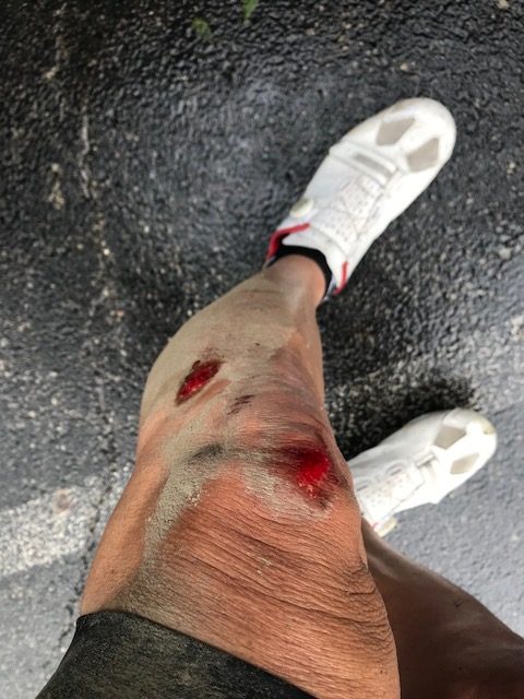
The left side of my body hurt. My leg was bleeding from road rash. My left shoulder hurt. I thought I may have broken my collarbone. But mostly, I wanted to go back to sleep.
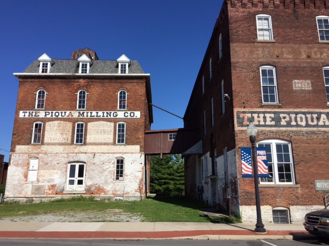
The high bridge in Piqua
I heard a voice. I don’t remember a face with the voice and the only words I recall were “I’ve called 911 and I’ve answered that question seven times now.“*
I had no clue where I was or what I was doing. This was much different than 15 minutes earlier.
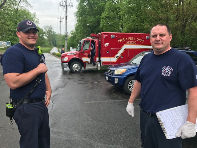
Somehow an ambulance made its way onto the trail and paramedics were talking with me. I don’t remember any of the conversations with one exception. I asked where I was. The response was “Ohio.”
Paramedics at the trail head
What? How was I in Ohio? Or why? I had no clue why I was here. My memory from earlier in the day was gone. I had my bike. I was wearing cycling clothes and it was obvious that I was on a bike ride but where and why?
A park ranger arrived in a pickup truck. At first, I didn’t know where I was so I certainly didn’t know how I got there and where I was parked. Or if I was parked. But my memory slowly was coming back and they asked me if I was parked at the trailhead about a mile south of here. They had seen my car and I told them I was parked there. The paramedics wanted me to jump in the ambulance but I just wanted to go back to my car. I did not try to ride my bike. They put it in the back of the truck and the only act of clarity I had was to turn off the Garmin so it did not record more miles than I actually earned. I rode with the ranger.
Some of my memory was coming back to me. We traveled almost one mile when we came to a trailhead which is where I had parked. The ranger asked me if that was my car and I told him it was.
The paramedics stopped and checked me one more time. I was parked right across from the highway from a hospital. They encouraged me to go to the E.R. to get cleaned up. I was pretty bloodied and my shoulder hurt, reminiscent of my broken collarbone five years ago.
The parking lot at the hospital was crowded. I saw one empty space up front for handicapped parking. I took it. I had a handicapped parking placard still in effect from my knee replacement surgery and on this day I needed to be close. I was still in a fog and forgot to hang the placard but wasn’t ticketed.
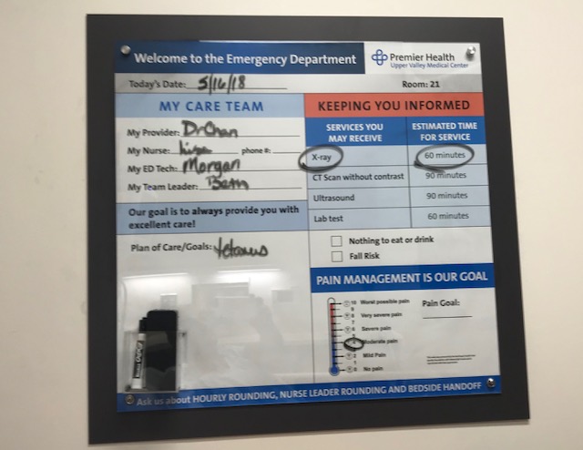
I was wearing cycling shoes. My cycling jersey was ripped. They asked me if I had been biking. And that was sort of the highlight of the exam. They cleaned my leg wounds (mostly) and X-rayed my shoulder (negative). The nurse told me she was going to take my blood pressure again. I said to her “again, but you haven’t taken it yet.” She responded, “Don’t you remember? I took it when you first came in here about 30 minutes ago.”
Have I been biking?
Despite this exchange, this was not enough to suggest they should examine me for a head injury. And while it’s possible they did a full exam on my head which I don’t remember, there was nothing on the discharge paperwork stating they had checked me for a concussion. Not only don’t I remember them ever checking me for a head injury, the discharge paperwork did not list it either.
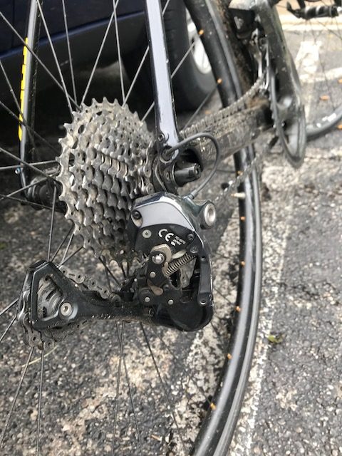
I would not have been happy but they should not have discharged me and let me drive. But I left and went back to the trail. I was going to ride some more (this was the primary indication I had a head injury). I went to get on the bike and saw the rear derailleur was messed up. The hanger was broken. I could not ride.
Broken hanger
Slowly my memory started coming back. It was a cool and cloudy day. It looked like it might rain at any moment. And I wanted to ride near Piqua.
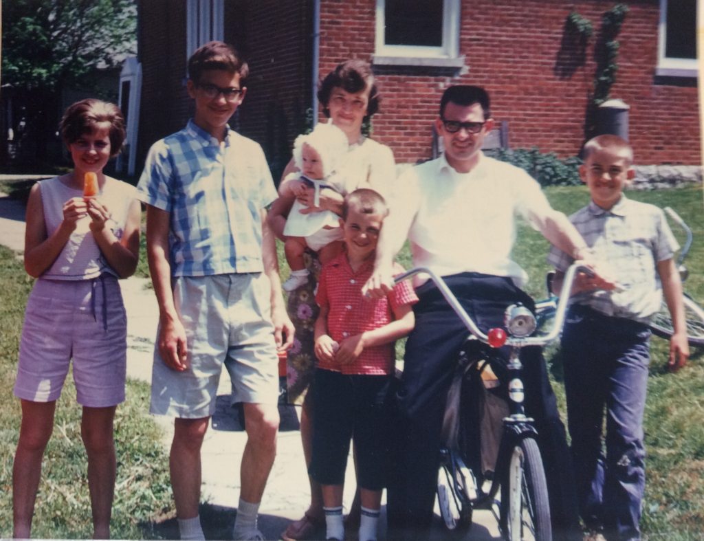
The Sherry family in front of the Lockington church/parsonage in 1966. L-R: Brenda, Bernie, Naomi (holding Betsy), Brad, Rev. Harry, Barry
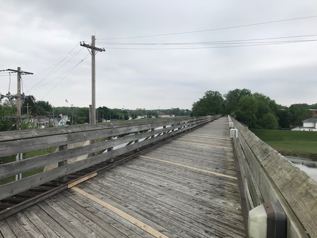
This was to be a pre-ride before the Ride of Silence in Dayton at 7:00 p.m. I had parked in Troy at a trailhead of the Great Miami River Trail and ridden north to Piqua. There was some mud on the trail and I passed a worker sweeping and I thought he was spreading the mud around.
Worker spreading the mud around on the trail
I chose to ride this morning’s route as my own journey back in time. We had moved to the small village of Lockington in 1964 when I was almost nine years old and lived here for three years. The small parsonage is now an extension of the church.
Lockington Kirkwood Bridge
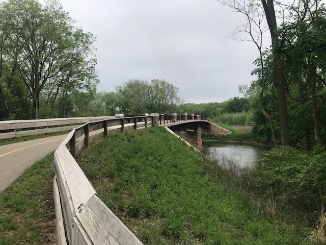
From Piqua, I rode to the Kirkwood bridge which was a covered bridge when I lived here. As a kid, I could ride my bike all over and this one was tough because in an otherwise pancake-flat topography, there was an actual hill to ride down from Lockington and then back up. The bridge burned in 1989 and was replaced with just a bridge. Looks like a roadway.
Kirkwood Bridge today
As a kid, I rode my bike to deliver newspapers (Piqua Daily Call – I made 2 cents per paper), to the Piqua Country Club to golf, and to Piqua to Echo Hills Golf Club where a youth season pass cost $5 for the year. No helmets and I don’t remember ever carrying water.
The former parsonage in Lockington, Ohio
We would use our bikes to rid litter off the roads. A soda (or pop) bottle was made of glass and carried a 2-cent deposit. These were like gold to kids. Find five, and it wasn’t that hard, and we would take them to Forsythe’s Frozen Locker in Lockington. We could trade five of them in for a cold Mountain Dew (10 cents) that we would drink there. A bonus would be to buy a frozen Zero candy bar for another five cents. While history will tell us the 1960s were a turbulent time for a kid growing up, actually they were pretty good.
It was a nice trip back in time. I found myself a bit fearful on some of the roads with the cars going by too close for comfort. And I think back to 50 years earlier when I was a kid. I rode on these roads and either those drivers were much more careful than today’s drivers, or probably, as a kid, I just did not perceive the risk of riding my bike on a highway – as a 12-year-old.
Piqua is such a beautiful city and I rode through it twice. The trail passes the nuclear reactor which made Piqua the first nuclear-powered city in the U.S.
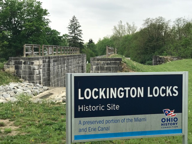
Lockington Locks
I made my way south on the trail and remember crossing the Great Miami River where four people were walking and taking up the entire width of the trail. I rang a bell and politely announced “passing” and thought it was a bit strange that three moved to the right and one moved to the left. I went right through them. And my memory ended right there.
Bridge over the Great Miami River
What happened next will remain a mystery. I have no memory of being on the train south of the bridge. I would wake up and see the river and hear a voice.
I would later compare the time stamp on my Garmin file with the timestamp of the 911 call and determined I was unconscious on the trail for six minutes. A retired Piqua cop, Paul Sullenberger, happened to be riding by and saw me. It was his voice I remember hearing.
Library, Piqua, O.
I don’t recall how the ambulance(s) got there. Nor do I remember talking to the paramedics. But I did. I don’t remember the 911 call yet I can be heard talking on it. I must have undergone some type of exam – and passed. I was told later that I knew the date and my name. I don’t remember having any conversation.
After 90 minutes the E.R I was discharged. I was still in a fog. A major fog. I just hoped to make it to Springfield, Ohio, where I had pre-paid for a room. I did. I was still sleepy but knew with a head injury that sleep wasn’t good. I stayed up as late as I could and went to sleep fearful that I might not wake up.
___ *The question was “Did you see me go down?” (He hadn’t)