Mayberry to Mabry

MOUNT AIRY, NORTH CAROLINA

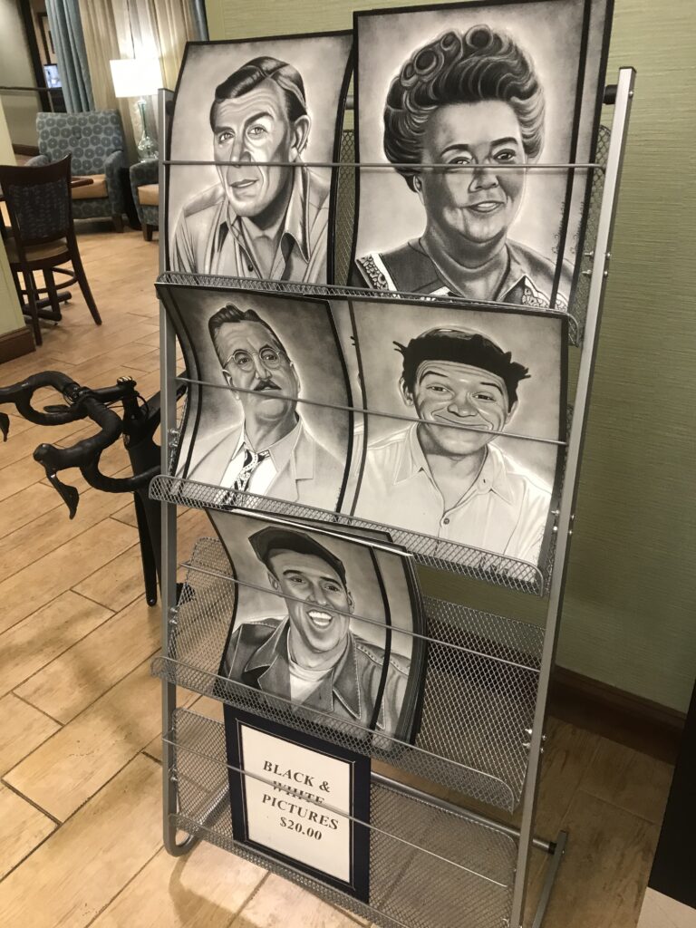
Mayberry. The home of Sheriff Andy Taylor. Aunt Bee. Opie. All on the Andy Griffith show. Andy Griffith grew up here in Mount Airy and I came for a bike ride. I had no expectations and had done very little research. I just arrived.

Downtown Mount Airy

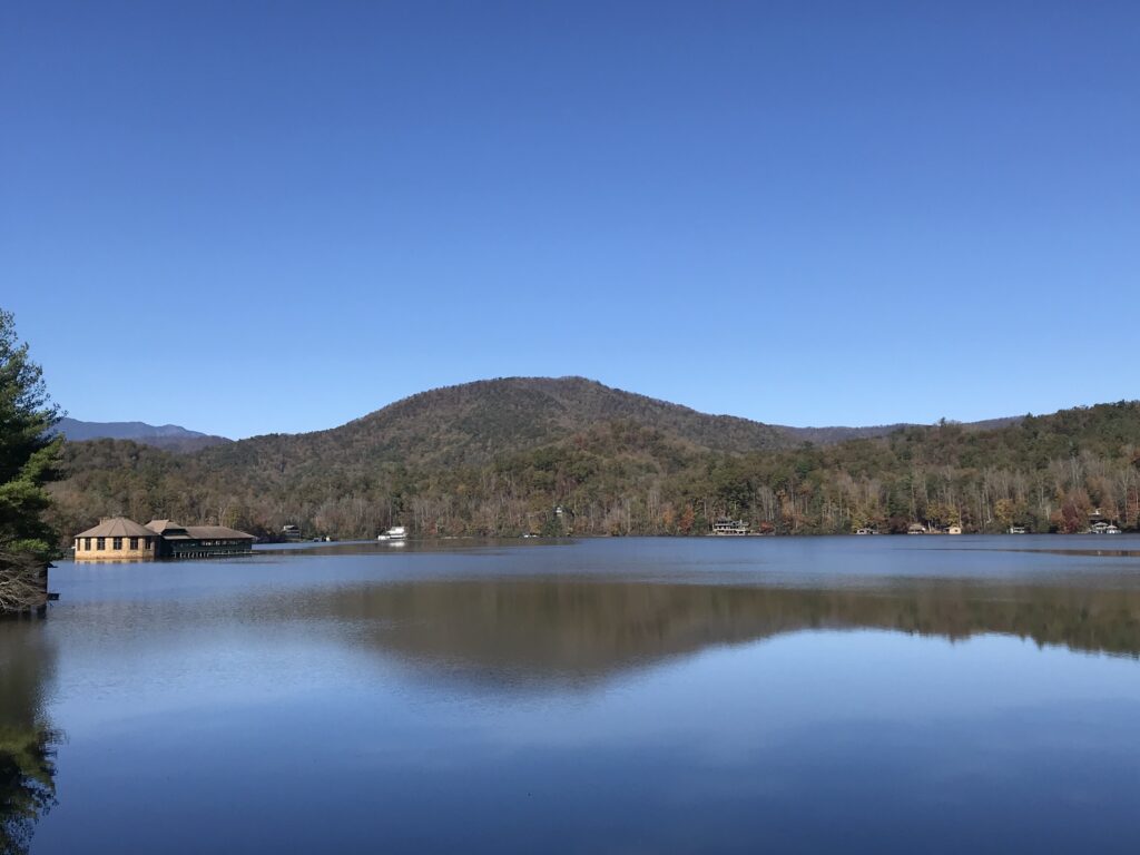
My ride was planned from Mount Airy, Riverside Park, to the famous Mabry Mill on the Blue Ridge Parkway. I found a ride on RidewithGPS by user, Adrian, and downloaded it to my Wahoo bike computer. Adrian elected to keep his profile private so I cannot publicly thank him for the suggestion.

At the Hampton Inn, Mount Airy

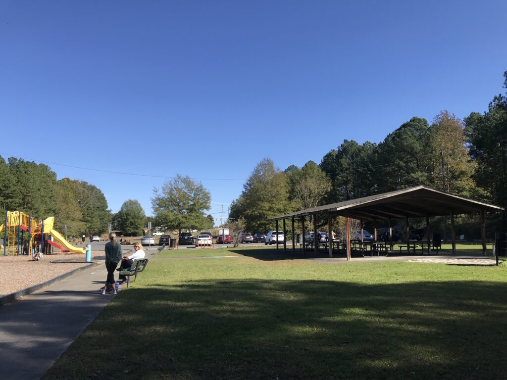
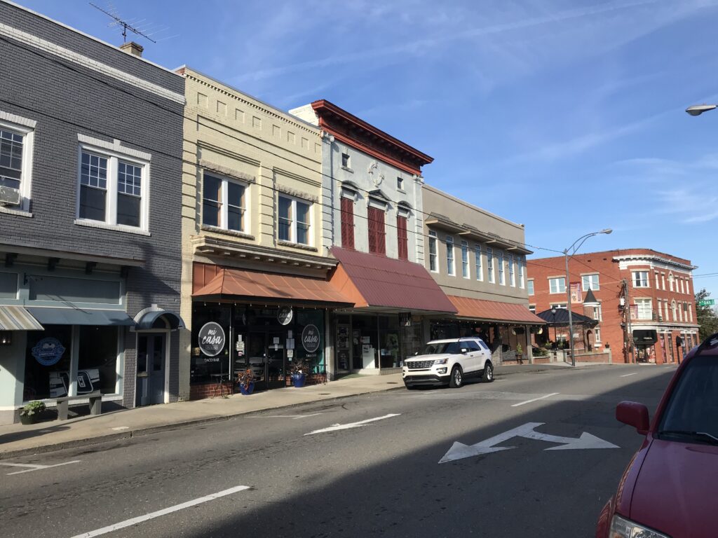
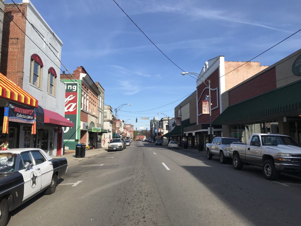
Although I was to ride north out of town, I was close to Main Street and started out by going into downtown Mount Airy. That is by going UP into downtown. It was quite a sizeable climb although probably no more than a quarter-mile.

Downtown Mount Airy

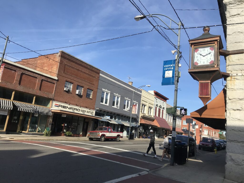
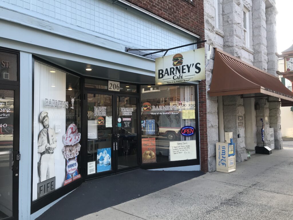
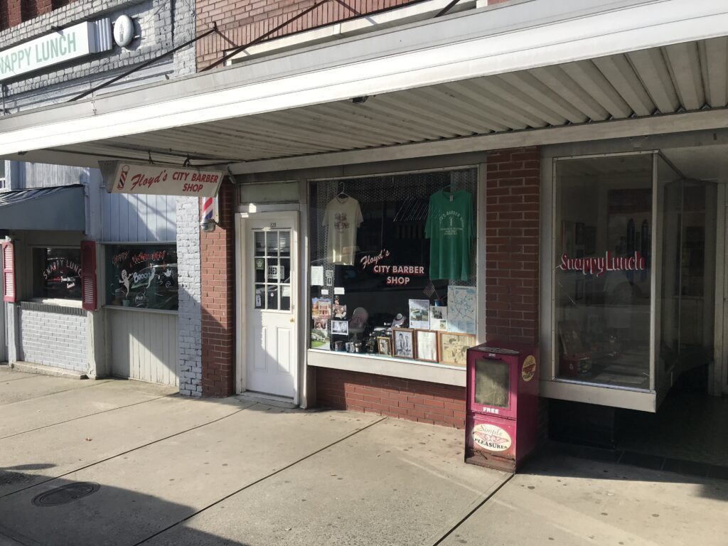
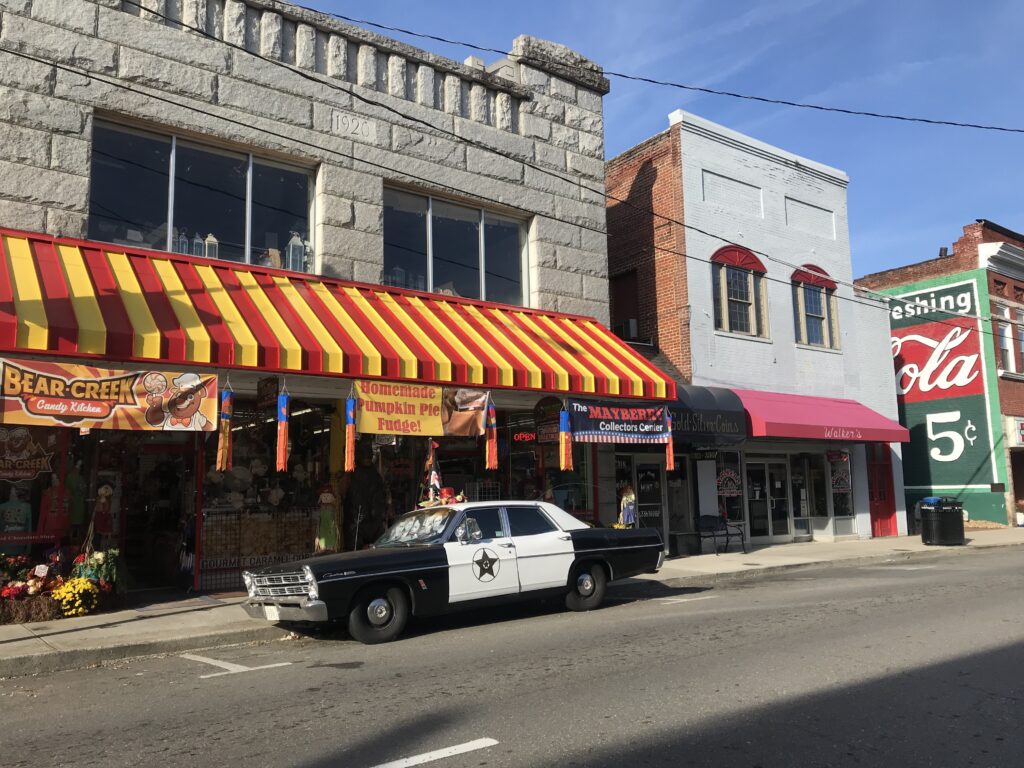
The downtown was only a few blocks long but was very vibrant. Not so much at 9:00 a.m. but by 1:30 p.m. it was teeming with people. It was hard to see an empty parking space. Many of the store fronts had a Mayberry theme from Floyd’s Barber Shop to Barney’s Cafe.

Barney’s Cafe

Although I should have headed out of town then I swung by my car to pick up some cycling food (gels) which I had forgotten to put in my pockets. And then I headed north.

Floyd’s Barber Shop

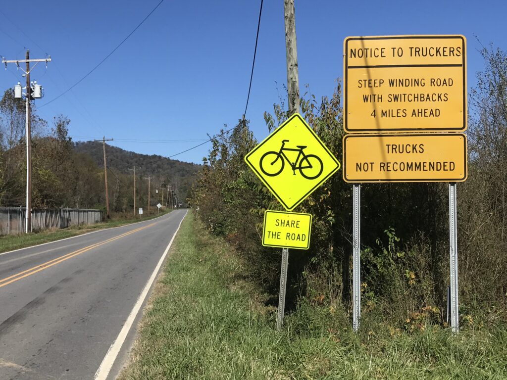
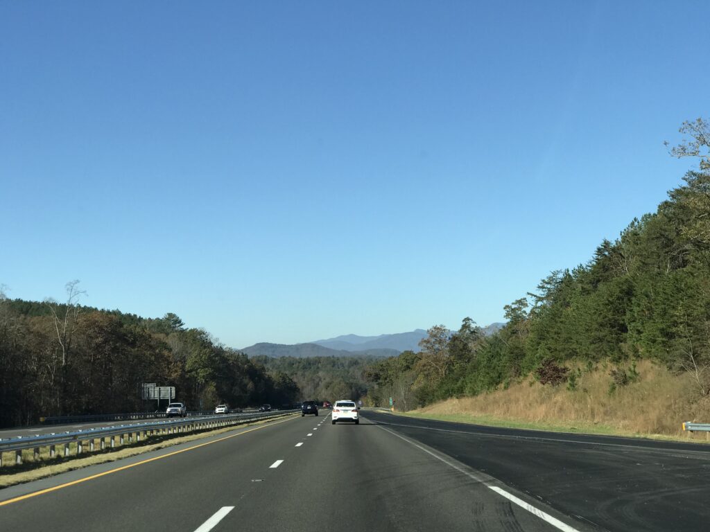
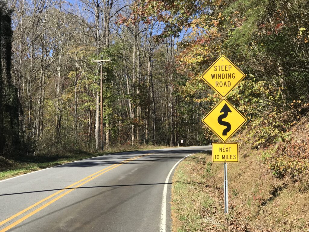
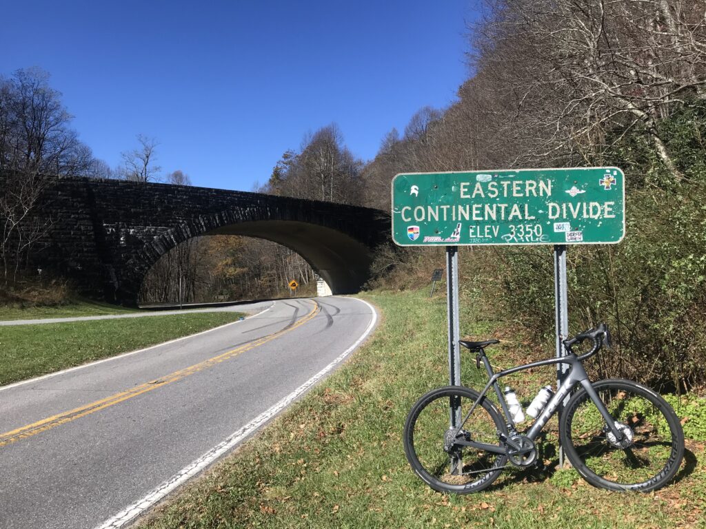
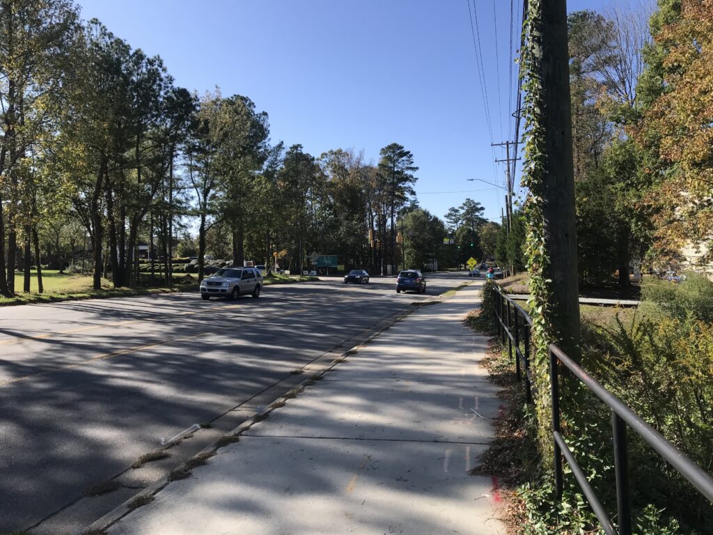
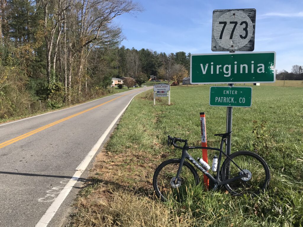
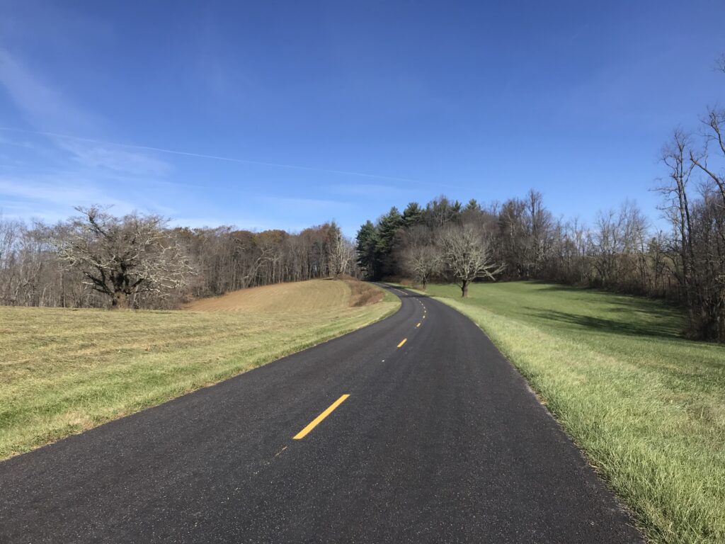
It was eight miles on a two-lane road, no shoulders, to the Virginia state line. And then it was about four miles to the turn up the mountain. The course profile was not complicated. Go straight until Rte 614, Squirrel Spur Road. Then turn left and be prepared for climbing. What a great road this was.

Going north – Virginia state sign. There was no North Carolina sign going south.

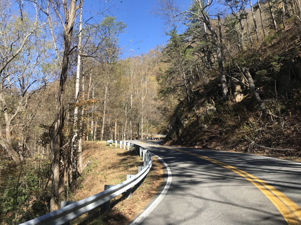
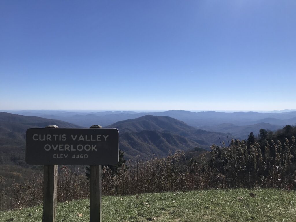
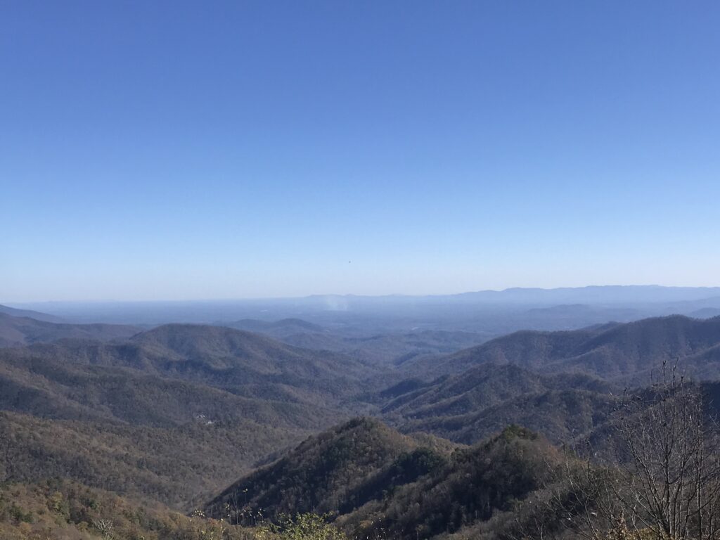
It was six miles to Blue Ridge Parkway and three of that was on a steep portion with switchbacks. The pavement was good but there weren’t many great vistas. But at one, on a sharp curve, there was a picnic area. I really enjoyed this climb.

Rough surface on the BRP

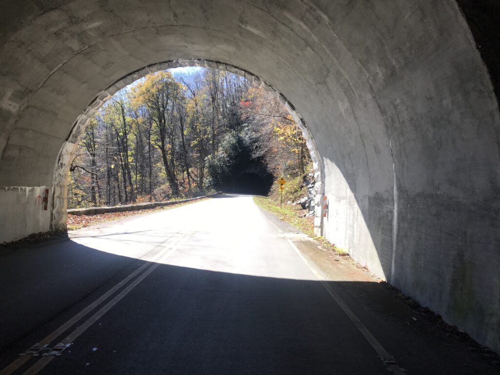
I came to the Blue Ridge Parkway and jumped on it. I left behind the beautiful pavement of Squirrel Spur Road and picked up a very rough chip and seal road on the parkway. It was quite rough. Not potholes, but just a rough-riding surface. Or a “heavy” road in cycling terms.

At U.S. Rte 59 in Meadows of Dan

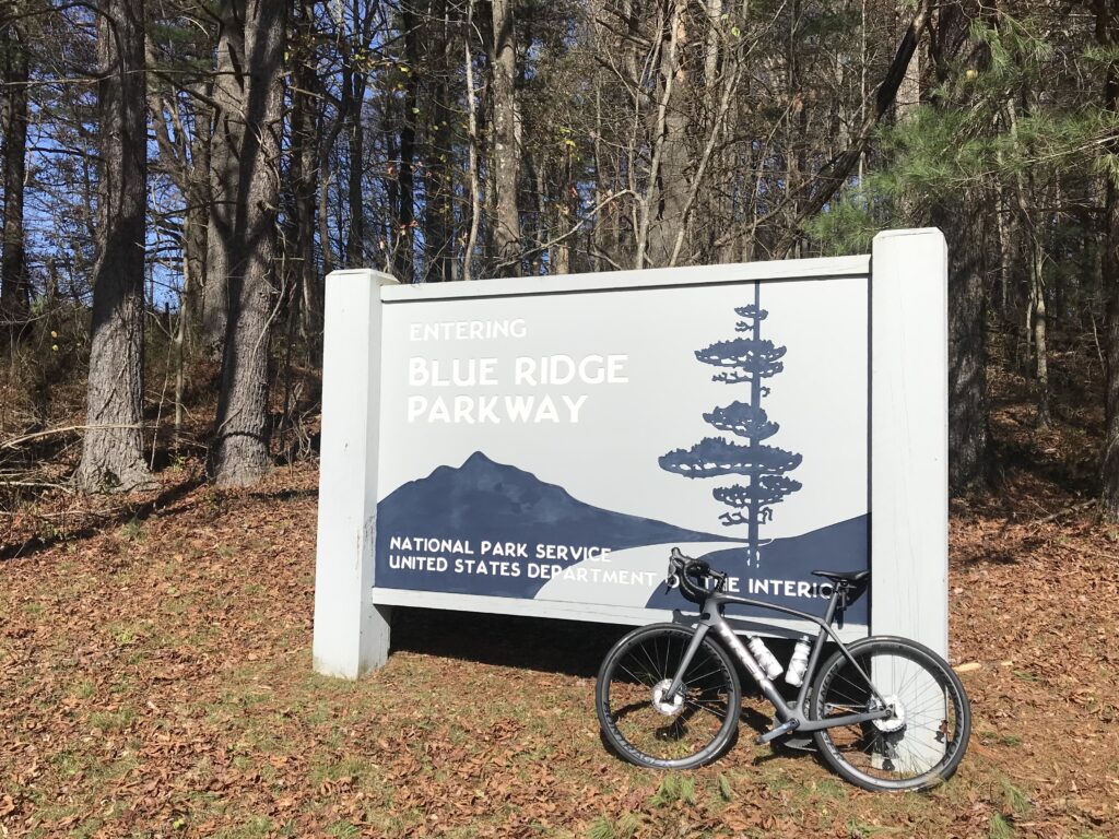
The parkway is a two-lane road, signed for 45 mph, so no traffic takes it for speed. On a chilly November morning, there were only a handful of cars that passed me in either direction.

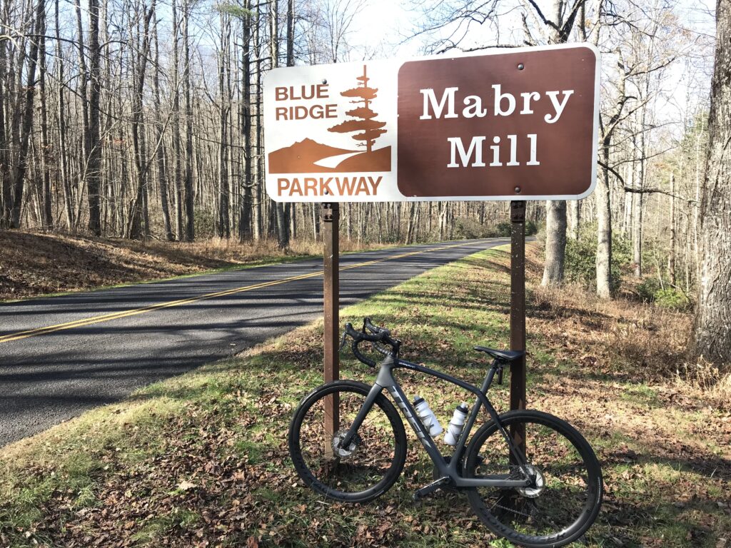
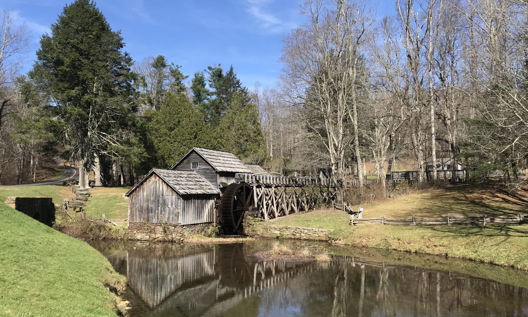
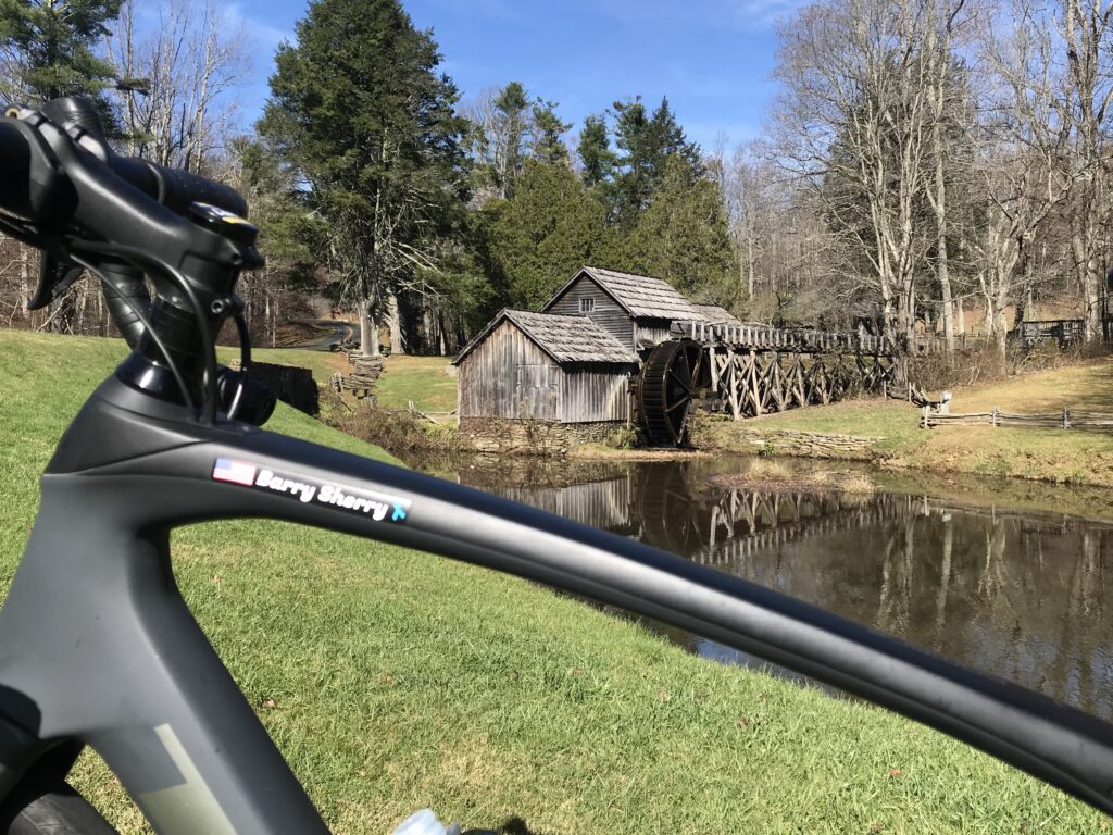
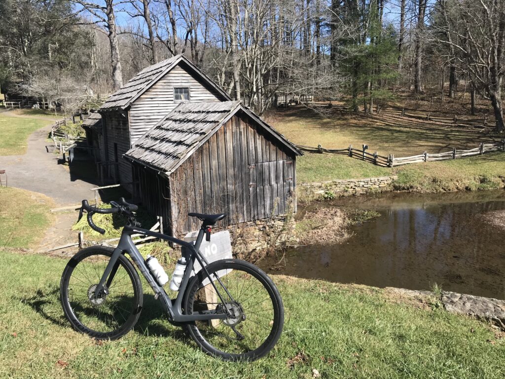
Only yesterday in a weak attempt at “research,” I read that Mabry Mill closed for the season five days ago. Was it worth riding to it if it wasn’t open? I decided it was. I could still get a photo op and would not take advantage of the amenities like a gift shop.

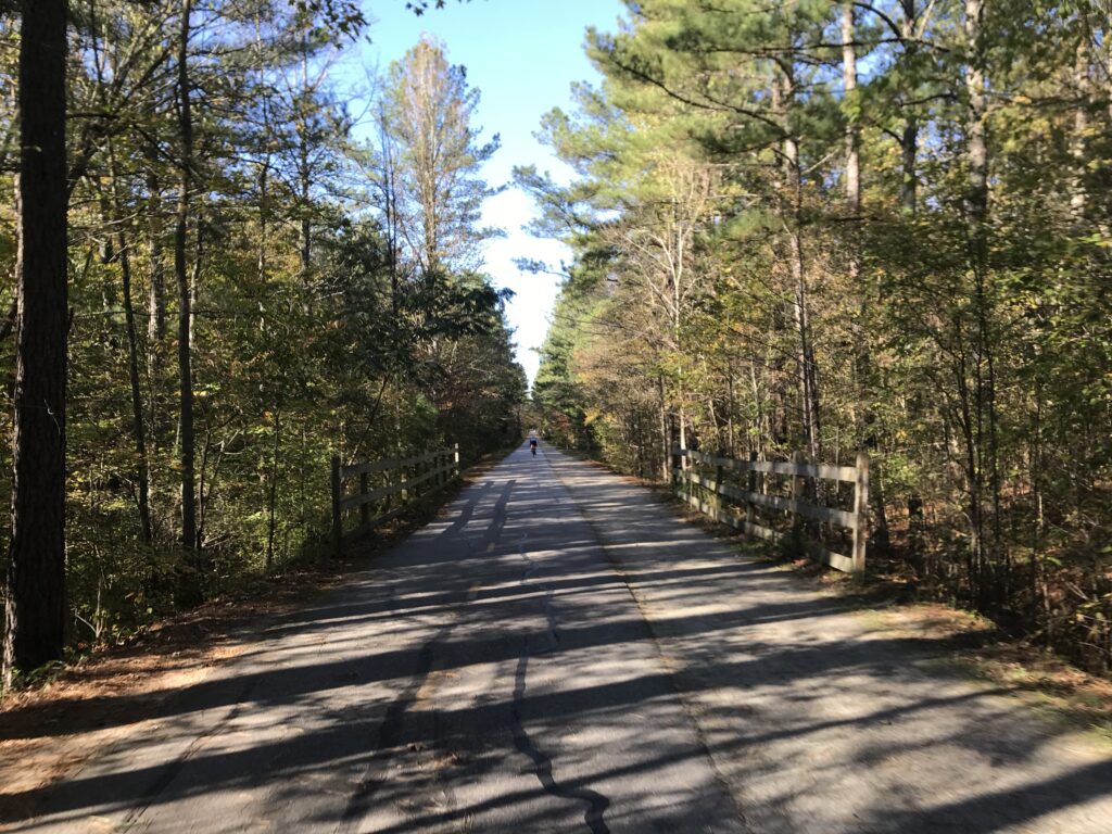
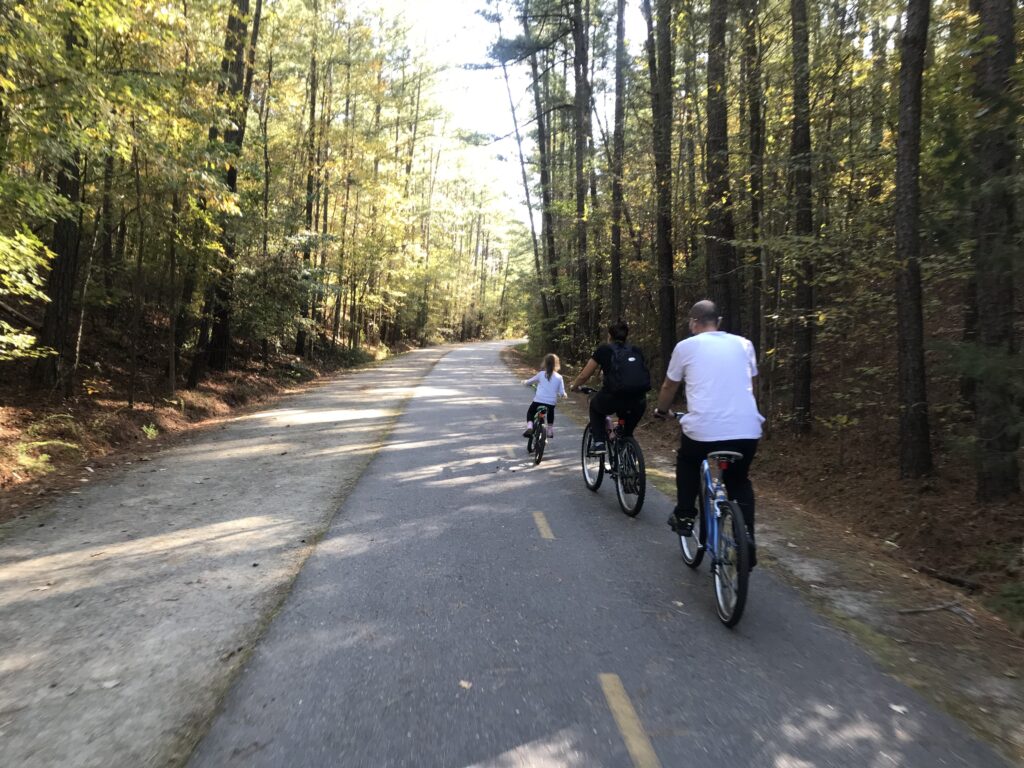
After a brief stop, I would have normally just retraced my route since this wasn’t a loop ride but an out-and-back (or an up-and-down). But in the tiny hamlet of Meadows of Dan I followed the Wahoo and took the Squirrel Spur Road which is parallel to the parkway. I was greeted with beautiful pavement instead of the rough chip and seal on the parkway. I was also greeted with screaming downhills and leg-killing uphills. The parkway would have been easier, much easier, but in tourist season this alternative makes sense. Today, I wish I would have stayed on the parkway.

Mabry Mill – the non-photographed angle

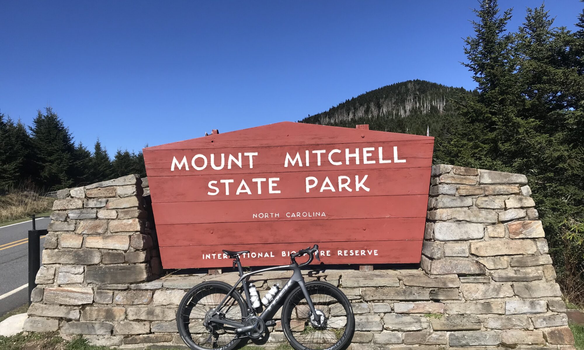
The descent down Squirrel Spur Road through the switchbacks was great. But I was facing a pretty strong headwind. I was also running on empty. The climb up Mount Mitchell yesterday left me a little tired. And while I remembered to stop at the car in Mount Airy for food, I forgot my Skratch drink mix for my water bottle and was only drinking water.

Downtown Mount Airy

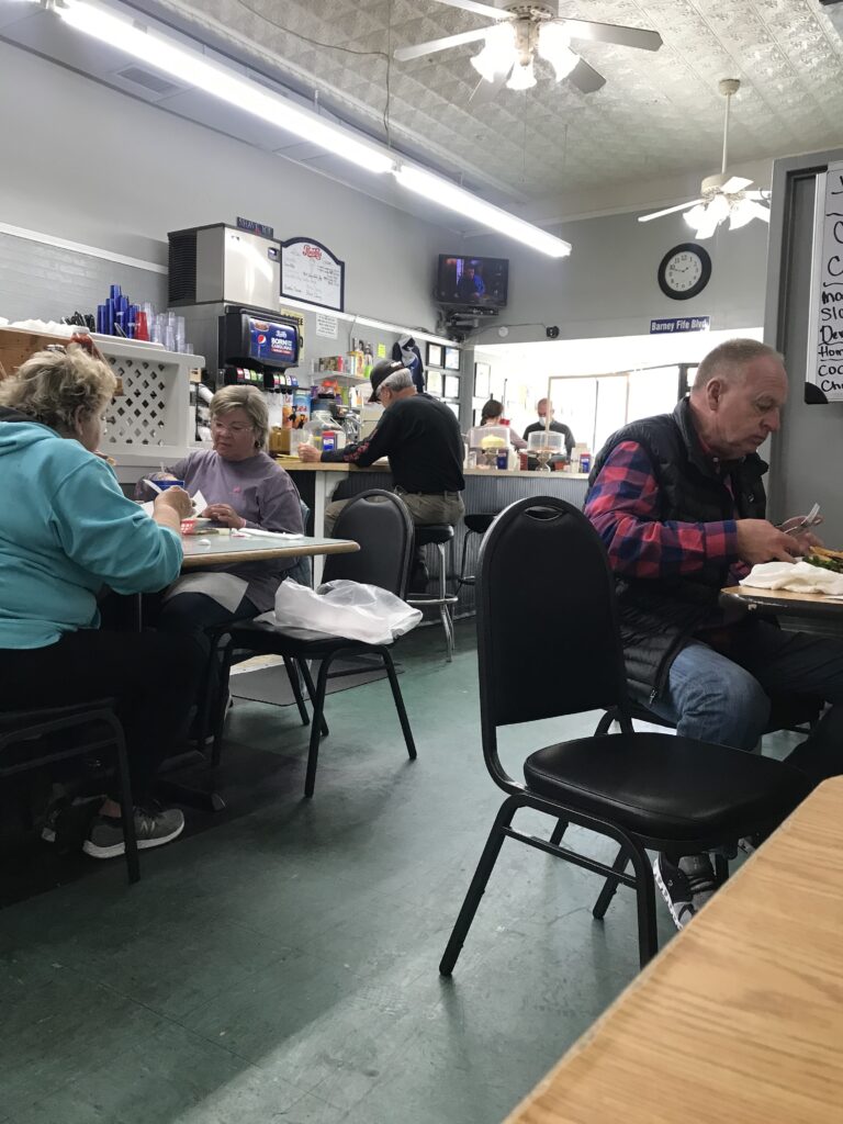
Uncharacteristically, I changed Wahoo to display miles to go on the computer. And I was counting them down. When I reached zero I decided I would go to Barney’s Cafe for a quick bite before my long drive home. It would have so much easier to go through a drive-through anywhere and get food to eat in the car. But I was in Mayberry and that deserved to sample the local cuisine and atmosphere.

Downtown Mount Airy

It was a good ride. But with yesterday’s effort, I was tired.

Barney’s for lunch

Distance: 53 miles
Average Speed: 13.2 mph
Weight: 167

And They Cheered for Me

MOUNT MITCHELL, NORTH CAROLINA

Our friends from Colorado scoff at the tiny mountains in the east. With 58 mountain peaks over 14,000 feet (4,267 m), they certainly have that right. But it’s not all elevation. Some if it’s elevation gain.

Parking at Dollar General

Mount Mitchell stands at 6,683 feet (2,037 m) above sea level. The elevation gain on this 24-mile climb is 6,076 feet. By contrast, Mount Evans, Colorado, which I have ridden up twice, stands at 14,272 feet, climbs 6,772 feet from Idaho Springs (elevation 7,500′) over 28 miles. So scoff if one must, but it’s not much difference. Well, if you ignore altitude (which you can’t).

Start of Rte 80 in Marion, NC

Mount Washington, New Hampshire is the highest peak in the northeast U.S. at 6,289 feet. Most of the elevation gain on that mountain is on the 7.5-mile auto road giving it an average grade of 12%. Beast!

Lake Tahoma, Marion, N.C.

Mount Mitchell was a bucket list climb for me. Consistently listed as one of the best or hardest in the U.S., I never made it a destination. With 2020 being the year of the Corona Virus and all my cycling events canceled, I decided to make my own adventure.

Lake Tahoma

I had hoped for a mid-October day but that did not work out. So I found myself in November driving to Statesville, North Carolina, where I spent the night then drove to Marion for the climb up the mountain. While on I-40 I crested a hill and had my first look at THOSE mountains. Ugh. It was reminiscent of seeing the White Mountains in New Hampshire and realizing I was signed up to race up Mount Washington.

I-40 on the way to Marion – first look at the mountains

But I would not be racing up Mount Mitchell. Just a ride. And the first order of the day was to find a place to park. The climb starts at the edge of Lake Tahoma but there is no parking to be found around the lake. So, generally, one must park about four miles away. There is a small area at the intersection of Routes 70 and 80 but I saw a Dollar General nearby and asked them if I could park there. And they agreed.

The first four miles were basically flat. Then I came to the dam at Lake Tahoma. This dam almost failed two years ago and all residents downstream were ordered to evacuate. But thankfully, it held. There are some beautiful homes around the lake.

Rte 80

At the end of the lake where the creek flows into the lake is where the climb to Mount Mitchell begins. This is on Rte 80 which is a narrow road with no shoulders. Today it was lightly traveled and all drivers were respectful.

Rte 80 passes under the Blue Ridge Parkway

The views were wonderful if you like a forest view. That is to say, there are no vistas to see for miles because this climb of 10 miles to the Blue Ridge Parkway is in a forest. But it sure is pretty. There is a river or creek flowing for part of it and it’s soothing to see it and to hear it. The switchbacks in the last mile are absolutely delicious.

Twin Tunnels

I was thinking “this isn’t so hard.” Then again, I never tried to go fast, and if I saw something of interest I stopped and took a photo. I reached the Blue Ridge Parkway and stopped long enough to remove my leg warmers. It was a cool day and I had unzipped my vest and was sweating.

The road kept climbing. I went through three small tunnels. I hadn’t studied the course enough to know where but I knew there was a one-half mile descent and a two-mile descent on the route.

One of the nice vistas

The road to Mount Mitchell State Park is a four-mile climb off the Blue Ridge Parkway. It seemed to be harder than the rest of the climb and it was. I wasn’t sure if it was because I was getting tired or if it was steeper. And it was the latter. Maybe the former too.

The turn off the Parkway begins a four-mile climb to the summit

It was a beautiful sunny day but I also some ice in areas normally shaded from the Fall sun. And as I was climbing the smell of Balsam and I thought sorry for those who drove and missed out on the smells.

There’s ice in them thar hills

When I reached the summit I saw just a few cars in the parking lot. I had been here before – in 1963 – and knew the photo showed my siblings and me in front of a tower at the summit. And it wasn’t here. I circled the lot and saw a trail or walkway to the actual summit.

The path at the summit leads down to the parking lot

It looked like a stone walk but was probably pressed concrete. I expected to see a NO BIKES sign but did not. Maybe I didn’t look hard enough. And in-season, no sane cyclist would ride on this path crowded with tourists. But I saw no one.

So I started up the path. And it was steep. My guess was 15-18%. Halfway up were some benches and a brief flat section. I looked up and the path kept going. And so did I. I turned the corner and saw the sign. I had made it. And there were seven people at the summit – four by the sign and three walking up the observation deck. And they all starting cheering me. “You made it!”

I probably shouldn’t have ridden my bike up there. Sorry. But I don’t think I could have walked up in cycling shoes and I needed to get there. I’m thankful I went on a November day after all.

Fifty-seven years earlier – Barry in light blue

Distance: 56 miles
Average Speed: 11.8 mph
Weight: 167

American Tobacco Trail

DURHAM, NORTH CAROLINA

A search of trails in the area landed me at the American Tobacco Trail. This is a 22-mile trail (15 miles are paved) starting at the American Tobacco Company in Durham, right next to the ballpark for the Durham Bulls. From there the trail heads south to Cary.

The trail loosely follows a rail line that was built in the 1970s for the American Tobacco Company. In the 1980s it was shut down. That wasn’t a good investment.

Parked at Solite Park

My first order of business was to find parking. There is parking in Durham at the trailhead as it is a shopping and entertainment district. Despite the offer of free parking for two hours, it necessitated downloading a parking app for my phone which I didn’t want to be bothered with. And I didn’t know if I would take more than two hours.

I looked for locations south of the city and found Solite Park. There was a playground and the parking lot was almost full. It looked safe enough. In preparation for this ride, there seemed to be a lot of safety questions on the reviews on TripAdvisor. Someone smarter than me can research this but this rail line divided neighborhoods, i.e., the wrong side of the tracks. But I was oblivious to that history and just rode my bike.

The ATT on a sidewalk

Solie Park was located at MP 4.5. It ad restrooms and a water fountain. I headed south on the trail. I was expecting rail trail – straight and level. However, as I would soon learn, in this section it was part sidewalk and often turned where one would not expect. Keep the eyes open for turns.

A family enjoying the trail

The bridge over Interstate-40 was pretty cool. It had its own contour instead of being a flat bridge. For this user, it was pretty awesome.

Bridge over I-40

Around Mile 8 I seemed to come to the real rail-trail portion of the trail. Straight and flat. Not real sure of the location except it’s the Huntington Ridge section of Durham. It’s really a one-mile section where one is seemingly on sidewalks and has the feeling of an urban trail rather than following a former rail bed. This often happens that development takes place after removal of tracks and before a rail trail is created. These detours are a minor inconvenience compared to having use of a 20-mile trail.

Mile markers were provided every quarter-mile which was very cool. At 14.5 the trail turned to gravel so I turned around.

Mile markers mark every quarter mile

The city of Cary had a nice lot at New Hope Church Road and if I ever rode this again I would come to this lot. There were also restrooms here as well. The trail has more restrooms and water fountains than any I have been on.

New Hope Church Road Trailhead Park, Cary

When I arrived back to my car I saw the trail was closed for a detour. It wasn’t a new discovery as I had driven through a construction zone to park there. It was part of the reason I started my ride heading south as I could navigate the detour later. The parking lot was almost empty. I wanted to ride the 4.5 miles into Durham but was concerned this was one of the high crime areas that I had read about (one user said police were making more patrols).

Sorry folks

But when I got to the main street (Fayetteville Road) to follow the detour, I was lost. I could not find the detour, and not being from the area, didn’t really know where to go to pick it up. I wasn’t about to set out on a trail that wasn’t well-marked. I put my bike in my car and drove 1/4 mile where I saw the end of the trail detour was. From there I parked and rode the rest of the way into Durham.

Trailhead at New Hope Church Road, Cary

As I got close to Durham, I went across at least three, and maybe four, bridges or trestles with great rickety boards. They really made a racket. The closer to Durham the louder the bridge that I rode across. This was awesome, actually.

You can see downtown

The downside was around Mile 2 I went through a litter-strewn section. There were some men hanging around. I’d say it looked like a homeless hangout. Nothing wrong with that but it didn’t feel safe although I went through it, twice, with no issues.

New Hope Church Road Trailhead, Cary

Bottom line – very nice trail. For this ride, the detour section was not well-marked but that will be temporary. There was the one-mile section where the trail zigged and zagged but just take it slow and watch for lane markings. The users all seemed courteous and it was surprisingly busy on a November weekday. My recommendation for others or if I am in the area again, is to park at the New Hope Church Road Trailhead.


Distance: 29.3 miles
Average Speed: 14.8 mph
Weight: 168

Verified by MonsterInsights