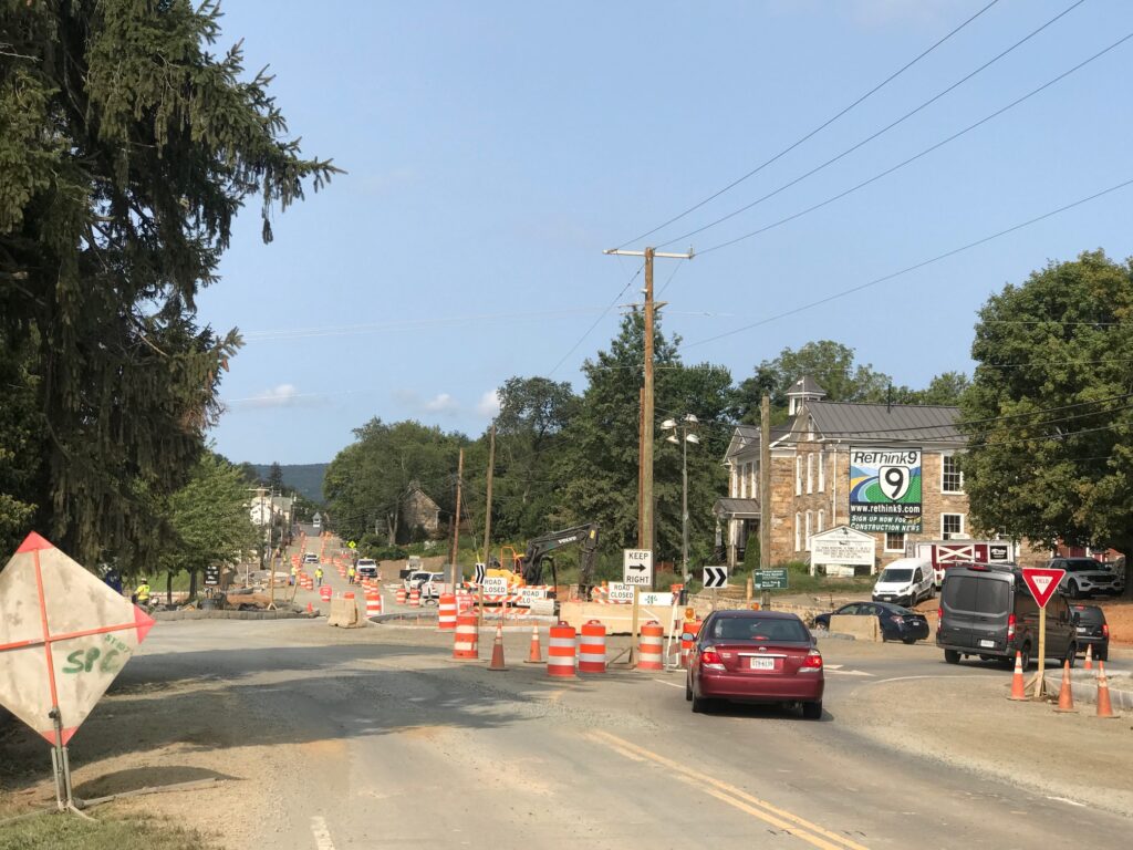
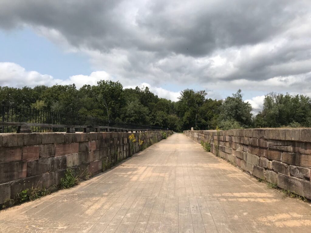
An annual event that I look forward to attending is the Alpine Loop Gran Fondo in Harrisonburg. But with the Coronavirus (COVID-19) pandemic in full force, the Gran Fondo was canceled as an outdoor event but it was still run as a virtual event.
The event itself would normally feature a ride, some friendly climbing competition, and food. The outdoor ride was off. The food was out. But the friendly competition was on.
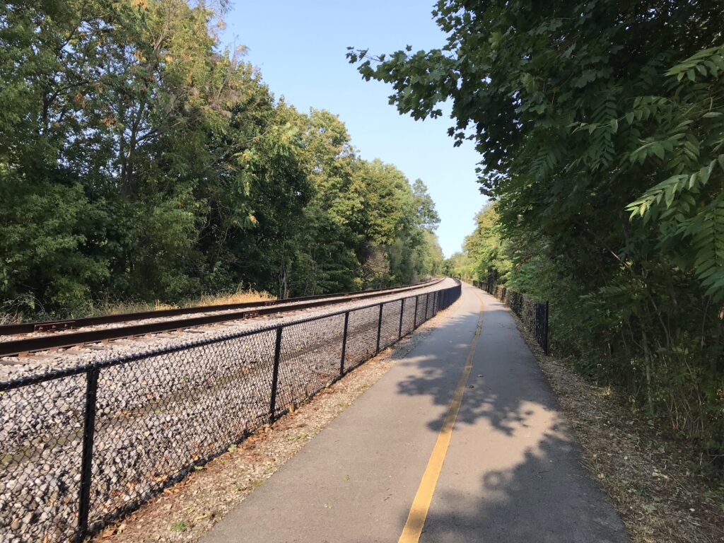
Unfortunately (for me), it was a Zwift competition. If you had an indoor trainer and the Zwift app, you could compete on certain courses and post your time versus others. The problem for me is I do not have a trainer. I ride outdoors – period. Outdoors is free.
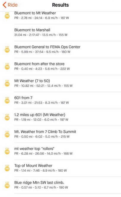
But they also introduced a quasi-outdoor competition. It involved Strava and local KOMs or PRs. And I was on a roll. I had snagged some KOMs in northern Va. after going years with none. And, not to be underestimated, I had changed age groups. Moving on up.
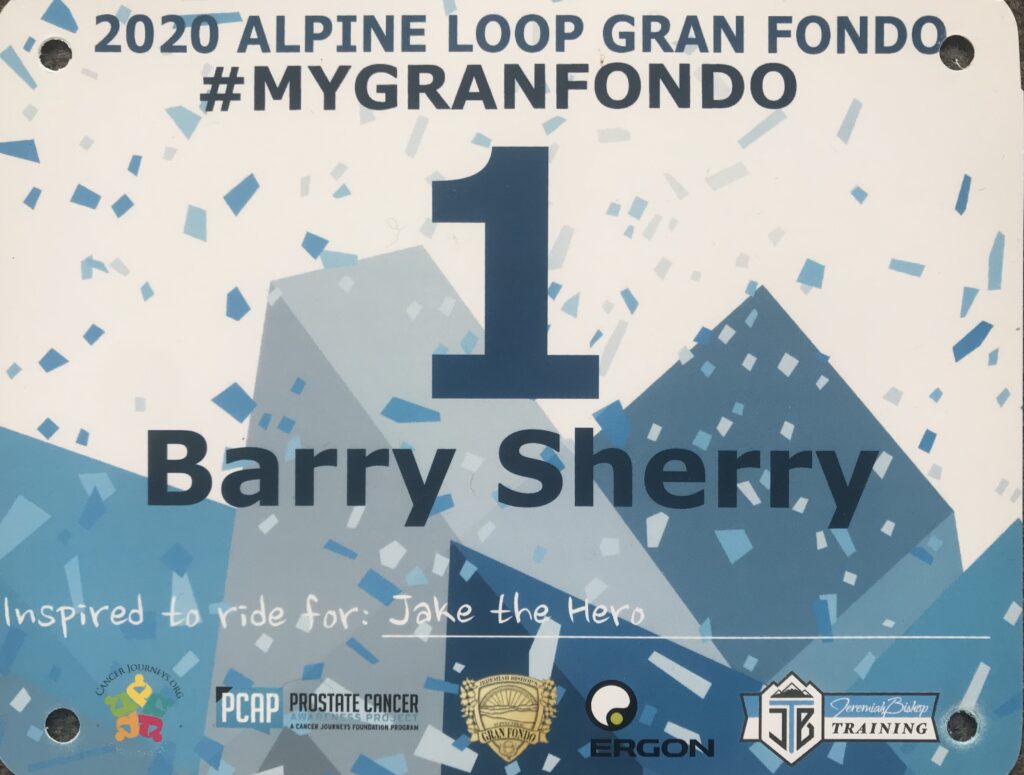
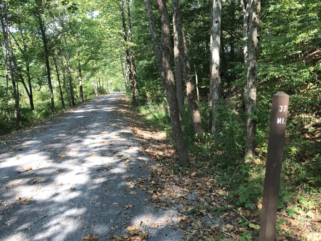
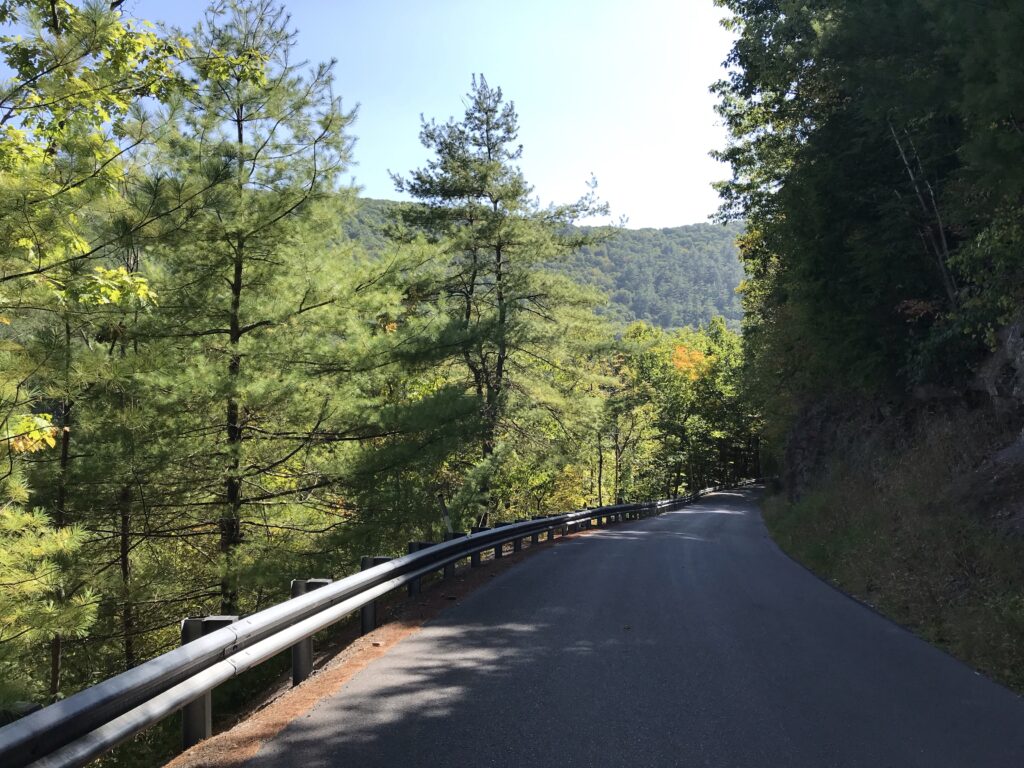
Bib 1 – Alpine Loop
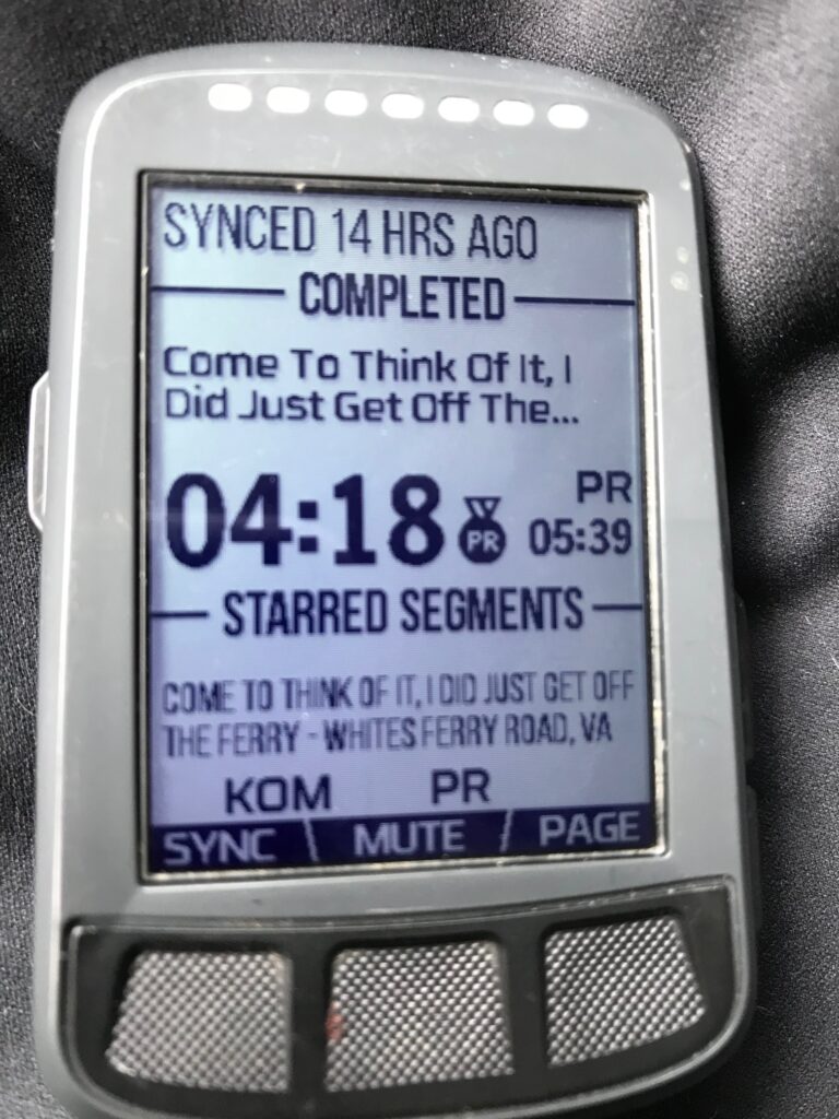
September was a good riding month. I had snagged a couple of KOMs and lots of PRs. And to be sure, I was certainly aided by weak participation. While I embraced the outdoor competition, I am sure many did not and some may have participated only in the Zwift competition.
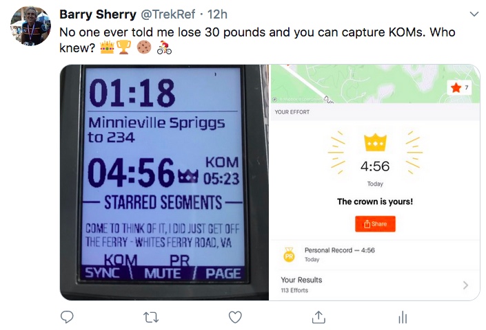
The Minnieville KOM. I am most proud of this one. Former had been 5:23 and I smoked it in 4:56. No one has been close since.
One thing going in my favor is that Strava KOMs including climbing and sprinting or sprint/climbing. I will never be a great climber. I am built more like a sprinter. But this competition fit my strengths whereas being first up Shenahdoah Mountain or Reddish Knob never will.
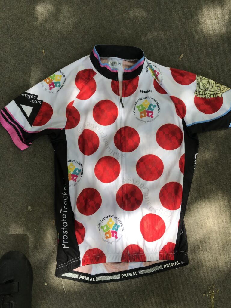
Polka-dot jersey for the 65-69 year age group, Alpine Loop Gran Fondo
At the end of the competition, I was announced as the KOM for the 65-69 age group. And that earned me a polka-dot jersey. A virtual polka-dot jersey. Wait, the jersey is real.
The Awards Ceremony. I am recognized at 21:40 in this video.
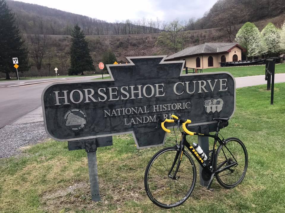
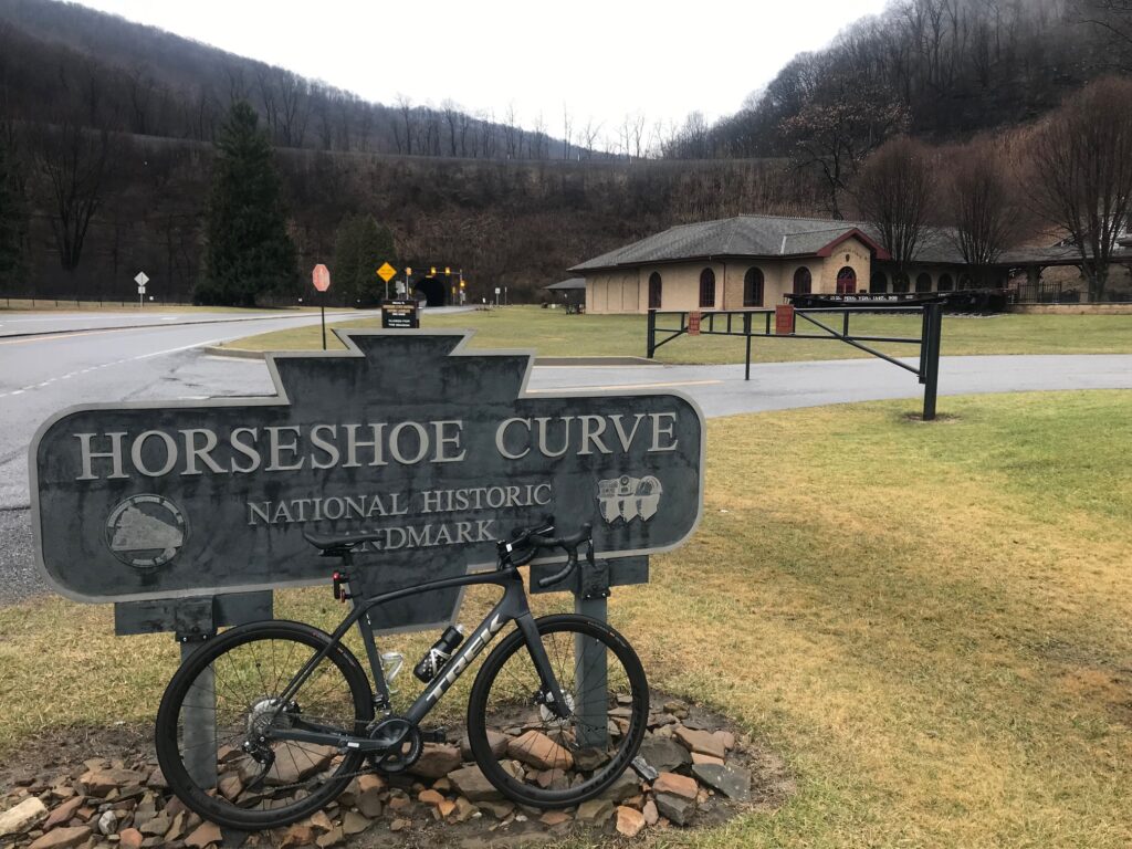
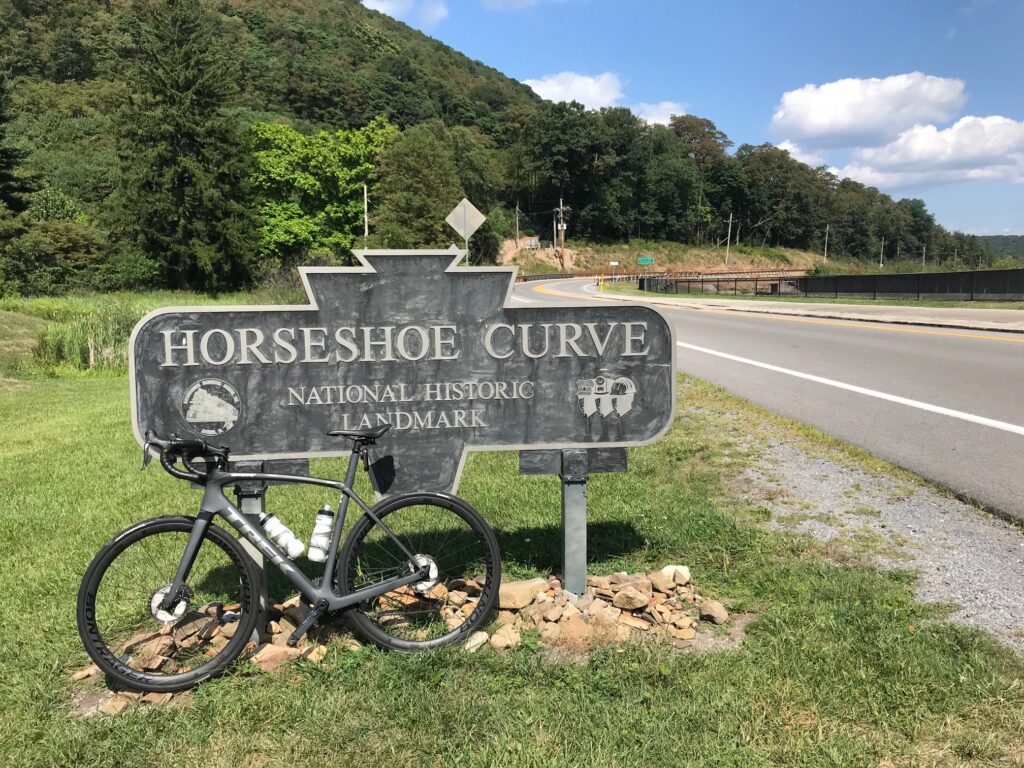
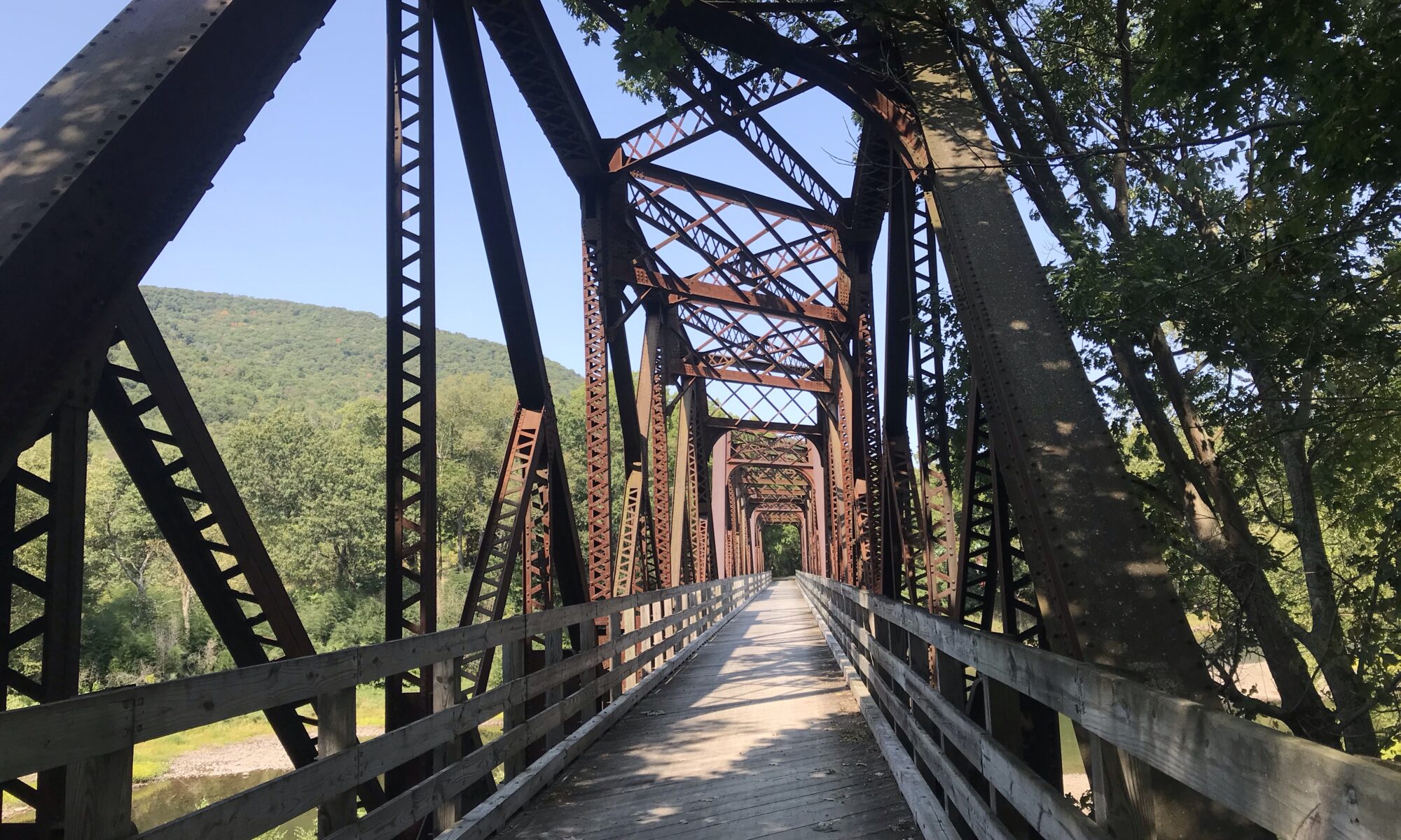
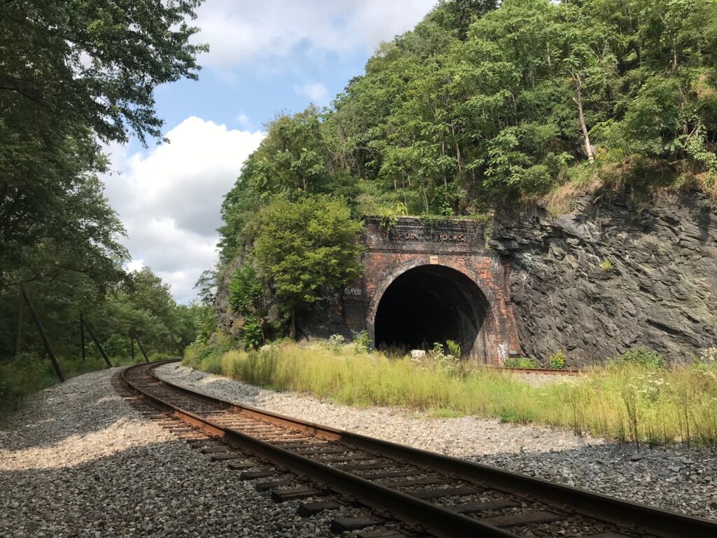
In early 2008 Bicycling magazine published an article about the toughest climbs in each state. Maybe not the toughest but most iconic in each state. For Pennsylvania, Horseshoe Curve was listed with a description of a “Three lakes, a 200′ tunnel and an 18% wall, what could be better?”
At the Curve – May 5, 2018
It was then I knew I had to ride it. And it has become my go-to ride. My happy place. So let me tell you in my words what is so special here.
I first came here after I read the description. And I keep coming back.
I call the climb Horseshoe Curve. Technically, I suppose, Horseshoe Curve is really the engineering marvel completed in 1854 which got trains over the Allegheny Mountains. The New York Central could run a train from New York to Chicago in 16 hours but it took four days to travel between Philadelphia and Pittsburgh using canals, horses, train cars, and the Allegheny Portage Railroad. One can read about the history anywhere, I will link to an article at Uncovering PA.
Typically, I park at the Logan Valley Mall to begin a ride. Although gradual, one begins climbing the minutes you push down on the first pedal. It’s about 2.5 miles up 58th Street to Kittanning Point Road. Make a left here and it’s an easy three more miles to the Curve.
Canal diverting mine water – May 5, 2018
If you are lucky, there will be a passing train or two and you can hear the clickety-clack clickety-clack of the train. If it is climbing you can race it although eventually, the sound will pull away.
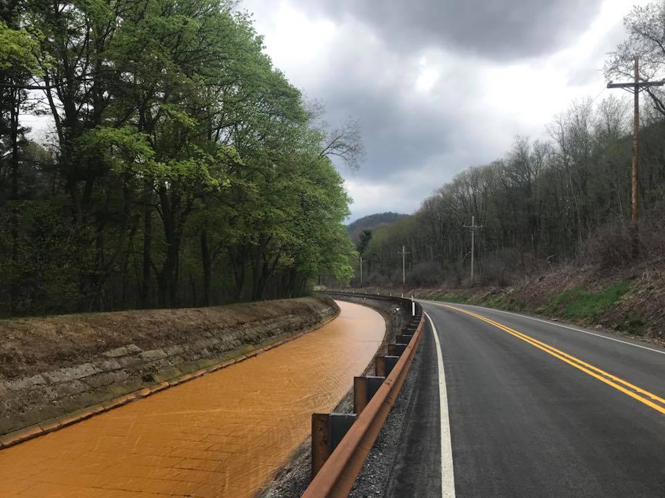
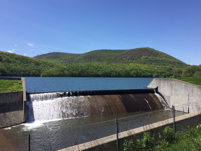
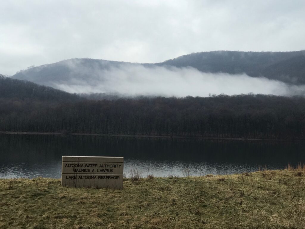
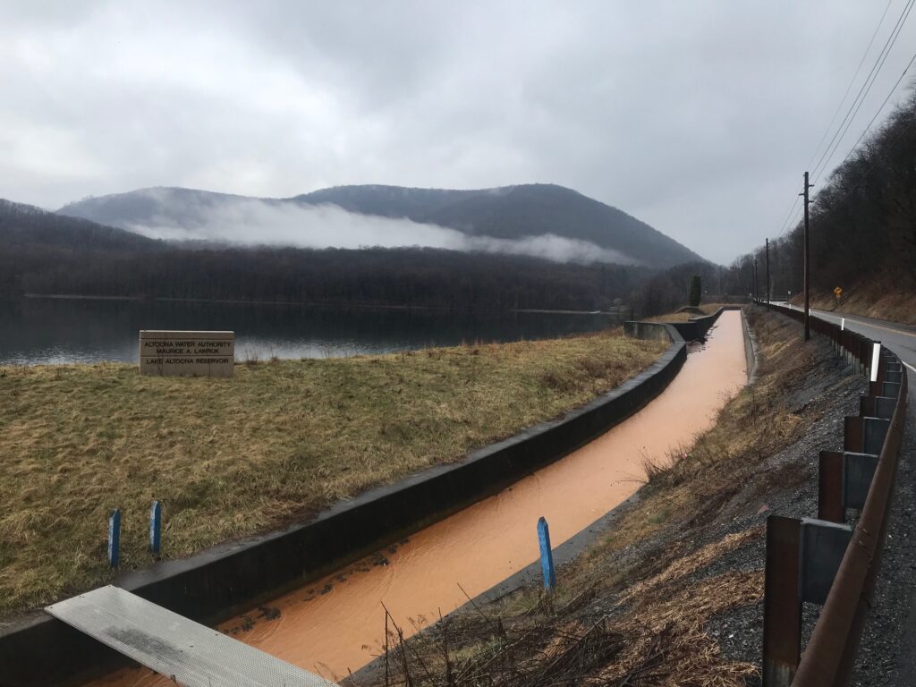
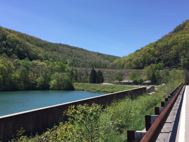
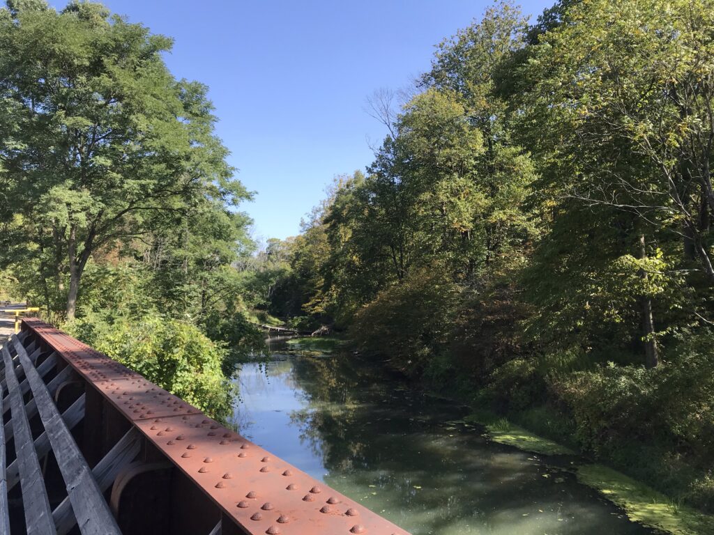
You will pass three lakes – all reservoirs with the Altoona Water System. The first is Lake Altoona, the largest and prettiest of the three. The second is the Kittanning Reservoir. The third is at the Curve itself. It is smaller than the first two and I’m not sure that it is named.
Lake Altoona Reservoir – 19 Mar 2020
The water in these lakes is pristine. But that is because of a unique water-diversion system. There is a lot of mine drainage in the area marked by the bright orange color of the acid water. There is a canal next to the lakes which carries this water safely past the lakes. I do not know where the orange water goes after bypassing Altoona’s water supply.
The canal the diverts water past Lake Altoona Reservoir
These three miles (3.2) are pretty easy. Yes, one is climbing but a lot of it is flat beside one of the three lakes. I calculate this portion to be 1.9% grade.
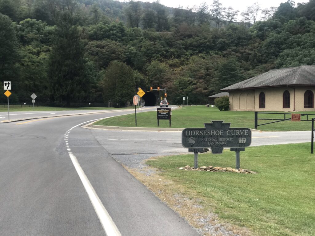
At the Curve itself are the attractions. The Curve itself is the main attraction. This is a pay-attraction area. As of 2020, admission was $8 but one would need to check to be certain. At the Curve, one can climb 194 steps or take a funicular (Inclined plane) to reach the viewing platform. I come here to ride a bike and not watch trains so I cannot comment any further about the Curve.
For years the Curve was covered in heavy forest. Around 2018 they cut down acres of trees which was both disappointing but also pretty cool. Now as you approach the Curve you can see the trains on the tracks. And the passengers on the Pennsylvanian (Amtrak, twice daily) surely must enjoy the view.
A foggy, wet, day – 19 Mar 2020
Traffic on Kittanning Point Road to the Curve is generally light and always courteous. In the three miles to the Curve one might get passed by 5-6 cars. Most of the traffic seems to be going to visit the Curve.
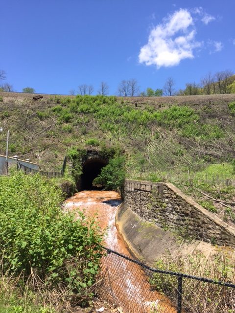
And then the fun begins. There is a 200-foot tunnel that goes under the Curve. Look carefully because there are two tunnels. One is for car traffic and the second is for water – that disgusting orange mine water that bypasses the drinking supply.
Mine runoff – ugh
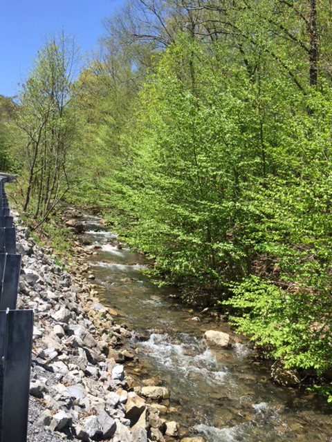
Go through the tunnel and everything changes. First, the road turns up. Second, one is in a deep forest. Nothing to see but trees and water of the Glenwhite Run. It is absolutely beautiful here. (And I typically do not have photos from this area as I don’t want to stop then have to restart.)
The legs may slow down as the body notices, even if the eyes do not, it is getting harder to pedal. By my calculation, it is 3.3 miles from the tunnel to Coupon-Gallitzin Road. And the grade works out to be 5.3% which doesn’t sound like much. But that also includes a downhill section near the top.
Glenwhite Run
There is a half-mile section that averages more than 12%. The “Wall” is 18% or 19%. Two things always happen when I go up this road. First, I always battle myself and wonder if this will be the first time I have to get off and push my bike. And second, there is an immense feeling of satisfaction and pride from having made it.
I am almost always alone on this stretch. Traffic is light – often only 1-2 cars will come up the road. Today, there was a logging truck followed closely by a car. And that was it.
16 Aug 2020
I’ve had my moments with others too. In 2009, I met Richard and Stacey Fiore riding up the road. Stacey had never made it before without walking and I sent her husband up the road while I rode with and encouraged her. I thought we had it but she dismounted only about 50′ from the top of the Wall.
For my first post-cancer ride in 2010, I brought some friends here from Northern Virginia. None was more special than my good friend, Scott Scudamore. I am sure glad he got to experience this climb and we had a blast twice bombing the descent on Sugar Run Road.
Kelley Vito said she understood why I find peace here because “you only think about dying while climbing that hill.” In 2017, I was with Chey Hillsgrove and Chelsea Johnson. Chelsea would see a curve ahead and then ask – “Oh my God, is that where it begins?!” I laughed and told her the truth – “Oh no, that’s not the Wall – the Wall is much worse.”
I would have bet against Chelsea that day but she found her inner strength and made it. I was so proud of her.
The third reservoir – at the Curve itself
But Kelley was right. When I come to these mountains, all I can think about is the next pedal stroke. Pushing up that hill. Or descending at crazy fun speeds but 100% focus on the descent. There is no time for cancer in my life when I am in these mountains and on this climb.
I was feeling quite down this morning. And I looked on my bike and the stem cap says “I am a Survivor – 10 Years.” And my bad feelings went away. Let’s enjoy this day!
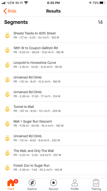
I didn’t have any segments starred in Strava so none displayed as I was riding. But at the end of the ride, I saw I was averaging more than a 15 mph pace. And I don’t think I ever did a ride with this climb that I averaged 15 mph.
I looked at Strava. I averaged 15.4 mph. And I had PRs on all the segments. Most of those I am #1 in my age group as well. Although my times are nowhere near the best times – I can’t compete with the young guns. But in competing against myself (PRs) and in my age group, I did pretty well.
All PRs on September 24, 2020
My earliest rides were not recorded. The first record ride I can find of Horseshoe Curve was August 2, 2009. I had lost a lot of weight prior to my cancer diagnosis. In addition, I was “training” for the Mount Washington Auto Road Bicycle Hillclimb. And on the same route as today, I averaged 14.2 mph. Of course I was 11 years YOUNGER!
For one day, I felt strong(er) in the mountains. My times pale in comparison to the young riders but I was better today than 11 years ago. And only in the last five years have my rides been uploaded to Strava for those comparisons – and I broke every personal record there too. On a heavy gravel bile.
This mountain is where I come to get away. And this is where I find peace on a bike.
Horseshoe Curve – Sept. 24, 2020
Distance: 20.4 miles Average: 15.4 mph Max Speed: 41.8 mph Weight: 179
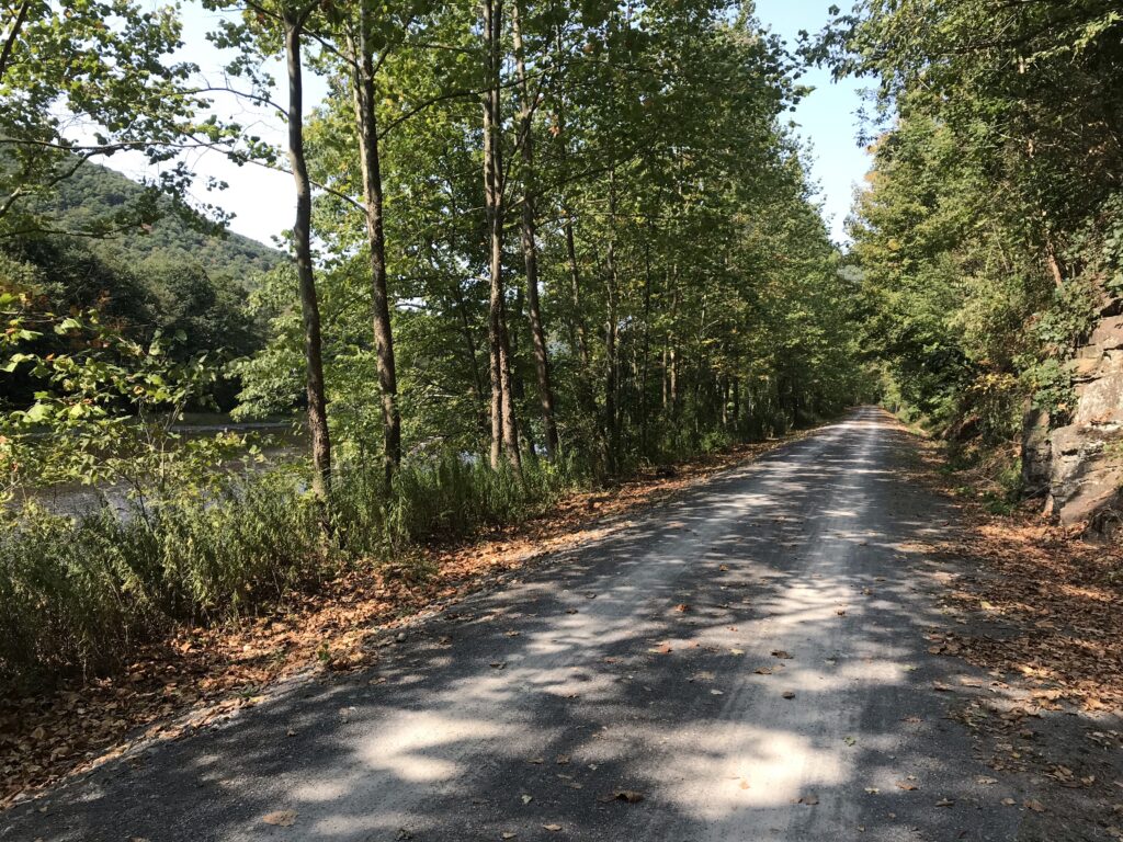
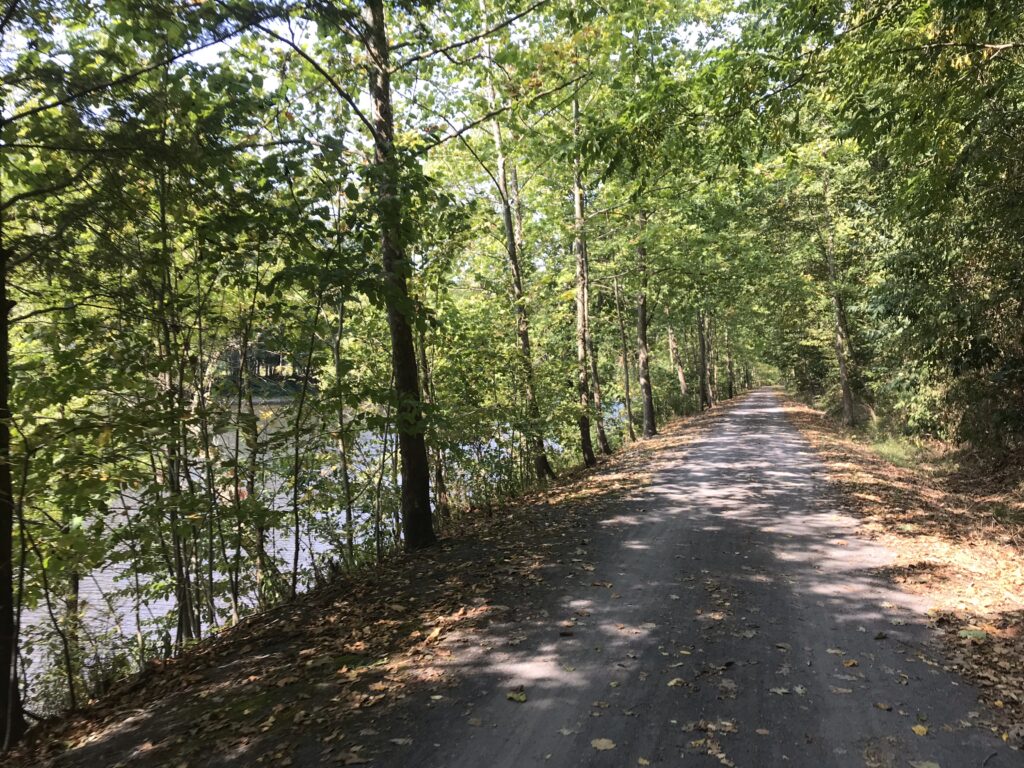
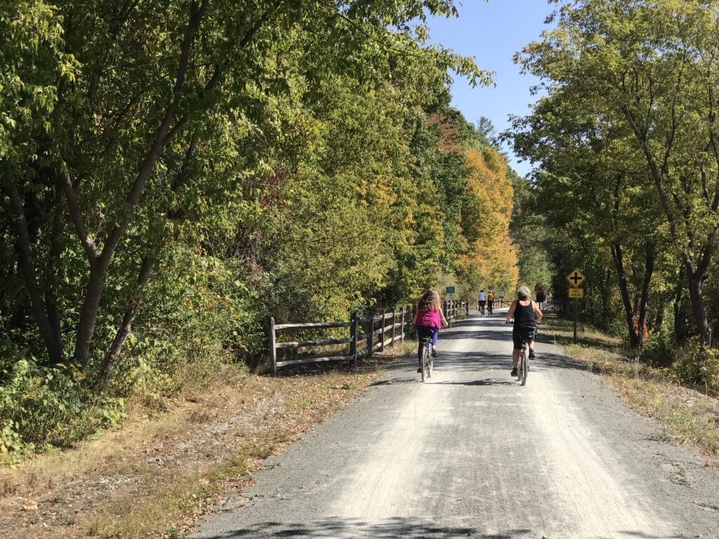
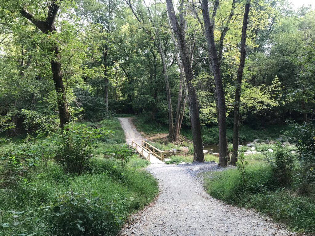
I read about this “destination” trail in Pennsylvania called the Pine Creek Trail. It is a 62-mile rail trail that runs between Wellsboro and Jersey Shore.
Start in Jersey Shore – An access trail to the rail trail
I love the open road. I don’t like traffic. There must be a happy balance between the two. Rail trails are especially nice if they are paved. Most are not. And this trail had a crushed limestone surface.
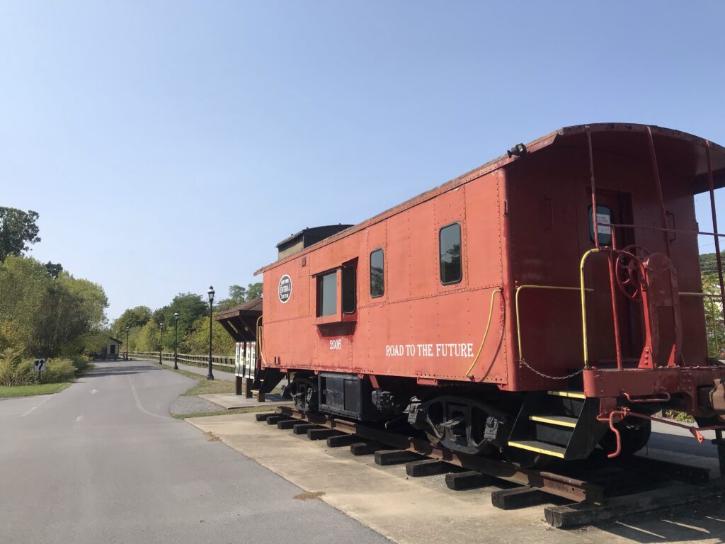
Caboose in Jersey Shore – probably the true start/finish
Most riders choose a hybrid bike to ride this trail. I chose my Trek Checkpoint, a gravel bike. I used road tires, 32 cc width. I think 25 cc would be ok too although 28 cc would be better. I do have 40 cc gravel tires with small knobby tread but decided that would be overkill for this trail. The 32s were fine.
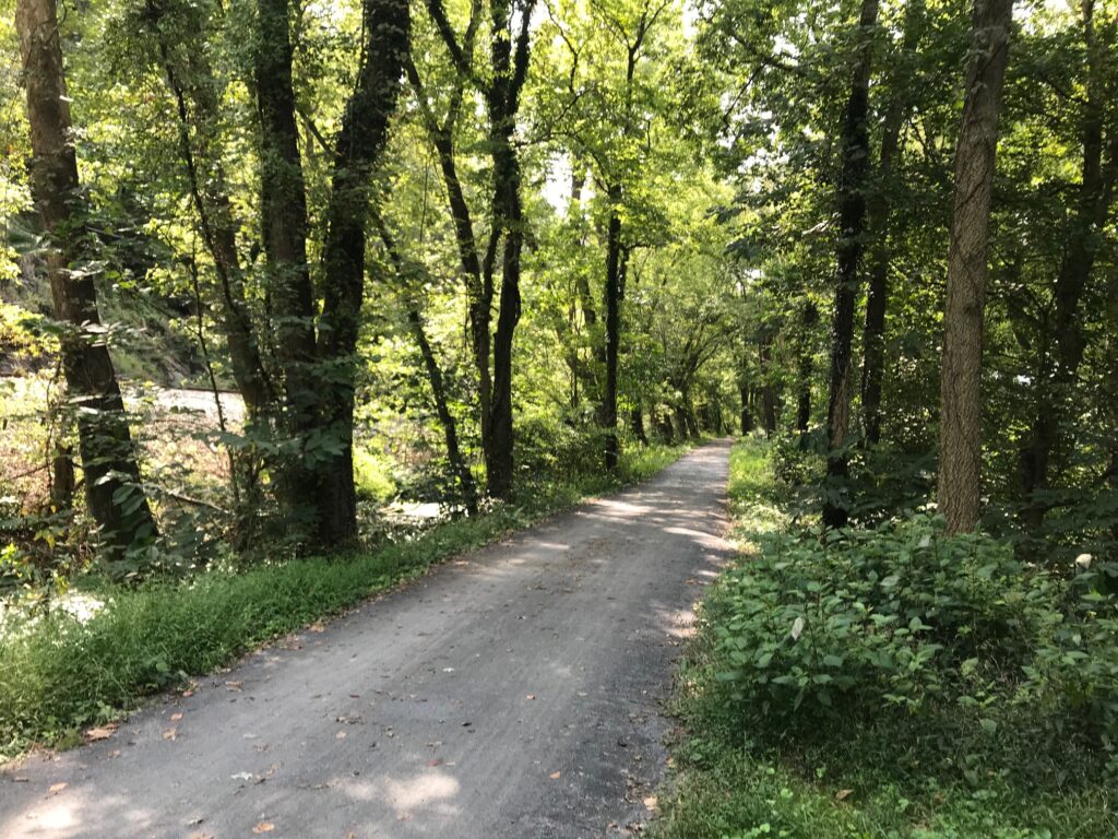
Some of the scenery on the Pine Creek Trail
And I was right. Especially near the Wellsboro and Jersey Shore trailheads, the path is packed down pretty solid. In the middle, I found a bit more loose gravel but it was no problem for my road tires.
Pine Valley Trail – Mile 37
The literature often suggests that the trail runs downhill from Wellsboro to Jersey Shore. I’ve seen estimates as much as a 2% grade. I call nonsense. Let’s resort for a minute to facts.
Wellsboro
Jersey Shore
Difference (feet)
1,306′ elevation
604′ elev.
702′
Distance (mi.)
Elevation Change (feet)
Grade
62
702
0.21%
Elevation Chart (If you can’t do the calculation yourself check out this elevation grade calculator by Kenneth Alambra.)
The elevation change over 62 miles is only 702 feet. That computes to 0.2% grade. Or for those who claim it’s one percent downhill, they have overstated the grade by fivefold. For this cyclist this trail is flat. But I didn’t know that before riding.
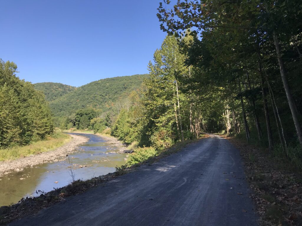
Pine Valley Trail
I wanted to ride the entire trail. Ideally, I could ride 62 miles and meet my ride. That wasn’t an option because I was riding solo. Actually, it could have been an option had I researched this because there is an outfitter in Wellsboro that will drive your car to Jersey Shore for $120.
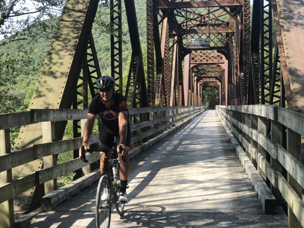
First Trestle
My options for riding the entire length would be: (1) ride 128 miles in one day; (2) Ride from one city to the other, overnight, then ride back the next day; or (3) ride out and back on two days to cover the distance.
Near Rattlesnake Rock Access Area
I thought I might not have enough daylight or energy for the first option. In retrospect, I would have. I did not like the lodging choices for the second option plus I did not want to carry extra gear with me to overnight. So that left me with the third option.
End or start of the trail – Jersey Shore
I decided on staying in Williamsport as they had many good lodging options. I left home early yesterday morning and arrived in Jersey Shore at 1:00 p.m. I would ride half the trail today and half tomorrow.
Pine Creek Trail
Based on the erroneous claims that the trail is uphill to Wellsboro, I wanted to start in Jersey Shore and ride uphill so I would have the downhill on my return. Of course, I would soon learn that the trail is flat.
Pine Creek Trail
I decided to ride for two hours then turn around. I would return around 5:00 p.m. which was a good day.
Turnaround point for Day 1 and start/finish for Day 1
I parked next to a trailhead in Jersey Shore although I don’t think this is part of the trail. I think it is a one-mile access trail to reach the actual trailhead.
View from Rte 414 near Cedar Run
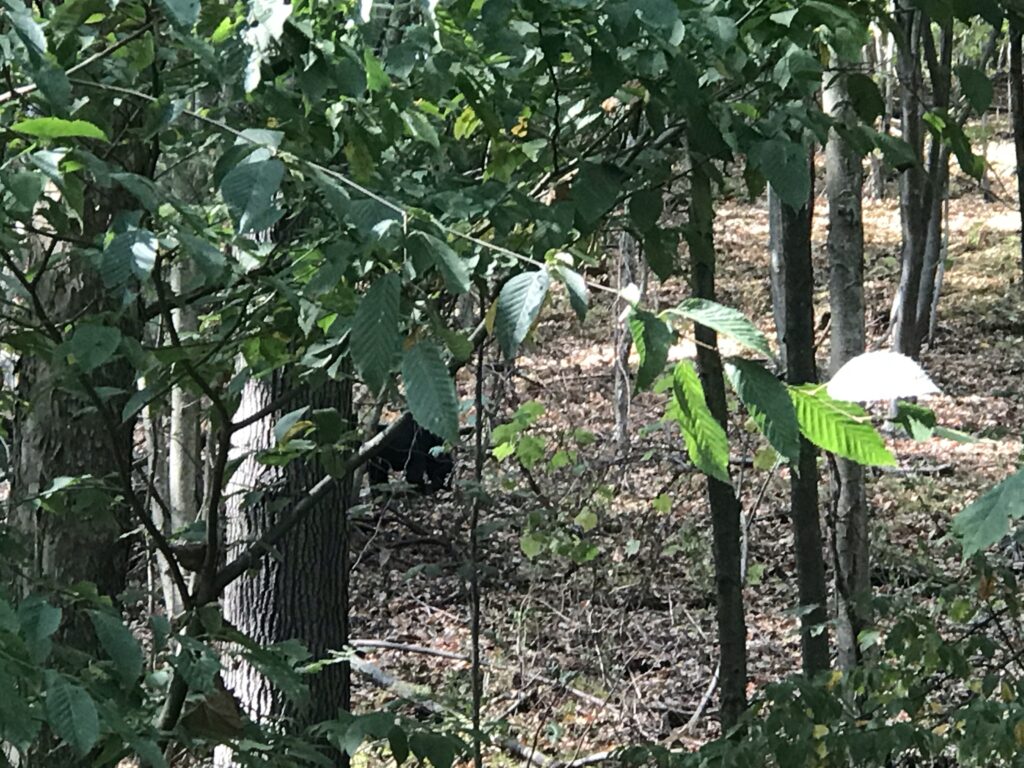
Once on the gravel trail, I had gone seven miles just south of Waterville. I came upon a woman on her bike and her adult son running. Except they were stopped and pointing in the woods. And there was a black bear. My day was made. My ride was made.
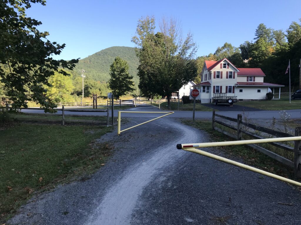
There are a lot of at grade road crossings. Although most are small roads that lead to cottages the trail does cross Pa. Rte 44 and 414 a few times as well. At each of these crossings, there were usually two gates to navigate. I soon discovered that rather than try to see how to get around the gates it was easier to see where the worn trail led. I thought that getting through these gates would slow my average more than riding on gravel.
Cammal – MP 35. Follow the worn path.
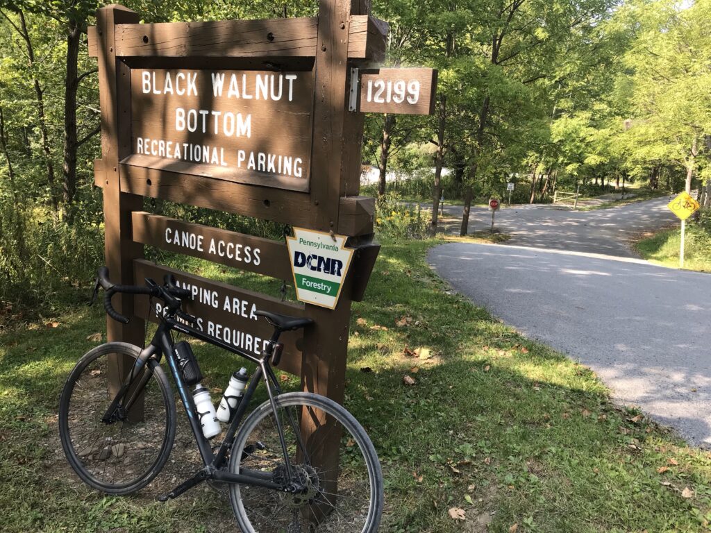
There were three trestles in this section and I rode to the Black Walnut Bottom parking area (MP 37). I chose to ride for two hours then find the next or closest parking area where I would start today. So this was perfect. It looked like I had ridden 25 miles and averaged 12.5 mph – which is what I planned for a gravel trail.
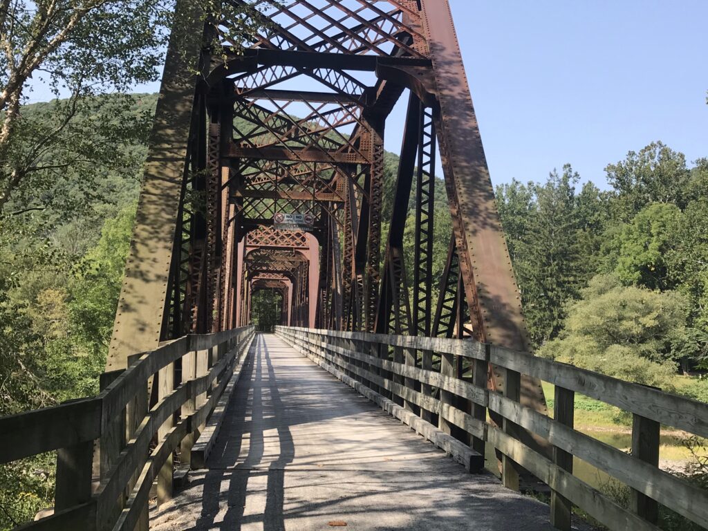
The second trestle
I had stopped a lot for photos. And bears. So my moving average was certainly faster. When I turned around I felt dirty. Grit all over. The bike was dirty. I was dirty. And I saw the road beside the trail. I hadn’t studied the route ahead of time but felt the road would take me back to Jersey Shore.
Start of the trail near Wellsboro
I could not check my phone for a map. The Pine Creek Trail is in the Pine Creek Gorge which is more commonly known as the Grand Canyon of Pennsylvania. There is no cell service deep in this canyon. So I jumped on the road to see where it would take me.
Start of the trail near Wellsboro – a bridge to grass
Some of the time the road was pancake flat and stayed next to the trail. Other times it climbed high. It gave me views high above the trail that I would not otherwise see. But I was still in the canyon. I did not climb out of the canyon. To see the canyon from the top I would have to leave and go to one of the vantage points. That would not happen on this trip.
One lane bridge at Slate Run – MP 4. This can be seen from the PCT or ridden on Rte 414
My return trip went much faster. Part of it was because I didn’t stop as much for photos. But part was because I was on the road. When I checked my data at the end of the ride I had averaged 15.5 mph. I was shocked because I expected 12-13 mph since I was on a gravel trail, at least for half the time.
Cottage on the Trail
Today’s ride would be a little more complicated. I did not want to simply do an out and back starting at MP 37 (Black Walnut Bottom) which is where I stopped yesterday. I had studied one alternative route back by road.
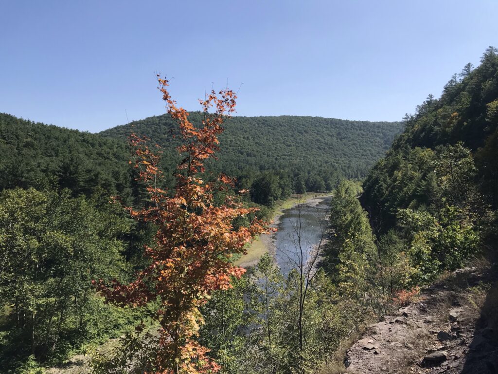
Marsh Creek – Around MP 8. About one-half mile south of here the Marsh Creek flows into Pine Creek and begins the gorge, or Grand Canyon of Pennsylvania.
It was 50° when I rolled out at 9:30 a.m. Deep in the canyon the sunshine doesn’t reach some of the deeper parts until later. It would be one hour until I saw anyone on the trail. They were all keeping warm.
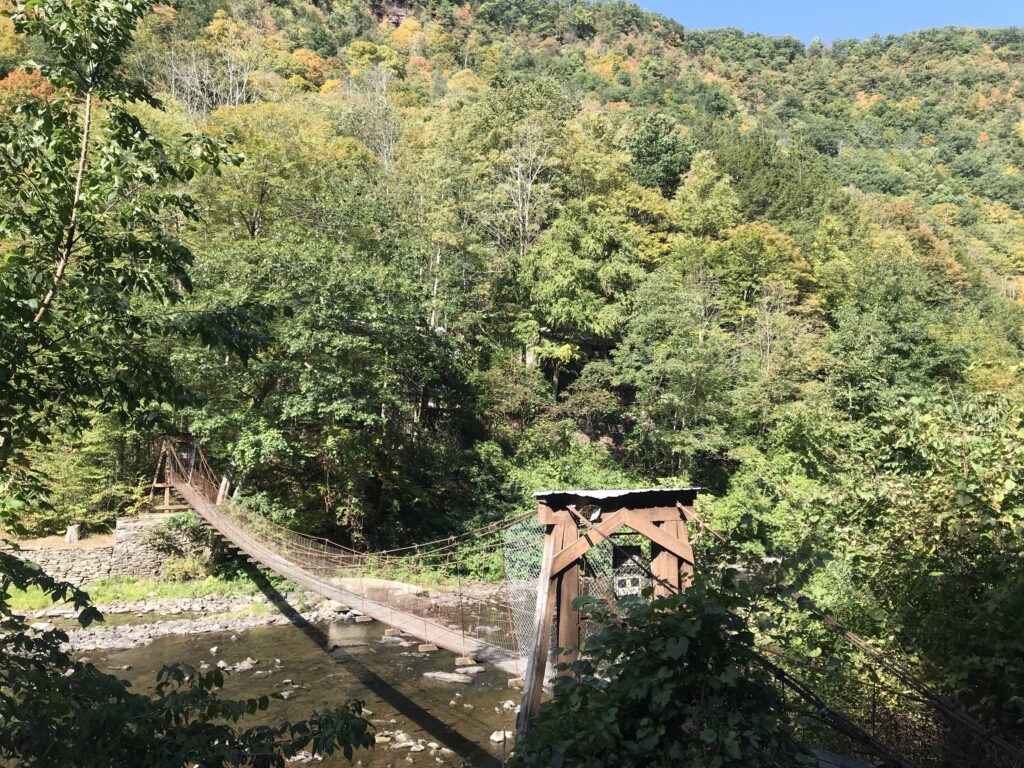
Swinging Bridge (Private Property) – Crosses Pine Creek to four cottages
I just rode. At Blackwell,a group of eight cyclists was just ahead. I recognized the 2016 Ride the Rockies jersey on one of them. Another referred to me as a serious cyclist. I guess I was because I would pass them and they would be out of sight 30 seconds later.
Two Women Riding around MP 5
I’ve read other accounts about this trail and how to get to the nearby waterfalls. I just rode. My road cycling shoes are not that good for hiking and I don’t really see me switching pedals and shoes for this bike. It’s a gravel bike but it’s primarily my second road bike. I’ll probably never have cycling/hiking shoes unless I put platform pedals on this bike.
Barry and the second trestle
I reached the end of the trail near Wellsboro (three miles away) and decided to execute my road plan of returning. I knew I would be riding more than 70 miles and only had two bottles with me, one banana, and one pack of Skratch energy chews. I should have stopped in Wellsboro for something to eat.
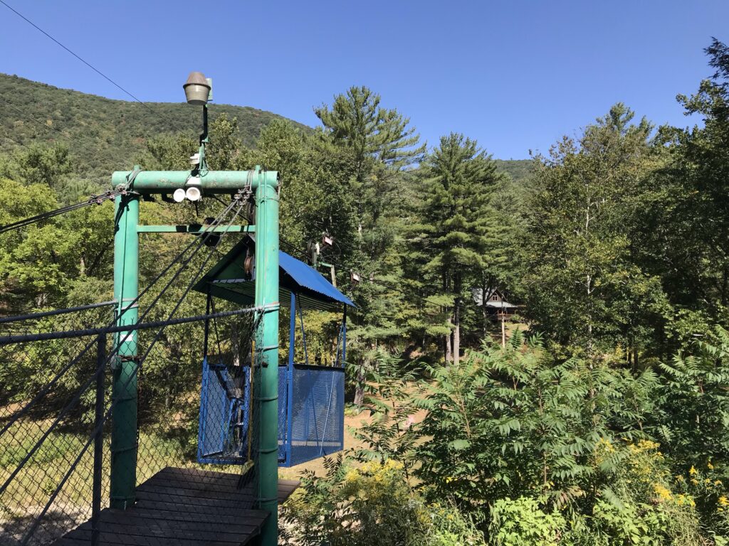
Zip line across a gorge to a house
One reason I did not was because of restrictions in place due to COVID-19. I didn’t go for a bike ride with a mask. Maybe a store or restaurant would have had a mask for me or wouldn’t care, but I just didn’t want the hassle.
Wellsboro
And I really wanted to keep riding. And so I did. This little city is quite beautiful. I had a 2.5-mile climb leaving Wellsboro and then a sweet 10-mile descent to Morris. There I picked up Rte 414 and had another five miles before meeting up with the Pine Creek Trail again. Although when I did I would stay on the road.
The Road Less Traveled – Rte 414 high above the trail
I arrived back to the car having ridden 71 miles (the road loop was shorter). My average, like yesterday, was 15.5 mph. The surface is generally pretty hard. Having ridden it once I now know I could have averaged 15 mph and done an out and back for the entire length in 9-10 hours. But for that, I would stop for lunch.
Distance: 123.7 miles Average Speed: 15.5 mph Weight: 178
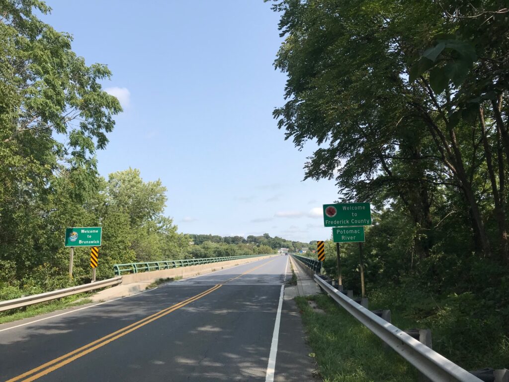
What a beautiful day. I had mapped out a 55-mile ride and loaded it on my Wahoo. Truth was, I didn’t need a map because except for a two-mile stretch of Va. Rte. 267 (Berlin Turnpike) from Lovettsville to Brunswick, Md., I have ridden all these roads before.
W&OD at Hamilton (MP40)
Well, not all roads. Twenty miles would be on the C&O Canal Towpath. Yes, on my Domane (road bike). I was comfortable riding the canal because six days ago I met my sister, Betsy, and her husband, Tom, plus friend, George, as they were doing a through-trip from Pittsburgh to D.C.
Betsy had texted me and said “They’ve resurfaced at least this part of the canal! .. no puddles, no roots, no rocks.”
Hamilton, Va.
When I met the crew last week, I had just ridden through a steady rain. Although it had quit raining when I met them, that led to a discussion about the surface. Between Point of Rocks and Whites Ferry, it is generally hard-packed. With the rain it looked, and rode, like asphalt.
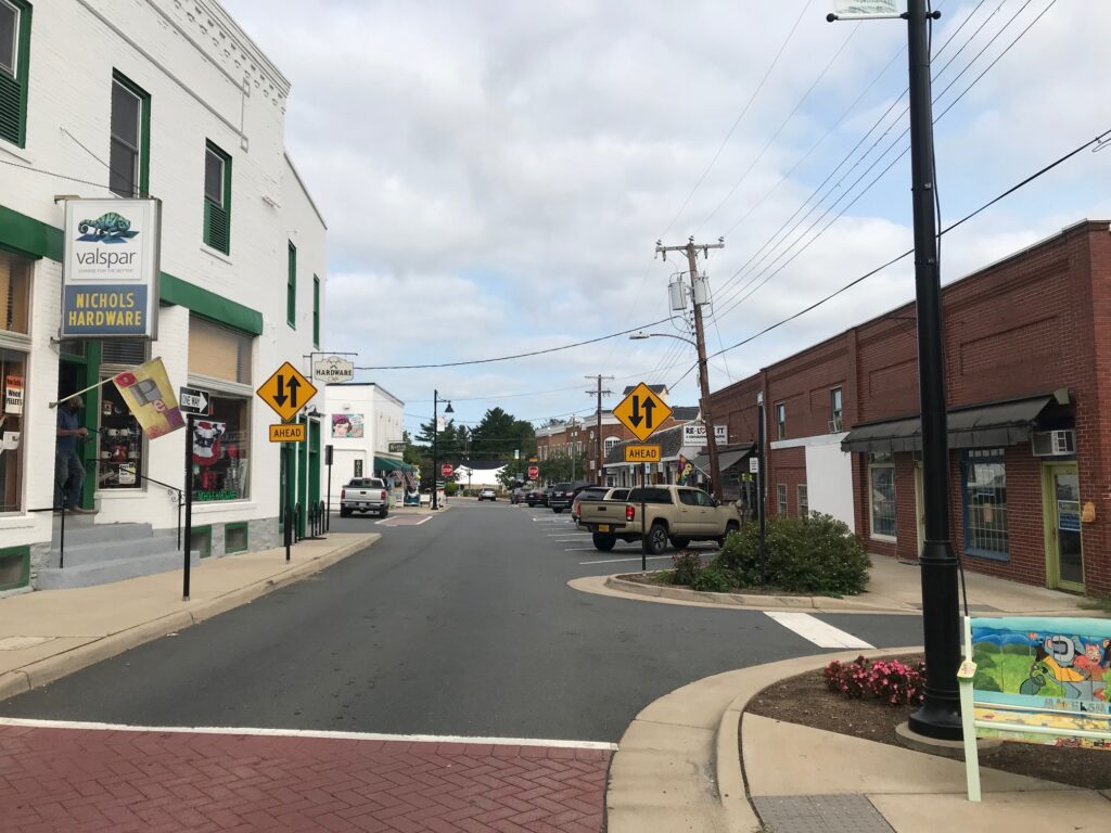
Purcellville
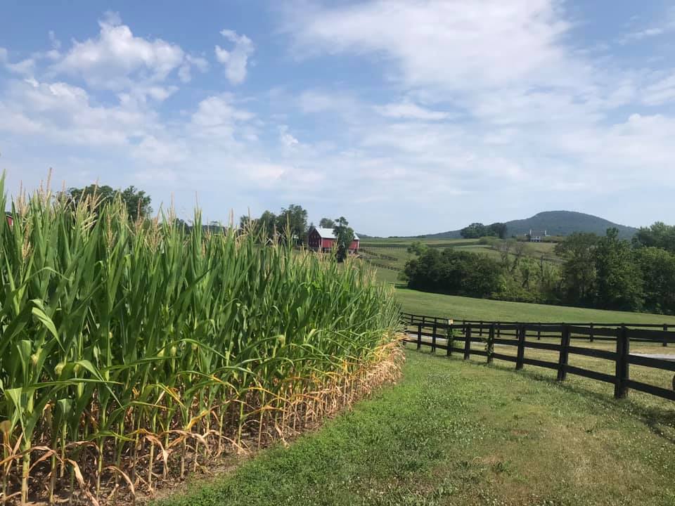
When I mapped out this ride I thought about taking Md. Rte. 28 from Brunswick then connecting to Martinsburg Road and the familiar country roads I have ridden many times. These are the roads to and from Sugarloaf Mountain so they would be familiar territory.
Purcellvile
But an alternative would be the C&O. The paved C&O. Well, so I thought.
Road Construction in Hillsboro
It was a chilly late-summer morning. Just 55° (13° C) at the start. My cold-weather gear consisted of arm warmers. And that’s it.
Doukenie Winery, Hillsboro
I followed the W&OD to Purcellville then took Hillsboro Road over to Hillsboro. There were ZERO cars behind me today. There’s a major construction project in Hillsboro with a detour around the quaint town, and cyclists benefit by the detour.
Lovettsville
From Hillsboro to Lovvettsville I followed Mountain Road. It was absolutely beautiful. I had mapped out an alternative for bypassing Lovettsville but that did not work out. I have to go back to the drawing board but I was comfortable staying on the roads I knew.
Welcome to Maryland (Brunswick)
Actually, the drawing board is confused. Checking what I had mapped out and downloaded, what Wahoo was showing today was not the same. In Purcellville, it was supposed to route me onto Chestnut Overlook Drive but did not show that. Then on Mountain Road, it told me to go straight about 200 meters, do a U-Turn, and then turn on Brittain Road. And that was gravel so I ignored it. But it looks like I had mapped an alternative for bypassing Lovettsville but that never showed up either. Don’t make me lose trust in my Wahoo.
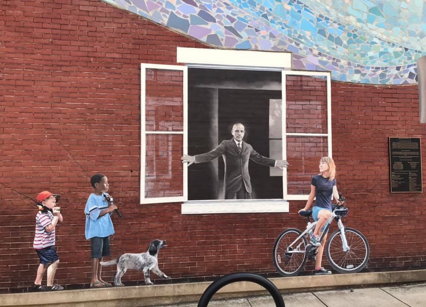
Horine Bldg (1910). The man is Dr. Arlington Grove Horine (1863-1956) owner of Horine’s Drug Store and Soda Fountain Shop. He was a surgeon with the B&O Railroad (1891-1903) and Brunswick’s mayor (1906-1914).
I jumped on the Berlin Turnpike (just the name of the road, it’s not really a turnpike). I came to a construction area and stop where the flagman held up a stop sign. We chatted briefly. He told me I was flying up the hill before I reached him. That was a nice compliment.
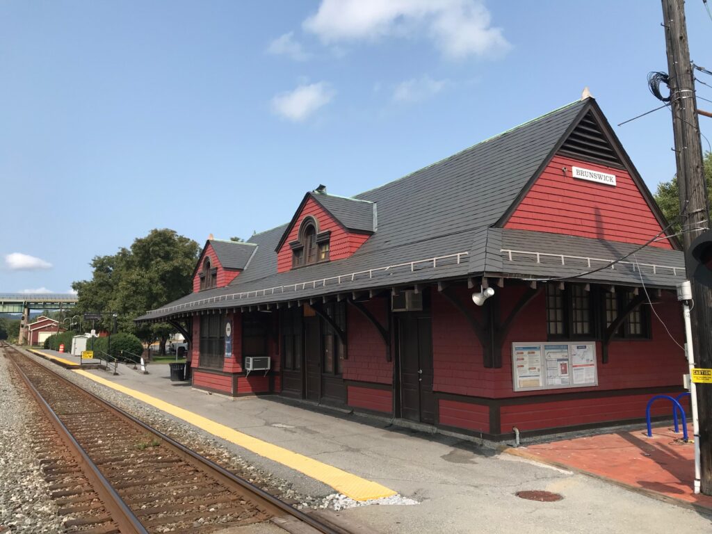
Brunswick, Maryland Train Station
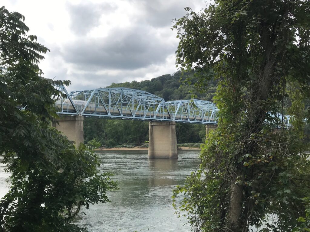
It wasn’t long to the bridge into Maryland and over the Potomac River to Brunswick. In Brunswick, I looked for Mommer’s Dinner, a quaint little restaurant where Andrew and I ate back in 2001. I did not see it and would learn that it closed. I can’t determine if it was this year or just some time in the last 19 years.
Bridge Out on the C&O
Crossing the B&O tracks, I came to the access road for the C&O Canal. And it was crap. I was expecting paved and this was a gravel road with many potholes. It was horrible.
C&O
Thankfully, it would last one mile, just to the entrance of the Brunswick Family Campground. And it was 19 years ago that Andrew and I camped one night here. We thought we found a great campground only to be woken up too early by the trains just 50 meters away through the trees.
Point of Rocks, Md.
But the canal path became much improved here. I could see, without the rain, that this was definitely a crushed limestone surface. Except for one detour around a bridge that was out, it would be 19 miles of glorious crushed limestone. Along the way, I passed many cyclists. All were much slower than me. Every time I looked my speed was 17-20 mph. Not bad on this surface.
Point of Rocks, Md. US Rte 15 connects Loudoun Co. Va. with Frederick Co., Md.
There was one guy I caught and surprised. He was probably around 40 years old. He had mountain bike tires but was making great progress – probably 15-16 mph. I called out “on your left” which surprised him. He looked back, a little surprised, probably thinking he was the fastest rider on the canal today. But I was on a road bike and he had fat tires. If we switched machines he would be way faster, I’m sure.
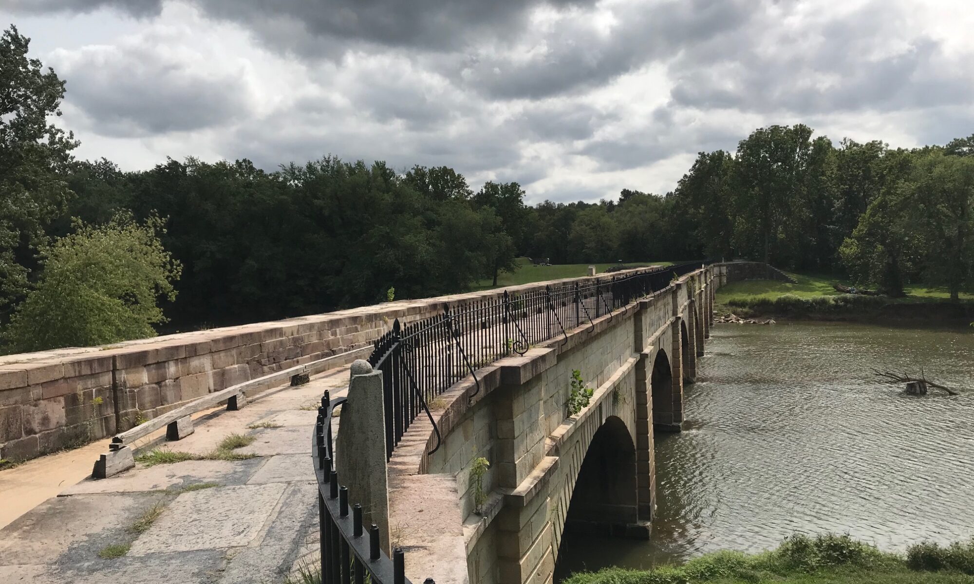
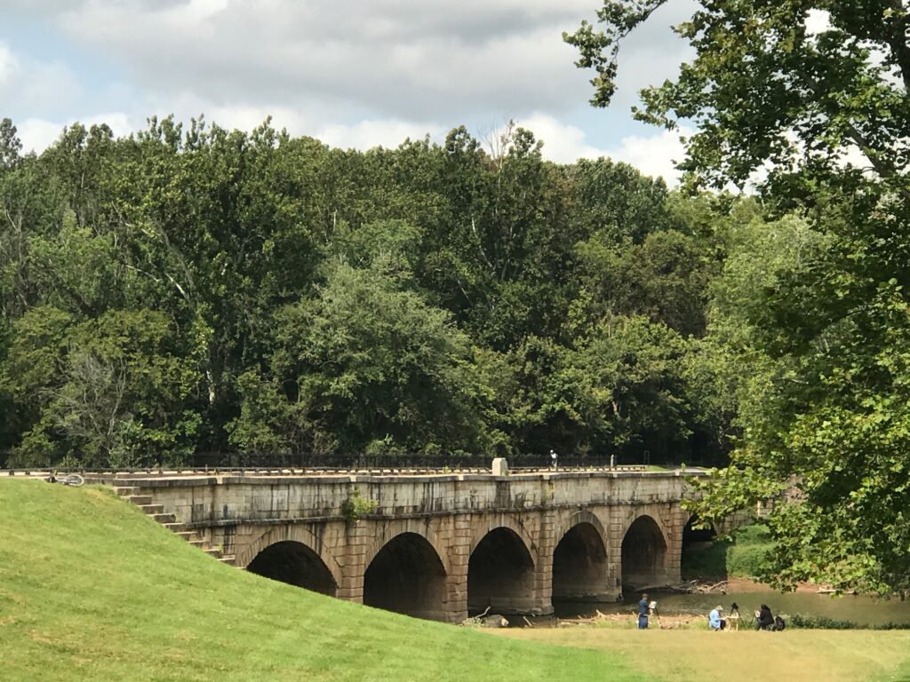
Monocacy Aqueduct
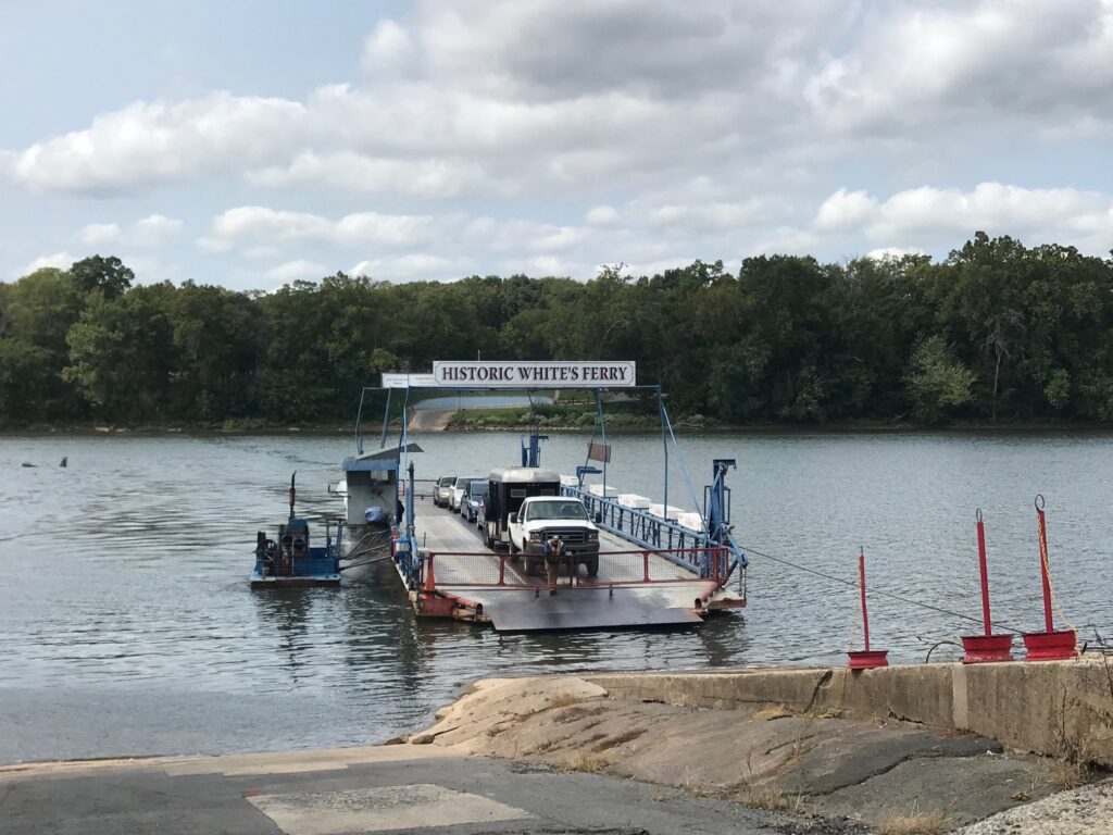
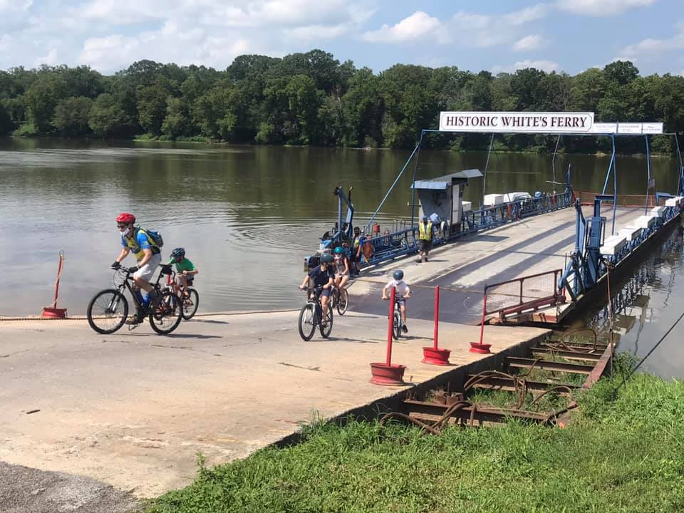
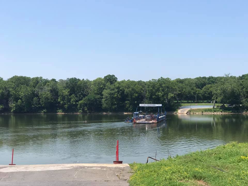
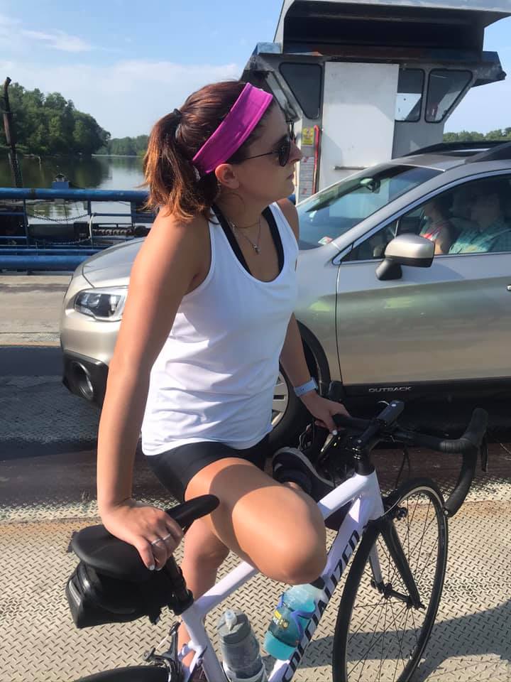
One week ago I was in a steady rain crossing the Potomac by ferry. Today was a gorgeous day. I arrived as the ferry was arriving from the Virginia side. I never stepped off the bike although I had to put a foot down for 4-5 minutes.
Whites Ferry
Leaving the ferry my legs felt good. There is a ramp here which is probably 15%. Almost always the lactic acid hits me here and I can barely pedal. Today I noticed no lactic. And although I was riding into a strong headwind and had 50 miles in my legs, I saw my time on this Strava segment was coming down. I would set a new PR. And I sort of smashed it.
Monocacy Aqueduct
It was a beautiful day. This is a ride I would love to do with friends. It can be done with road bikes. The canal section isn’t bad except for one mile in Brunswick but that shouldn’t be enough to discourage one from this ride.
I sort of smashed my PR. It is good for #1 overall for my age group but just 67th total (out of 2691)
Distance: 55.0 miles Average Speed: 16.3 mph Weight: 181
Oh how Strava Live Segments change everything. I came to ride the BlueRidger Proper (counter-clockwise). The weather was mostly sunny at the start but with a strong wind which would be cross-head or just a headwind for much of the ride. The temperature was 70°.
A few weeks ago I had ridden on Rectortown Road and found a segment I liked: Frogtown Road to Atoka Road. My goal for today: PR on that segment.
Rokeby Road, Upperville, Va.
I am loving my Live Segments but not every segment I sat seems to show up on my Wahoo. Once it’s there it stays but I never no until the next time I approach a segment if it will be a Live Segment. I rode off into a very strong headwind. Part of me said to just pedal through it while another part said to go for it. I listened to the bad me.
It did not show up as a Live Segment. Nor do I think that it would have done any good. I changed my time display to see elapsed time and went passed Frogtown at 8:48. As I approached Atoka Road I could see I was around 11:24. I knew I needed 2:24 and not 2:36. I was way off. And it was the wind. Well, at Atoka a woman looked at me and pulled out right in front of me causing me to sit up. I didn’t have to brake but I could no longer keep the pedals moving. So I settled for 3rd best of my time which was really tied for the second-best of my times. But way off the mark.
General Store at Airmont
The rest of the ride was uneventful. On Rectortown Road the road “bottoms out” as it crosses Goose Creek. I wanted to hit 40 mph here and I did. And then I got a Live Segment – GO! This was for Rectortown Test Climb. And even though I was riding into a strong wind, I decided to see if I could PR it. I was happy when 3:53 (New PR!) popped up. Old PR had been 4:15. Then I could rest the rest of the way.
House on Snickersville Turnpike near Bluemont
Fighting the wind, I averaged 16.1 mph out to Airmont. Without doing a deep search, I found a ride from 11 years ago where I averaged 18 mph on this part. But that was in a group; I didn’t fight winds in my face; and I was 11 years younger.
Bluemont, Va.
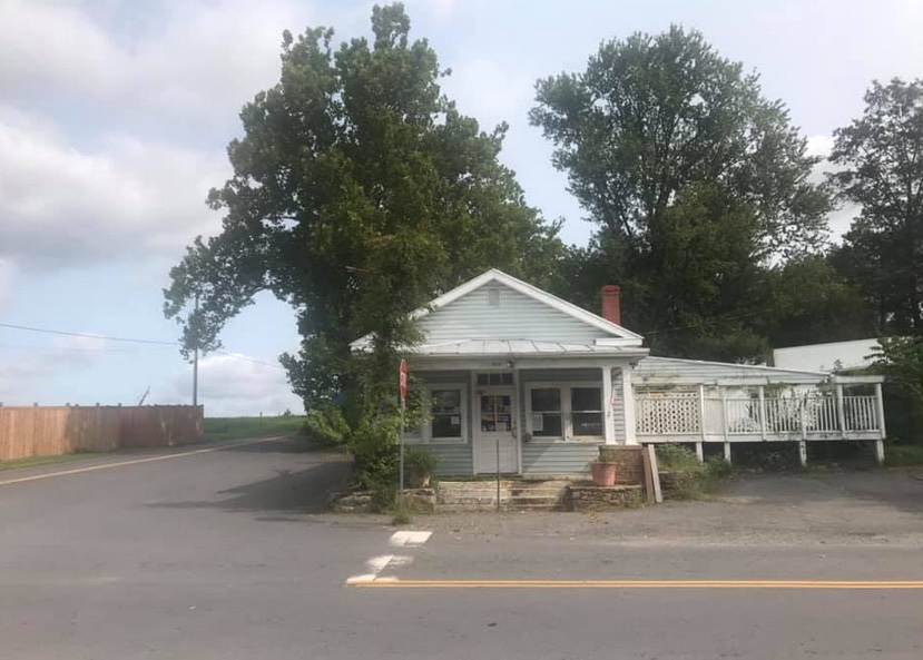
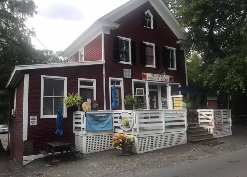
Passing through Bluemont, it appeared to me that some new construction has taken place since the last time I rode through here. There was a building on the left and then I saw the E. E. Lake General Store. Apparently it is a welcome center but has the old General Store facade.
General Store, Bluemont, Va.
The climbs were pretty much as I remembered them. Moderately hard. There is a steep climb out of Bluemont on Snickersville Turnpike. It has a 180° switchback at the top and is flat over to Rte. 7. Rte 7 has a wide should as it climbs to the top of the pass. This is the easiest of the three sections here. And turning on Blue Ridge Mountain Road is a pretty steep climb with no end in sight. I still don’t know where it finally ends and dips down.
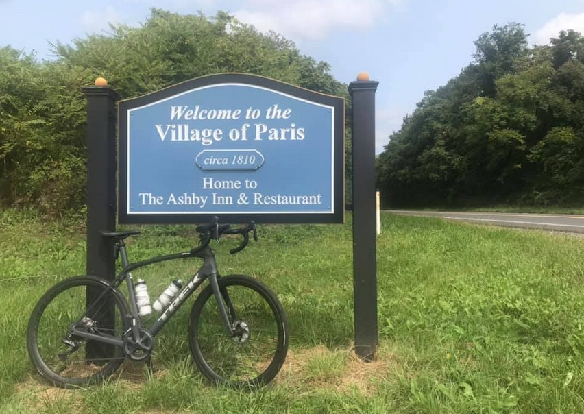
Ashbys Gap, US Rte 50, Paris, Va.
The ride off the mountain is nice. When I got to U.S. 50 I found it was too windy to descend without braking. That may have been the first time I rode here using brakes. But there were cross-wind gusts hitting me making it hard to control the bike.
Paris, Va.
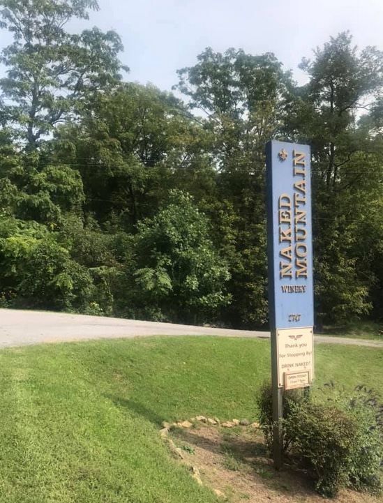
Once on Leeds Manor Road I expected and received, a Live Segment for Naked Mountain. Once it starts the Wahoo displays the elapsed time, a contour map of the climb, your estimated time, and your PR time. My PR coming in was 9:06. Today I went through in 7:44.
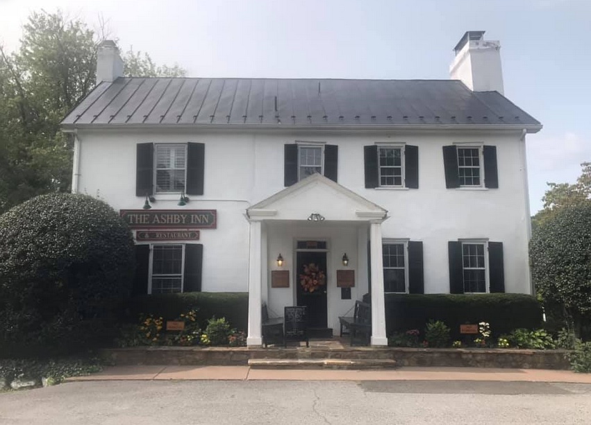
Ashby Inn, Paris, Va.
There is pavement on this road but it is rough. I wanted to descend faster but didn’t trust the pavement. Rounding a corner on a downhill the road turned up and a GO! appeared. This was for Naked Mountain Winery. It’s a short climb but I had no legs. Pretty much left everything I had a few minutes ago on the Naked Mountain climb. Wahoo disagreed. My old PR was 2:21 and I lowered it today to 1:41. I would like to see what I could do when I didn’t fight the winds.
Naked Mountain Winery
The last 10 miles from Markham I had great pavement and crappy pavement. I thought I had a tailwind but my speed was only 16 mph – the same as the first 20 miles into the wind. Maybe my legs were fried at this point.
I wanted to beat four hours and came in at 3:47. Goal accomplished. It was a good solo ride fighting the winds. Wish I could do better but Strava thinks I had a good day.
Strava PRs
Distance: 55.2 miles Time: 3:45 Average: 14.7 mph Weight: 180
Two weeks ago Tim Casebere and I were riding out near Remington when we ran into another cyclist. The cyclist, David Thatcher, is from Gainesville and we exchanged numbers for a future ride.
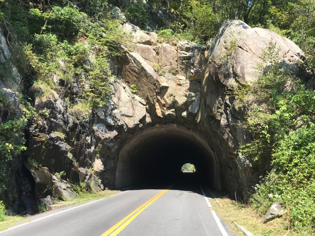
Tunnel
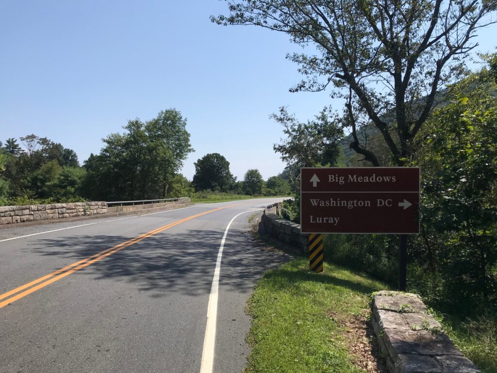
Yesterday David texted me and told me he planned to do a 40-mile ride on Skyline Drive and invited me to join him. I agreed.
Old Rag Mountain
The only hiccup in our plans was where to meet. David said first parking south of the US 211 entrance at Thorton Gap. I saw the area known as Panorama or the tunnel overlook. When I questioned him he told me it was Mary’s Rock Trailhead, “within 1000 yards of 211.”
Looking west
I entered Skyline Drive and passed Panorama and went to the tunnel overlook. Didn’t see David or Mary’s Rock. I knew I went too far so I turned around. I figured I would go back to Panorama and ride by myself if that was the case.
Skyline Drive at Thorton Gap
Somewhere outside of Warrenton all cellular service is lost. I doubted I would be able to contact David by text. But returning to Panorama, which has a very large sign, is a small sign or Mary’s Rock Trailhead. I was in the right place.
Looking west
We hadn’t ridden together except for a little bit in Fauquier Co. near Remington. And he was on a bonk that day. I did not know what to expect from David.
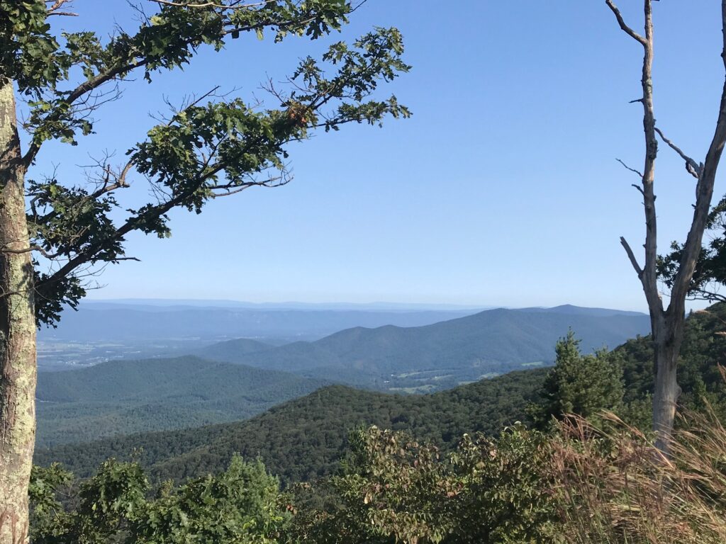
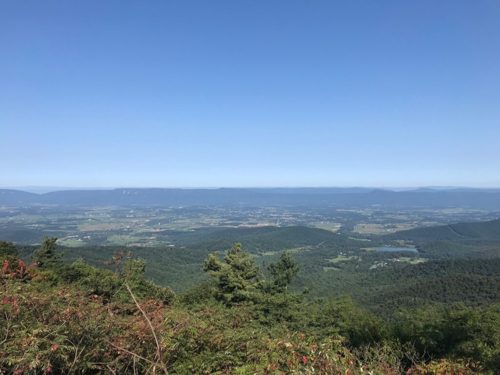
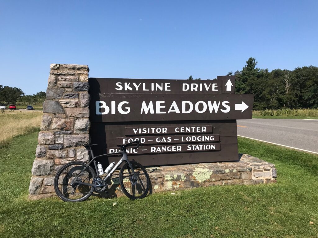
Big Meadows
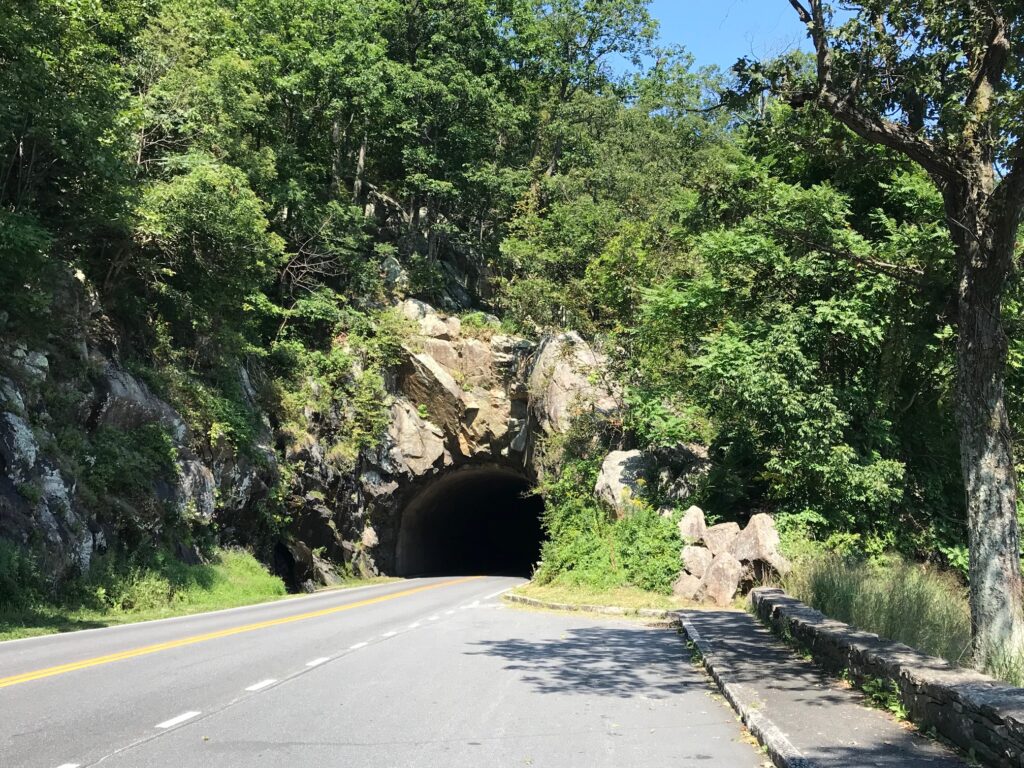
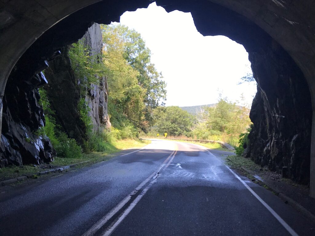
It was a perfect morning, probably 65°. If I would have been riding on the flats I probably would have opted for arm warmers. But knowing there was a climb immediately, I went with nothing additional. We started out of the parking lot. I was matching David’s pace but after half a mile or so, he was about five meters in front of me. We went through the tunnel, stopping at the end for a quick photo, then continued up the hill.
Same tunnel – different view
I stayed with David early on but he was clearly the stronger rider going uphill. Using my friend, gravity, I was the faster rider going downhill.
David Thatcher
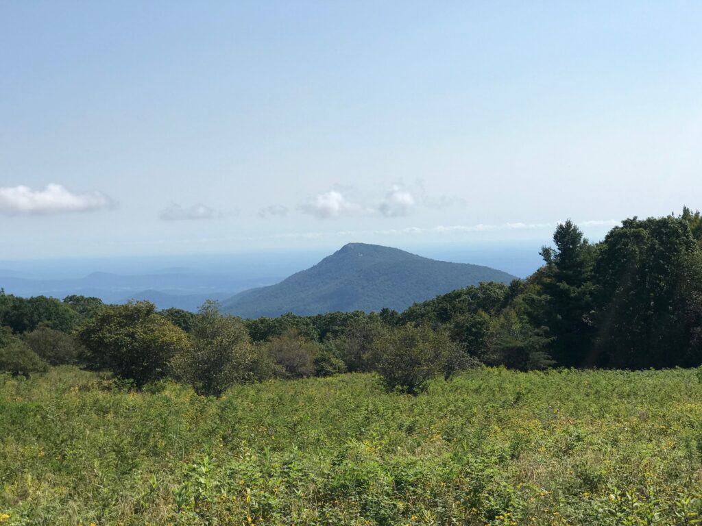
Our first climb lasted about 4.5 miles followed by a three-mile downhill then a three-mile uphill, passing Skyland, the high point on the trail. There was construction in this section which actually made riding more pleasant. The pave was perfectly smooth asphalt.
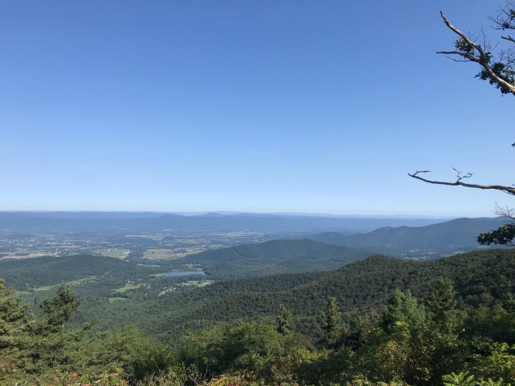
Looking west
Four of five times we came to a flagman where we had to stop and wait for a pilot car to come by and lead us, and waiting cars, through. We just tucked onto the back behind the cars. And even going uphill, they held all oncoming traffic until we cleared. No oncoming traffic. No following traffic. It was a beautiful ride.
Skyline Drive Tunnel
Other than a garter snake sunning on the new asphalt, I didn’t see any wildlife. No deer. No bear. But plenty of beautiful vistas.
The distance wasn’t far but we had more than 100′ of climbing per mile. Arriving back to our cars I congratulated David on winning all the hillclimb points on course. He said that’s what he does best. And he did well today.
Distance: 40.1 miles Average Speed: 13.0 Weight: 183
I have made a decision that all my posts of rides will include one additional metric: Weight.
Like many adults, I have a problem maintaining a healthy weight. And last month on my birthday, I made the determination – I will get down to that healthy weight. And by publicly posting it, I will force myself to maintain that – once I reach it.
In cycling, a Clydesdale is a category for heavy riders. Some could be simply that they are big men (very tall) but most are just overweight. And they cannot compete going uphill with their lightweight competitors. So some events, hill climbs usually, have a Clydesdale category. It may vary but is usually 190 pounds. And the women have a Philly category.
Sometime after cancer treatment 10 years ago, my weight started creeping up. There is a medical reason for that but that’s not an excuse. It’s a challenge. And we all have challenges in life.
I’ve never registered as a Clydesdale. But the best opportunity for me was at the 2018 Hillclimb World Championships in Santa Barbara. I did not because I always held this belief that I would lose the weight before the event. And I never did.
Only after the world championships did I see it. Just two people had registered as Clydesdales. No matter how bad my time (and it was), I would have finished on the podium (Top Three). Damn me. And possibly, if I rode with those two guys, I could have stayed with them until the end and maybe even pulled out a better time. Or maybe not. I was, after all, coming off knee replacement surgery just a few months earlier.
For me, all my adult life, to control my weight I have to be aware. That means the scale has to be my friend. And I’ve gone too long without stepping on the scale.
On my birthday I went for a 65-mile ride near Altoona, Pa. I bonked. I blamed the heat (true) and lack of hydration (true) and lack of nutrition (also true). But I also realized that I was carrying too much weight. When I got home I made the determination to lose weight.
I stepped on the scale. 210 pounds. Ouch. And that was that.
I made a spreadsheet. It was simple. Date. Weight. 7-Day Moving Average.
Aug 15
190
191.285714285714
Aug 16
190
190.714285714286
Aug 17
189
190.428571428571
Aug 18
189
190.142857142857
Aug 19
187
189.428571428571
Aug 20
186
188.714285714286
Aug 21
189
188.571428571429
Seven-day moving average spreadsheet
I chose this method of tracking with a focus on the seven-day average. This would allow me to miss a day of weight tracking and not worry about it. It also accounts for the daily fluctuations that occur depending on when I can weigh in. Sometimes a loss, or a gain, is all water weight. In the chart, above, I gained three pounds (Aug. 21) but the moving average was down (because the 189 replaced a 190 value seven days earlier).
My “program” is simple.
Eliminate grazing, that between or after meal snacking
Eliminate deserts
Eliminate all the sugary stuff (candy bars – no Mint Twixt, donuts, Pop-Tarts)
Portion control
And that is the magic plan. From early July to late August – down 26 pounds.
There is a side benefit to this. My riding is getting better. I bemoaned the fact that 10 years ago I would do a long ride at 17 mph+. This year it has been more like 14.5 mph+. A few weeks ago I did a ride and set 23 PRs. Had another 48-mile ride where I averaged 17 mph. Dropping the extra 25 pounds has really helped my cycling.
It is embarrassing to admit this but this is public to hold me accountable. If I put future posts with my weight I have to be aware. And if I’m aware it won’t get away from me. No more Clydesdale.
Until November 2019, I was running the Garmin 510 bike computer which was not one of the newer ones capable of live Strava segments. I bought the Wahoo Elemnt Bolt and slowly made a transition to running the Wahoo.
There was a learning curve for advanced features although the basic stuff of speed, time, and distance, were ready immediately. I rode through spring and then in late spring, upgraded to a paid subscription for Strava.
Before subscribing, I would check known segments after each ride. Sometimes I would set a new PR (personal record). Usually not. Nowhere was this more evident than in the summer of 2019 when I was chasing a segment in Prince William Forest Park.
Each day I would go to the segment and go full out for 45-50 seconds. Sometimes I thought it felt good. Other times I knew I didn’t have it. Then one day I got home and uploaded my ride and found I had the KOM.
Live Strava Segments are just that. As I approach a segment I am notified. Then the big GO! appears on my screen. Throughout the segment, I can see my progress.
Looking back on those Prince William Forest Park segments, I always went as hard as I could. So seeing that I was one second down may not have been enough to find that one second. But when I’m on the 3-5 or 10-minute segments, one can find the energy to push it a little harder to match the last time when you are getting feedback.
Live Segments have changed the way I ride. I do a lot of LSD (Long, Slow, Distance) rides. I also know that interval training is necessary to improve. Live Segments give me those intervals that require me to go hard.
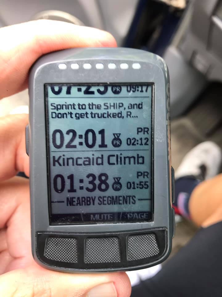
Nowhere was that better shown than today’s ferry ride. The W&OD was crowded but I came to the Kincaid Climb just before Leesburg. I was worried about getting a good time here because there was a slight headwind and there were lots of people. If I had to slow while waiting to pass I knew I was toast. But bad luck avoided me and my computer said 1:38 which was down from my previous PR of 1:55. My actual Strava time was 1:39.
Without Live Segments, this is one I would normally just roll through with no effort. In fact, my last ten rides, before today, were: 2:27, 2:17, 2:43, 2:28, 1:55 (old PR), 2:18, 2:24, 2:31, 2:44, and 2:23. I went hard and was rewarded. It’s not great – I am 33rd overall but that’s out of 16,292 athletes. So in that regard, this old cyclist is in the top 99% – 99.8% to be exact. And I am number one in my age group.
I even hesitated to go for a PR on Kincaid. Part of me wanted to save myself for the next climb. And that, too, is the beauty of Live Segments. Had I seen that I was down even 5-6 seconds I probably would have just sat up and soft-pedaled to the end.
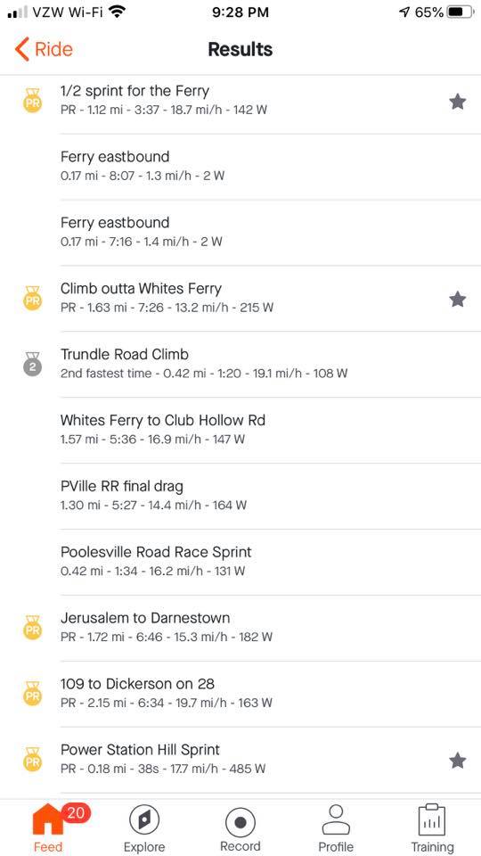
I was expecting to compete for four segments today. The ones that show on my Wahoo are the ones that I have selected (starred). I was on the shoulder of US 15 North when I got the GO for Sprint to the SHIP and don’t get TRUCKED. Instant feedback – I went through in 2:01, lowering my time from 2:12 three weeks ago. My Strava time was actually 2:02. But I was two for two. I was on a roll.
A family exiting the ferry
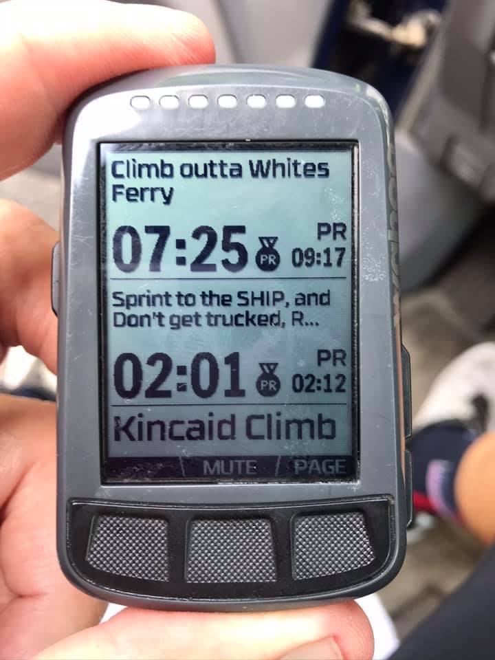
I came today to improve my time on the climb after leaving Whites Ferry. Three weeks ago I did this climb and had a PR (9:17). I waited at the top for my friend, Tim Casebere, at what I thought would be the “finish” line. I was actually short of the finish which was located over the top of the climb and about halfway down the next dip in the road.
When I got home I saw that I was second on the day – beaten only by Tim by three seconds. I laughed. I guess the clock was ticking while I waited. So I knew that if I simply didn’t stop at the top today I would improve my time on Climb Outta Whites Ferry. I went hard, saw that I was 45 seconds up, and then saw the PR on the screen (7:25). Wow! Almost two minutes. Note the “official” Strava time was 7:26 – I’ll still take it.
Climb Outta Whites Ferry
I was happy. I was riding well and I headed next over towards Edwards Ferry then back into Poolesville. There was one segment remaining, that I knew of. It was a climb on Martinsburg Road. And I was three for three and drenched with sweat. And it felt great.
I made my way over to Beallsville and decided if Rt 28 was closed five miles ahead (there was a bridge out at the Monocacy River two weeks earlier when I rode it) that I would take the road which now would be less traveled. It was closed ahead and as I hoped, I had no traffic for the next two and 1/4 miles to the turn onto Martinsburg Road.
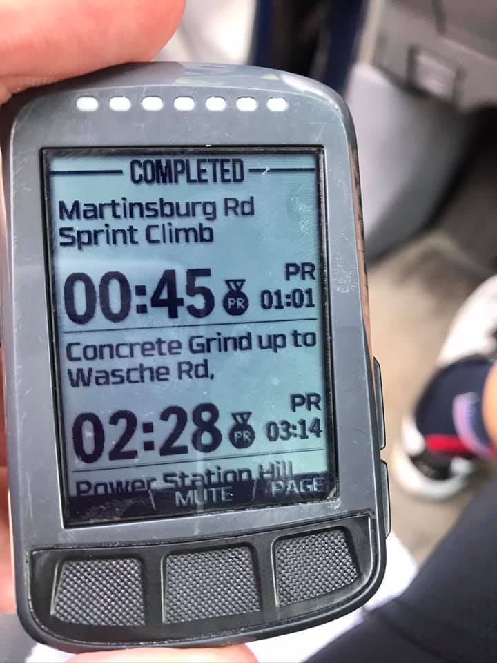
Immediately I was smacked in the face with a GO! I was on Power Station Hill Sprint. I could see it wasn’t long and went through in 0:39 – down from my previous best, 1:07. (Actual Strava time was 0:38). I was four for four.
I turned on the beautiful concrete Martinsburg Road and again, GO! I got into a big gear and watched my advantage over my PR increase. I went through the Concert Grind up to Wasche Rd. in 2:28, lowering my PR from 3:14. (Actual time was 2:27.). I was five for five and knew at least one more segment remained.
Martinsburg Road
The reason it was one more is that three weeks ago the Martinsburg Rd Spring Climb popped up while I was riding with Tim. My PR was 1:01 that day and I knew it was ahead. But would I have anything left after going five for five in previous segments?
These Live Strava segments have been wonderful but not perfect. Some that I have starred and are supposed to show up on my Wahoo, haven’t. And I had starred some segments before today and they did not show up as race segments. Yet. So I knew one remained but thought there could be more.
I hit the downhill portion of Martinsburg Road pretty hard then started up the climb. Then came the GO! and I dug deep. I finished in 0:45 which surprised me. And now I was six for six.
It was a good workout and I was prepared for more segments. I didn’t know how much more I could find if there were more segments to pop up. But that would be it.
Without Live Segments, I probably would have ridden “medium-hard.” But I never would have dug deep for six segments on this ride. I can’t see not being a premium member of Strava simply for this benefit. It has changed my riding for the better.
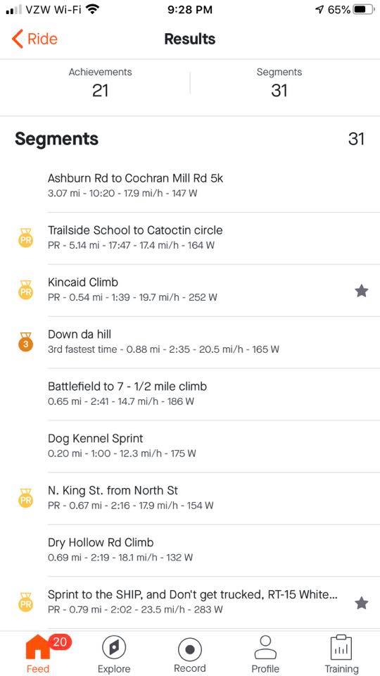
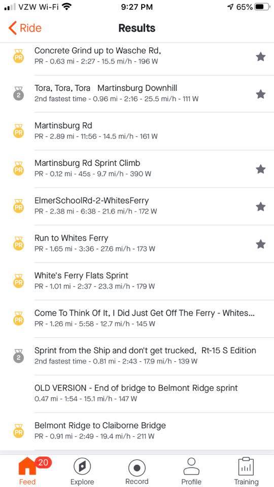
In the end, I had 17 PRs on this ride. For some of those I wasn’t even aware of but I got them because I went hard on the segments. Because of Live Segments.
The Remaining PRs
Trailside School to Catoctin Circle (17:47) N. Kind St. from North St. (2:16) 1/2 Sprint to the Ferry (3:37)* Jerusalem to Darnestown (6:46) 109 to Dickerson on 28 (6:34) Martinsburg Road (11:56) ElmerSchoolRd2 – Whites Ferry (6:38)* Run to Whites Ferry (3:36)* Whites Ferry Last Sprint (2:37) Come to Think of it I Did Just Get Off the Ferry (5:58) Belmont Ride to Clairborne Bridge (2:49)**
__ *These are starred segments in Strava but did not show up on my Wahoo to race. But I still did OK.
__ **I didn’t know this segment existed but two dicks went flying by me at the light at Catoctin Circle. It was a red light that another cyclist and I was waiting for. Just as it turned white (for pedestrians and cyclists), they had a head of steam and went flying by us dangerously close. I thought what dicks but then I caught them. I wanted to follow but they passed a couple of people dangerously close. When it was finally clear, I went by never to look back at them. I kept my speed up simply to get away from them. No one likes to ride near dicks.
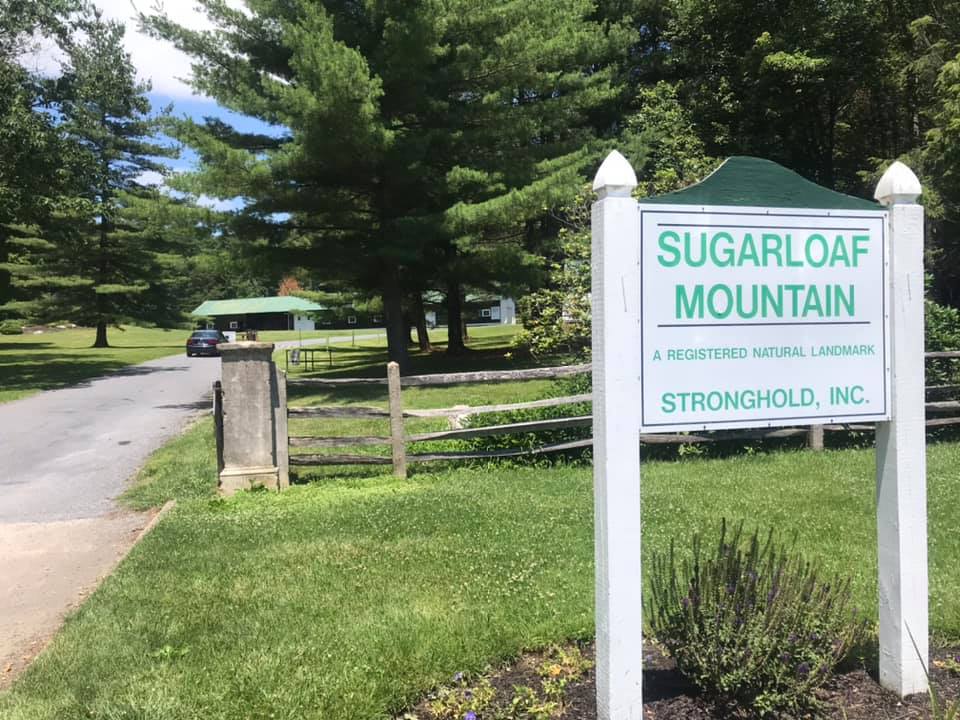
All the years I’ve been riding and I’ve never been to Sugarloaf Mountain – Maryland. I’ve seen group rides in Montgomery Co. (Md.) organized for Sugarloaf and decided it would make a nice ride. And it was so nice I would do it thrice.
White’s Ferry
I mapped out a ride and downloaded it to my Wahoo bike computer. I prefer “loop” rides to “out-and-back” so I made this a loop that would begin and end from Poolesville although from Poolesville to Leesburg would have to be out and back because there’s no other way.
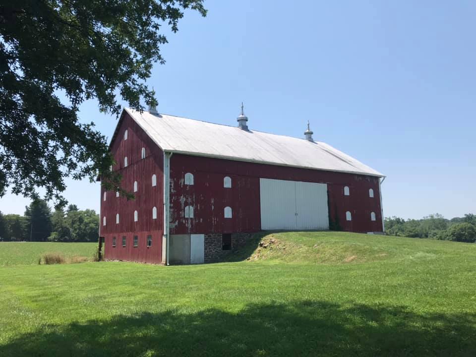
Barn on Martinsburg Road
Every ride needs a ferry. It’s so relaxing to cross the Potomac River at White’s Ferry. Bikes are last off the boat and one advantage is you know for the next 10-15 minutes there will be no cars behind you.
At the observation point on Sugarloaf
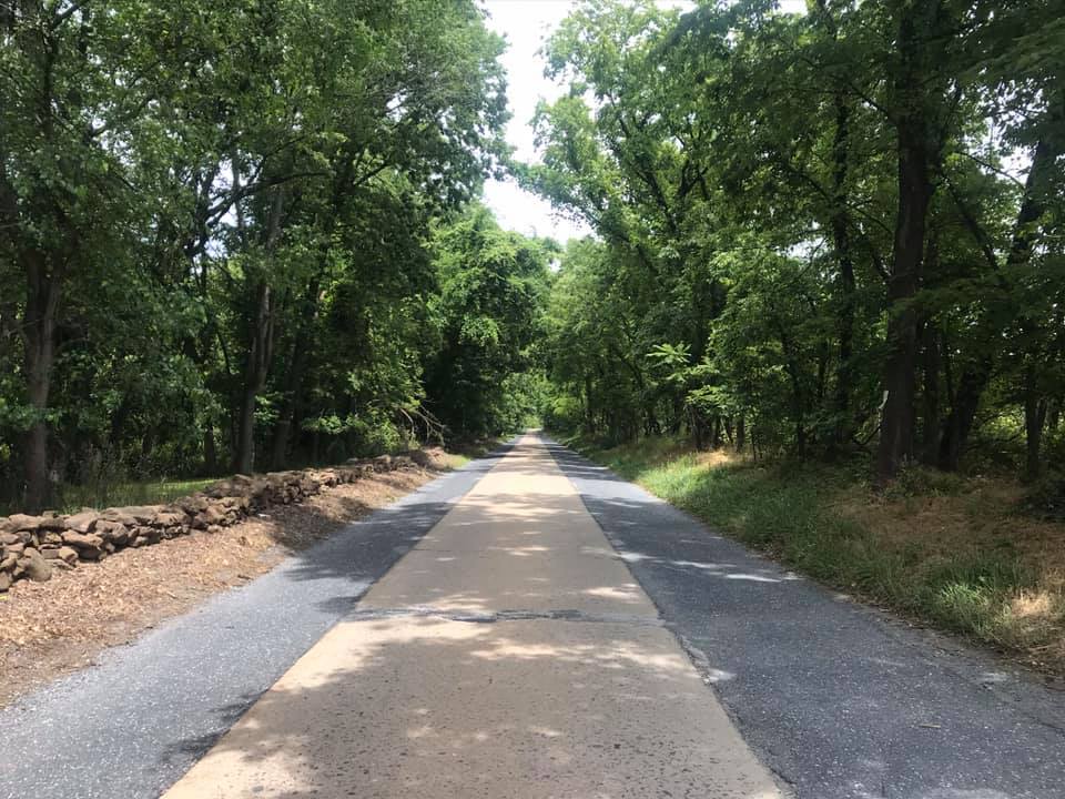
On June 16th I parked in Leesburg and headed for White’s Ferry. After the climb out of the valley, I turned on Wasche Road. It is a country road with very little traffic. It connected with Martinsburg Road which is this cool one-lane looking road in a canopy of trees.
Martinsburg Road
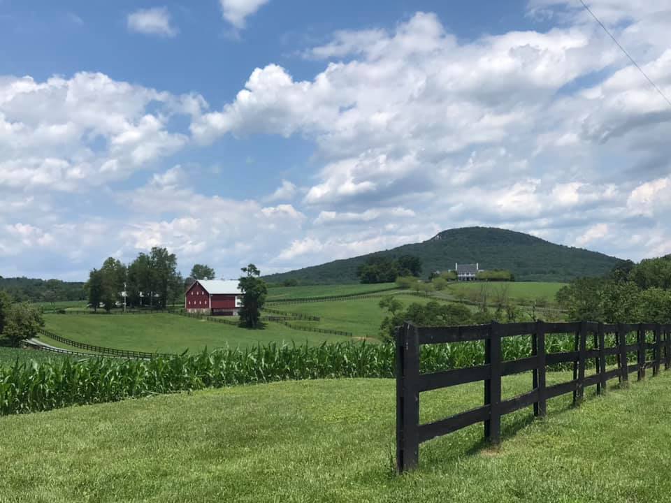
Rte 28 to Dickerson is not so good (traffic) but it’s only a mile and a quarter. Once on Mt. Ephraim Road one can see this hill (mountain) that pops up out of nowhere. On my first attempt, I was going to ride in a clockwise direction but discovered that was the wrong way. So I reversed course and went counterclockwise.
The high point in this picture is Sugarloaf Mountain
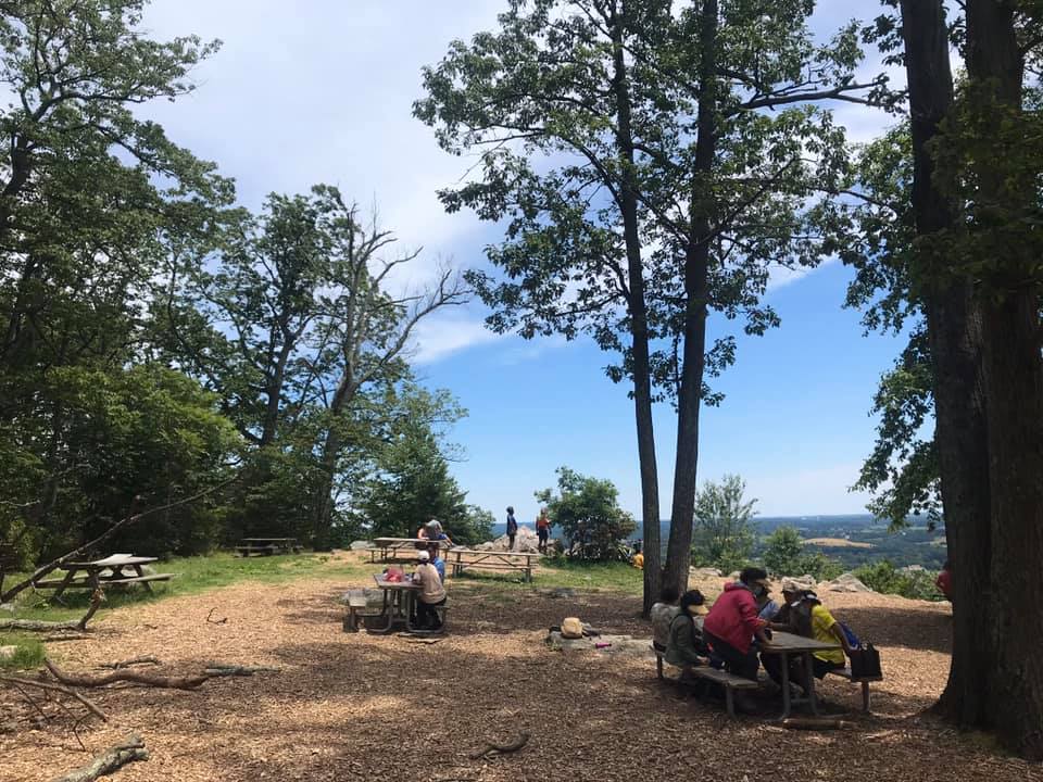
The road itself is not good pavement and it is completely wooded until one reaches the overlook. There is a small picnic area here as well.
Picnic area on Sugarloaf
On my first trip down I turned right on Comus Road. Gravel. Then it was a left on Mt. Ephraim Road which was also gravel. It became W. Harris Road which was also gravel. I took that to Barnesville where I picked up pave. Beallsville Road was lightly traveled but no shoulders and some blind corners – I was not comfortable and would not recommend it.
Sugarloaf
Just 10 days later I invited Tim Casebere to ride with me. We went to the mountain the way I had gone before but this time came back on pave. At Martinsburg Road, we stayed on the road which gave us a really nice descent followed by a nice climb. Wasche Road is a better choice if your legs are hurting. But Martinsburg Road was very lightly traveled. And we saw a wild canine – thinking it may have been in coyote as it was too large to be a fox. Pretty cool.
It has a sign – it must be a mountain
Finally, on July 19, Eryn was visiting from New York and she joined Tim and me to see what the deal was with this ride. It was very hot with temperatures in the mid-90s. We altered our route slightly first going into Poolesville then taking a busier road to Beallsville. But here we caught a break because there was a detour on Rte 28 because of a bridge out at the Monocacy River so we had Rte 28 to ourselves.
Beallsville, Md.
,We had planned, and stopped, on the way back at the Dickerson Market for water. but before I went in I spotted a cold gallon of water (partial) on the porch. I know this was purchased by a cyclist, used to fill water bottles, then left on the porch for the next cyclist to use. I’ve been on both ends myself – sometimes I bought a gallon and left it behind, today I used it. Thanks, cyclist!
Crossing the Potomac on White’s Ferry
The entire time you are in Maryland you can’t quite believe you are in Montgomery County, the same county with Bethesda, Gaithersburg, and Rockville. This section is rural, and while the mountain is not that much of a mountain, it feels more like you are in Frederick County. But what a nice ride.
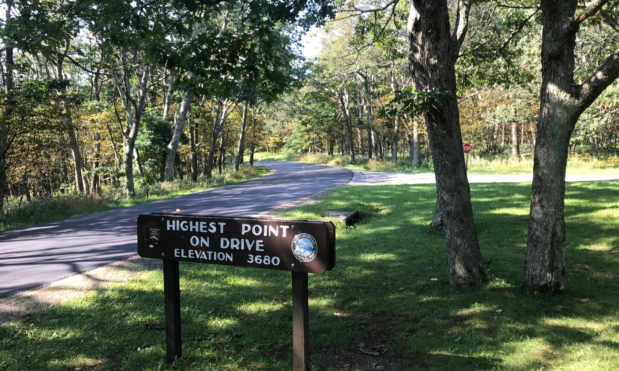
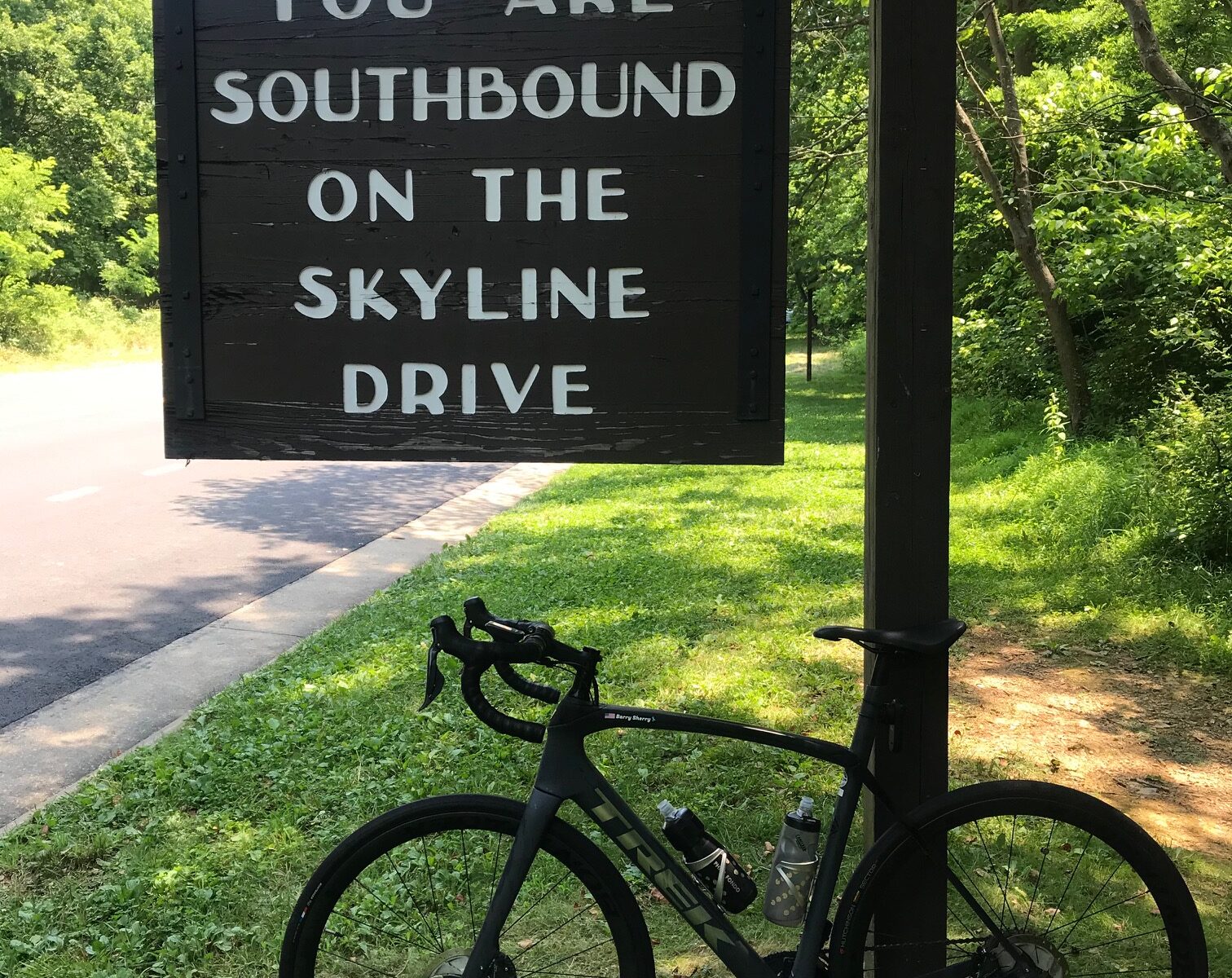
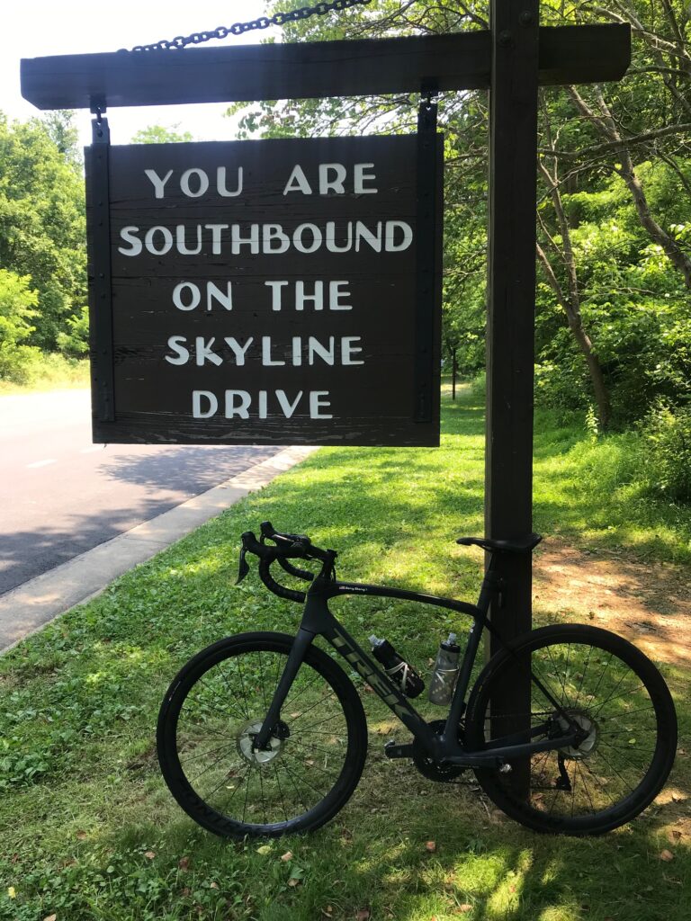
Without looking, and I’m not, it has been a while (years) since I have ridden on Skyline Drive. The forecast looked favorable enough, which simply meant – no rain.
GO!
I was going to park at the library but saw a park – Burrell Brooks Park – and it was nearly perfect. It had a port-a-john, a clean one, in fact. But there was no shade. It did give me an opportunity to take a shortcut over to Skyline Drive but I guess you’re not supposed to use it. At least cars.
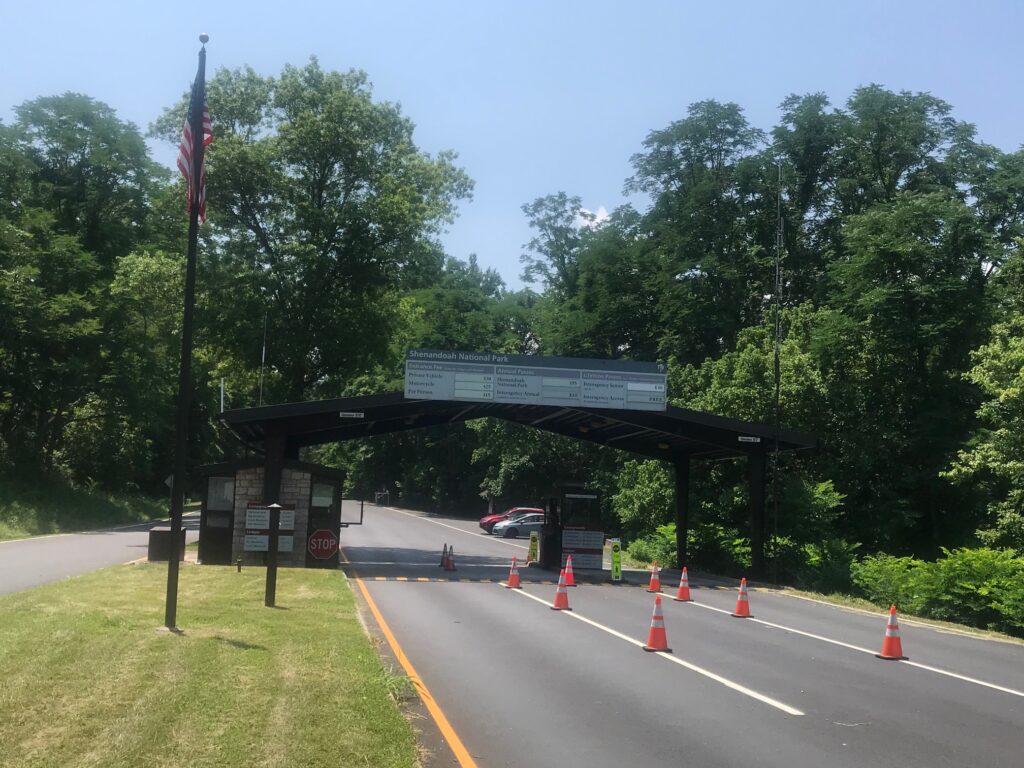
Entrance Station
I waited in line at the entrance station in among cars. The ranger had pleasant words for me as I handed her my senior pass for free admittance.
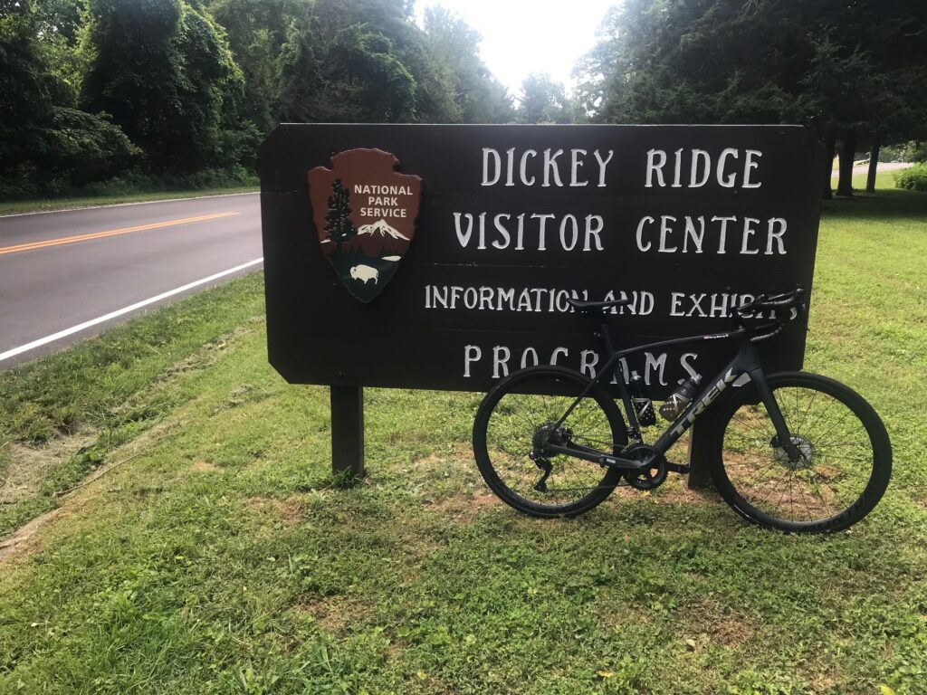
Dickey Ridge
And then it was pedal and sweat. The temperature was a reasonable 84°. Who wouldn’t take that for a July day in Virginia? But the humidity must have been close to 100%. The sweat was pouring off me.
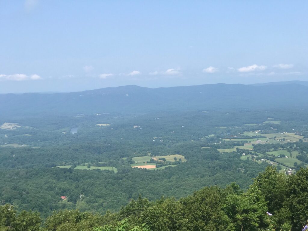
View from Dickey Ridge Visitor Center
I wanted to rub my eyes, or at least my right eye which was burning, but that often makes it worse. I just kept pedaling.
View looking west
I reached the Dickey Ridge Visitor Center at MP 4. I pulled in. I went in the restroom and found some tissue and water. I cleaned my (1) eyes; (2) glasses; and (3) camera lens. I was soaked including my shoes. I had squishy feet.
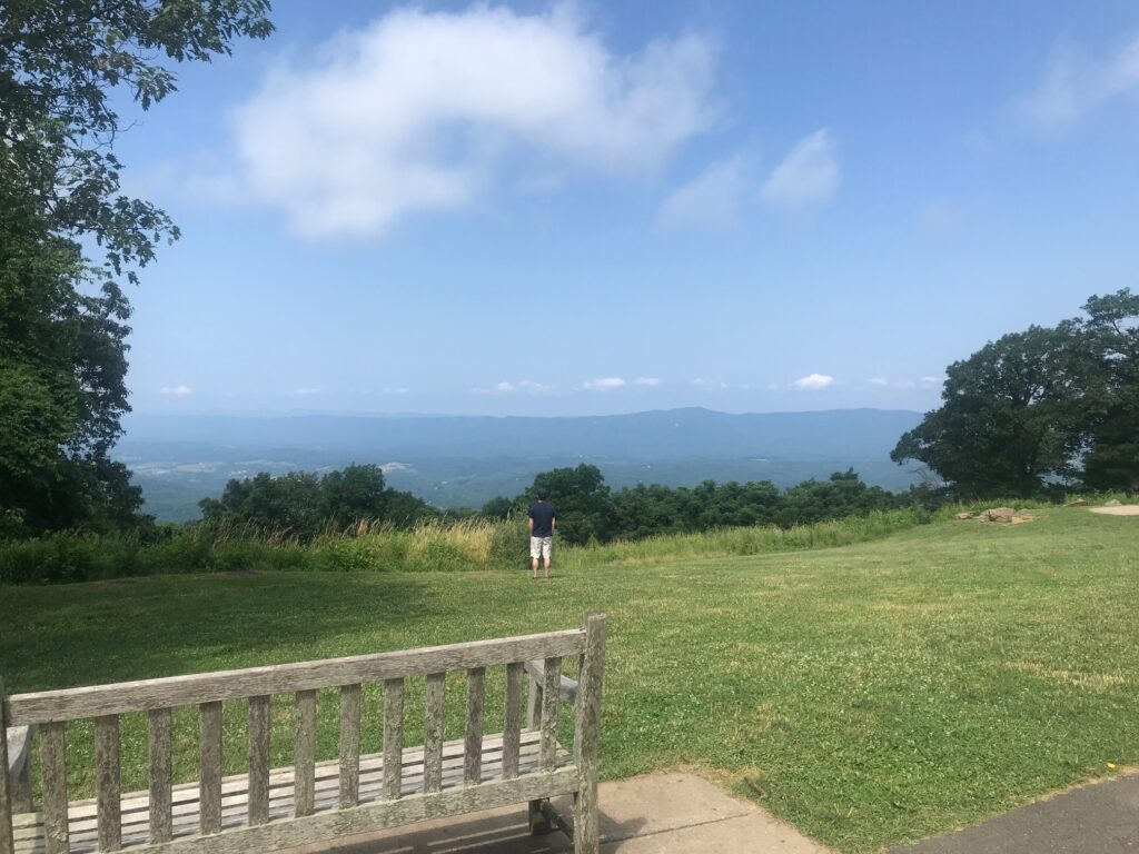
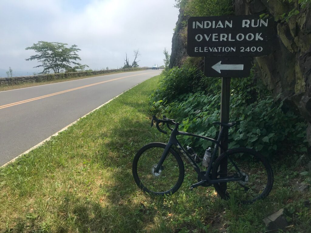
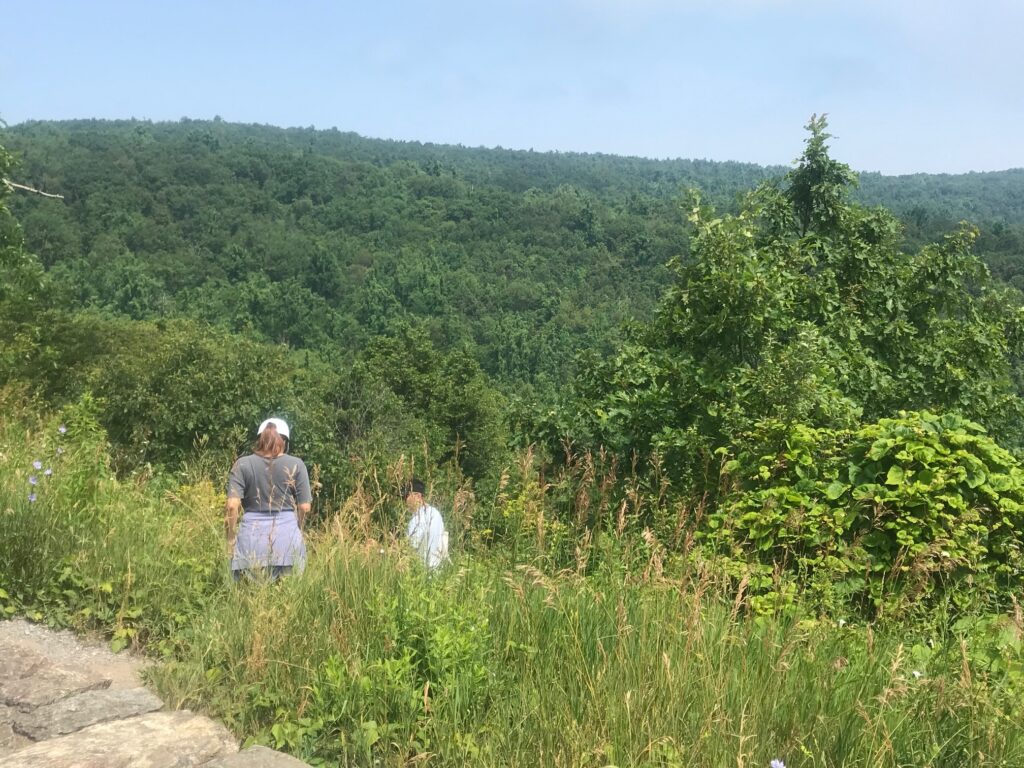
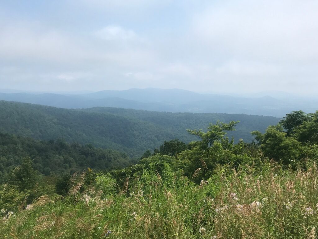
Indian Run Overlook
My plan today was simple. Ride until climbing stopped. Then turn around and coast back home. But at MP 6 the road goes downhill. And that was too early to turn around. So I enjoyed a 1.5 mile downhill before I started climbing again.
Indian Run Overlook
I came to an Indian Run Overlook at MP 9.5. Took some photos and decided that was a good turn around point. I wish it was all downhill from there but there was the 1.5 descent I enjoyed on the way up and I got to climb that back. But once reaching Dickey Ridge Visitor Center it truly was all downhill from there.
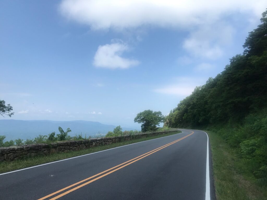
Skyline Drive at Indian River Overlook
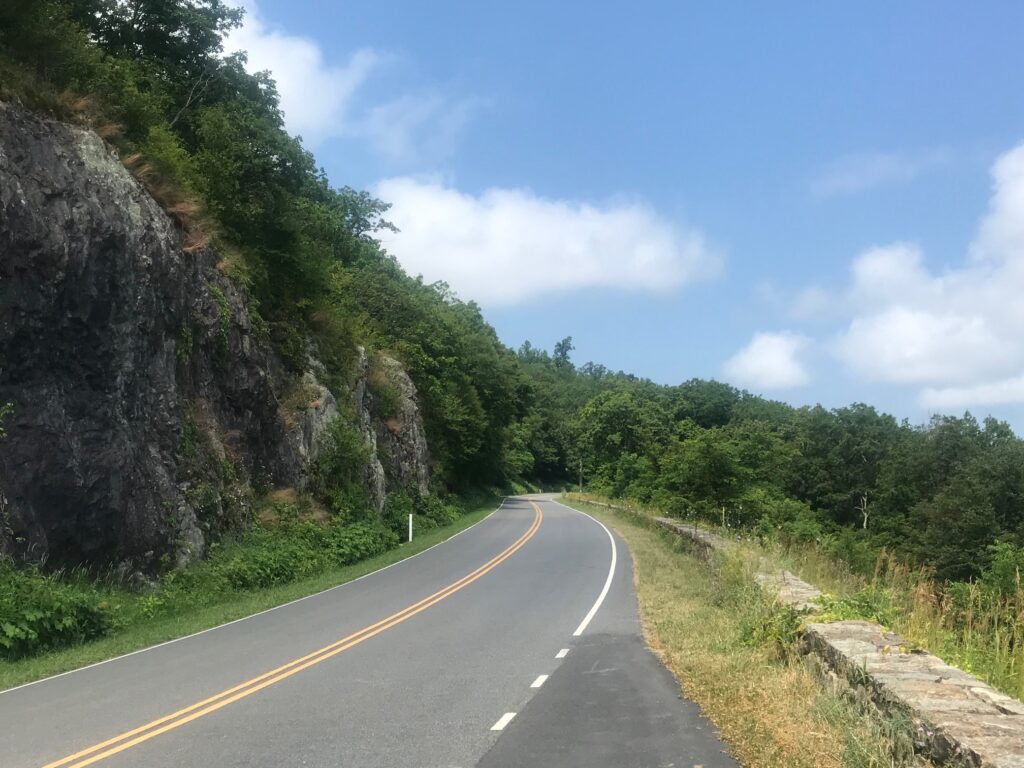
Great roads. Great pavement. Sweeping curves. No shoulders but, generally, this is tourist traffic and drivers respect speed limits and cyclists.
Skyline Drive headed north
My max speed going back (or going up on the one descent) was just 42 mph. Would have liked to have gone faster but what a great ride. Need to come back here soon.