Alpine Loop Gran Fondo

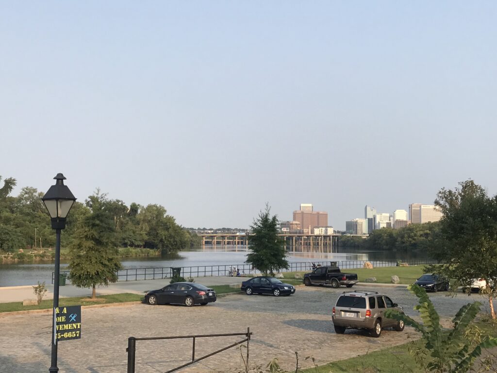
HARRISONBURG, VIRGINIA

I did not have a good feeling about this weekend. Tires, like most bike parts, have been in short supply since last year. It caught up to me on Monday when I had a flat on my front wheel.

Rocktown Bicycles, Harrisonburg, Va.

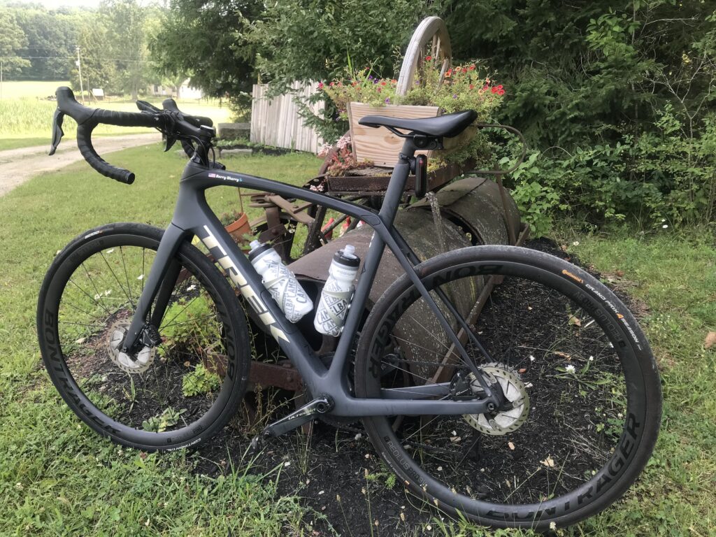
I bought replacement Schwalbe tires and installed them on Thursday. On Friday I rode to Fosters in Manassas. While I was eating the rear tire went PFFFFFFT. That was strange for a new tire but I pulled out my repair kit, put in a new tube, and was ready to roll.

Rocktown Bicycles, Harrisonburg, Va.

The tire held well despite only 40 psi. I stopped at home, brought the pressure up to 90 psi, then finished my ride. After I put the bike back the rear tire went PFFFFFFT. I changed the tire and one hour later the third new tube went PFFFFFFT. Well, it was time to learn my lesson. I inspected the wheel and saw there was a hole in the rim tape. It was 7:00 p.m. on Friday and no place for repair. I would travel to Harrisonburg with a wheel needing repair.

James Madison University, Harrisonburg, Va.

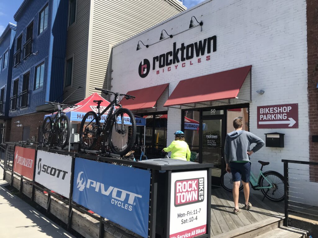
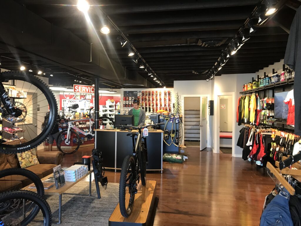
Yesterday I went Rocktown Bicycles in Harrisonburg. This is a very nice shop and Sean greeted me. I told him what I needed and in 10 minutes I was out the door and ready to roll.

Maybe move the post two feet? Harrisonburg, Va.

As the top fundraiser for the Prostate Cancer Awareness Project, I was invited on a private ride at noon with Jeremiah Bishop. But my phone decided to bring in every single saved email and put it in my phone’s inbox. With thousands of emails, I could not find the one about the ride info. I tried unsuccessfully to contact someone about the ride.

Early morning registration

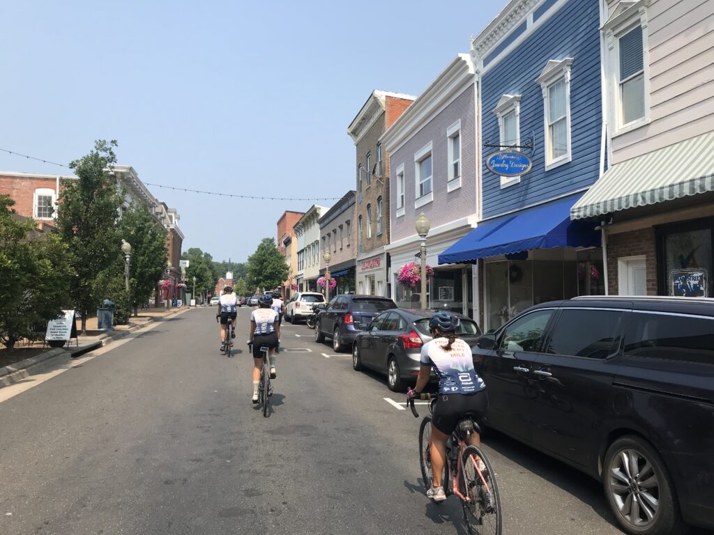
My alternative was that I went to Brothers Craft Brewing and then the Hotel Madison, two locations we had used in the past. No ride. Since registration was at 2:00 p.m. and I decided to ride around town. And that was OK because I did not need a 30-mile ride before the Alpine Loop Gran Fondo.

Robert Hess and Barry Sherry line up first for the roll out

I stayed in town at Tru by Hilton. Who uses alarm clocks? Well, the guest before me, that’s who. At 5:00 a.m. the alarm went off. I was not ready to get up. And I didn’t know how to turn off the alarm. I unplugged the clock and started my day with one less hour of sleep than planned.

The starting line – my vest was in my back pocket for the photo

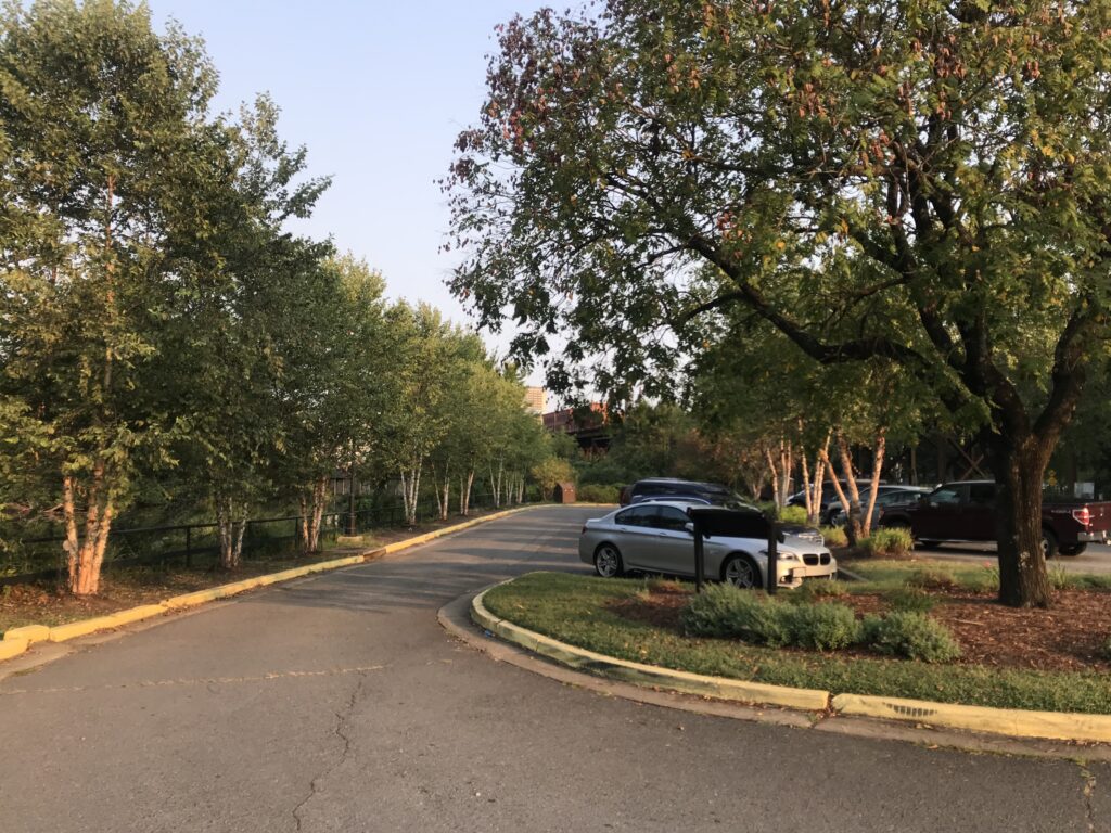
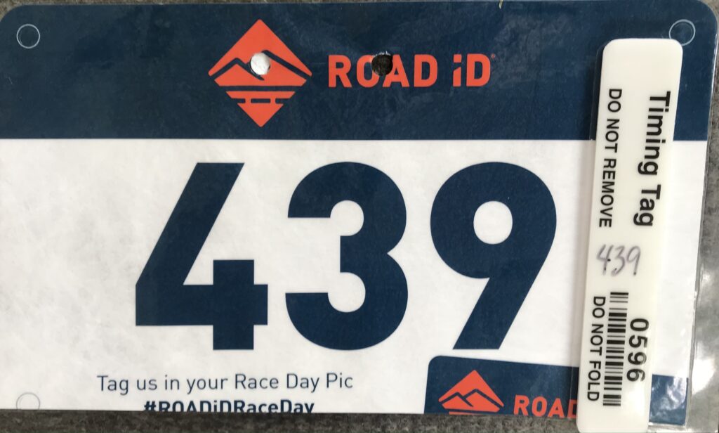
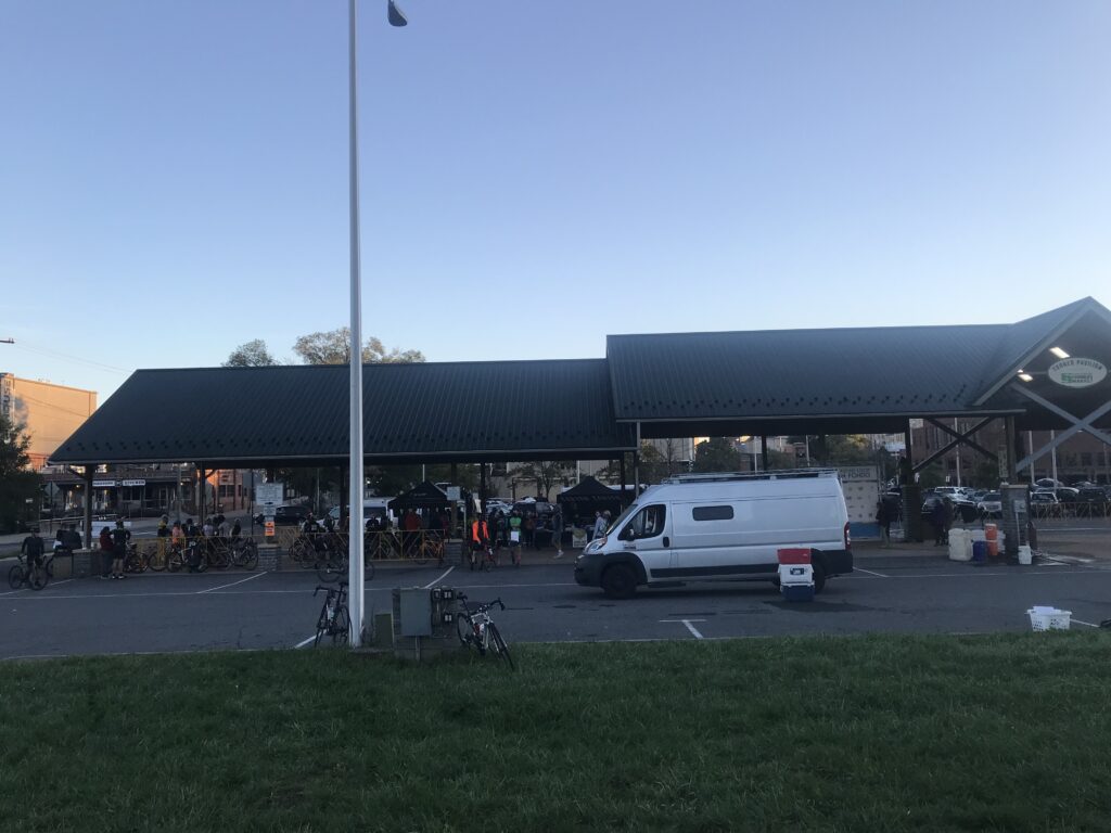
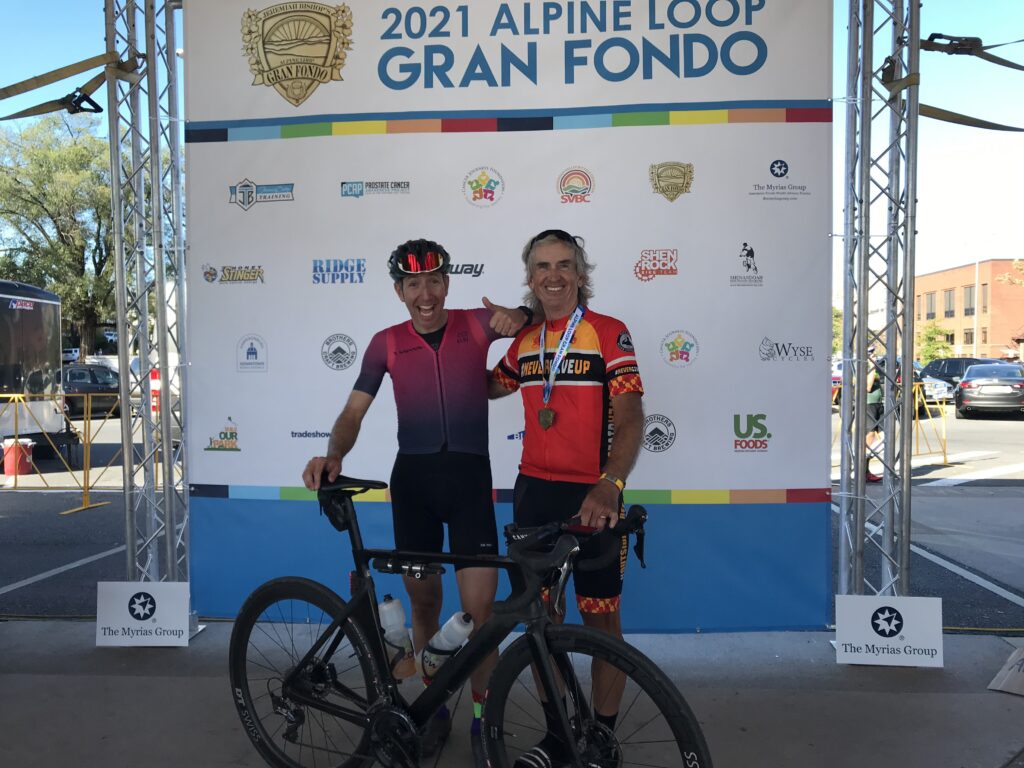
I drove to the venue after thinking I would ride there. But U.S. Rte 11 looked sketchy (curb to curb, no shoulder). Once I arrived I got my timing chip and then heard my name being announced as the top fundraiser. I went to the mic and told my “secret” to raising money. “You have to ASK people.”

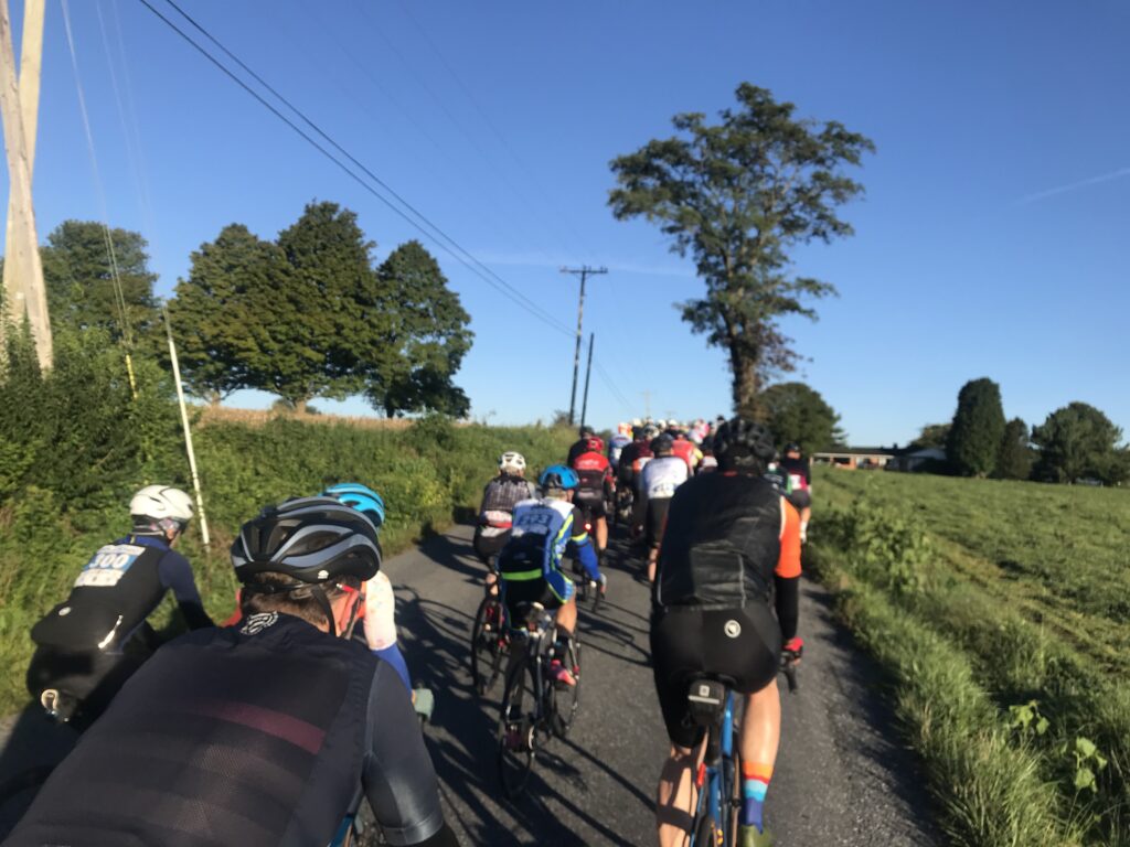
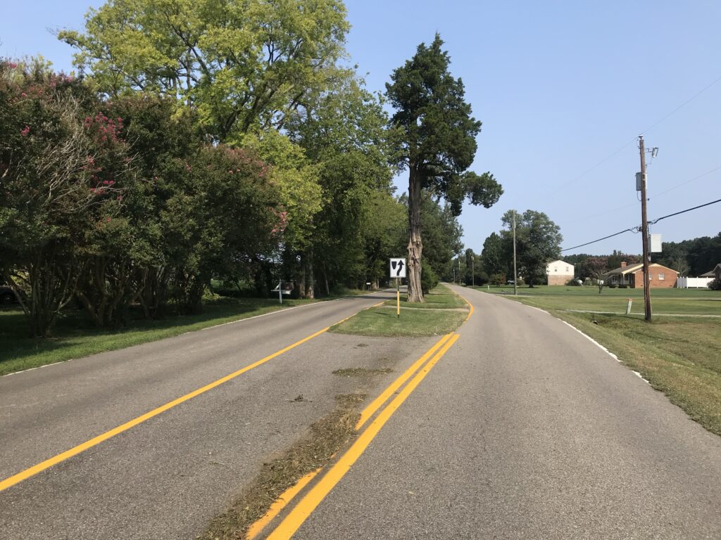
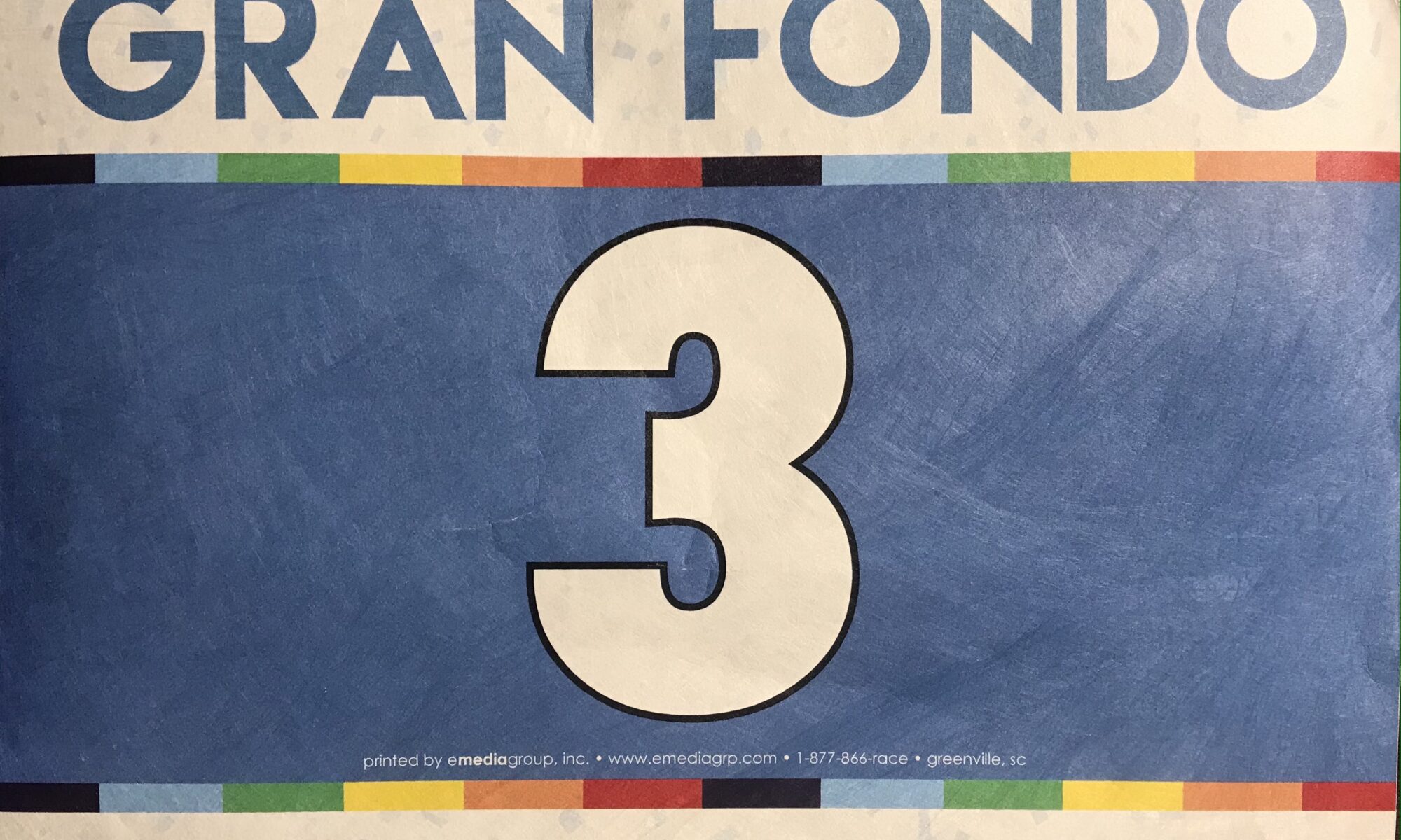
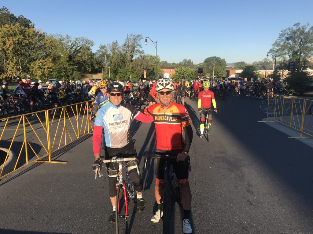
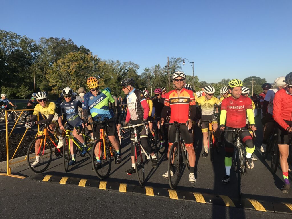
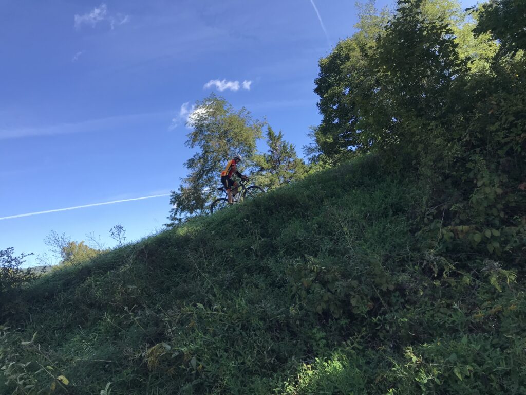
The choice today was 78 or 100 miles. These are the same routes except for the addition of a 22-mile loop. At the start I wasn’t “feeling” 100 miles. I got my bottles ready, grabbed some food, and went to the starting area. It was 48º. I put on a vest and arm warmers.

Robert are you in there?

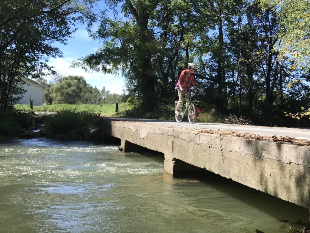
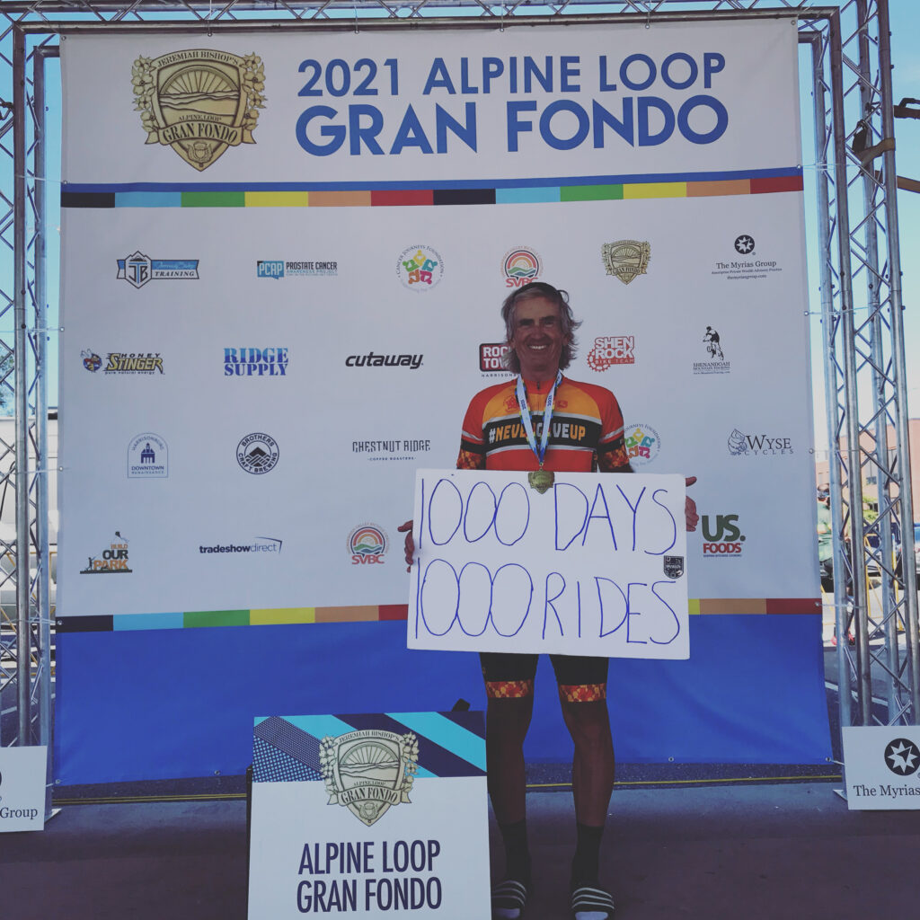
We rolled out of town. Once we turned on Switchboard Road I let people pass me. The road is crowded and it’s tight. I just don’t trust the big group. And I had a bigger goal. At 10 miles into the ride I would “celebrate” 1,000 consecutive days of riding at least 10 miles. I didn’t want to be taken down in a crash which almost happened beside me when a rider clunked his gears, came to a start, and was almost rear-ended.

Our fan section

Also, further back was Robert Hess. I pulled over to wait for him. I didn’t see him so I continued. But when we came to At Whitmore Shop Road I waited for him to arrive. We chatted for a few minutes and then he went left and I went right. I already let the main group gain 4-5 minutes on me.

Proud Grandfather

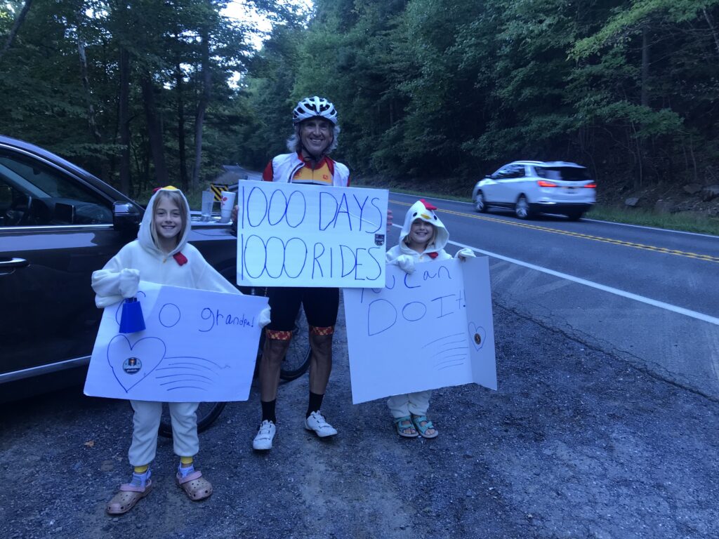
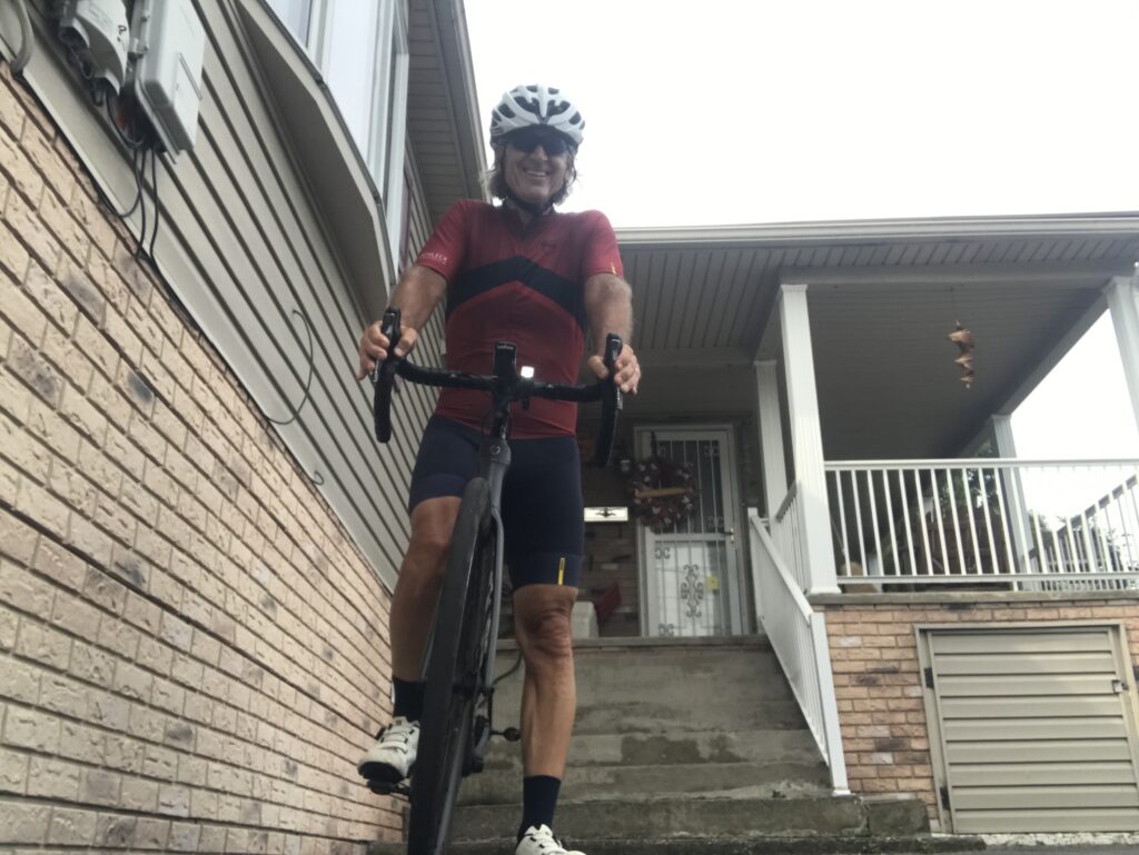
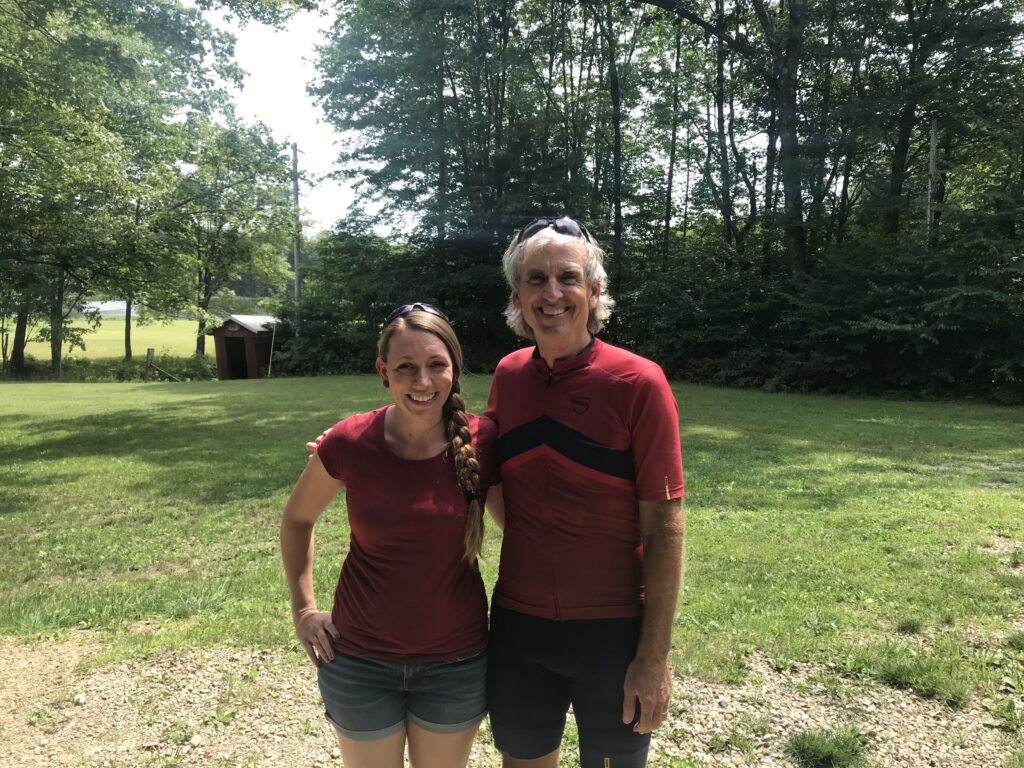
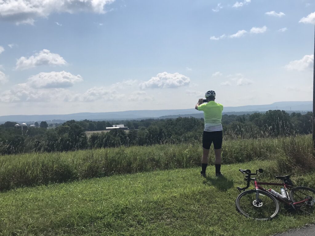
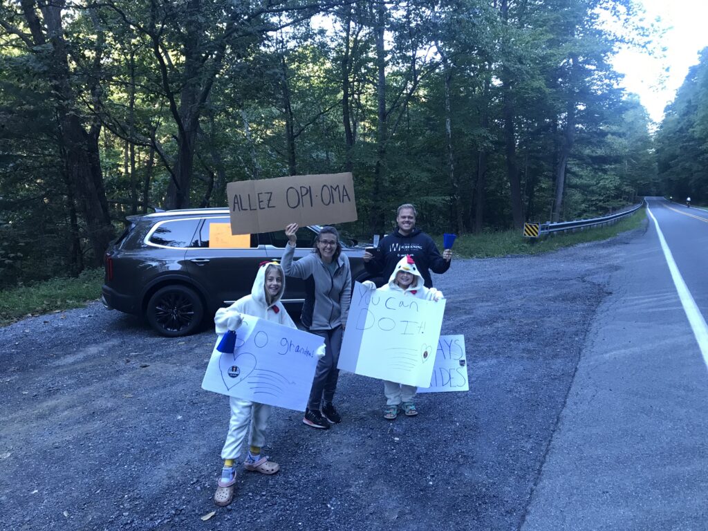
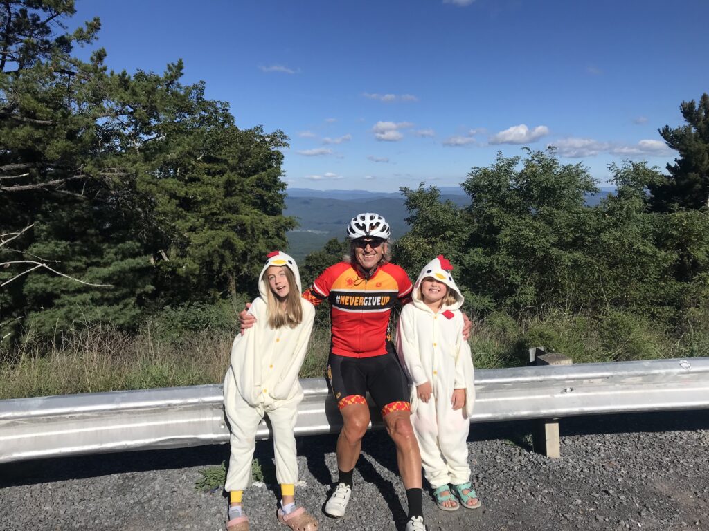
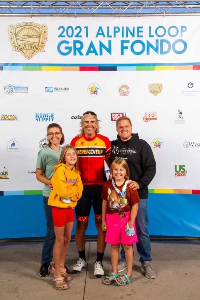
I told Ashley and Bryan they could expect me to roll by at 9:00 a.m. And at 9:00, I saw them up ahead on a pull-off area just before George Washington National Forest. They had signs cheering me on. I stopped for about five minutes, gave the girls a hug, and told them I would see them at the top.

Chickens on High Point

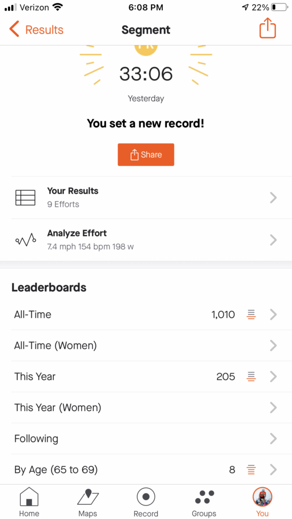
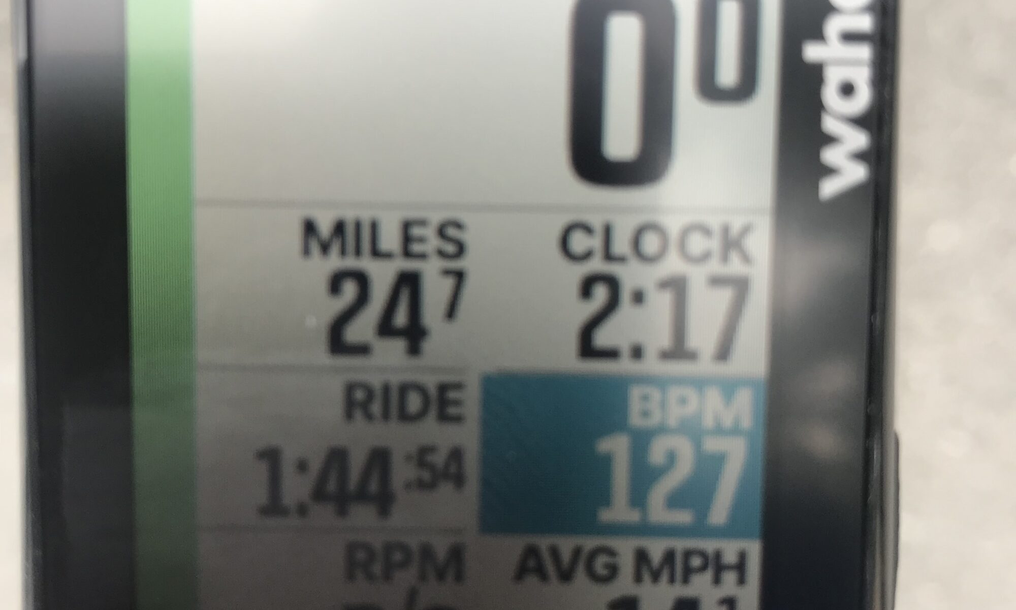
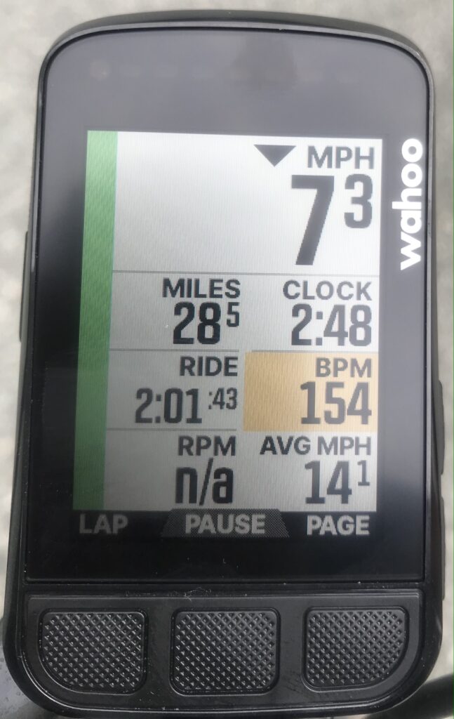
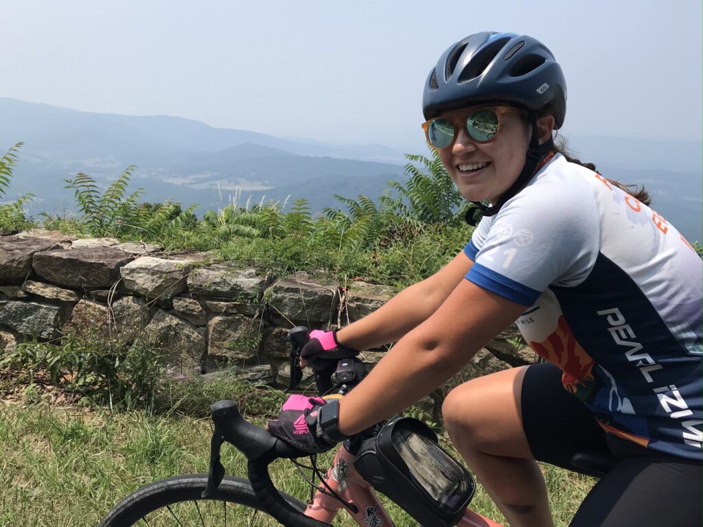
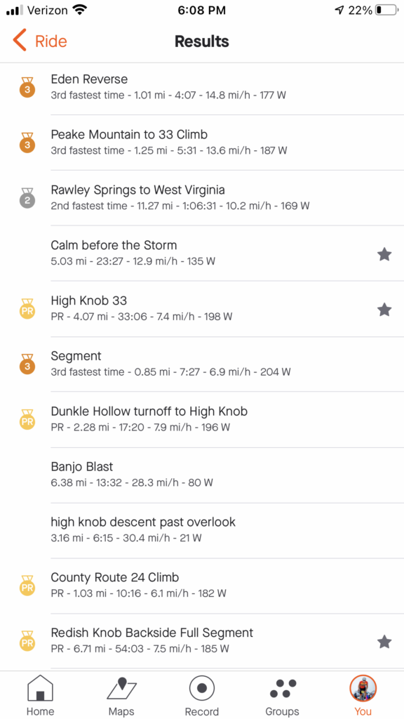
I hit the climb which is a timed KOM segment. After four or five minutes I looked at my Wahoo computer. I was only eight seconds behind my all-time best which was 10 years ago. I had no idea.

Another minute or so and I was only down six seconds. I started to think that maybe I could get a PR. I was 10-12 minutes in when I saw I was ahead by two seconds. And I was catching people. I was feeling good. Every previous attempt I was trying to count the distance to the top. Today I didn’t even notice. Everyone up the road was just a new target to reel in.

Volunteer at the rest stop in Brandywine, WV

In all, I caught and passed 11 people on the climb and did not get passed by anyone. Of course, I was almost dead last when I started so who was left to pass me? I was up 1:02 when I reached the top. A PR! I was very excited.

Rest stop at Sugar Grove, WV. Rocktown Bicycles provided the bike support.

At the top, the girls were waiting for me. My day was made. No matter what else happened I PR’d Shenandoah Mountain and I saw the girls on course. It would be a great day. When they told me that they would be in town in the afternoon I decided I would do the 78-mile ride so they could see me finish.

Sugar Grove, WV

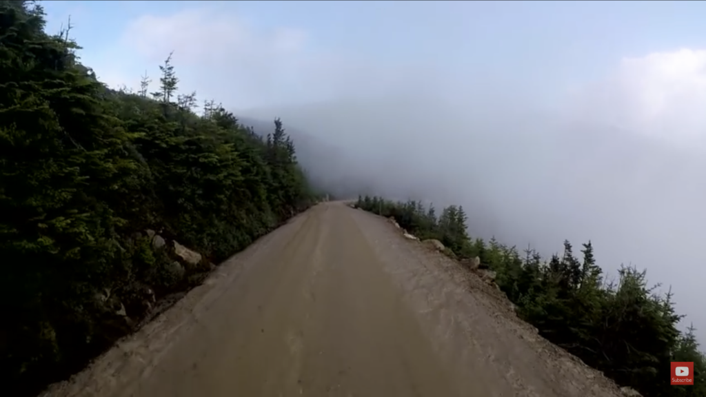
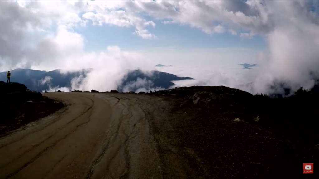
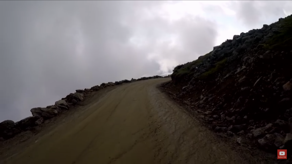
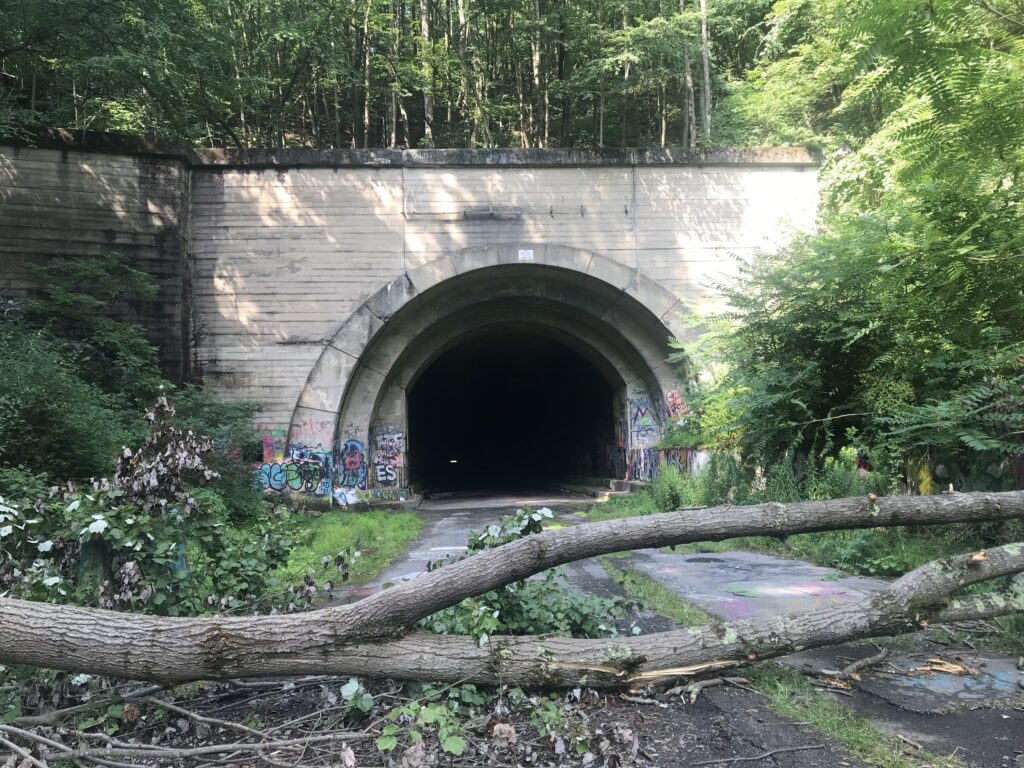
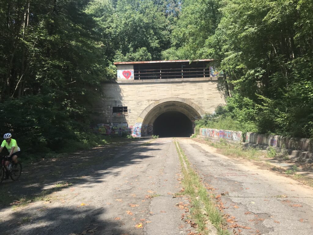
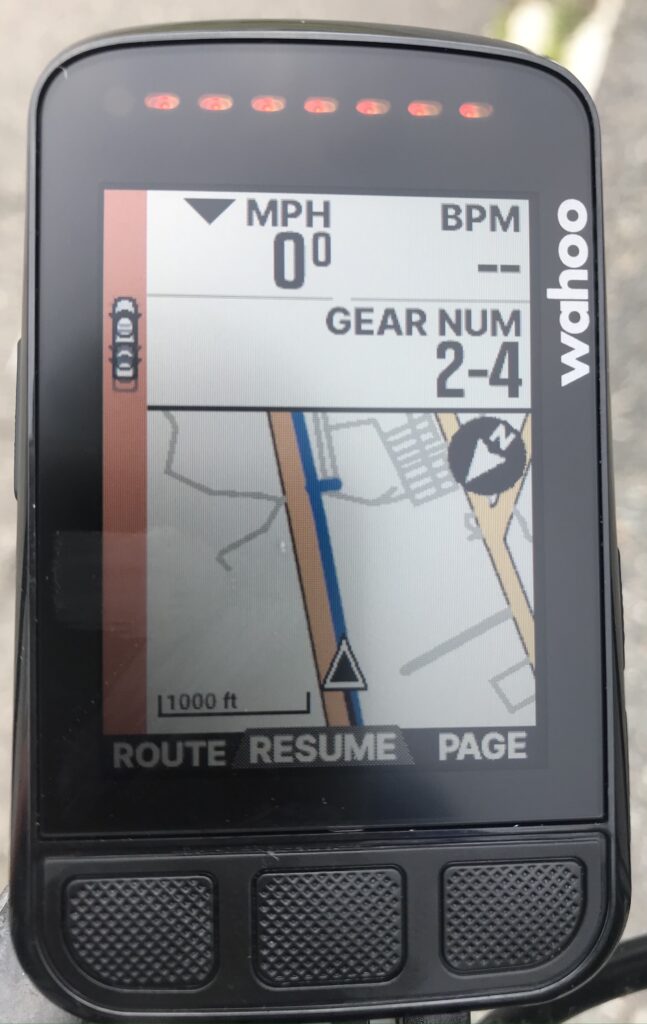
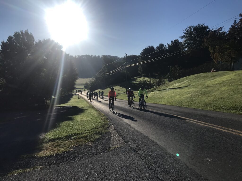
I bombed the descent on Rte 33 to Brandywine. I made it over to the rest stop which is at the base of the climb up Reddish Knob. After a short break and a small can of Coke, the climb began. I don’t know what happened but almost immediately I was 40 seconds behind my best time. But the time began to come down. And I was catching and passing people. The Live Tracking on my Wahoo stopped working and I would have to wait to find out if I set another PR. (I did.)

Start of the climb up Reddish Knob

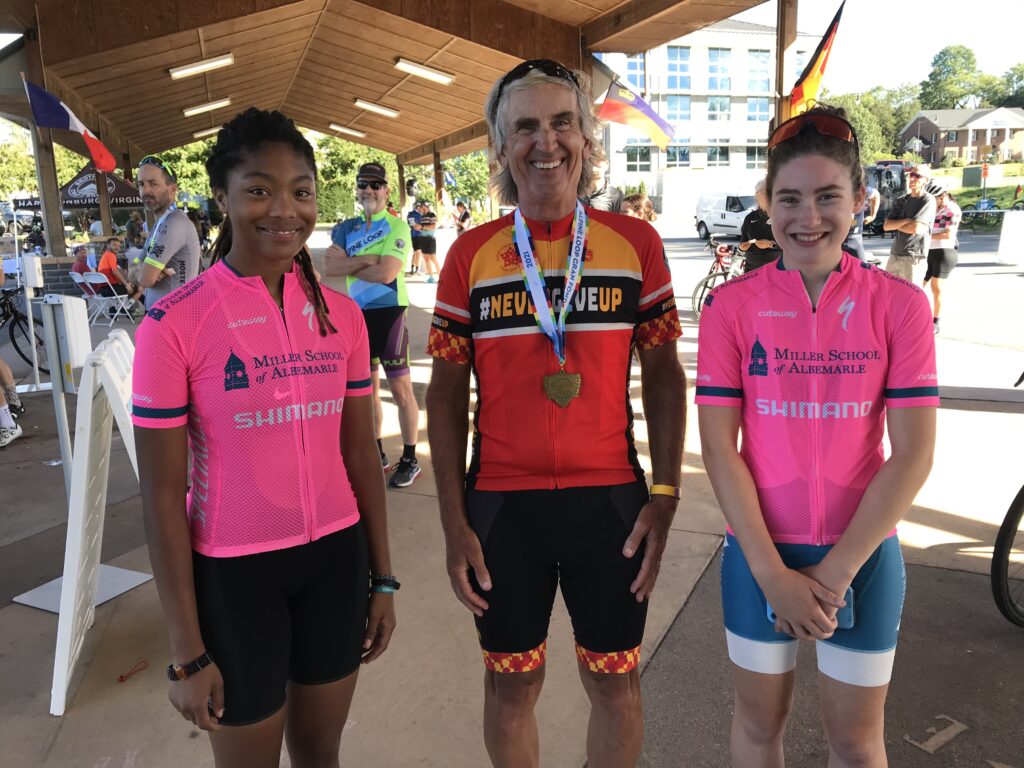
I passed two girls from the Miller School of Albermarle. I had been chatting with them at the rest stop and they were pulled over. I really admire these young kids. Since they weren’t in immediate distress I continued on but decided when I reached the top I would turn around and go back to shepherd them up the climb. I passed the KOM finish but realized it was about a half-mile short of the Strava segment. So I had to keep going to the end when I could turn around. In all, I passed 10 riders on this climb. I was passed by no one.

Flying down the mountain

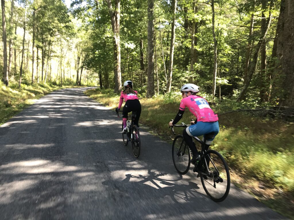
Going back down I met the girls then turned around. One of them had to stop to take on a gel. But other than that they were riding well. When we reached the summit we started down Reddish Knob. I warned them the pavement was crap but they did not heed the warning. They flew! At first, they gapped me but I eventually caught on. They were taking too many risks for my liking as I hung on.

Flying down the mountain

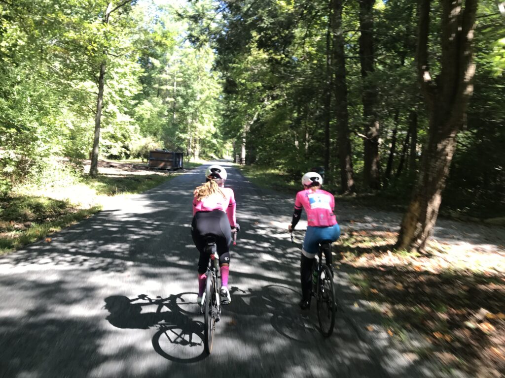
As the road started to level out, we slowed down and just chatted. As we left the steeper part of the mountain which was mostly traffic-free, I went to the front and they stayed on my wheel until we reached the next rest stop together. They told me they were riding the 78-mile route.

The Amish near Dayton, Va.

Actually, I was feeling good enough now to ride the 100 but had the granddaughters waiting for me in town. I texted them that I would finish between 2:30 and 2:35.

Beaver Creek

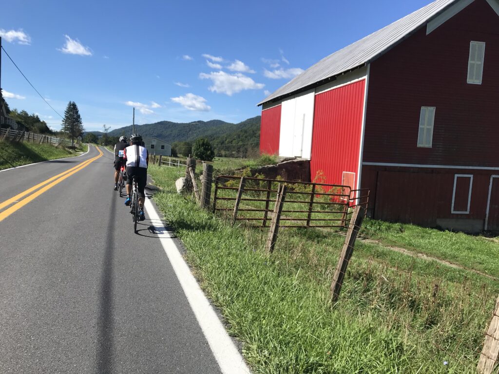
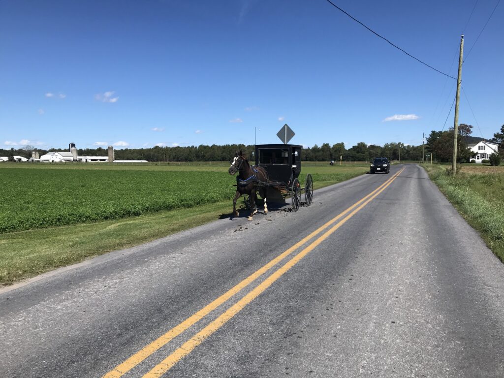
In the valley I saw lots of Amish, at one point maybe more than 30 buggies pulled by horses. I passed one buggy, announcing my presence as loud as I could so I did not spook the horse. I waved at very single one that passed me in the opposite direction and almost all waved back – and smiled too. The time was 1:45 and they appeared to all be headed to a 2:00 gathering.

Near Dayton, Va.

Most surprising to me was a young Amish man passing me in the opposite direction. I waved but he couldn’t wave back as he had one hand on his handlebars and one hand holding a cell phone to his ear. It appeared to be a flip phone, not a smart phone.

Jeremiah Bishop and Barry Sherry

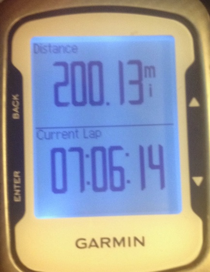
The last timed climb was Mole Hill. I wasn’t sure I would have anything left but saw that I got a PR on it too. And there were three more segments on the way back into town. I PR’d them all.

1000 Days 1000 Rides

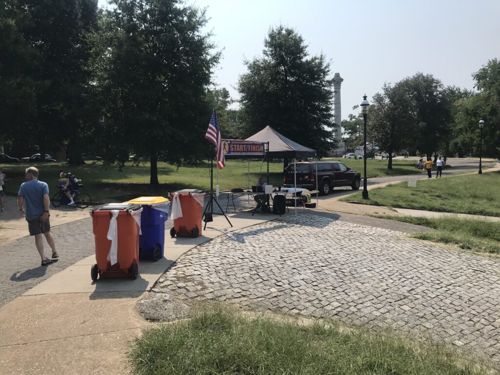
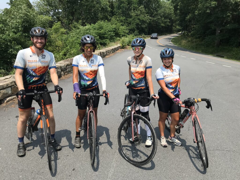
At 2:32 p.m. I came to the finish. The grandkids were waiting. I was introduced to the crowd but without anything that I had written on my application. We took a family photo and I hung out for a while.

My riding partners down the mountain

After they left I checked Strava. PRs on the three timed climbs and all three I was in the Top Ten Age Group. Then I checked to see if there were any times better than mine in that list for today. And there was one. I found a guy who beat me by 2:00 on Shenandoah; 1:00 on Reddish, and I beat him by a minute on Mole Hill. So he got me by 2:00 total and I knew I was not the KOM for my age group. But I did finish second in my age group in the climb. And this year a sprint was added. I finished second there too. Maybe there were only two of us.

High Knob 33 is Shenandoah Mountain

But I was happy. My best times were 10 years ago and who would have thought I could PR at my age? I am not a climber and this improvement was very satisfying. I accept that there are better climbers. I had a great day on the bike and a better one off the bike with my granddaughters.

Everyone (that knew the Tour de France) loved this sign Ashley carried

Note: At the beginning, I was right behind a safety bump and was not clipped in to start. I awkwardly pushed off with my feet losing a couple of places and forgetting to start my Wahoo. This file is missing the first 0.4 miles.

Climb to Conquer Cancer

RICHMOND, VIRGINIA

I came to Richmond wanting to set a PR on Libby Hill. And if it was good enough, maybe win my age group (fat chance). I failed. I tied. Ugh.

Parking at Great Shiplock Park in Richmond

The Climb to Conquer Cancer is an event run by Amy’s Army of Cancer Warriors benefitting the Massey Cancer Center at Virginia Commonwealth University. I first did this event two years ago. In that event, I climbed Libby Hill three times, one pre-race, and twice during the race. Today I climbed it to get to registration and then during the event. I also did the climb once when I rode from Williamsburg to Richmond. So this was my sixth time.

Timing Chip – Climb to Conquer Cancer

In the COVID era, some events haven’t come back (Livestrong-Austin is canceled next month). Others are modified with smaller fields. This was an extreme modification. They offered no rest stops. None. Nada. I would have to carry everything I needed with me or stop along the route.

Survivor Bib – Climb to Conquer Cancer

Unlike past years where there was a small ceremony, National Anthem, then a police-escorted roll-out, today was “show and go.” For me, it meant not forming up with any other riders.

Registration Tent

I left the house around 6:15 a.m. which was a little late. My ETA was 7:45 which was later than I wanted to arrive. I parked at Great Shiplock Park which is convenient enough. I had iced my bottles and took Skratch mix with me. Added that to one bottle, poured ice water in both. Grabbed two packs of entry chews from Skratch and one gel. And that would be my nutrition and hydration for the day.

Libby Hill Cobbles.

I rode up Libby Hill, even stopping to take a picture of the cobbled route. It is much bumpier than I remembered.

Monument Libby Hill Richmond

Registration was giving your name and being handed a timing chip plate for the bike. With one zip tie, it never fit well on the bike. I should have forced the issue and used two ties. There were “bibs” for survivors, in honor of, and in memory of. But there were no Sharpies to write names on them. And there were no safety pins to attach and wear them.

Was this Amy?

I signed up knowing this would be a “lite” version. I was OK with not having support. But I wasn’t prepared for not having a Sharpie or safety pins. I had those in my car. I would have taken some to registration. But this was a major disappointment.

James River, Richmond

On a cancer ride, there is great community among the riders when they wear the names of others or even themselves. These are talking points. Connecting with others. And today, this ride missed that.

Battlefield Park Road

It was a beautiful day. The temperature at registration was 65º. There were some riders milling around and I wasn’t sure if they were waiting to register or not. I leaned my bike against a tree and registered. Then I rolled out by myself.

My Wahoo GPS seemed slow in drawing the route for me so I navigated from memory, a little, before it picked up the track. I only missed one turn but knew it right away. And then I was off and riding.

Virginia Capitol Trail

I had marked a number of segments, most were in the first half of the route, that I would compete for PRs. And they started coming just one after another. And each one was a PR. I caught and passed some riders. Twice I was passed by a paceline but it was actually once. After having been passed the paceline took a break at the 7-Eleven while I kept going.

Osborne Turnpike, Richmond

I rationed my food and water and never stepped off the bike. I put a foot down in the first block at a traffic light, then again crossing Rte 5, and finally, I took a natural break on a deserted side road (in the woods). No riders went by. I literally was by myself all day long only occasionally seeing riders up the road and passing them.

East Main Street, Richmond

Around Mile 50, with no additional food or hydration, my Wahoo tempted me with GO! I decided not to contest any more PR segments, waiting instead for the finish. I came to Libby Hill. There were a couple of volunteers at the base. I turned onto the cobbles.

Looking down Libby Hill

I have a bike better equipped for climbing the cobbles this year than I did two years ago. And I have a body better equipped. I should have set a PR. I looked for the gutter where I could ride the concrete instead of the cobbles. When that ended I turned the last corner. I saw a photographer so I naturally stood because standing photos are so much better than seated. But I quickly took a seat. It was too rough to be standing.

Finish line on Libby Hill

I finished. I asked about the timing chips and was told I could keep mine. There was nothing at the end. I wanted to take a photo of someone finishing. No one came. I left.

Capitol Trail coming back into Richmond

Other than Libby Hill, I’d say there are no hills on route at least after the first five miles. It’s a rolling country route, mostly roads but some on the Virginia Capital Trail. It’s neat to finish on Libby Hill. And it’s a good cause. I hope they can get back to a fully supported ride. With safety pins.


I don’t know about the timing on the climb. I sort of trust Strava uploads more than the chips on our bikes. I do not know what triggered the start of my climb. I did not see any timing mechanism at the start, only at the finish.

I don’t know what age groups the event has. If they use what Strava (and Mount Washington Auto Road Hillclimb) uses, I would be in the 65-69 age group. I was 9th overall, all-time, in my age group and five of those were done on Zwift in the comfort of their homes. And no one today was faster. But there may be someone who doesn’t use Strava. Or timing – maybe mine didn’t record for the event. I don’t know. And maybe they use a 60-69 age group and I can’t see the 60-64 age group. But it does look like maybe, just maybe, I won that age group today.

Overall, of people who uploaded to Strava, I was 16th out of 40.

MWARBH 2021

PINKHAM NOTCH, NEW HAMPSHIRE

I’ve got some thinking to do after this one.

The hill climb in 2014 was my last one. I mean, my last one ever. What got me to the top that day was thinking that would be the last time I ever raced on this mountain.

Each year I receive an invitation from the Mount Washington Auto Road Bicycle Hillclimb to sign up. And each year I ignore it. But having lost 40+ pounds last year I felt stronger and faster than I have been in years. I was feeling it.

The race did not take place last year and this year they were hopeful it could with a reduced sized field. It would be without the big tent and podium. No spectators. No medals. And the conditions seemed to change as the date came closer. I wasn’t 100% sure I would travel to New England until I left on Wednesday.

Mt. Washington Auto Road – the day before the race

I did not have a ride down which is required so I posted on a Facebook page for either a ride down or a driver (of my car) up. Samantha sent me a text and we were all set.

I went to registration at 4:00 p.m. yesterday then set up my bike with the number plate (#218), helmet stickers, and timing chip. I put the bib on my jersey, It was the most prepared I have ever been for an event. I was feeling it.

I was wearing my bright red Roosters Racing t-shirt and a guy saw that and asked if we (Roosters) were based in San Diego. I told him we could be. It turned out that he did a ride with Jim Ray (“Jambo”) a few years ago.

Notice the photo of Phil Gaimon in the Number Four

Samantha and Troy showed up along with Duncan, their dog. I gave Sam a bag of clothes for the summit along with my rider ticket so they could drive to the summit. I then headed back to North Conway for dinner and an early night, although it wasn’t that early.

I was up at 5:30 a.m. and got breakfast at the Hampton Inn & Suites. I drove out to the Auto Road and arrived by 7:15. I talked to the driver of the car beside mine, Jon, until Sam arrived.

Mt Washington from Pinkham Notch Road (Hwy 16)
The summit is straight ahead where the cloud meets the mountain.

Samantha found me and took my phone because I asked her to take some photos at the top. Looking at my starting time (8:50), I told her that I hoped to be there around 10:30. I would be way off.

I was expecting the temperature to be chilly at the start although I had not checked the weather. No arm warmers were necessary. My warmup was a ride out on Hwy 16. I started towards Wildcat ski station. When I reached 1.5 miles I turned around. I felt good but didn’t want to put unnecessary climbing in my legs before the race. I knew with three miles (out and back) that my total today would be around 11 miles. That would be enough.

It was fun chatting with other riders today, first at Glen House and then in the queue for the race. One guy said he had ridden this “35 or 40 times,” although some of those were unsanctioned in the 80s. Another guy wore a Stelvio jersey and we talked about Passo Stelvio. Another wore a green MWARBH jersey similar to the one I have but it appeared to be without a date. And he said he thought they used the design twice. I saw a guy on an Elliptigo – which is basically an elliptical machine on two wheels. It did not look like he had any super low gear and the event photos show him walking. Assume he made it but probably more walking than elliptical machine.

Bernie Ryan
He did a ride with Jambo a few years ago

For the first time, at the start of the race, I was in front of the bridge. Usually, I was on but most often, behind the bridge. I was probably in the third or fourth row although we were all loosely scattered. Our pre-race communications stated that masks would be worn at the start and at the finish. I did not see a single mask all day.

The cannon went off. One guy remarked “I hate that” (loud sound). We rolled out on the only flat section past the toll station. No one in our last group appeared to sprint to the hill about 200 meters away. In fact, I coasted.

Once on the climb, it was a pretty quick grouping. Some riders went to the front. Some stayed way behind. I was near the front but made no effort to stay with them. More or less I was in “no man’s land” the entire race. I do not recall anyone from behind after the first couple hundred yards catching and passing me.

Jersey ready to go

I came in hoping for a PR today. I weighed less than I ever did going up the mountain (unless in 2009 I was at 175). With Strava Live Segments I was getting live feedback. Almost immediately I was 10 seconds down. I thought that might be due to coasting on the flat section. Then I was 20 seconds down. And it was growing. I was not keeping pace with the old me – the former me. Although it was early in the race I knew that was a bigger problem. I would not be gaining that time back.

It was hot. My Wahoo was showing 85º which felt to be accurate. I was sweating profusely. And those are the days I have problems with cramping. I hadn’t thought to prepare for dehydration other than I told one rider at the start that the heat made the decision on how much water to bring easy – both bottles or as much as you can carry.

MWARBH Dirt Section
Source: Phil Gaimon’s Worst Retirement Ever (YouTube), 2017
This is where I crashed in 2008

Some, many, or most of the yellow group were already up the road. Still ahead were pink and green as well as the blue and red groups, each five minutes ahead of the other. I caught a couple of greens and a couple of pinks. That’s hard to imagine since I rode so poorly.

I was truly by myself. I must have been gaining (slowly) on some even slower riders because I thought the visual of a couple of them on a crest was beautiful. I thought maybe I should have my phone/camera although not sure if I could handle it while climbing.

MWARBH Dirt Section
Source: Phil Gaimon’s Worst Retirement Ever (YouTube), 2017

I had taken a drink and altered my pace slightly to replace the bottle in the cage. And I felt a twinge in the hamstring. I knew then I was dehydrating and cramping. It was also when I saw the only photographer on course. I needed to switch bottles and held the empty one by my teeth while I reached down and moved the full one to the front cage. The photographer caught me with a bottle in my teeth. There was nothing I could have done other than take my empty bottle and roll it towards him. I didn’t. I’m no pro. I just let him snap away. I saw the picture. It wasn’t pretty.

Another view of the last curve – MWARBH 2021

Around the five-mile mark, I turned the corner and could see a long stretch of dirt ahead. And I could see a number of riders. It wasn’t so much that I caught anyone, it’s just that I could see maybe a quarter of a mile up the road, the only time all day I could do this. I focused on two riders who looked to be pushing their bikes. It must have taken me 12-15 minutes to catch and pass them. And they were pushing their bikes. I even told them it took me 12-15 minutes – they were walking about as fast as I was riding.

MWARBH Dirt Section
Source: Phil Gaimon’s Worst Retirement Ever (YouTube), 2017
This is near the beginning of the dirt section

At the six-mile curve, I turned the corner and thought that sure is steep. I think it’s 18%. I was expecting a photographer here but there wasn’t one. But the road was steep and the surface was quite hard, almost like granite. Rough granite to be sure.

Phil Gaimon – This appears to be Six-Mile Curve
Source: Phil Gaimon’s Worst Retirement Ever (YouTube), 2017

Then I heard the train. Damn! “We’re late,” I told one rider as I was passing him. In the past, I always ended with the train in the station. It sure makes for a nice photo. But the train was on schedule and I was not. It left the station before I arrived.

In the last mile, I must have passed 6-8 riders. I did not get passed by anyone. The last mile seemed easy and that is relative, of course. But fighting cramps, it was easier in this section to find the sweet spot and keep going.

Steve Liming, 68, Scottsdale, Arizona
Finish by Walking. But he made it.

I saw the final climb to the finish line. I was alone and was greeted by lots of cheers. “You’re doing great!” (I knew better – but anyone who can climb this, well, they deserve cheers). I’ve been up this seven times before so I knew I could do it again. I would have told you that I stood “out of the saddle” until the last 20 yards but the photos tell a different story – the truth.

It gets steep here (22%) – MWARBH 2021
Source: Joe Viger Photography

At the top, Sam was on the inside corner with my phone. I was both disgusted at my performance and wanted a good photo op. So I smiled for my camera (but not for the race photographer).

I rolled across the finish line. Once clear by 10 meters or so there was a stopping area. I put a foot down but couldn’t move. I knew if I swung my leg over the top tube that I would cramp severely. I leaned down on the handlebars, careful not to call it slumping. A volunteer came over and put a blanket on me. Although I was soaked, I did not need it. It was 57º at the summit with a gentle breeze (10 mph). Another volunteer, or maybe the same person, brought me my medal and said she was going to just hang it on my bike, apparently thinking I was too weak to lift my head. I took what seemed like a long time but was probably no more than two, maybe three, minutes to catch my breath and get off the bike.

Last corner and 15 meters of climbing left – MWARBH 2021
Source: Joe Viger Photography

Sam brought my phone to me and then encouraged me to stand in the line on the hillside to get a photo at the summit sign. That took a while but she was waiting down by the finish line. We walked down the many steps to the lower parking lot. I loaded my bike next to that of Jen Murphy. I was most worried about the drive down – for cramps.

Eighth time up the mountain – MWARBH 2021

I was OK riding in the car. We pulled into the parking area. I opened the door in the Tesla and stood up. Then it hit me. A cramp in the left hamstring and buttocks. It hurt so bad. I tried to find a position to relieve it but finally collapsed to the grass. I was only down for about 60 seconds or so when the cramp passed. Sam helped me up and Jen gave me some electrolytes.

I was able to unload the bike and put it in the car. I was still in my sweaty bib shorts and was able to change out of them before the drive home. I just wanted to avoid cramping on the drive.

Almost to the finish

Actually, once I settled in I don’t think anyone passed me after Mile 3. But no one started after our group and all the stronger riders were already up the road.

I saw many paperboying the climb. I did not intentionally but there were times my wheel just seemed to changed directions. At times I had a hard time holding a straight line. But it was a matter of a few feet, not back and forth across the road.

I thanked every volunteer on course on the climb. It seemed at each mile marker there was a volunteer with a clipboard checking off each race number.

I don’t have good heartrate data since I did a 3-mile warmup ride and it is included in the data file. If I would do this again I need to just have a file for this climb. Maybe for RideWithGPS I will split the file and get a better look but keep it the same in Strava.

Maybe because of the cramping it was the second most tired I was at the finish. Or third. First was 2008 when I went up in regular gearing. The second may have been 2009 (PR) but I don’t remember being exhausted as much as I couldn’t unclip. And then today.

Barry, Sam Shipman, Troy

The original name of this blog was IBikedMtWashington. I guess it should have been IClimbedMtWashington except there are lots of hikers who also climb Mt. Washington. And I met a few of them today.

I was pleased they had the Polartek blankets at the summit. However, unlike years 2007-2014, they did not have the MWARBH and the Year on them.

Weight: 175 lbs*


THE GEAR

I was sad that I did not have my trusty Trek Pilot. Instead, I rode my 2021 Trek Checkpoint Gravel Bike. It is aluminum which makes it heavier than my Pilot.

It comes stock with a 30/45t front derailleur. And I changed the rear cassette to 11:40 giving me a 30:40 climbing ratio.

I put the Domane’s lighter-weight front wheel on the bike. The weight of the bike is 22.42 pounds.


THE RIDE DOWN

When I first came to the mountain in 2007 matching lone riders with drivers was easy. Or easier. The event came with a pasta dinner at registration and there was an area for drivers without riders (offering rides) and cyclists needing a ride. Sometime around 2010 the pasta dinner was replaced by a coupon good for a meal at a local restaurant and the matching process went online. There was no food coupon this year.


*I really don’t know about this weight. I had lost 40+ pounds through the end of 2020. I was religiously weighing in every day but then settled into a lifestyle where I felt comfortable. Whereas I may have stepped on the scale occasionally, I no longer recorded it. My last recorded weight was on March 25, 2021, weighing in at 168 pounds. I’m guessing I weighed 175 but maybe I was 180 or 185. But that was a good guess. I really wish I had been recording my weight since my first attempt in 2007.

Concord

CONCORD, NEW HAMPSHIRE

On my way to Mount Washington, New Hampshire, I was looking to stop the day before a little short of North Conway, mainly so as not to pay North Conway prices. I arrived last night and found a Papa Gino’s where I ordered a pasta dish thinking that would help me on the climb tomorrow.

Abandoned rail in Concord. I don’t think this is part of the railcar adventure.

I stayed at the Tru by Hilton which was a very nice property. It had rained hard overnight and I was hoping this rain would not doom the Mount Washington Auto Road Bicycle Hillclimb on Saturday. But the afternoon looked good although it was a very gray day in Concord. But I had plenty of time and it wasn’t raining. I asked the young lady at the front desk for routes. She asked if I wanted hills and I told her I did not. With a big climb tomorrow I did not need to ride hills today.

I had looked for rail-trails in the area but found none. I scouted the area briefly last night but didn’t see much. The only rail-trail riding I found was a rail car adventure where one can pedal a railcar on an actual railroad (abandoned). I didn’t think that was good to do the day before the race. Maybe next time.

Scenic Railriders, Concord, New Hampshire
(Photo – https://scenicrailriders.com
Used without permission but I’m advertising for your business)

I headed downtown having been warned that this was the weekend for the Market Days Festival. Since they didn’t open until 10:00, I asked a volunteer if I could bike through the market area. She waved me through and said, “Welcome to Concord.”

Market Days Festival in Concord

I was exploring completely on feel. While I can create routes and upload those to Wahoo, I need a private WiFi connection (home) to upload it. So I didn’t try.

Market Days Festival in Concord, NH

At the end of town, I wanted to cross the river and it looks like I found myself on Interstate-393. Oops. I did not see a sign restricting usage but knew I did not want to be there. I was able to turn around and find a safer route.

Merrimack River (Loudon Road Bridge)

It was a short ride. Just enough to loosen my legs. Arriving back I had to negotiate through the cars that were backed up off the highway waiting to go through the drive-thru at Dunkin Donuts. The Pacific Northwest has its love affair with coffee and long lines at coffee kiosks. And New England has their love affair with Dunkin Donuts.


A Mystical Ride

MYSTIC, CONNECTICUT

Over the winter I sketched out a cancer ride with a ride in every state. It did not come to fruition, yet, but this ride was on my Wahoo. I was traveling from home to Mount Washington, New Hampshire, and had time to try this ride from Mystic, Connecticut into Rhode Island at the town of Waverly.

Barn Island Wildlife Management Area
Stonington, Connecticut

There was one thing I did not account for. The weather. There was a huge swath of rain from Long Island to Boston. It was following me. It had rained overnight where I stayed in Norwich. The forecast did not show any breaks all day in the rain and I was resigned to riding in the rain somewhere. But I saw a possibility. There seemed to be a window of opportunity around 10:30 for about an hour, maybe two. So I went for it.

On paper, I envisioned a grassy beach area near the sound. In reality, it was very wooded and buggy too. I was getting bit up by mosquitoes when I wasn’t riding.

One man’s home is his castle

I parked in the Barn area. The parking at the sound was reserved for boats and trailers although, on this gray and rainy day, no one was parked here.

I took a somewhat country road. It was part country and part suburbs. On the Connecticut side, I briefly rode next to the Pawcatuck River. I missed the one photo op thinking I would have a better one. I didn’t. The rain started.

The Sound at Barn Island, Stonington, Connecticut

I crossed the river and entered Westerly, Rhode Island. The rain picked up. I was following my route through town but I was in town. And it wasn’t fun anymore. The roads were wet. I was wet. On a sunny day, I would have continued to Watch Hill, and if I’m back here again I will need to try that. But not in the rain. Not today.

Westerly, Rhode Island

I turned around and was anxious to see how my new Wahoo ELEMNT Bolt would handle the directions I mapped out. Would it continually try to put me back on route or understand I was headed back? Answer: It adjusted and put me on course to go back to my car.

Two castles

The long way, about six miles, would be to retrace the road I had come from along the Pawcatuck River. Or at 2.5 miles, I could take South Broad Street / Stonington Road. I chose short.

On another day I would have gone long even though cyclists seem to have an aversion to out-and-back or retracing our routes. We prefer loops. But I chose the shortest way to minimize my time in the rain. But Stonington Road is a two-lane road, no shoulders, and pretty busy. It was not a fun ride.

Had it been a sunny day, I think I would have liked this ride. I’m not sure about the Rhode Island portion because I didn’t ride much. I would try it again to Watch Hill and then decide if it really is too sketchy. But it felt good to break up the driving today by riding in two states.


The End of Father Time (Posts, that is)

ROSSITER, PENNSYLVANIA

No fewer than six times have I worried enough to blog about Father Time. He is, after all, undefeated. But why worry?

Last week I rode from Geistown (Johnstown) to Rossiter and was worried that I might not be as fast as I was on a ride 11 years ago. After controlling for similar segments (East Conemaugh to Arcadia), I concluded that I went at least the same speed. And if I parsed it further, stopping when I reached Northern Cambria then resuming when I left, I think I was faster last week than I was 11 years ago when I first rode this.

Kirspy Kreme, Belsano, Pa.

Today I had the realization that it doesn’t matter. Sometime, someday, Father Time will catch up with me. And so what?

I parked at the Kia dealership in Geistown (with permission) and headed down Scalp Avenue. I went straight through Johnstown, not electing for photo ops over by the Inclined Plane. When I came to East Conemaugh, my first timed segment began. I was 20 seconds or so up on my best time when it quit giving me feedback about halfway up the climb. I just continued the pace.

Northern Cambria, Pa.

Confirmation of a PR would have to wait until I uploaded my data to Strava. I needed 14:09 (2010) and came in at 13:20. It was good for #1 age group (an age group of two – apparently not many cyclists my age attempt this road and this climb).

The next two climbs “Don’t wanna go to school” and “Station Road Climb” forced me to quickly sit up. Although on the former I got my second best time and on the latter, I became the “local legend” (with two attempts in the past 90 days). Not only aren’t too many people my age riding this route, apparently not too many cyclists of any age ride out here.

Water stop at Sheetz, Northern Cambria, Pa.

Last week I smoked the segment from Belsano to Duman Lake (11:08 – KOM). Today I came in two minutes later. I rode yesterday in Virginia in 95º heat and it drained my resources. I had nothing left for today. Not expecting much on Blue Goose Climb to Nicktown I grabbed a PR (6:49), taking seven seconds off my PR of last week. That moved me up one place (to sixth) and kept me at #1 age group, being the only one in my age group.

Northern Cambria, Pa.

The temperature today was around 70º and very overcast. My shoes seemed to be constantly wet and I wasn’t sure if there was water coming off my front tire or I was dripping that much sweat (and I was). Right after Nicktown came the descent to Northern Cambria. This is untimed by Strava Live Segments so I rode reasonably hard. But I didn’t feel like I put in the KOM effort of last weekend and I was right. At 5:32 it was my second-best effort but was 0:14 off my mark from last week.

In Northern Cambria, I went to say hello to cousins Don and Nancy but it didn’t look like they were home. So I went to Sheetz. Filled my bottles with ice, bought a $0.99 bottle of water, topped them off, and headed to Cherry Tree.

Yinz Bar, Cherry Tree, Pa.

The roads turn “heavy” here and the road at Stifflertown had new tar and chips although I could ride it with no problems. Just not fast. I set a new best time for Stifflertown to Arcadia, even soft-pedaling near the end. I was chased by a big dog – couldn’t tell you what breed.

Then I headed off for Smithport. Arcadia to Trojan Road is not available for Live Segments as it is a slight downhill. Nor was I racing it – more Just Riding Along. But I set a PR (KOM) of 5:32 which was 0:04 better than last week.

I turned on Trojan Road and here is where the road turns up. And I was 7-8 seconds ahead of the Arcadia to Smithport segment. I maintained that lead until I turned off Trojan Road onto Williams Road and the climb. If the road turns up at Trojan Road, it turns up in anger at Williams Road. Less than one-half mile in length, I lost 27 seconds to last week’s KOM effort. And I figured then I had no chance at the larger Arcadia to Smithport segment. But I saw I was bringing the time back and finished in 20:32 which was 19 seconds better than in 2014.

Visiting Dad

Leaving Smithport I was riding in a very light rain although it would last for only about five minutes. Rather than go straight to the (Lowmaster) Reunion, I turned and went up Church Road to Fairview Cemetery. There I visited my dad’s grave. I am sure he approved.

But the short route to the reunion at Winebark Park also took me on dirt, gravel, and chip and tar road (almost all chips). Plus the entrance in and out of the park is dirt or grass so I gave up a lot of time there.

Tyger Road, Rossiter, Pa.

Unlike last week I did not care what my time was. And I am never going to worry about my time now compared to 10 years ago. There will be a time when I can’t produce the power or speed I did 10 years ago. But I am on a bike. And looking at my age group, I am doing things now that very few people my age are doing. So I am thankful for any speed. I am on a bike. I am finding peace.


Father Time is Undefeated

ROSSITER, PENNSYLVANIA

Father Time is Undefeated. I hear that more than I need to but perhaps mostly from Ron Cook on KDKA-The Fan. While accepting that premise I also want to believe I can delay ‘ole Father Time.

I seem to be measuring my rides on average speed. Throughout much of 2021, my rides have mirrored what I did 10-11 years ago (which is basically when I really started tracking such things using GPS). And then there is this ride, Somerset to Punxsutawney. I averaged 16 mph in 2010 and have never gotten back to it. Is Father Time winning?

Parking at Team Kia, Geistown

About today: I parked at Team Kia in Giestown (with permission). From there it is a five-mile descent to Johnstown before the real ride begins. This is the first ride I have done using Strava Live Segments so I had targeted some segments to “race” today.

Downtown Johnstown

The first was the climb out of Johnstown that begins in East Conemaugh. And it did not come in. So I rode the climb at tempo but never going too deep. The result was my second best time (14:30) which was only surpassed by my ride in 2010 (14:09). I am pretty confident that I could have squeezed out 21 seconds if I knew my progress. So this may have been a win.

Inclined Plane, Johnstown

I was plagued throughout my ride with Live Strava Segments that did not appear where I expected them. This evening I figured out why. I had a new Wahoo and did not set it up with Wifi to connect with my mother’s Wifi. So any segments I set up or selected (starred) yesterday did not sync when I selected sync. Operator error.

Conemaugh River, Johnstown

I had a surprise segment in Vinco (PR) but could not get the Station Road Climb segment in Twin Rocks. That was set on a dedicated ride three years ago in which my goal was a PR. And in 2018 it was also near the beginning of my ride.

Morning overlooking Johnstown (from Geistown, Scalp Ave.)

I knew I would PR the four-mile segment from Belsano to Duman Lake. That was 12:32 (2010). I knew I would have to go hard and I saw I was on pace for the KOM (11:08). In the last mile, I went from being 4-5 seconds ahead to being 1-2 seconds down.

Conemaugh River, Johnstown, Pa.

I buried myself pushing the pace. Finally, I saw the time – 11:09 PR. Missed it by one second. What an effort. Then I told myself that what I saw was a provisional time and maybe once uploaded I would gain one second. I was shocked when that actually happened. And I was even more shocked to see that the KOM was 11:09 and not 11:08 which I was fixated on. I got a well-earned KOM. This segment can best be described as a time trial segment more than a sprint or a climb.

I went reasonably deep for a PR on the Blue Goose climb to Nicktown and got it. And I also got a KOM on the downhill from Nicktown to Northern Cambria. But only by six seconds and since this is not a Live Segment (more than -0.25% grade), I could only hope that pedaling the entire way would earn those seconds.

Winebark Park, Rossiter, Pa.

In Northern Cambria, I stopped at Don & Nancy’s house even while figuring they were out of town. Then I headed to Sheetz. I filled my bottles with ice then bought water from their cooler.

Northern Cambria, Pa.

In Cherry Tree, I passed the fair Cherry Tree Days where a banner proudly displays ALWAYS THE FIRST WEEKEND IN AUGUST. Trying to keep a good pace I did not slow or stop to take a photo.

Cherry Tree VFD

Here the ride gets tougher. It’s all up and down (mostly up) and the roads are “heavy.” I did set a KOM on the Williams Road climb but I am the only cyclist who ever recorded and uploaded to Strava on that road. I was getting tired and by the time I did the last stretch to the “Crossroads” (which is where my great-grandfather, John T. States, lived, I was toast. Done.

Corinne and Barry. When you attend the family reunion and find someone else wore your outfit.

It is time now for reflection. Maybe chasing segments left me more drained than just riding along. Or maybe Father Time is reminding me, Father Time is Undefeated.


Reflection time. I wanted to look at the average speed over time. It ranged from 14.0 to 16.4. I am convinced that I had a strong tailwind in 2010 which helped me achieve the 16.4 speed. That was one week after I posted 14.3.

Today’s ride of 15.4 was almost my second best (which was 15.5). I’m thinking I sucked but that’s almost the best time in 10 years.

Weather certainly affected some rides as I was caught in heavy rains a couple of times. I also think, strangely enough, that the longer rides starting in Friedens or Somerset were a bit easier in that they had 15-20 additional miles that trended downhill to Johnstown whereas stating in Geistown is almost starting in Johnstown.

Sheetz, Northern Cambria

Using the ride in 2010 where I averaged 16.4 mph, RideWithGPS shows the average grade was 0.7% Compared to today’s Geistown ride which was 1.2%. So that could explain most of the one mph difference between the two. Of course, so could competing for KOM segments. I was drained after the segment to Duman Lake and it wasn’t too long before I had to start the Blue Goose Climb. Ending in Nicktown it was only one mile before the descent to Northern Cambria. So chasing segments may have been an overall negative. But getting a higher speed on the segment may have helped out. Who knows?

DateDistanceMPHStart
8/7/201089.4214.3Friedens
8/14/201077.5616.4Friedens
8/13/201178.8214.4Friedens
8/3/201376.0014.4Friedens
8/10/201361.5114.9Friedens
8/2/201485.0515.5Davidsville
8/6/201686.1814.7Somerset
8/13/201640.4315.0Ebensburg
8/12/201740.3214.3Ebensburg
8/19/201751.5314.1Ebensburg
8/4/201860.0314.2Geistown
8/10/201956.0015.0Geistown
8/7/202157.7315.4Geistown

Another factor that is hard to quantify is rest. Yesterday I set four PRs climbing over Ray’s Hill tunnel in Breezewood. My legs felt like Jell-O to start. So how the legs feel leading up to the ride, nutrition both prior to plus while on and off the bike, weather (heat and rain), will all be a factor in how I ride. Plus age – but it doesn’t look like that’s a factor here.

And maybe the final factor is the amount of time I spent sightseeing or stopping to take photos. Today I did not just motor through Johnstown but turned and went over to the Inclined Plane. Likewise, in Northern Cambria, I went to the Lowmaster’s house then went to Sheetz, making a couple of U-turns in the process. No hurry at all. In 2010 I went straight through Johnstown with no sightseeing stops and the same for Northern Cambria. Today’s sightseeing added 1.5 miles but also took 18 minutes. Adding that to the 2010 trip and my average speed would have dropped to 15.8.

I’m not sure what it means but I will include heart rate. Today my average was 136 bpm. My high HR was 174 which was on my “time trial” from Belsano to Duman Lake. Looking back 11 years my HR was 132 bpm and my max was 166 which was on the climb out of Glen Campbell (I missed a turn). I think this is inconclusive. An out of shape rider may have a higher HR than someone in shape. Or if one works harder than the other that could also be a factor. But the work rate as measured by HR was about the same. Maybe I need power meters?

One other comparison. From the bridge in East Conemaugh to Trojan Road (Arcadia/Glen Campbell). It is 41 miles. Both times took me 172 minutes (2:52) at an average of 14.4 mph (it trends uphill beginning with the climb out of Johnstown). Looking at this metric, I rode the same today as I did in 2010 which was my best time ever. And maybe, just maybe, if you take out the eight minutes in Northern Cambria today riding over to Sheetz, then I rode better today.

Also looking at this metric, maybe I didn’t have a great tailwind in 2010. Maybe that was the standard and I matched it today, some 11 years later.

When I did not come close to my 2010 speed I was bummed. But looking closer, I posted a good speed today for the Appalachian Mountains. The difference between total speed between 2021 and 2010 can mostly be explained by the sightseeing component and some by eliminating the long time trending downhill by starting in Friedens.

Father Time is coming for me – but maybe not as fast as I feared. Back off Jack!

Abandoned Turnpike

BREEZEWOOD, PENNSYLVANIA

I have been here perhaps 10 times. Maybe 15. I’m sure I could look it up but I’m lazy. But I wanted to bring my friend, Tim, with me.

Gate at entrance to Abandoned Turnpike

We left Woodbridge at 6:30 and drove out I-66, stopping in Linden at the Apple House Restaurant for some apple butter cinnamon donuts. We arrived in Breezewood at 10:00 a.m.

Apple cinnamon donuts from The Apple House Restaurant

The entrance to the Abandoned Turnpike used to be a dirt singletrack. I was never able to ride up the pitch and only once dared to ride down it. Today I noticed that it had been widened and paved with some asphalt. Both Tim and I were able to ride up the path to the beginning of the trail.

Riding down the turnpike

There was a gate across the road and the jersey barriers were arranged that one could not take a bike. We had to do the Limbo, ducking under the bar with our bikes.

Approaching Ray’s Hill Tunnel

We were only in about a mile when we passed two guys coming back. One was riding slowly and the other was pushing his bike as his had a flat. I offered any help and was willing to give him a tube but he said he would walk. They were almost back to the cars.

Tree down

I mentioned to Tim that there is a lot of broken glass here and to always be vigilant. We rode our Trek Checkpoints with knobby tires so I was feeling pretty secure. I also thought that the turnpike looked like it had been swept at some point. Although there was broken glass, it wasn’t nearly as bad as it had been.

I talked to a family from Carlisle at the entrance to the first tunnel and Tim went ahead without me. Brave guy. In the tunnel I hit something, probably falling cement from the ceiling.

Overlooking the valley

The distance, end to end, is just 8.5 miles so an out-and-back ride is just 17 miles. That seemed too short of a ride. So I added a valley loop and created two KOM segments on Strava that I could compete for. Tim could too but having never ridden this before Strava would not show his first effort as a PR.

I went ahead on Hess Road and captured both KOMs. I consider these as garbage KOMs. First, is because very few people ride here. Second, no one knew these were segments before I created them. But I have ridden here before and would be happy with PRs. But they were KOMs and I will take them.

Between the two tunnels

We finished the loop and headed back inside the tunnels. As I came out of the second tunnel I could feel some squishiness in my front tire. I looked and told Tim that I was flatting and was going to ride ahead.

With less than two miles to go, I had hoped to ride as far as I could before it was unrideable. Being so close I didn’t want to take the time to change the flat thinking it would be faster to ride than perhaps walking. And walk I did.

Sideling Hill Tunnel

It was about 3/4 of a mile when I could no longer ride. At that point, I had to walk. I could have changed the flat but I was so close, or so I thought. End of the ride for me. But I should have changed the flat.


Although I blamed glass, I think it was just as likely broken asphalt or broken concrete inside the tunnel. I found no debris in the tire.


Wahoo ELEMNT Bolt

My history of bike computers is as follows:

2012 – Garmin 705. State of the art, a little bit large, color screen. Pricey. $700 retail price I got mine for $500. Don’t buy version 1 of the newest technology. You will pay.

2013 – Garmin 500. Small compact unit. Ultimately, it died and Garmin gave me a $100 or $150 credit towards the purchase of my next one.

My Garmin 500
When I rode 200 miles it would not offload the data

2014 – Garmin 510 – Small compact unit. Basically, it was the same as the 500 but could sync wirelessly.

2019 – Wahoo ELEMNT Bolt – Small compact unit, similar to Garmin. It had a black and white screen. There were some differences between Garmin and Wahoo.

First, Garmin was and is programmed using buttons on the unit.

Wahoo is programmed using your phone’s app.

Wahoo ELEMNT Bold Phone App
Changing the Climbing Fields on the phone app for the ELEMNT Bolt

Second Garmin displayed digits down to the hundredths and appeared to be very accurate when uploading to a website. In other words, if you rode 10.01 miles then your upload will show 10.01 miles.

Wahoo shows distances in tenths. Almost immediately Wahoo would display 0.1 miles. Actually, it’s not “immediately” but likely 0.05 miles which is rounded up to 0.1. If you wanted exactly 10 miles and waited until the odometer shows 10.0 miles, most likely the upload would be a little short, e.g., 9.95 miles. If one is anal-retentive or obsessive-compulsive about exact mileage figures then you will probably not like the Wahoo.

Third, Garmin had a return to start mapping feature which would presumably route you back to your start location using the shortest routes.

Wahoo ELEMNT Bolt had a return to start feature which would retrace your turns. If you did a 15-mile ride and were five miles from your start, Garmin would route you those five miles. Wahoo would send you back the 15 miles from where you came.

Fourth, the Garmin 510 had a “turn by turn” mapping feature which let you preload rides onto the unit. But it did not have maps. So 200 meters before a turn it would beep and display TURN RIGHT. The Bolt had maps and was far superior.

Mapping is important to me. I had multiple failures loading routes to the Garmin 510. I did not have confidence that my preloaded route would work. Sometimes it did, sometimes it didn’t. The Bolt always worked.

And fifth, and the reason I bought the Bolt, the Bolt had the capacity to display Strava Live Segments while my Garmin did not. In fairness, I could have bought the newer equivalent Garmin unit (which may be the Garmin 530) which would display Live Segments.

And a word about accuracy. In this high-tech world, we expect our units to find us with feet if not inches by bouncing a tracking signal to a satellite in space. They are not always that accurate. When I first got my Bolt I mounted it next to the Garmin and for about six weeks I ran both units simultaneously. And rarely did the two head units produce the same data. If I did a 50-mile ride one might display 50.04 and the other 49.86. And it wasn’t the case that the Bolt was always greater than the Garmin. Or the Garmin always showed more than the Bolt. It depends.

There seemed to be no rhyme nor reason as to which unit would display the greater number. Initially, I would choose to upload the unit that showed the greater distance (LOL) but eventually decided it really didn’t matter. And when I put the Trek Domane SL5 into service in last January 2020, I went with just the Wahoo Bolt.

I love my Wahoo ELEMNT Bolt. It is the low end of their units. The ROAM has more features.

2021 – Wahoo ELEMNT Bolt – Color edition (July 2021)

My Bolt case was showing signs of wear and I purchased a new one. In the past 20 months, I discovered two major changes.

First, the newer Bolt now has a color screen. It is also sharper in its display.

And second, the “map/route to start” for lost cyclists now maps to start. I have not tried this feature to see how it really works.

Wahoo ELEMNT Bolt – Photo 1

Photo 1 – This is the base screen for the Bolt. The colors here define heart rate and traffic.

The Bolt pairs with the Garmin Varia radar/taillight unit to show traffic approaching from the rear. IMHO, the Bolt does a better job than Garmin’s own unit, in my case, the Garmin 510.

The Garmin 510 defaults to a full screen view when no traffic is present. When traffic is picked up by the Varia unit, the screen shrinks to about 7/8th size showing a “lane” as a strip on the far right of the unit with a dot moving up the lane so one can see how close the vehicle is.

The Bolt has a “lane” on the far left which is always visible. In my older unit, black and white, it was a darker lane. But it showed vehicle icons instead of dots Not big deal. But the reason the unit is superior is because the Bolt beeps at the presence of traffic and displays colored lights at the top from yellow to red (take cover) to green (all clear).

Wahoo ELEMNT Bolt – Photo 2

Photo 2 – The Bolt’s traffic lane has changed from green to yellow and displays a vehicle icon near the top (it’s close). The unit also beeped and displays yellow lights at the top of the unit.

Wahoo ELEMNT Bolt – Photo 3

Photo 3 – The heart rate zones can be set up by the user and on the basic screen colors will correspond with the zones.

Wahoo ELEMNT Bolt – Photo 4

Photo 4 – Hear rate zone is Zone 5. I am in the red. Except I really wasn’t. This was paired to the Wahoo TICKR which never was accurate for me. At first when I went into the red I would stop even though I was nose-breathing. I would take my heart rate manually it would be around 100-110 bpm. Ironically, I found the Bolt paired better with Garmin’s heart rate monitor than its own TICKR.

Wahoo ELEMNT Bolt – Photo 5

Photo 5 – Mapping works great in the Bolt. Not only does it display roads, major roads in yellow, but it also displays bike paths, in blue.

Wahoo ELEMNT Bolt – Photo 6

Photo 6 – Live Segments from Strava. This is the summary screen after completing some segments. Notice the neat crown for a KOM. Not shown is the progress screen. On a segment the displays shows your PR (but can toggle to race the KOM), total time, distance remaining, time relative to the segment (e.g., plus or minus 3-4 seconds) and a projected finish. When I got this unit it was not set up like my first Bolt and that would have been a game changer. But some fiddling with the phone app and I have it set up the way my first unit was set up. Everything is perfect.

Also not shown: I have the unit set up to show incoming phone calls and text messages. I could also choose emails but chose not to. Emails can wait.

Bottom line. I love this unit. At $280 maybe a little pricey but paired with Strava’s Live Segments, it has made riding so much more fun.


2022 – Wahoo ELEMNT Bolt – (Warranty)

Meltdown

Uh, we have a problem. The unit was on the charger overnight and in the morning I unplugged it to put it on my bike. The cord seemed to stick and was hard to pull out. I didn’t have my reading glasses on or my contacts in and my thought was last night in the haste I used a USB cord instead of the C cord to charge it. Perhaps I forced the wrong cord on it.

The flap that covers the opening would not close. My granddaughters were with us yesterday and the unit was just on a table. I thought that maybe one of them was “playing” with it and bent that flap so that it will not close.

When my ride ended I put on my reading glasses and took a close look. I used the right cord and it look like it had burned a little. The unit itself definitely overheated and had a meltdown. And it was deformed enough that the cover flap would not close.

I contacted Wahoo with photos. Within an hour I had a return slip and was on my way to FedEx. Four days later I had a new replacement in my hand from Wahoo.

I don’t know what happened with that old unit but their customer service is the best. Period.

Lunch with Texas Friends

LINDEN, VIRGINIA

Planning for this day began weeks ago, accelerated last week, then almost blew up today.

Welcome Texas 4000

At 3:00 a.m. my alarm went off. I ignored it but never really got back to sleep. I had offered to provide lunch today for the Texas 4000. With everything in place I received a text at 10:00 p.m. last night that the location I worked hard to secure would not work because the satellite view showed there was not enough room to turn their van and trailer around.

Ready to roll with a pocket full of Twizzlers

We would leave the house without knowing where we would be setting up. All of us, lunch providers and the Texas4000, would have to be very flexible about where we met.

Apple butter cinnamon donuts from The Apple House Restaurant

Cheri and I left home around 7:00 a.m. to set up the lunch stop. Our destination was Linden which was around Mile 75 of their 150-mile day. We were still on the road at 8:15 a.m. when I got a text that the first group was way ahead of schedule and would be in for lunch at 9:00 a.m. It was “lunch” because they ate at 3:30 this morning in preparation for a 4:00 a.m. rollout.

My Texas 4000 Stem Cap

Rather than take Interstate-66 to Linden, we took Watermill Road which is a beautiful backcountry road as I knew the roads they would be riding today. I didn’t know how many groups were on the roads (I figured three or four – answer: three) and whether they would be ahead of us or behind us on Watermill as they came down Mountain Road.

We came upon four riders for the T4K. I have a T4K jersey that I bought in 2016 and we gently passed going wide very lightly tapping repeatedly on the horn. Cheri waved the jersey out the passenger window. We heard a shriek. “That is so cool!!!”

As we continued to drive on Watermill we came upon a second group. Again, a gentle pass of the group with a multiple light horn tap, enough to let them know we were friendly and that they should look. This time it evoked a louder reaction. Both groups would say that was a real pick-me-up as they were already on Mile 50 of a 150-mile day.

Still unsure of where we would meet them and set up lunch, we stopped at the Apple House restaurant in Linden. I would be quick and left my wife, my phone, and the keys in the car as I went inside for donuts. The manager had promised that they would donate donuts but since I was unsure of who was working, I grabbed my Texas4000 jersey as a way of explanation.

Austin, Autusa, Kirsten, Morgan

Aaliyah, the cashier, disappeared for a second and went to get two dozen donuts. I opened the door to the restaurant and motioned for my wife to come in “but leave the car unlocked” and she did. The car had power-locked behind her. A sick feeling instantly hit me.

The keys and my phone (which could unlock the car) were in the car. We were at least one hour from home and our extra key and no way to get there. I felt sick to my stomach. Minutes earlier I had been texting with Adrian from the Texas4000 about where to meet and now my phone was in the car.

Austin, Autusa, Barry, Kirsten, Morgan
And there is my Texas4000 jersey

Still in my hand, I hung my Texas4000 jersey on the rear of the car facing James Monroe Highway (Rte 55). Almost immediately Lindsey and Serena from the T4K popped in driving one support vehicle.

Texas 4000 van and trailer

Shortly thereafter the van and trailer with Adrian came into the lot. Adrian had been my point of contact the past month and we were looking forward to meeting. But I felt like crying. All the food was locked in our car. Striking out on calling a locksmith, Aaliyah suggested calling 911. Cheri did. We only needed to have a child, pet, or life-saving medication in the car which needed extraction. So we did.

Deputy sheriffs from Warren Co., Va.

Two deputy sheriffs from Warren Co. showed up within 6-7 minutes. While it seemed like hours, they were able to get their super coat-hanger into the car and press the unlock button.

Riding through beautiful downtown Front Royal

With both support vehicles of the Texas4000 and still nowhere to go, I went back into the restaurant and got permission to use their picnic tables. And we hurriedly started setting up.

The rest stop was short since the riders were on a long day. A Challenge Day they call it and today would be 150 miles and about 15,000′ of climbing. And most of the climbing was in the second half of the ride.

Austin, Kirsten, Autusa, Morgan (crashed by Barry) at the Skyline Drive entrance

Two groups came and went while the third, “The Renegades” were still on the road. What I had hoped to do initially, I finally could. I jumped on my bike and rode east for almost two miles until I found them so I could bring them in. I had hoped that we would be set up early enough I could ride against their route for 20 miles then bring them to the stop. Two miles would have to do.

I rode until I saw Austin, Autusa, Kirsten, and Morgan. As soon as they passed I did a U-turn and took them to the lunch stop. Once refueled, they got ready to ride. They invited me to roll with them. I had some cleanup to do but told them to go ahead and I would catch up.

Morgan

Once I was rolling I wondered if that was a good idea to send them ahead. Maybe I messed up. But after 4-5 minutes I saw their orange and white jerseys up the road.

Morgan told me that their hosts almost never rode with them and they really enjoyed having new people jump in. And she added, “especially a professional.” If I had milk in my mouth I would have spewed it all over her laughing.

We had to cross through a closed construction area

I was able to ride with them until their first rest stop in Shenandoah National Park on Skyline Drive. I would have ridden all day in a perfect world but my wife was up the road waiting and I wasn’t going to ask her to leapfrog with the T4K all day just for more miles for me. She had done enough preparing and setting up the lunch stop for which I was grateful.

Austin, Autusa, Kirsten, Morgan

To my new friends of the Texas4000, thank you for your fight against cancer. Be safe and godspeed as you continue your ride. #fightingcancereverymile


Verified by MonsterInsights