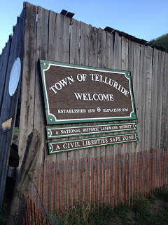
I began the day in Colorado Springs where I parked at the Cheyenne Mountain Resort and boarded a bus along with other riders for Ride the Rockies. We were transported to Telluride for check in.
As a rookie, the first day was a little daunting. Grab the luggage from the bus, check in with Ride the Rockies, check in with Alpine Cycle Connection, check in with Alpine Lodging. Take a bus to the Riverside Condo. Drop luggage. Go back to check in. Find bike. Remove it from crate. Build it. Take box to High Country Shipping and pay to have it shipped to Colorado Springs. Relax.
Once I could relax I decided to explore a little. I took a bike path out of town until it ended. There I met Chris and Erin, two locals from Telluride who had paddle down the river. I meet a lot of fun folks and they were the most fun of the day. “Carbon neutral” or zero as Chris described it. They paddled down and would hitch a ride back in a passing pickup truck. And they did.
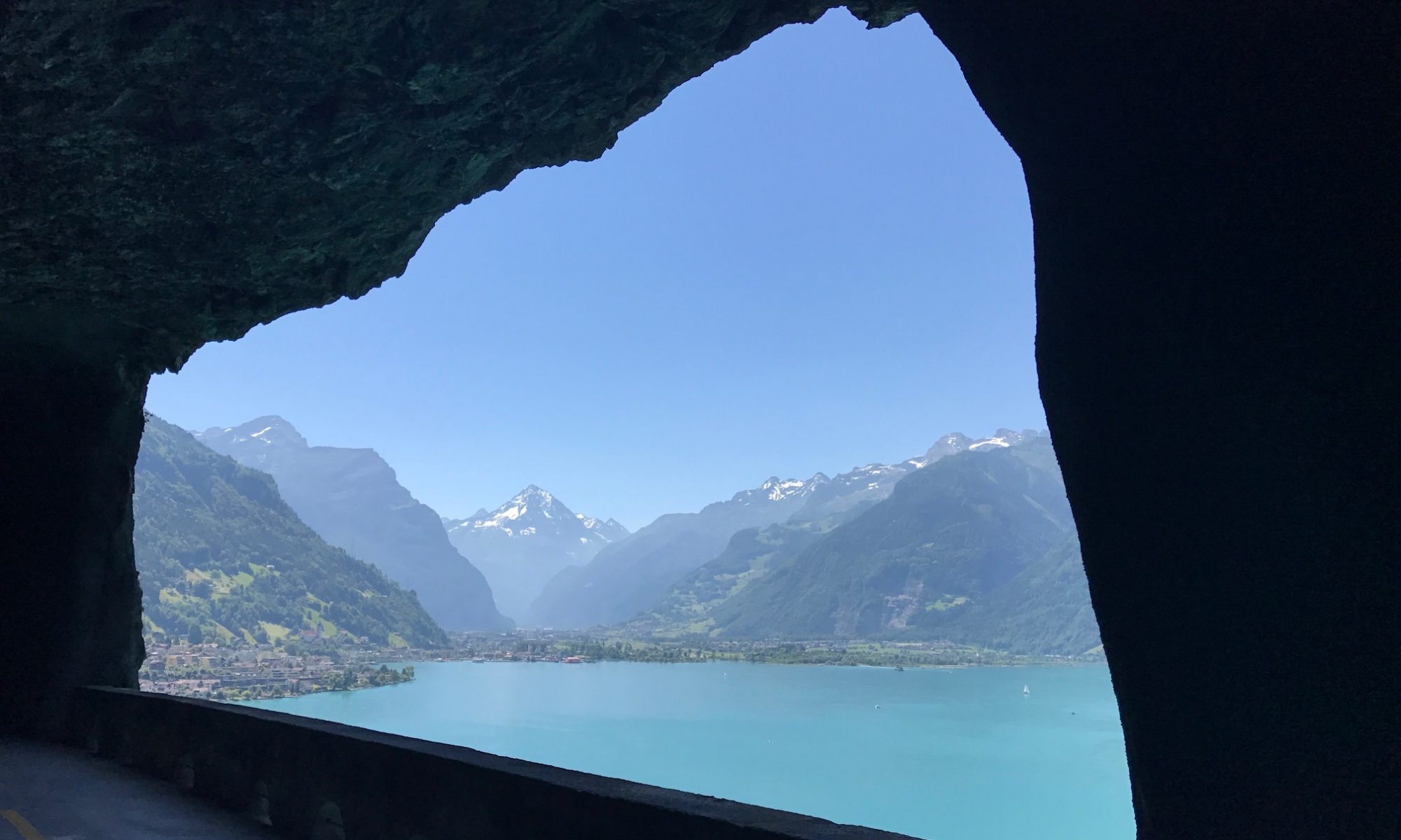
Telluride is a former silver mining town. Victorian homes are ever present. The scenery is stunning.
Don’t Be the Bunny
Just eight blocks wide and 12 blocks long I felt I didn’t have enough time to really explore. Light was fading.
My lodging was in the Riverside Condos along with my roommate for the week, Scott Olson.
View from the Condo
I did not take the free gondola up to the mountain village. Saving something for next time.
I don’t think I’ve seen a town with so many dogs. Big dogs. Friendly big dogs.
This is a delightful town.
The downtown was closed off for the evening for entertainment. My friends, Chris and Erin asked if I would join them but I was on eastern time. It was bedtime. And a big ride tomorrow awaits.
This was the day that I really looked forward to. I was meeting a cancer group, Team Portland, and escorting them from Bedford to Ligonier. It was a cold 43 degrees as I rode out of my parents’ house in Friedens for the ride over the mountain to Bedford to meet the 4K.
Out of the box I hit the mile and a half climb on Pompey Hill Road and its 18% grade. Damn it. My legs weren’t ready for that shock. But once that was over it was a matter of getting on US 30 and making my way, mostly down, to Bedford.
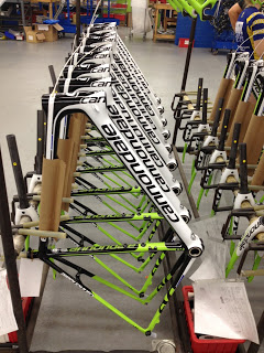
I joined the group at the Cannondale plant tour, already in progress. It took me just a few minutes to ask someone if this was a plant or a museum as the guide kept explaining how they used to make bikes there. They still do – just not as many. And it missed how much of the work is now outsourced.
New Cannondale Bikes in Bedford
Although the planned route was listed as 62 miles, I knew with two major climbs it would be a long day. I had hoped to go around the first small climb that goes to Schellsburg on US 30 by going to Manns Choice on PA 31 and over the lake at Shawnee State Park. It would add three miles but avoid the nasty climb. Instead, we did the nasty climb and stayed on 30.
We were joined for the first five miles by some employees from the Cannondale plant. See, they don’t make as much there as they used to, above. It was great having them ride with us.
After leaving Schellsburg and passing the Buffalo farm, it is a six mile climb up Allegheny Mountain. Four miles up we stopped at Lookout Point. I told anyone who listened that there used to be a “Ship Hotel” here years ago. It was hard to explain.
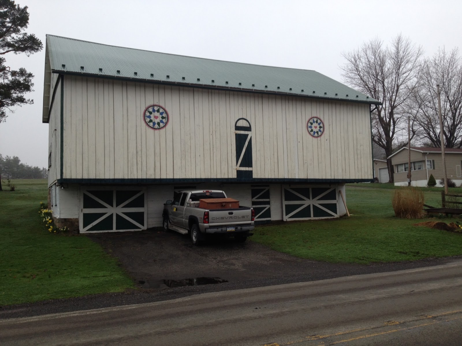
As we rolled out for the final two miles I was delighted that we passed the only building on the route, an antiques barn, and it had a painting of the ship hotel. You don’t see those things when you fly by in a car.
Joanna Freeman
After summiting the climb we continue on the stretch of road known as Seven Mile Stretch or Longview. At the end we descended to the Flight 93 Memorial. I had arranged a visit with the National Park Service on a tight schedule and was a little nervous when only one group entered the park. I rode back up the hill to Longview and saw more riders on the side of the road. At first it appeared they were taking a break. I was not happy as we needed to move the group along. But then I saw they were talking to someone and that made me smile.
On some day schedules, and speed, are important, but the mission is talking with people. And they had met a woman from the Flight 93 Memorial Garden. In fact, after they left I stayed and talked some more.
Eventually we gathered all the riders and the Park Service let us out a back gate onto Buckstown Road. Hoping to make time I also routed the group over a small road called Covered Bridge Road.
Call it my screw up because my local intel failed to mention it was a gravel road and I hadn’t pre-ridden it. And it would get worse.
Gobblers Knob road was also gravel but it was actually closed. The temporary road had heavy gravel on it. We only had 200-300 yards and I powered through it but most riders walked it.
We got through Friedens and over to Beulah Church where Pattie and Margaret Cramer served a full picnic “lunch” even though it was 5:00 p.m. After dinner the team leaders knew some riders could not make the final climb. Some were unsure and some certainly could. But the leaders wanted to have a team meeting as it was only Day 3 and they yet to do that. They decided to shuttle all the riders to Ligonier.
I would take anyone who wanted to go with me, and some did, but the team was all for one and one for all. I went on solo.
I stopped for pictures and kept thinking they would pass me. It was only between Laughlintown and Ligonier that they passed me and I soon arrived in Ligonier as they were unloading their first group.
I had almost 90 miles on the bike while my friends had 40. I got the bragging rights.
Since last year I have been intrigued by the route the 4K for Cancer Team Portland took from Waynesboro, Pa. to Breezewood. Before this year’s departure I contacted Team Portland and suggested I could help. They believed me.
I designed a ride that would keep them off US Rte 30 and got them over to the abandoned section of the Pennsylvania Turnpike. I had hoped to be packed for Ride the Rockies earlier in the day then drive to Ligonier and leave my car while I biked to Somerset in preparation for meeting the 4K in Bedford tomorrow.
My planning did not work out so I was very late getting on the road. But that gave me an opportunity to meet the 4K Team Portland. When I contacted Daniel Gray and he told me they were near Houstontown, Pa. I knew I could get to Breezewood and ride backward and meet them.
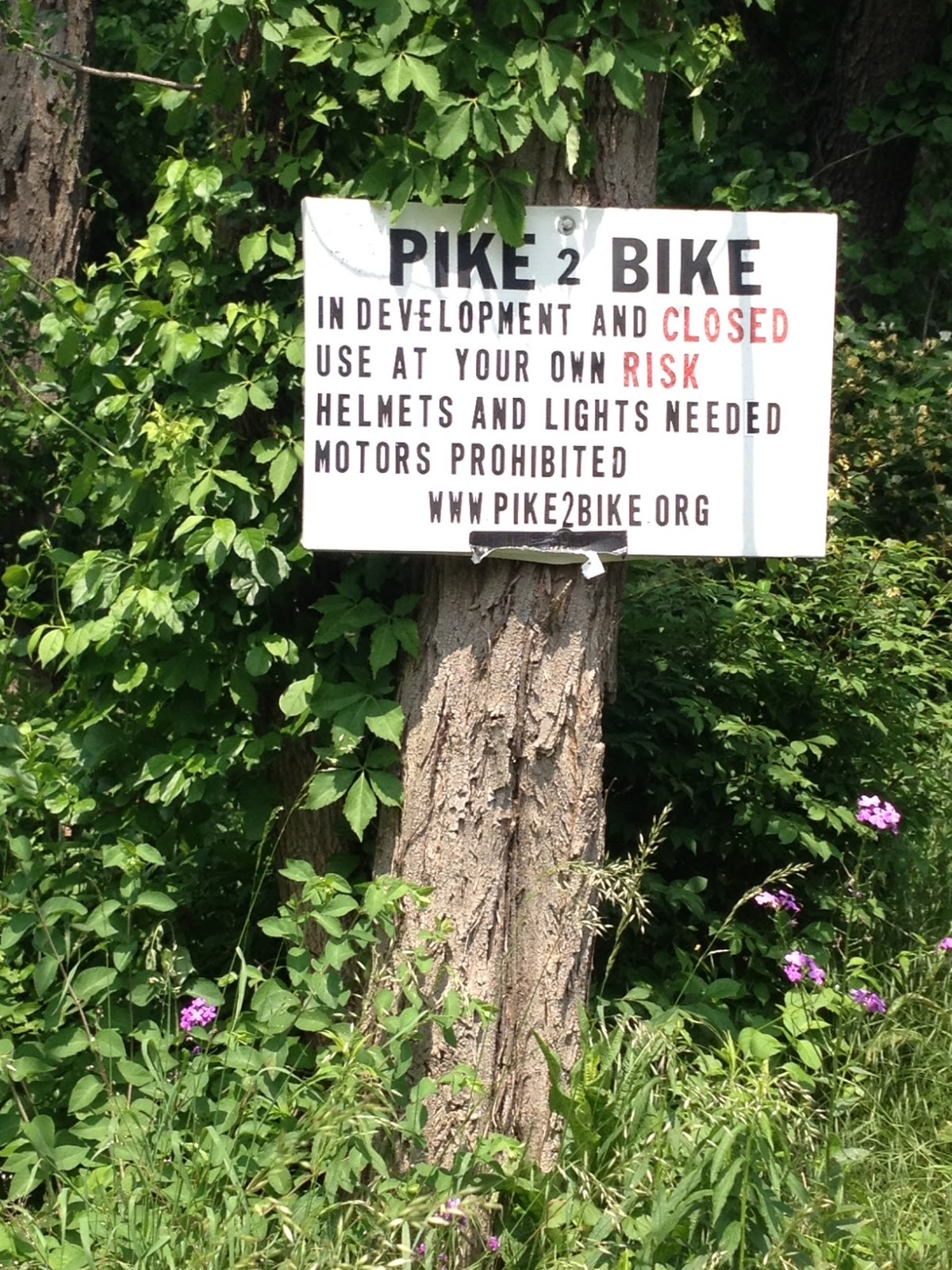
Yes, this is the Pike 2 Bike Entrance
I had never been on the abandoned pike. Although I found the entrance, I mistakenly went down the wrong road before realizing there must be a path to the pike. And there was.
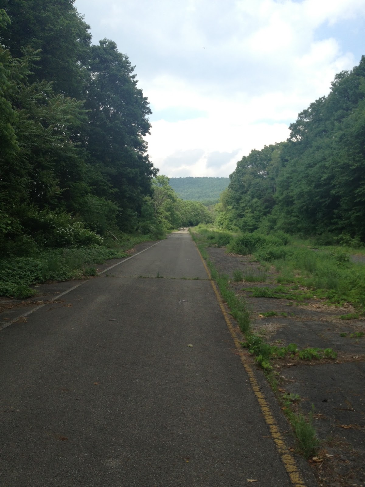
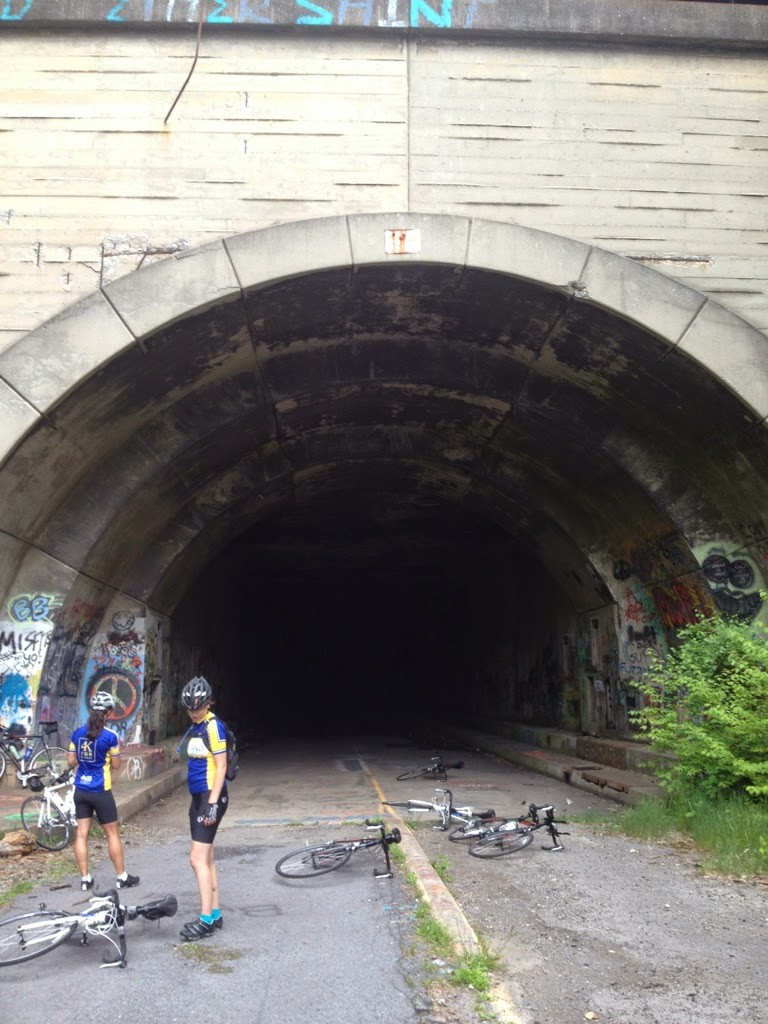
Climbing the path I came to the pike. Ten miles of abandoned turnpike. Two tunnels (very dark — need lights). I rode through the first tunnel and was most of the way to the second tunnel when I came across the 4K coming in my direction.
Abandoned Pike
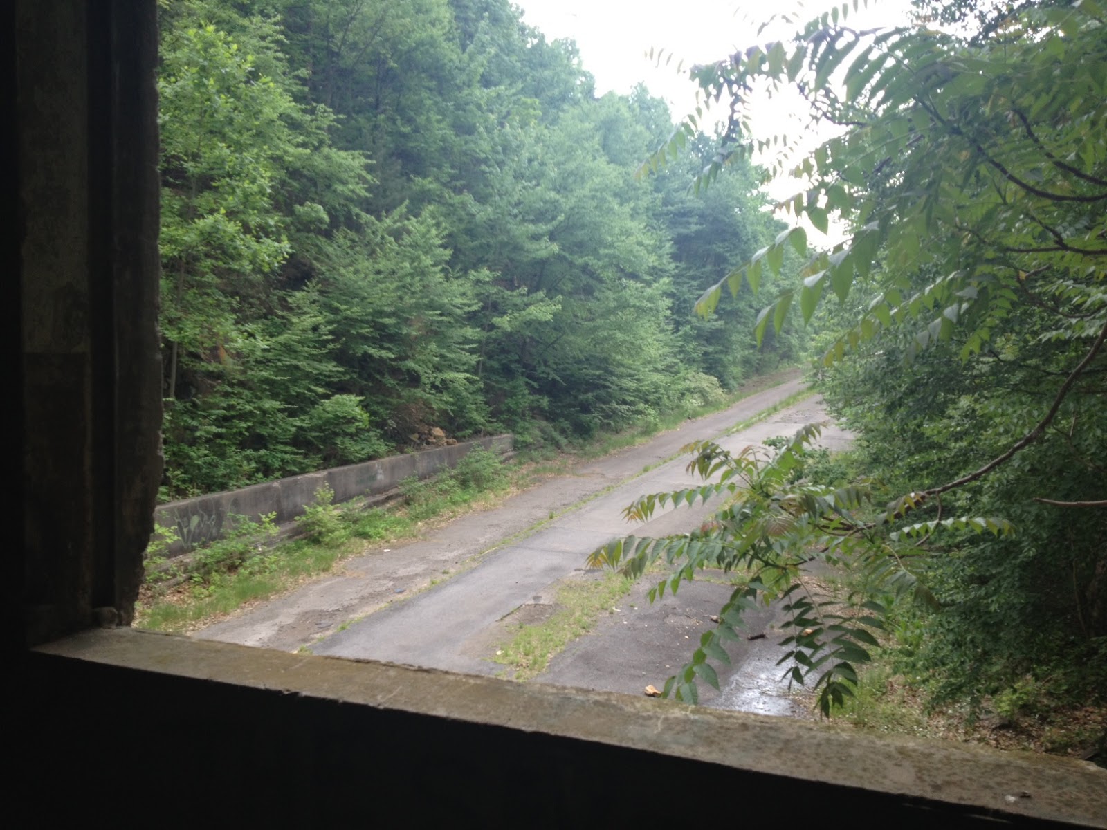
I kept going to the second tunnel when I met the last four riders of the 4K. We then explored the tunnel’s maintenance section before riding on through.
Looking out window in Maintenance Room in Tunnel
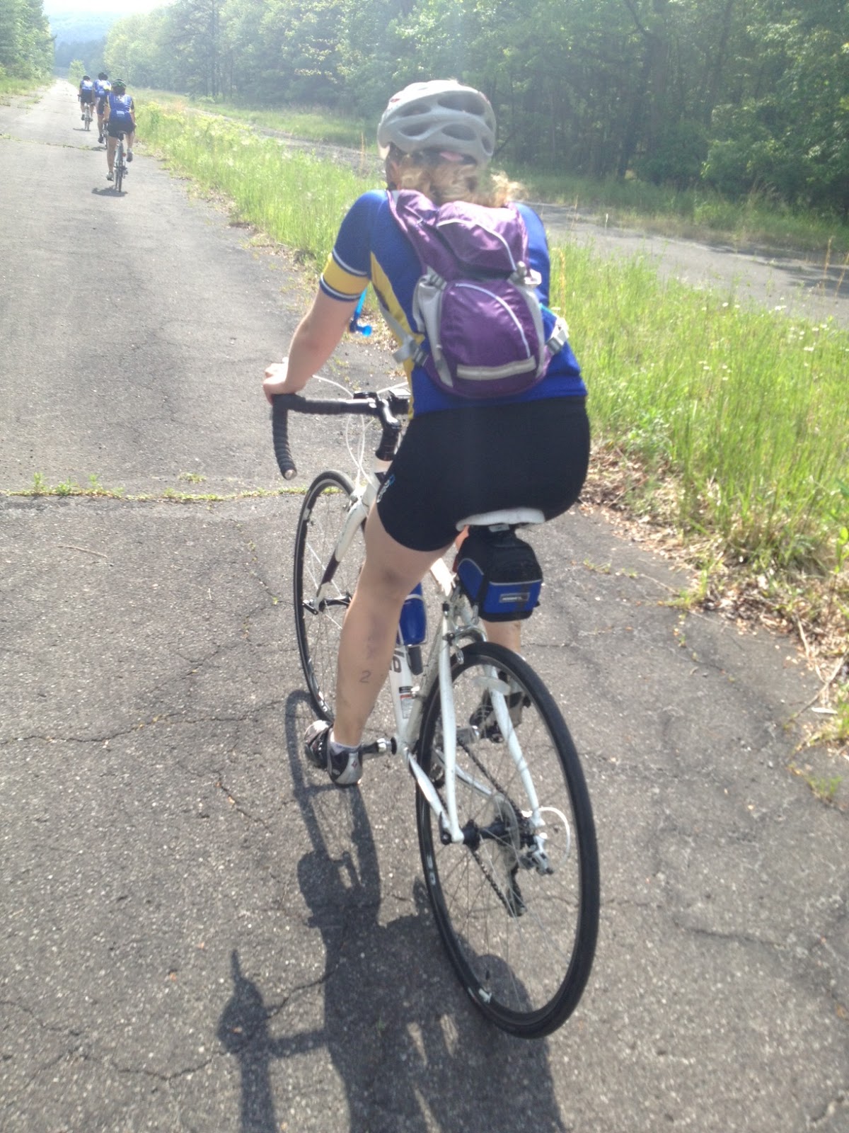
Once back on the road I followed the 4K on the Pa. Bike Route S between Breezewood and Everett. Although it is about the same distance as US 30, it has some very nasty climbs. I knew the section between Everett and Bedford was the same.
4K Riders on the Pike Sarah Robbins
I was able to convince all the riders I found to skip the last bike route section from Everett to Bedford and just ride on Route 30. They did. The US 30 route was two and one half miles shorter than the Pa. Bike Rte S route. Until I mapped both, I thought the bike route had a lot more climbing. It does but spread out over the longer distance it’s about the same gain per mile. Route 30 has one long grade whereas the back roads features a lot of ups and downs. At least I saved them 2 1/2 miles.
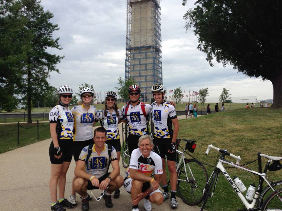
I had been looking forward to this day both to meet my Pedal Pal, Anthony Venida, and to see the 2012 alumni who came to help and the alumni of the Key to Keys ride. I arrived the just as the the groups were rolling out to the Inner Harbor for the Sendoff Ceremony. I took my time then gave chase. I caught some riders.
I saw many of the 2012 Team San Francisco who came to make the first day remarkable. And they did.
Before the teams rolled out I met some of Team Portland because I knew I’d be riding with them on Tuesday. Then Team San Fran rolled out to the American Visionary Art Museum where they would form groups.
I rolled out in the first group with alumna, Erin Mack, along with Anthony. I wanted to be in the first group because the Baltimore to D.C. ride seemed to always have problems with cues. I made the cues and rode the route ahead of time although I had to dispel the rumor that I actually had ridden it this morning. Since we rolled out at 8:00 a.m. that would have had to been about 4:00 in the morning. Not happening.
I brought my own chalk to chalk the cues but that would prove hard to do because the alumni beat me to almost every turn. Still, the chalk that Livestrong handed out in 2009 when Lance Armstrong returned to cycling would prove useful.
We were comfortably in the lead until Anthony dropped a chain and Jeff Graves’ group came flying by. And Jeff’s group would lead the way the rest of the day.
After donated Papa Johns pizza in Berwyn Heights, I joined Jeff’s group to chalk some turns on the Anacostia River Trail. Things went perfectly.
Shut Up Legs
When we reached the Washington Monument, Jeff asked if we could do some bonus miles around Hains Point. So we did — which is what I did last year to Jeff’s group — without them knowing. But this group was much more refreshed and ready for it.
We reached the host in Alexandria and waited for the other groups. Erin’s group, which I left, missed a cue and went across the Memorial Bridge instead of 14th Street Bridge but no big deal. I would not call that “lost.”
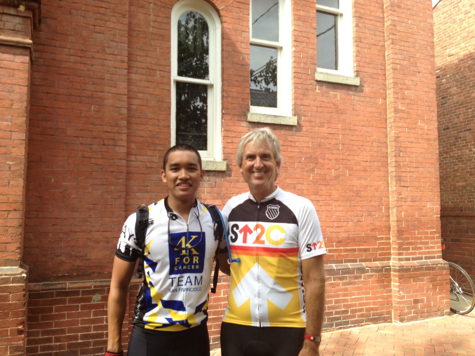
Anthony, Barry
Rain threatened and we had a few sprinkles but that was all. This is a great group of young people representing the 4K and they will do well. Ride safe my friends!
Some days things work out as a surprise. Today was one of those.
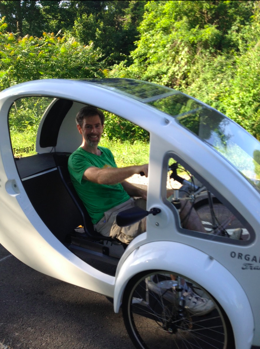
I love the Airport Loop. Early in the morning, the summer temperatures are still pleasant, the route shaded, and one sees a lot of cyclists, runners, and walkers along the trail. Some are unusual, like the $4,000 organic transportation pedal car I saw at Gallows Road.
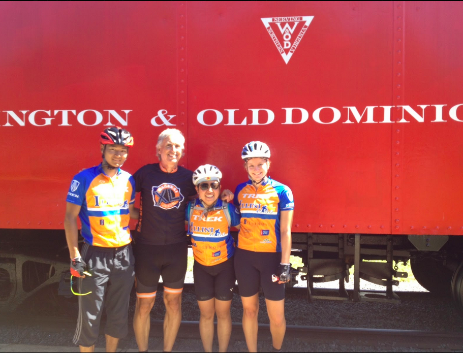
While riding inbound on the Custis Trail I was passed in the opposite direction by four riders wearing the same orange and blue jersey. A few minutes later I was passed again by four other riders. And then a third time.
I didn’t catch much except “Trek” was on the jersey and I thought “Illini” may have been on the front of these orange jerseys. I did not think much else about them as I continued my ride.
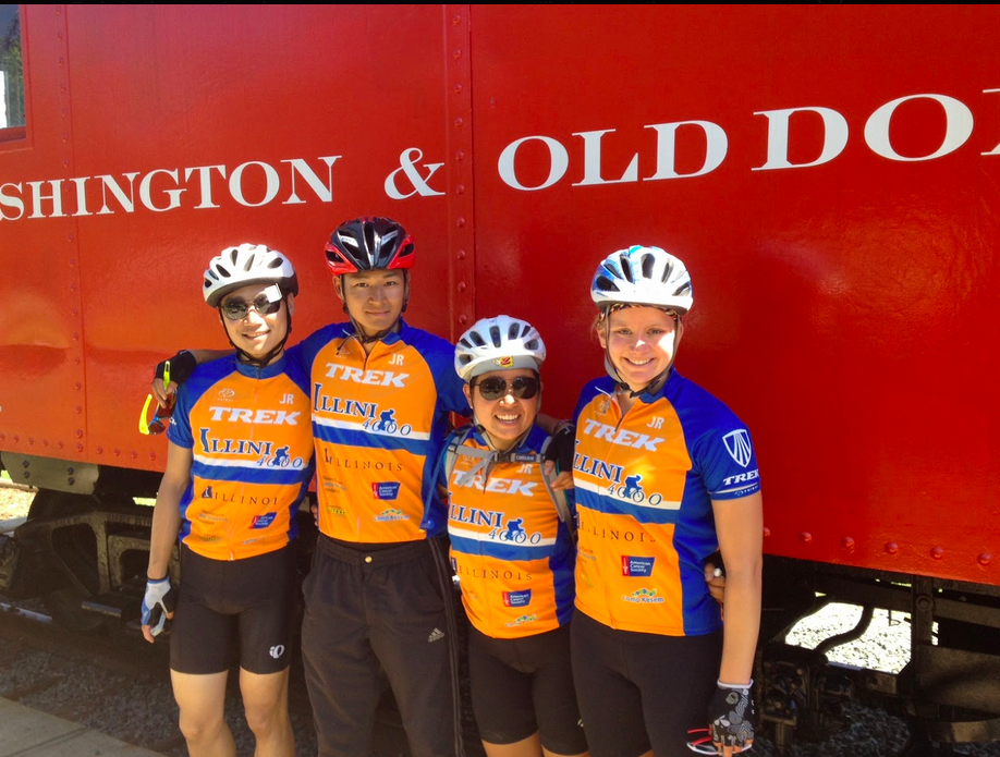
Yang Song, Je Won Hong, Meiling Liu, Jordan Orr
After completing the loop and heading back to my start at Gallows Road, I caught four of these riders. And so I talked with them. They’re with the Illini for Cancer 4000. The Illini 4000 is much like the Texas 4000. Only their starting location was New York City and their destination this year is San Francisco.
I rode for a while with Yang Song, Je Won Hong, Meiling Liu, and Jordan Orr. I was glad to be their guide for a while. Today they were riding from Washington, D.C. to Boonsboro, Maryland. This first section was the W&OD out to Purcellville before jumping on real roads.
Je Won, Barry, Meiling, Jordan
What was to be a nothing day turned into something special because I met four cancer fighters.
I came to Pennsylvania on a scouting trip for some friends preparing a charity ride across the country. Google Maps show the most direct route from Bedford to Ligonier is through New Baltimore then up Imgrund Mountain Road. The problem was I wasn’t finding anyone who knew much about the road. (Or perhaps people knew and were unwilling to talk. Imgrund Mountain Road is believed by some to be the real crash site of Flight 93 and, as the lore goes, no outsiders are supposed to know since Flight 93 has put this area on the map.)
My dad drove the upper portion for me last week and told me it was “red dog” (look it up). But he never saw the nasty lower portion. I called the supervisor for the township and when I told him we were thinking about biking up it, he recommended against driving up it.
Non-cyclists view many hills, if not all hills, as something they wouldn’t ride on a bike. I knew that I could not rely on outside intel to make the determination if this was a safe route for my friends’ ride. I had to see it, and ride it, for myself.
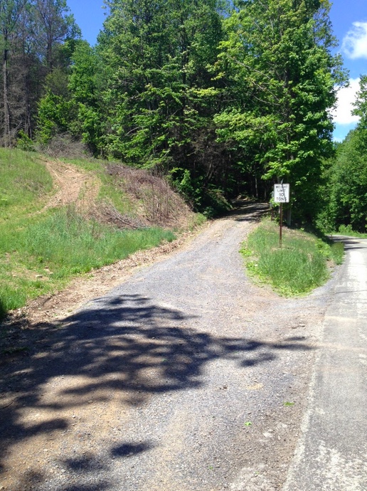
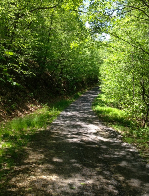
Imgrund Mountain Road, the lower section
I went exploring and first started up Wambaugh Hollow Road, part of the Pennsylvania Bike S Route over the mountain. I remembered on Google Maps that near the top of the climb a road connected with Imgrund Mountain Road. Except that it didn’t.
I met a local and when I asked about the road that connected to Imgrund Mountain Road he told me there may have been an old hunting trail through there but assured me the only road over the mountain started back at the base off of New Baltimore Road. And then he looked at me in disbelief when I told him I was going to ride up it. Not to be outdone, then his “friendly” dog chased me, nipping at my heels.
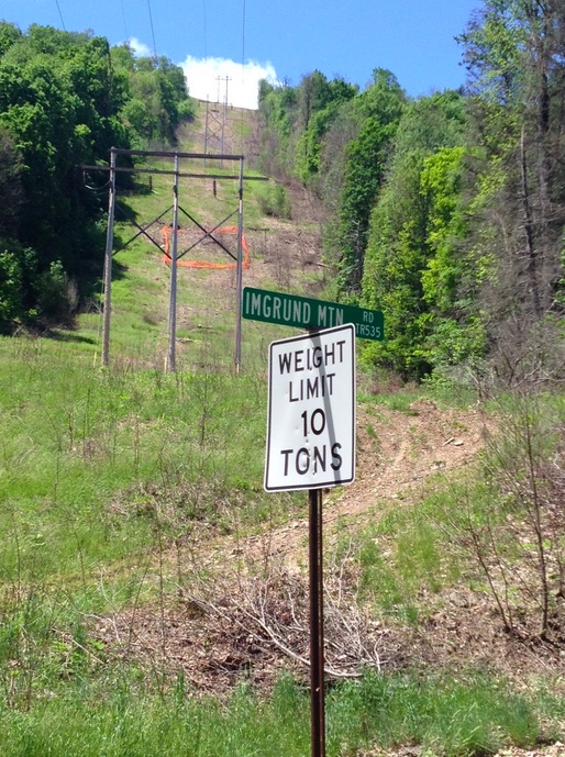
Imgrund Mountain Road
I descended back to New Baltimore Road and found the entrance to Imgrund Mountain Road. I saw gravel. Dirt. Rocks. And a forest floor. My immediate thought was “no way.” I almost turned back knowing the answer.
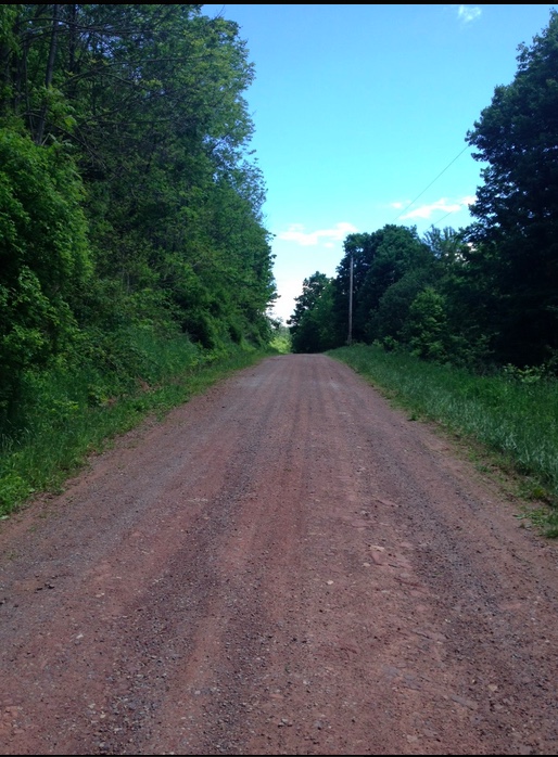
Red dog road part of Imgrund Mountain Road
But my next thought was to see just how far I could go. So I started up the road. The first half-mile was rough. By rough I mean hard. The surface was mixed stones and dirt and even some water flowing down it creating gullies, so I couldn’t get any rhythm pedaling. I was trying to find a line that would do the least damage to my wheels.
I would not recommend a car travel up this road. Big enough for one car it has a very uneven surface and some rocks protruding from the surface. It is, however, perfect for a 4×4. And an adventurous spirit.
I kept climbing, at times getting out of the saddle but always finding the rear wheel would slip with each pedal stroke. After the first half-mile, the grade lessened some but still was considerable.
Power line. Google maps recommended this route instead of Imgrund Mountain Road.
The road threw everything it had at me for two and one-half miles. Just when it seemed I was at the top I saw a curve to the left and another climb. There was heavy gravel on the curve and my GPS showed a 22% grade.
I made it and the road leveled off. The surface got better – all packed dirt or gravel and flattened out and even trended down.
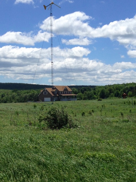
House powered by wind-power generator
But the other factor was the wind. Heavy winds were blowing and it was cold. Memorial Day weekend it was 45 degrees at the start, never getting higher than the low 50s.
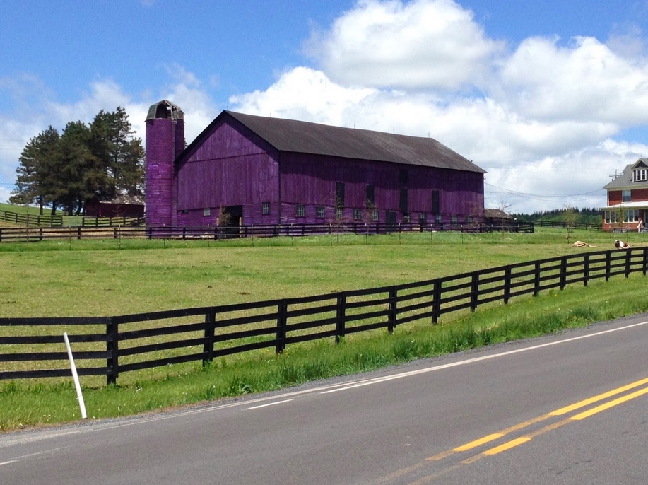
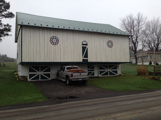
Purple barn. Why Pennsylvania, why?
I wanted to ride 10 miles over to Friedens and surprise my parents but felt uncomfortable controlling the bike in the winds. Instead, I headed to US 30 and rode back to New Baltimore.
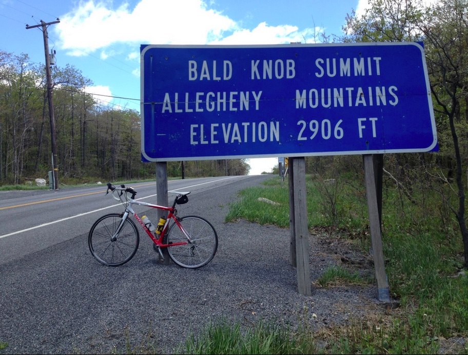
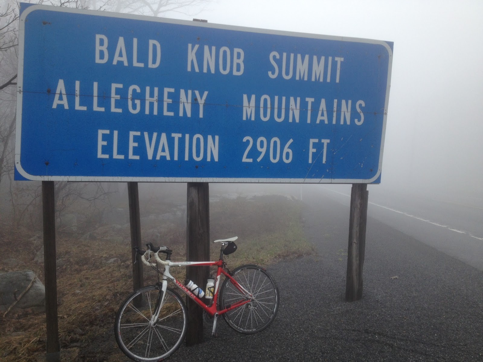
Bald Knob Summit – U.S. 30
I could not recommend this ride for anyone on a road bike. Yet a huge sense of accomplishment swelled over me. I even thought of recommending the route to my friends just so I could chide them knowing I did it and some of them couldn’t. But that would be foolish. Real foolish. I’ll find them another way over the mountain.
___ EPILOGUE (April 13, 2014) – I contacted Google and they have since corrected the hunting trail and the power line which showed as connecting to Imgrund Mountain Road. I still wouldn’t recommend it on a bike
A few hours after this ride and I must say that I’m happy. That wasn’t the case seven hours ago.
I was looking forward to riding with Ben Jones and Brian Moelk in their first century and wanted to set the example of fitness. Instead it was me who had difficulty. Following a cool spring, this was the first test of sweating on a bike and I failed the test.
Ben Jones
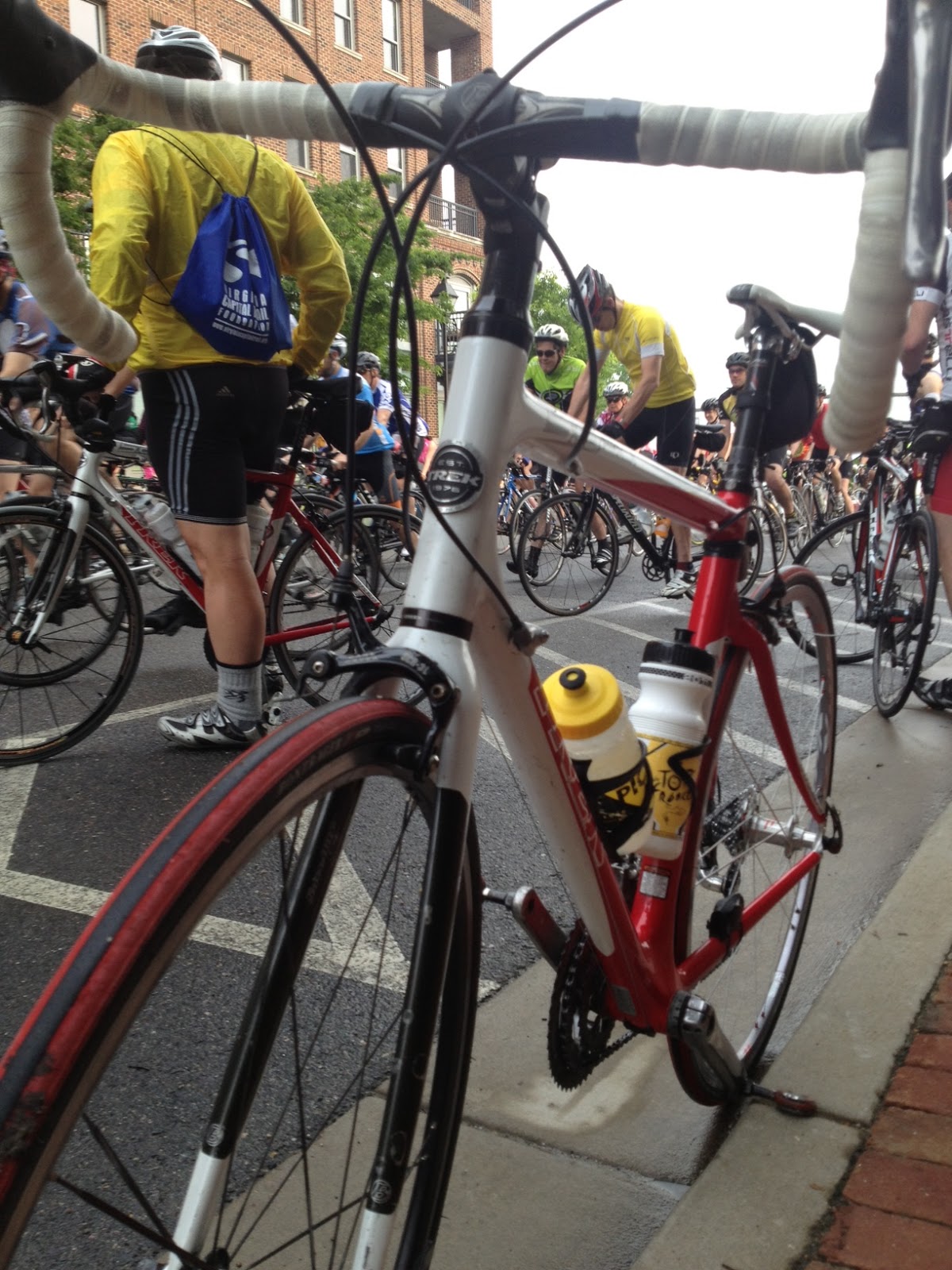
But, I am reminded by the picture that back of the pace line is still part of the pace line.
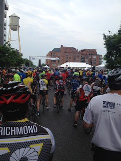
We pushed off seven minutes after the start of the ride for century riders depriving ourselves of riding in a pace line. Or in a large group. On a windy day that would have helped.
But we were treated to gorgeous riding skirting Richmond Battlefield Park. Tree covered roads would be the norm for the first 25 miles. We averaged 18 mph for those first 52 miles in windy conditions – mostly cross winds. At times we were on wet roads but not in the rain. We must have just missed some storms.
On the road while Ben changed his flat
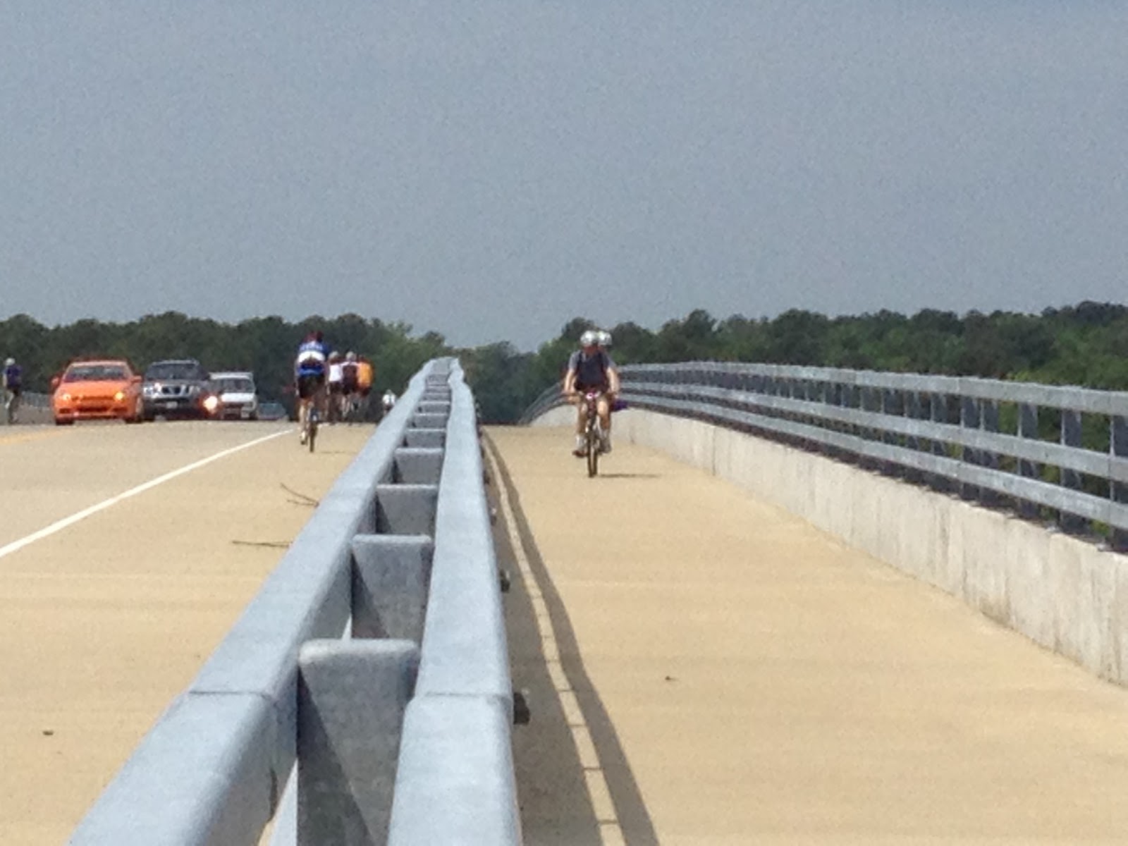
At Mile 52 we crossed the high bridge over the Chickahominy River. On the climb I cramped briefly and eased up letting Brad and Brian to fly over the top. After a brief lunch at Chickahominy River Park we climbed back over the bridge.
Bridge over Chickahominy River
I announced I was going to use the trail instead of the shoulder so that I could stop at the top at take some pictures. While I was honest in stating that, I was also a little concerned that we would hit the climb up the bridge hard and I might cramp. I knew I could soft pedal in the bike lane. It was uneventful until the rest stop at Mile 62.
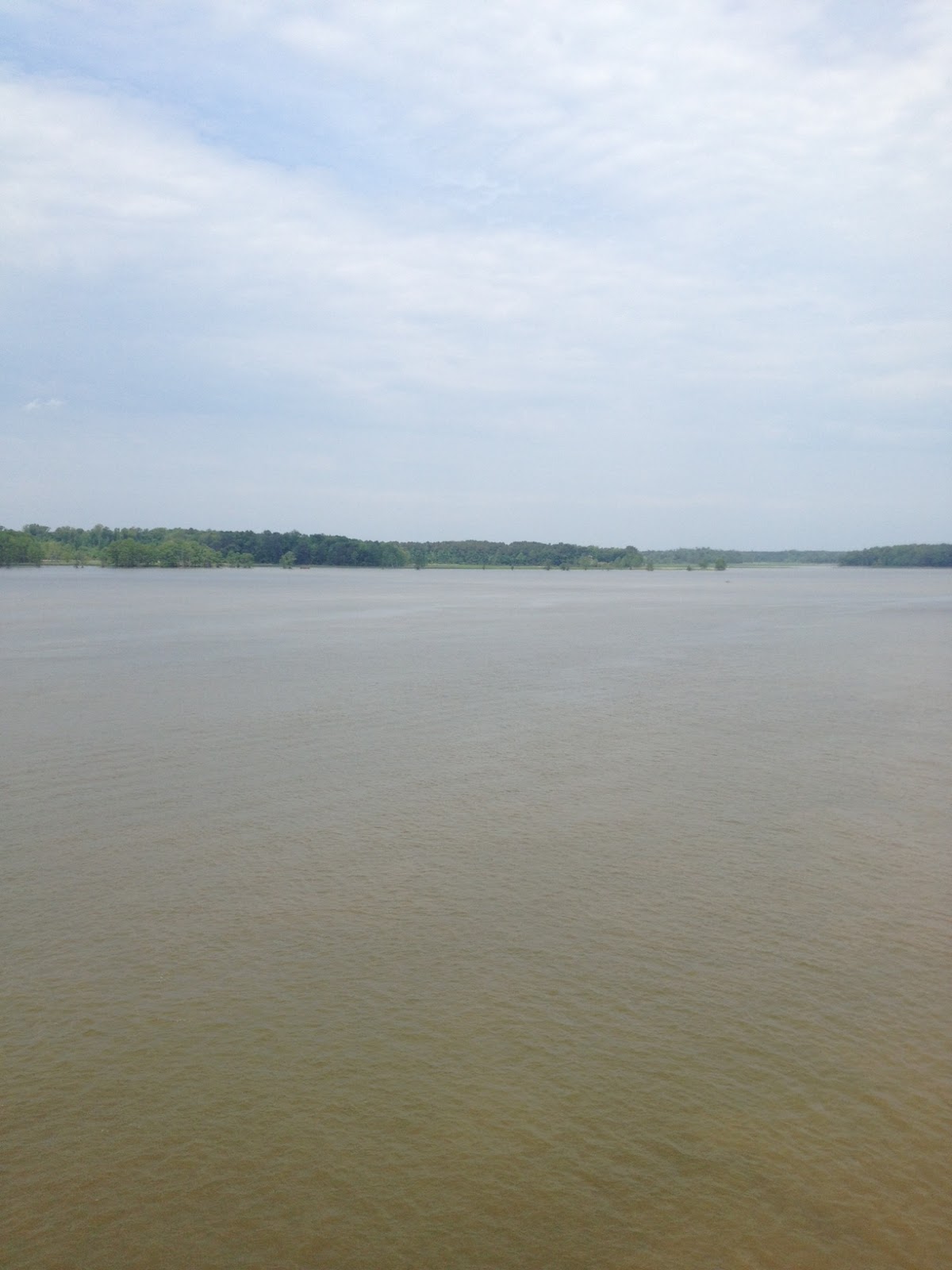
Chickahominy River
Once we left the rest stop we had a little bit of rise and I cramped. Big time. I had to dismount and stand. For the next 40 miles I would pedal and, at times, cramp. I was taking on a lot of water and Powerade as I rode but it wasn’t enough.
I had good moments though. Around Mile 90 we were following a guy for about two miles and I felt bad we were wheel sucking. Ben and Brian were content to let me follow their wheels but I came from 4th wheel to the front and pulled. Things worked well for a mile or so until we came to an overpass. It was just enough of a power demand that I cramped again.
I just needed to find my “happy place” where I could pedal without exerting too much effort. And at times, I did. After a brief stop long enough just to foot my feet down. I got back on and regrouped. I went by again and opened up a 100 yard gap as it was the most comfortable pace for me to ride. But eventually they caught me and eventually I cramped.
Ben Jones, Barry Sherry
The wind coming back was strong and mostly a head wind. Despite the relative flatness of the course the wind made it a big effort. But the rain which threatened all day, held off. At the end of the day, Ben and Brian finished their first century and we averaged just under 17 mph.
Ben, Brian, Barry
What was disappointing and painful for 40 miles ended up being a positive. I fought off quitting and continued on. It’s not the way I wanted to lead my friends but still I was part of the pace line.
After two days of driving from Key West to Baltimore then to Somerset, Pa., I was ready for a nice ride. Maybe not this one but it’s the ride I got.
I have driven the mountain up westbound on US Rte 30 from Shellsburg towards Stoystown probably more than 100 times and always wanted to bike up it. A nice little climb it’s a two-lane road with a little bit of a shoulder. Safe enough.
I left my parents’ place and rode into Somerset, fueling (eating) at Sheetz. Then I headed east on PA 31. The rode has narrow shoulders and lots of coal truck traffic. But generally the coal trucks gave me wide berth – it was the regular pickup truck drivers who made no attempt to go wide even when no cars were approaching.
The weather was about 50 degrees and a mist from the fog hung over the area. The first 20 miles featured some nice rollers on the Allegheny Plateau. Crossing the Allegheny Mountain I pedaled hard trying to hit a good speed. Only when the road flattened out did I check to see my high speed — 50 mph.
Anytime I hit 50 mph it’s going to be a good day on the bike. I descended to the valley floor then navigated by feel. I knew where I could go to get to Shellsburg but took a chance on a road before Manns Choice. I guessed right.
In my mind I was going to go farther – over to Rte 96 and past Shawnee State Park to Shellsburg but I was also planning to meet my sister, Betsy, for lunch. So a 50+ mile ride made more sense than a 60+ mile ride. I found Buena Road which cuts over to Rte 30 near the Buffalo Farm.
Coming out on US 30 I turned left and started up the mountain. I always wanted to ride up US 30 but in better conditions. It was foggy and visibility was low. Winter dirt was still on the shoulders. Here they use a mix of of salt and black cinders to treat the roads. Combined with the mist and fog, it made for a wet mix on the bike.
I began the six mile climb and enjoyed every pedal stroke. I only wish I could see. Visibility was so poor near the summit I could hear a car approaching before I could see its head lights. I was hoping that no car would come flying up behind me. But none did. And over the six miles only 20 cars passed me on the climb.
On a clear day it is advertised that one can see three states and seven counties. But today I could barely see 100 yards. I passed the remains of the Ship Hotel, a travel icon in the 1930s.
I continued on “Seven Mile Stretch” and reflected that three days ago I was riding Seven Mile Bridge. What a difference. Unrelenting sunshine. Views that went forever. Here? Not so much.
I passed the entrance to the Flight 93 Memorial then continued to Stoystown before heading back to Friedens. It was a dirty, chilly and wet day but was still a good 54 mile day on the bike.
With a day to relax in Key West before heading home, I awoke to a beautiful day with nothing planned. Some of my teammates from the Key to Keys ride were flying home while others were sleeping in from a late night on the town. Still others had family members join them in Key West.
Me? I had my bike.
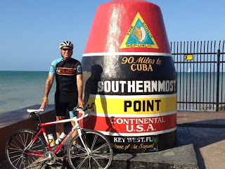
I started with no real plan. I began by riding back to the buoy that marks the Southernmost Point of the Continental United States and seeing many “Southernmost” landmarks including hotel, hotel on the beach, furniture store, and hockey rink.
I passed the Key West AIDS Memorial. I don’t like to think of “them” vs. “us” but it makes me wonder why no Cancer Memorial. I’m not suggesting less be done for AIDS but more needs to be done for cancer.
I left headed north – the only way one could head, and rode. As I rode I got to thinking about the Seven Mile Bridge which many teammates got to ride yesterday but we survivors, did not. And I rode.
The ride was a combination of shoulder on US 1, bike lane on US 1, and bike path separate from US 1. From the original highway which featured separate one lane bridges, many of the bridges are fully intact and are designated for riding down the middle and fishing from the sides. This is part of the Florida Keys Overseas Heritage Trail.
I had pictured mile after mile of bridges but most of the highway through the keys is actually on land. The big exception being the Seven Mile Bridge.
Not all bridges are intact
I knew it was near mile 50 and wasn’t concerned about riding 50 miles. But I was unsupported and to ride 50 north would require 100 miles total. I wasn’t sure how my body would react to the distance. Or the winds.
Railroad Bridge, then Highway Bridge, then Ruins
As I rode farther north, I decided that I would turn around at noon unless I was on the bridge. At noon I was a couple miles short. I lied. I kept going.
Just short of the bridge I stopped at a campground/gas station/food store. I bought a water and Gatorade but the water was too much to fit in my bottle. In the store I explained that I was coming back and wanted to leave my half-full water behind the counter and the woman offered to keep it in the Snapple cooler instead. So cool. Off I rode.
I rode across the Seven Mile Bridge greatly enjoying the trip. It seemed to be littered with GU packages and sponges and I thought damn cyclists. We have to do a better job and not drop our energy packets when empty.
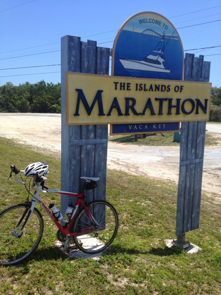
I touched the sign to Marathon Keys then turned around and rode back. Stopping at the food store to pick up my water one woman wanted to know how many miles I had ridden. I wasn’t displaying mileage so I showed her the buttons to push on my Garmin so she could see it — but not tell me. I didn’t want to know. I was just enjoying the ride.
I also found out that the litter on the bridge was from yesterday’s seven mile race across the bridge. Damn runners. I had a bit of a headwind riding the first 60 miles and was able to ride the final 44 miles at more than 20 mph. Tailwind. Nice. Real nice.
Pigeon Key
I felt good except for too much sun. Each day on the trip began with applying SPF 50 sunscreen and then halfway through I was always able to reapply at the team car. With no support today I only applied before I left. But the legs felt good. And I can cross the Seven Mile Bridge off my bucket list.
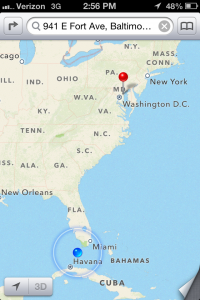
We left Baltimore eight days ago for a 1,300-mile trip to Key West. Today we arrived. Well, actually it was a 414-mile ride and an 886-mile drive trip. Yes, there were more than twice as many miles in a van than on a bike.
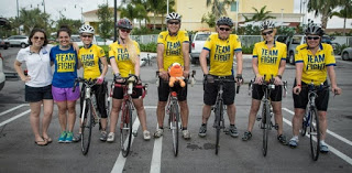
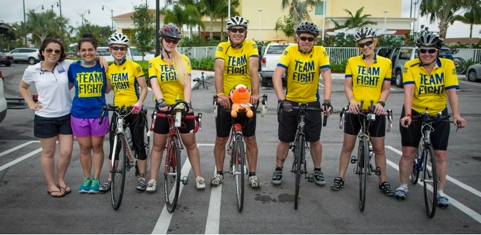
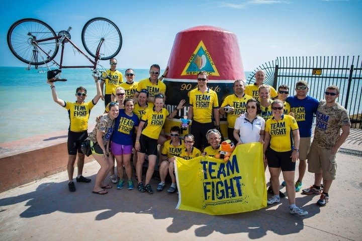
We are the Survivors!
The day began with the dedication circle. Imagine what a better place the world would be if 25 people held hands and dedicated a ride, or the day, to them. I have met some wonderful young people giving up a summer of their lives to participate in the 4K for Cancer or the Texas 4000 so I dedicated my day to them.
Each day began with the super-secret unveiling of the teams (groups) for the day. I had never ridden with the leader and it became apparent to me that his ego was threatened by strong riders. He liked to be the strong one in his group so today would be no different.
The groups were announced and Groups 1 and 2 would be comprised of cancer survivors. The names were called – all except for mine. I didn’t say anything but a couple of people quickly told him that he had forgotten me. So I was included with the cancer survivors.
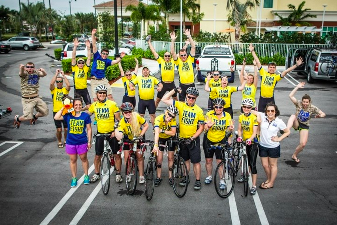
Celebration time at roll-out
Thus the final dedication began with calling the names of six riders and two staffers — all of us being cancer survivors. We became the middle of the circle and the outer circle closed around us. It was very humbling.
The six of us would ride from Homestead. This was my first day to ride with Jessica Tanner. The rest of the team was Jae Slye, Paul Lemle, Meg Shipman, and Patti Jackson. Our drivers were Abby Ramirez and Samantha Powell.
We rolled out and just had fun while riding. We kept a very comfortable pace which allowed me to drop back or speed ahead. It was just a fun day to ride.
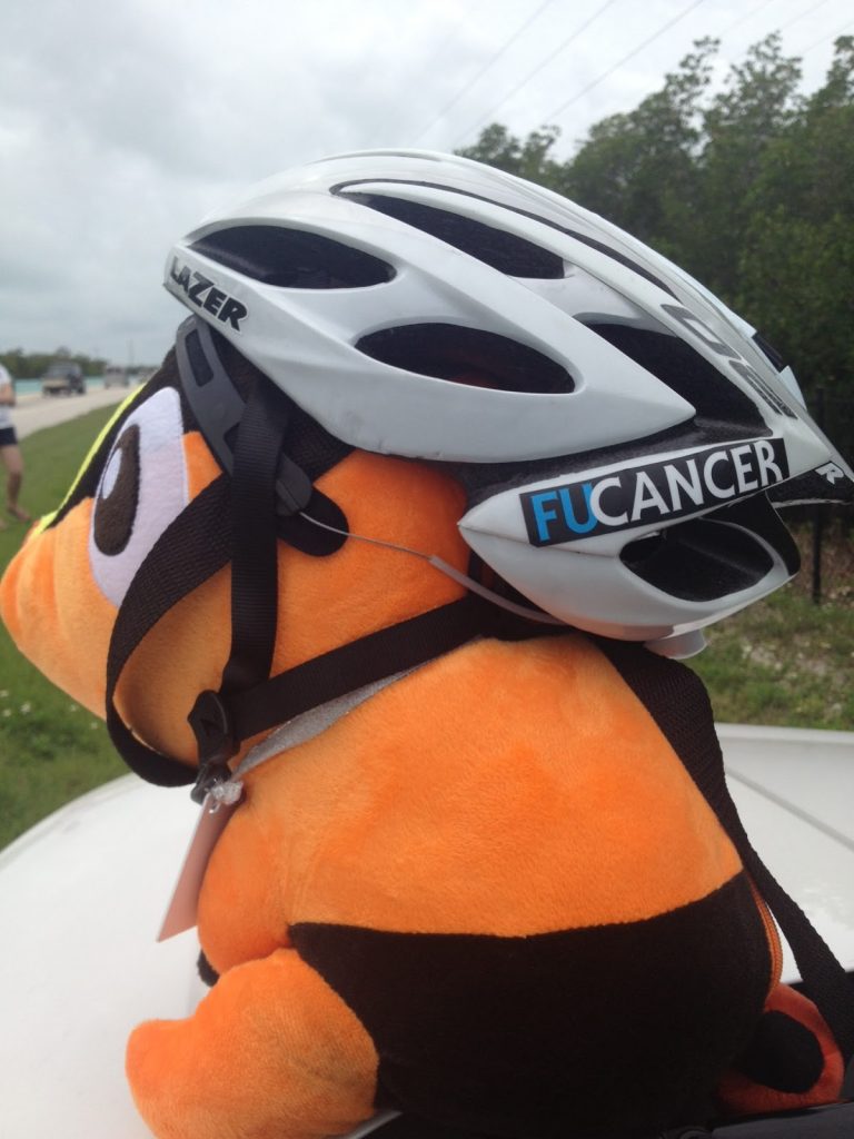
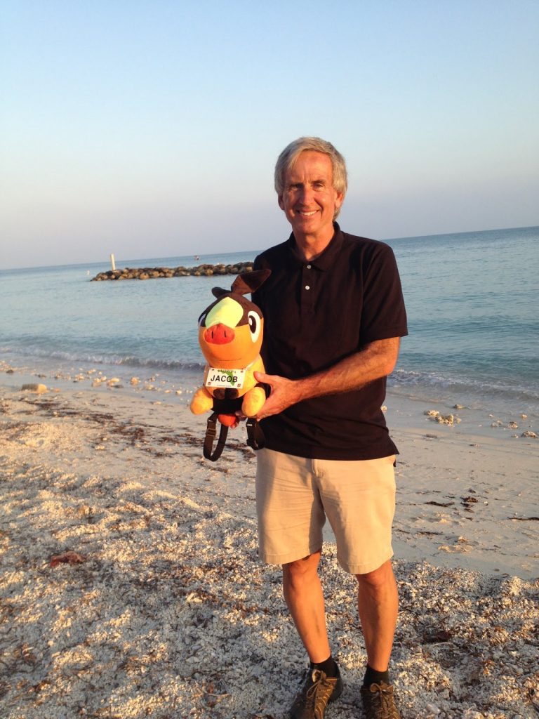
For Jacob
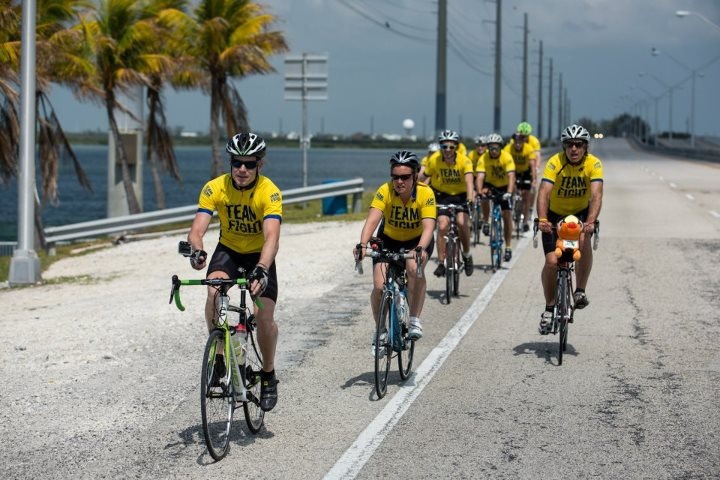
The top of the Keys is pretty boring on a bike. Or maybe more realistically, the entrance to Keys. It’s a divided highway with aqua-blue jersey barriers, 45-55 mph traffic, and a narrow shoulder. This is not for everyone. But we had great company and even a flat by Jae didn’t bother us today. Even the 30 minutes it took to change it because she was riding deep-rim wheels. Nope, we were relaxed.
My expectation before the ride was to ride the entire length of the Keys on this day. I don’t know if that is any longer a bucket list option for me. It was fun today to ride with my teammates.
Twenty miles from Homestead we jumped in the Tundra and began our drive to rendezvous with the rest of our teammates. We first stopped in Key Largo for a quick restroom break. Then, on schedule, once back in the car we decided we needed lunch. One of the staffers reminded us we didn’t have time but we were survivors. We said screw it. This was a day of celebration. Our celebration.
We stopped at The Beach Cafe at Morada Bay in Islamorada. Great location and great food. We got back in and swore, on a day no group had time to stop to eat, that we would never tell. And we haven’t.
As we went through Marathon we saw it out ahead. The Seven Mile Bridge. We were amazed at this structure and disappointed. To a person, this was the section of the Keys that we most wanted to ride. That would have to wait for another day.
But our group leaders kept this for themselves to ride. “Cancer survivors, we honor you by letting you lead us out today and ride past Walmart and Wawa. And we will ride the fun part in the Keys.”
We arrived about seven miles north of Key West. This is where we met the other riders who were hungry and maybe a little concerned about our whereabouts. We then rode into Key West together. The first mile in Baltimore from Race Pace Bicycles to the Inner Harbor and the last miles into Key West were the only times we rode together.
We blocked an entire lane and most people were celebrating with us. The people of Key West were very welcoming. While riding I was talking to a couple on a motor scooter and both were cancer survivors. I invited them to ride with us but they got caught at a light. The celebration was on.
We arrived the famous buoy and were greeted by a number of family members of riders who had made the trip.
Dinner was celebrated at Fort Zach on the beach with evening activities in town.
This was an amazing journey. I take back friendships and memories. For every person who donated and/or help me up in prayer or good thoughts, words cannot describe what that means to me.
This was also a week of transformation. For three and a half years I have been a cancer survivor. And yet, until my name was called to enter the “Circle of Survivors” (it wasn’t really called that) most people on the ride did not know I was a survivor.
What they heard me talk about were the many other people fighting cancer that I rode for each day. And that’s what it really is about. This wasn’t a ride for me. It was a ride for all people who are battling cancer and to remember those who have lost the battle. And I’d rather be an advocate than a survivor.