Blair Witch Project

BURKITTSVILLE, MARYLAND

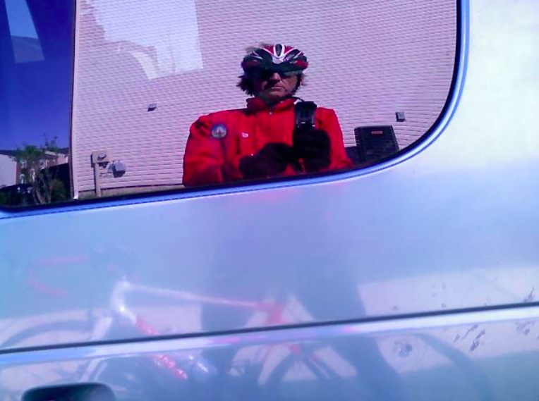
This was one of the hardest 50 mile rides I have done. Stupid wind.

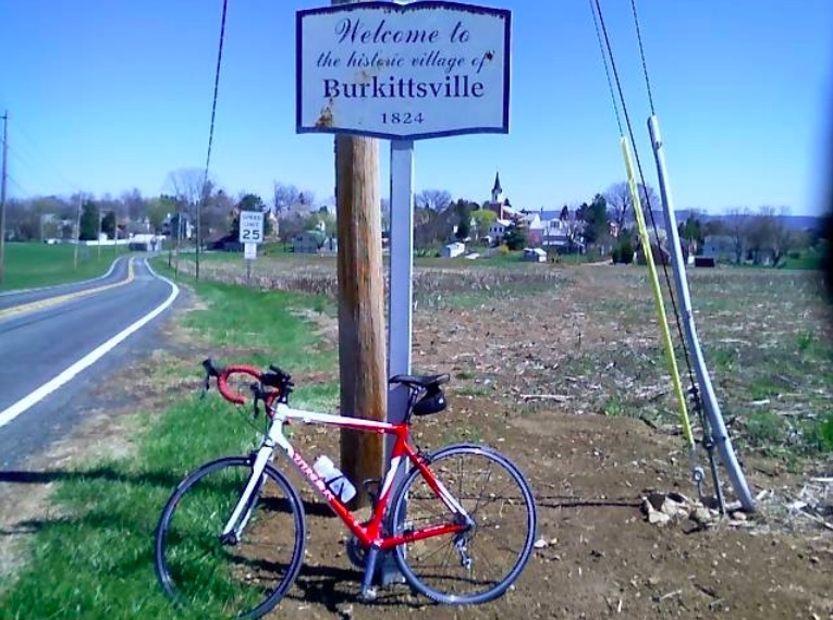
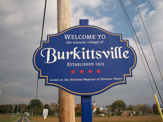
I had a rough idea where I was going when I left Ashley and Bryan’s place in Ranson (near Charles Town, WV) but wasn’t completely sure. I knew I wanted to go to Burkittsville which is the home of the Blair Witch Project. It was Halloween, after all.

My route eventually took me on U.S. 340 across the Shenandoah River at Harpers Ferry then, about three miles later, across the Potomac River from Virginia into Maryland. The bridge is narrow with no shoulders and the pedestrian sidewalk was closed. I had no choice but to pedal across it.

I fought a brisk wind for most of the ride. It was so strong, and cold, that at times I was out of the saddle even on the flats, trying to generate enough power.

At Burkittsville I headed up Gapland Road. It was less than a one mile climb but one portion measured at 16%. It was a neat little climb. At the summit is a memorial to Civil War Correspondents. This was also the site of the battle for South Mountain. 

Burkittsville, Md.

Also, it was here that was Rest Stop Number One for the Civil War Century ride I did last month. To go from 1,600 riders in one place to just one seemed quite strange. 

One of many plaques at South Mountain

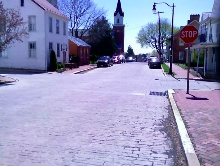
Last month Townsend Road had been newly “chipped,” that is, there was lots of fresh gravel on a tar base. It was the scariest portion of the century ride just trying to stay upright. Today the road looks like any other asphalt road.

Chip and tar but in great shape

In September I was leading a group of 6-7 riders down Burnside Bridge Road around 25-30 mph. We came to Antietam Creek and I wanted to capture a picture of the creek next to the road and a bunch of swimmers and tubers enjoying the last swim of the summer. But I couldn’t apply the brakes and pull over so that memory is engraved only in my mind.

Today I was able to stop and take a picture. No kids swimming. Just a beautiful scene.

Burnside Bridge Road, near Sharpsburg, Md., at Antietam Creek

At Sharpsburg I headed towards Shepherdstown. Bethany, Ashley, and my money attended here. But it had been a while since I had been to this quaint town. There is a historical marker on Rte 9 at the Va.-WV border that states that it had been urged to make Shepherdstown the nation’s capital. Interesting.

Shepherdstown, West Virginia

I had wanted to follow the bike path that parallels Rte 9 but discovered it ends with no access to Rte 9 (bicycles prohibited). I followed Rte 115 to Ranson not knowing where I was going. My sense of direction told me to turn on 17th Street looking for a way to Flowing Springs Rd then back to Ashley’s. However, it was a pleasant surprise when I followed this street and discovered that there was a back entrance to Ashley’s development. Who knew?

“City” of Ranson

Fifty miles and I was more drained than on any of the century rides I have done this year. Stupid wind.

A Windy Blair Witch

RANSON, WEST VIRGINIA

Visiting Ashley in Ranson, West Virginia, I decided to head out for a ride along the basic route of the South Mountain Loop, a 37-mile route for hybrids or mountain bikes, which originates in Brunswick, Maryland. Only one problem presented itself: I rode the route just once six years ago and would attempt to ride it from memory. I did pretty well, only missing one turn which I would do differently.

The day was cold and windy. Winds were constant at 20-30 mph with higher gusts. Temperatures were in the mid-30s to start and only climbed to near 50º (10º C) by the end of the ride. Everywhere there was a headwind. I don’t know how this could be but it was.

Instead of starting in Brunswick, I started in Ranson and followed US 340. When I crossed the Shenandoah River just upriver from Harpers Ferry, I turned on Chestnut Hill Road. From 340, Chestnut Hill Road looks almost impossible to drive up and does look impossible to bike up. But on a bike is where magic happens.

I turned the corner and kept climbing higher and higher. The GPS showed 12% then 14% then 18%. When it “leveled” off to 4% I decided to turn around and go back to the route I had planned. I descended at 45 mph. I could have gone faster but there was a stop sign, heavy traffic, a guard rail, and the Potomac River at the bottom.

I followed US 340 into and out of Virginia and across the Potomac River into Maryland. I passed beautiful farmland to Burkittsville, the location of the horror movie, The Blair Witch Project. It’s a lovely little village and I can’t say I saw any witches. But who really knows for sure? They don’t all look like Elphaba.

Welcome to Burkittsville

Out of Burkittsville, I climbed a ridge road along South Mountain before being dropped back into the valley then climbing up Reno Monument Road. At the base of Reno Monument Road is a large, slightly unkempt house on the left. You know, the kind where a huge dog is lurking ready to attack. Outriding dogs can present their own adrenaline rush but I’m not going to out pedal a dog while going up a 20% hill.

My dogdar (that’s like radar to detect dogs) was on full alert mainly because when I rode this six years ago I was chased by a big dog at this house. Yes – you remember those things.

I was quietly pedaling, not shifting gears, and generally trying to avoid disturbing any creatures who may live there. And then I saw him. A huge dog but I’m not sure of his breed.

And he saw me. Or she saw me. I didn’t want to get close enough to check.

The dog came flying across the yard and I dismounted and started being really nice. There was no way I was going to flee and kick in the dog’s chase mentality. I was on the right side of the road and the dog was to the left. I hoped that he wouldn’t come across the road at me. I walked a little saying stupid things he couldn’t understand like “nice puppy.” This completely killed my average speed for the day too. I should have paused the Garmin.

My break came when just as the dog was coming out of his yard a car came down the hill and almost hit it. Brakes squealed, the driver stopped and I used the car as a shield to sneak away.

Reno Hill kicked up to 20% but it was a relatively short climb. At the summit, there are some Civil War markers and a “Private Road” sign which invited me to ride.

Burkittsville, Md.

I turned left and was riding the very summit of South Mountain. A one-lane paved road with no traffic was great. I wondered where the road would end. I thought it was a U.S. Park Service one-lane road which perhaps made a loop. The grade was great for climbing. A lot of 12% with even higher numbers as well. After two miles I came to a dead end. Some government installation. Some secret government installation. I smiled for the cameras and turned around.

Back to the main road, I descended into the valley on the east side of the mountain. I missed the road that would have taken me to Chestnut Ridge and down to Harpers Ferry. But Rte 67 has a very wide shoulder and was a nice run into Brunswick.

As I approached Brunswick I saw the last road on the right and thought it would be fun to take it to Harpers Ferry if that’s where it went. It didn’t. It was a heck of a climb and ultimately I realized I was climbing for no reason that the road would not cross the mountain. I was right. I made a loop right back to Rte 67. Bonus miles.

I was not prepared for the distance with the climbing on this day. Or the wind. I climbed almost 6,000 vertical feet. Other than a small packet of Sport Beans (by Jelly Belly), I had no food and I ran out of water. I bonked and the thought of climbing back out of the river valley was too much. I pulled out my cell phone but no one answered my distress call.

My emergency funds consisted of two dollars in my saddlebag and were used to purchase a Snickers bar at the Exxon Station at the base of Harpers Ferry Road. Hunger solved. I made the 2-mile climb up the US 340 past Harpers Ferry to the plateau with ease.


The stats don’t show the entire trip because I reset the Garmin nine miles into the ride so I rode close to 66 miles. It was a good day but very tiring.

Verified by MonsterInsights