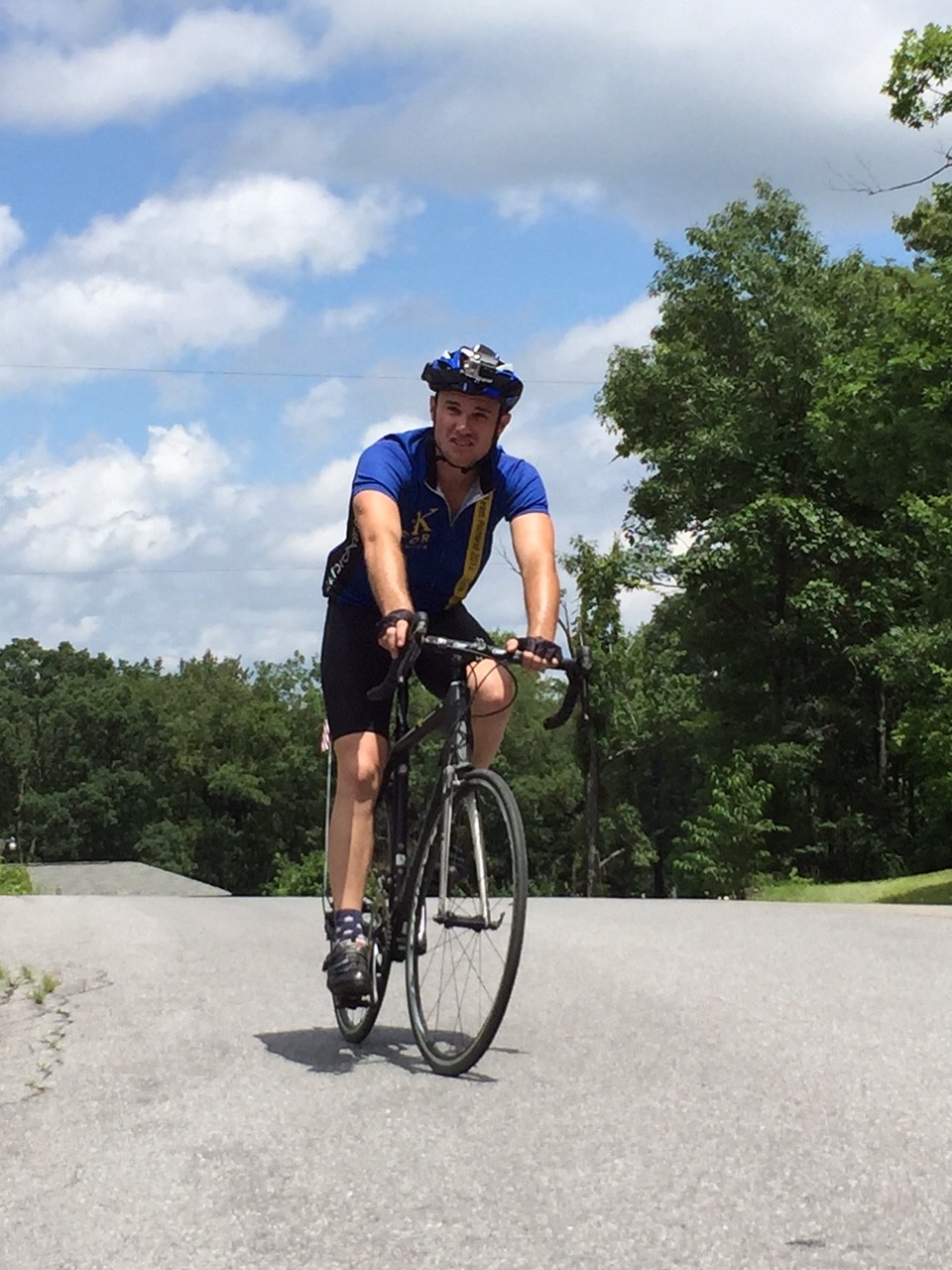
Seven years ago, almost to the day, I parked in East Freedom and rode up Blue Knob for the first time. Today’s circumstance would be different.
I was traveling to visit my father in the hospital in Johnstown and I thought this would be a nice way to honor him. Needing gas, I filled up at the Sheetz in East Freedom and then requested permission to leave my car for 90 minutes for a ride. Permission granted.
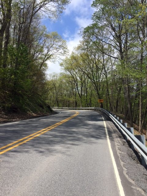
I rode over to the house that we lived in in 1958-1961. I took a couple of pictures then headed up Rte 164 towards Portage. The climb begins almost immediately although the first couple of miles it is mostly in the 3-4% range.
It is a highway, but a mountain highway. The road has no shoulders but relatively little traffic and all gave me a wide berth when passing. The upper portions seemed to hold steady in the 10-12% grade but with the curves none of the traffic was going too fast either.
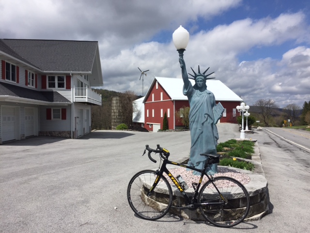
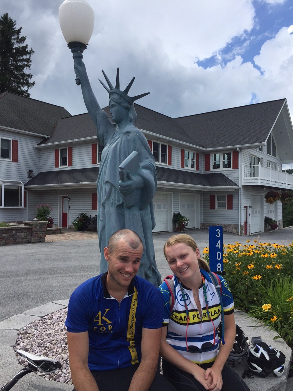
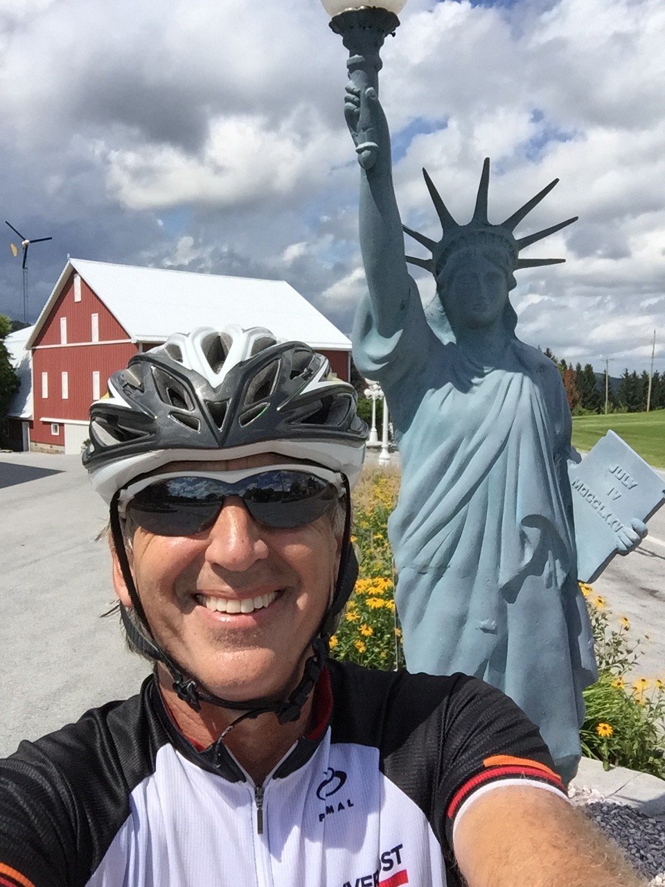
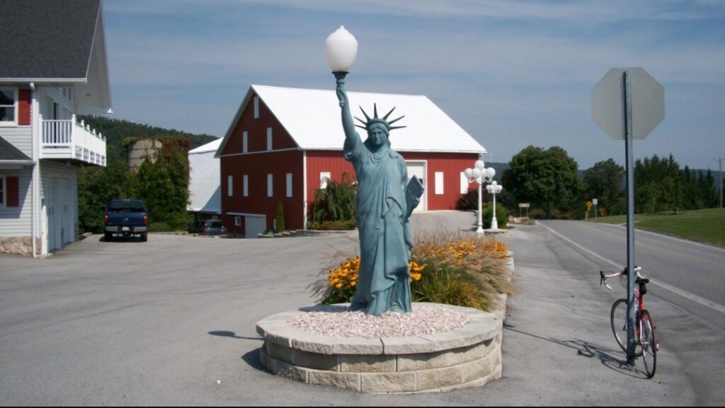
At the top I stopped for a photo op with Lady Liberty. The surprise is no longer there as it was seven years ago but it’s nice to take a picture.
From the top it’s all downhill to Newry. The road was a little rough but a nice ride. I wore arm warmers and was glad as it was a little chilly on the descent.
I continued past Newry to Reservoir Road then headed back to East Freedom. It wasn’t a long ride, just 21 miles, but all that I had time for. One good mountain climb and a quick visit to one of my childhood homes.
I drove to Somerset, picked up my mother, then we went to Johnstown. In the hospital I showed my dad the picture of that house and he was glad to see it. That made the ride very worthwhile.
It was June, 2008, when I first rode “The Wall” in Altoona. I knew it was special then and in 2009, it became my “escape from cancer” place to ride.
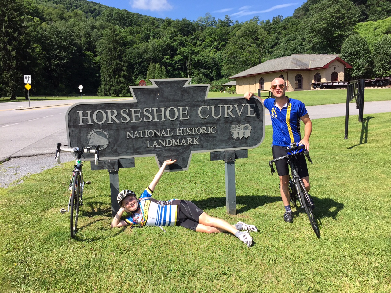
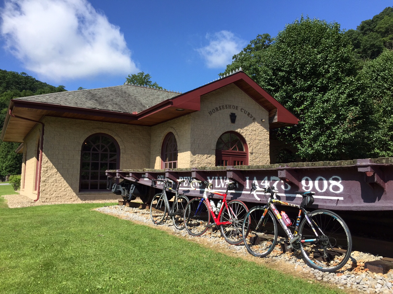
Horseshoe Curve
I have ridden it in spring, summer, and winter – but not fall. Interesting.
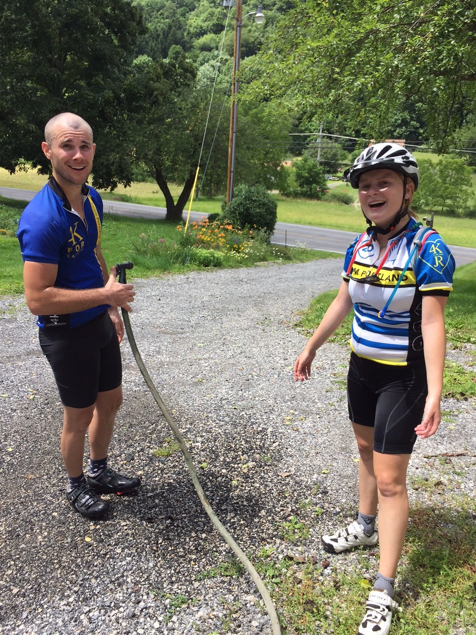
Chey, Chelsea, Barry
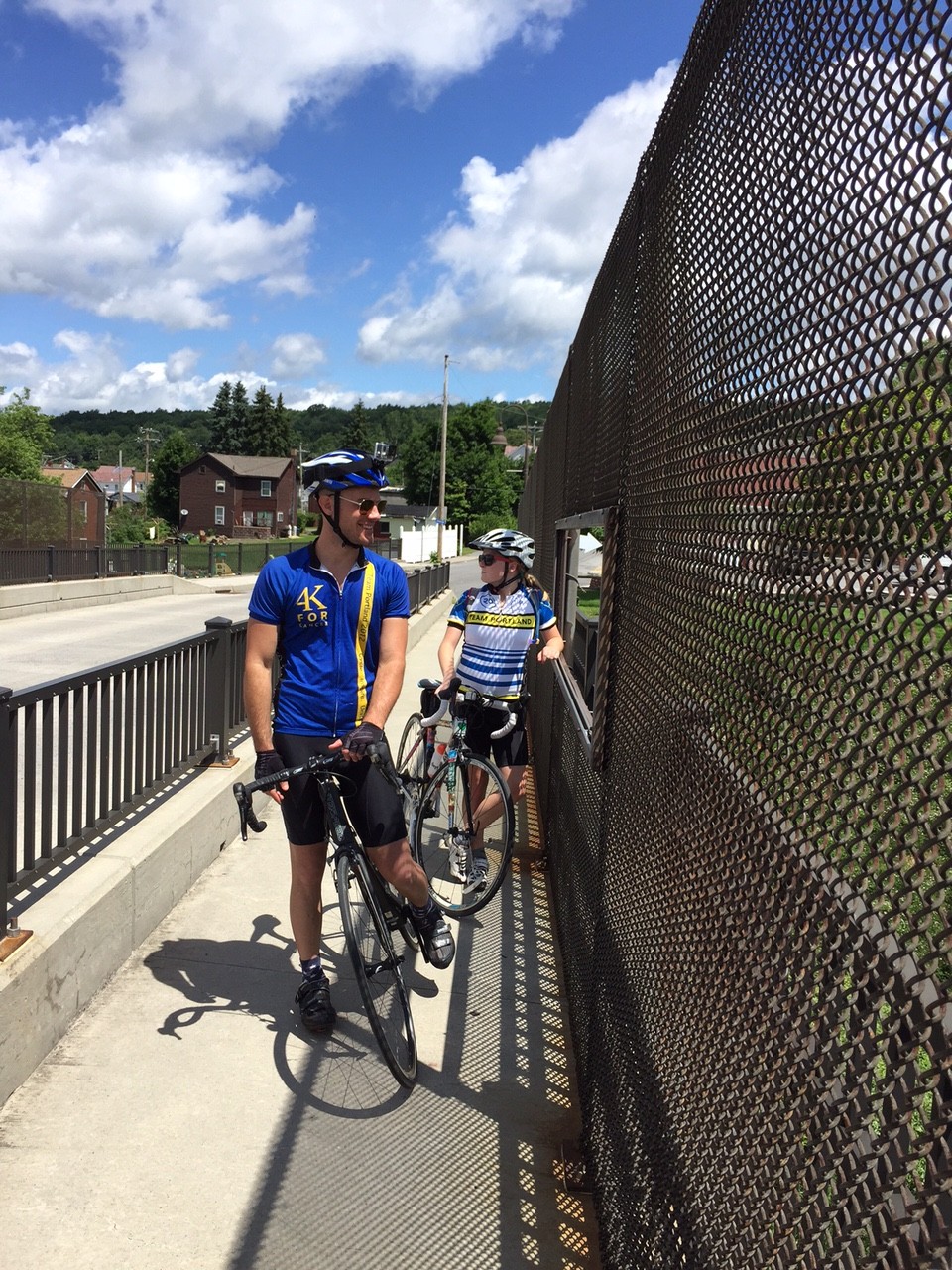
We had been planning for Jacob’s Hero Ride, a charity ride across Pennsylvania to benefit children’s cancer research and to honor Jacob Grecco. However, that did not materialize. But I promised two of the riders, Chey Hillsgrove and Chelsea Johnson, that we could still ride some in Pennsylvania.
Horseshoe Curve
Yesterday we rode in the Bedford Valley, now today it was our turn in the high mountains. I mapped out directions to Beale Ave. and Kittanning Point Road and we started riding.
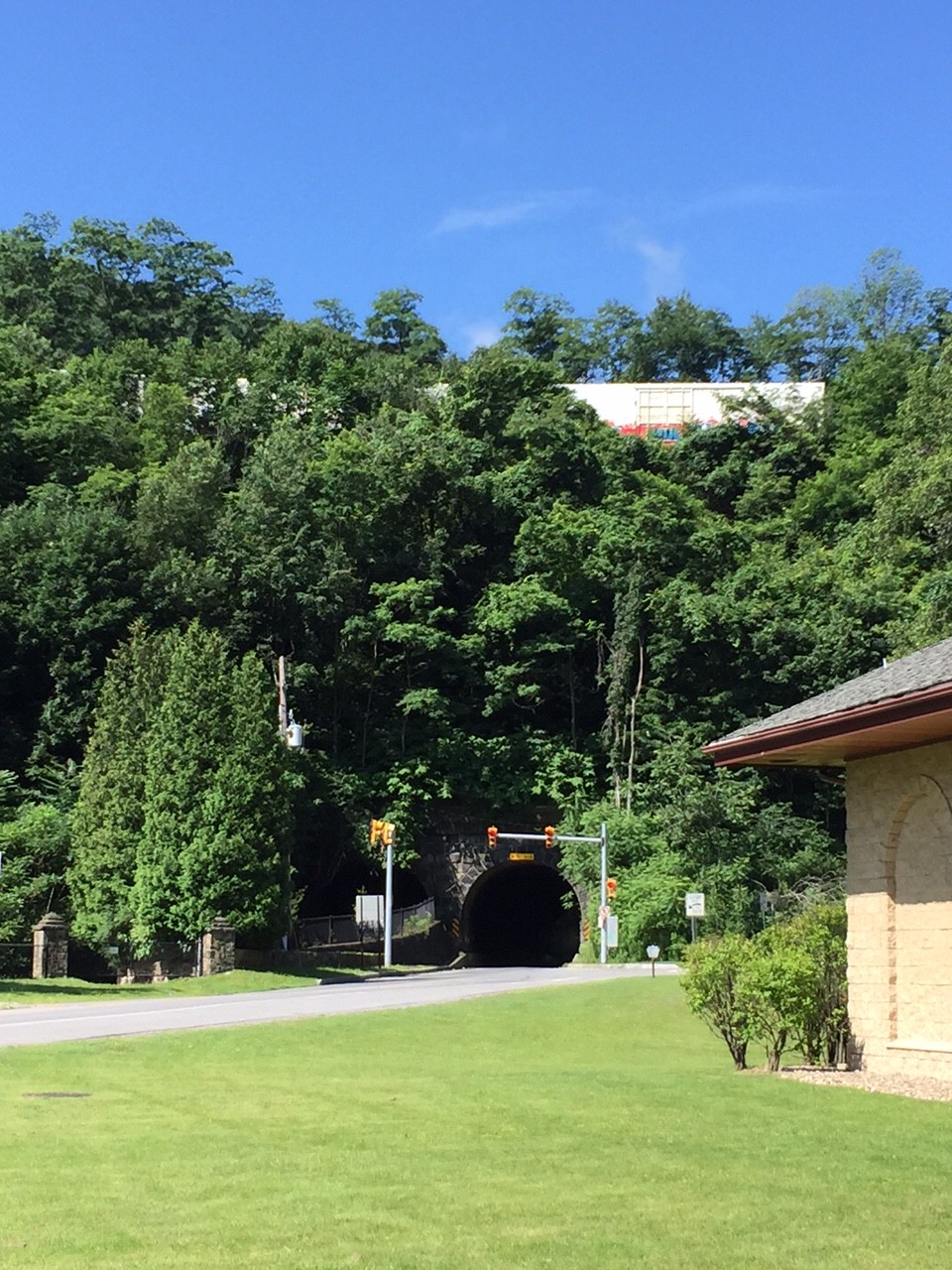
Horseshoe Curve Tunnel
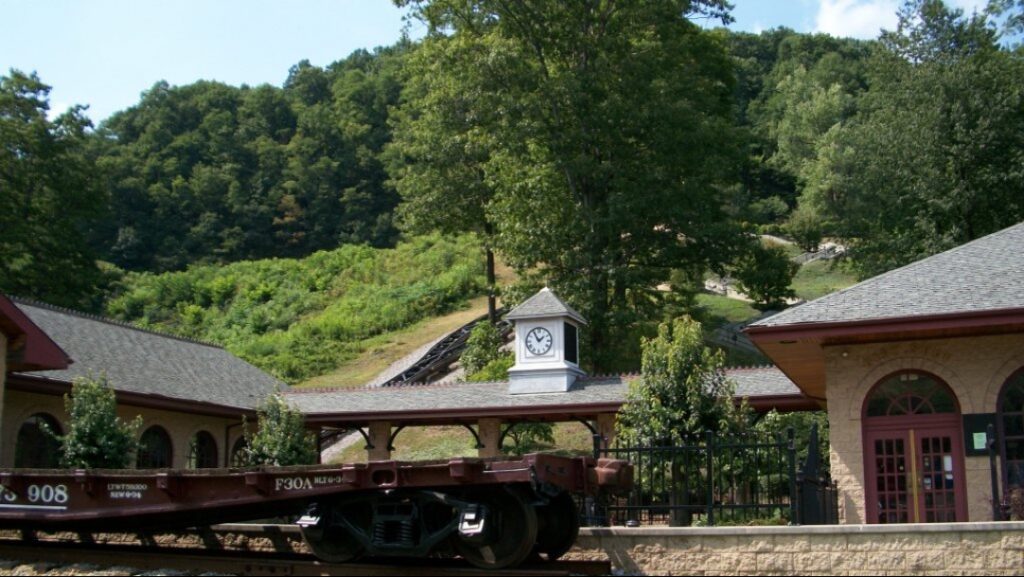
It was an easy ride up to Horseshoe Curve where we stopped for a photo op. Chey and Chelsea hiked the steps up to the curve where the trains go by while I stayed behind with the bikes. They got to ride the funicular back down.
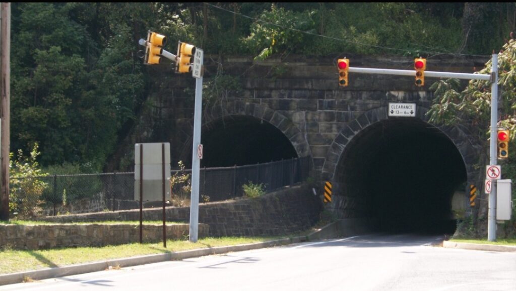
As we rolled out from the visitor center we had to wait at the tunnel for the light. A big truck pulled behind us and we motioned for him to move up. When the light turned green, he went ahead and we followed. He blocked any vision of the other end of the tunnel. Literally, we could not see the light at the end of the tunnel. For 15 seconds or so we were riding in pitch black as our eyes hadn’t adjusted and wearing sunglasses made it worse.
We did great on the climb and then – The Wall. I was worried about Chey’s bike – he was running a 39:23 setup. And Chelsea was simply worried. She stopped to start some music then made it all the way up. Bravo!!
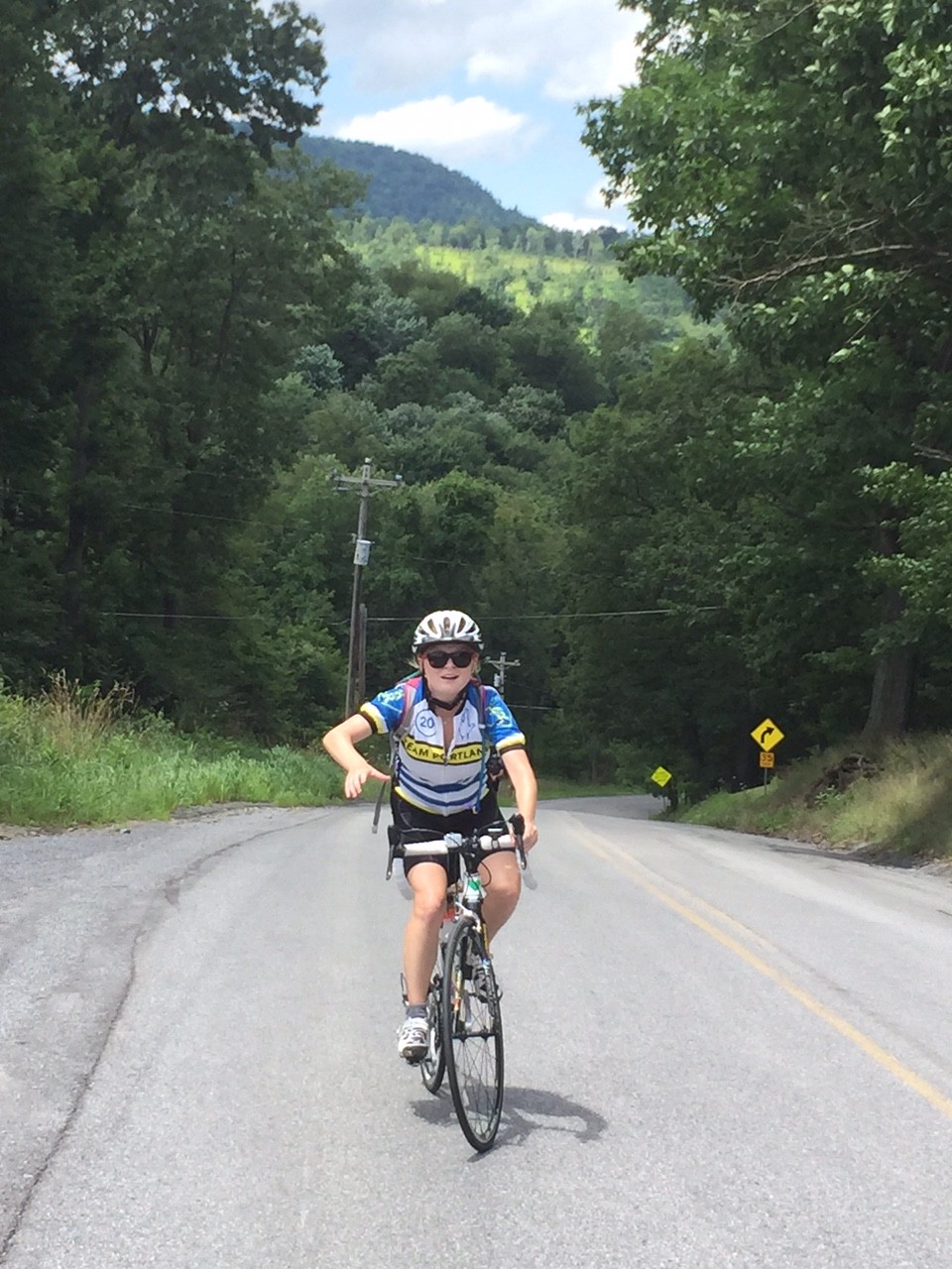
Chelsea Johnson on Valley Forge Road
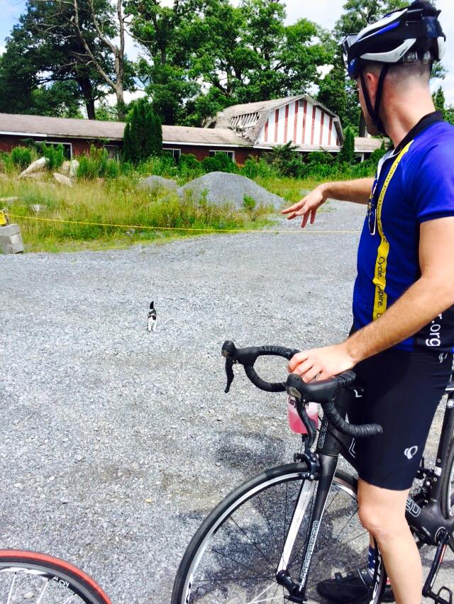
At the top, by the old Forest Zoo, we met a kitten with no collar. It may have been a feral kitten and I couldn’t quite tell if it wanted to be friendly with us or attack us. We left.
Credit: Chelsea Johnson
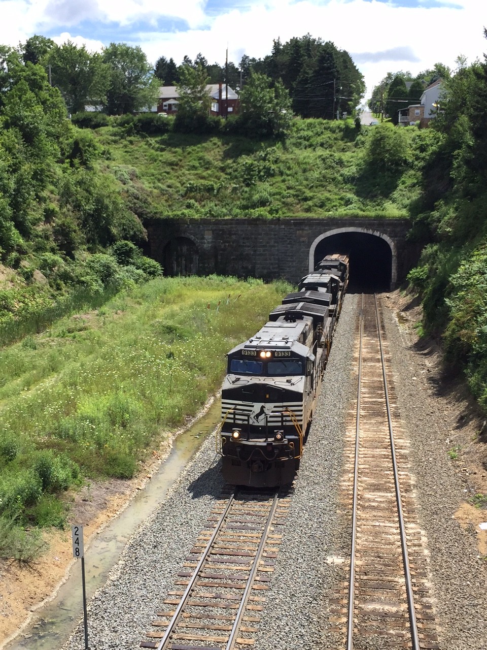
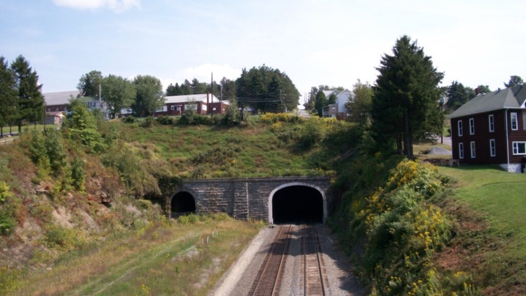
We went down into Gallitzin and viewed the tunnels where the trains headed to or coming from the Horseshoe Curve pass through.
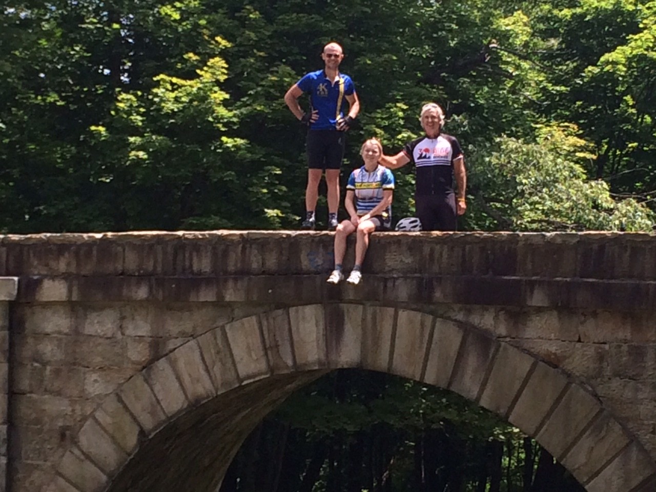
Chey and Chelsea on railroad bridge
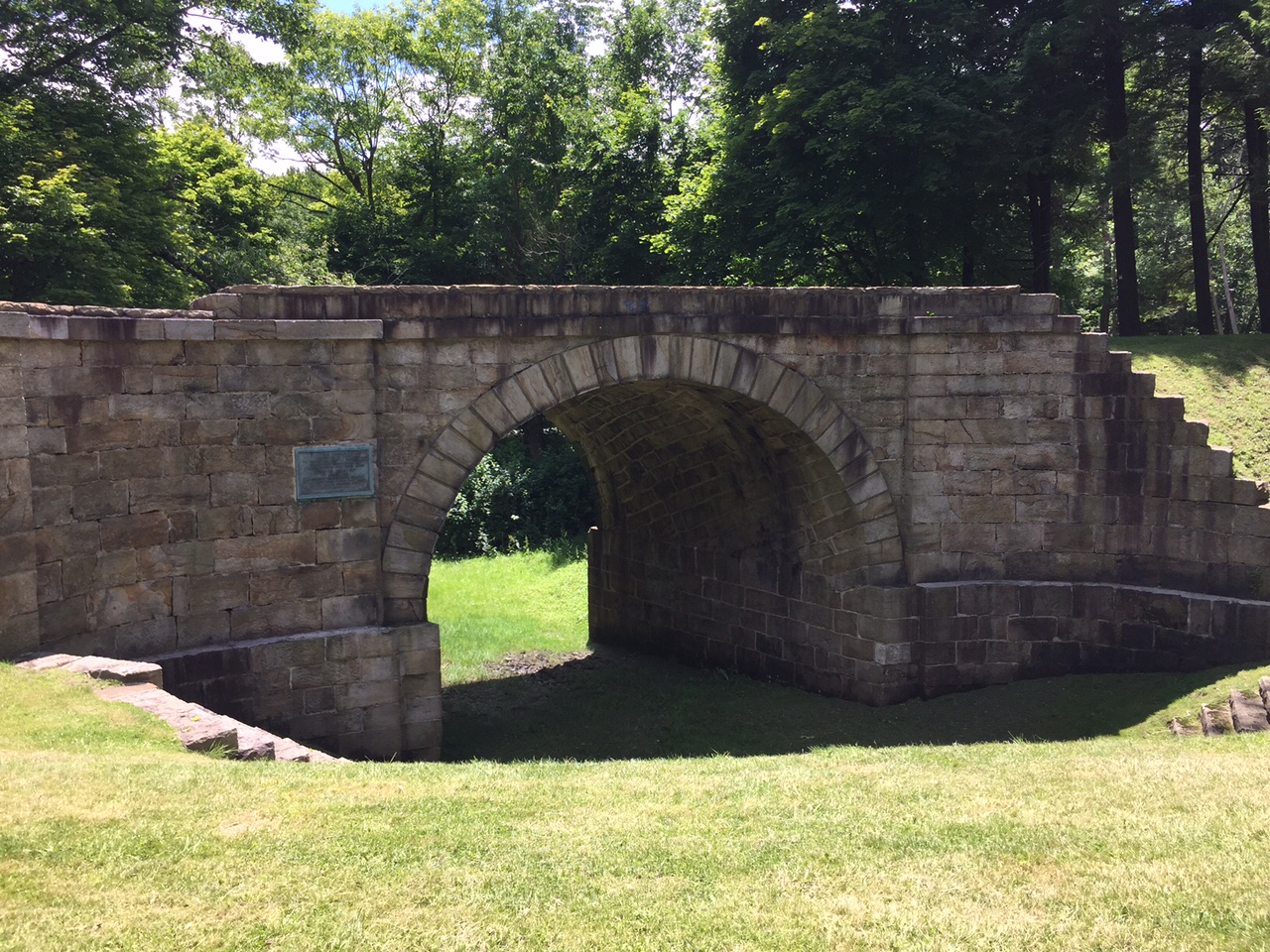
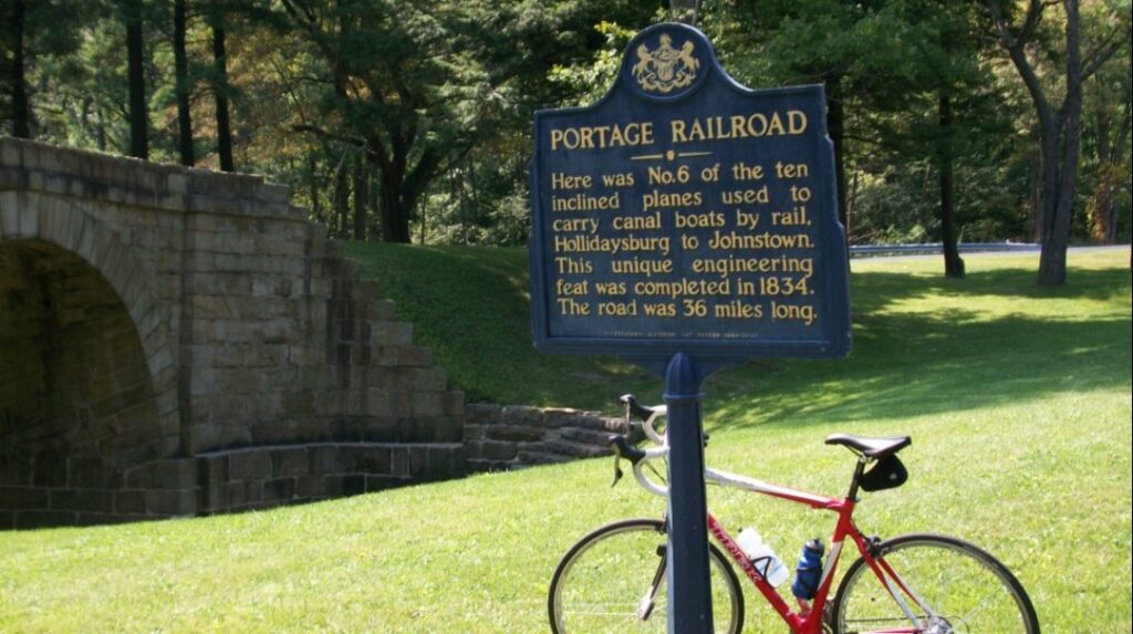
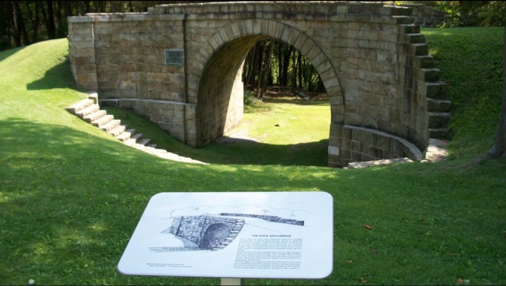
Then we headed through the Allegheny Portage Railroad National Site. We stopped at the stone arch bridge at “Six of Ten.” This was a bridge built for the Hollidaysburg – Blairsville Turn Pike over the Portage Railroad in the 19th Century.
CSX Train in Gallitzin Tunnel
The descent down Old U.S. 22 was great and we turned off onto Foot of Ten Road then onto Valley Forge Road. I had ridden Valley Forge Road two to three times prior but always in the other direction. This direction was definitely harder. There were two steep hills in succession.
Stone Arch Bridge
It was only one mile to the top of the first “boob” (because that is what Chey thought they looked like on the profile – and they did). And it was another mile to the top of the second one with a 14% kicker near the top. And although it was about a two mile descent to Puzzletown, that didn’t seem to be enough to recover.
Chey, Chelsea, Barry
I probably should have read the look in Chey and Chelsea’s faces, but I did not. It would have been good to turn onto Puzzeltown Road and head back towards Altoona. Instead, I made us climb.
We turned onto Old Knob Road. We began a 4.5 mile climb to the top where it intersected with Johnstown Road, aka 164. It started as a low percentage grade climb, mostly 2-3%, but grew as we went.
Chey Hillsgrove
I had slipped ahead of my riding partners and passed a house with two people outside. I greeted them and asked if I could get water. Karen Sell obliged and got me water. Then she saw Chey and Chelsea too. She got us all water and offered a water hose to cool down with. I cannot imagine finishing the day without this water stop.
Chey and Chelsea
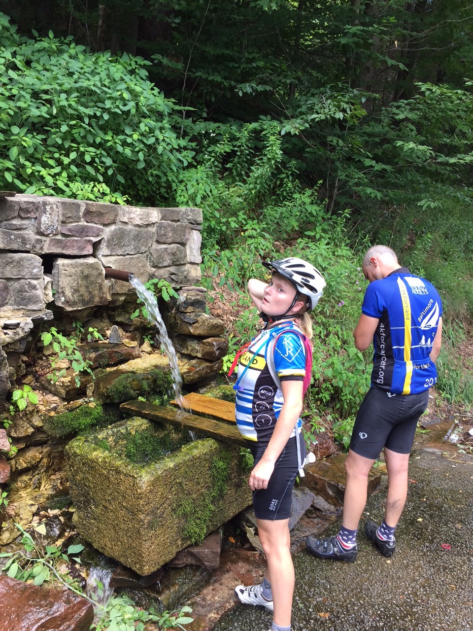
As we went up the road, again I pulled ahead. And then I saw it – a natural spring on the side of the road. Acting like a child, I put my head under the cold water. Three times. I waited for Chey and Chelsea to enjoy it too.
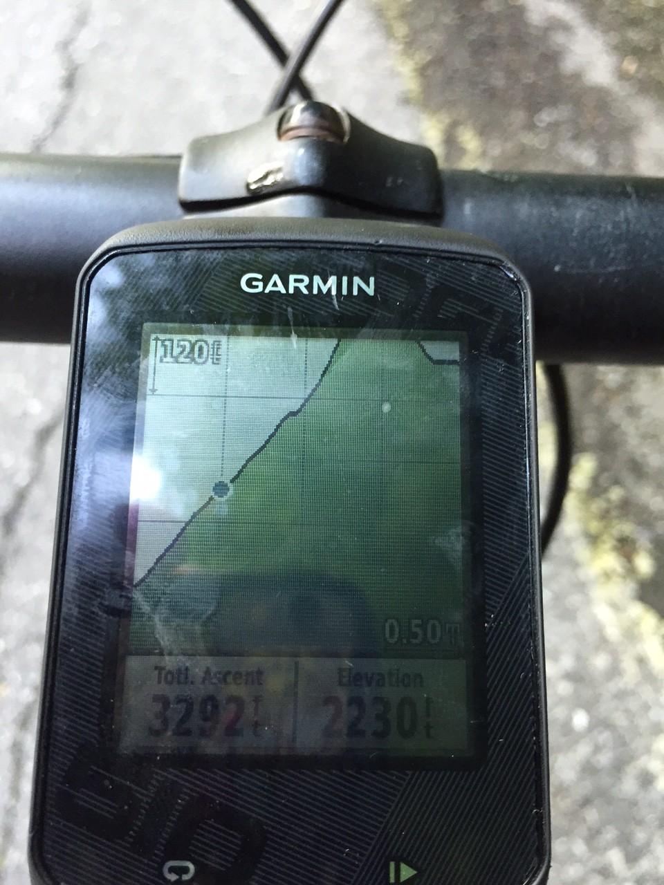
Garmin
As we continued I again pulled ahead. I looked at the profile on Garmin of the route I mapped and it wasn’t pretty. It kept going up and I knew near the end it really ramped up – to at least 14%.
Chelsea and Chey at spring
I arrived at the top and waited. I talked to a woman across the road. I talked to drivers who had come up the road. One told me my friends were “just around the corner.” I descended almost half a mile to find that corner.
Steeper than I thought
As they reached the summit we heard thunder and saw lightning. Oh oh! But we had a seven mile descent to East Freedom. We could see the mountains where it was raining but managed to avoid it. Until..
…We reached East Freedom and the skies opened up. I rode ahead hoping Chey and Chelsea would follow. I knew there was a Sheetz just ahead where we could seek shelter.
Chey and Chelsea
We got in and Chey and Chelsea ordered real food. I grabbed a Snickers and Chelsea chastised me about getting real food. I told her a Snickers was real food – hadn’t she seen their commercials?
It was storming and I didn’t see the need to expose three of us to lightning. I offered to ride back to start and get the car. Chelsea and Chey readily agreed.
I started out to find Reservoir Road – which was closed. It was barricaded and I didn’t see it in the rain. I went ahead to Plum Creek Road and hoped it would take me there. I checked my maps and knew I had to retrace my route. Damn. I just added three miles.
In fact, without worrying about other riders, I probably should have found Rte 36 which was the shortest way back. But I still don’t know how safe it was. Especially in the rain.
I was in and out of two more storms before reaching Altoona. But I made it back safely, retrieved the car, then retrieved Chelsea and Chey from Sheetz in East Freedom and we all headed back to Maryland, Delaware, and Virginia.
I am proud of my friends’ efforts today. It took longer than we planned but we enjoyed the Horseshoe Curve, the Gallitzin train tunnels, talking to a woman about the Portage Railroad, and having Karen rescue all of us with a water stop.
Barry after a climb
I had not ridden this direction before, and if I had thought about it more, we would not have gone in this direction. I made the decision in part because I wanted to tackle The Wall first while the weather was good.
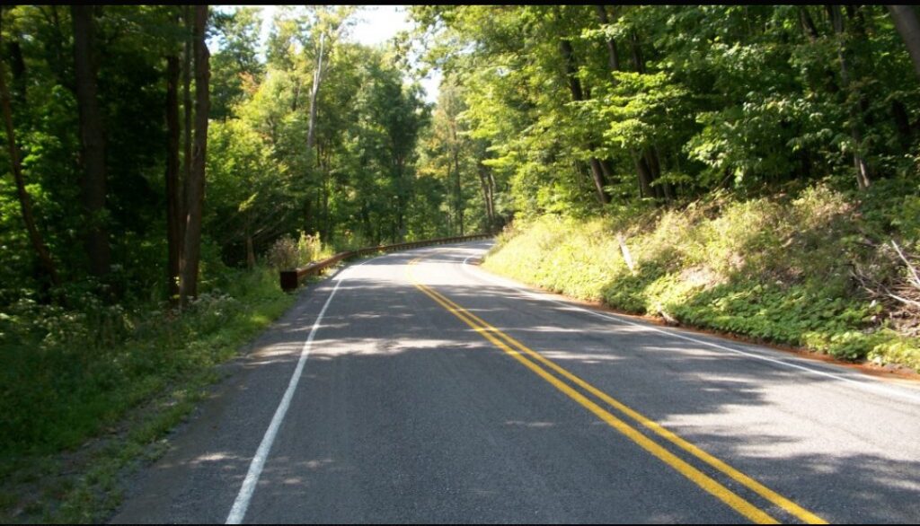
But it comes down to paint on the road. Even in the mountains, these roads kick up, but if they have paint on them (lane markings) they rarely go beyond 12% and usually no more than 10%. Johnstown Road (164) out of East Freedom is a road with paint. We rode down it. Likewise, Old Rte 22 is a road with paint. We rode down it. (I have ridden up them before.)
The back country roads don’t have paint. They’re not graded for heavy traffic. Glenwhite Road (Horseshoe Curve), Valley Forge Road, and Knob Run Road don’t have paint. Or if they do they just have center line paint and not edge of road paint. They also have ramps of 14-19% grade. We rode up those. But now I know – it’s about the paint.
Correction: See that 14% grade? It has center yellow line paint. A major road. Yikes!
It was a tough day. But we all made it. And had fun.
My early season riding began with a climb to the top of Blue Knob Ski Resort and included back-to-back weekends in August climbing Horseshoe Curve’s 18% “wall.” It is simply one of my favorite places to ride. But my cancer diagnosis made these mountains even more special. It was here where I could get away from cancer and find peace on my bike.
With Fall approaching and my season hitting the “wall” quicker than when climbing it, I took the opportunity to go to East Freedom, Pa. for one last ride in the mountains as I fully fight this cancer battle.
Statue of Liberty at Blue Knob
My ride took me up Pa. Rte 164 to the crossroads at Blue Knob. This was a seven-mile climb with long sections of 8% grade. It is a two-lane road with no shoulder but not heavily traveled either. And every single car gave me a wide berth when passing.
At the summit, I found a taste of New York. Their very own Statue of Liberty. Who knew?
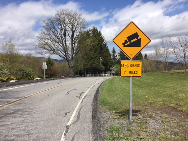
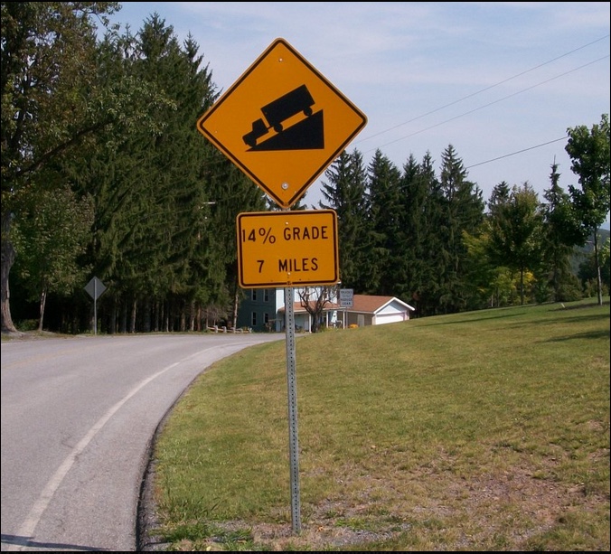
14% Grade
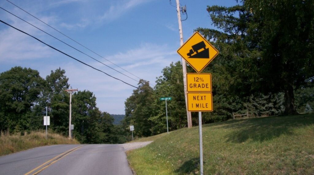
I spotted a sign — “14% grade (next) 7 miles.” It was heaven! Nowhere can I find an equivalent grade to Mount Washington — 7.6 miles at 12% average. But this held promise. At last, a training ground for Mount Washington.
I braced for my descent because 14% can be quite dangerous on a bike. But it wasn’t to be. By my calculation, there may have been a section that was 10% but it didn’t last long. And it soon flattened out. Who makes these road signs anyhow? It was just a tease.
Also by my calculation, and my gut feel on the bike, from Blue Knob to Puzzletown was 4.5 miles at a 5% grade.
Allegheny Portage Railroad
From Puzzletown (can anyone figure out what they do there?) I traveled Valley Forge Road and found a sign for a 12% downgrade was close to an actual 12% which led to a 12% climb. Or more. But only for a mile down and a mile back up.
On Valley Forge Road
Reaching Old U.S. 22 I had a 5½ mile climb to the summit. For much of the climb, there were two lanes upward, divided, which meant that cars could easily move to the left lane to avoid getting too close to me. I rode on the right side of the white line but for a long stretch, there was very little shoulder. Yet more often than not cars gave me no berth and two idiots honked their horns at me like there was somewhere I could go. Into the woods, perhaps.
For about 30 minutes my mind was playing games trying to analyze why most drivers on a two-lane road would give me wide berth and cross into the oncoming lane and these drivers wouldn’t move over to the empty lane that was going in the same direction. Old US 22 would be used mostly by locals — locals who may believe it was faster and should remain faster than getting on the new US 22. Locals who believe the road belongs just to them. I just don’t know. Maybe people are jerks. A revelation.
Allegheny Portage Railroad
I never visited the Allegheny Portage Railroad Historic Site and always wanted to. And today I could. I am always intrigued by old-time engineering marvels and this was one of them.
Allegheny Portage Railroad – Lemon House
Operating from 1834 to 1854 it was built to carry barges from Johnstown to Hollidaysburg which connected river traffic between the Ohio and Susquehanna Rivers. It consisted of 10 inclined planes (think of the Inclined Plane in Johnstown or the Duquesne or Monongahela inclines in Pittsburgh).
Allegheny Portage Railroad – Incline Number 6
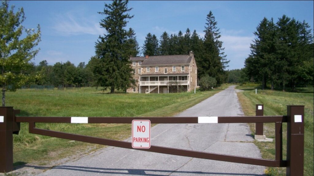
At the summit I was looking for a road over to Gallitzin but never found one. I saw a truck with U.S. Government Plates and stopped it and asked for directions to Tunnelhill. When I balked at the park ranger’s first suggestion, riding on U.S. 22, she told me to cut through the Allegheny Portage Railroad Park. Even though it was gated, she assured me that I could and I was surprised at the site and delighted in that it did take me to Tunnelhill Street.
I was glad I did. I would have never seen the Lemon house, other than from the road, or the tracks of Incline Number 6.
In Gallitzin, I met a local who encouraged me to go to the Gallitzin tunnels. He didn’t tell me the road to them was straight down. But it was. One can stand on a bridge and see the trains coming through the mountain. I wonder what’s it’s like to live above the tunnel?
Imagine living above a train tunnel
The climb back up to Tunnelhill Street was a neat 14-16% grade. But at 27 miles, that would be the last real climbing of the day.
From Gallitzin, it was a straight shot down Horseshoe Curve Road (Glenwhite Road) past the famous landmark and three reservoirs.
Horseshoe Curve
I’m not complaining because every ride up Horseshoe Curve is a good ride but who the heck thought of a process called chip and tar? The descent down to Horseshoe Curve can be screaming, especially when coming down off The Wall but the upper portion of this road had recently been chipped. Or tarred. Maybe just chipped. Without tar.
A 4-mile climb to the summit, sections of 18% grade and a 200′ tunnel. Life doesn’t get any better than this.
There were no line markings. Descending was tricky because with the loose gravel, er, I mean “chips,” one could easily slide out. Once I got to the good pavement I could let it roll.
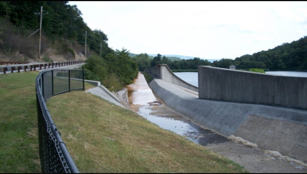
Because of mine drainage, there are channels to keep the acid water out of the reservoirs
The rest of the ride was simple exploring as was all but the Gallitzin to Horseshoe Curve portion. I wrote down some simple directions and followed those but was unsure when I was in Hollidaysburg where I should travel to next. There was a service station with a store and I needed to replenish my water.
I walked into the convenience store and it reeked of cigarette smoke. All I could see was shelves of cigarettes and chewing tobacco. I turned to the sales clerk and asked “do you sell anything healthy in here?” I’m a jerk.
When she asked what I meant I simply asked for water. Outside was a visibly pregnant mother smoking, waiting with the dog while her husband bought more cigarettes. I wanted to scream at her “GIVE YOUR CHILD A CHANCE!” But would good would have it done? I am reminded that this is still Appalachia and a cyclist with shaved legs wearing Lycra is the stranger here.
Actually a very steep portion of Glenwhite Road
I will miss riding in Altoona. Each of my trips involved meeting special people. On the first, I met John Griffin who lives in a house where I lived 50 years ago. He invited me in. On the second and third I met and rode with riders from Spokes and Skis — Joel, Richard, Bryan, and Stacey. Also there was Stephanie from Panera. And today I had a park employee let me cut through the park, a local send me to the tunnels, and two others point me in the right direction when I was unsure. Really unsure.
I’m afraid this is the end for a while. I have hit the wall.
I parked in East Freedom, Blair Co., at the elementary school. It started out sunny and seemingly warmer than it was. I wore a jersey and arm warmers. I soon realized it was cooler than I thought with temperatures never climbing more than the mid-50s. I slipped on a jacket that was in my back pocket.
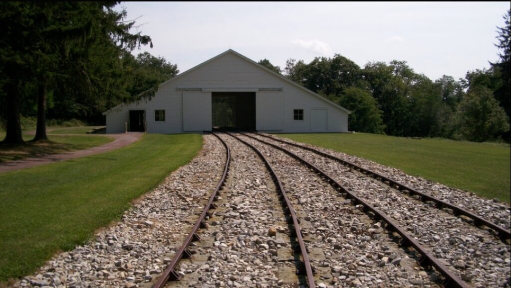
My route took me down the valley and around the base of Blue Knob. Blue Knob is both a State Park and ski resort. At 3,127 feet (953.1 meters) it is the second-highest peak in Pennsylvania, second only to Mount Davis in Somerset Co. (3,212 feet).
After 22.5 miles the climb began at Pavia. The Blair Bicycle Club listed the climb as almost five miles at 7%. They listed a 25% section which I did not find. But the distance was right and it was a nice climb. I think two cars passed me on the way up so “lightly traveled” might even be an understatement.
Blue Knob Ski Resort
It was a ghost town at the top if one building, a ski lodge, constitutes a town. If I needed a place to get more water or food and had counted on this, I would have been out of luck. Actually, I was counting on this but on this cool day, the two bottles on my bike were enough.
The descent from Blue Knob was a little scary. The first mile of the descent was steep and in horrible shape. There were many potholes and lots of loose gravel. The steepness necessitated riding the brakes but the gravel made it dangerous to use them.
The wind was blowing and it was cold — in the mid-40s, and I was still soaked with sweat from the climb. But after the first mile, the pavement improved. And once I reached Ski Gap Road it was a long straight 2-3% descent back down to Claysburg.
At Claysburg I had to return to East Freedom. But the road I was on, Bedford Street, was lightly traveled and in great shape. This would be a great place to live to ride. One can stay on the flat roads of the valley or head to the mountains.
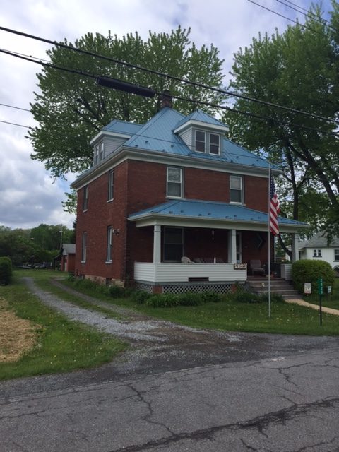
And then the most surreal part of the ride. In East Freedom, I saw a man mowing his lawn. I first went by him then something said to turn around. I did and I caught his attention. I introduced myself and then told him “I used to live in this house.”
John Griffin immediately said “well you have to come in and see the house.” He proceeded to take me room by room while I was wondering “was this the house I lived in when I was three or was it the house next door?” But eventually, I figured out that it was the right house and gave him a little history to go along with what he gave me, namely, the house was built in 1910.
Afterward, it was a quick trip to Panera in Altoona for some refueling and lunch with a special cousin. This was an incredible day. It was a trip over a mountain and back in time.


Recent Comments