The alarm didn’t go off. It didn’t need to. I was up at two minutes before 4:00 a.m. and decided I would drive to Pennsylvania and ride a portion of the Great Allegheny Passage Trail.
Supporters of the Big Savage Tunnel at Deal
Although I have ridden on the trail many times (all in sections except one through trip from Pittsburgh to D.C.), today would be different. I was going to provide “trail magic.”
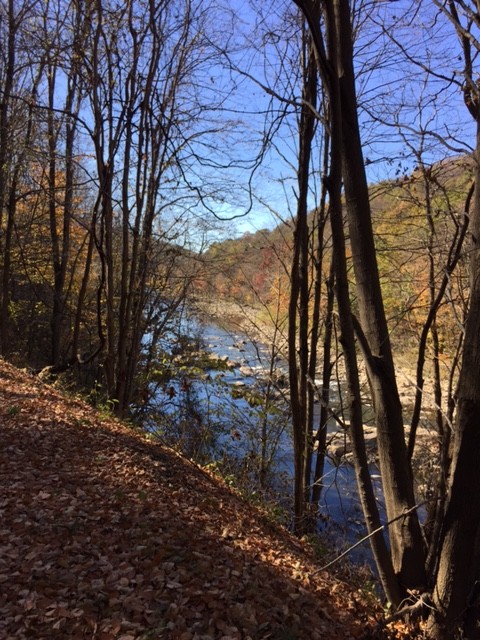
Near Meyersdale
Trail magic occurs when people on the trail experience the magic through the kindness of a stranger. Usually, it will be food or water. But it could be a ride too. I left home and stopped in Cumberland to load up on ice. I had purchased water and snacks before and was all set.
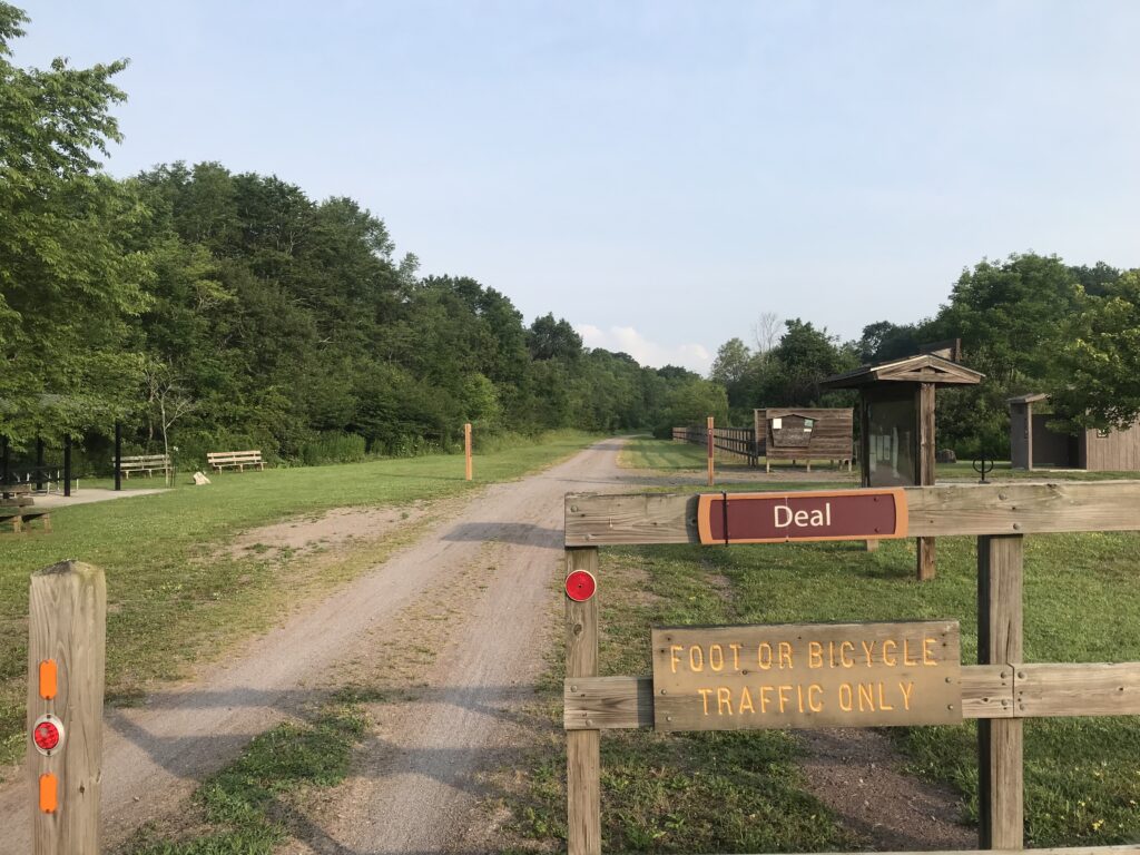
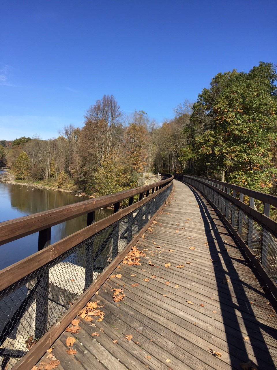
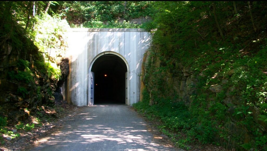
Trailhead at Deal
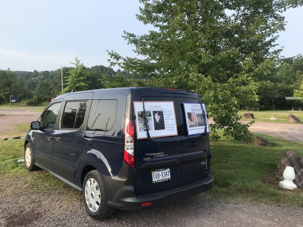
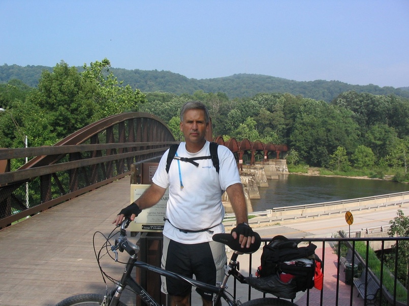
I parked at Deal Road. At 7:45 a.m. I pedaled off towards Ohiopyle. My trail magic was directed at the Texas4000. Although their website indicated that they would be on the trail this day, I never ran into them. It would have been a grand gesture but just didn’t work out. Just south of Markleton I turned around to head back.
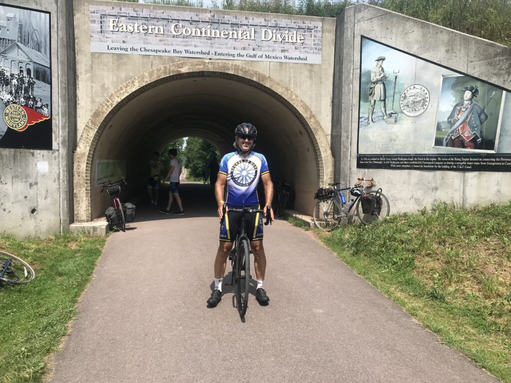
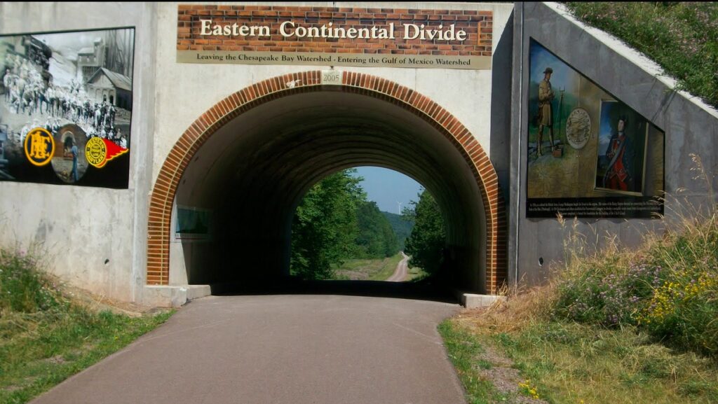
Eastern Continental Divide
Although disappointed, I was prepared for this possibility and would make the best of it. It was a beautiful day. I was on a bike. It would be a great day.
Near Meyersdale
When I had passed Rockwood there was a volunteer standing at her “welcome center.” She asked me to sign the guest book and I told her I would on the way back. So now, on my way back, I stopped and signed the book. Name. Address. Comments: “Pave it.“
Salisbury Aqueduct
This trail is so nice but how much nicer would it be with a fresh coat of asphalt. I rode my gravel bike (Checkpoint) but with road tires (32s). And that was easy enough. 28s or 25s would have been OK too. But crushed limestone is a tad bit harder to pedal than asphalt. Mostly for me, it’s the dust. My water bottles were coated with fine limestone dust and it tastes gritty even if it really isn’t.
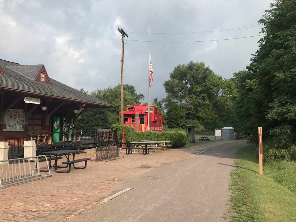
Meyersdale Station
I caught a young woman, Hannah, near Garrett. She was leaving Rockwood when I was signing the guest book and was far enough up the trail that I assumed she had jumped off at Rockwood rather than continue on the trail. I asked her where she was headed and she said the Eastern Continental Divide. I told her I was too if she would let me ride with her. She said that would be fine.
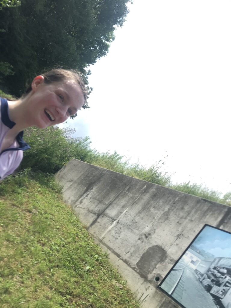
Hannah. Not sure if this was an accidental selfie but it was on my phone.
Hannah was from Cedar Rapids, Iowa, but is now living in Morgantown. She came to Ohiopyle to ride her first Century. So we talked all the way to the Continental Divide. When we turned I insisted that she stop and get some trail magic. And she was happy too. I had ICE – and the temperatures had crept up to the high 80s. I gave her a cold Gatorade to take with her as well.
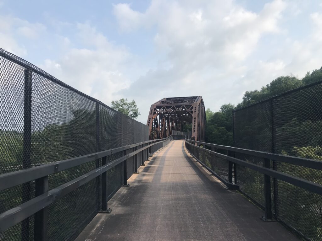
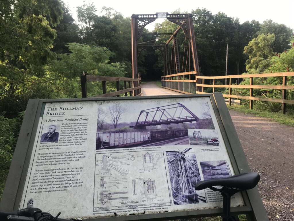
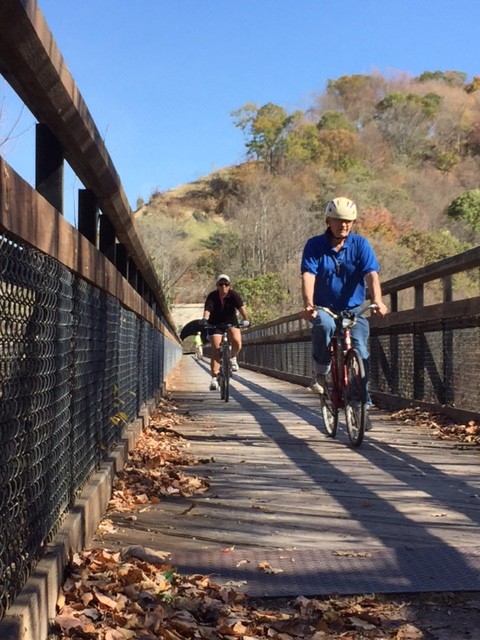
Bollman Bridge
As Hannah was leaving I rode with her another four miles towards Meyersdale before wishing her the best of luck and turning around. Then I returned to the car. It was just in time as two women and a man were sharing what little water they had left. I invited them to my car for some trail magic. Ice. And water.
My car at Deal
It didn’t work out for the Texas4000 on this day (I learned they were wheels down at the ungodly hour of 5:00 a.m. and I just missed them at Deal) but it did for other complete strangers. That was fun this trail magic thing. And an added bonus. My name is on a plaque at this stop.
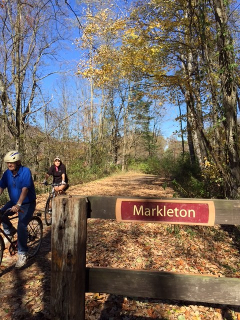
I told my sister, Betsy, that I would meet her and Dad at Markleton, Pa. on the Great Allegheny Passage. Betsy followed him to Fort Hill, where he left his Jeep, then the two of them drove and met me at Markleton. It was in the low 60s but absolutely beautiful.
GAP near Markleton
I chose this route because of the newly opened Pinkerton tunnel. Also, my dad hadn’t been this far on the trail. I knew it trended downhill from Markleton to Fort Hill and packed a lot of scenery into its five miles.
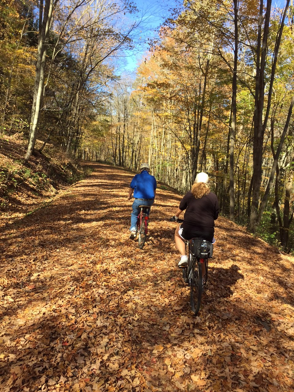
GAP in the Fall
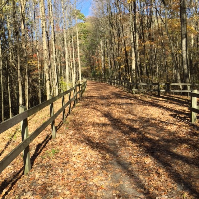
With leaves mostly still on the trees in Northern Virginia, it was strange to be here where most leaves are on the ground. The trail was fully covered in places.
Casselman River near Markleton
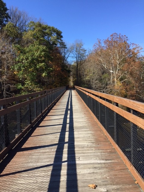
Words cannot describe how pretty the trail is. We went a couple of miles then came to the Pinkerton Trestles. It was probably 10 years since I last rode through here which was always Trestle – Detour – Trestle. And that was a beautiful route.
Dad at Pinkerton Low Trestle
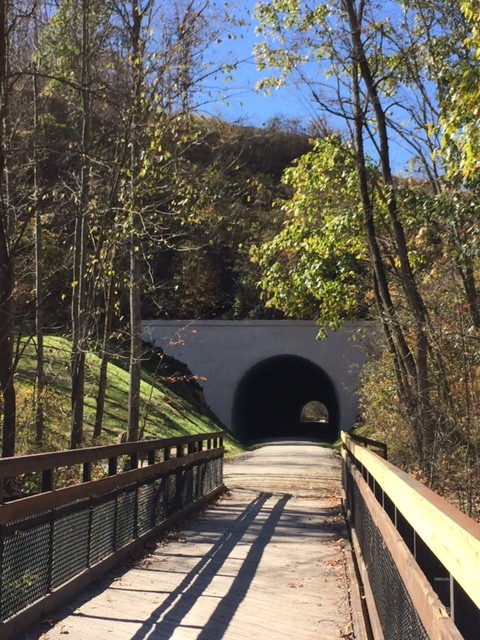
Prior to the tunnel, the trail followed the railbed across the Pinkerton Low trestle. Rather than enter the tunnel, there was a one-mile detour out and around the tunnel which followed the natural flow of the Castleman River. But with the tunnel open it was now a straight shot from trestle to tunnel to trestle.
Pinkerton Tunnel
With the tunnel opened, it was even more beautiful. Although the trail trended downhill, it is mostly flat. One can’t coast but pedaling is a little easier in this direction. We were in a heavy forest and with leaves on the trail one could not see the surface of the trail.
Heavy leaf coverage on the trail
And then – the trestle. We came to the Pinkerton trestle although we didn’t stop on it. We saw the tunnel and kept riding. It is not lighted, one would be helpful but is not necessary.
Pinkerton Tunnel
At the far end, we were on the Pinkerton High Trestle. We stopped and took pictures off of this one.
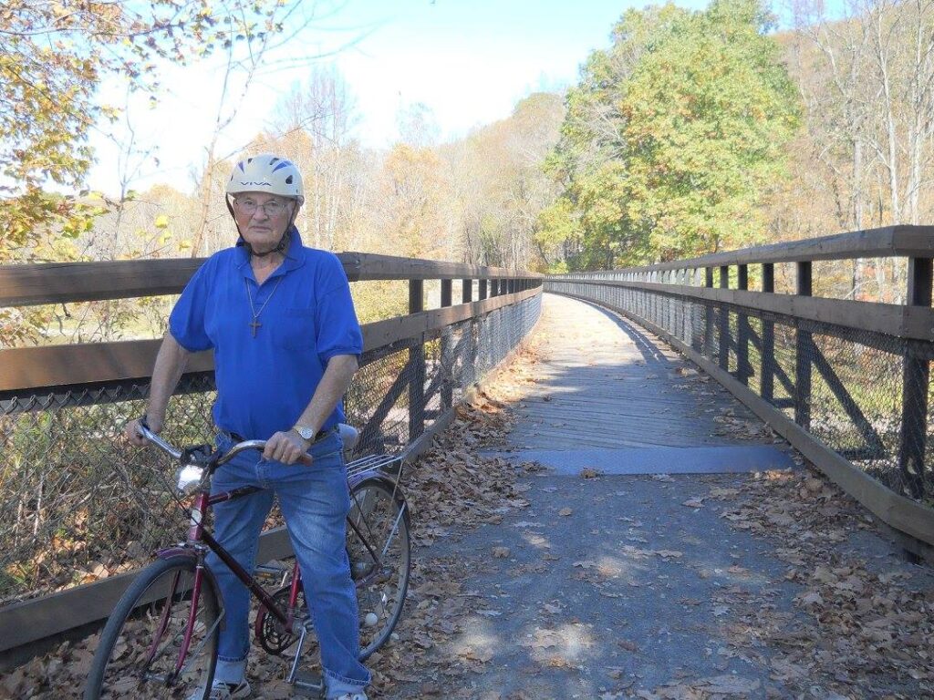
Besty and Dad on the Pinkerton High Trestle
Reaching Fort Hill where his Jeep was parked, my dad asked, “Is this the end?” There was resignation in his voice but he wanted to keep riding. I was worried that if we rode four miles down to Harnedsville it would be too much for my 86 year-old father to ride another four miles back up to his car. I grabbed his keys and drove his Jeep down to Harnedsville. And so we rode.
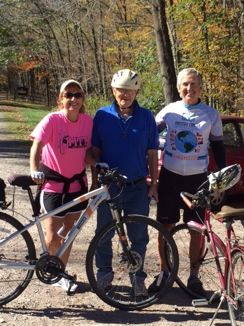
Besty, Dad, Barry
Betsy and my dad rode ahead. Arriving at the trailhead with his Jeep, I rode back up to the trail to meet them and we then continued to the Harnedsville trailhead. At the end, we got a little concerned when he went into the middle of the road where the trail crosses. He stopped. This is a road normally lightly traveled, but now there was a car coming from each direction. Betsy yelled “Dad!” I got the attention of one car and motioned for him to slow or stop. All of a sudden it clicked and Dad said “OK!” And then he moved. Whew!
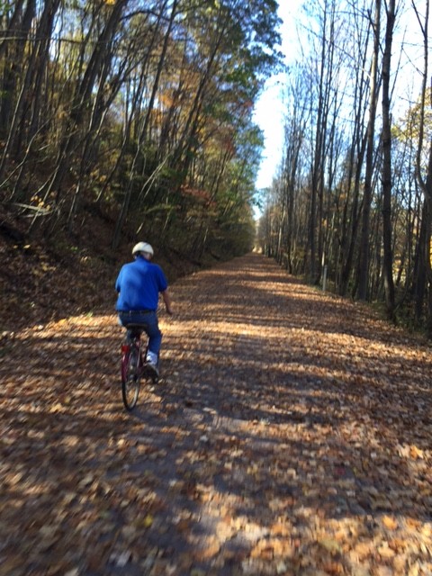
Dad near Markleton
Although my Dad wanted to ride ahead and look at a church in Harnedsville, there was no way we were going to ride on the road with him. I loaded his bike in his Jeep and he drove home.
GAP at Confluence
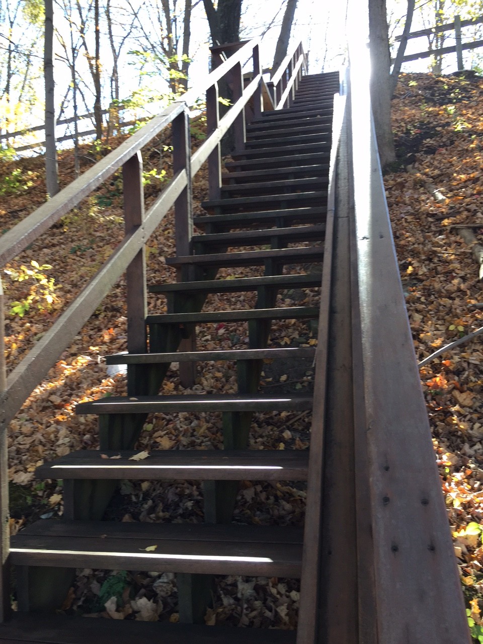
Betsy and I rode on down to Confluence. We looked for a place for a snack and found stairs leading from the trail with a bike trough to walk the bikes. The problem was the trough was on the side and not in the middle so the pedals hit the supports as I pushed the bike. Oh well.
Stairs from the GAP, Confluence, Pa.
We grabbed some cookies and a drink then rode back up to Markleton. What a gorgeous day on a bike.
Confluence overlooking the Youghiogheny
UPDATE: (SEPT. 14, 2016) – This post has been updated to “My Last Ride With Dad.” With each ride, we wondered if this was our last ride with him but this ride had more of a finality to it than the others. My dad seemed a little out of it standing in the road and I worried for his safety going home. He made it safely and then promptly sold the Jeep.
He never talked about it but looking back I sense he knew his mind was failing and that it was best to sell that beat-up Jeep he loved so much. We were just talking about another ride this spring when he fell in April. I wanted one more ride. I looked first at recumbent bikes. Handcycles. Tandems where I did the work. Ultimately, he would never ride again. And on this day we said our final goodbye to him we were thankful for the rides we shared with him. We were the lucky ones.
Oh, Lord, you delivered Daniel from the lion’s den Delivered Jonah from the belly of the whale and then The Hebrew children from the fiery furnace So the Good Book do declare Oh Lord, Lord if you can’t help me, For goodness sake don’t help that bear (Lyrics from The Preacher and the Bear)
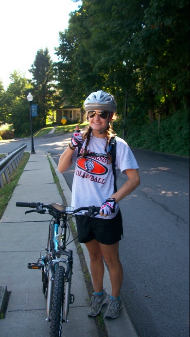
I have more than 9,000 miles on my butt riding on the road since I’ve been on a mountain bike. But my niece, Emily Cramer, just bought a new mountain bike and was excited to go riding with her.
Emily ready to ride
In 2003, I rode the Great Allegheny Passage from Pittsburgh (McKeesport) to Cumberland, Md. then on to Washington, D.C. but the section from Meyersdale, Pa. to Cumberland wasn’t open yet. Now it is. I suggested we could do the segment from Frostburg, Md. to Garrett, Pa.
My dad dropped us off in Frostburg as we had left my van in Garrett for our return trip. I took Andrew’s mountain bike and it felt good getting on the trail but I forgot how dirty and dusty it is. The trail from Frostburg heads up the mountain until reaching the Eastern Continental Divide.
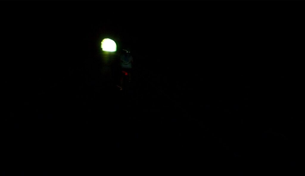
Light at the end of the (Borden) tunnel
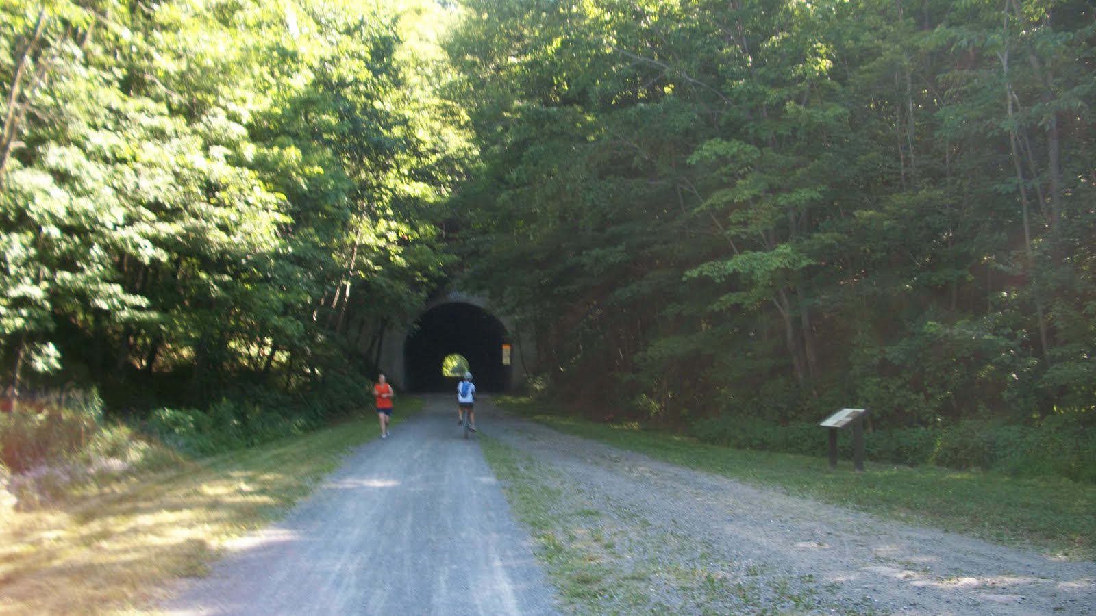
We first came to the Borden Tunnel. We didn’t have lights and thought we’d be okay. But once it became pitch black it was weird. One doesn’t realize that part of our balance comes from sight. If you don’t believe it, try standing on one leg for 60 seconds. Then try it with your eyes close and see how you wobble. And so it was as we pedaled. The sense of moving forward disappeared. You could feel yourself pedaling but without seeing trees or walls or buildings it was very hard to tell if you were moving. Except you were pedaling. Weird, weird, and more weird.
We exited the tunnel and came around a corner when we saw it. A pretty large bear up ahead on the trail, perhaps 75 meters. We stopped but I could not get my camera quick enough. And my first instinct was not to photograph it but think about how best to protect us if it should turn towards us. But it didn’t. It looked at us and then turned and continued to cross the trail then head up into the woods.
How wild! I always wanted to see a bear in the wild but always thought, and hoped, it would be from within the safe confines of my car. Not on a bike on a trail.
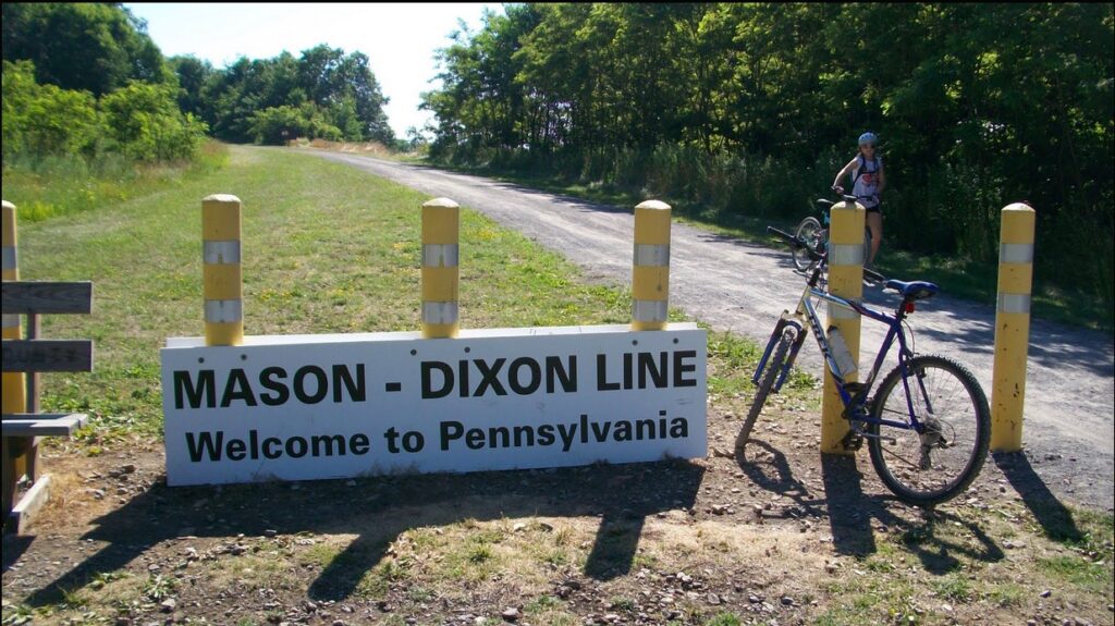
Mason Dixon Line
At this point, we were probably no more than 300 meters from the state line dividing Maryland and Pennsylvania. We had to pass where the bear had crossed the trail and gave a quick look to see if he was still around. I didn’t see him. We came to the state line, took a picture, and moved on. Quickly.
Barry and Emily
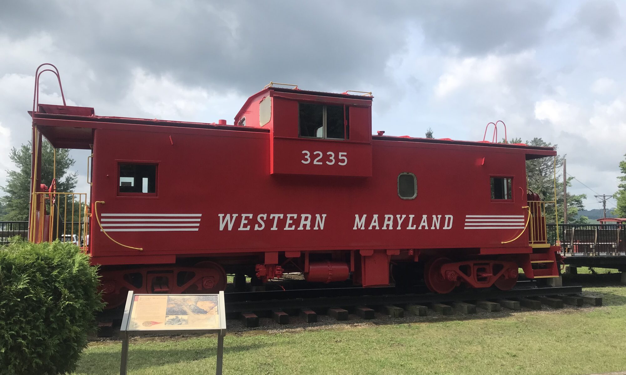
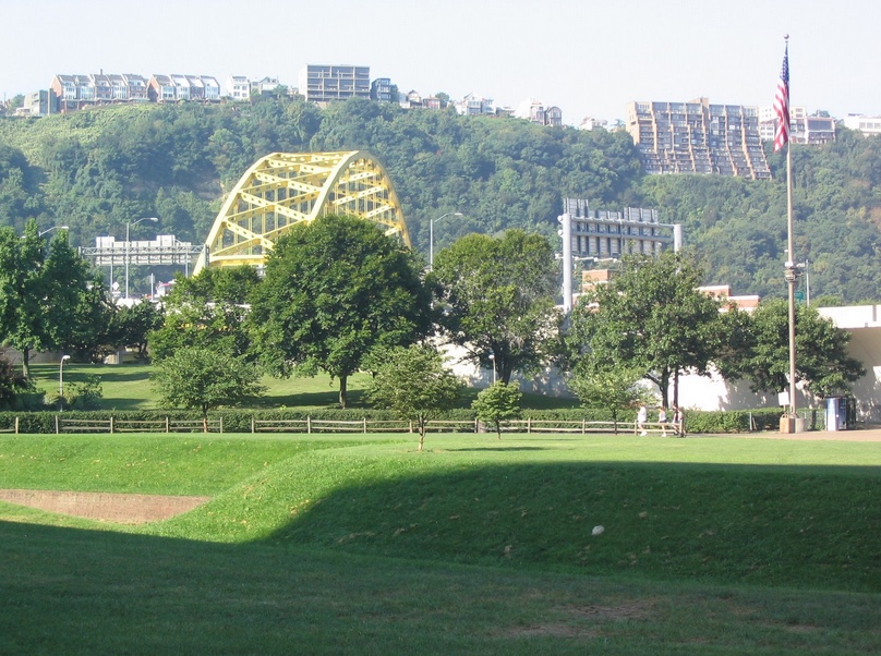
Compared to seeing a large bear, nothing on the ride could then compare. We went through the 3,294 foot (1 km) Savage Tunnel. I was looking forward to seeing a wall of donor bricks but didn’t see any.*
Big Savage Tunnel
We reached the high point on the trail at Eastern Continental Divide where it goes under Pa. Rte. 2011, McKenzie Hollow Road. I pedaled up this road seven years ago. This was much easier. Although it was “downhill” from there, that’s a 1-2% grade on crushed limestone so there’s no coasting.
Eastern Continental Divide
And the only pavement on the trail is 50 meters on either side of this crossing.
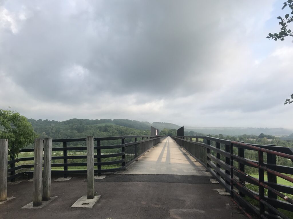
Keystone Viaduct
We crossed the Keystone Viaduct, the Bollman Bridge, passed the Meyersdale train station, and crossed the 2,200-foot Salisbury Viaduct before returning to the van parked in Garrett.
Salisbury Viaduct
The beauty of the trail is outstanding and it was great riding through and over some of the engineering marvels in the area.
____ *The Big Savage Tunnel Recognition Plaque is in the final phase of review. When complete, it will be erected at the Deal Trailhead.
It was August 1999 that I read an article in the Washington Post’s Travel section about a trail that would connect Pittsburgh and Washington, D.C. I live in northern Virginia but am from western Pennsylvania. The Pittsburgh to D.C. route passed through many locations of which I am very familiar.
Although I never lived there, my parents retired to Somerset Co., Pennsylvania. My daughter, Bethany, was attending Shepherd College in Shepherdstown, WV. Going “home” meant traveling, by car, roughly the same direction as the trail, of which I am sure I have done more than 100 times in my life.
By 2001 the seed had grown and this weed took root. Andrew was young (12) and his mind was not mature enough to know not to say no. He was big for his age and was going to ride with me. We borrowed a one-wheel trailer and attached it to my bike, loaded it with supplies, and headed out of Washington, D.C. We took a longer route, the W&OD out of Alexandria to Leesburg before crossing Whites Ferry and over to the C&O Canal. We rode 70 miles the first day before pulling into a campground. Our second day was Andrew’s 13th birthday. We were both sore but continued on. But we had an accident at Antietam Creek. My rear wheel was bent beyond repair. We had to abandon the trip.
Two years later I had a business trip to Pittsburgh. A smarter Andrew, then 15, was wise enough not to want to take this venture again. To him, mile after mile of forest and river views along the Potomac River was just “boring.” After ensuring that he did not want to ride with me I decided that I would finish the trip we started two years earlier. However, it would be west to east instead of east to west.
I rented a car and drove one way, taking my bike with me. I would bike home — Pittsburgh to D.C.
I did little training for this ride. Actually, I did none. I was barely on my bike. I had foot problems that were bothering me immensely. I never rode more than 10 miles at one time. I never thought about doing this ride until the business trip came up just a few days before I left. This lack of preparation would turn out to be a very critical mistake.
THE JOURNEY BEGINS
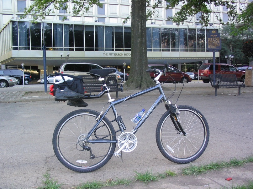
I printed out my cue sheet and thought I knew my way out of Pittsburgh. I left the Hilton at Point State Park and took a picture of downtown. This was a great beginning.
Downtown Pittsburgh at the Hilton
I started off on the Pittsburgh streets where my ride would be a short six blocks up to Grant and First streets. When I reached the beginning of the river trail I stopped again to take a picture of my “official” start. Within minutes I was pedaling the paved rail trail from downtown next to the Parkway East. I was enjoying myself. The temperature at 9:30 a.m. was in the low 70s and there wasn’t much humidity. It was a perfect day for riding.
The start of the trail in downtown Pittsburgh – Grant and First Streets
On my bike I thought I had everything I needed. Unlike two years ago when Andrew and I started out going from D.C. to Pittsburgh, we had tried to carry everything we needed. I towed a one-wheel trailer (“Bob”) and we had our tent and sleeping bags with us. We even had a cooler loaded with food. We probably had too much.
This time I wanted to take just the minimum. I had a small bag mostly with bike supplies (pump, extra tubes, wrenches) on the back of my bike and wore a Camelbak with my personal items. I had just taught a day at our arbitration advocacy course in Pittsburgh and had my “business casual” clothes with me as well. I rolled them as tight as I could and stuffed them in my backpack. Having filled my pack with clothes I had no room to fill the bladder with water. It was a calculated decision based on the pleasant weather and the presumed availability of water along the route I was riding. It was also a critical mistake.
I was taking in everything by riding this section of the trail next to the old J&L property. As a kid I remember driving into Pittsburgh from the Parkway East and seeing this gigantic steel complex belching out fire and smoke from its stacks. Now it’s gone and an industrial park is in its place.
I was following the Monongahela River. The trail featured a slight upgrade. While the grade was manageable, that would also be a theme for the next two days; continuous climbing.
I soon caught a young lady in her mid 20s who was roller blading. We talked briefly. She was just out exercising and I was riding from Pittsburgh to Washington. She wished me luck and I was gone. I can only imagine what she thought when I told her I was on my way to D.C.
How to travel light on a bike. Small pack on bike. Small water bottle in cage. Wear a Camelbak filled with clothes, not water. Dehydrate. Bonk. This method is not recommended.
Cruising along the “Mon” and feeling good I was surprised to discover the trail ended just 2.5 miles outside of Pittsburgh. I was on the Eliza Furnace Trail aka “Jail Trail” but it quickly went away from the river which told me that I did not want to ride there. I looked at my black and white map I had printed and was unable to discern river from trail. I had thought that staying on the north side of the river was the correct choice but then thought of Pa. Route 837 which I remembered was one of the detours to the trail. I realized that I had followed the wrong trail out of Pittsburgh and needed to cross the river.
Fifteen minutes into the trip to D.C. and already I had selected the wrong route!
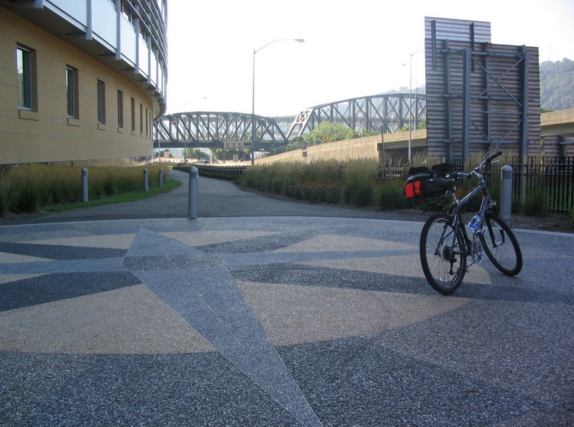
I rode down to an industrial road and rode back towards Pittsburgh to the Hot Metal Bridge. The Hot Metal Bridge is now decked to carry cars on part but had been a railroad bridge at J&L built in 1904. While on the bridge I had my best view of downtown Pittsburgh and wanted to stop and take a picture. But there were no shoulders or bike lanes, only a jersey barrier and 5 inches of white paint. And not the most bicycle friendly population either.
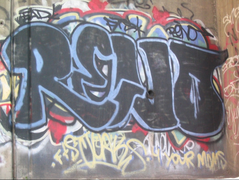
Grafitti along the Eliza Trail
At the end of the bridge, I did stop to take a picture of downtown. It would be the last time I saw the tall buildings of the Golden Triangle. There was a trail here and I jumped on it. I never looked back. This was on the south side of Pittsburgh and it just felt right, that after the tactical mistake of following the wrong trail, I finally picked up the right one. I would state that most of the trails around Pittsburgh are virtual trails, that is, they exist in the future but aren’t yet developed.
I think had I left Station Square I would have ridden on a trail for a couple of miles but may have also been forced to ride on Carson Street. But now I was on a trail and immediately was beside the huge UMPC Sports Complex, which is where the Pittsburgh Steelers practice. I saw some Steelers in the far corner of one field but they were too far away to identify any of them.
As I rode the trail a huge CSX train passed me and the engineer waved to me. I waved back. After about three miles on this trail I came to a sign which stated “trail ends.” My only legal option was a U-turn. Getting out of Pittsburgh was proving to be extremely challenging. This wasn’t the way it was supposed to be.
I stopped and surveyed my location. River to the left. Industrial plant or steel mill straight ahead. Two busy railroad tracks to the right. Sign marking the busy railroad tracks. “No trespassing.” I thought about backtracking again on this day and decided that was not in order. I needed to cross the tracks. I picked up my bike and carried it across the tracks where I had to cross a guard rail to get on Pa. 837. Once on that road I thought I could ride to Sandcastle, a Pittsburgh water park on the river where I was hopeful the trail would continue.
Pa. Rte 837 featured “modern” Pennsylvania road building techniques. Jersey barriers on both sides and no shoulders. This road carried lots of industrial traffic and sometimes one thought the tractor-trailer drivers just wanted to see how close they could get to this cyclist. I came to a ramp and had to navigate the ramp like any traffic. This was essentially a limited access highway except there were no signs prohibiting bikes. Or pedestrians. Or farm vehicles and the like.
I came to the Glenwood bridge and pulled into a small gas station which carried some snack items. Having exhausted the water on my bike already, I stopped and invoked one rule that would guide me along my journey. Never pass up a chance to take on more fluids. I stopped and bought a Gatorade and asked about the trail. Neither worker knew anything about the trail and told me I would have to ride to McKeesport on this road. I believed they were right.
For all the talk about a rail trail to Pittsburgh, the reality of it is that the last 20 miles to Pittsburgh (or the first 20 miles out of Pittsburgh) consisted of some finished trails and many road detours. I was resigned to staying on the road. I left the station and climbed a steep hill into Homestead and saw no trails. I rode past a roadside sign commemorating the Homestead Grays, the Negro League team that played here featuring Josh Gibson among others. I stayed on Rte. 837 and came to Kennywood Park. It wasn’t quite 11:00 a.m. and the smells of 100 years of amusements came over the highway. Or maybe it was just creosote. I wanted to go into the park and grab some funnel cakes but had to keep going.
Passing Kennywood, I crossed a bridge over a rail yard and began a descent to the Mon river valley. This was a four lane road which I would not recommend for most cyclists, especially youths. But I came to McKeesport and crossed the bridge over the Monongahela into town. I rode through McKeesport and came to the last bridge on the Youghiogheny River. This was where the Youghiogheny flowed into the Monongahela. Try spelling that in Scrabble!
I found a sign marking the Steel Heritage Trail so I thought I had finally had found my path. I crossed the bridge and descended into a poor section of town. I started to follow the Steel Heritage signs but soon discovered that they, quite literally, led one in a continual loop. There was no way out of this section and I headed back to the base of the bridge. I saw a two lane road which paralleled the “Yough” and decided I would follow it upstream because it surely would lead to the trail.
The road continued for a mile or two and then came to an industrial plant. I wasn’t sure what I would do next but decided to ride another 50 yards. There, on a traffic sign, I could see a blue sign marking the YRT (Yough River Trail). I no sooner left the road and hit the asphalt of the YRT that I saw spray painted on the trail sign “Trail Closed.”
I didn’t know what to do. My experience is that even when a trail is marked closed that you ride it as far as you can and deal with the consequences later. It was especially true here because I saw no other options other than backtracking and riding the roads — roads which weren’t clearly marked and for which I had no map. I started up the trail and had an immediate climb. As I reached the summit of my climb I saw orange barrier mesh that had been placed over a section of trail that looked like it had succumbed to a hill slide where the trail simply gave way and was gone. However, there was enough repaired to continue through. My hopes of a paved rail trail soon ended as the trail turned to the crushed limestone base which makes up all these trails in this section.
I had an on-board computer tracking my speed and miles (sounds impressive, doesn’t it? — it’s just a $25 speedometer) and my odometer told me that I had gone 26 miles when I saw my first mile marker — 20. I assume that the mile markers are right and that when the trails are finally completed that will be the accurate distance back to Pittsburgh. But starting in the Golden Triangle, going up the wrong trail and having to backtrack, plus taking a road overland certainly added to the starting distance. There was a trail map and I could see that Connellsville was at milepost (MP) 58.
A boat went flying by upstream and I was a little surprised that this section of the Yough was navigatable. I wasn’t sure if there were dams on it or the white water was just further upstream. I hadn’t seen any cyclists but at Boston (Pa.) came to a park where some locals were riding. You can also tell the locals by the lack of equipment they carry. I was feeling pretty good but getting a little tired. I was sitting in the saddle most of the time.
Near West Newton I came to an intersection and saw an ice cream stand about 100 yards off road. I bought a vanilla-raspberry cone and continued on. I never rode a bike before while eating a cone and thought it was a stupid idea. Not because of safety but because of bugs. Who wants bugs in their cone? But I don’t believe I ate any bugs so it worked out.
At MP 40 I started cramping in my right thigh. Cramping is a sign of dehydration and I was suffering. The temperature wasn’t too bad, mid to high 80s, but I hadn’t been taken on enough fluid either this day or in preparation the day or days before. I was most unprepared for the mental agony of a continual uphill climb from the moment I left Pittsburgh.
Along the route I tried using my cell phone and was able to connect with my dad. My plan for Day 1 was to get to Confluence, Pa., where my parents would pick me up. I made four or five calls throughout the afternoon, each one pushing the time back. First from an ETA of 4:00 p.m. to 4:30 then to 5:00 and eventually to 6:00 p.m. The last call would not only push the time back but also the pickup point from Confluence to Ohiopyle. I was “in difficulty” and my speed was dropping.
I did stop at a Cedar Creek State Park and bought a snack and drink. I wasn’t hungry but forced myself to eat. I can’t say that it tasted good but I ate to get some energy. When you exercise hard you typically do not get hungry but you need to keep the body fueled so I knew that much.
Just a couple of miles outside of Connellsville the trail passed a campground where all trail users were welcome. I went into the camp store and asked for a banana. They didn’t have any. I did buy water (they didn’t have Gatorade either) and drank most of it on the spot.
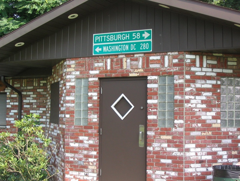
In Connellsville I rode through a small downtown area which had a curbed lane especially for bikes. That was pretty neat. In front of a bike shop there was a drink machine with juices but it didn’t work. I reached the waterfront park and stopped to take a picture of the sign: Washington 280, Pittsburgh 58. It wasn’t much but it was a sign of progress. My 58 miles had been 64 and I still had 18 to go. Just as I entered Ohiopyle State Park two women leisurely rode by me from Ohiopyle. They said “isn’t it a gorgeous day for riding?” and I responded “too hot.”
Connellsville, Pa.
It is in Connellsville that the trail starts its increase in grade. From Ohiopyle, the river drops the most to Connellsville and I knew it would be a difficult climb to end the ride. I had ridden about five miles and it was here that I was passed for the only time. A teen pedaled by me and I wanted to yell “but you haven’t just ridden 70 miles.”
I continued on, alternating between being in and out of the saddle. Often I broke pace and sprinted then coasted, sprinting and coasting, just to change the pace up this last climb. The one redeeming feature was the beauty of the river. I tried to watch the river as much as possible and saw a blue heron which completely surprised me. I did not know that there were herons in southwestern Pennsylvania.
It was nearing 6:00 p.m. and I hadn’t reached the top yet. I knew I was getting close when I saw a sign on the trail warning users not to descend to the river far below for swimming in the rapids was prohibited. That was an ominous warning that Dimple Rock was waiting. Twenty people have lost their lives in the last 20 years, most of them at Dimple Rock, including one man earlier this summer.
In the 1970s I had purchased my own four-man inflatable raft and we had ridden these rapids many times. In 1975 while at Dimple Rock we capsized and in the ensuing struggle to remain afloat while being thrown through the turbulent rapids, my sister Brenda met one of the rocks in this section. She ended up in the hospital and had to have her spleen removed.
By the late 1970s the State Park began to limit access to the river pushing off private rafts like ours. I eventually sold the raft but riding this section brought back memories. However, I had never been on this rail trail before because when we rafted the river in the valley below this had been the right of way for the Western Maryland Railway. We always marveled at the trains that passed through those woods high above us.
About 6:10 p.m. I reached the trestle at Ohiopyle. I could look down 100 feet below and see the end of “the Loop” a place I rafted many times in my life. On this day those memories did not come streaming by. I just wanted to finish the day. Even more than finish I knew that only about 400 meters separated the first trestle with the second one that crosses above the falls and ends at the train station in Ohiopyle. And I knew that half way between the two trestles was a Powerade machine. I crossed the trestle and even though my parents were waiting, I stopped and got a drink. There were no trash cans present and my empty water bottle was already on the bike so after drinking half I mounted the bike again for the final 200 meters, carrying my drink.
Here stands one of the prettiest trestles anywhere. Following the old Western Maryland Railway it crosses the deep water right about the falls at Ohiopyle. One hundred years ago this line carried wealthy passengers from Pittsburgh to Ohiopyle for summer vacations. But the automobile changed that and passenger service stopped by the mid 20th century. Freight ran on these lines until 1975 when the WM was merged with B&O. Since the B&O has better rights on the opposite side of the river the WM was abandoned. Now this old trestle was rebuilt with a wooden road bed for carried bikers and walkers.
I crossed the bridge to see my parents sitting the bench at the station. My mother had a camera and as I approach I said, “no smiles here.” She handed me a power bar and I bought another drink. The end of a long day.
The end of a long day – Ohiopyle, Pa.
We drove back to Somerset and I took my parents out to the Grapevine Italian Restaurant to thank them and to celebrate their 53rd anniversary. Another tactical mistake before this day was eating wings and fries the night before. They are good but are not a high energy food. This night I went right for the pasta.
The check came and I got out my credit card to pay . When I went to sign the receipt I found that I could not grip the pen. Strange.