Sideling Hill the Hard Way

HANCOCK, MARYLAND

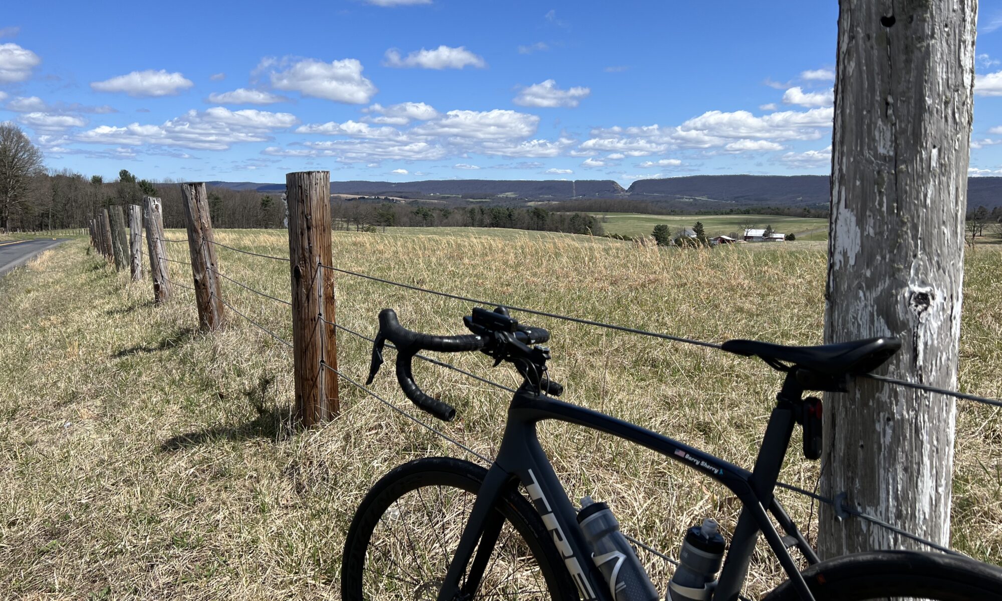
It was 1974 when I first drove National Highway (aka U.S. Rte 40) up and over Sideling Hill. It is a four-mile climb and my little car struggled to go up in 4th gear. Well, it never did. Sometimes third gear and always downshifting to second gear to take the horseshoe curve at the top.

On US 40. Sideling Hill cut for I-68 is in the background (Zoomed)

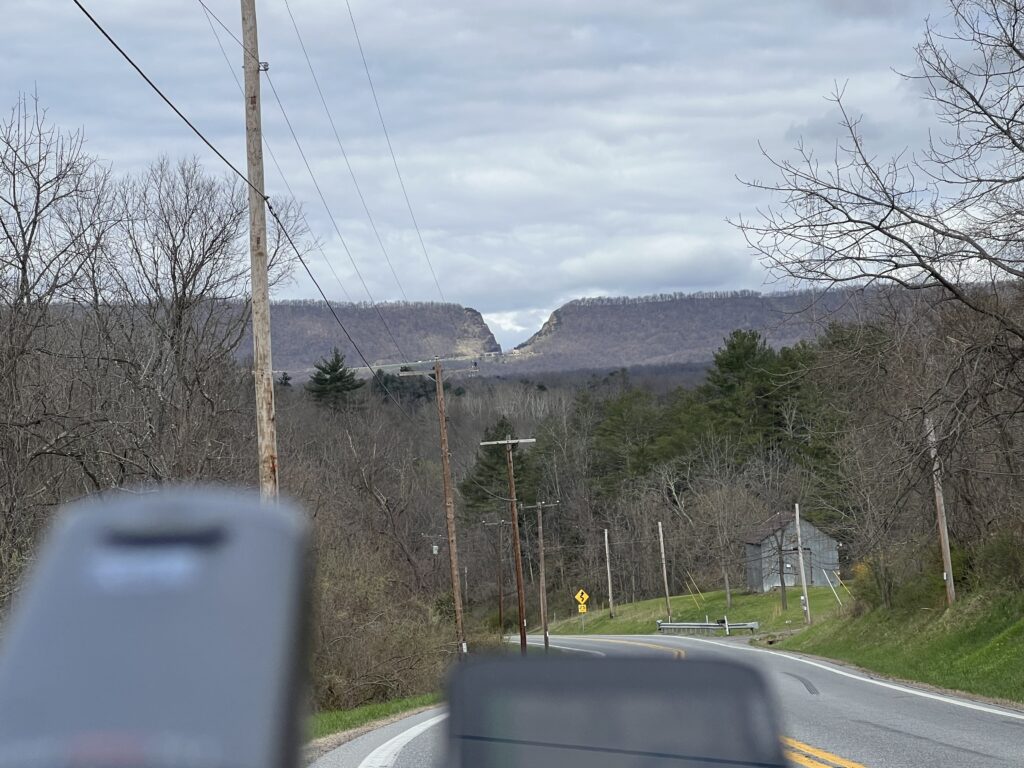
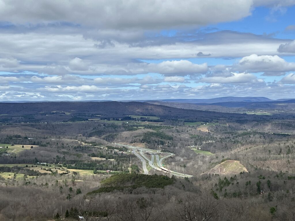
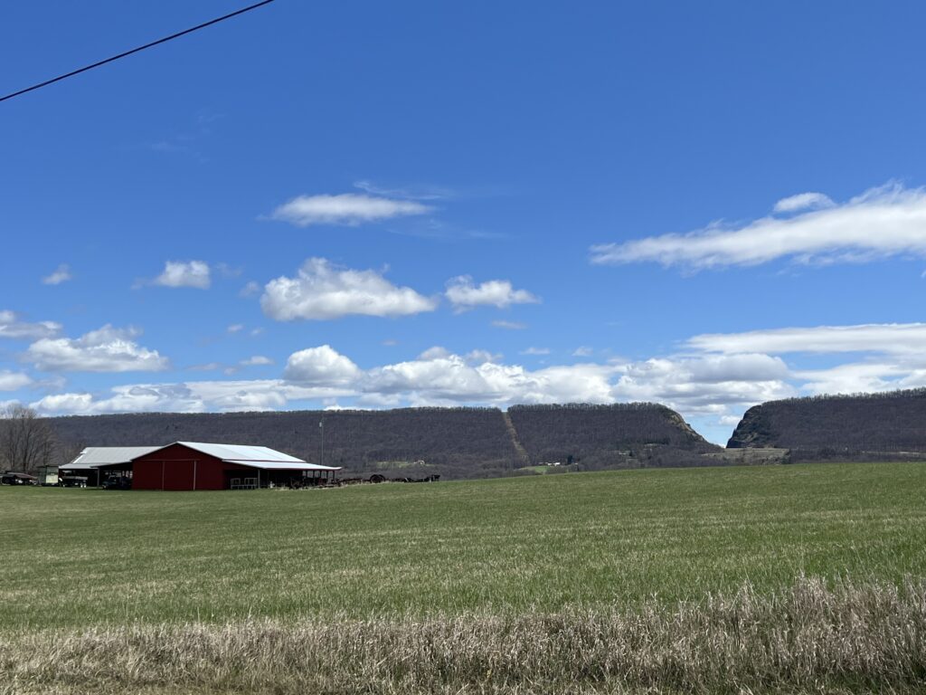
Interstate-68 was constructed and finished, at least parts, by 1991. It which followed some of old US 40. The most impressive feature on I-68 is the cut in the mountain so the highway could go through a gap instead of crossing all the way over the top.

Crossing the Western Maryland Rail Trail, Hancock, Maryland

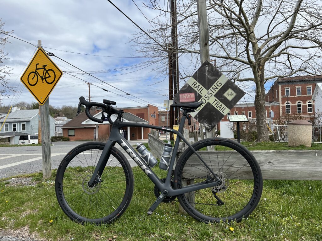
There are only a handful of crossings over this ridge. One of those in Pennsylvania near Breezewwod is now the Abandoned Turnpike. The tunnel is one that I have ridden through probably a dozen or so times.

Old U.S. 40. The cut in Sideline Hill for I-68 is far off in the distance.

But today would be about the climb. I parked at the C&O Canal parking lot in Hancock. I began with a short climb and the first four miles of the profile looked like sharks’ teeth. At Mile 4 the climb began.

Old. U.S. 40 (now Scenic 40)

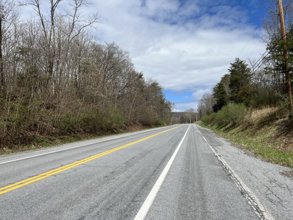
Although the speed limit was 55 (or was it 50?) mph the very few cars all gave me wide berth. Or often it wasn’t necessary as there was a wide shoulder I could use although it still had some winter dirt in the lane.

The climb on Scenic U.S. 40

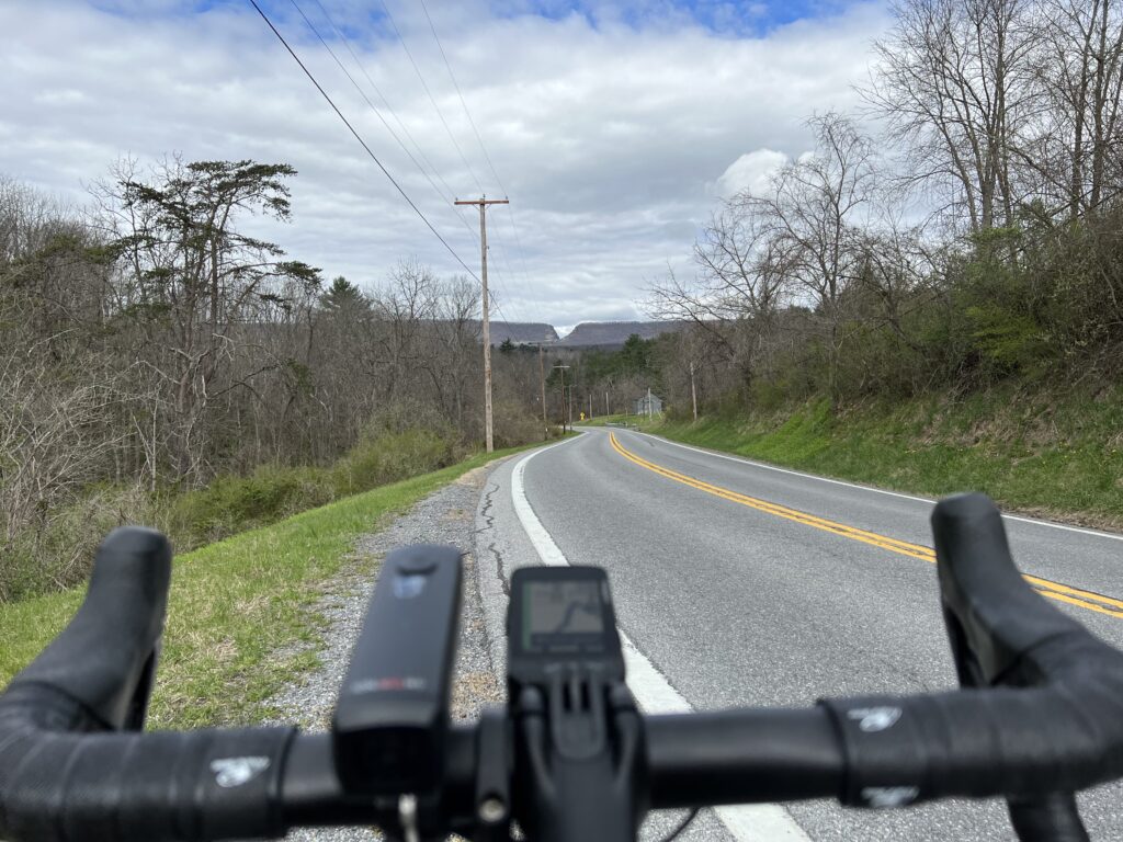
This was my first real use of the new display of my Wahoo. As it displayed the profile of the climb each section was color-coded as to grade. That was pretty cool.

Wahoo display of the gradient ahead. The graph segments are 1/4 miles (400m).

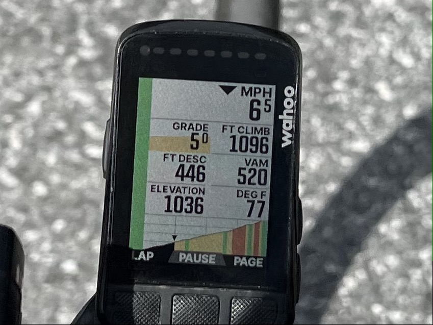
I didn’t race up the climb but kept a steady pace. I concentrated on remaining seated as I often pop out of the saddle more than most cyclists. I would say this was relatively easy. I also left room for improvement if I would do this again.

The top of Sideling Hill

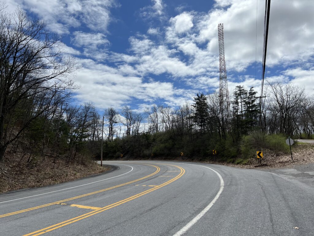
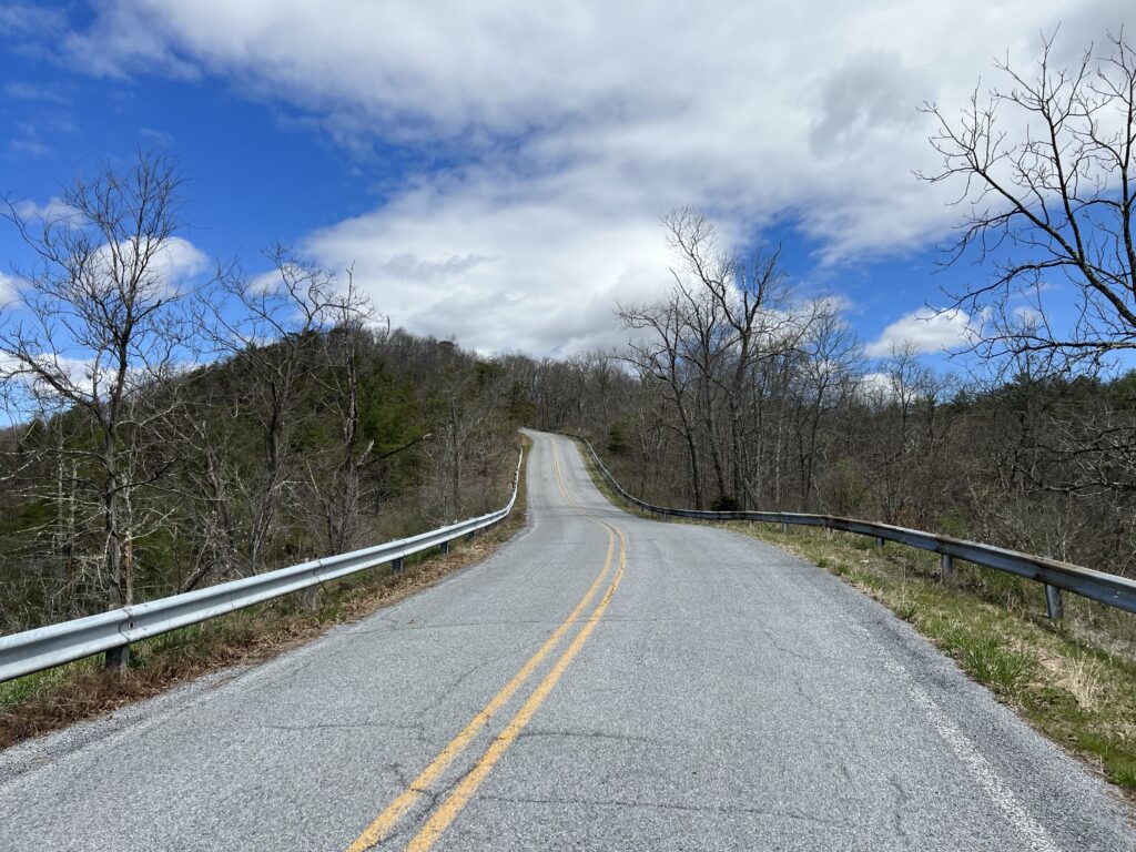
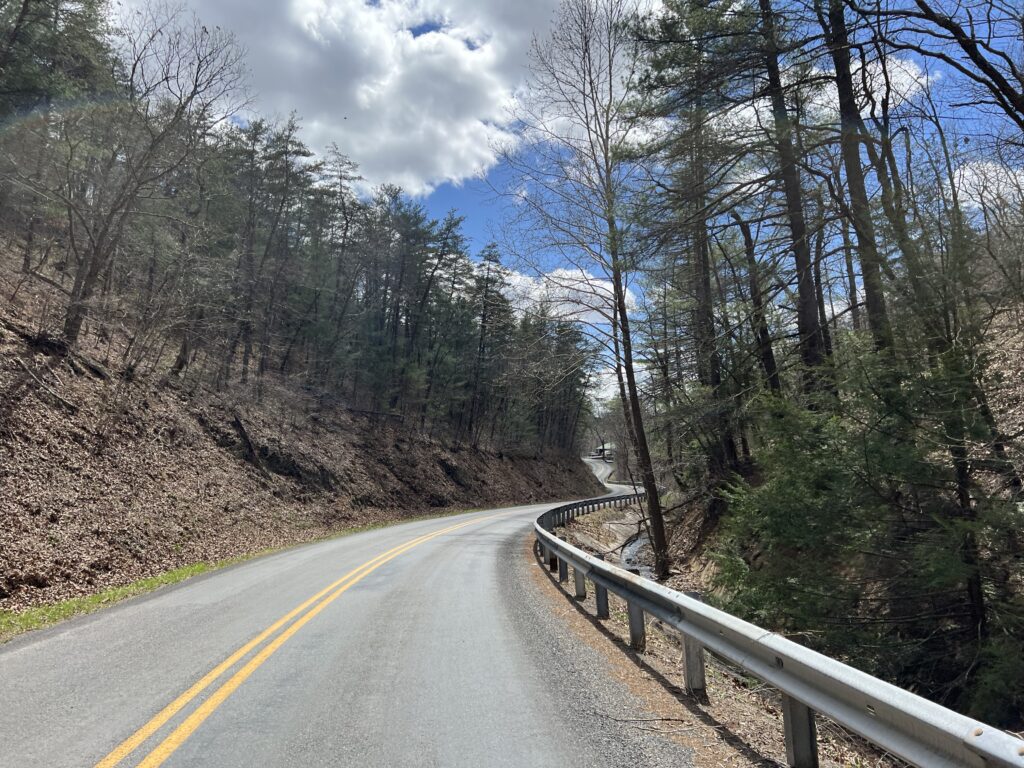
Once over the top and a quick stop at the scenic overlook, I began the descent and squeezed the brakes. It was windy, the road, while straight, wasn’t smooth, and there was a sharp turn-off just one mile down the mountain. Once on McFarland Road, I needed to squeeze the brakes a bit tighter. The road was steeper, 10% in many parts, and technical (lots of curves).

View from top of Siedling Hill, Scenic U.S. 40, looking was towards I-68.

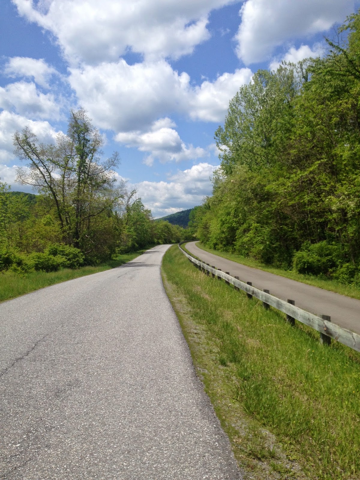
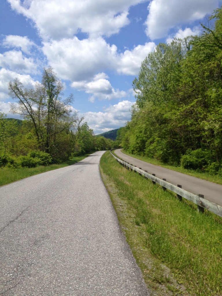
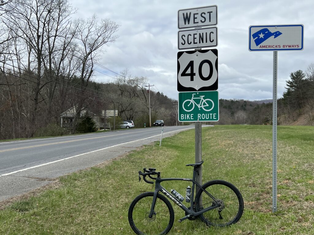
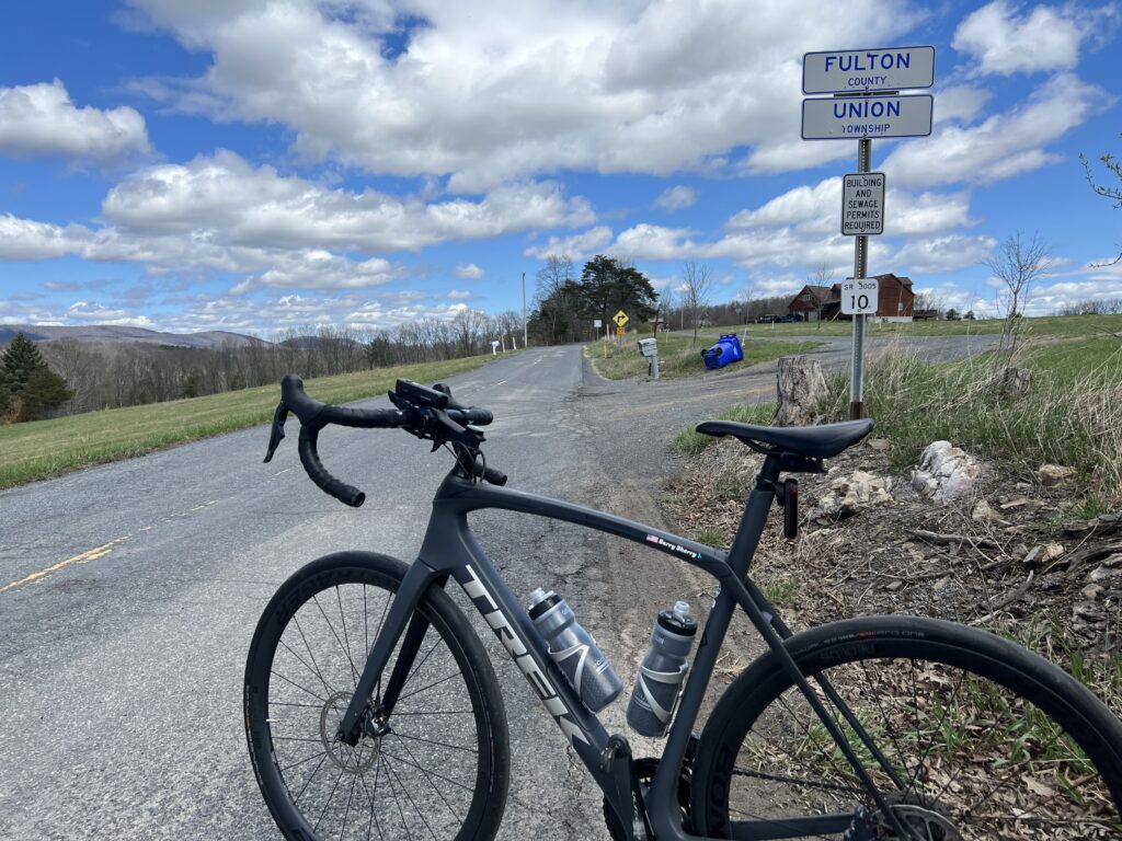
I had mapped out a Pennsylvania portion and followed High Germany Road. It was only two miles to the state line but it was more climbing to the Mason-Dixon Line. The border was not marked other than by a Fulton County sign.

Mason-Dixon line. Really.

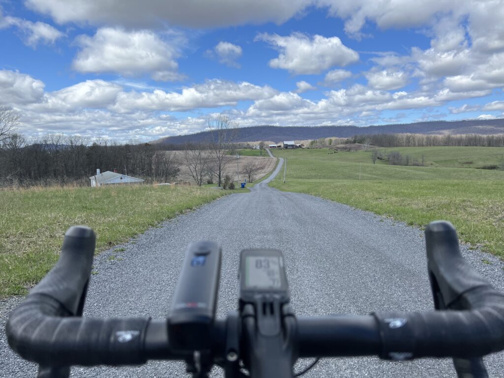
I turned onto a gravel country road which was okay because I expected some gravel. I did not know this road was not it. A review of the map shows this wasn’t supposed to be gravel. It should have been paved (according to the map).

High Germany Road

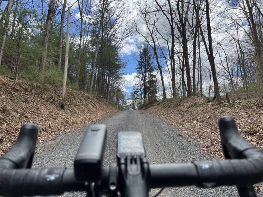
And then things started to unravel. I followed Buck Valley Road and my computer indicated to bear left which was a gravel road. I chose to stay on pavement until Wahoo was determined for me to make a hard left up a gravel road.

It’s gravel and it’s pretty.

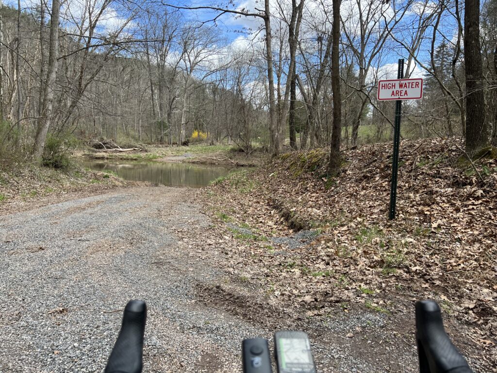
It was sketchy and I was going deeper into the woods. I came to Sideling Hill Creek and there was no bridge. No crossing. Wahoo wanted me to follow a hunting trail but I turned around.

I was a little bit lost and a little bit scared. I was out of food and my water was low. I hoped for a cell signal enough to find a map and was able to get one. I could see the route I needed to get me to Orleans.

The road ends here. Literally.

When I came to the climb to Town Hill I decided to forgo it. Wahoo said my next turn, here, was in three miles so I knew the climb was 1.5 miles. My legs didn’t have it. I was beat up from 3500’ of gain in 25 miles. Since it was an up and back, or up and down, I decided to skip it and head back to Hancock.

At the Oak Barrell Cafe and Deli, Little Orleans, Md. (Right off I-68)

The Orleans Road was delightful. It was six miles but I don’t remember any traffic. The first three miles were rollers followed by a delightful three-mile downhill. It was probably a 4-5% downhill – not too fast where I needed to touch the brakes. It was the most enjoyable part of the ride.

Orleans Road

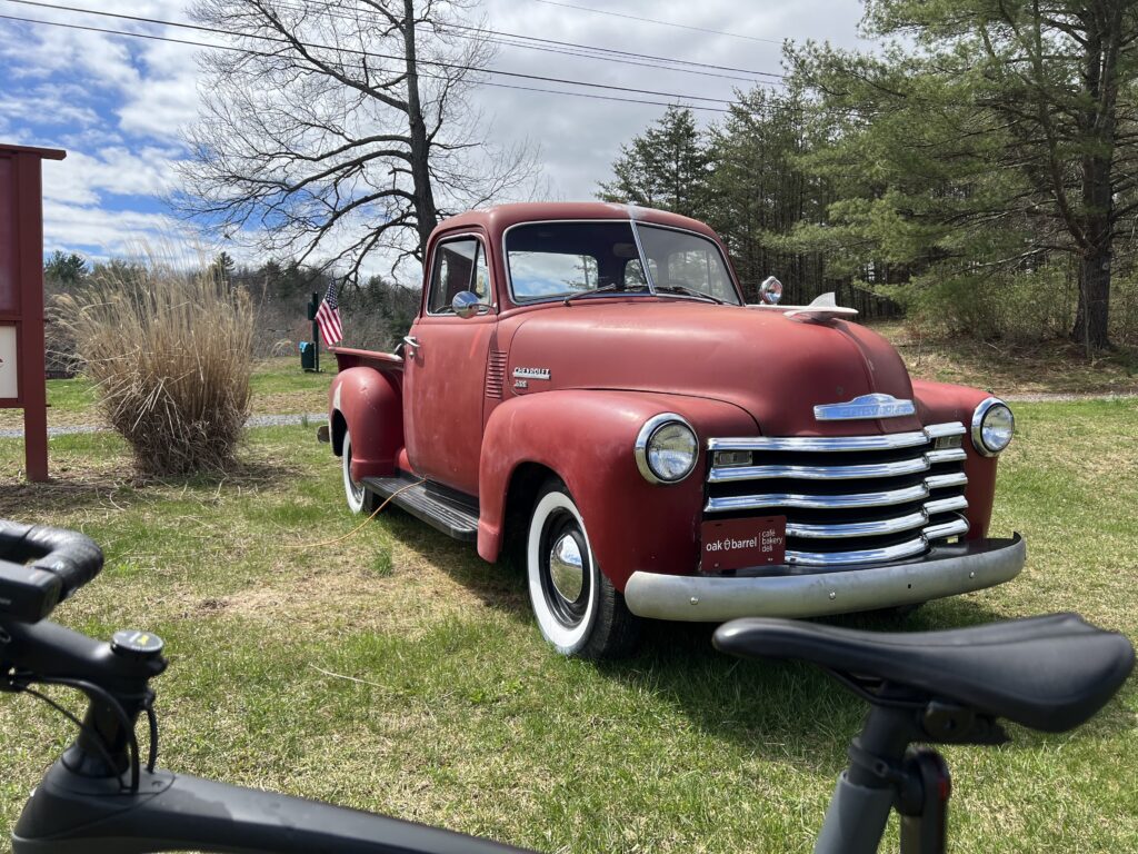
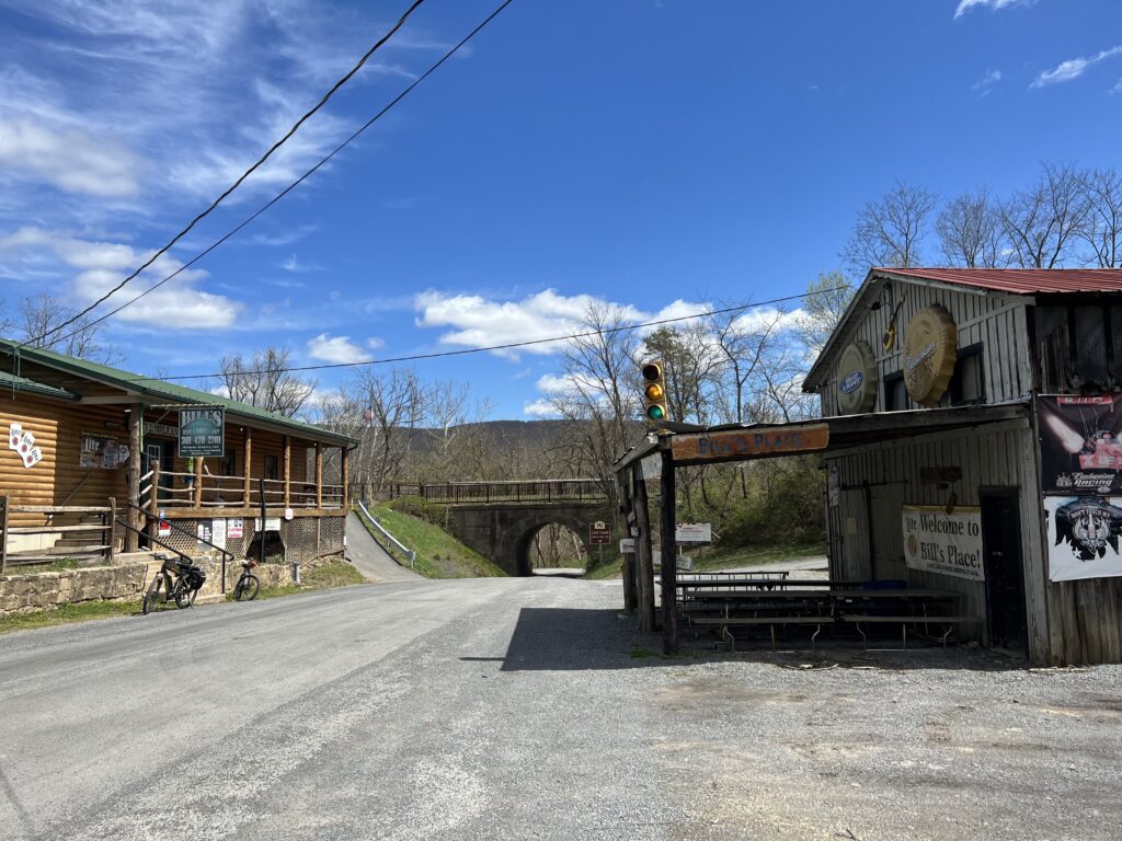
I came to Orleans and passed Bill’s place. I recognized it from my Pittsburgh to D.C. trip in 2004. I had planned my day on stopping here for lunch and I picked the week he took his summer fishing vacation. And it was closed. Today there were two cyclists here, outside. It may have been closed today too although more likely they were just milling around before leaving.

Bill’s Place, Little Orleans, Md.

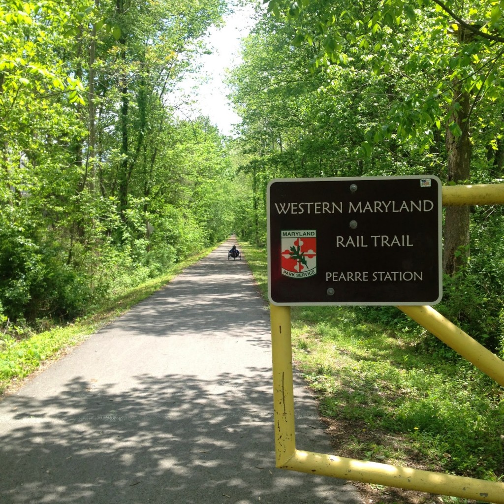
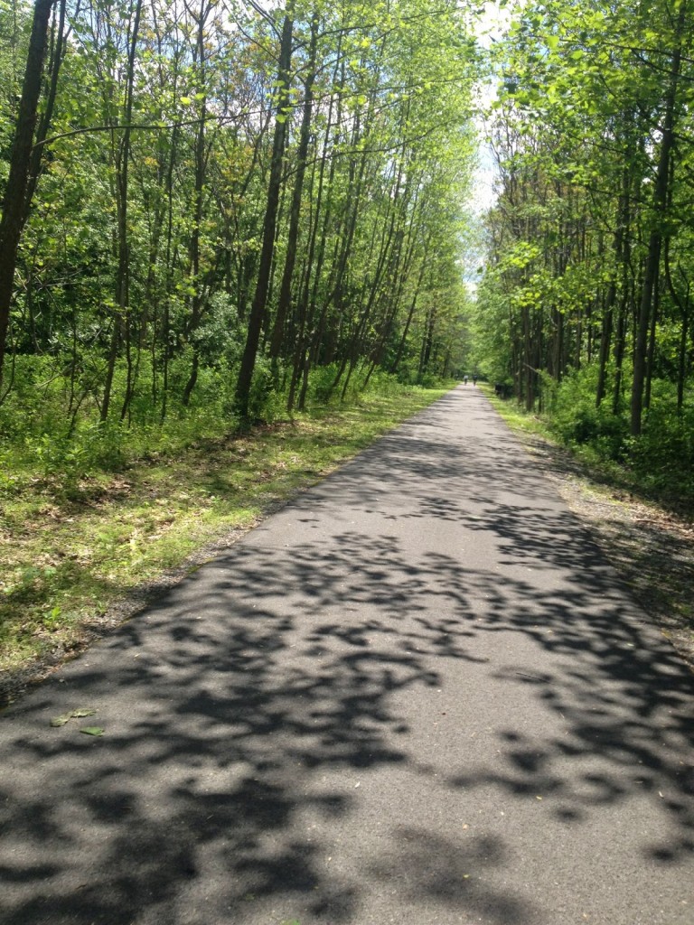
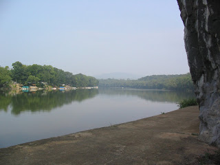
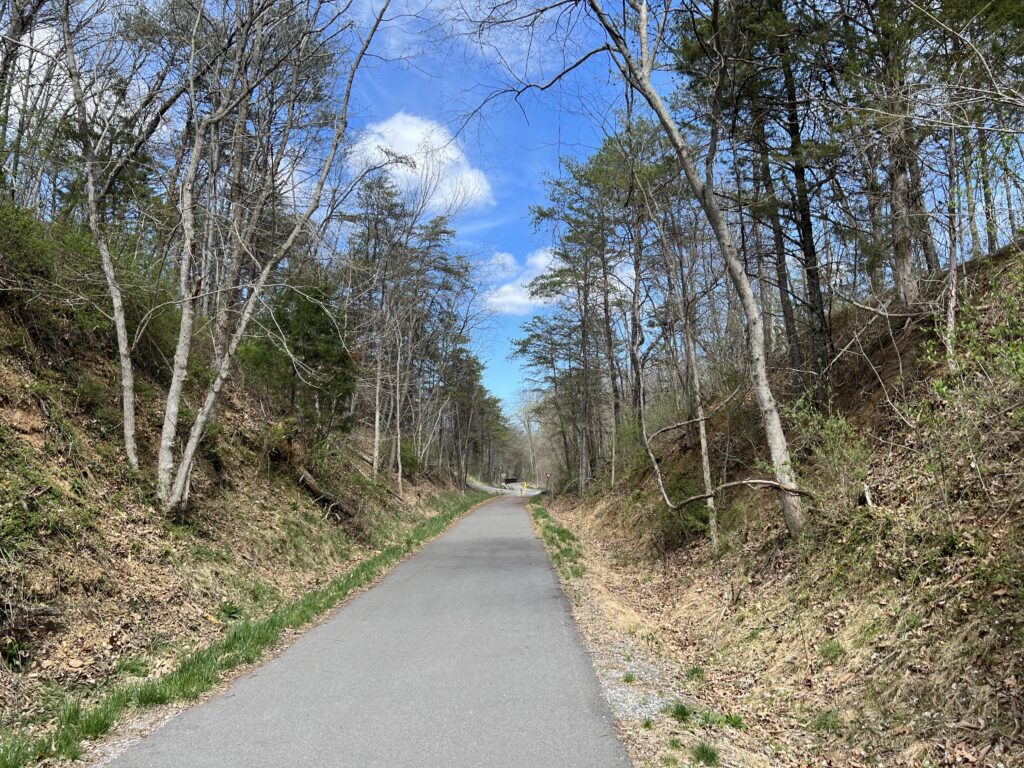
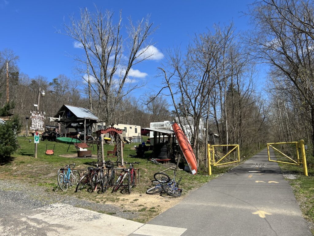
I had mapped to follow New Germany Road and the one-mile climb away from the Potomac River did not look very appealing compared to the alternative. The alternative was the smooth-as-silk Western Maryland Rail Trail extension. I hadn’t been this far and hoped that I would have 18 miles of paved trail back to Hancock.

Western Maryland Rail Trail

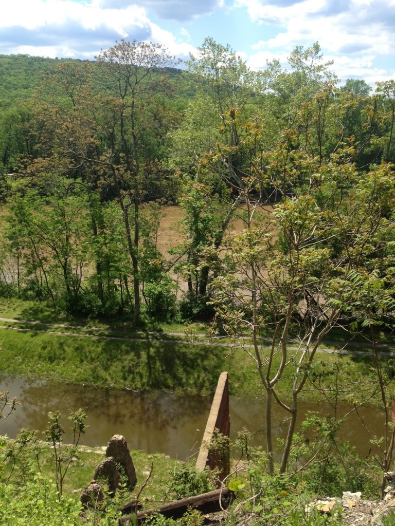
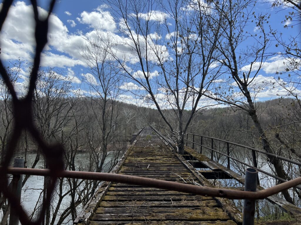
I jumped on the trail and went the wrong way. Not crazy. I just wanted to see how far it would go in the opposite direction. Not far was the answer. It was less than a mile (0.8) when it came to the Potomac River. There is a beautiful bridge here waiting to be converted to trail use but it looks like it might remain closed forever. Apparently, West Virginia, on the other side of the bridge, is not real thrilled about spending money expanding the trail into the Mountain State.

The end of the line – Potomac River, Little Orleans, Md.

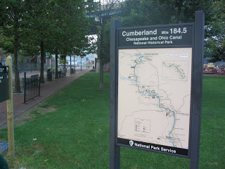
After turning around I followed the trail a mile and a half where it ended at the Indigo Tunnel. A ramp takes users down to the C&O Canal Towpath where one must ride a little more than two miles to pick up the rail trail again.

Indigo Tunnel

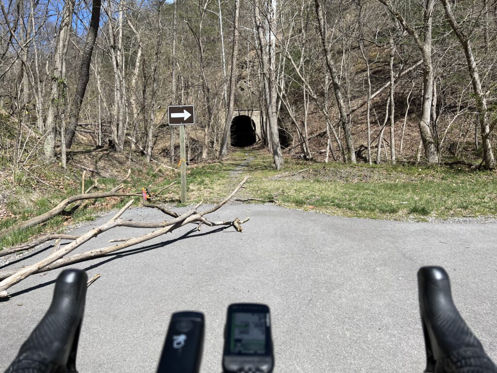
Paving the trail and opening it through the tunnel seems like a simple proposition. Except there is a colony of endangered bats that live in the tunnel. So for now the bats win and that’s okay with me.

C&O Canal

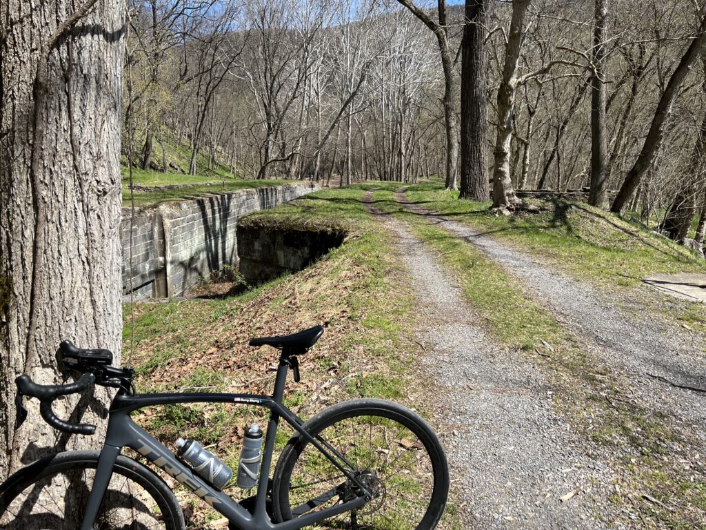
Except that I was riding a road bike today and the towpath is the towpath. Suggestion to the National Park Service. How about paving the two miles of the twopath so the users of the rail trail will have a paved trail the entire way?

A bike-kayak-everything rental on the WMRT

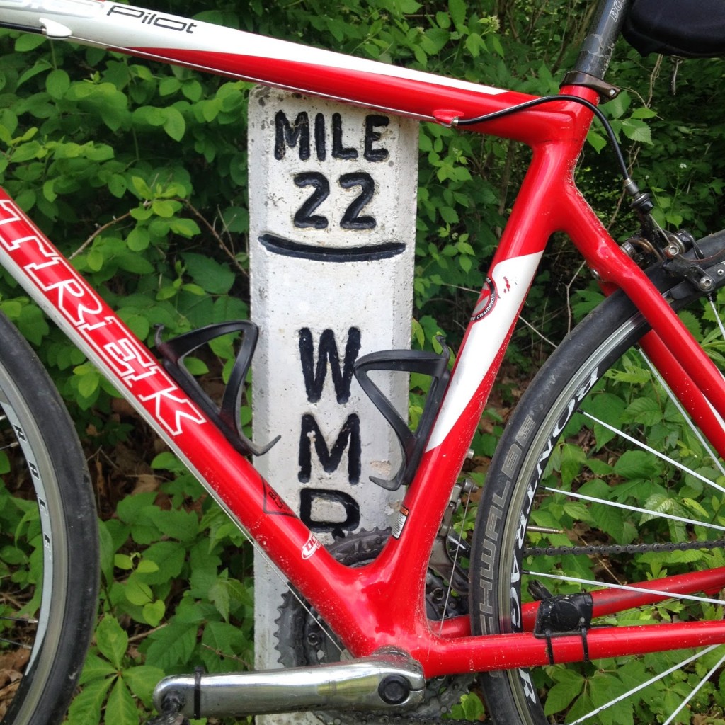
One back on the trail it was familiar territory. When I first started riding this trail the eastern portion was very rooted. This is from Hancock (MP 10) to Big Pool (MP 0). That was the first section completed. The western section, up to MP 22, was newer and the tree roots had not started peeking through the surface of the trail. That has changed in the last few years and today it was very rooted, especially near MP 20.

A look from the western side of Sideling Hill

But it was sure nice to have almost 30 miles of flat after all the climbing. The legs were sore but I avoided any mechanicals or crashes. Life is good!


IF I do this ride again. Pennsylvania is still doable but must stick to all pavement. Skip Schultz road by staying on High Germany Road to Harmonia Road. That probably would add 1.5 miles. Then stay on Buck Valley Road. There are no gravel shortcuts here. Lastly, make the climb to Town Hill B&B for the best views around. And take High Germany Road out of Little Orleans. It is a one-mile climb but followed by great downhills before merging back with the WMRT. It also avoids riding on the canal.


Western Maryland Rail Trail

HANCOCK, MARYLAND

My planning was off this weekend. Yesterday I was planning a road ride and ended up on the trail – without my mountain bike. Today I planned to ride near Altoona but it was, well, cold. I mean late-winter type cold, low 40s around 10:00 a.m. I did not bring cold weather riding gear.

Road to left – Trail on right

I drove through Portage to East Freedom, Pa, looking for new cycling roads and passed the first church my dad served as a pastor, in 1958. But it was still too cold to ride.

Western Section Terminus

I drove towards Virginia then stopped in Hancock, Maryland. Andrew and I had ridden here before, probably around 2001 or 2002, but I knew there was a rail trail – the Western Maryland Rail Trail.

Looking down – Canal in foreground
Potomac River in background

The trail is built on the former right of way of the Western Maryland Railway. It is a paved 23 mile trail. If one starts in Hancock, as I did, you are basically in the middle of it.

It was a bit warmer in Hancock, mid 50s, but I still wore knee warmers and a jacket. I headed out a road which seemed to parallel the trail and followed it as long as it seemed reasonable. And once on the trail I found access to the road, or a different road, and rode it as well.

The trail, at least the western portion, is in pretty good shape. The asphalt is in very good condition and there are minimal roots working their way up. I had remembered the eastern section being older and more rooted. But there were a number of small twigs on the path though.

It was an out and back good for 25 miles. It wasn’t a high mileage day or any amount of climbing but was a good way to break up the ride back to Virginia.

C&O Canal in Hancock

Pittsburgh to Washington D.C. – Day 4

A Riding Companion

Probably the hardest thing about this trip is doing it alone. With each day in the saddle comes more soreness and one questions why I am doing this and the necessity of finishing it. If I was riding with a companion or group we would all be sharing the stories of our soreness but rally together. Riding alone I had no such support.

I left Hancock at 8:45 a.m., first stopping at Sheetz and taking on a Gatorade. I swung by the bike shop in town but noticed they did not open until 10:00. I decided to depart and not wait for the store to open. I left on the Western Maryland rail trail which parallels the canal for 9 miles. The advantage is that it is a paved trail — a good respite for a tired butt.

I had ridden this section of the canal before so I didn’t feel the need to stay on the path to accomplish anything. The paved path of the rail trail was welcomed although a number of tree roots were coming up under the trail in this section so it had its own series of speed bumps.
When I reached the end of the trail I did not heed the sign warning of the end of the trail. I was hoping instead to follow a local road to Fort Frederick State Park. After riding on the road for 1.5 miles and seeing hills ahead I doubled back to the sign directing trail users back to the C&O.

Had I planned ahead, I could have stayed on the road into the park and reconnected with the trail. But I didn’t want to risk missing it and adding more miles to a sore body.

For the first 10 miles on this day I could not get comfortable in the saddle. It was easier to ride out of the saddle than siting down simply because of the pain. I became determined to ride the final 120 miles to D.C. out of the saddle if I had to. Once back on the trail I alternated a mile in the saddle and a mile out of the saddle.

For most cyclists, this trip is not a problem. I was suffering only because I did not training on the bike and only on a whim decided to ride home from Pittsburgh to D.C.

The first, and only, town I came to was Williamsport. I passed the one entrance point thinking there would be another. There wasn’t. I missed my opportunity to get lunch. Bad decsisions as to eating would continue to haunt me on this ride.

I knew somewhere south of Williamsport was a detour where the canal has washed away years ago. I kept riding waiting for the detour. As I moved south there was more activity on the river. As I approached Dam #4 the river became slow and deep. This was also a point where the canal disappeared although a path was in place, presumably not the original tow path. At a couple of points there were sheer rock cliffs on the left and the river on the right. The trail narrowed to one lane.


C&O Canal Towpath Near Williamsport, MD
Yes, here it has been reduced to a ledge

I came to the trail detour sign and had mixed feelings. Riding on the canal wasn’t easy with mile after mile of packed dirt. A paved road seemed like a great diversion. The tow path is at river level and the surrounding roads are much higher. One needs to climb out of the river valley. I started a climb up a 100 yard hill. I saw a German Shepherd waiting to greet this cyclist so I called to the grandma in the yard and asked if he was friendly. She said the dog was and he came over and greeted me. So did her four year old granddaughter. Then the woman asked if I was riding with a woman because a woman had just ridden by a few minutes earlier. That was all I needed to hear. A person!

I crested the hill and looked out ahead to see if I could find other riders. I couldn’t. I picked up my pace and within a mile I could see a single rider ahead. Like a predator chasing his prey, I sat up in the saddle and effortlessly pedaled until I caught her. She was surprised anyone was out on this road and I was more surprised to discover a woman riding solo out here. We talked and rode together for the rest of the day.

Dianne Rennack had planned to ride the C&O Canal with two other friends. Just before the trip her friends dropped out so she was faced to quit or got it alone. She choose to ride it alone. On Thursday she started in Cumberland, a few hours behind me. She rode into Hancock in the evening and stayed at the same Super 8 Motel as me. On this day she left Hancock at 8:00 a.m. so she had a 45 minute lead on me. She was not managing a good pace and told me to ride ahead. I didn’t. I needed someone to ride with and the ride became much easier. We rode together for just one mile before we reached the hill descending back to the canal.

On Tuesday when I left Pittsburgh I wore my helmet. When I started cramping at mile 40 I knew I was dehydrating. Since I was on a trail and the helmet added to my heat, I removed my helmet and attached it to the back of my bike. I didn’t wear it the rest of the Allegheny Highlands Trail to Meyersdale but did put it on to ride in and from Meyersdale to Cumberland as I was sharing the road with cars. Or they were sharing with me and not always too kindly either. But once I reached the C&O Canal in Cumberland I removed the helmet again. On this day it was hot on the road but for the five mile detour I decided not to ride with my helmet.

We approached the top of the hill and were greeted by a sign warning of a steep descent and for bicyclists to dismount. There was no way I was going to dismount. I had ridden 150 miles from Pittsburgh to Frostburg, all uphill. And every chance to descend for free was going to be enjoyed. I was going to descend quickly even if for just 100 yards. I looked at Dianne and she said “go ahead.”

I let ‘er rip. I quickly was up to 32 mph and was looking at the bottom of the hill. A 90 degree right turn was staring me straight ahead with a guard rail protecting me from the forested canal. I applied the brakes and realized instantly that I was outriding my brakes. (I could not slow down quick enough to make the turn.) In what must have been just 1-2 seconds it seemed everything went before my eyes. I knew I was going to crash into the guard rail and I knew I was without a helmet. I was going to do my best to protect my head and I thought that my trip would end simply because I was enjoying my speed down the hill. There was gravel on the asphalt and my wheels locked up on the pavement. It sounded horrible — tires screeching and it was surprsingly loud.

I thought about Joseba Beloki crashing a few weeks earlier in the Tour de France. When he tried to turn on a hairpin curve his wheel slid on melting tar. In an instant his rear tire overheated and popped off the rim, leading to his horrific crash and leading to Lance Armstrong’s memorable detour. My tires were not as inflated as a road bikers and they did not explode. They screeched and I wobbled on my bike but somehow I saved it. I don’t know how I didn’t crash.

Beloki and Armstrong
Source: Velonews

Right before I was to crash into over the guard rail I slowed it down enough that I could turn. I was scared but had saved me and the bike. After 60 seconds later Dianne came creeping down the hill and looked at me. She said she heard my bike crash and asked if I was okay. I told her I didn’t know how I saved it but that I was okay.

Note to any and all who attempt this ride: If you don’t walk your bike down the hill as the signs suggest at least ride your brakes.

With the scare over for the day, we rode together to Shepherdstown. We both looked forward to a general store on the tow path where we could get a drink and something to eat. When we reached it we started down and across the canal. Then I looked up and saw the CLOSED sign in the window. Just like the store in Orleans, Md., this store was closed too. We were both disappointed but had no choice but to move on. At MP 72, Shepherdstown, we said goodbye, each glad that we had someone to ride with and both happy for we knew that we each rode together faster than we would have had we been riding alone. Dianne was headed on to Harpers Ferry while I was stopping to see my daughters, Ashley and Bethany, both living in Shepherdstown.

I had seen the typical wildlife along the canal that day but while riding together we did see one turkey on the trail. There’s something special about seeing a wild turkey, almost the symbol of our country.

To get to Shepherdstown, I had to climb the access road up to the bridge on Rte 65 that crossed the Potomac river. This is as steep as hill that I would encounter, worse than climbing Big Savage Mountain. But it wasn’t too long, maybe 300 yards at most. I put the bike in the granny gear and methodically climbed until I reached the top. A tractor, a tractor!, passed me on the way up and I was desperately thinking about grabbing on. But I didn’t.

At the top of the hill I stopped and pulled out my cell phone and called Ashley. I told her that I was in Maryland but would see her in five minutes. I crossed the bridge into West Virginia, passing the Shepherd College football stadium on the left immediately as I entered the state. A few hundred yards later I was at her dorm.

Ashley’s friend Beth came out to greet me with a pitcher of water. Beth said I stunk, and I did, so I asked her to arrange a shower for me. She did. I was able to shower in the men’s wing of the dorm and visited with Ashley and her friends until Bethany and Andy returned from working that day. The four of us then went to Ruby Tuesday in Martinsburg (Andy drove — I was done biking for the day). I spent the night at Bethany and Andy’s apartment. I told them that I would be up at daylight and gone.

Pittsburgh to Washington D.C. – Day 3

A Rude Awakening

This was to be the “over the hump day.” Yesterday I descended from Frostburg on U.S. 40 way too fast. It just isn’t fair after two days of continuous climbing that the payout is to coast for seven or 10 miles. Then pedal again. It wasn’t too fast — it just went by too quickly.

About two thirds of the way between Frostburg and Cumberland is the small town of La Vale, Maryland. Along U.S. 40 are many motels and I needed a good night’s rest. The Comfort Inn and Suites was the best looking property available so I checked in. Every muscle hurt but I went to the pool and whirlpool. I thought the whirlpool would help but I don’t think it did. But it didn’t hurt.

I was in bed by 9:00 p.m. and had great difficulty falling asleep. Moving was very painful and if I rolled over in bed while sleeping the pain would wake me up. I tried to lie as still as I could.

At 3:00 a.m. I had a wake up call from the “front desk” asking me to come down to the desk. I ventured up front and, of course, they knew nothing about it. It was a prank call from inside the hotel. I could not get back to sleep after that. 

By 6:00 a.m. I was in the lobby trying to find breakfast and looked forward to getting out of there. I was very sore and very tired. And very grumpy at this point. I’m not sure who I was more angry at though. The idiots who were prank calling guests in the hotel at 3:00 a.m. or the hotel staff who seemed not at all concerned by the fact that they did not provide this guest with a restful night’s sleep. No apology was given at checkout and a letter to the general manager later produced a 50% voucher off my next stay. There won’t be a next stay.

I was on the road at dawn. It was chilly when I headed out and that sure felt good. I rode through Cumberland and stopped at the trail head of the C&O Canal (MP 184.5). It was cool in the mountains and a little bit foggy. I had hoped the fog would stay but it soon lifted.

I had read that near Cumberland the towpath was reduced to one path through people’s back yards but I saw nothing like that. The ride was mostly uneventful. The canal is at many times a depression in the earth, now filled in by trees and shrubs. At other locations the canal remains filled with water and is easily to visualize canal boats floating through those stretches today.

Not too far from Cumberland there is a long stretch of water full of life. As I was riding I was watching for the wildlife in the canal. I spotted something swimming and slowed down to watch. When the creature spotted me he dove deep and I could see the outline of an otter headed for safety. 

Some of the canal was damned by many trees, the work of those crafty beavers. I saw some trees that were still standing but would not be for long as the beavers had been gnawing on them for a while. There were turtles sunning themselves on logs everywhere. I started to count but suffice it to say there were more than 100 turtles. The turtle would be the most often spotted animal along the canal.

I was in pain but determined to finish the ride. The canal tow path was bumpy in parts and not as smooth as the rail trail in Pennsylvania. Because of my saddle sores, I started spending more time out of the saddle and it was nearly impossible to get into a good riding rhythm and keep it.

I had driven near this stretch of the canal and wasn’t surprised by too much. But approaching the tunnel at Paw Paw was amazing. This structure was completed in 1850 and carried the water through the mountain. It is water-filled today and the tunnel remains safe to navigate. 

I started to ride through it but soon dismounted for fear I would crash. It is dark in there and without a light one can’t see the wet path. Or what lurks in the dark. The warning was to bring a light but I did not have room to carry one with me. A wooden railing was to my left and the wall to the right making the path about three feet wide. I made a lot of noise as I walked though the tunnel. I needed to alert whatever creatures waited for me. It turns out there were none.

On this day I thought I might meet some through hikers or bikers but I met none. Around MP 150 I met a family of four who had come down from a summer cabin to fill up some water jugs. They had two small girls and a Labrador Retriever. The Lab was wearing a glow stick around his neck which they put on him at night for him to hunt frogs.

When I asked what was ahead they told me that there was a store in Orleans and I remembered the trail maps mentioning a store called “Bills.” Although they told me it was a “mile or two” I thought I had missed it when I rode further. But after five or six miles I did come to an opening in the trail and saw that painted on the concrete wall was the word “store.” I left the trail and rode up a hill for about 50 yards and saw Bills. On the left was a Pepsi machine which would not take bills (ironic for a place called Bills). I had no coins. I looked at the store and saw a sign “Gone Fishin’.” What a disappointment. For a hungry traveler this was my mirage in the desert.

At MP 140 I met a man on a recumbent bike and we rode most of the way to Hancock. He was an interesting man about 60 years of age. I had passed him as I was headed east and he was headed west. When I had stopped for water at a pump and he had turned around and caught up with me. We talked the rest of the way to Hancock. It was here that I rediscovered how much easier it is to ride with someone. We rode to MP 135 then switched to the paved Western Maryland rail trail. The trail climbed above the Potomac River higher than the canal but we maintained a nice pace. And then after about 10 miles we came to an intersection and my new partner said he was going to stop. Cigarette break.

I rode the rest of the way to Hancock by myself. I didn’t realize it was so hot until I reached town and saw the temperature on the bank sign. A sultry 97 degrees. I went to the low budget Super-8 motel and checked in. I then rode back to the bike shop in town and had my gears and chain cleaned form the miles of limestone dust. Hanging out there was my new friend Joe, smoking a cigarette. I went to dinner at the Lockhouse Restaurant. Ordered pasta. After dinner I returned to the motel and called it a night.

Verified by MonsterInsights