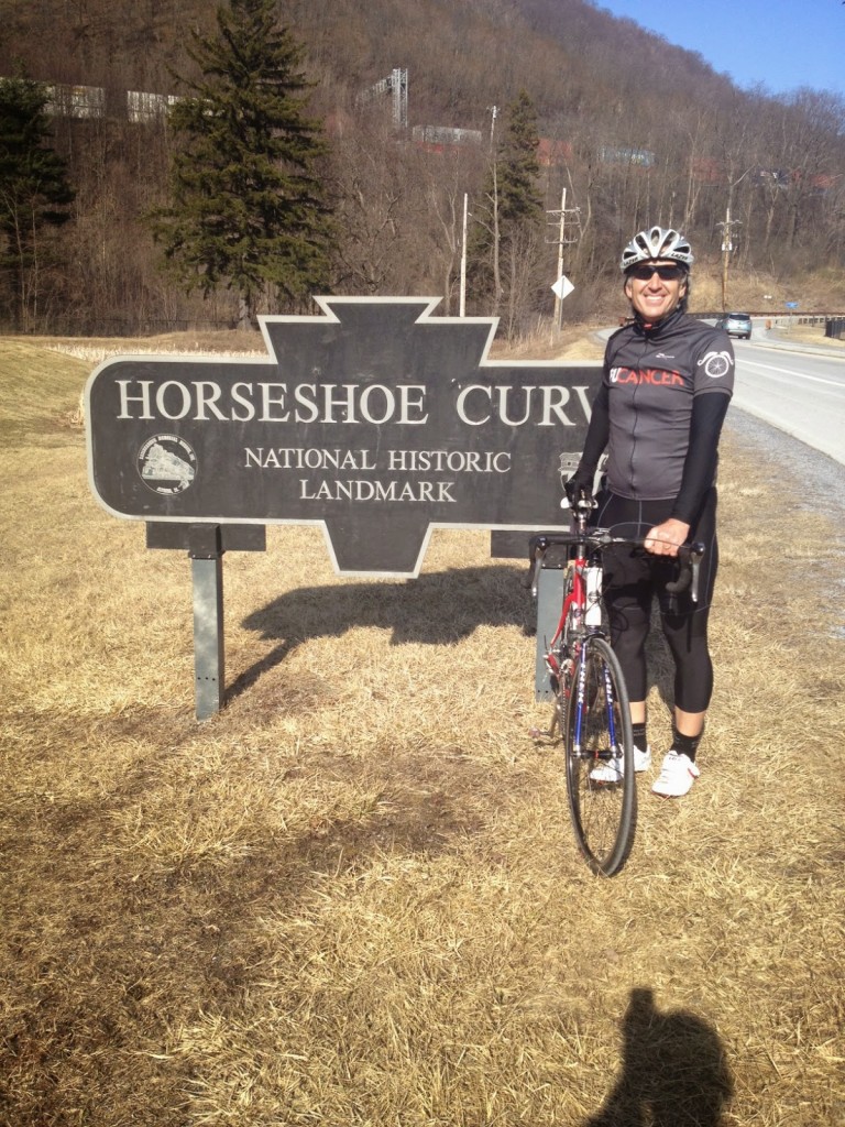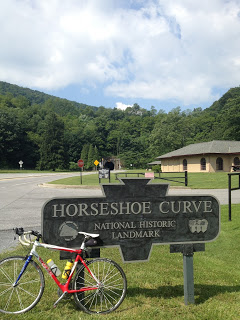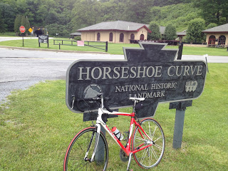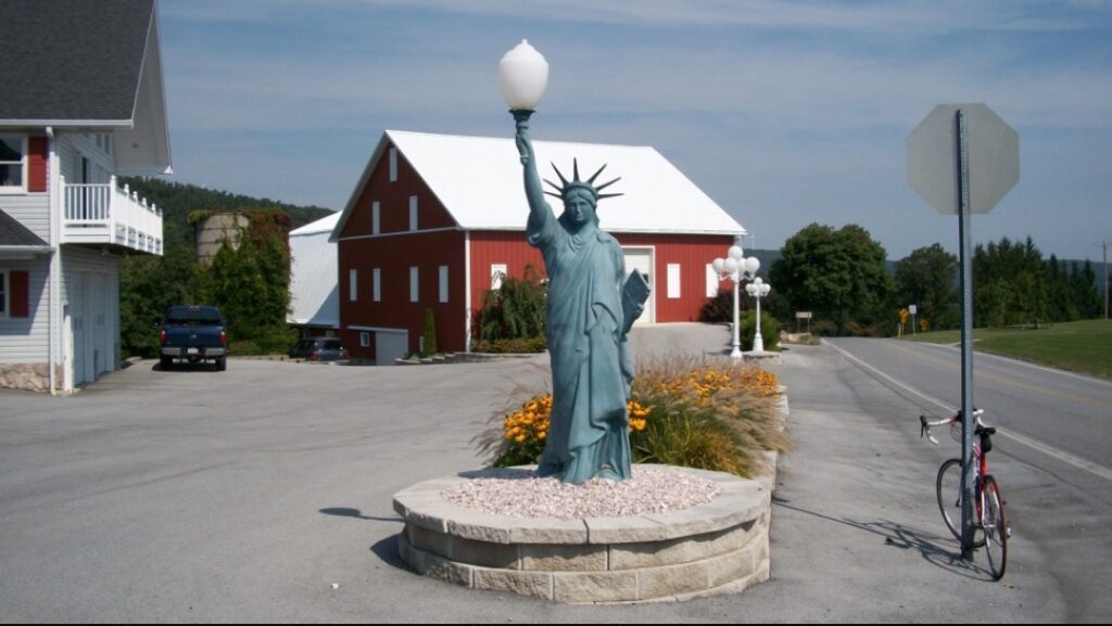
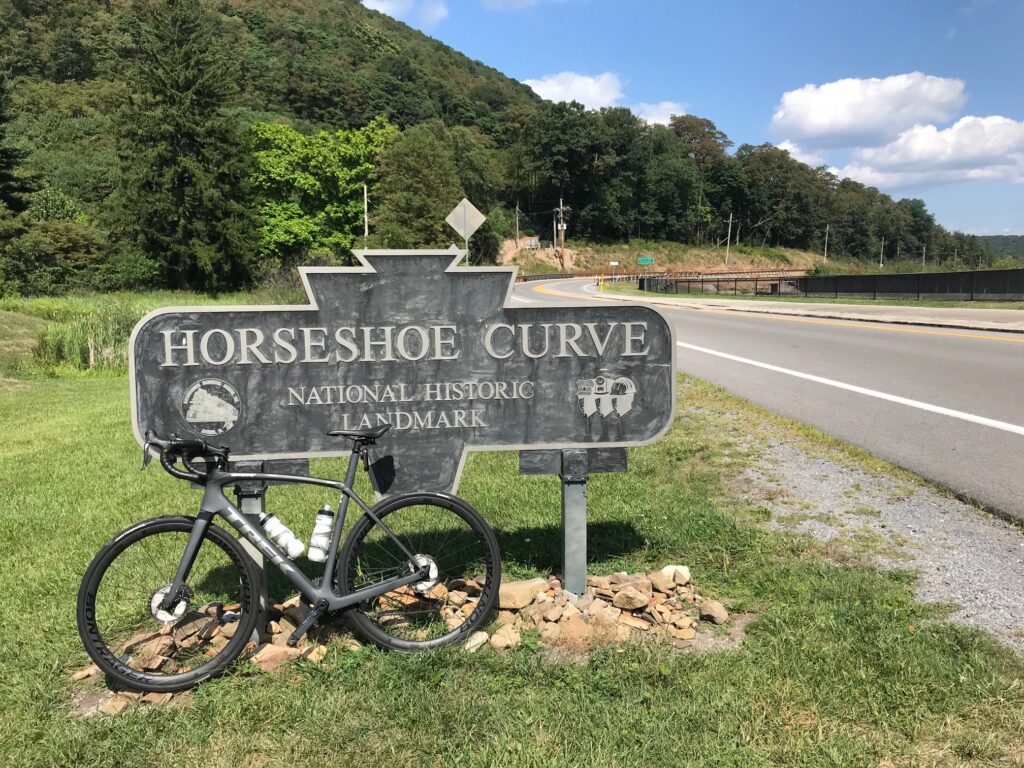
ALTOONA, PENNSYLVANIA
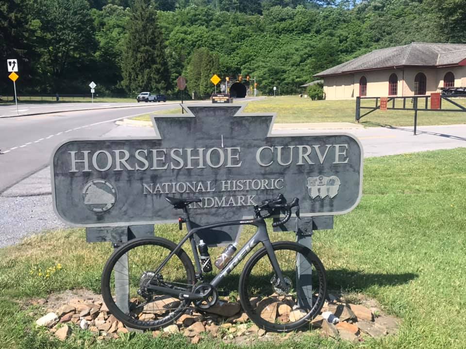
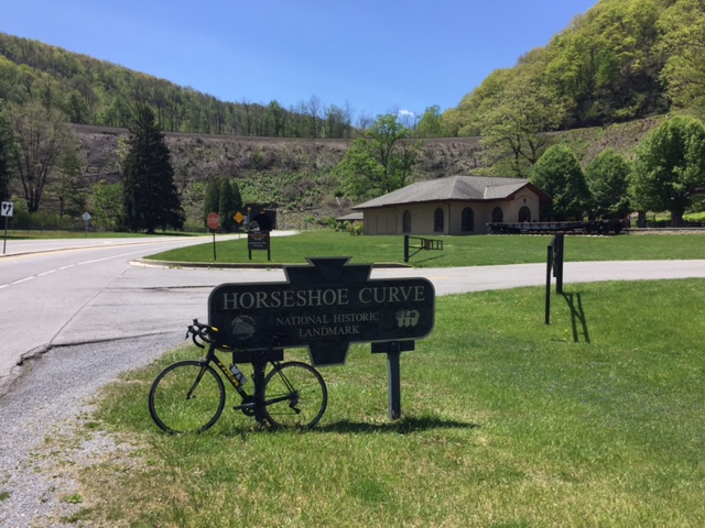
In early 2008 Bicycling magazine published an article about the toughest climbs in each state. Maybe not the toughest but most iconic in each state. For Pennsylvania, Horseshoe Curve was listed with a description of a “Three lakes, a 200′ tunnel and an 18% wall, what could be better?”
It was then I knew I had to ride it. And it has become my go-to ride. My happy place. So let me tell you in my words what is so special here.
I first came here after I read the description. And I keep coming back.
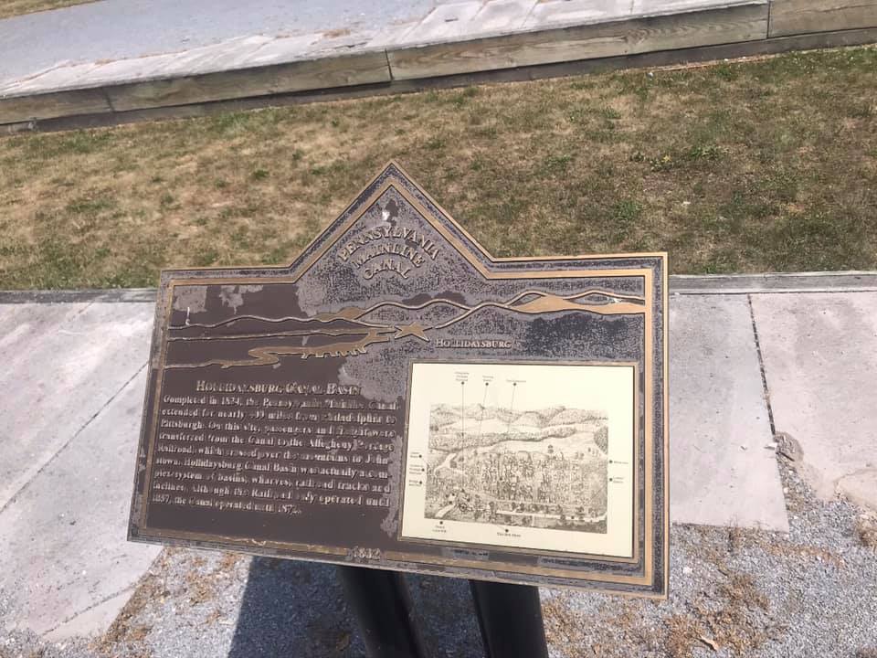
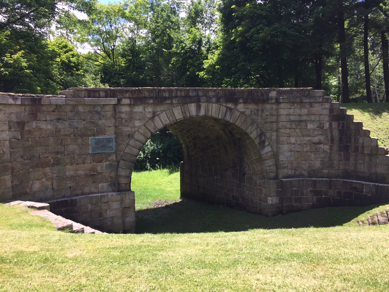
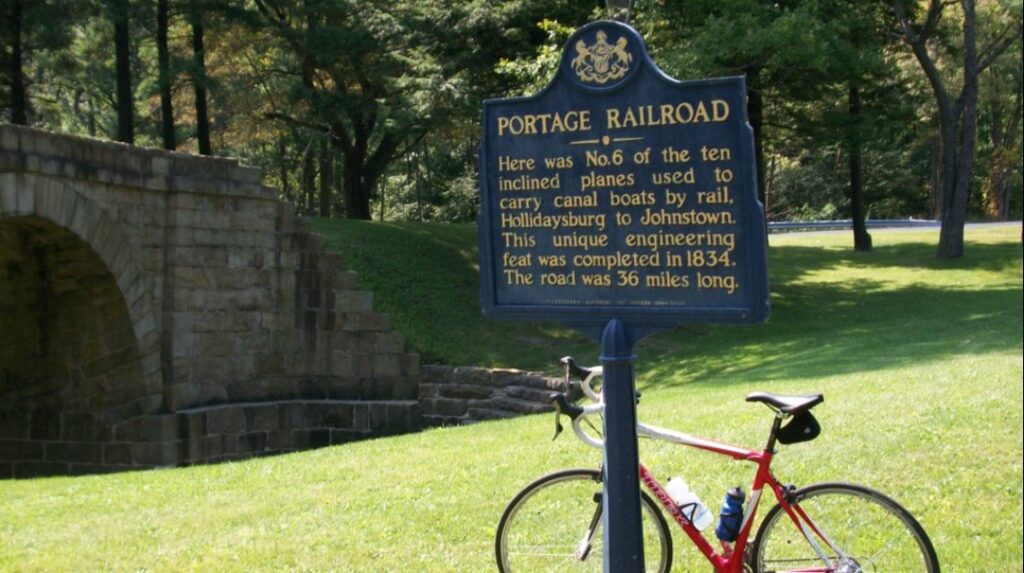
I call the climb Horseshoe Curve. Technically, I suppose, Horseshoe Curve is really the engineering marvel completed in 1854 which got trains over the Allegheny Mountains. The New York Central could run a train from New York to Chicago in 16 hours but it took four days to travel between Philadelphia and Pittsburgh using canals, horses, train cars, and the Allegheny Portage Railroad. One can read about the history anywhere, I will link to an article at Uncovering PA.
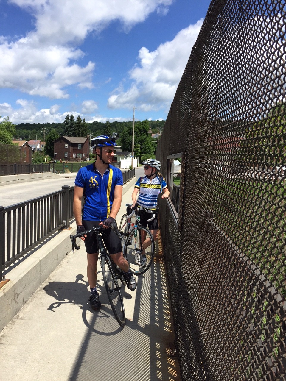
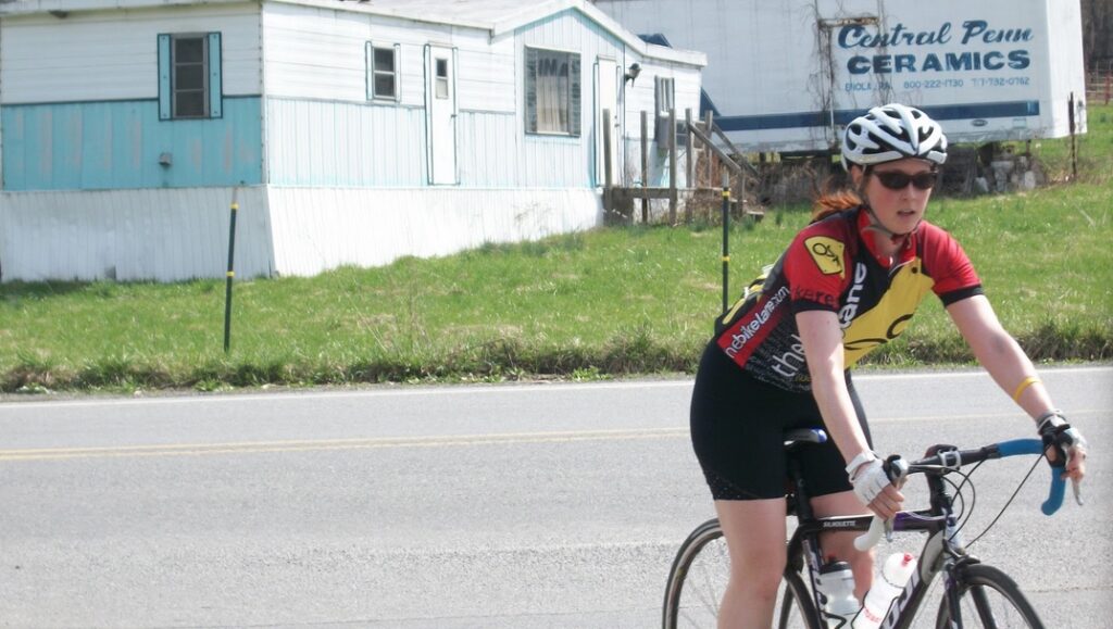
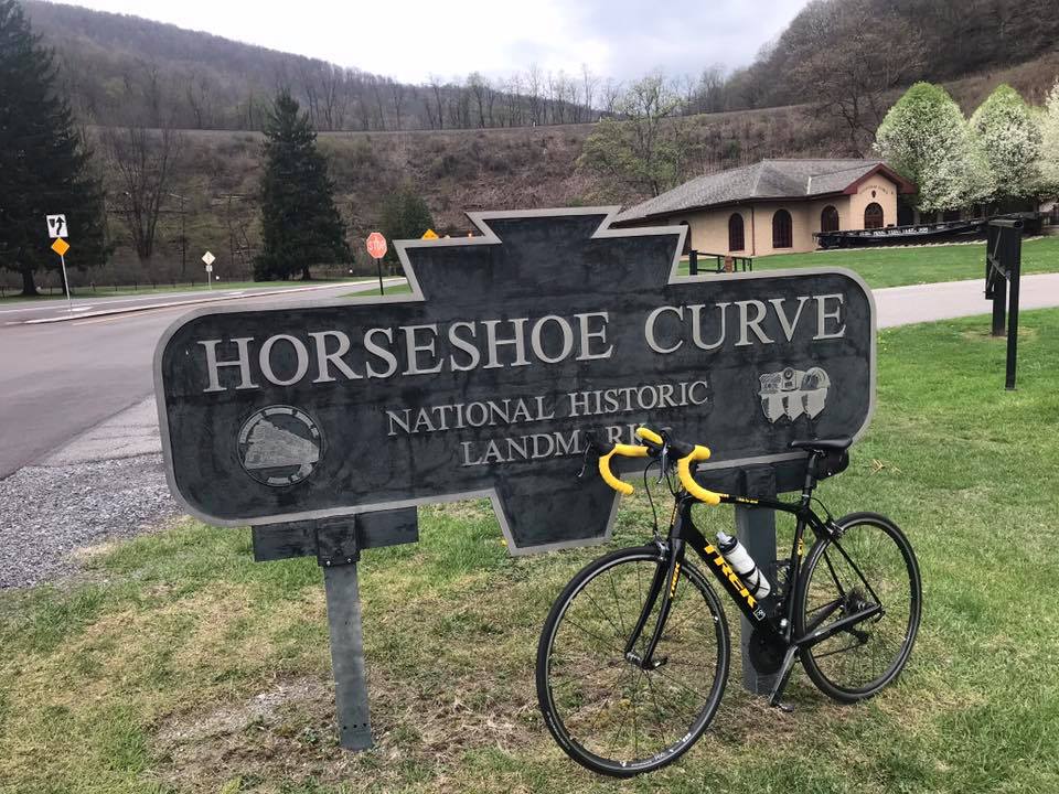
Typically, I park at the Logan Valley Mall to begin a ride. Although gradual, one begins climbing the minutes you push down on the first pedal. It’s about 2.5 miles up 58th Street to Kittanning Point Road. Make a left here and it’s an easy three more miles to the Curve.
If you are lucky, there will be a passing train or two and you can hear the clickety-clack clickety-clack of the train. If it is climbing you can race it although eventually, the sound will pull away.
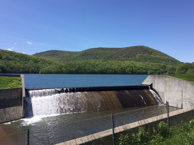
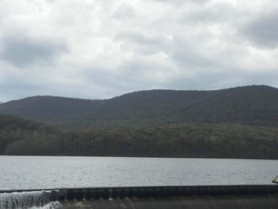
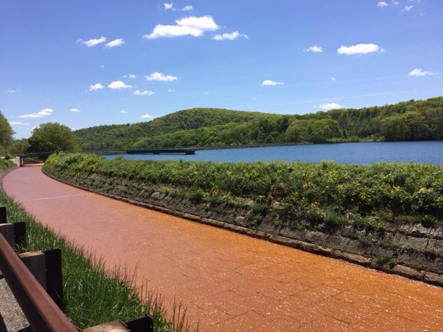
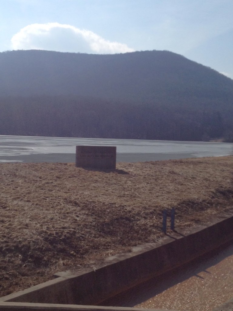
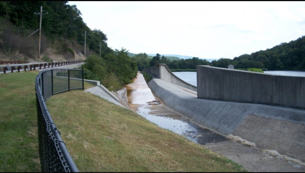
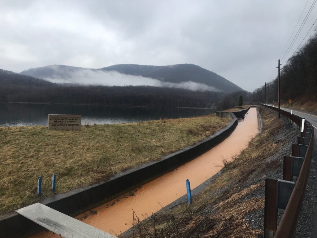
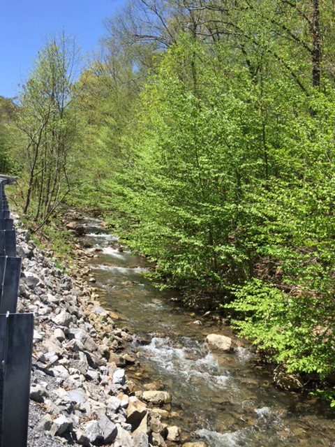
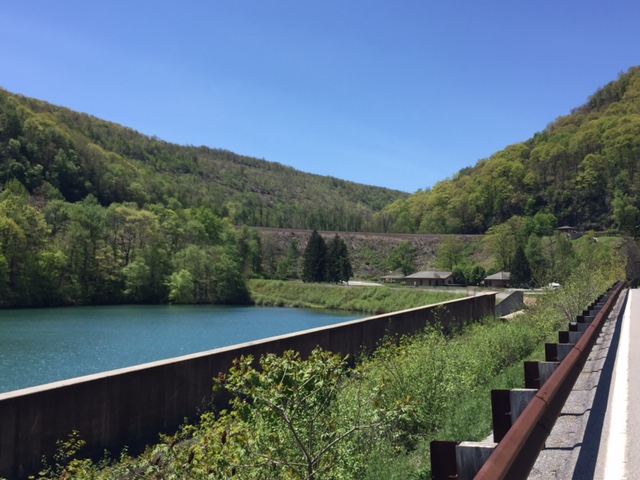
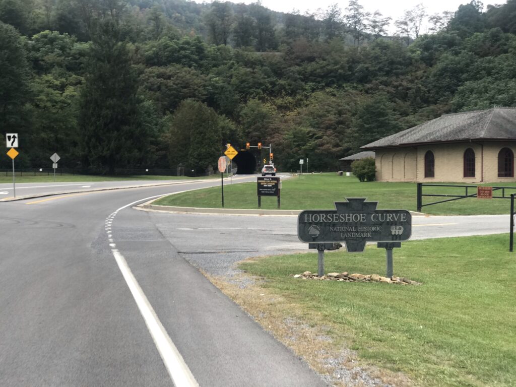
You will pass three lakes – all reservoirs with the Altoona Water System. The first is Lake Altoona, the largest and prettiest of the three. The second is the Kittanning Reservoir. The third is at the Curve itself. It is smaller than the first two and I’m not sure that it is named.
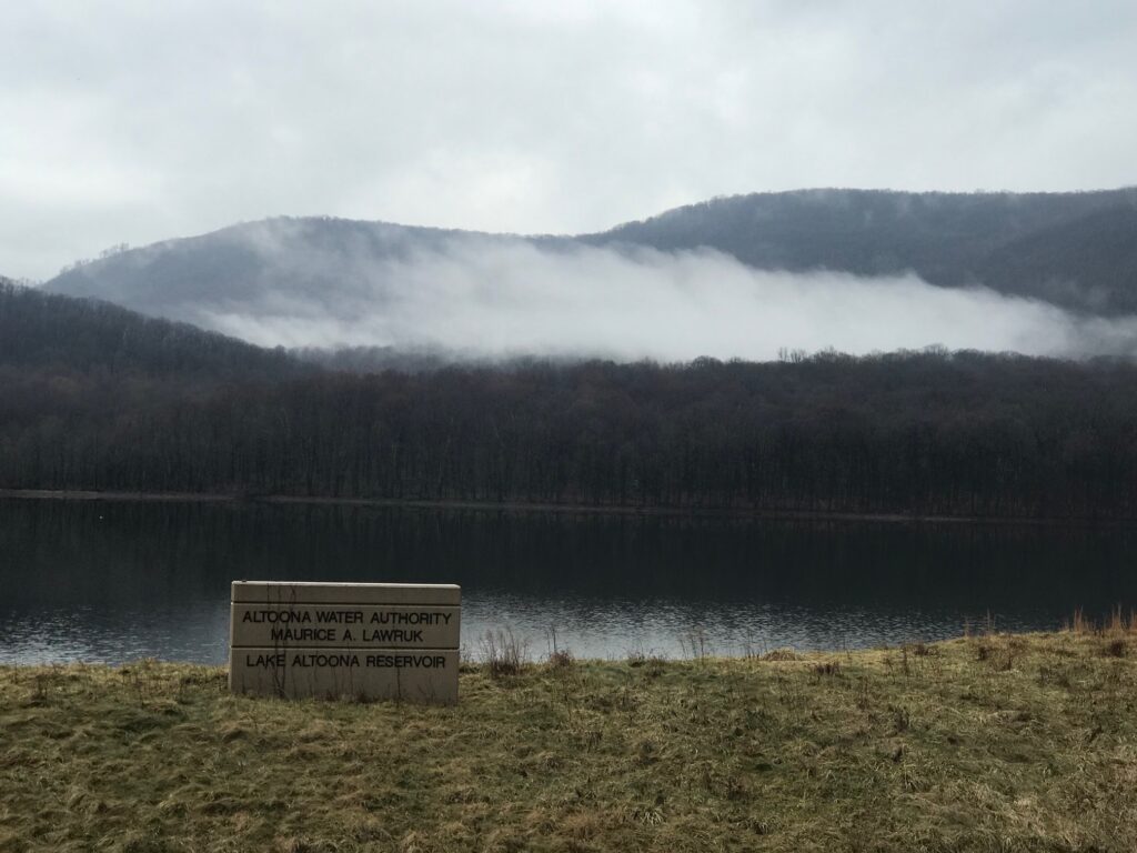
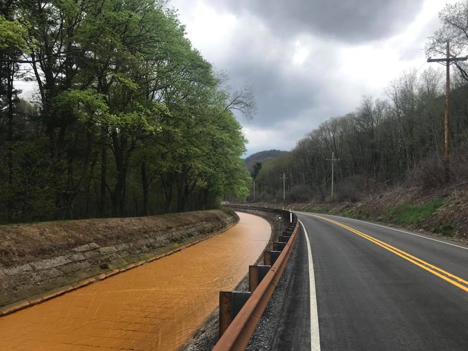
The water in these lakes is pristine. But that is because of a unique water-diversion system. There is a lot of mine drainage in the area marked by the bright orange color of the acid water. There is a canal next to the lakes which carries this water safely past the lakes. I do not know where the orange water goes after bypassing Altoona’s water supply.
These three miles (3.2) are pretty easy. Yes, one is climbing but a lot of it is flat beside one of the three lakes. I calculate this portion to be 1.9% grade.
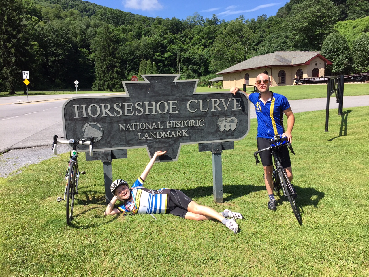
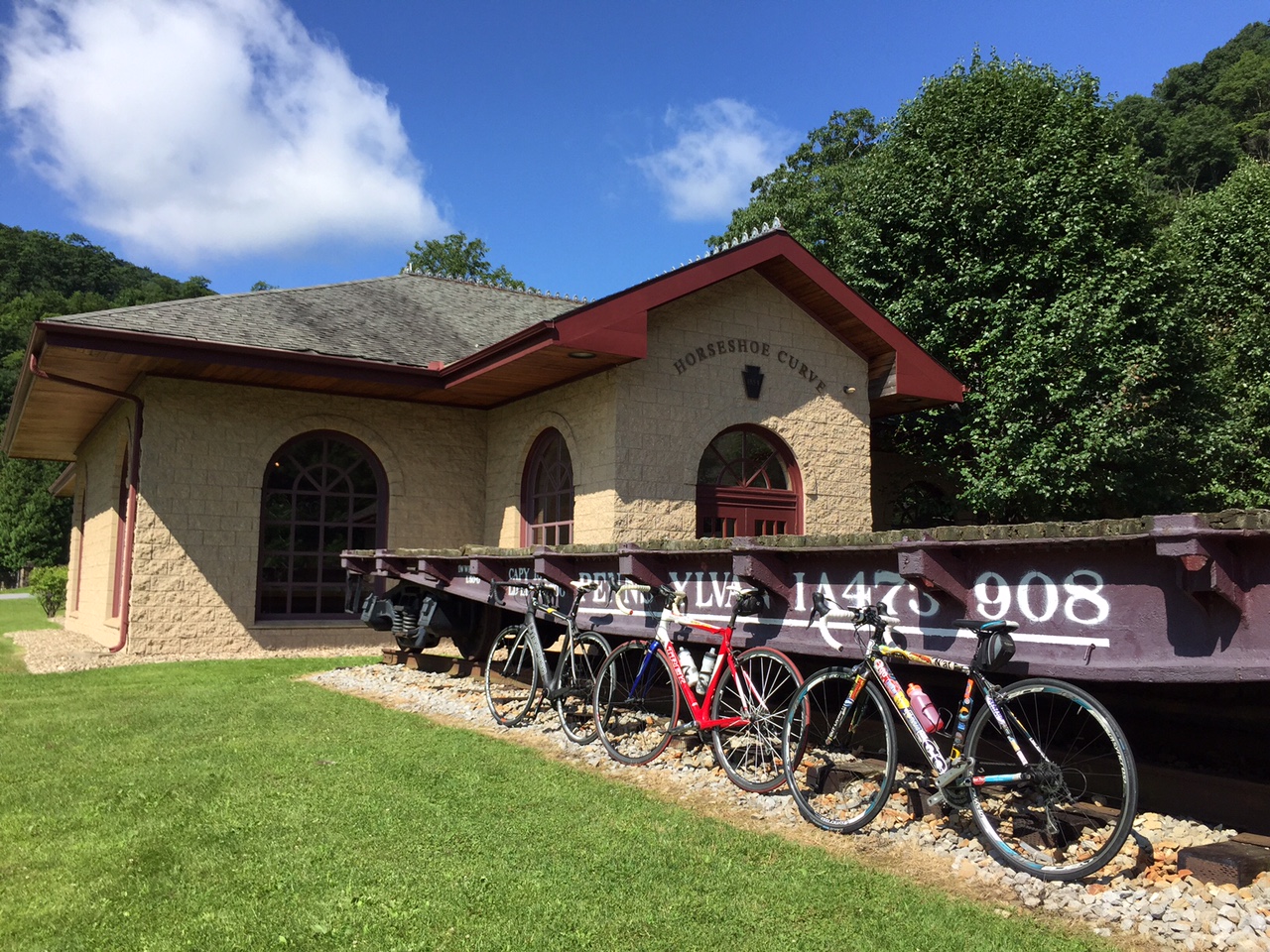
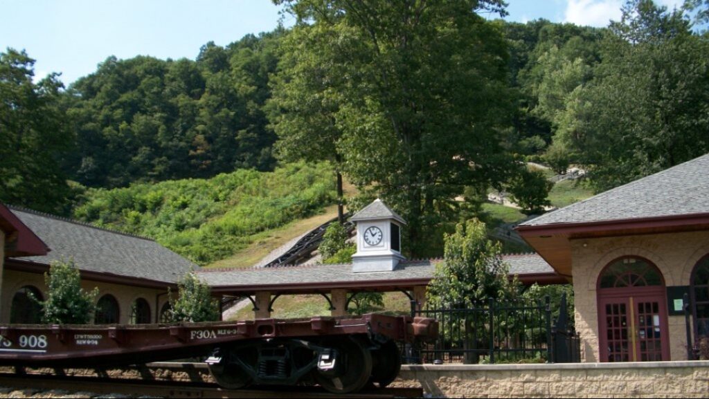
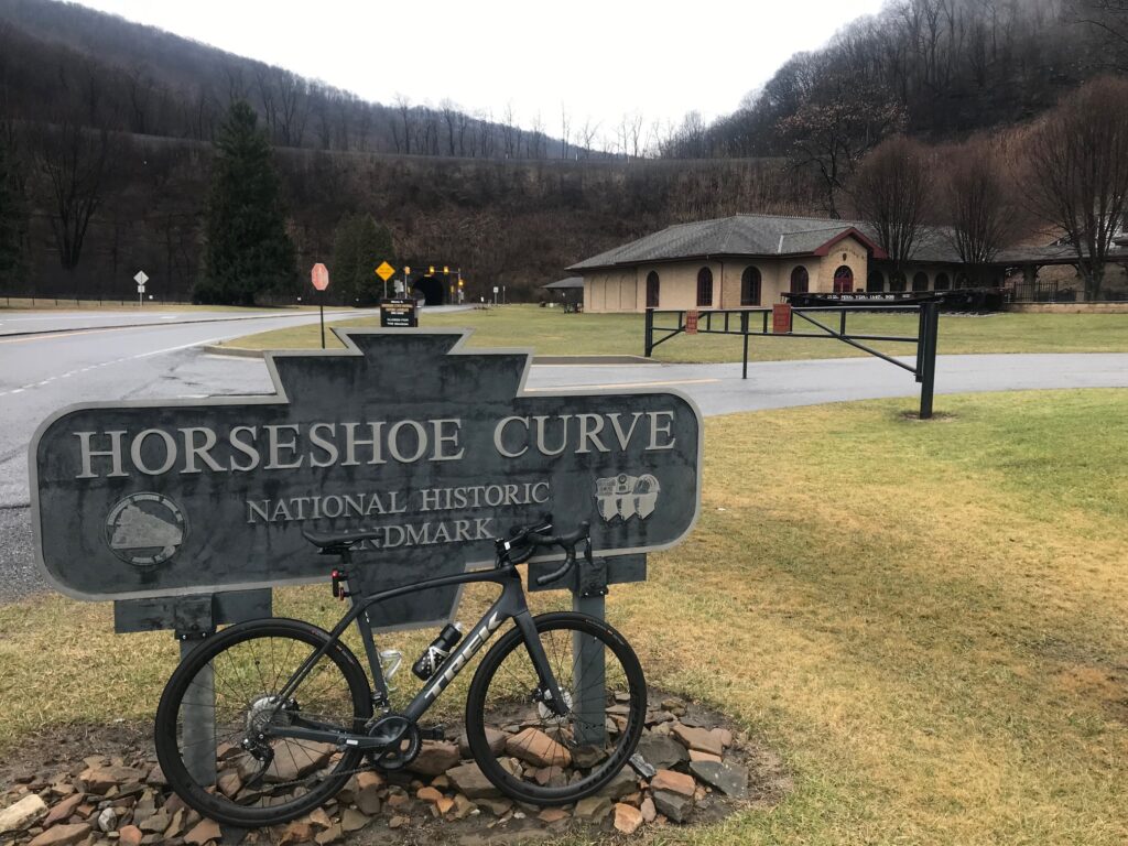
At the Curve itself are the attractions. The Curve itself is the main attraction. This is a pay-attraction area. As of 2020, admission was $8 but one would need to check to be certain. At the Curve, one can climb 194 steps or take a funicular (Inclined plane) to reach the viewing platform. I come here to ride a bike and not watch trains so I cannot comment any further about the Curve.
For years the Curve was covered in heavy forest. Around 2018 they cut down acres of trees which was both disappointing but also pretty cool. Now as you approach the Curve you can see the trains on the tracks. And the passengers on the Pennsylvanian (Amtrak, twice daily) surely must enjoy the view.
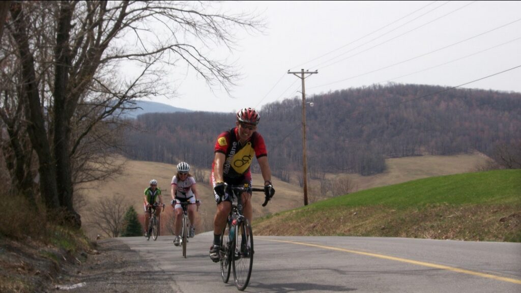
Traffic on Kittanning Point Road to the Curve is generally light and always courteous. In the three miles to the Curve one might get passed by 5-6 cars. Most of the traffic seems to be going to visit the Curve.
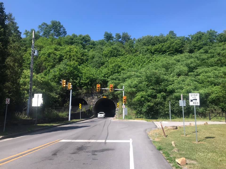
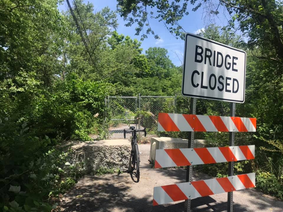
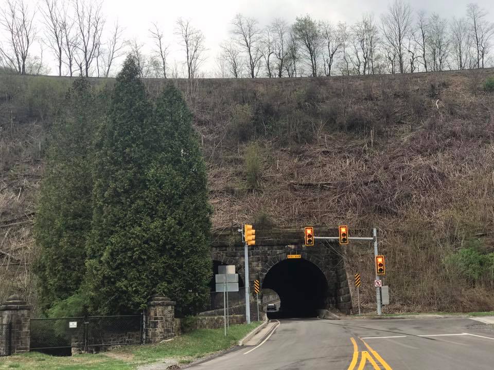
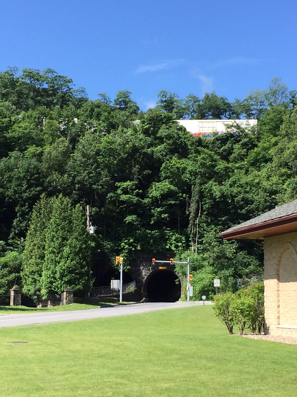
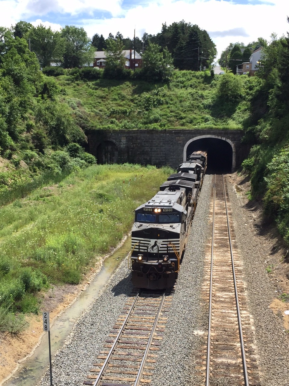
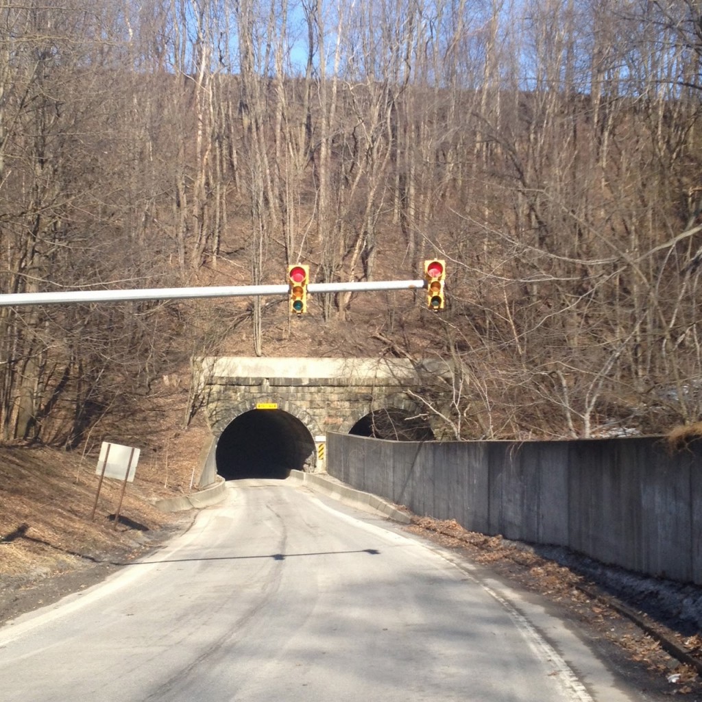
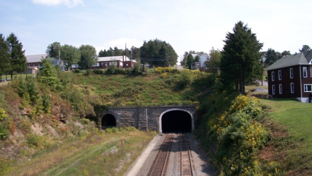
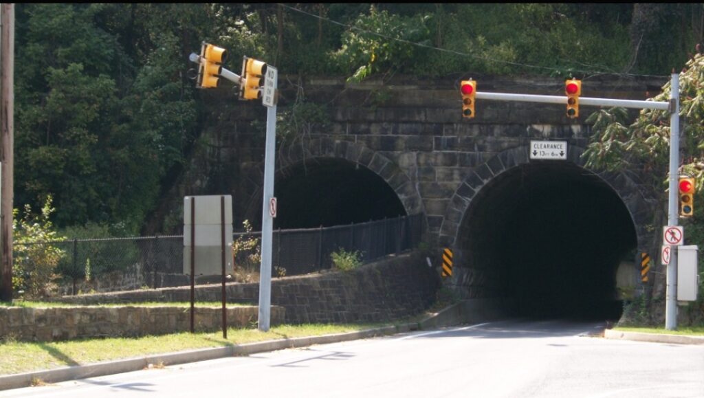
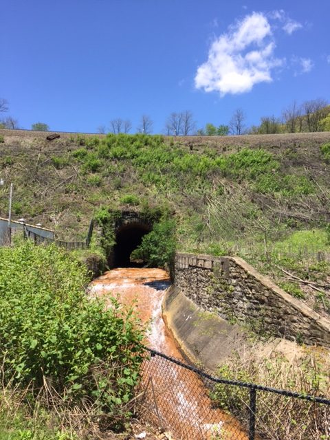
And then the fun begins. There is a 200-foot tunnel that goes under the Curve. Look carefully because there are two tunnels. One is for car traffic and the second is for water – that disgusting orange mine water that bypasses the drinking supply.
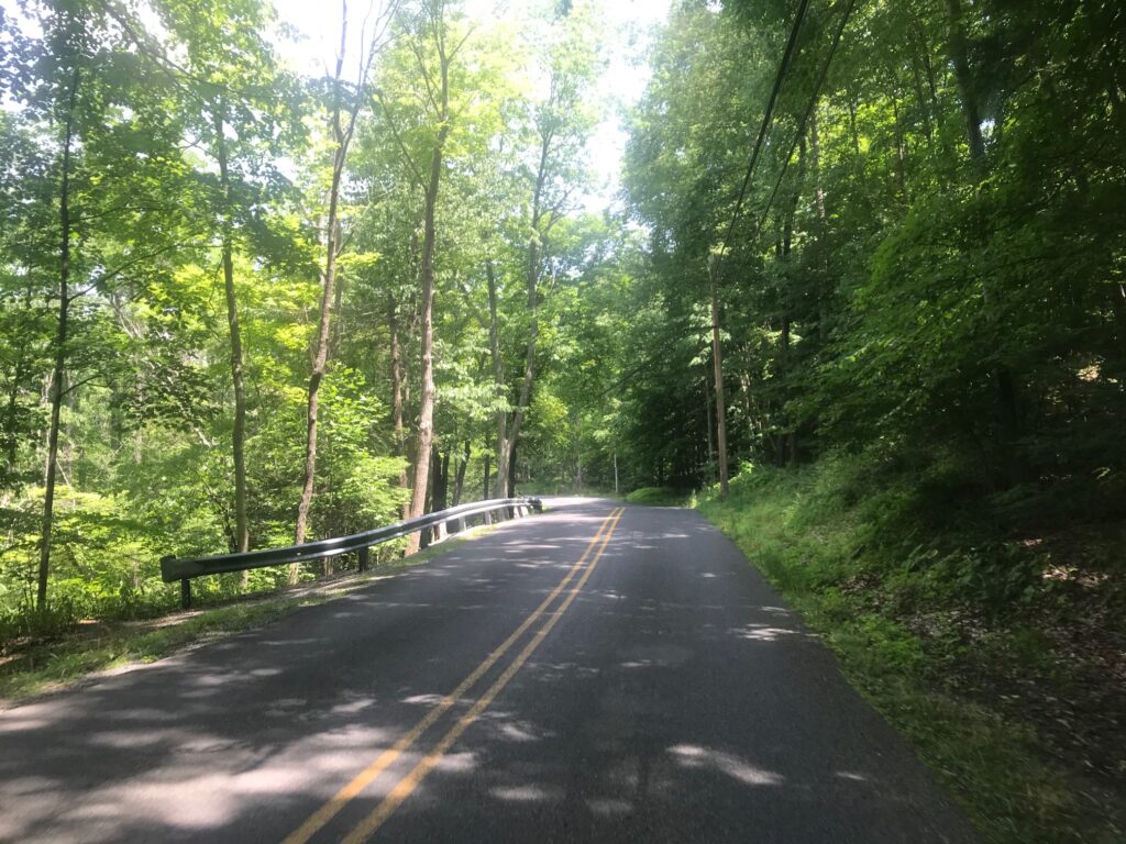
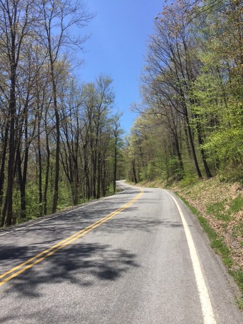
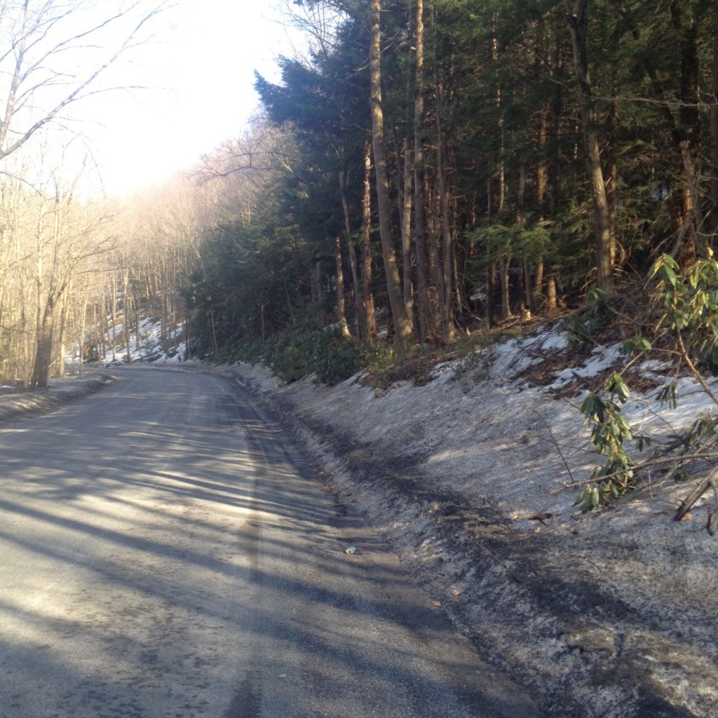
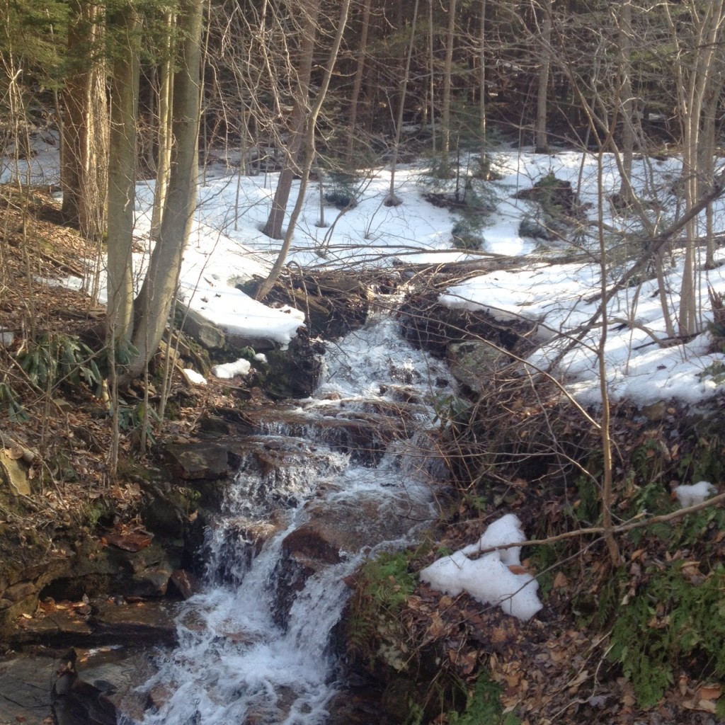
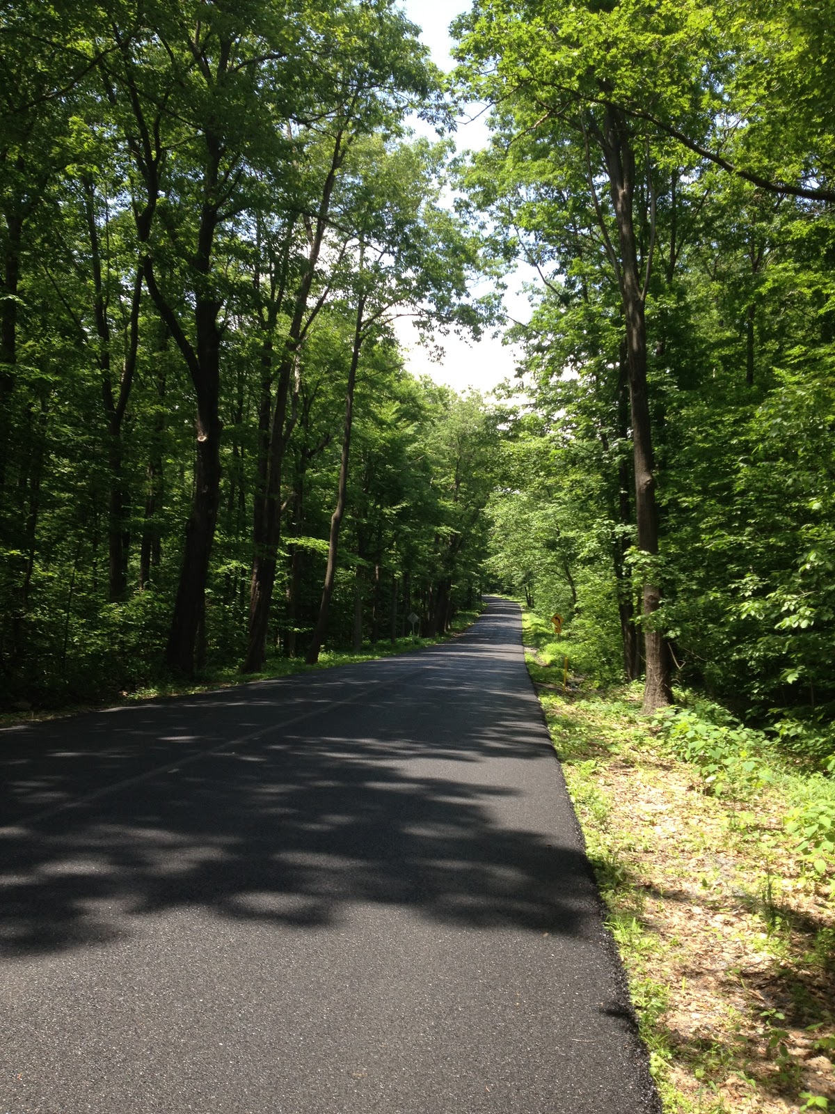
Go through the tunnel and everything changes. First, the road turns up. Second, one is in a deep forest. Nothing to see but trees and water of the Glenwhite Run. It is absolutely beautiful here. (And I typically do not have photos from this area as I don’t want to stop then have to restart.)
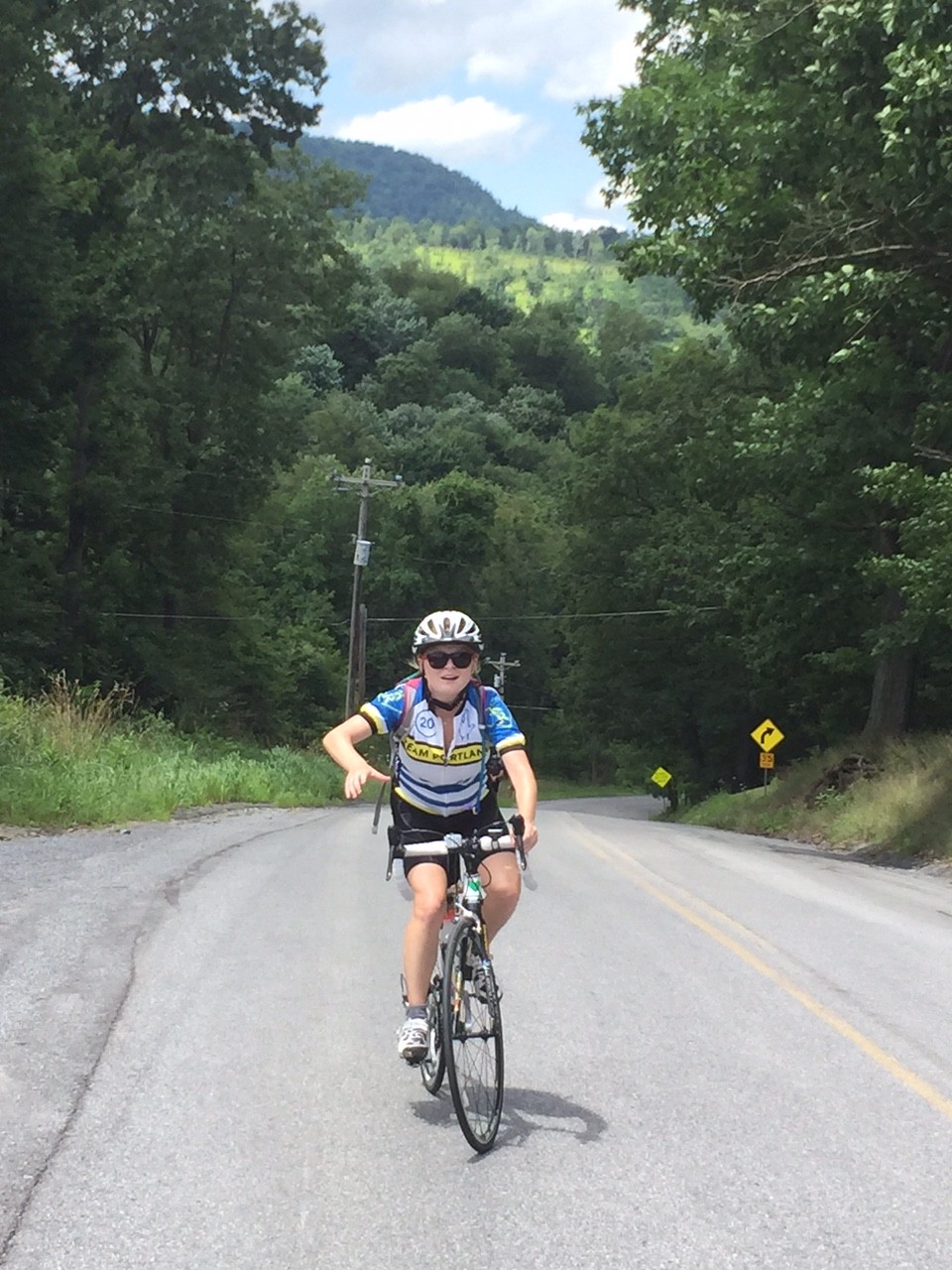
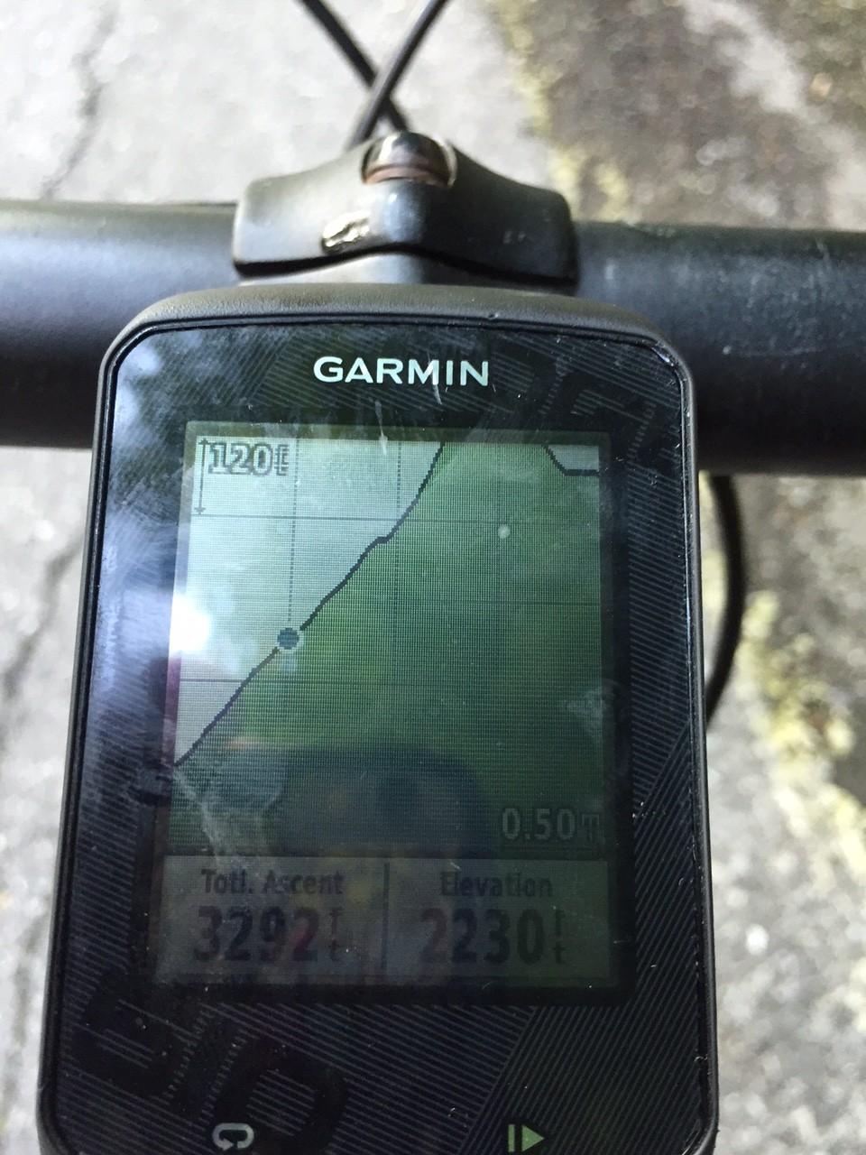
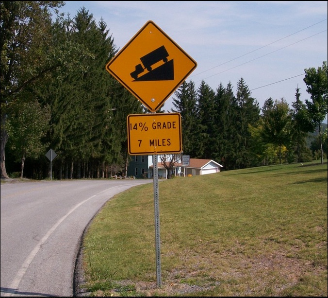
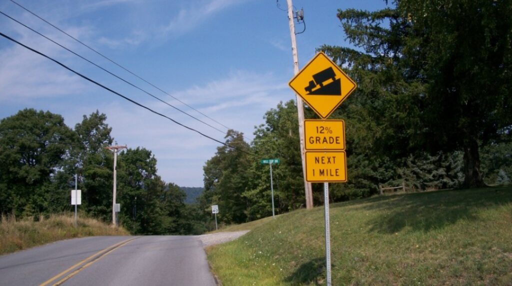
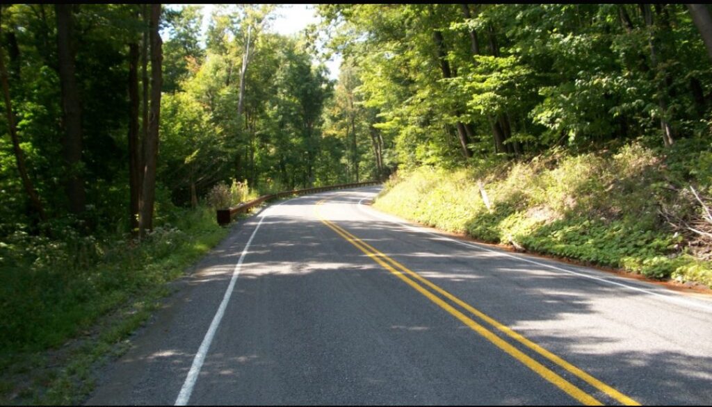
The legs may slow down as the body notices, even if the eyes do not, it is getting harder to pedal. By my calculation, it is 3.3 miles from the tunnel to Coupon-Gallitzin Road. And the grade works out to be 5.3% which doesn’t sound like much. But that also includes a downhill section near the top.
There is a half-mile section that averages more than 12%. The “Wall” is 18% or 19%. Two things always happen when I go up this road. First, I always battle myself and wonder if this will be the first time I have to get off and push my bike. And second, there is an immense feeling of satisfaction and pride from having made it.
I am almost always alone on this stretch. Traffic is light – often only 1-2 cars will come up the road. Today, there was a logging truck followed closely by a car. And that was it.
I’ve had my moments with others too. In 2009, I met Richard and Stacey Fiore riding up the road. Stacey had never made it before without walking and I sent her husband up the road while I rode with and encouraged her. I thought we had it but she dismounted only about 50′ from the top of the Wall.
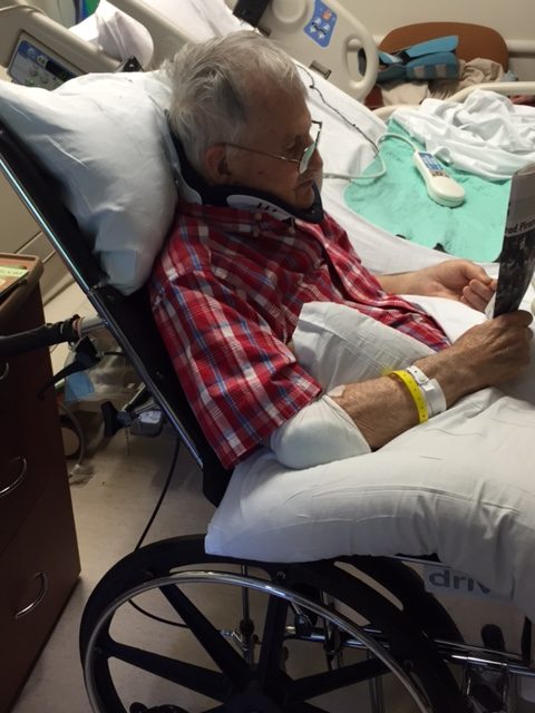
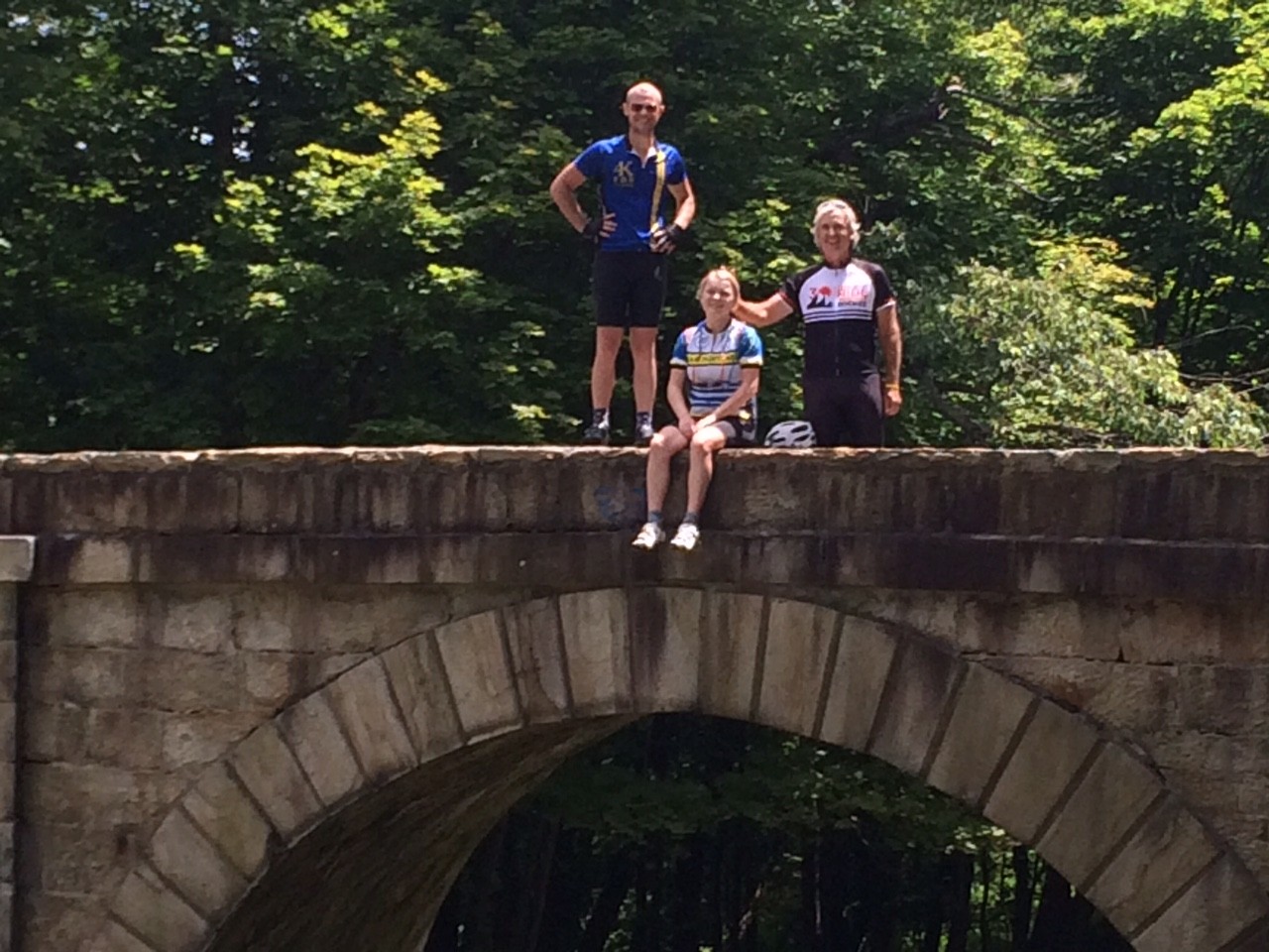
For my first post-cancer ride in 2010, I brought some friends here from Northern Virginia. None was more special than my good friend, Scott Scudamore. I am sure glad he got to experience this climb and we had a blast twice bombing the descent on Sugar Run Road.
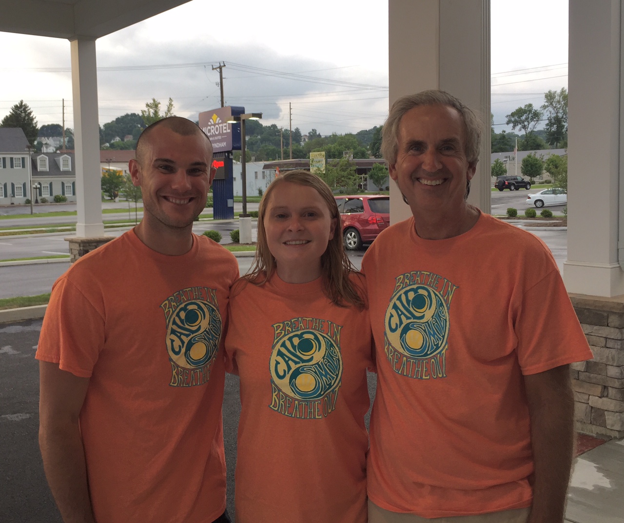
Kelley Vito said she understood why I find peace here because “you only think about dying while climbing that hill.” In 2017, I was with Chey Hillsgrove and Chelsea Johnson. Chelsea would see a curve ahead and then ask – “Oh my God, is that where it begins?!” I laughed and told her the truth – “Oh no, that’s not the Wall – the Wall is much worse.”
I would have bet against Chelsea that day but she found her inner strength and made it. I was so proud of her.
But Kelley was right. When I come to these mountains, all I can think about is the next pedal stroke. Pushing up that hill. Or descending at crazy fun speeds but 100% focus on the descent. There is no time for cancer in my life when I am in these mountains and on this climb.
I was feeling quite down this morning. And I looked on my bike and the stem cap says “I am a Survivor – 10 Years.” And my bad feelings went away. Let’s enjoy this day!
I didn’t have any segments starred in Strava so none displayed as I was riding. But at the end of the ride, I saw I was averaging more than a 15 mph pace. And I don’t think I ever did a ride with this climb that I averaged 15 mph.
I looked at Strava. I averaged 15.4 mph. And I had PRs on all the segments. Most of those I am #1 in my age group as well. Although my times are nowhere near the best times – I can’t compete with the young guns. But in competing against myself (PRs) and in my age group, I did pretty well.
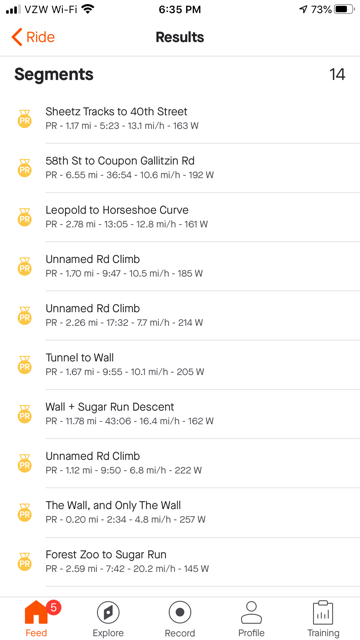
My earliest rides were not recorded. The first record ride I can find of Horseshoe Curve was August 2, 2009. I had lost a lot of weight prior to my cancer diagnosis. In addition, I was “training” for the Mount Washington Auto Road Bicycle Hillclimb. And on the same route as today, I averaged 14.2 mph. Of course I was 11 years YOUNGER!
For one day, I felt strong(er) in the mountains. My times pale in comparison to the young riders but I was better today than 11 years ago. And only in the last five years have my rides been uploaded to Strava for those comparisons – and I broke every personal record there too. On a heavy gravel bile.
This mountain is where I come to get away. And this is where I find peace on a bike.
Distance: 20.4 miles
Average: 15.4 mph
Max Speed: 41.8 mph
Weight: 179