Lunch with Texas Friends

LINDEN, VIRGINIA

Planning for this day began weeks ago, accelerated last week, then almost blew up today.

Welcome Texas 4000

At 3:00 a.m. my alarm went off. I ignored it but never really got back to sleep. I had offered to provide lunch today for the Texas 4000. With everything in place I received a text at 10:00 p.m. last night that the location I worked hard to secure would not work because the satellite view showed there was not enough room to turn their van and trailer around.

Ready to roll with a pocket full of Twizzlers

We would leave the house without knowing where we would be setting up. All of us, lunch providers and the Texas4000, would have to be very flexible about where we met.

Apple butter cinnamon donuts from The Apple House Restaurant

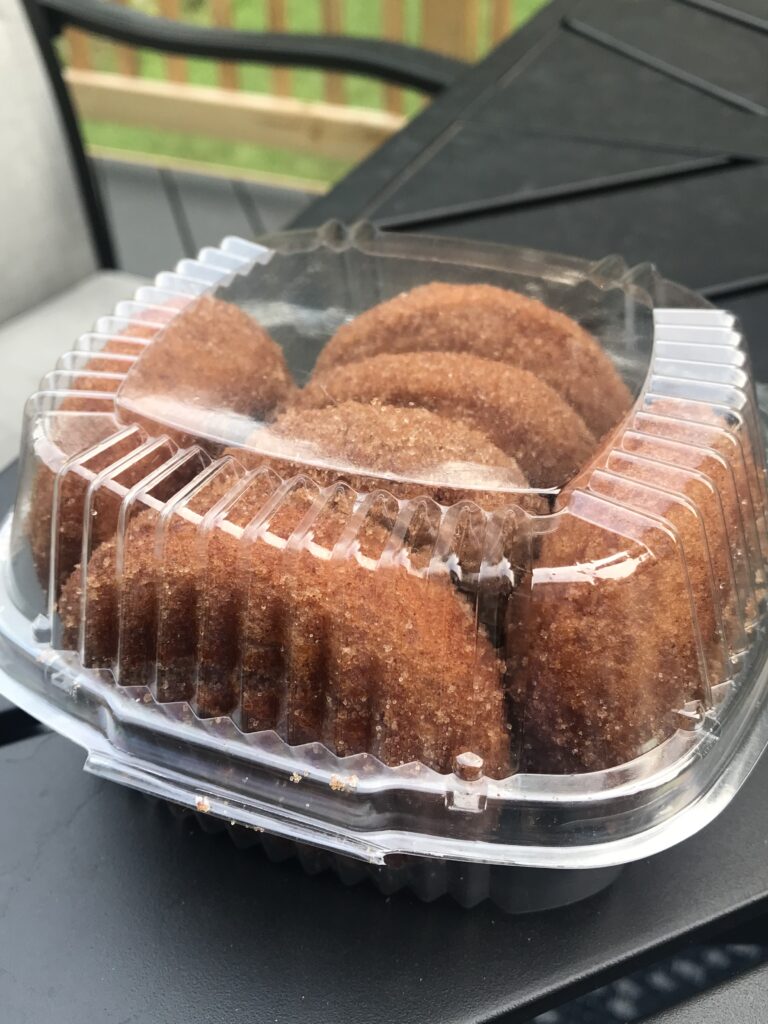
Cheri and I left home around 7:00 a.m. to set up the lunch stop. Our destination was Linden which was around Mile 75 of their 150-mile day. We were still on the road at 8:15 a.m. when I got a text that the first group was way ahead of schedule and would be in for lunch at 9:00 a.m. It was “lunch” because they ate at 3:30 this morning in preparation for a 4:00 a.m. rollout.

My Texas 4000 Stem Cap

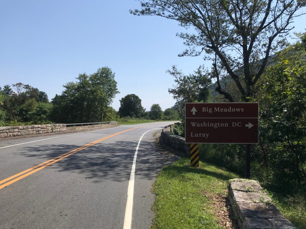
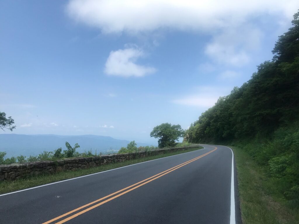
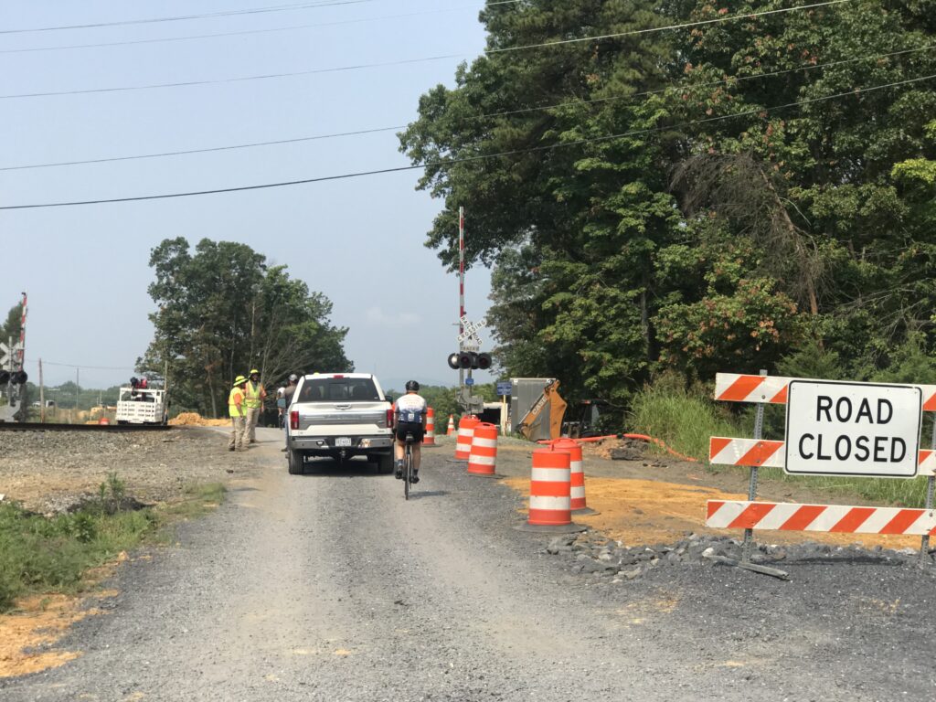
Rather than take Interstate-66 to Linden, we took Watermill Road which is a beautiful backcountry road as I knew the roads they would be riding today. I didn’t know how many groups were on the roads (I figured three or four – answer: three) and whether they would be ahead of us or behind us on Watermill as they came down Mountain Road.

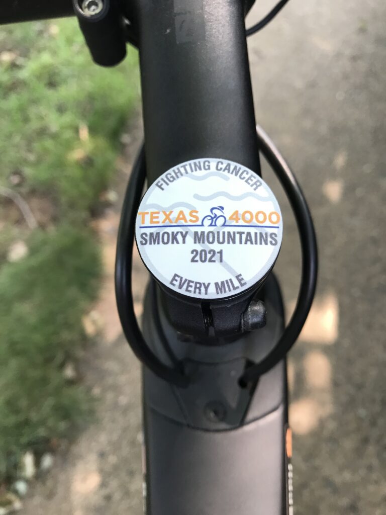
We came upon four riders for the T4K. I have a T4K jersey that I bought in 2016 and we gently passed going wide very lightly tapping repeatedly on the horn. Cheri waved the jersey out the passenger window. We heard a shriek. “That is so cool!!!”

As we continued to drive on Watermill we came upon a second group. Again, a gentle pass of the group with a multiple light horn tap, enough to let them know we were friendly and that they should look. This time it evoked a louder reaction. Both groups would say that was a real pick-me-up as they were already on Mile 50 of a 150-mile day.

Still unsure of where we would meet them and set up lunch, we stopped at the Apple House restaurant in Linden. I would be quick and left my wife, my phone, and the keys in the car as I went inside for donuts. The manager had promised that they would donate donuts but since I was unsure of who was working, I grabbed my Texas4000 jersey as a way of explanation.

Austin, Autusa, Kirsten, Morgan

Aaliyah, the cashier, disappeared for a second and went to get two dozen donuts. I opened the door to the restaurant and motioned for my wife to come in “but leave the car unlocked” and she did. The car had power-locked behind her. A sick feeling instantly hit me.

The keys and my phone (which could unlock the car) were in the car. We were at least one hour from home and our extra key and no way to get there. I felt sick to my stomach. Minutes earlier I had been texting with Adrian from the Texas4000 about where to meet and now my phone was in the car.

Austin, Autusa, Barry, Kirsten, Morgan
And there is my Texas4000 jersey

Still in my hand, I hung my Texas4000 jersey on the rear of the car facing James Monroe Highway (Rte 55). Almost immediately Lindsey and Serena from the T4K popped in driving one support vehicle.

Texas 4000 van and trailer

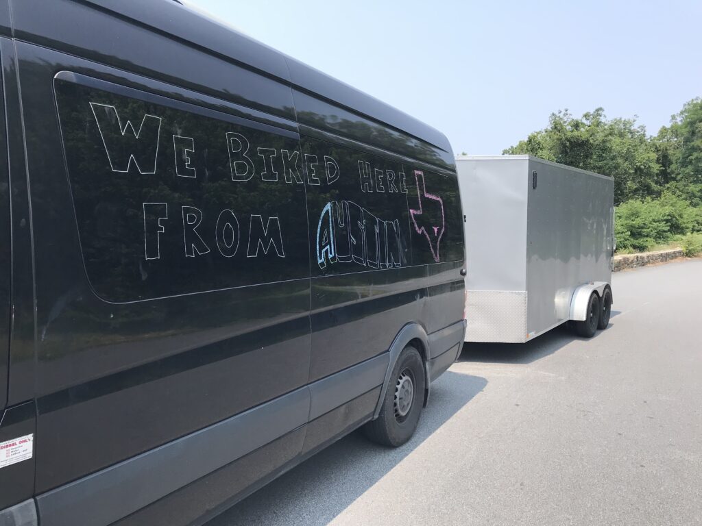
Shortly thereafter the van and trailer with Adrian came into the lot. Adrian had been my point of contact the past month and we were looking forward to meeting. But I felt like crying. All the food was locked in our car. Striking out on calling a locksmith, Aaliyah suggested calling 911. Cheri did. We only needed to have a child, pet, or life-saving medication in the car which needed extraction. So we did.

Deputy sheriffs from Warren Co., Va.

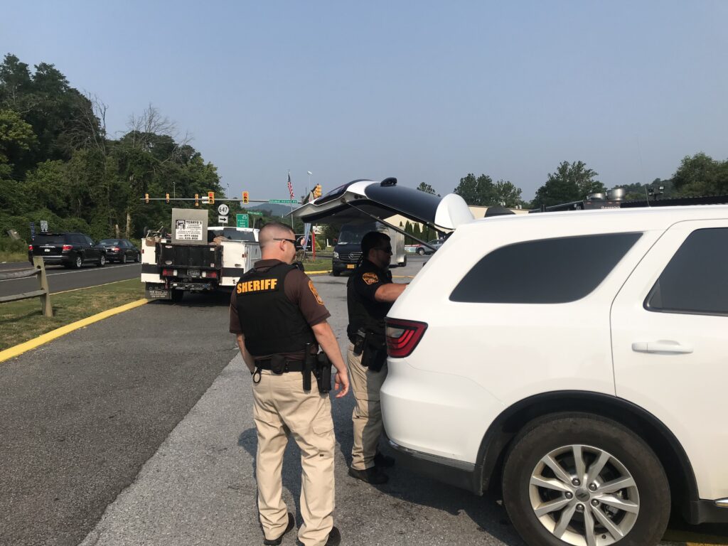
Two deputy sheriffs from Warren Co. showed up within 6-7 minutes. While it seemed like hours, they were able to get their super coat-hanger into the car and press the unlock button.

Riding through beautiful downtown Front Royal

With both support vehicles of the Texas4000 and still nowhere to go, I went back into the restaurant and got permission to use their picnic tables. And we hurriedly started setting up.

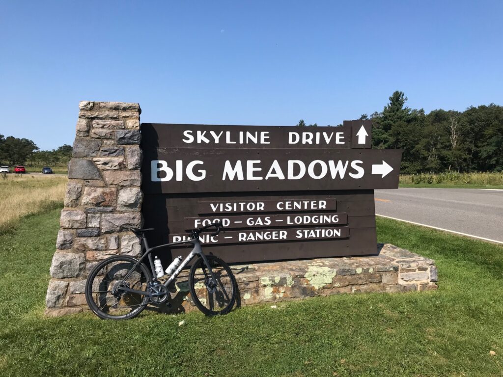
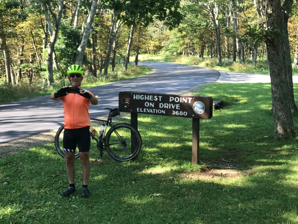
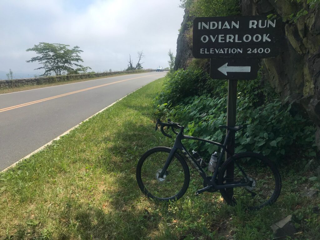
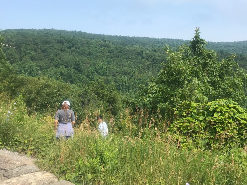
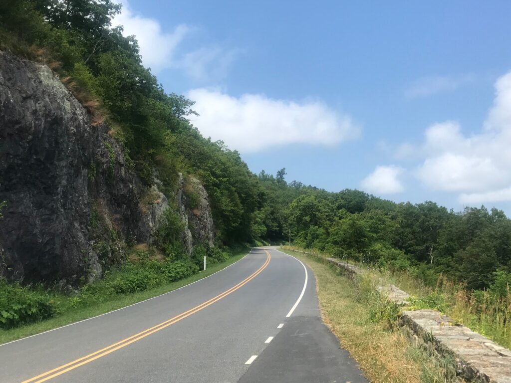
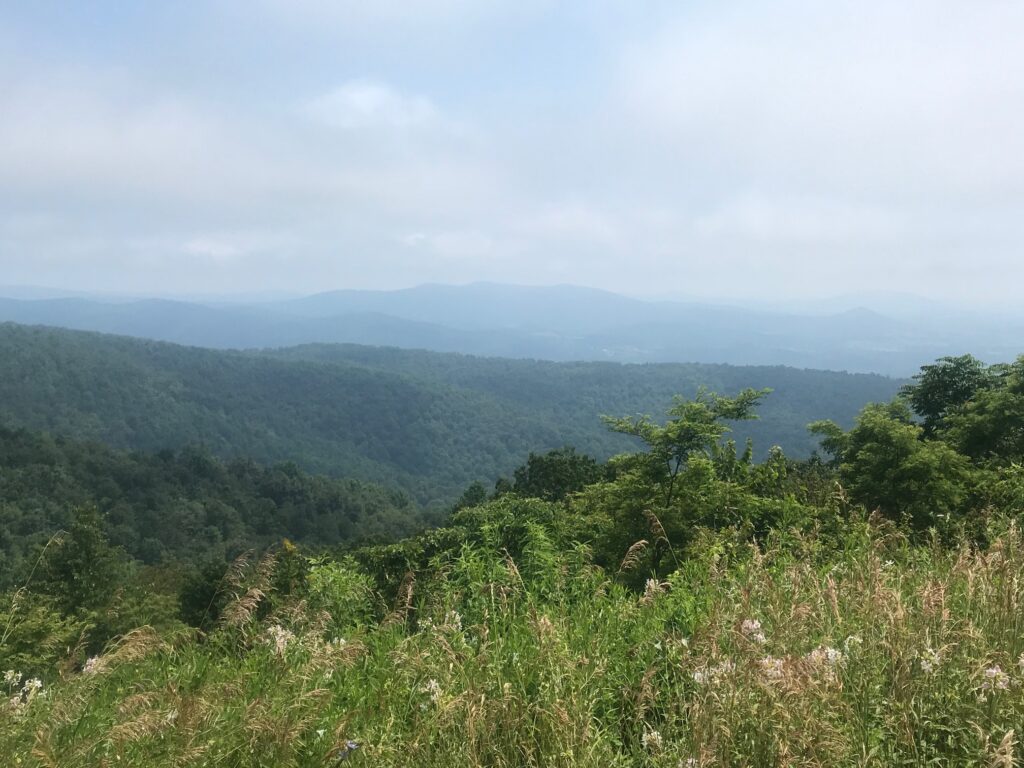
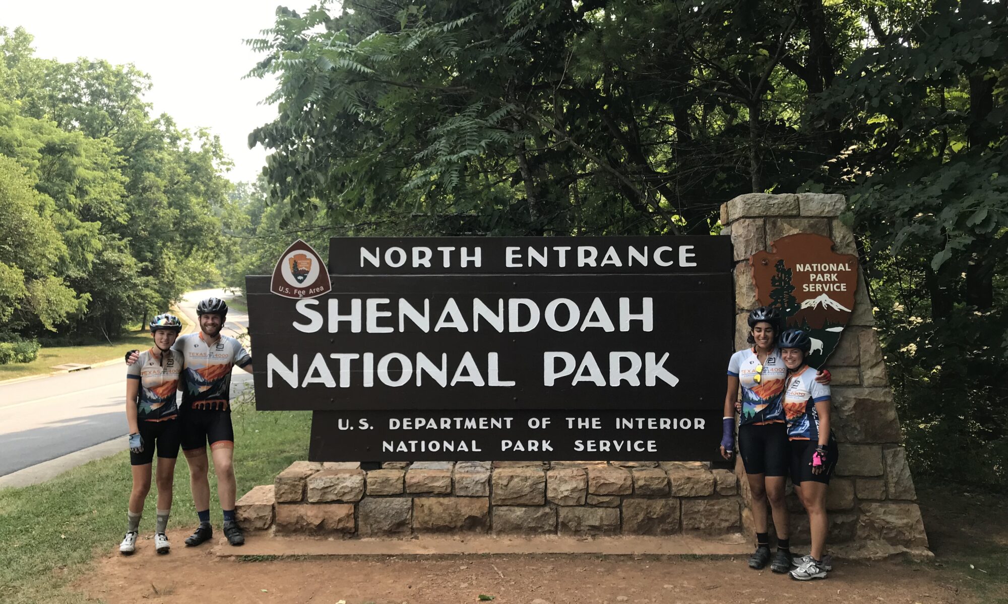
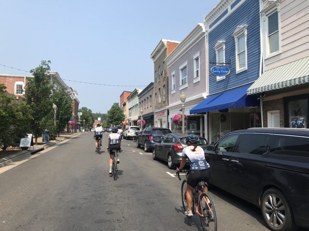
The rest stop was short since the riders were on a long day. A Challenge Day they call it and today would be 150 miles and about 15,000′ of climbing. And most of the climbing was in the second half of the ride.

Austin, Kirsten, Autusa, Morgan (crashed by Barry) at the Skyline Drive entrance

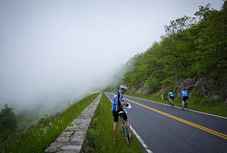
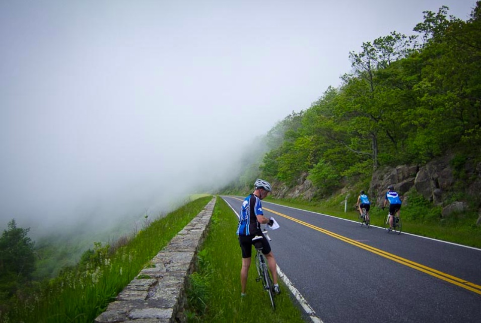
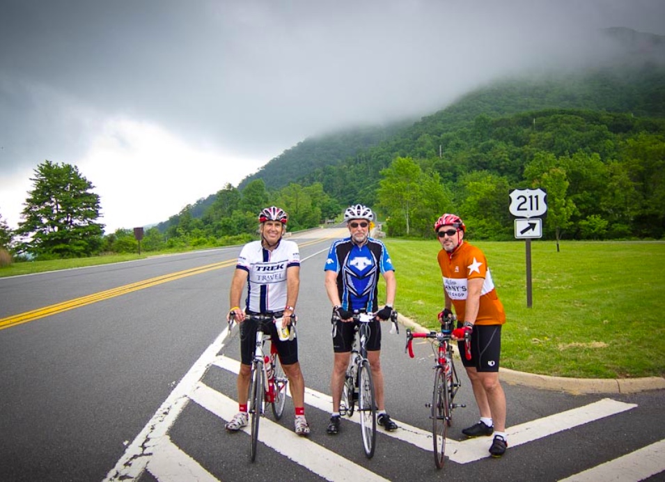
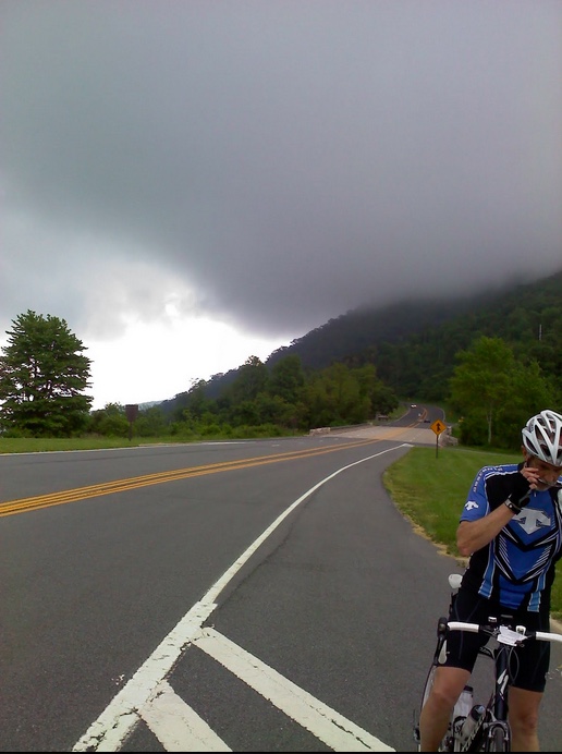
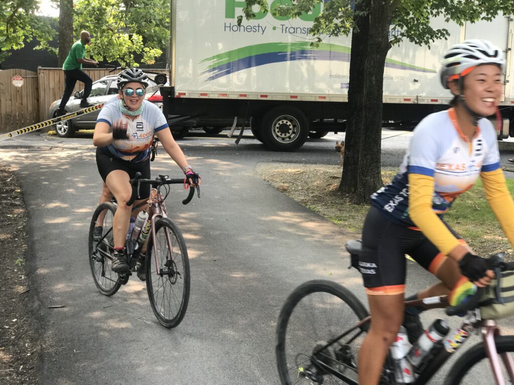
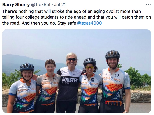
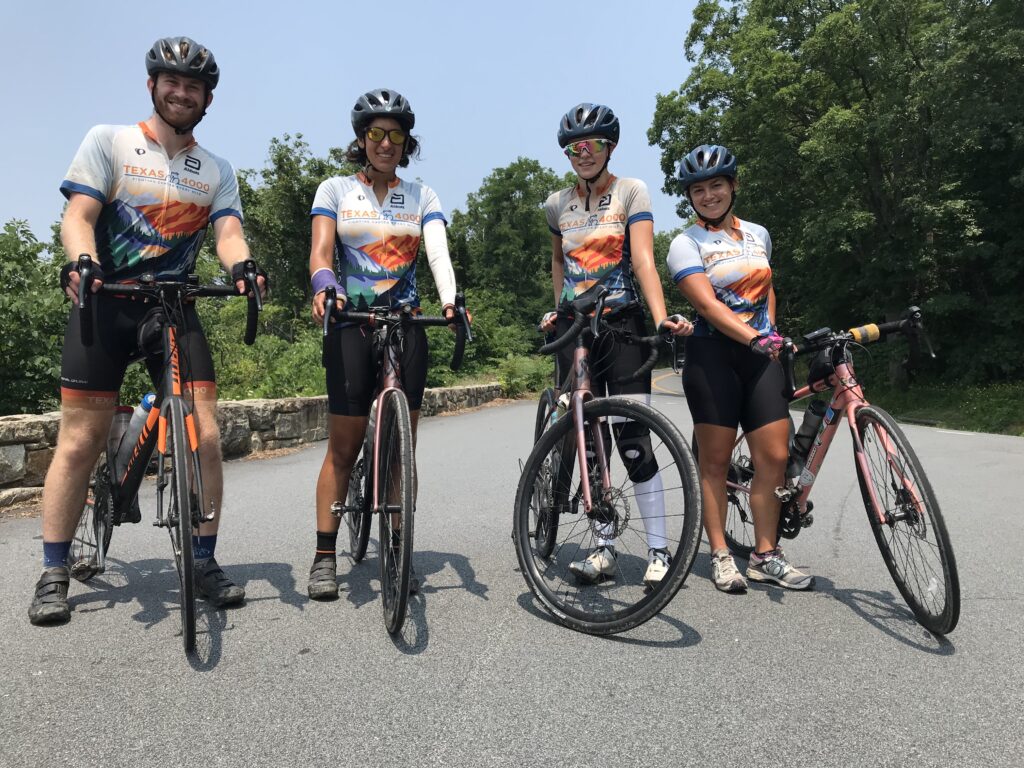
Two groups came and went while the third, “The Renegades” were still on the road. What I had hoped to do initially, I finally could. I jumped on my bike and rode east for almost two miles until I found them so I could bring them in. I had hoped that we would be set up early enough I could ride against their route for 20 miles then bring them to the stop. Two miles would have to do.

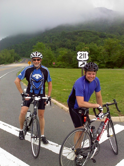
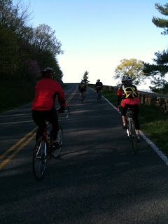
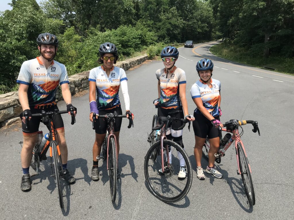
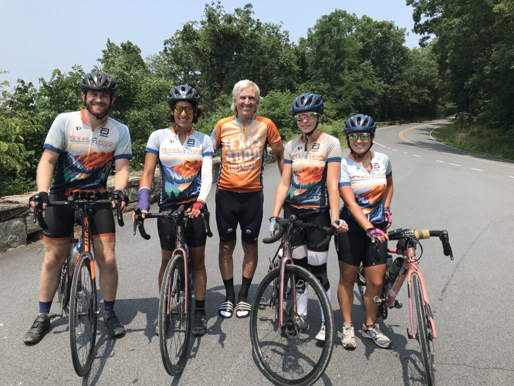
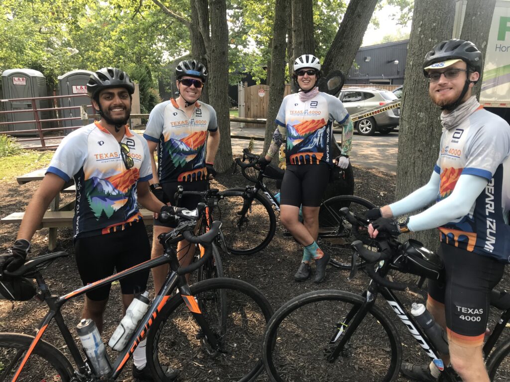
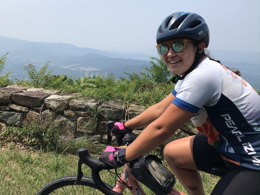
I rode until I saw Austin, Autusa, Kirsten, and Morgan. As soon as they passed I did a U-turn and took them to the lunch stop. Once refueled, they got ready to ride. They invited me to roll with them. I had some cleanup to do but told them to go ahead and I would catch up.

Morgan

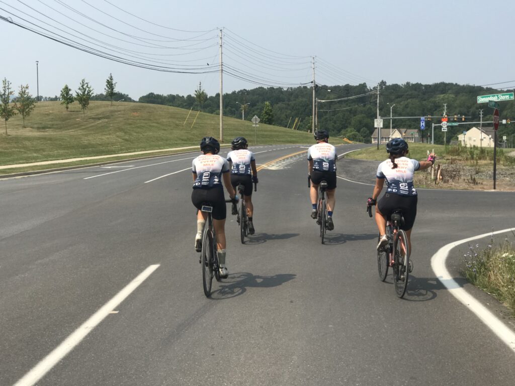
Once I was rolling I wondered if that was a good idea to send them ahead. Maybe I messed up. But after 4-5 minutes I saw their orange and white jerseys up the road.

Morgan told me that their hosts almost never rode with them and they really enjoyed having new people jump in. And she added, “especially a professional.” If I had milk in my mouth I would have spewed it all over her laughing.

We had to cross through a closed construction area

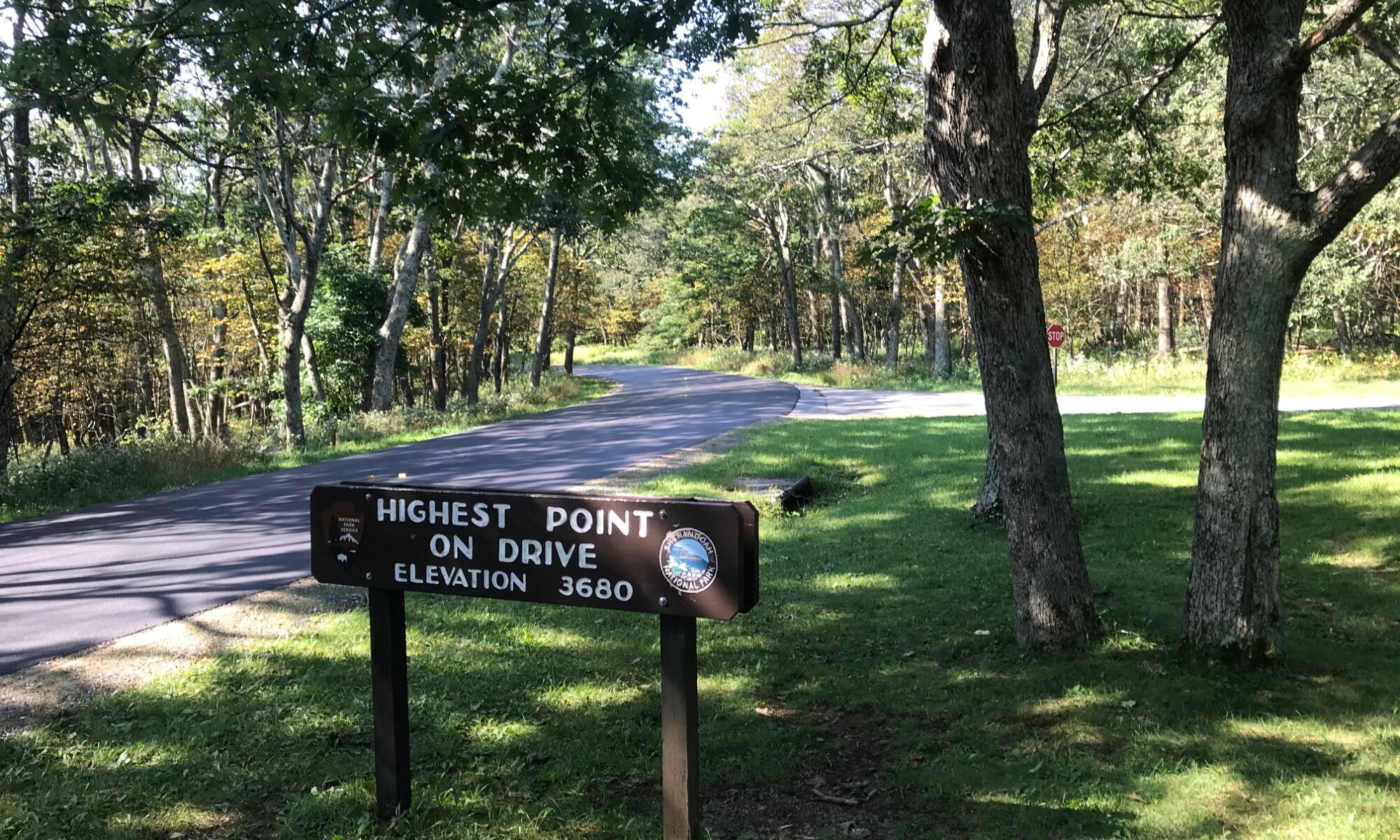
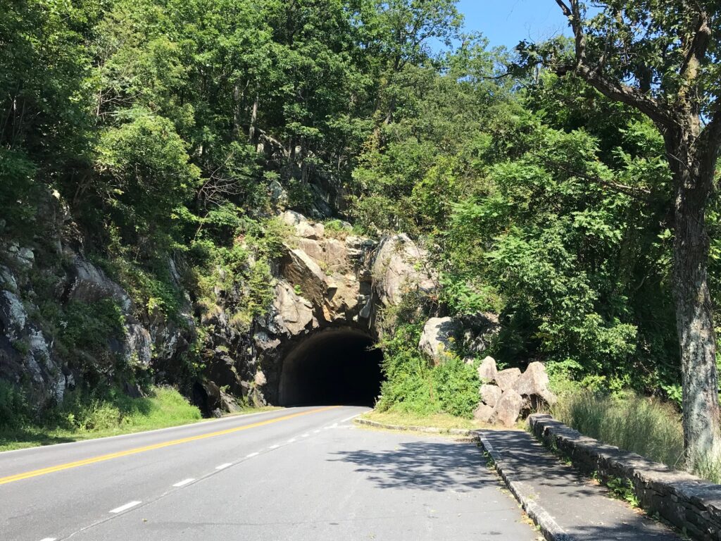
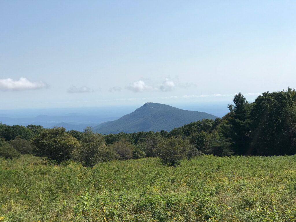
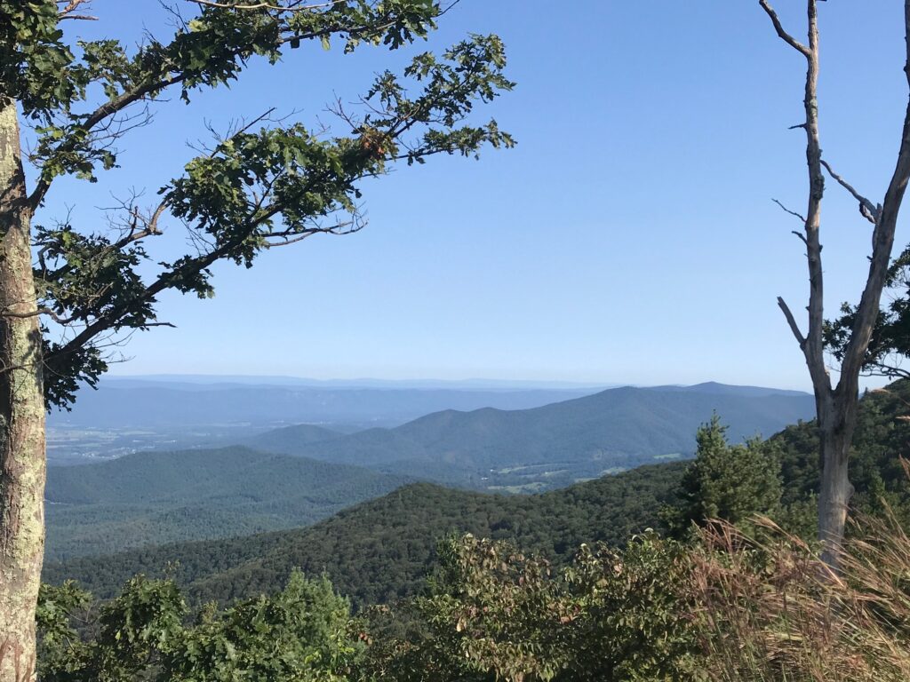
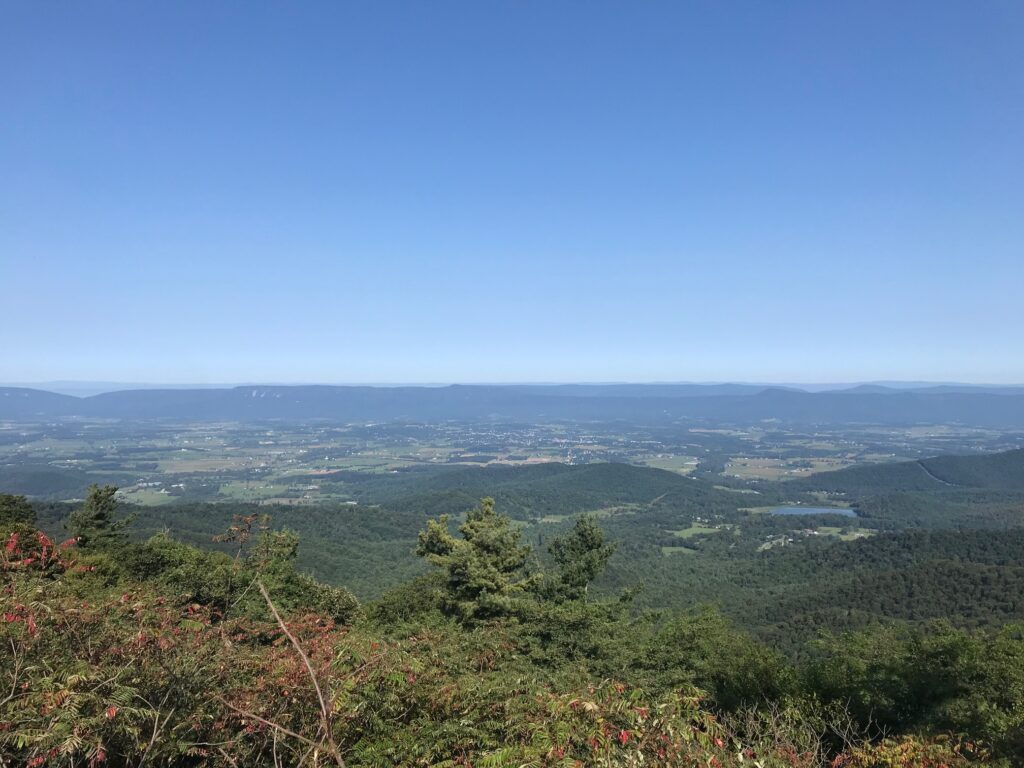
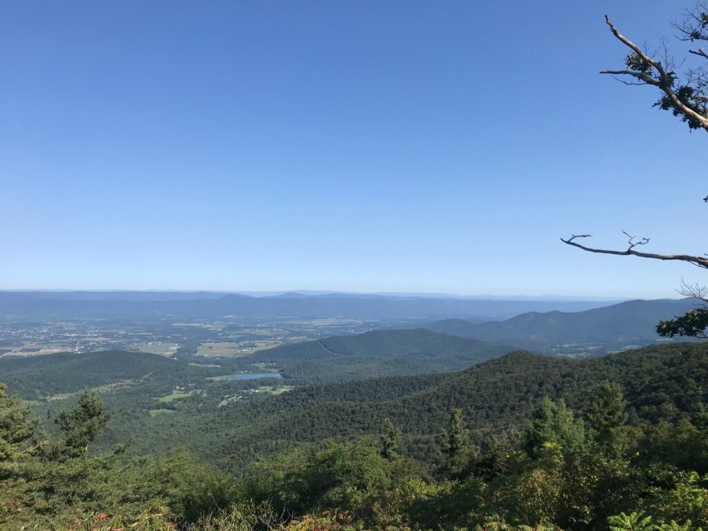
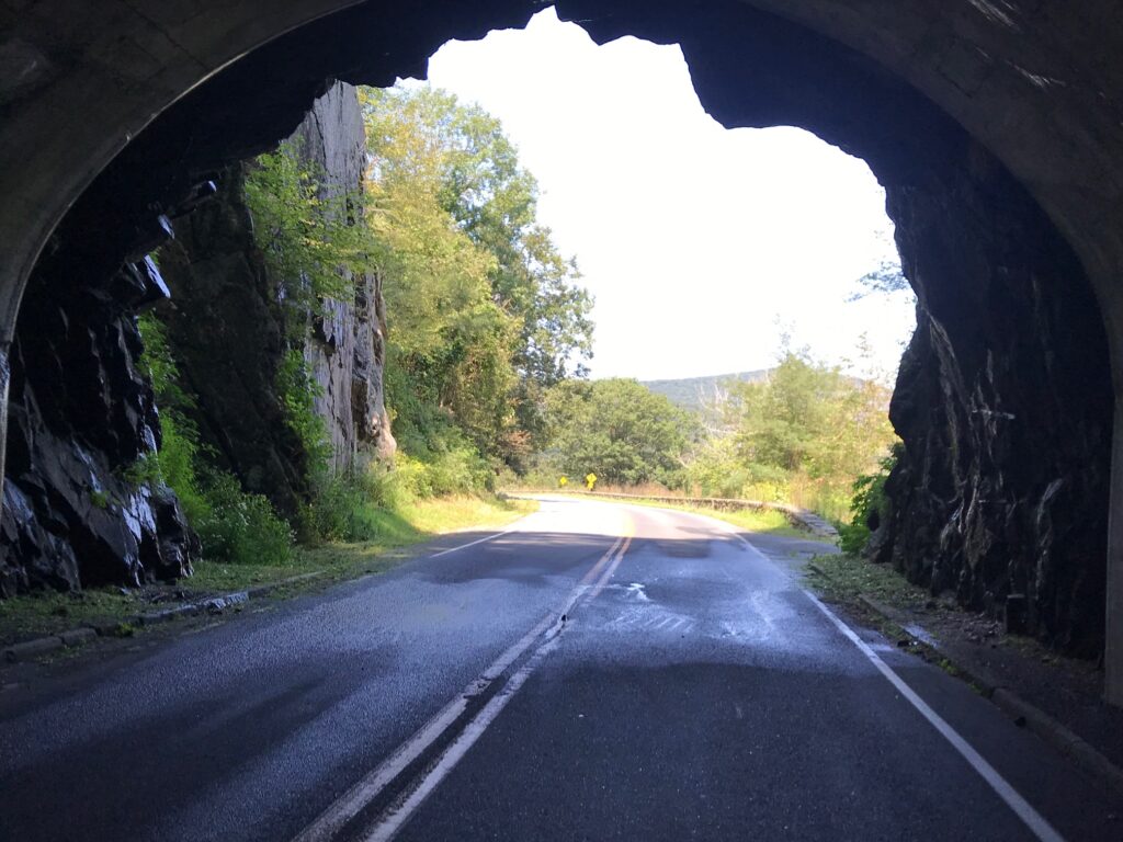
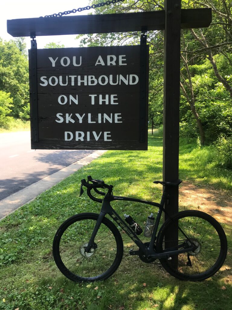
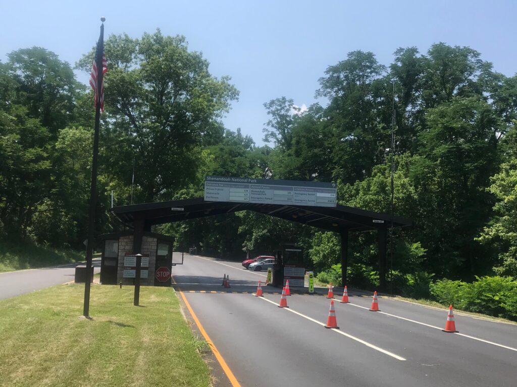
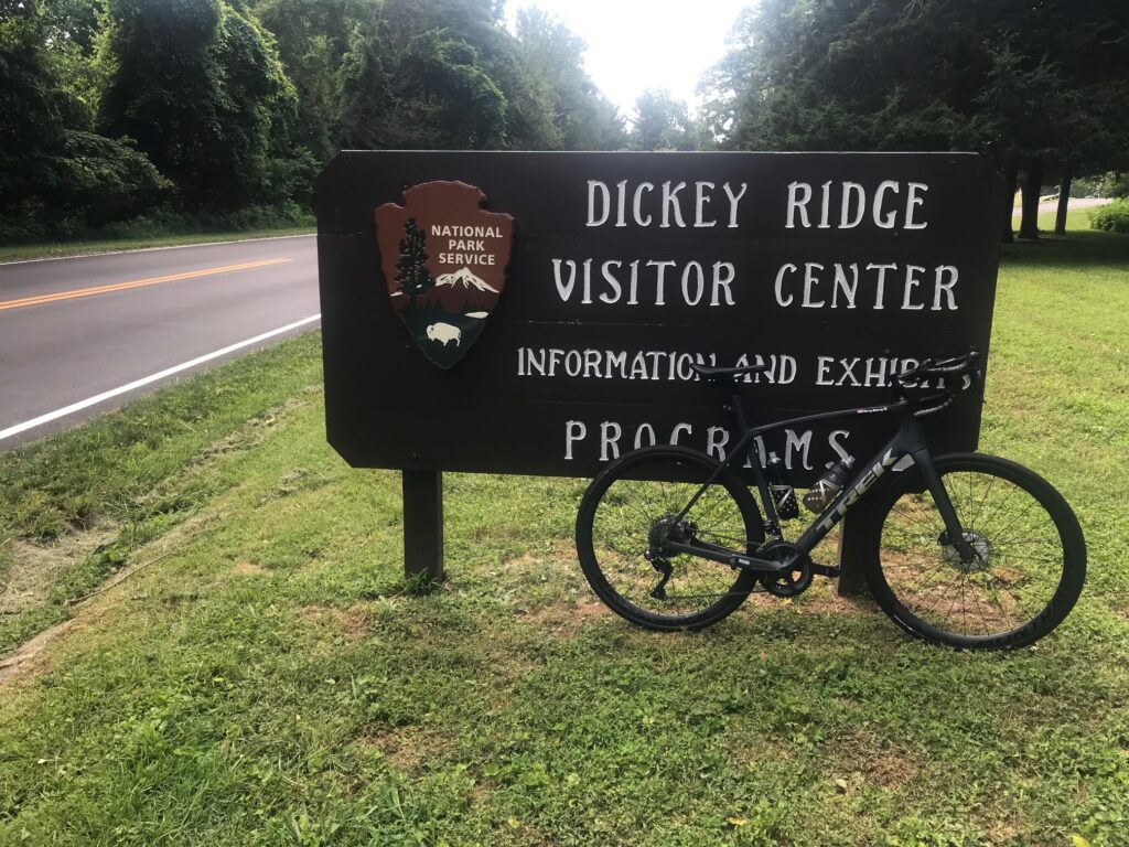
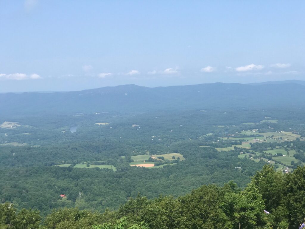
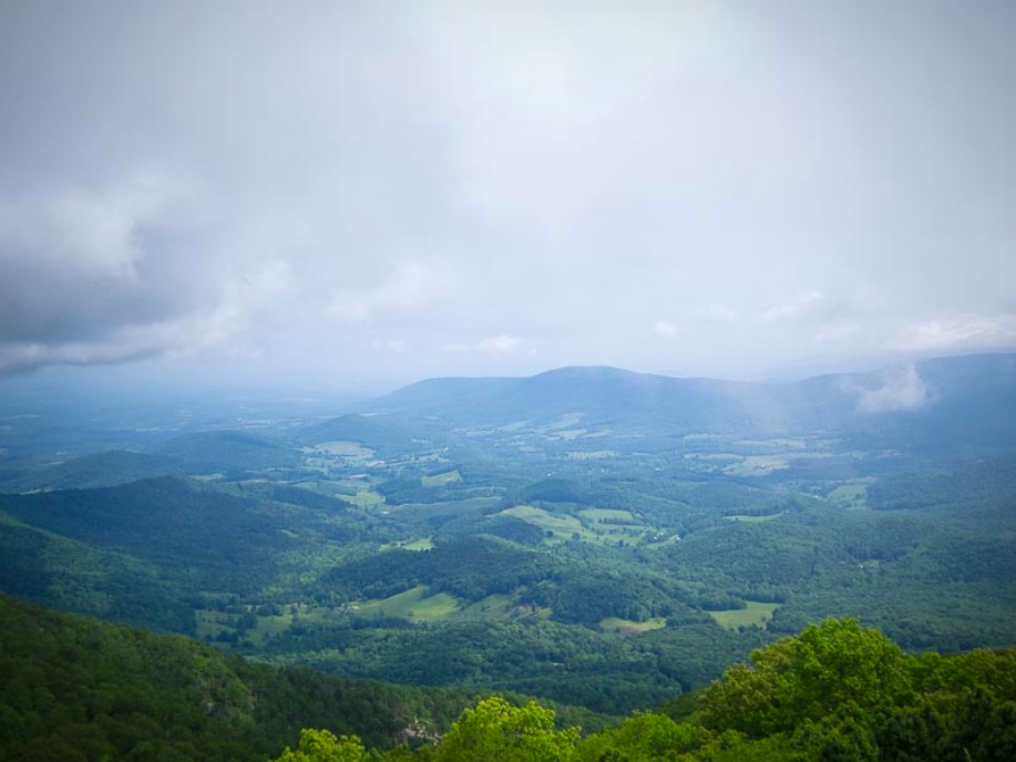
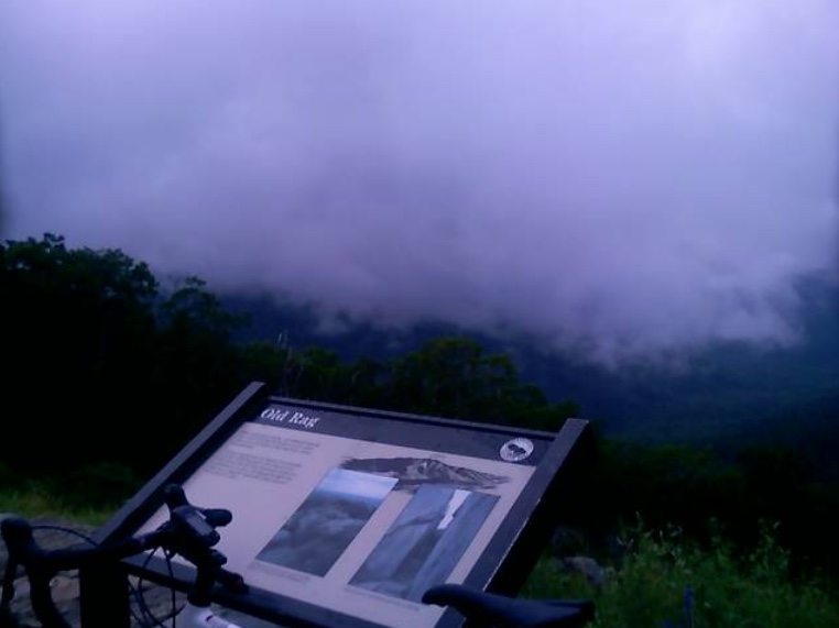
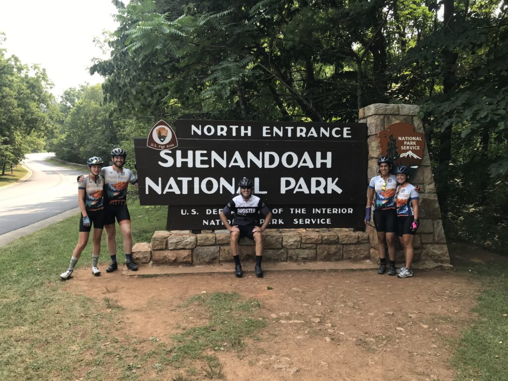
I was able to ride with them until their first rest stop in Shenandoah National Park on Skyline Drive. I would have ridden all day in a perfect world but my wife was up the road waiting and I wasn’t going to ask her to leapfrog with the T4K all day just for more miles for me. She had done enough preparing and setting up the lunch stop for which I was grateful.

Austin, Autusa, Kirsten, Morgan

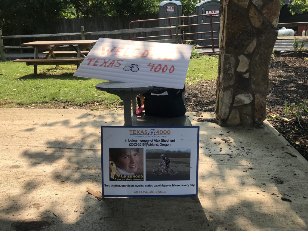
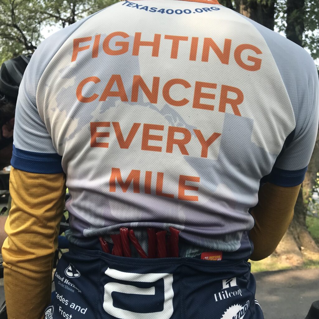
To my new friends of the Texas4000, thank you for your fight against cancer. Be safe and godspeed as you continue your ride. #fightingcancereverymile


Skyline Drive to Big Meadows

THORTON GAP, VIRGINIA

Two weeks ago Tim Casebere and I were riding out near Remington when we ran into another cyclist. The cyclist, David Thatcher, is from Gainesville and we exchanged numbers for a future ride.

Tunnel

Yesterday David texted me and told me he planned to do a 40-mile ride on Skyline Drive and invited me to join him. I agreed.

Old Rag Mountain

The only hiccup in our plans was where to meet. David said first parking south of the US 211 entrance at Thorton Gap. I saw the area known as Panorama or the tunnel overlook. When I questioned him he told me it was Mary’s Rock Trailhead, “within 1000 yards of 211.”

Looking west

I entered Skyline Drive and passed Panorama and went to the tunnel overlook. Didn’t see David or Mary’s Rock. I knew I went too far so I turned around. I figured I would go back to Panorama and ride by myself if that was the case.

Skyline Drive at Thorton Gap

Somewhere outside of Warrenton all cellular service is lost. I doubted I would be able to contact David by text. But returning to Panorama, which has a very large sign, is a small sign or Mary’s Rock Trailhead. I was in the right place.

Looking west

We hadn’t ridden together except for a little bit in Fauquier Co. near Remington. And he was on a bonk that day. I did not know what to expect from David.

Big Meadows

It was a perfect morning, probably 65°. If I would have been riding on the flats I probably would have opted for arm warmers. But knowing there was a climb immediately, I went with nothing additional. We started out of the parking lot. I was matching David’s pace but after half a mile or so, he was about five meters in front of me. We went through the tunnel, stopping at the end for a quick photo, then continued up the hill.

Same tunnel – different view

I stayed with David early on but he was clearly the stronger rider going uphill. Using my friend, gravity, I was the faster rider going downhill.

David Thatcher

Our first climb lasted about 4.5 miles followed by a three-mile downhill then a three-mile uphill, passing Skyland, the high point on the trail. There was construction in this section which actually made riding more pleasant. The pave was perfectly smooth asphalt.

Looking west

Four of five times we came to a flagman where we had to stop and wait for a pilot car to come by and lead us, and waiting cars, through. We just tucked onto the back behind the cars. And even going uphill, they held all oncoming traffic until we cleared. No oncoming traffic. No following traffic. It was a beautiful ride.

Skyline Drive Tunnel

Other than a garter snake sunning on the new asphalt, I didn’t see any wildlife. No deer. No bear. But plenty of beautiful vistas.

The distance wasn’t far but we had more than 100′ of climbing per mile. Arriving back to our cars I congratulated David on winning all the hillclimb points on course. He said that’s what he does best. And he did well today.


Distance: 40.1 miles
Average Speed: 13.0
Weight: 183

Skyline Drive – Front Royal

FRONT ROYAL, VIRGINIA

Without looking, and I’m not, it has been a while (years) since I have ridden on Skyline Drive. The forecast looked favorable enough, which simply meant – no rain.

GO!

I was going to park at the library but saw a park – Burrell Brooks Park – and it was nearly perfect. It had a port-a-john, a clean one, in fact. But there was no shade. It did give me an opportunity to take a shortcut over to Skyline Drive but I guess you’re not supposed to use it. At least cars.

Entrance Station

I waited in line at the entrance station in among cars. The ranger had pleasant words for me as I handed her my senior pass for free admittance.

Dickey Ridge

And then it was pedal and sweat. The temperature was a reasonable 84°. Who wouldn’t take that for a July day in Virginia? But the humidity must have been close to 100%. The sweat was pouring off me.

View from Dickey Ridge Visitor Center

I wanted to rub my eyes, or at least my right eye which was burning, but that often makes it worse. I just kept pedaling.

View looking west

I reached the Dickey Ridge Visitor Center at MP 4. I pulled in. I went in the restroom and found some tissue and water. I cleaned my (1) eyes; (2) glasses; and (3) camera lens. I was soaked including my shoes. I had squishy feet.

Indian Run Overlook

My plan today was simple. Ride until climbing stopped. Then turn around and coast back home. But at MP 6 the road goes downhill. And that was too early to turn around. So I enjoyed a 1.5 mile downhill before I started climbing again.

Indian Run Overlook

I came to an Indian Run Overlook at MP 9.5. Took some photos and decided that was a good turn around point. I wish it was all downhill from there but there was the 1.5 descent I enjoyed on the way up and I got to climb that back. But once reaching Dickey Ridge Visitor Center it truly was all downhill from there.

Skyline Drive at Indian River Overlook

Great roads. Great pavement. Sweeping curves. No shoulders but, generally, this is tourist traffic and drivers respect speed limits and cyclists.

Skyline Drive headed north

My max speed going back (or going up on the one descent) was just 42 mph. Would have liked to have gone faster but what a great ride. Need to come back here soon.

Indian Run Overlook


Temperature: 84°
Weight: 205

Escaping Father Time

FRONT ROYAL, VIRGINIA

SkyMass is always a good test of fitness. And sometimes a giant slap in the face.

Starting at the water’s edge in Front Royal, one begins with a 7.2-mile climb on Skyline Drive. That is followed by a two-mile descent and then another eight-mile climb. A two-mile descent follows then another three-mile climb. You get the picture.

This was a Potomac Pedalers ride and I had hoped there would be 30-40 riders at the start. Instead, there were eight. And one had to turn back after 10 miles when his rear derailleur cable broke.

On the first climb not long after entering Shenandoah National Park, I shifted and my chain briefly came off the front chainring. On a flat road this is no problem as I can soft pedal and bring it back onto the sprocket. On a 7% grade this is more of a problem. I quickly lost my momentum and could not unclip quick enough. Gravity won. I steered into a ditch and hit the ground pretty hard but nothing was hurt except my pride.

SkyMass 2011

With the group now in front of me, I simply had to ride at my own pace and catch them 10 miles later although they were never more than a couple of hundred yards ahead of me. I see you – I just can’t catch you.

Skyline Drive. SkyMass 2011

With Mike turning back, there were seven on the ride and three guys went ahead. Four of us would loosely stay together for the rest of the ride.

Thorton Gap. SkyMass 2011

At Thorton Gap, where US 211 crosses under Skyline Drive, we saw an approaching storm that would largely miss us. We followed 211 down to Luray (LOO-ray) and then over to Massanutten Mountain. Here the road kept getting harder. It was only a 3-mile climb which started out as 6-7%, pretty much the same grade as much of Skyline Drive. But the last mile kicks up to 10% then 12%, then 15%. There was even a stretch of 18%.

Shenandoah Valley

I had decided to let the group ride ahead and at one point, maybe twice, I looked up and saw our group leader of the day, Greg Gibson, off his bike either walking or simply resting. It was quite a test.

Thorton Gap. SkyMass 2011

We regrouped at the top and hit the descent off the mountain into George Washington National Forest. The Fort Valley Road featured no more climbs but a series of rollers. I found that while I stayed with the group when we came to some risers I just couldn’t match their pop over the top. I sat up and let the group ride on and decided to meet up at the rest stop.

Storm is Coming. SkyMass 2011

After the stop, we rolled off together. Again, I couldn’t match the accelerations at the end of the rises. The group was kind enough to wait at the last turn as we turned onto Mountain Road. That featured our last climb of the day and like the earlier one on Skyline Drive, a brief shifting moment led to a stuck chain and this time, a hard fall on the floor. Bloodied and beaten, Mike, a British rider waited for me and we rode home together.

Blood!

My injuries were minor; a lacerated pinky, and some road rash on my elbow, and a little on the knee.

At the end of the day, my speed was 14.5 mph which was 0.5 less than when I rode this 13 months ago. With each ride, I wonder if Father Time will reach out and grab me, and today I worry more than ever that he did. One year ago I was just five months from cancer surgery. And I rode faster than today.

I think on that day we stayed together the entire time and I don’t remember a mile when I wasn’t pulling, or more likely, hanging on someone’s wheel. Today I doubt that I was on someone’s wheel more than 15 miles of out 80 and 10 of those were the last miles home as Mike and I rode together.

Maybe it was just a bad day in the saddle. Or maybe Father Time has got his grip on me. Maybe two crashes, which were really fall overs, took their toll on me. I do note that I rode over 5,000 miles last year with only one such incident — with a woman and her dog. And today I had two on one ride.

At the end of the day, I still completed a tough route which was better than sitting at home on the sofa.


SkyMass

FRONT ROYAL, VIRGINIA
A group of eight of us who ride from The Bike Lane went out to Shenandoah National Park for “SkyMass” — a ride up Skyline Drive and over Massanutten Mountain. Many of the riders have been in the group rides out of Reston although I had never spent much time with them before – probably because I was always chasing them.
It was cold at the start – low 40s. It was a beautiful sunny day but windy (blustery) which added to the chill. The cold wind would be with us all day. At the start I saw Dee Reeb who looked absolutely freezing in just a cycling jersey. I wasn’t sure what I would wear but since I had a jacket I gave her my warm warmers. And I’m glad I did. I think I would have froze if I had to watch her ride with no protection on her arms.

We started immediately with a 6-mile climb on Skyline Drive at constant 6-7%. With no warmup in the legs, this little climb can hit you hard. But we all stayed together to Dickey’s Ridge Visitor Center. After the visitors center we developed more of a gap on the descent. We had a couple sick descents at more than 40 mph. I think the hardest I worked all day was closing a gap with three riders on one of the descents. Pedaling downhill, in the wind, at more than 40 mph and gaining slowly on the group in front is hard work. But I connected at which point I was in their slipstream.

We reached Rte 211 at Thorton’s Gap. Panorama, a store on the drive, did not have drinking water, which appeared to be the story of the day. We simply turned and headed out to Rte 211 for the trip down the mountain. Rte 211 is a mountain road that crosses over the Skyline Drive from Sperryville on the east to Luray (Loo-ray) to the west. The upper most section has a number of switchback curves.

One rider took off and no one went with him. The curves were fun to take but I felt trapped 4 or 5 riders back. At a safe opening, I opened up the pace to move to the front and which point we became “organized.” I glanced down as I was leaning hard in a curve – 35 mph. Awesome!

I was able to pull my group back up to our first rider and we regrouped at the bottom. We headed over some back country roads to our next store looking for water. We reached Hope Mills Country Store on Rte 522. Closed.

Julie Guy

Not to worry. We could take on more water after Massanutten.

We had a couple miles of gravel roads (what was up with that?) and then reached the 3-mile 12% climb up Massanutten. This could be a training ground for Mount Washington. The road was constant 12% although not as long. Or windy. But it was a nice climb with a nice descent on the other side.

The trip down the west side of the mountain took us into the George Washington National Forest where we would stop at a campground looking for water. None.

Oh well. After this descent the road flattened out except for some rollers. Here, three of the guys forced a break while five of us sat back and tried to ride at a steady pace. We caught them at a country store rest stop at mile 62 complete with BBQ chicken. Two riders bought and the rest peeled off a piece or two. It was perfect. Can’t imagine eating an entire breast but just a slice was the right amount. And it was good.

Maybe best of all on this day – no road rage incidents. In fact, at one house we passed some folks were sitting on the porch and one guy yells out “GO USA!” Certainly better than being thrown at. It was a wonderful day!

Garmin Stats and Map

84 miles and 6,000 feet of climbing.

Note: All but second photo credit: Dee Reeb (used without permission but she wore my arm warmers for 84 miles)

Sperryville, Luray, and Skyline Drive

SPERRYVILLE, VIRGINIA

It was back to Sperryville for an almost repeat of Friday’s ride. It was cool, perhaps 68°. I headed off and only went 200 yards and thought I might need a jacket. I went back to the car. I wasn’t worried about climbing as I knew my body heat would be enough. It was the descent I worried about as I didn’t want to get too cool.

I headed off a second time. I had gone just 200 yards and realized I didn’t have my heart monitor. I am learning to play with my Garmin Edge 705 and the heart rate monitor is part of it. I want to see what my body was doing as I was climbing. Back to the car.

The third time was a charm. I headed out for the seven-mile climb to the top. The first two to three miles are at two percent grade before the road turns up.

On Friday I never went lower than my 4th sprocket so I figured I had to match that today as well. That has 19 teeth and I can go to my lowest gear which has 27 teeth. I am hoping that what the run-up to Skyline Drive lacks in grade (6-7% mostly) that going in a higher gear will offset.

I’m hoping.

Unlike Friday I didn’t have water running down the road at me and thunder and lightning near me. There were no weather distractions so one could think about the ride up the mountain.

Supposed to be a view of Old Rag Mountain from here

As I crested the top a motorcyclist passing in the other direction gave me a huge thumbs up. It is nice to be recognized.

I switched into the big ring for my ride down the mountain to Luray. Technically I didn’t go all the way to Luray. Although I was prepared to when the road passed the National Park Headquarters it flattened out to a four-lane divided highway with a speed limit of 55 mph. I didn’t need that. I came to climb, not ride another mile or two of flat roads, so I turned around and began my climb back to the summit.

This one was a four-mile climb. I didn’t have any difficulty but there were times I wanted to switch to a lower gear than 19 teeth. But I didn’t.

I reached the summit then paid $8.00 to ride on the Skyline Drive. I wanted to go south at least as far as the tunnel which came in a mile or a mile and a half. It was very foggy here and I had no lights on me. I was worried about being seen in the tunnel but I went. No cars came behind me while I was in the tunnel.

As with much of my riding, my new goal became to ride until the road turns downward. That would be about five miles by my estimate. I just kept climbing. When I finally reached the high point, I turned around for the crazy descent back to Earth.

I love roller coasters but the thrill of descending at high speeds, around corners and just straight away on a bike is better than ANY coaster I have ever been on. This is the WEEEEEEEE! moment that makes climbing pays off.

In short order, I was back to the Skyline Drive entrance and then back on U.S. 211 East to Sperryville. Although I had cars behind me, no one caught me until I had descended four miles and the road flattened out a bit.

It was a great ride. My Garmin unit measured my distance and 32.5 miles over 4,200 hundred vertical feet of climbing.


Sperryville and Skyline Drive

SPERRYVILLE, VIRGINIA

In preparation for Mt. Washington, I will not find an 8 mile 12% grade climb with 40 mph winds and near-zero visibility. So one must train under lesser conditions.

My Independence Day route took me to Sperryville, in Rappahannock Co., Virginia. Just as I arrived it started raining. I didn’t want to ride up the mountain in the rain and hoped to wait it out. I listened to WTOP news and their weather forecast described a storm over Rappahannock Co. which would be breaking up soon. As soon as the rain stopped I started up the mountain.

From Sperryville, it would be a seven-mile climb to the summit although the first two miles would be only a two percent grade or so. I started up the mountain. After the first two miles, it started raining. I didn’t avoid it after all but at least it was a light rain.

Until the road reaches Shenandoah National Park it is a two-lane road with no shoulder. I noticed the cars with cargo on their roof racks tended to give me a wide berth while vehicles without cargo often didn’t move out of the lane even when no opposing traffic was coming. I figured the tourists were more understanding than locals of cyclists on this road. Maybe I was wrong but it is what I thought.

Once in the park, the road widens to three lanes — two in the up direction so faster drivers can pass those in the slow lane.

There was one courteous driver who passed. He was the driver of an 18-wheeler and my only thought was why an 18-wheeler was even on this road. But I was on the “shoulder” at that point which was about six inches to the right of the road. I heard him behind me and noticed he wasn’t going to pass even though he could. He waited until there was no opposing traffic. I gave him a high wave when I heard his engine rev to thank him for waiting until there was more room to pass. He responded with a quick but light reply on his air horn.

I was tapping out a good rhythm and saw a sign that Skyline Drive was two miles away. Then I heard a loud clap of thunder. I hoped not to see lightning. My glasses were keeping the rain out of my eyes but were fogging up a bit. I thought I saw a flash but wasn’t sure. But then, I was sure.

There was thunder and lightning all around. I know the safest place on a bike during an electrical storm is not on a bike. If there was an opening one could lay down the bike and sit low away from any trees. But I was in a forest. My choices were to keep going or to turn around. I had come too far to turn around and I thought I might get through the storm quicker by going through it. I continued climbing.

The rain was coming down very hard. The gullies next to the road were running full and flowing across the road. At times I was battling not only gravity but currents too. I continued.

The heaviest part of the storm did not last long, no more than 10 minutes. I was soaked. I wondered what the few riders who passed me thought. I alternated my pedaling in and out of the saddle.

On my rear 10-speed cassette, I knew I wasn’t in my low gear. And that became intentional. I reasoned that if I am going to climb Mt. Washington I have to make lesser climbs a bit harder. Not using all my gears was part of my plan.

Unlike mountain or hybrid bikes, there is no click shifting with gear numbers on my road bike. It’s all done by feel and if one must know, a quick glance back to see where the chain is on the gears.

I approached the summit and the pedaling became easier. I had made it. I biked over the summit to Page Co., and then stopped to check out my gearing. I wasn’t even in my second gear. Or third. I had climbed to the summit of Skyline Drive in my fourth sprocket which gave me a great feeling about my fitness level for next weekend.

I turned around for the reward — a fast descent back down to Sperryville on wet roads.

Verified by MonsterInsights