Nine hundred and ninety-one days. That’s the number of days it has been since I last crashed which was on July 3, 2013. I broke my collarbone that day.
Today was to be simple. Real simple. We got a call yesterday that a foreign exchange student on her way home to Denver was stuck in New York since Denver got hit with 18″ of snow. Could she come stay with us for a few days? We said yes to picking up Katrin Bunke from Germany and, as a bonus, her friend, Kaede Furusawa from Japan, too.
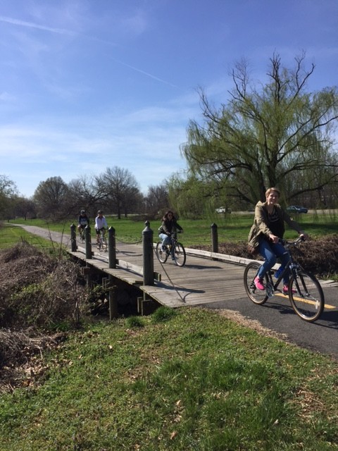
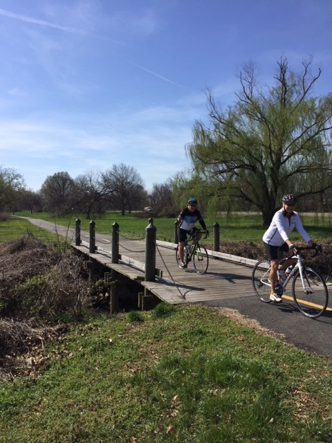
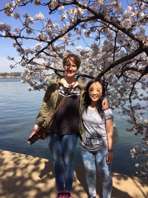
Katrin on the Mt Vernon Trail
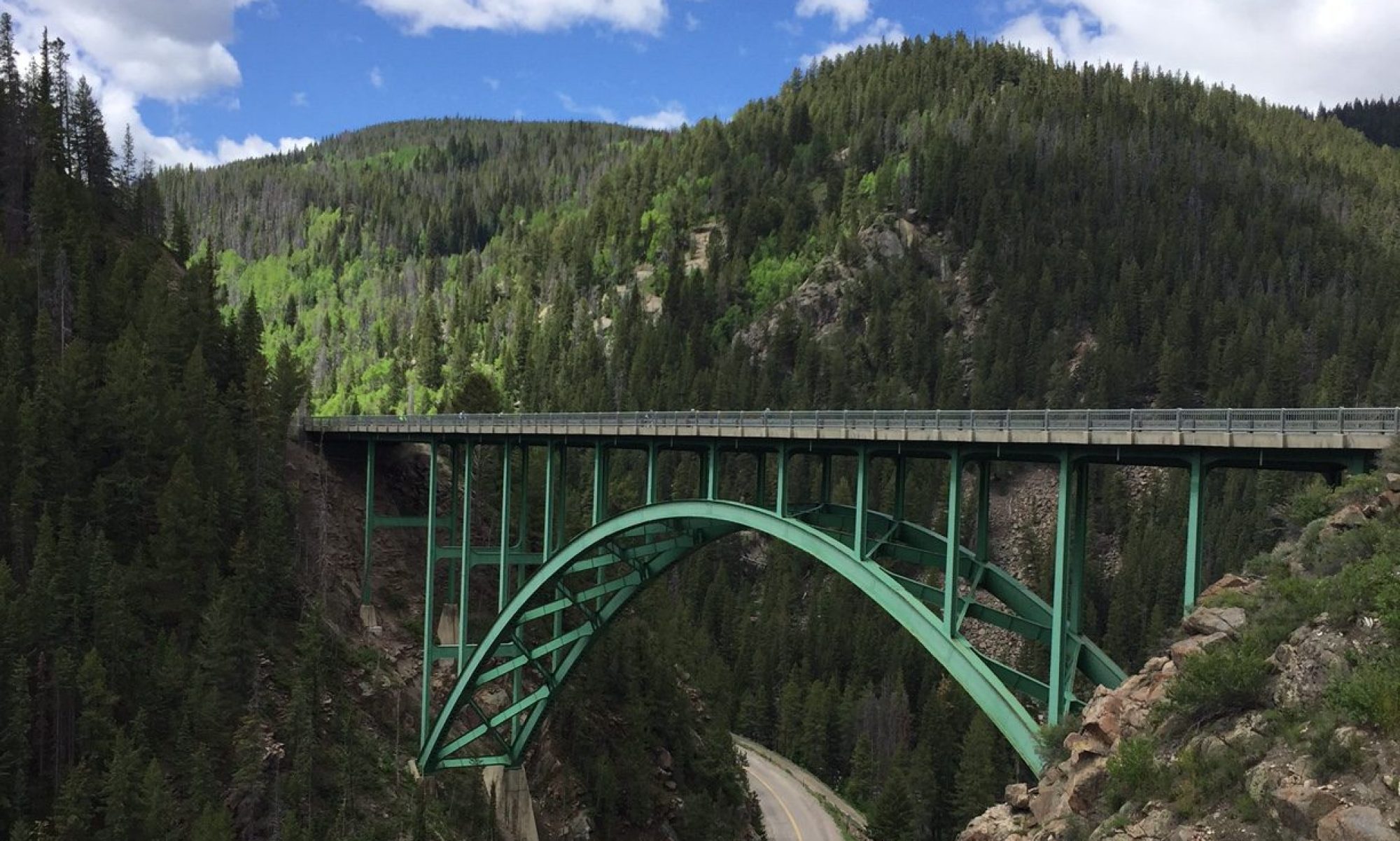
So what to do with two foreign exchange students “stranded” in the DC area? Go for a bike ride, of course. We had the added bonus of 80° (27° C) and the cherry blossoms at their peak. I asked Terry Moran if we could borrow a bike from his wife, Patty. He agreed. They agreed. We met Terry and Patty, picked up the bike then drove to Daingerfield Island for our adventure to see the cherry blossoms.
We left the lot and rode to Gravelly Point, stopping to watch the airplanes fly over us, landing just a few hundred meters away. We made our way across the 14th Street Bridge and stopped at the Jefferson Memorial. As I was coming to a stop I saw Kaede stop and was talking to some students. These were her friends from the YFU trip in New York. They had added a Washington, D.C option to their trip but as it turned out, Katrin and Kaede got it for free.
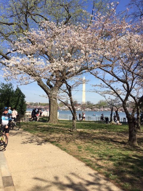
Cherry blossoms at the Tidal Basin
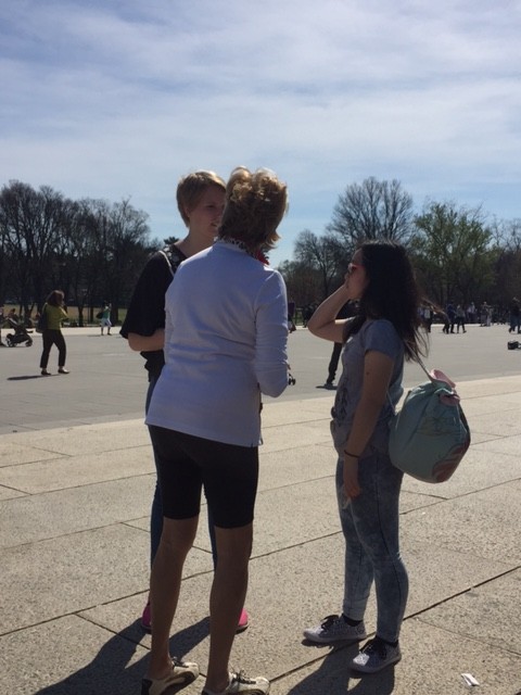
We rode up to the Lincoln Memorial where Patty and the girls walked up inside the memorial while Terry and I waited with the bikes. We then directed the girls to the Vietnam Memorial where they walked down and visited. We stopped briefly at the World War II Memorial then made our way over to the White House.
Katrin and Kaede
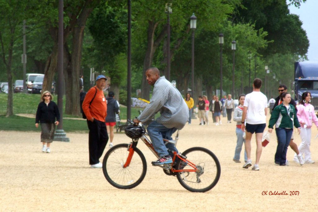
We circled the Ellipse and as Terry tried to stop for a photo-op he was directed by the Secret Service to keep on moving. So we all did. I came to the transition between street and sidewalk. And lurking there, unbeknownst to me, was a 3/4″ lip that was parallel to the street. As I turned my wheel it did not. I came crashing down on my left side, landing hard on my hip and elbow. Nothing broke but I had road rash mostly on my elbow. But my ego was shattered.
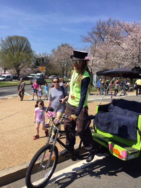
Bike taxi
We went to the north portico of the White House so the girls could get a photo-op, which had been denied them on the south side. We then got on the bike lane on Pennsylvania Avenue and rode over to Ford’s Theater. We were hoping to get them inside but there was an hour wait.
Outside the Lincoln Memorial
Checking the time we decided it was best to call it a day. We headed out, carefully maneuvering through traffic and people to get back over to the 14th Street Bridge where one could ride without the crowds. A 15 mph headwind actually felt pretty good the last four miles back to the car.
For the girls who aren’t used to riding, the sunshine and 25 km (15 mi.) was enough of a ride. For me, it was enough of a ride too. With bruises and road rash, well, let’s just hope it’s another three years before I hit the pavement.*
I keep a “throw-away” bike at work which I can use to ride at lunch or more often, ride to the Mall to play Ultimate Frisbee with our lunchtime crowd. There are a number of us who ride to the game and generally the bikes are parked together. Most are locked but some are not.
My bike is usually locked with a cable but a couple of days earlier Steve Darragh had borrowed the bike lock. No big deal.
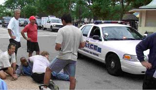
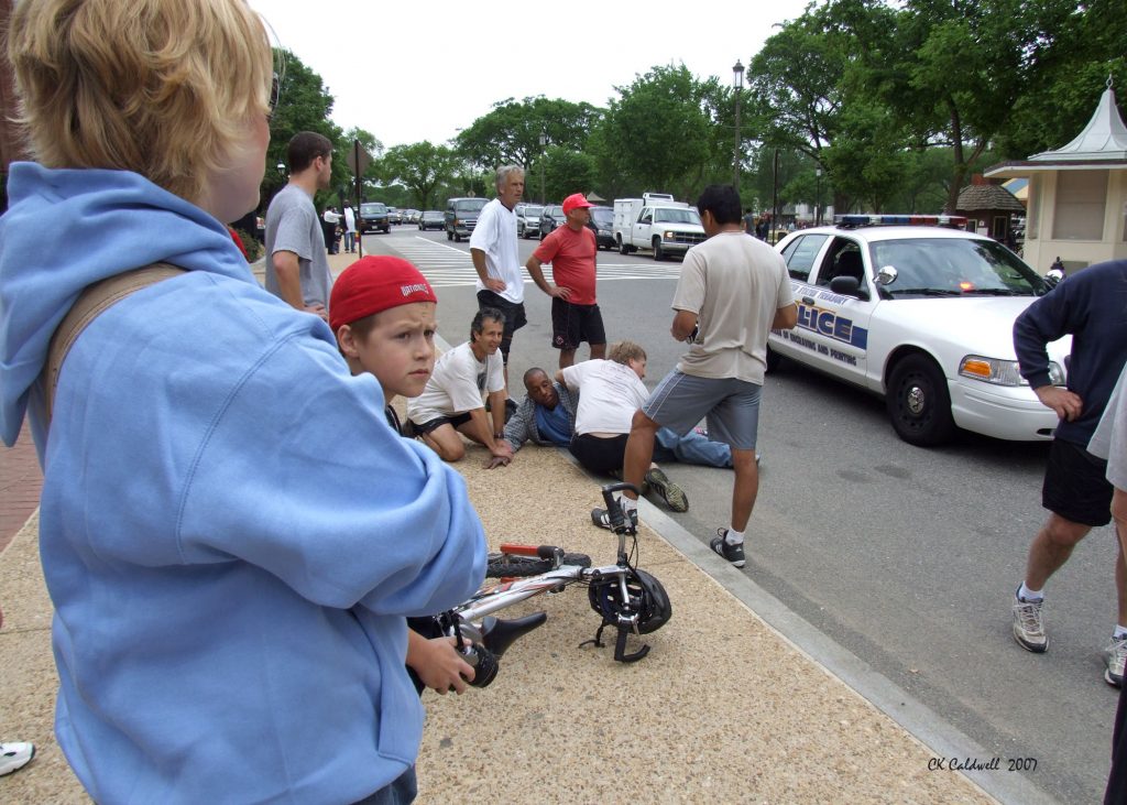
During the game I saw a man walk by our bikes which were parked beside a heavily-traveled pedestrian walkway. He looked at our bikes then turned to watch us play. I turned to make a play then looked again and I saw the back of him on my bike taking off with it.
All of a sudden, I decided I wasn’t quite ready to lose my throw-away bike. “Hey!” I screamed. “Get off my bike!” Foolishly, I sprinted to catch up to him to knock him off my bike. He looked and saw that I was in pursuit, some 40 yards away, and decided to out sprint me. Thankfully, my equally foolish friends realized what I was doing and ran after me and him. We caught him as he reached the street and knocked him off my bike to the street. My bike only suffered minor scratches.
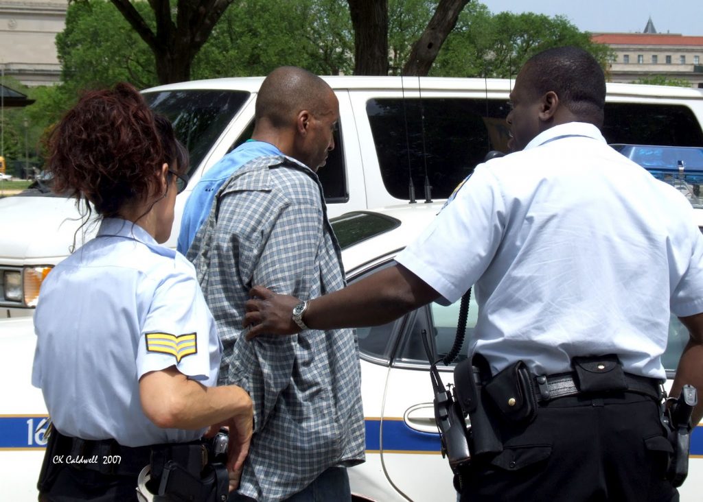
My friends restrained him as I waited for the police to apprehend him and complete 90 minutes of paperwork. When they searched him they found that he had a crack pipe on him. And a knife. Only later was I reminded that you never chase a criminal as they are usually armed and willing to kill you.
I forgot.
_____
Pictured above are my friends Mark Gaffigan (who did most of the wrestling although I was initially on the ground too), Ernie Rodriguez (in red) and Dave Frenkel (holding his arm down). Ernie had him in a choke hold moments before we stood up to talk to the police. We restrained him but no one hurt him once he was on the ground (that is, no more hurt than getting knocked off my bike to the street will do)
He was arrested, then released, where he would be caught stealing at least three more times before being locked up in July. On July 25, he pleaded guilty to being a bad bike thief and was sentenced to 90 days in jail. I don’t know his criminal background enough to opine whether that was a fair sentence or not but I think an appropriate one would have been 10 days in jail while wearing a sign saying “I was caught by a bunch of old white guys.”
Here I am with my bike and the police who get all of the credit and did none of the work.
Photo credits: CZ Caldwell, who happened to be shooting photos on the Mall and was more than willing to be a witness in this case. Her artwork can be found at: http://www.zazzle.com/starlily
SHEPHERDSTOWN, WV — I was up around 7:00 a.m. and was prepared to leave by 8:00. I wanted to be quiet and went about filling my Camelbak with the ice and water that Bethany had filtered the night before. Bethany got up and saw me off. I rode off to Sheetz and bought a Gatorade and breakfast sandwich. After eating, I rode again by Bethany’s apartment and Ashley’s dorm at Shepherd University.
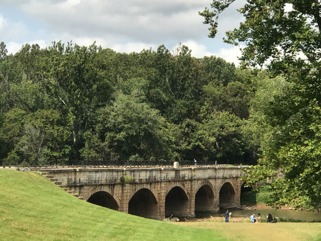
I crossed the bridge on Rte 65 from Shepherdstown into Maryland then descended the steep hill back to the canal. This time I rode the brakes careful not to outride them. I safely descended the hill and turned on the access road that parallels the canal for three miles. I came to the Antietam Creek aqueduct, one of the best-preserved water crossings on the canal. This was the point that Andrew and I reached two years ago before breaking my rear wheel (we call it taco). Having reached this point I had ridden from Pittsburgh to D.C., at least in parts.
A band of heavy thunderstorms had moved through late yesterday and the canal was showing it. Much of the canal has returned to its natural forested state, albeit with a canal depression. Where the canal contains water is a little more out in the open than the forested sections. Heavier than normal spring rains followed by a somewhat rainy summer had left the canal towpath in wet shape.
Because of miles of forest cover, the canal has not had a chance to dry out. The first section to Harpers Ferry wasn’t too bad. As I approached Harpers Ferry I expected that I would see more people as this section is very popular with tourists. I did.
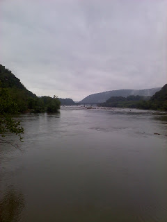
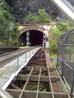
The Potomac River at Harpers FerryTrain Bridge at Harpers Ferry
I stopped briefly at Harpers Ferry and climbed up the railroad bridge that crosses the Potomac River into town. Here two tracks exit the railroad tunnel and one has a great view of the river and the Shenandoah River entering the Potomac at this location. I went back to my bike and headed south again. I was still having problems sitting in the saddle (saddle sores) but I knew it would be my last day.
I started hitting stretches of good trail for 200-300 yards then had to ride through a 15-foot puddle. It was a killer to try to gain any speed. One shouldn’t need to brake on a path but I was constantly applying the brakes so as not to get too muddy.
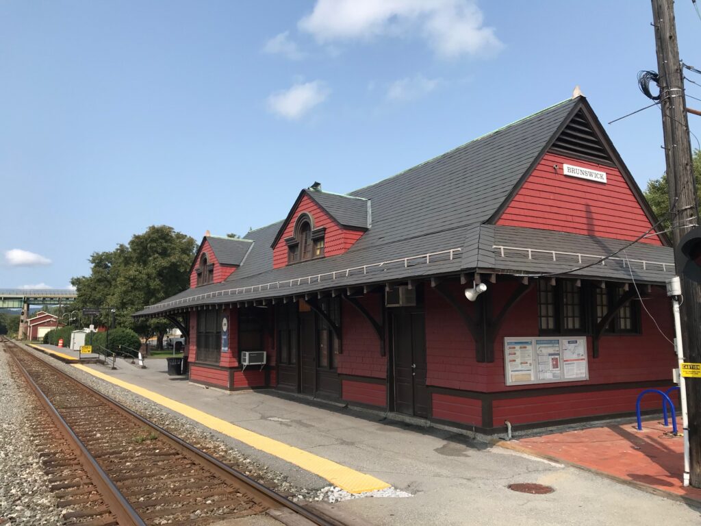
Just south of Brunswick about 15 girls came running up the towpath. This was the girls’ cross country team from Brunswick high school. A few minutes later an adult running group came through as well.
Brunswick, Maryland Train Station (Photo 2021)
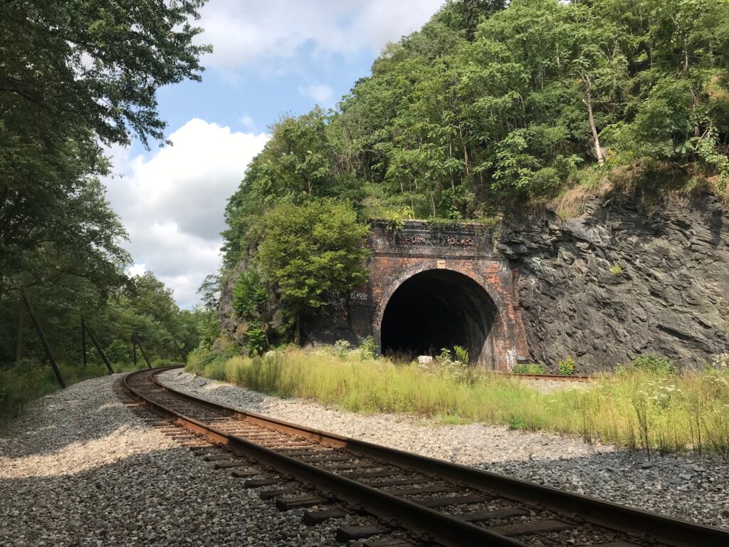
It was getting muddier as I approached Point of Rocks. This location is always neat to view. Here the river and a sheer rock cliff are almost side by side. The railroad was in a legal battle with the canal for this piece of land. The canal won and built next to the river and the railroad tunneled through it. After the canal shut down the railroad acquired the right of way, filled in the canal and put a railroad track around the mountain. Here you really do have one track around the mountain and one through it.
Point of Rocks, Md. (Photo Sept. 2020)
It was getting muddier and I was not making good time. I had forgotten where the Monacacy River Aqueduct was and was surprised when I came upon it. I walked my bike across the aqueduct (required) and continued south.
Monocacy Aqueduct (Photo Sept. 2020)
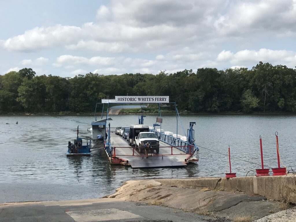
Around 12:30 I reached White’s Ferry where an important decision would be made. Ride to Virginia or continue on into D.C on the C&O?
Whites Ferry (Photo Sept. 2020)
White’s Ferry has operated for years and is the only operating ferry north of D.C. on the Potomac River. To cross into Virginia would be to pay the $1 toll and then ride about three miles into Leesburg. At Leesburg, one can pick up the paved Washington and Old Dominion Rail Trail which runs slightly downhill to Shirlington, about four miles from D.C. So here was the situation. The paved road would be easier riding, much easier riding, but is also out in the open and hotter. Plus there are a lot of users on the W&OD including roadies who fly by, heads down, checking their cadence.
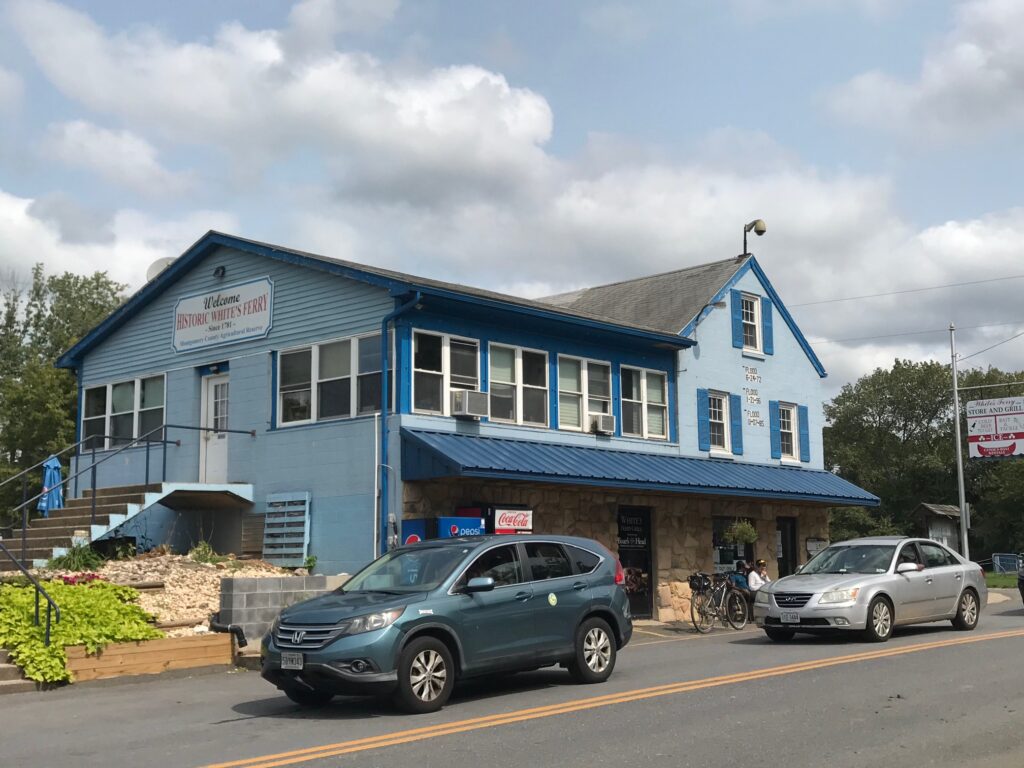
This may be a once-in-a-lifetime experience and there would be some who would suggest that I really didn’t ride Pittsburgh to D.C. if I didn’t continue to Washington. Having talked with some other riders at Whites Ferry, I decided to continue on the towpath. I refreshed by grabbing a quick bite at the store then headed south again.
Historic Whites Ferry Store and Restaurant (Photo: Sept. 2020)
Some riders I met here were pretty muddy. I figured they must have been ahead of me coming down from Harpers Ferry. I told them I hoped they came from the north but they said they actually came from the south and were going back. They asked how far I had ridden this day and I told them almost 40 miles from Shepherdstown. We were at MP 35 so I was more than halfway home on this day. They were impressed and even more so when I told them I started out from Pittsburgh on Tuesday.
As they started riding I decided to tag along. They waited for me and allowed me to ride with them. It was a welcome invitation. We chatted along the way but we rode fast. Where I had been struggling, and indeed had yet to settle into a rhythm in the saddle down to Whites Ferry, I sat up on my saddle and matched their quick pace. And it felt good.
The two riders were probably in their mid-40s and mid-50s. The younger one was named “Trace” and he set a great pace. But he didn’t lead right away. His friend did and they took turns setting the pace for me. Our second rider crashed in one of the muddy spots. The trail was treacherous.
When you approached a mud hole there were two choices. Ride through it or ride around it. Riding around it was preferred but on either side were trees. It wasn’t as simple as riding on level ground to traverse the mud hole. If you went around it often the path went on an angle next to the trees and one could not ride just sitting up. If you did the back wheel would slide off the hill and you could crash. That’s what happened to our first rider. He wasn’t hurt, just covered with mud.
Trace took over the pace-setting and picked some wicked lines through the mud. Sometimes in 15 yards, we would swing wide right, then swing all the way through the mud to the extreme left. I had to follow their line. Only occasionally did I choose to ignore the line Trace had selected and chose my own. When I did I was right.
We rode together for most of 15 miles to Seneca. At the end, I thanked them so much and regret that I did not get their names. They were the George Hincapie to my Lance Armstrong, and I’m no Lance Armstrong. But what a difference riding with a pacesetter means where I didn’t have to do the work. One doesn’t have to be traveling 30 mph into a headwind to appreciate someone riding in front of you. Even on this day with no wind just riding behind someone made a world of difference. It really lifted my spirits and I now had 50 miles behind me and was looking forward to the last 20.
After my pace setters left it wasn’t far before I saw a woman pedaling slowly ahead of me. The towpath was getting very crowded as there were many entrance points from here to D.C. So it was not unusual to see other riders and there were bike rental locations nearby. But I recognized the two bags hanging off her bike. I came up behind her and said “You need to pedal faster than that if you’re going to get home today, DIANNE.” She looked was completely surprised. She thought I was headed home on the W&OD. And she was tired.
But we both picked up our pace. We passed Swains Lock and Seven Locks. We took a detour around a rocky section. Near the end of our trips, we came to the Capital Crescent Trail. Here Dianne was headed home to Chevy Chase and I was headed into D.C. We said goodbye and went our separate ways.
I thought about how to handle my last two miles. Should I go slow and savor the moment that I had completed this journey or should I ride quickly to the finish? I decided to ride it fast.
I had ridden 350 miles over rail trails and backcountry roads in Pennsylvania and the entire length of the C&O Canal. I had seen many types of animals including numerous turtles and deer, otters, turkeys, and herons. But one thing I hadn’t seen was a snake. That was about to change.
Just in front of me on the trail was a snake. Not any snake but a poisonous copperhead. In D.C. no less. For the couple of miles I had switched to the Capital Crescent trail which is right beside the Potomac River. Just beside the trail was the C&O. The snake was crossing the trail and another cyclist stopped to protect it and other riders. He made sure no one accidentally hit the snake and it moved on safely in the weeds next to the river.
I rode the last mile and then all-too-quickly came to Georgetown. That was it. I wanted to scream because the trip was over. I did ask someone if this was it (the end of the route). They said it was. (What I didn’t know was there was a Milepost 0 post near the Kennedy Center which I did not find.)
There was a great sense of accomplishment having just completed the route but part of me wondered if there was more. Wanted there to be more. It really was all about the journey and not the destination.
I meandered over to the river area near the Kennedy Center and asked a man to take my picture. I rode about six blocks over to the Foggy Bottom Metro stop. There was a street vendor and I was looking for food. But they were sold out so I just bought a celebratory Mountain Dew. This was it. I put my bike on the Metro and headed to Virginia.
Barry at the Kennedy Center
EPILOGUE
Mistakes – I made a Few
Training, training, training.
I made a few mistakes on this ride but none more critical than not training.
I did not ride enough before the trip. The summer of 2003 was not one in which I had done much bike riding. My business trip to Pittsburgh came without much advance notice and it was only then that I decided I would ride back home on a bike. I did not prepare my body for the rigors of being on a saddle more than six hours a day.
This ride should be within any cyclist’s capability but in 2003 I would not be considered a cyclist. Just an average guy determined to ride from Pittsburgh to D.C.
I gutted it out the entire trip and was suffering greatly. I could barely walk my legs and butt hurt so bad. When I went to sign the receipt in Somerset after the first day I noticed I could barely hold a pen in my hands. Both hands went numb on this trip.
The numbness in my hands (ulnar neuropathy) perhaps would not have occurred or I would have noticed it before the trip and got better fitted on my bike to prevent it. But I think it occurred because my butt hurt so bad I ended up out of the saddle way too much. The result was my weight was more on my hands than on my butt. It would be many months before the numbness eventually went away.
My second major mistake was dealing with food and water. I thought I would be able to get enough water and food along the route but that was harder than I thought.
On the first day out of Pittsburgh, my Camelbak was full of clothes so I did not have room for water. That was a major mistake. There simply weren’t enough places along the route to Ohiopyle to get water. Eating properly the night and even days before is important. Wings and fries are not long-distance food.
On the first day, I was “in difficulty” but did not feel hungry. Yet I knew to stop at Cedar Creek Park for a quick bite.
Generally, I never had a chance to eat on the trail. After the first day, I added Granola bars to my pack which helped. On Day 2, I ate at a Subway in Meyersdale, a stop I had preplanned. On Day 3, I hoped to eat at Bills in Orleans but his store was closed. I missed the exit to go into Paw Paw, WV. On Day 4, I missed the opportunity to stop at Williamsport and hoped to eat before Shepherdstown but that store on the towpath was closed as well.
I didn’t plan as well as I could have because I had ridden many of these sections before and I thought I knew them. I was wrong. My weekend rides in which these stores were open were the extent of my planning for food. On Day 5, I did grab a very bad hot dog at Whites Ferry. And a cold Gatorade.
If there was a third mistake it was riding solo. I found it was so much easier to ride with someone, especially when someone else was setting a faster pace. Even if not pace setting, just being with another person takes one mind off the suffering. Plus, in case of an accident, and I barely saved one on the canal on Day 4, there would be a person to help or summon help.
Finally, I did like my distance, an average of 70 miles per day. But I would want to ride from D.C. to Pittsburgh instead of Pittsburgh to D.C. It’s just more difficult the first two days to ride uphill from Pittsburgh to Frostburg. The “uphill” from D.C. to Cumberland is on the canal, one mile of flat followed by a 10-foot uphill. The section from Cumberland to Frostburg is a climb but is relatively short.
It was great to complete the trip and afterward said “never again.” But after a summer of riding more than 2,000 miles recovering from knee surgery, I am now in bike shape. And the trail calls to me again…
Probably the hardest thing about this trip is doing it alone. With each day in the saddle comes more soreness and one questions why I am doing this and the necessity of finishing it. If I was riding with a companion or group we would all be sharing the stories of our soreness but rally together. Riding alone I had no such support.
I left Hancock at 8:45 a.m., first stopping at Sheetz and taking on a Gatorade. I swung by the bike shop in town but noticed they did not open until 10:00. I decided to depart and not wait for the store to open. I left on the Western Maryland rail trail which parallels the canal for 9 miles. The advantage is that it is a paved trail — a good respite for a tired butt.
I had ridden this section of the canal before so I didn’t feel the need to stay on the path to accomplish anything. The paved path of the rail trail was welcomed although a number of tree roots were coming up under the trail in this section so it had its own series of speed bumps. When I reached the end of the trail I did not heed the sign warning of the end of the trail. I was hoping instead to follow a local road to Fort Frederick State Park. After riding on the road for 1.5 miles and seeing hills ahead I doubled back to the sign directing trail users back to the C&O.
Had I planned ahead, I could have stayed on the road into the park and reconnected with the trail. But I didn’t want to risk missing it and adding more miles to a sore body.
For the first 10 miles on this day I could not get comfortable in the saddle. It was easier to ride out of the saddle than siting down simply because of the pain. I became determined to ride the final 120 miles to D.C. out of the saddle if I had to. Once back on the trail I alternated a mile in the saddle and a mile out of the saddle.
For most cyclists, this trip is not a problem. I was suffering only because I did not training on the bike and only on a whim decided to ride home from Pittsburgh to D.C.
The first, and only, town I came to was Williamsport. I passed the one entrance point thinking there would be another. There wasn’t. I missed my opportunity to get lunch. Bad decsisions as to eating would continue to haunt me on this ride.
I knew somewhere south of Williamsport was a detour where the canal has washed away years ago. I kept riding waiting for the detour. As I moved south there was more activity on the river. As I approached Dam #4 the river became slow and deep. This was also a point where the canal disappeared although a path was in place, presumably not the original tow path. At a couple of points there were sheer rock cliffs on the left and the river on the right. The trail narrowed to one lane.
C&O Canal Towpath Near Williamsport, MD Yes, here it has been reduced to a ledge I came to the trail detour sign and had mixed feelings. Riding on the canal wasn’t easy with mile after mile of packed dirt. A paved road seemed like a great diversion. The tow path is at river level and the surrounding roads are much higher. One needs to climb out of the river valley. I started a climb up a 100 yard hill. I saw a German Shepherd waiting to greet this cyclist so I called to the grandma in the yard and asked if he was friendly. She said the dog was and he came over and greeted me. So did her four year old granddaughter. Then the woman asked if I was riding with a woman because a woman had just ridden by a few minutes earlier. That was all I needed to hear. A person!
I crested the hill and looked out ahead to see if I could find other riders. I couldn’t. I picked up my pace and within a mile I could see a single rider ahead. Like a predator chasing his prey, I sat up in the saddle and effortlessly pedaled until I caught her. She was surprised anyone was out on this road and I was more surprised to discover a woman riding solo out here. We talked and rode together for the rest of the day.
Dianne Rennackhad planned to ride the C&O Canal with two other friends. Just before the trip her friends dropped out so she was faced to quit or got it alone. She choose to ride it alone. On Thursday she started in Cumberland, a few hours behind me. She rode into Hancock in the evening and stayed at the same Super 8 Motel as me. On this day she left Hancock at 8:00 a.m. so she had a 45 minute lead on me. She was not managing a good pace and told me to ride ahead. I didn’t. I needed someone to ride with and the ride became much easier. We rode together for just one mile before we reached the hill descending back to the canal.
On Tuesday when I left Pittsburgh I wore my helmet. When I started cramping at mile 40 I knew I was dehydrating. Since I was on a trail and the helmet added to my heat, I removed my helmet and attached it to the back of my bike. I didn’t wear it the rest of the Allegheny Highlands Trail to Meyersdale but did put it on to ride in and from Meyersdale to Cumberland as I was sharing the road with cars. Or they were sharing with me and not always too kindly either. But once I reached the C&O Canal in Cumberland I removed the helmet again. On this day it was hot on the road but for the five mile detour I decided not to ride with my helmet.
We approached the top of the hill and were greeted by a sign warning of a steep descent and for bicyclists to dismount. There was no way I was going to dismount. I had ridden 150 miles from Pittsburgh to Frostburg, all uphill. And every chance to descend for free was going to be enjoyed. I was going to descend quickly even if for just 100 yards. I looked at Dianne and she said “go ahead.”
I let ‘er rip. I quickly was up to 32 mph and was looking at the bottom of the hill. A 90 degree right turn was staring me straight ahead with a guard rail protecting me from the forested canal. I applied the brakes and realized instantly that I was outriding my brakes. (I could not slow down quick enough to make the turn.) In what must have been just 1-2 seconds it seemed everything went before my eyes. I knew I was going to crash into the guard rail and I knew I was without a helmet. I was going to do my best to protect my head and I thought that my trip would end simply because I was enjoying my speed down the hill. There was gravel on the asphalt and my wheels locked up on the pavement. It sounded horrible — tires screeching and it was surprsingly loud.
I thought about Joseba Beloki crashing a few weeks earlier in the Tour de France. When he tried to turn on a hairpin curve his wheel slid on melting tar. In an instant his rear tire overheated and popped off the rim, leading to his horrific crash and leading to Lance Armstrong’s memorable detour. My tires were not as inflated as a road bikers and they did not explode. They screeched and I wobbled on my bike but somehow I saved it. I don’t know how I didn’t crash.
Beloki and Armstrong Source: Velonews Right before I was to crash into over the guard rail I slowed it down enough that I could turn. I was scared but had saved me and the bike. After 60 seconds later Dianne came creeping down the hill and looked at me. She said she heard my bike crash and asked if I was okay. I told her I didn’t know how I saved it but that I was okay.
Note to any and all who attempt this ride: If you don’t walk your bike down the hill as the signs suggest at least ride your brakes.
With the scare over for the day, we rode together to Shepherdstown. We both looked forward to a general store on the tow path where we could get a drink and something to eat. When we reached it we started down and across the canal. Then I looked up and saw the CLOSED sign in the window. Just like the store in Orleans, Md., this store was closed too. We were both disappointed but had no choice but to move on. At MP 72, Shepherdstown, we said goodbye, each glad that we had someone to ride with and both happy for we knew that we each rode together faster than we would have had we been riding alone. Dianne was headed on to Harpers Ferry while I was stopping to see my daughters, Ashley and Bethany, both living in Shepherdstown.
I had seen the typical wildlife along the canal that day but while riding together we did see one turkey on the trail. There’s something special about seeing a wild turkey, almost the symbol of our country.
To get to Shepherdstown, I had to climb the access road up to the bridge on Rte 65 that crossed the Potomac river. This is as steep as hill that I would encounter, worse than climbing Big Savage Mountain. But it wasn’t too long, maybe 300 yards at most. I put the bike in the granny gear and methodically climbed until I reached the top. A tractor, a tractor!, passed me on the way up and I was desperately thinking about grabbing on. But I didn’t.
At the top of the hill I stopped and pulled out my cell phone and called Ashley. I told her that I was in Maryland but would see her in five minutes. I crossed the bridge into West Virginia, passing the Shepherd College football stadium on the left immediately as I entered the state. A few hundred yards later I was at her dorm.
Ashley’s friend Beth came out to greet me with a pitcher of water. Beth said I stunk, and I did, so I asked her to arrange a shower for me. She did. I was able to shower in the men’s wing of the dorm and visited with Ashley and her friends until Bethany and Andy returned from working that day. The four of us then went to Ruby Tuesday in Martinsburg (Andy drove — I was done biking for the day). I spent the night at Bethany and Andy’s apartment. I told them that I would be up at daylight and gone.
This was to be the “over the hump day.” Yesterday I descended from Frostburg on U.S. 40 way too fast. It just isn’t fair after two days of continuous climbing that the payout is to coast for seven or 10 miles. Then pedal again. It wasn’t too fast — it just went by too quickly.
About two thirds of the way between Frostburg and Cumberland is the small town of La Vale, Maryland. Along U.S. 40 are many motels and I needed a good night’s rest. The Comfort Inn and Suites was the best looking property available so I checked in. Every muscle hurt but I went to the pool and whirlpool. I thought the whirlpool would help but I don’t think it did. But it didn’t hurt.
I was in bed by 9:00 p.m. and had great difficulty falling asleep. Moving was very painful and if I rolled over in bed while sleeping the pain would wake me up. I tried to lie as still as I could.
At 3:00 a.m. I had a wake up call from the “front desk” asking me to come down to the desk. I ventured up front and, of course, they knew nothing about it. It was a prank call from inside the hotel. I could not get back to sleep after that.
By 6:00 a.m. I was in the lobby trying to find breakfast and looked forward to getting out of there. I was very sore and very tired. And very grumpy at this point. I’m not sure who I was more angry at though. The idiots who were prank calling guests in the hotel at 3:00 a.m. or the hotel staff who seemed not at all concerned by the fact that they did not provide this guest with a restful night’s sleep. No apology was given at checkout and a letter to the general manager later produced a 50% voucher off my next stay. There won’t be a next stay.
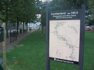
I was on the road at dawn. It was chilly when I headed out and that sure felt good. I rode through Cumberland and stopped at the trail head of the C&O Canal (MP 184.5). It was cool in the mountains and a little bit foggy. I had hoped the fog would stay but it soon lifted.
I had read that near Cumberland the towpath was reduced to one path through people’s back yards but I saw nothing like that. The ride was mostly uneventful. The canal is at many times a depression in the earth, now filled in by trees and shrubs. At other locations the canal remains filled with water and is easily to visualize canal boats floating through those stretches today.
Not too far from Cumberland there is a long stretch of water full of life. As I was riding I was watching for the wildlife in the canal. I spotted something swimming and slowed down to watch. When the creature spotted me he dove deep and I could see the outline of an otter headed for safety.
Some of the canal was damned by many trees, the work of those crafty beavers. I saw some trees that were still standing but would not be for long as the beavers had been gnawing on them for a while. There were turtles sunning themselves on logs everywhere. I started to count but suffice it to say there were more than 100 turtles. The turtle would be the most often spotted animal along the canal.
I was in pain but determined to finish the ride. The canal tow path was bumpy in parts and not as smooth as the rail trail in Pennsylvania. Because of my saddle sores, I started spending more time out of the saddle and it was nearly impossible to get into a good riding rhythm and keep it.
I had driven near this stretch of the canal and wasn’t surprised by too much. But approaching the tunnel at Paw Paw was amazing. This structure was completed in 1850 and carried the water through the mountain. It is water-filled today and the tunnel remains safe to navigate.
I started to ride through it but soon dismounted for fear I would crash. It is dark in there and without a light one can’t see the wet path. Or what lurks in the dark. The warning was to bring a light but I did not have room to carry one with me. A wooden railing was to my left and the wall to the right making the path about three feet wide. I made a lot of noise as I walked though the tunnel. I needed to alert whatever creatures waited for me. It turns out there were none.
On this day I thought I might meet some through hikers or bikers but I met none. Around MP 150 I met a family of four who had come down from a summer cabin to fill up some water jugs. They had two small girls and a Labrador Retriever. The Lab was wearing a glow stick around his neck which they put on him at night for him to hunt frogs.
When I asked what was ahead they told me that there was a store in Orleans and I remembered the trail maps mentioning a store called “Bills.” Although they told me it was a “mile or two” I thought I had missed it when I rode further. But after five or six miles I did come to an opening in the trail and saw that painted on the concrete wall was the word “store.” I left the trail and rode up a hill for about 50 yards and saw Bills. On the left was a Pepsi machine which would not take bills (ironic for a place called Bills). I had no coins. I looked at the store and saw a sign “Gone Fishin’.” What a disappointment. For a hungry traveler this was my mirage in the desert.
At MP 140 I met a man on a recumbent bike and we rode most of the way to Hancock. He was an interesting man about 60 years of age. I had passed him as I was headed east and he was headed west. When I had stopped for water at a pump and he had turned around and caught up with me. We talked the rest of the way to Hancock. It was here that I rediscovered how much easier it is to ride with someone. We rode to MP 135 then switched to the paved Western Maryland rail trail. The trail climbed above the Potomac River higher than the canal but we maintained a nice pace. And then after about 10 miles we came to an intersection and my new partner said he was going to stop. Cigarette break.
I rode the rest of the way to Hancock by myself. I didn’t realize it was so hot until I reached town and saw the temperature on the bank sign. A sultry 97 degrees. I went to the low budget Super-8 motel and checked in. I then rode back to the bike shop in town and had my gears and chain cleaned form the miles of limestone dust. Hanging out there was my new friend Joe, smoking a cigarette. I went to dinner at the Lockhouse Restaurant. Ordered pasta. After dinner I returned to the motel and called it a night.
There’s a saying that the Tour de France is not won during the day but at night. The point is how well one can sleep and recover after 100-150 miles of racing. I would have lost the Tour.
Sleeping was very difficult. It seemed that every muscle in my body ached and I already developed saddle sores. This is something a rider who is fit would not have to worry about. I simply did not prepare for such an endeavor and I was paying for it.
I began the day with a breakfast at my parents then loaded my Camelbak correctly this time. I left my dress clothes and figured to pick those up later. I filled the bladder with as much ice as I could then poured in the water. It holds 100 oz. of water.
My dad said to me “You’re riding your bike home? I can drive you home.” He didn’t understand the journey; my goal of riding from Pittsburgh to D.C. “Do you want me to drive you to Frostburg or Cumberland?,” he asked. I told him that I wanted to go back to where I left off at Ohiopyle.
My route on this day would take me to Meyersdale where the trail would end. There was a 30 mile gap between Meyersdale and Cumberland that was uncompleted. I had studied the overland route but wasn’t feeling certain, especially since I messed up something so simple as getting out of Pittsburgh yesterday.
I asked my sister, Betsy, who also lives in Somerset, to go to the atatrail.org website and print my detour instructions for my final review. I had printed many cue sheets but for some reason these were missing. Betsy handed them to me and said “you know, there’s one route in there that says ‘we wouldn’t want to ride this on a bike’. That’s the one you’re riding today.” Well, thanks Betsy!
We drove over the hills to Confluence on our way to Ohiopyle. It was very foggy and a little cool. I thought it was a perfect day for riding and hoped the fog would stay on the hills for much of the morning.
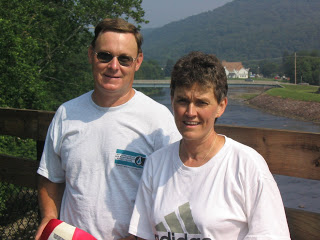
We reached Ohiopyle and I began to unload my bike. There was a couple who had just unloaded their bikes and the man said to my dad “hey, I know you.” Just two and a half weeks earlier we had attended the “States” Family reunion near Punxsutawney, Pa. This was my second cousin Alyson Reitz (nee Spicher) and her husband. They had driven down from the Punxsutawney area for the day and wanted to ride the Ohiopyle area. They were contemplating riding “down” to Connellsville and back or “up” to Confluence and back. I told them to definitely ride up to Confluence (with me) because the second part of their trip would be downhil. So for the first 12 miles of my second day I had some company.
Ken and Alyson Reitz
Alyson is the author’s second cousin
Riding with someone is so much easier than riding alone. Although they told me to ride ahead so I didn’t slow them down I wasn’t about to. First of all, I needed their company to keep going. Second, while I was riding back to Washington, D.C., riders mistakingly thought I was in a hurry and would want to ride faster than their pace. They forget, they may be in a sprint while I am in a marathon.
We rode together. When we reached Confluence, which is at the confluence of the Casselman and Youghiogheny Rivers and Laurel Run, we parted company and I continued on to Markleton and crossed the high and low trestles at Pinkerton.
From here it was a matter of just keeping my speed up as best I could. I had ridden this stretch twice before so there wasn’t a lot new to see. When I rode it before it was Meyersdale to Ohiopyle so I usually averaged 14-15 mph since it was slightly downhill. Even downhill on the Allegheny Highlands Trail one has to pedal to keep up speed. This is not an asphalt trail but consists of crushed limestone. But now I was going uphill so I needed to work even harder.
Pinkerton Trestle
I should have made much faster speed. The 42 miles from Ohiopyle to Meyersdale should have rolled away in three hours or so but it was more like four. I was tired but also relieved, in part, when I came to Meyersdale. I stopped to admire and photograph the Salisbury Trestle.
Crossing the valley 100 feet bleow is enjoyable not only in the view but also because the deck is concrete and I was finally off the limestone trail, never to see it again on this trip. I really enjoyed riding across the 1900 foot long trestle. At the Meyersdale end one has to navigate the vehicle barricades that allow only bikes to get through. Here I didn’t do so well. At first I thought I could stay clipped in and zig zag ride through the posts but then realized I had to stop. Quickly.
I hadn’t unclipped from the pedals and that always spells disaster. The bike stopped. The feet were stuck to the pedals. When that happens, the rider falls and this rider did but it was a soft fall. The gloves protected the hands and the bike, thankfully, was okay. It was stupid and was one of those things that happens when the body and mind gets tired.
At the Salisbury Trestle the improved trail ended although one can continue riding for another mile or so to the old Western Maryland train station. But here the trail is just an old road bed and is very rough. I was riding a Trek Navigator which is a hybrid, neither road bike nor true mountain bike. But it has fatter tires like a mountain bike and lacks the high gears of the road bikes so it is much closer to a mountain bike. When I reached the station I turned down the street and rode it downhill until I came to a Subway sandwich shop. I had driven through Meyersdale one month earlier and scouted this location for food.
Here I was able to wash up my hands and face and ordered a 6 inch sandwich. I drank some soda but before leaving filled my Camelbak with ice and topped it off with water again. I had depleted the 100 oz that I started with. I had ridden almost 45 miles uphill from Confluence and the big mountain climb was ahead.
The thought of climbing the mountain was not a pleasant one. The unimproved trail may have continued another five miles past Meyersdale but no one seemed to know for sure. Least of all was the girl at Subway. I had calculated the distance to Frostburg as 18 miles. When I told her that I was headed to Frostburg on a bike, she couldn’t believe it. I asked her how far away it was, not entirely trusting my memory. She said, “in a car traveling 60 mph, probably one hour.” I said oh no, that would be 60 miles and I know better than that.
Really Off the Beaten Path
I wasn’t sure how to leave Meyersdale. I could climb the hill in town back up to the WM Station and try to head out the unimproved road which was to be the new rail trail. But I didn’t want to head out on an unimproved rail bed for a couple of miles only to find a gated or closed trestle. So I headed out on the road which I knew would cross the mountain. I started down in the valley and in a couple of miles passed under the trestle which would be the next to open on this trail. It looked finished but may not have yet been open.
The stretch from Meyersdale to Cumberland was the “missing link” in a completed trail from Pittsburgh to D.C., if you ignore the 20 miles coming out of Pittsburgh. A couple of trestles remained to be finished and most importantly, the Big Savage mountain tunnel was yet to open. But in August 2003 there was one way over the mountain. Back country roads up and over the mountain.
I started the climb. I had yet to use my granny gear and part of me said to save it for when you really need it. But I decided that climbing Savage Mountain qualified and I dropped down into granny gear. Well, I didn’t. I had a lot of clanking and grinding but my front sprocket would not drop down into first. I decided to stop and manually move the chain which worked. The climb was steep in places but also offered a brief downhill or two. They weren’t for long and while it was nice to coast and catch my breath every downhill also meant that I had to climb that much again.
I was taking on fluids as much as I could and did not cramp up. In fact, in Confluence I took on two bananas which I would do every day. One to begin the day and one as a snack. At one time I was thinking if it was 18 miles to Frostburg and if I had to walk it, at 2 mph, it would be nine hours so I would still make it by midnight. The mind plays tricks when the body is so tired. My dad had said to call if I wanted to spend another night with them. For all the hard riding I had done today, Meyersdale and even Cumberland still weren’t that far from my parents in Somerset.
Had I been able to get a cell signal I would have ended the day. I was in a lot of pain. But I had to keep going as there was no signal out here in the mountain wilderness.
I kept my pace, keeping it going at a steady 3 mph. I started thinking six hours or 9:00 p.m. But as the grade lessoned I was able to start thinking more rationally. I had another 24 oz Gatorade on my bike and decided that the Gatorade would be my champagne when I reached the Mason-Dixon Line (otherwise known as the Pennsylvania-Maryland border).
There was very little traffic but when one car with Maryland plate passed me I was able to sit a little higher and work a little harder. I knew I was close to leaving Pennsylvania. I came to the top of the road, but not the mountain, but was almost there. For the first time I could see towers on the mountain over near Interstate 68 in Maryland. It was about 4:30 p.m. and I called my dad and told him I was out of Meyersdale. (He wanted me to call him at Meyersdale but there was no cell signal there.)
Mason-Dixon Line
I saw the sign that said “Frostburg 7” (miles) and knew that it wouldn’t be midnight. I rode another mile then reached the Maryland border and drank my Gatorade. I still had work to do. I climbed higher though Finzel then reached U.S. Rte 40. Here I began a fast descend down a hill in preparation for climbing the summit of Savage Mountain. I kept working to get up the mountain and then stopped at the top to look around.
I was 100 feet above I-68 watching trucks struggle to climb this hill. I crossed the summit at 5:30 p.m. and descended quickly into Frostburg not worrying that I was doing 39 mph in a 25 mile zone. Descending down the mountain I didn’t brake nor did I pedal. I simply coasted and enjoyed the couple minutes of satisfying ride that came after 12 hours of hard riding from Pittsburgh. The day was almost over but would you believe that one must make a final climb to get into Frostburg?
I rode through Frostburg and descended down the mountain on US 40. The temperature on top of the mountain was 86 degrees so it had been a warm day for riding. When I came to Lavale, Md., I decided to call it a day at the Comfort Inn. But the night was not so comfortable.
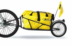
Andrew and I went into work with my vanpool and loaded our gear for our departure from L’Enfant Plaza in southwest Washington. We each had a rack on the back of our bikes to carry one sleeping bag. I was pulling a “Bob” — a one-wheel trailer behind my bike. The Bob was fully loaded with six days supplies for each of us, camping gear, and every bike tool that one could think of.
A Bob trailer
It was hot and sunny. Even as we left the building shortly before 9:00 a.m. it was already pushing 80°, going up to a high of 90°. And humid. We rode out the building and got on the sidewalk to cross the Case Bridge which carries I-395 over the Washington Channel. At the end of the Case Bridge, we went under it, and rode the 200 yards to the Thomas Jefferson Memorial. There I took a picture of Andrew to commemorate our official starting point.
We then rode on the 14th Street Bridge on its sidewalk/bike lane and crossed the Potomac River into Virginia. At the bridge’s end we got on the Mt. Vernon Trail and within the first half-mile saw our first wildlife of the trip — a blue heron standing passively on the banks of the Potomac.
We rode through Gravelly Point, the excellent plane-watching park where we have been many times watching the flights in and out of Reagan National Airport. We continued past the airport down to Four Mile Run Trail and picked it up to ride to Shirlington.
Four Mile Run where it enters the Potomac appears to be a straight stagnant pool of water which was channeled out years ago for flood control. But within a couple of miles that would change. We followed the trail to Shirlington, crossing the pedestrian bridge over the very busy I-395. Once in Shirlington, we rode about two blocks to find the entrance to the Washington & Old Dominion Trail (W&OD).
The W&OD was a short line electric railroad that ran from northern Virginia to Bluemont, some 60 miles away, until the 1960s. When it ceased operating, the Virginia Electric and Power Company bought the right away for its power poles then later the Northern Virginia Regional Park Authority negotiated with VEPCO to use the old trackbed as a rail trail.
The W&OD is a nine-foot wide paved trail from Shirlington to Purcellville. Because it mostly follows a former train right of way, the grades are gradual. But from Shirlington to Purcellville, it is a gradual grade uphill when it’s not flat. Except for a couple of overpasses to cross busy highways or go through neighborhoods, there are no downhills headed west. It’s basically easy pedaling, but it’s pedaling all the way to Leesburg, our destination on the W&OD.
The first mile on the W&OD the trail parallels a busy street. There is no shade and plenty of road noise. Only three miles from Shirlington, the trail follows Four Mile Run and diverts through a wooded area. I didn’t know such a beautiful area existed inside the Beltway. I thought everything had been developed but this trail, while uphill, is worth a trip in itself. Four Mile Run at this point is a narrow stream, with lots of water cascading over the rocks on its way to the Potomac.
I was surprised when all of a sudden we were in Bluemont Park at a Frisbee Golf Course. I had played the course once before but never noticed the rail trail cut through it. We exited Bluemont only to be dumped into a residential neighborhood without good directions as to where the trail headed. It is poorly marked at this point. We waited until a cyclist passed through and followed him up about two blocks past a Metro Station where we rejoined the trail.
We were parallel to I-66 and rode through the city of Falls Church. We later crossed over I-66 then made our first milestone for the day, the crossing of I-495 — the Beltway. Here the trail was flat and we entered the town of Vienna. We stopped for our first break of the day and ate lunch. After refilling our stomachs and water bottles we started out the trail once again.
The difficult part of this section of the trail is that it crosses many busy streets at grade. For each crossing, we would lose our momentum as we had to come to a stop and wait for traffic. In Herndon, Andrew couldn’t get his shoes off the pedals quick enough (he had borrowed cleats that clipped in) and he had his first spill of the trip. He had to stop short of crossing the roadway but his shoes were locked firmly on the pedals and Isaac Newton’s law won here. Andrew was scraped up a little but we continued without needing the first aid kit.
Our first deer was spotted in Vienna, not in the residential section but here the trail goes through a wooded area. It was surprising to see a deer so close to where thousands of people live.
We continued on the trail and crossed busy Route 28 via a flyover. We knew this marked the end of the residential section, and also the end of any shade at all. I had set my watch so that every hour we would stop and rest/stretch if we hadn’t already done so. It was coming up on an hour since our last stop and there was a “bike rest area” at Smith’s Switch Station on the trail about one mile past Route 28. Picture a pretty straight section of trail and no other roads or houses around, then picture a rest area for bikes. We stopped and bought our first drinks of the day to supplement what we were carrying.
The rest area is just north of Dulles Airport so we watched a few big planes on their approach to Dulles. If the trail had been mostly flat to this point, it now became a definite uphill, but gradual, ride to Leesburg. The sun was beating down on us and we were quite thirsty but kept riding, stopping once to view some quarry operations that were beside the trail.
Once we entered Leesburg we stopped for a drink at a 7-11 then took our lives in our hands as we left the W&OD. We had traveled 35 miles on this trail and the trail continues another 10 miles out to Purcellville. But we needed to follow U.S. Route 15 North. It was only three miles but it could have been 30.
We had to ride on the gravel shoulder as the cars and trucks flew past us. I let Andrew lead so I could direct him and also I would be the first “target” seen from the rear.
We reached White’s Ferry Road and pedaled that back road 1.3 miles to the water’s edge. This is the only crossing point on the Potomac between the Beltway and Point of Rocks, Maryland. White’s Ferry shuttles vehicles across the river and we walked our bikes on and paid the one dollar fare.
Once across into Maryland, we were a little disheartened to see that we were only at Milepost 35 of the C&O canal. We had ridden 35 on the W&OD, plus 3-4 from Leesburg, and 4-5 from D.C. to the trailhead. It was now 4:00 and we were pretty tired.
We started up the towpath which in this section was two dirt tracks separated by a grass median. This is why a one-wheel trailer was required. We saw more deer but rabbits and turtles were spotted mostly. The canal has sections where it is fully watered and there were stretches covered with green duckweed, but much of the canal’s bed has been overgrown by forest. We met no one coming in either direction for the next hour or so.
The serenity of the forest was broken by noise ahead which sounded like white water. Indeed it was. We were crossing the grounds of Dickerson power plant and in 1992 they had built a kayak whitewater slalom run for use by the U.S. Olympic Team to train. There was no one training on this day but the course is still there including the slalom gates.
It was just a few miles further that we came upon the crossing on the Monocacy River. The C&O paralleled the Potomac River although much of this section you couldn’t see the river. But here, where river flowed into river, the engineers had built a stone aqueduct to carry the C&O over the Monocacy River so that the canal would not be prone to flooding like the rivers were. There is a beautiful stone arch bridge which carried the canal over the Monocacy River here.
Unfortunately, with the flooding in 1972 from Hurricane Agnes, the aqueduct was damaged and for the past 30 years has been shored up with additional supports. We could walk across the structure though and after a few minutes rest and some pictures, we did.
We continued up the canal to Point of Rocks, Maryland. While we were getting hungry, we didn’t see anything here and decided to push on. The time was 6:00 p.m. and we were hoping that Brunswick, Maryland would hold promise for us. We rode ahead to Brunswick and passed an RV campground between the trail and the river. The owner rented us a site for the night so we went ahead and rode into town to eat at Mommer’s Diner.
It was in this diner that we met a couple of girls traveling through from Cumberland to D.C. We talked about conditions in both directions and they talked about how they loved Shepherdstown. Of course, we have spent many a day and dollar in Shepherdstown since Bethany goes to school there. One thing I remembered them talking about was the great bike shop. The one girl had problems with a rack and her duct tape was beginning to fail so they made the necessary stop in Shepherdstown for the repairs.
After dinner at Mommers, we headed back to our campsite to learn a most disturbing fact. The campground is nestled between the river and the canal — a beautiful location. The canal here is grown up with trees but it wasn’t always that way. While at Mommer’s we met an older couple. The man had worked for the U.S. Park Service and maintained the canal in this area. As a boy, I would guess in the 1940s, he said the canal here was watered and they would ice skate for miles on the canal in the winter. We also learned that the Park Service does plan to restore the Monocacy Aqueduct. But on the other side of the campground through those trees hides a railroad yard.
We had been thinking of staying at one of the many Hiker/Biker campsites along the towpath but the thought of hot showers was too much to ignore. We paid $9 for the campsite and took our showers, probably spending more than twice that money standing in the shower. Once we pitched the tent and tried to sleep the trains came alive. It seemed like it would last all night with cars being coupled and uncoupled. Then, of course, there’s always that pleasant sound of the air brakes being released.
The humidity of the day kept it from cooling off so it was still in the low 80s when we turned in for the night. No breeze, it was miserable.
Still, we had survived 70 miles the first day with no problems. The legs were in good shape and the butt didn’t hurt too bad either. It looked like it would be a good trip.