RANSON, WEST VIRGINIA
Visiting Ashley in Ranson, West Virginia, I decided to head out for a ride along the basic route of the South Mountain Loop, a 37-mile route for hybrids or mountain bikes, which originates in Brunswick, Maryland. Only one problem presented itself: I rode the route just once six years ago and would attempt to ride it from memory. I did pretty well, only missing one turn which I would do differently.
The day was cold and windy. Winds were constant at 20-30 mph with higher gusts. Temperatures were in the mid-30s to start and only climbed to near 50º (10º C) by the end of the ride. Everywhere there was a headwind. I don’t know how this could be but it was.
Instead of starting in Brunswick, I started in Ranson and followed US 340. When I crossed the Shenandoah River just upriver from Harpers Ferry, I turned on Chestnut Hill Road. From 340, Chestnut Hill Road looks almost impossible to drive up and does look impossible to bike up. But on a bike is where magic happens.
I turned the corner and kept climbing higher and higher. The GPS showed 12% then 14% then 18%. When it “leveled” off to 4% I decided to turn around and go back to the route I had planned. I descended at 45 mph. I could have gone faster but there was a stop sign, heavy traffic, a guard rail, and the Potomac River at the bottom.
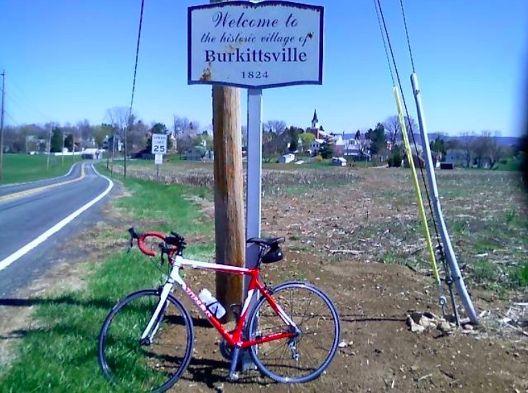
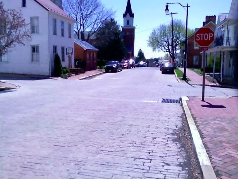
I followed US 340 into and out of Virginia and across the Potomac River into Maryland. I passed beautiful farmland to Burkittsville, the location of the horror movie, The Blair Witch Project. It’s a lovely little village and I can’t say I saw any witches. But who really knows for sure? They don’t all look like Elphaba.
Out of Burkittsville, I climbed a ridge road along South Mountain before being dropped back into the valley then climbing up Reno Monument Road. At the base of Reno Monument Road is a large, slightly unkempt house on the left. You know, the kind where a huge dog is lurking ready to attack. Outriding dogs can present their own adrenaline rush but I’m not going to out pedal a dog while going up a 20% hill.
My dogdar (that’s like radar to detect dogs) was on full alert mainly because when I rode this six years ago I was chased by a big dog at this house. Yes – you remember those things.
I was quietly pedaling, not shifting gears, and generally trying to avoid disturbing any creatures who may live there. And then I saw him. A huge dog but I’m not sure of his breed.
And he saw me. Or she saw me. I didn’t want to get close enough to check.
The dog came flying across the yard and I dismounted and started being really nice. There was no way I was going to flee and kick in the dog’s chase mentality. I was on the right side of the road and the dog was to the left. I hoped that he wouldn’t come across the road at me. I walked a little saying stupid things he couldn’t understand like “nice puppy.” This completely killed my average speed for the day too. I should have paused the Garmin.
My break came when just as the dog was coming out of his yard a car came down the hill and almost hit it. Brakes squealed, the driver stopped and I used the car as a shield to sneak away.
Reno Hill kicked up to 20% but it was a relatively short climb. At the summit, there are some Civil War markers and a “Private Road” sign which invited me to ride.
I turned left and was riding the very summit of South Mountain. A one-lane paved road with no traffic was great. I wondered where the road would end. I thought it was a U.S. Park Service one-lane road which perhaps made a loop. The grade was great for climbing. A lot of 12% with even higher numbers as well. After two miles I came to a dead end. Some government installation. Some secret government installation. I smiled for the cameras and turned around.
Back to the main road, I descended into the valley on the east side of the mountain. I missed the road that would have taken me to Chestnut Ridge and down to Harpers Ferry. But Rte 67 has a very wide shoulder and was a nice run into Brunswick.
As I approached Brunswick I saw the last road on the right and thought it would be fun to take it to Harpers Ferry if that’s where it went. It didn’t. It was a heck of a climb and ultimately I realized I was climbing for no reason that the road would not cross the mountain. I was right. I made a loop right back to Rte 67. Bonus miles.
I was not prepared for the distance with the climbing on this day. Or the wind. I climbed almost 6,000 vertical feet. Other than a small packet of Sport Beans (by Jelly Belly), I had no food and I ran out of water. I bonked and the thought of climbing back out of the river valley was too much. I pulled out my cell phone but no one answered my distress call.
My emergency funds consisted of two dollars in my saddlebag and were used to purchase a Snickers bar at the Exxon Station at the base of Harpers Ferry Road. Hunger solved. I made the 2-mile climb up the US 340 past Harpers Ferry to the plateau with ease.
The stats don’t show the entire trip because I reset the Garmin nine miles into the ride so I rode close to 66 miles. It was a good day but very tiring.