Chickens on the Loose! – MWARBH 2022

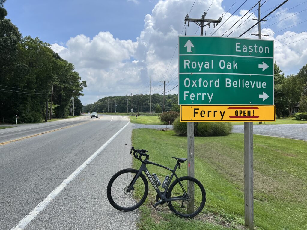
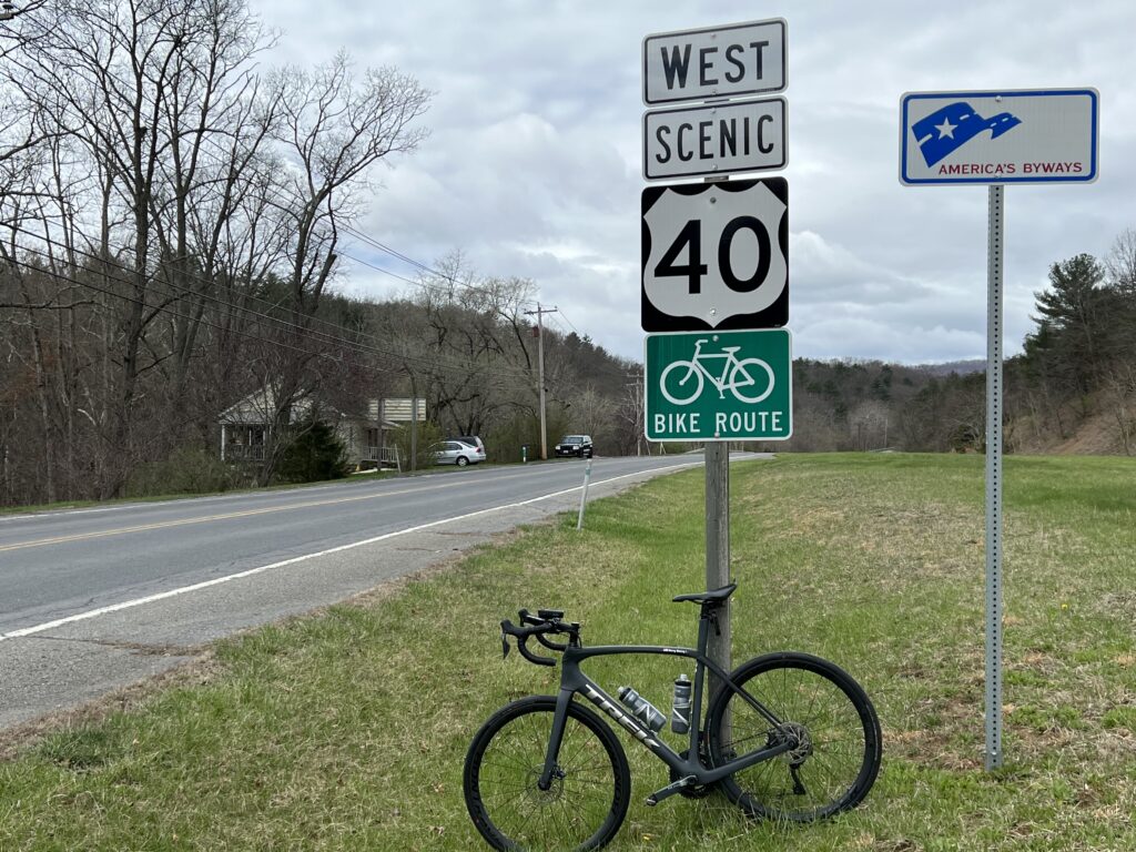
GORHAM, NEW HAMPSHIRE

This is the hardest hill climb in America. Change my mind.

Last year I sucked. It was a “comeback” after seven years off and it was awful. I could not end my years of mediocrity on that sour note.

The drive out to the MWARBH on White Mountain Highway.
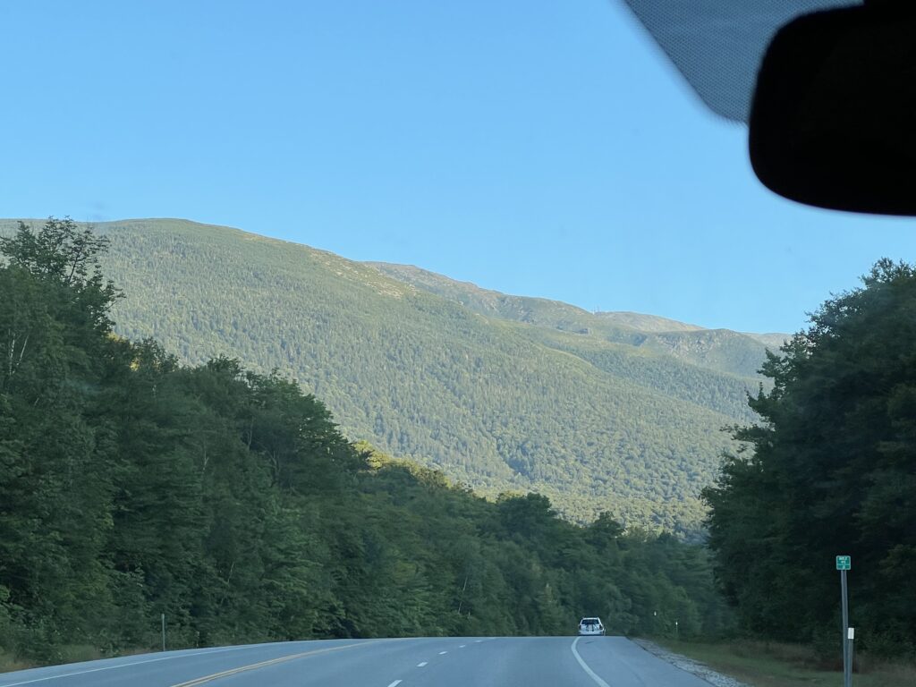
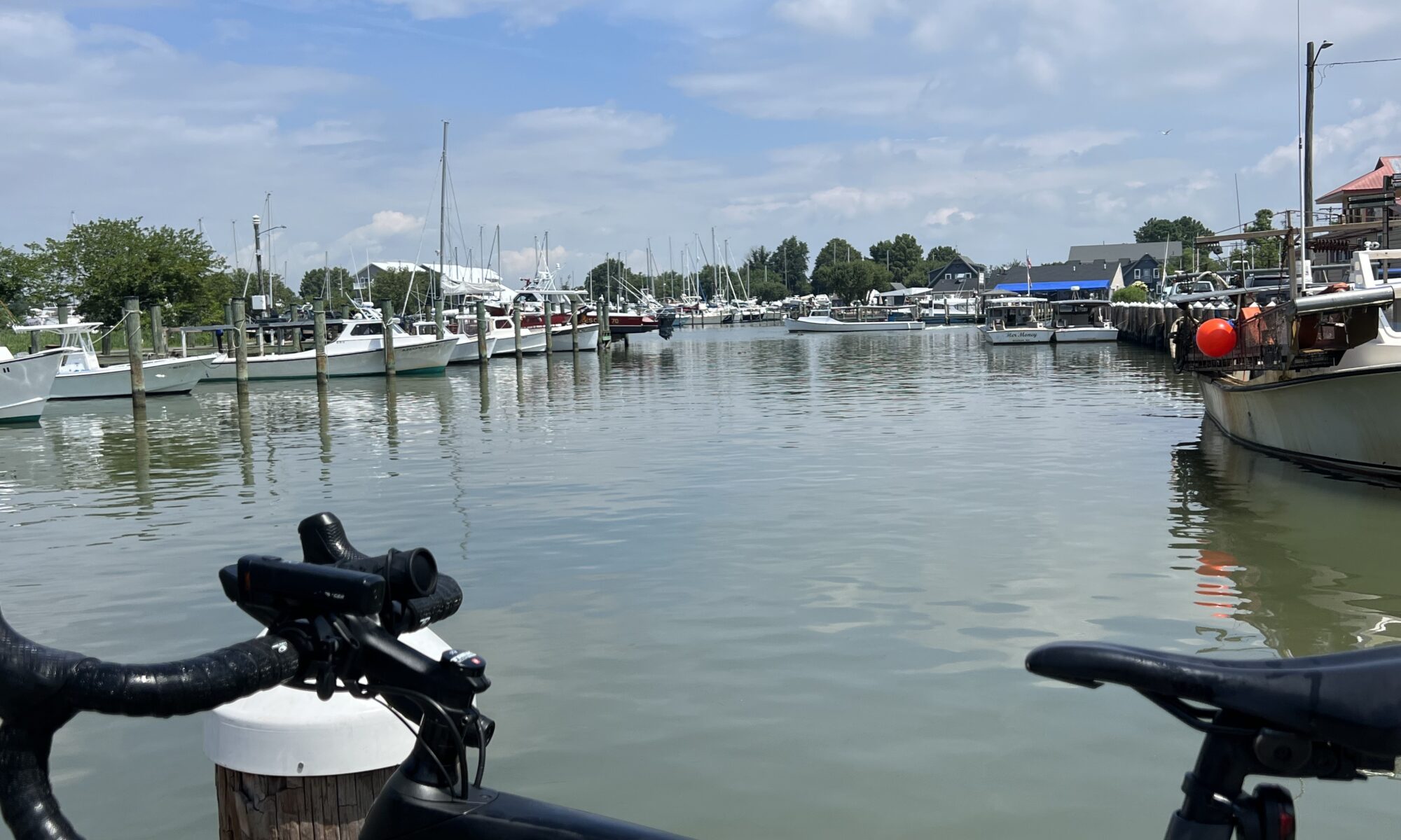
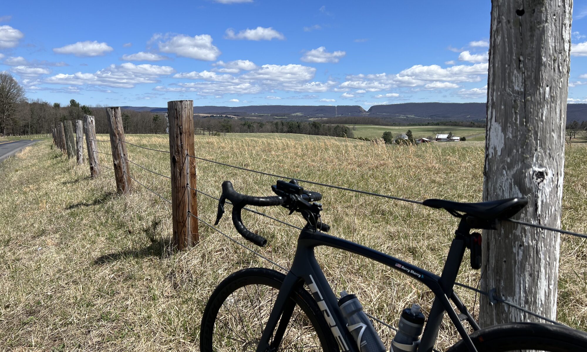
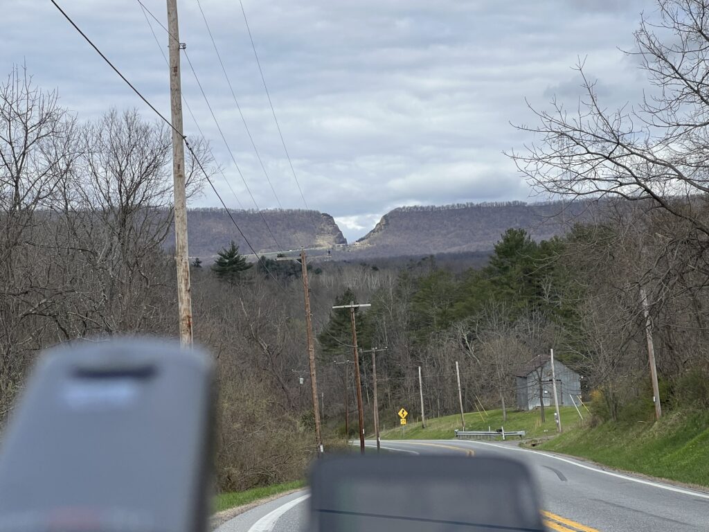
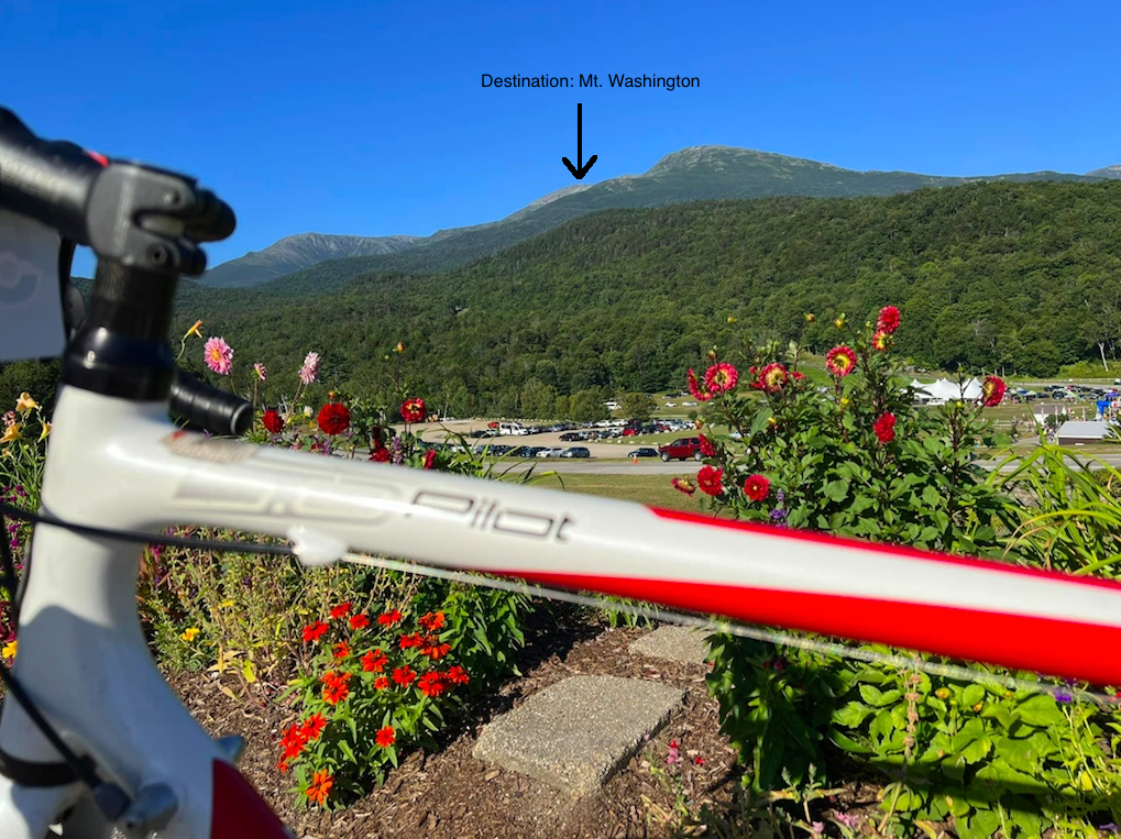
My stomach always starts to churn when I see Mt. Washington out in the distance.

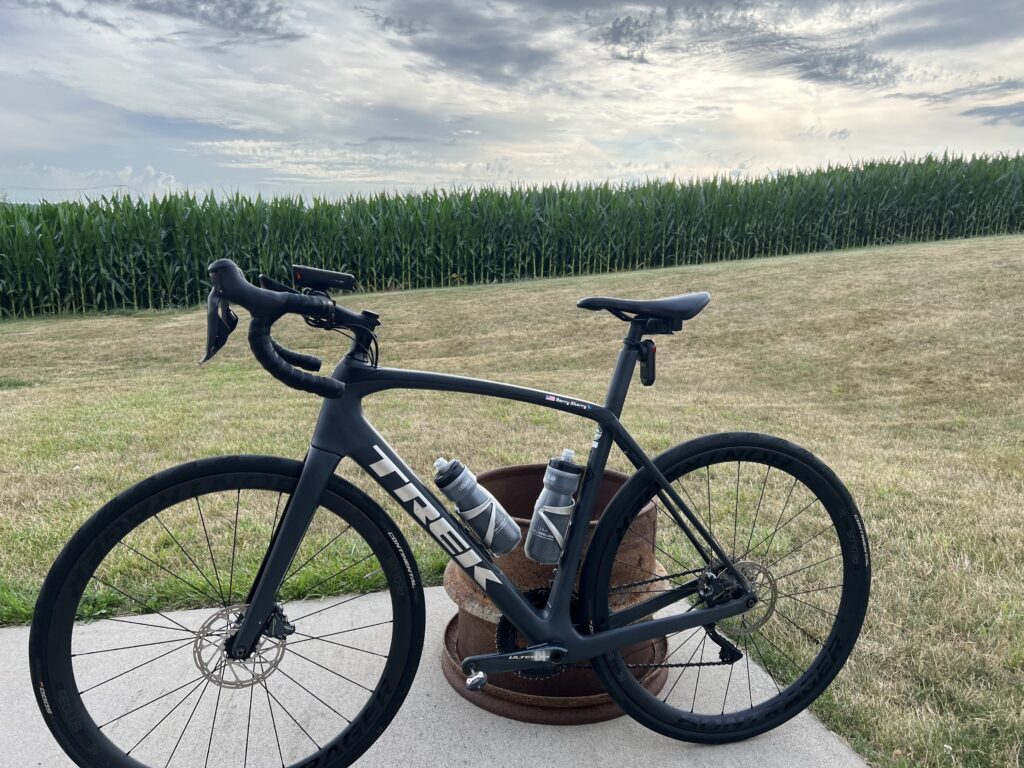
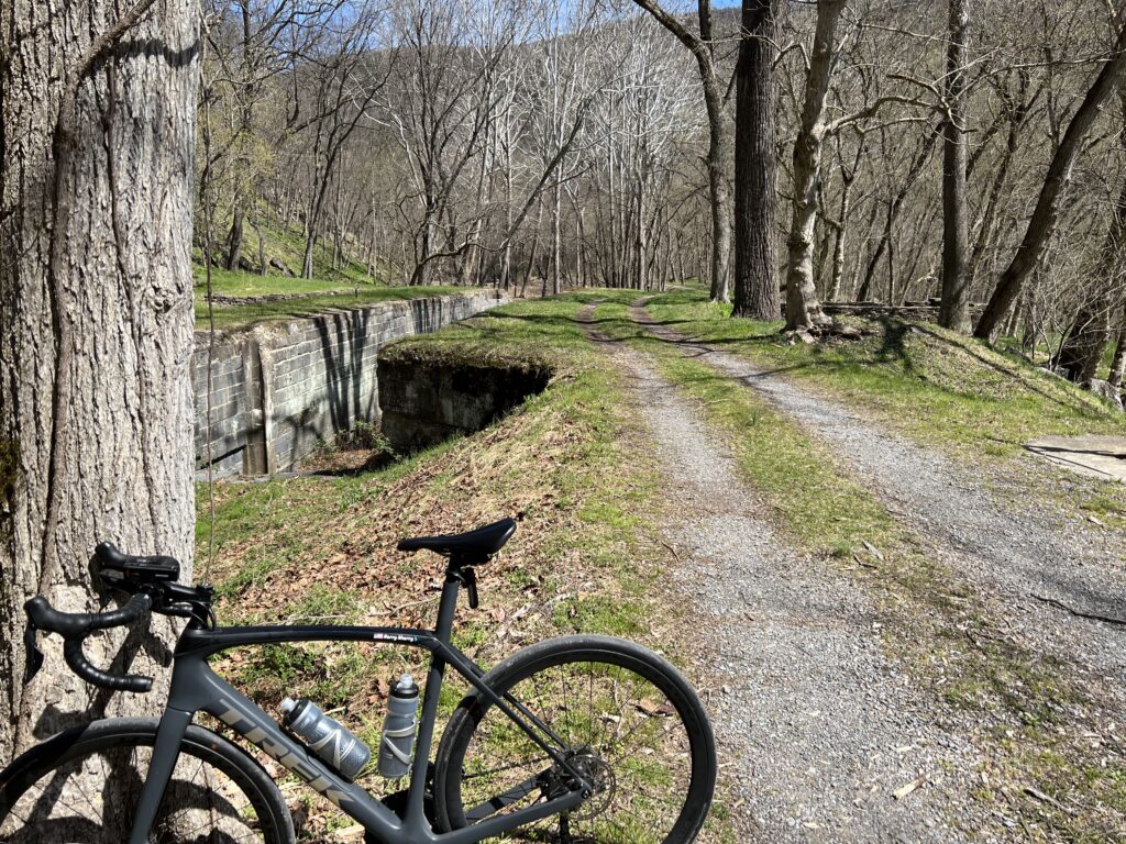
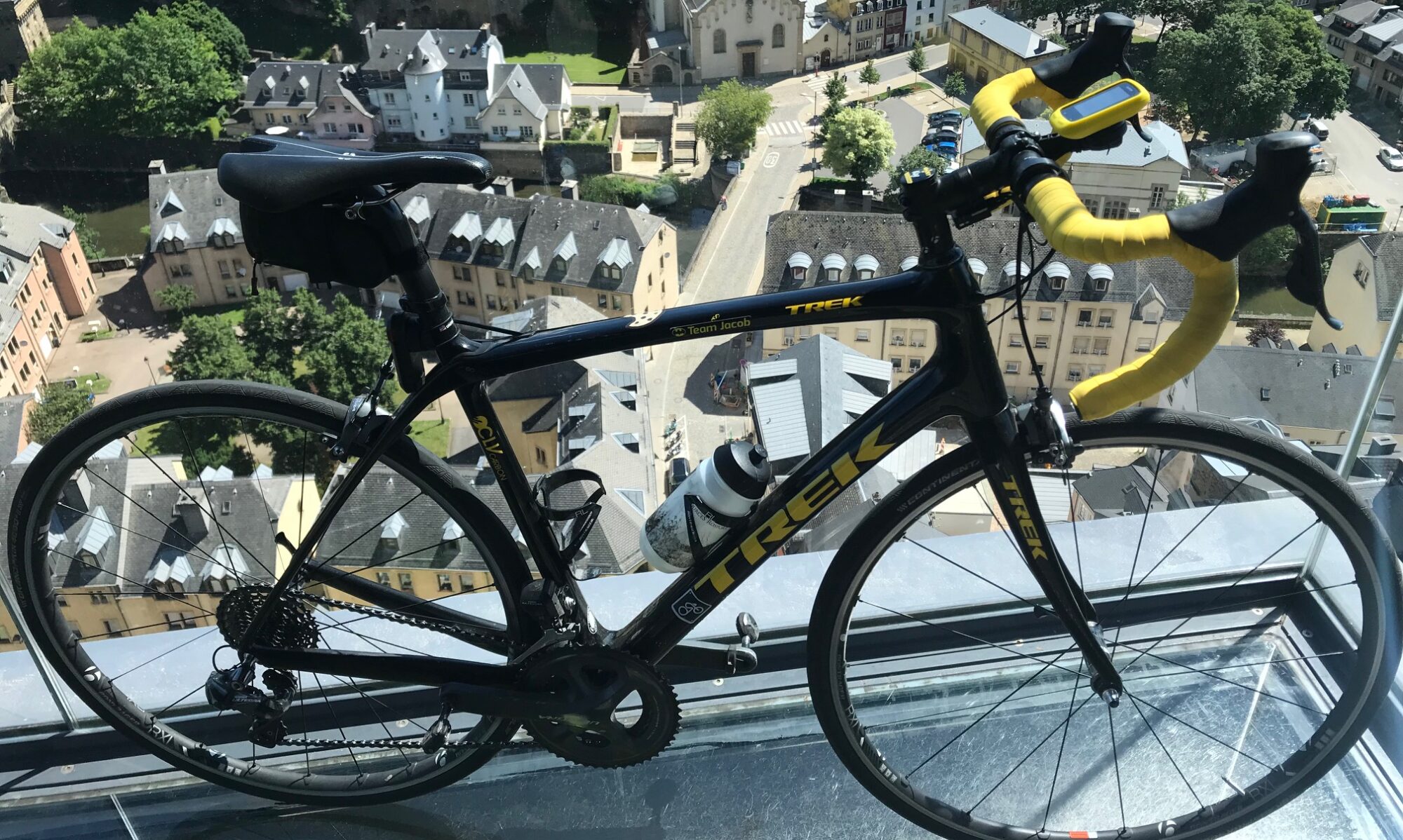
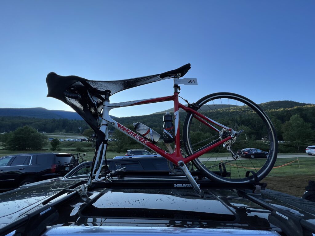
In 2020 my Trek Pilot had a broken chain stay and was basically totaled by the warranty department at Trek. It was my climbing bike for seven previous races, 2008-2014. So last year I rode its replacement, my aluminum Trek Checkpoint gravel bike. It was heavy, and although it may have matched the gearing of the Pilot, it didn’t feel that way. Actually, it didn’t match the gearing exactly either.

Pre-ride warm-ups are also important

After hanging in my garage for two years and destined for the landfill, I decided I would repair the Pilot. Sure, the cost may have been more than the bike was worth but it has been a special bike to me. I sent the frame to Ruckus Composites in Portland, Oregon, and then had Tom Szeide at the Bike Lane in Reston, restore it to its original parts. And I signed up for the Hillclimb. Again.

I got my bike back and everything was on plan but then an awful thing happened. I stepped on the scales. Actually, that wasn’t awful. What was awful was looking down at the scales. It was June 1. And I weighed 200 pounds.

Early morning at the base of MWARBH

I don’t know what happened. I had been so diligent about watching my weight since I lost 50 pounds in 2020. But I felt so good that I quit watching believing that a change in lifestyle meant I would never gain weight again. And apparently, I was gaining. Well, not apparently, I had gained back much of the weight.

The event tents at the MWARBH

There was no way I could race this climb as a Clydesdale. I had two months to lose 30 pounds. I wasn’t just in the Clydesdale category. If they had a plus I was Clydesdale+

And I did. It wasn’t easy and many may suggest that it was too much weight to lose in too short of time. But damn, am I proud of myself.

View from the parking lot at the Glen House

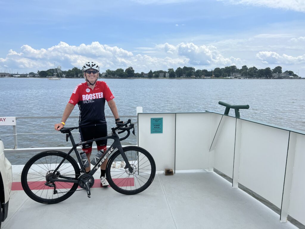
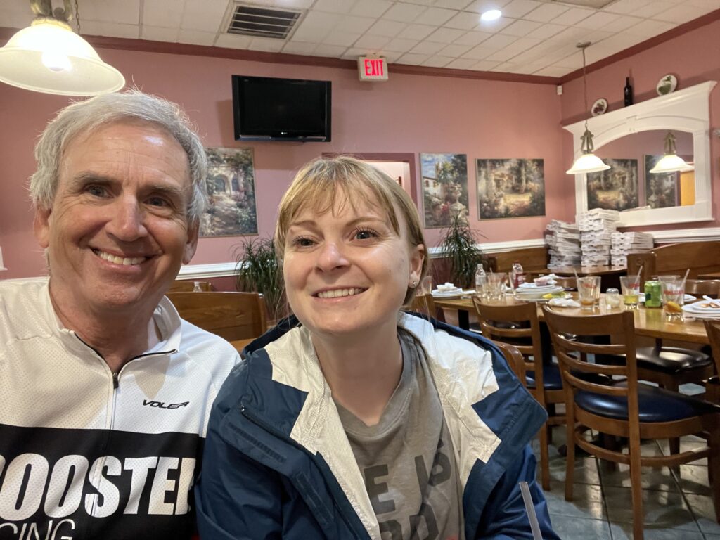
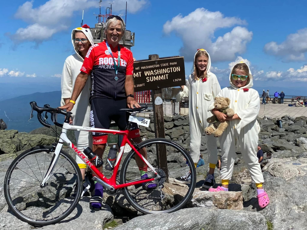
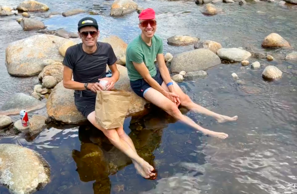
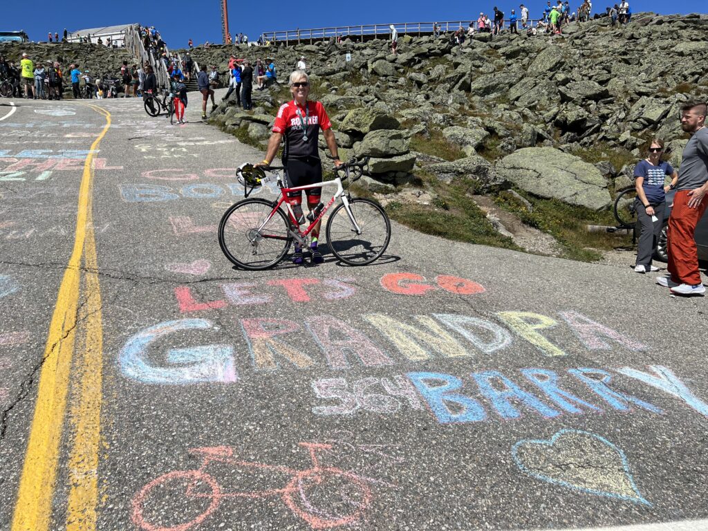
Ashley and Bryan agreed to come to Mt. Washington with me. Ashley first made the trip with me in 2007 when the race was canceled. Then she and Bryan came with me in 2008. And she came again in 2014. So this was her fourth trip to the mountain. But I really wanted my granddaughters there. There’s something very special about a grandfather being proud of his granddaughters and hopefully, granddaughters being proud of their grandfather.

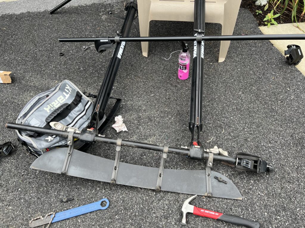
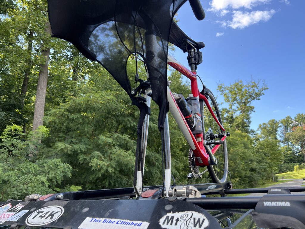
After looking at our options we settled on Ashley and Bryan driving their Kia Telluride. I put my Yakima roof rack on their car. I would have preferred to drive my car but my Ford Transit Connect does not have side rails that support my Yakima rack. I had to hurry to REI and buy 56″ crossbars since the 48″ bars I used on my RAV4 were a little short.

Installing new crossbars

I will say there is something special about a bike on the roof of a car. I love the look but normally prefer to keep the bike inside the car. We just didn’t have enough room for a party of five plus a bike in either of our cars.

Ready for New Hampshire

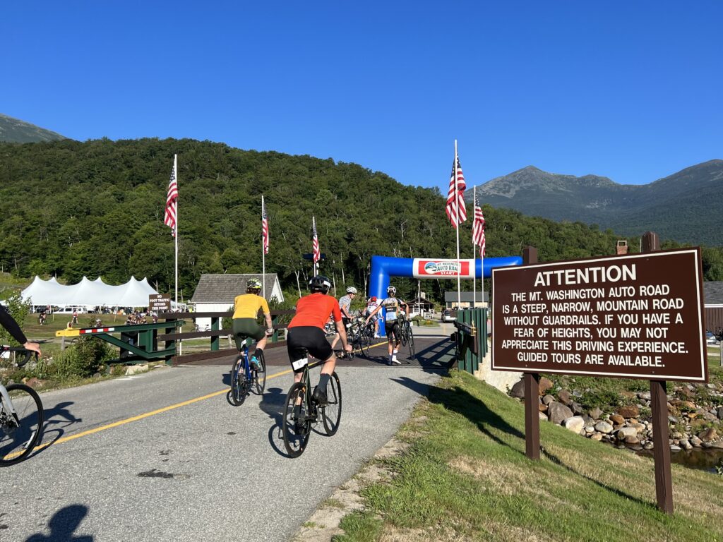
The MWARBH requires you to have a ride down. To encourage carpooling they waive the toll road fee for the vehicle and driver if you take two riders down the mountain. So I logged into a special site the MWARBH had created and posted that we had a spot. Bruce McDonald from Whitestown, Indiana, clicked on our carpool and added himself.

MWARBH Ride Down Match List

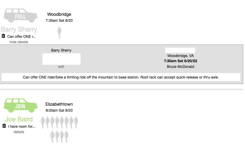
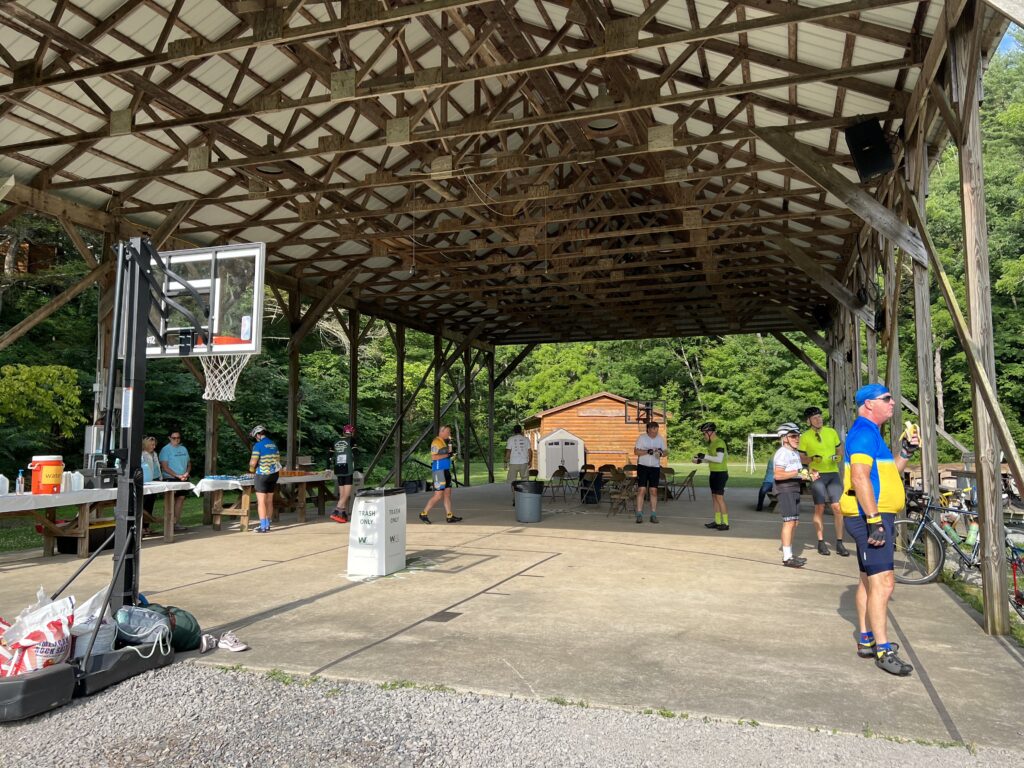
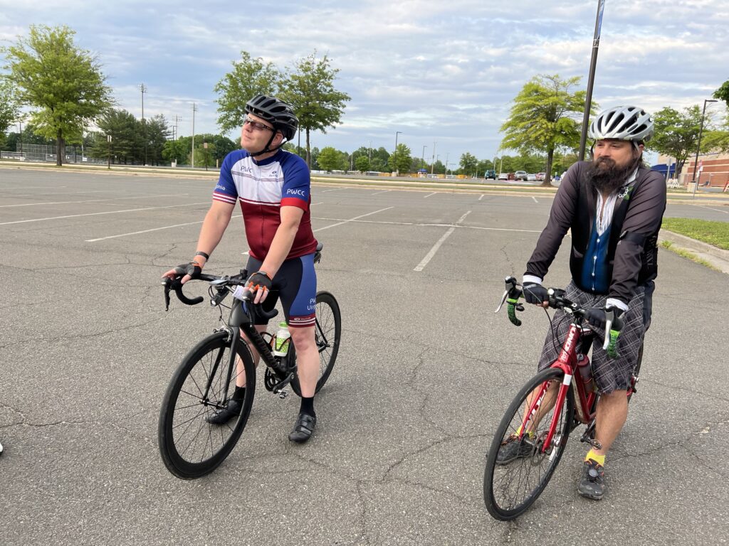
Bruce and I exchanged a couple of text messages hoping to meet at registration yesterday but our paths would not cross. Instead, we met today at 7:15 am in the registration tent. This would be his tenth ride up the mountain. I knew I would like him because when we met he was wearing a Steelers knit cap.

With two rider tickets in hand, Ashley and Bryan sat in the line of cars waiting to go up to the summit. All along, the race announcer was making comments that anyone still in the parking area is late, seemingly oblivious that the line was the queue and it wasn’t moving because they were collecting passenger tolls at the booth.

Riders (mostly) during the singing of the National Anthem

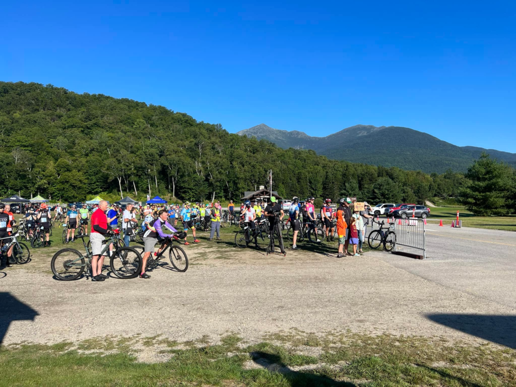
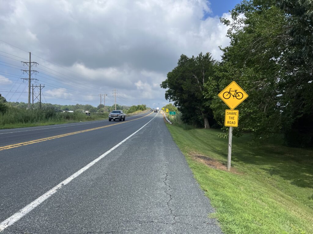
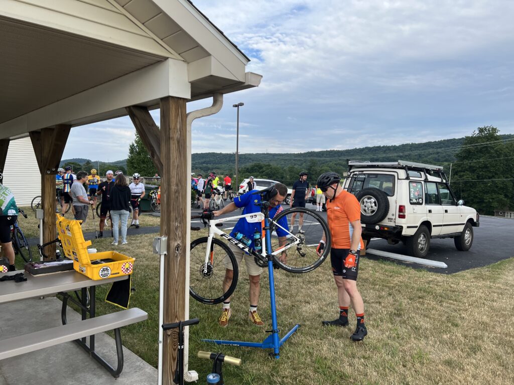
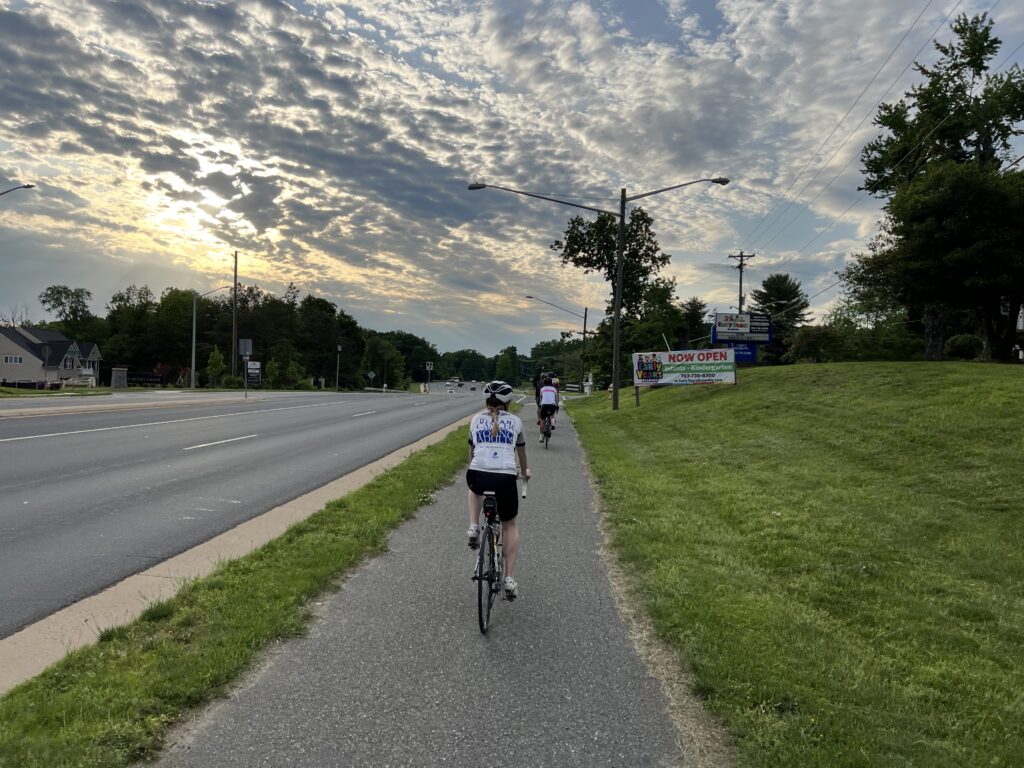
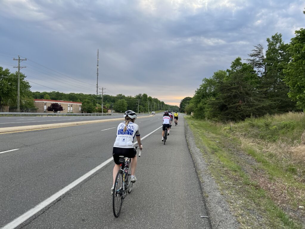
Unlike prior years, I decided not to go out and ride on White Mountain Highway as a warmup ride. I don’t think I would benefit from a pre-race ride of 2-4 miles. Instead, I stayed in the parking area. I was riding in the grass when Phil Gaimon rode by and called out my name. It’s pretty impressive when the race favorite knows your name and gives you a shout out.

First Wave of Riders – Phil Gaimon is closest to the camera in the front row

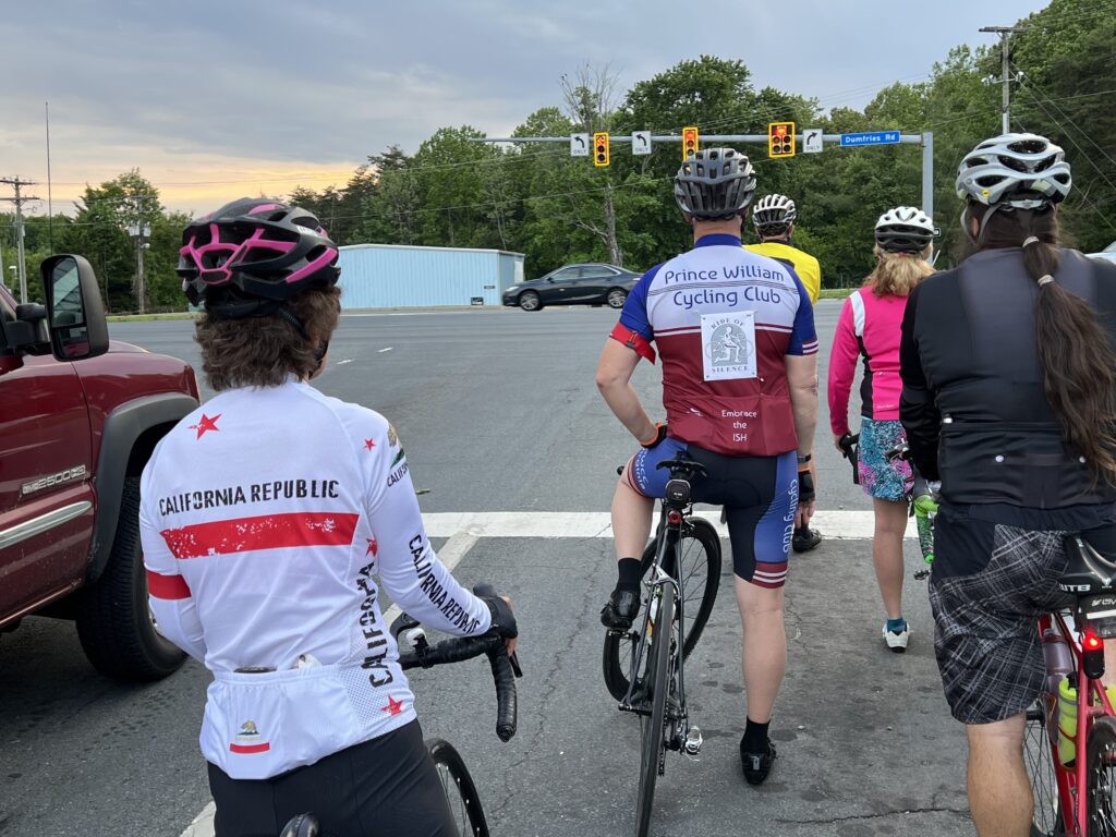
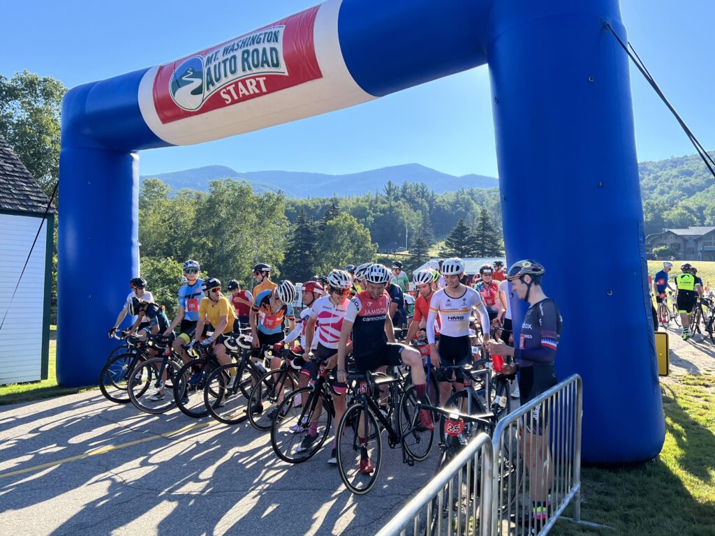
After watching the first two waves depart, in five-minute increments, I went across the bridge and the White Mountain Highway up to the parking lot of the Glen House. I wouldn’t call this a warm-up as much as simply pedaling off nervous energy. It was easier pedaling than just sitting around.

No longer says there is a mile section of dirt road

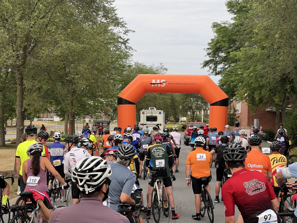
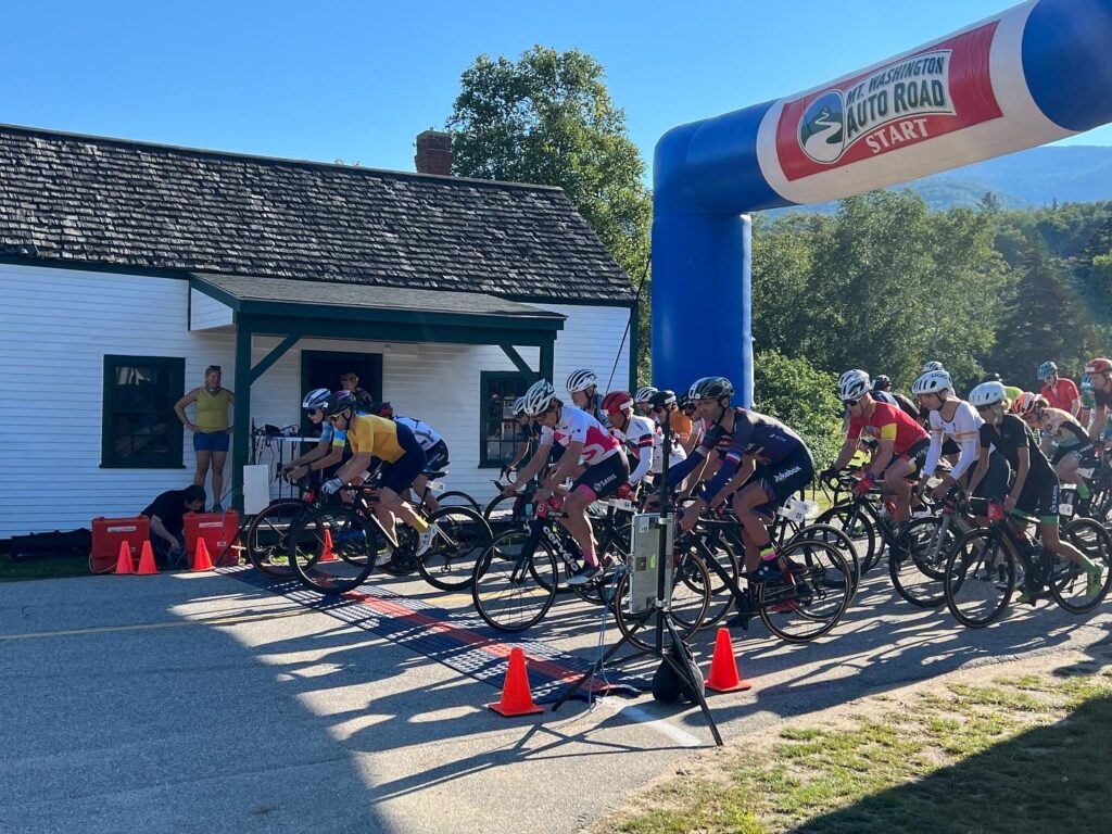
It was 8:51 when I left the parking lot and coasted downhill to the bridge and starting line. I started last in the last wave. The start cannon went off at 8:55.

Wave 2 racing past the Toll Booth

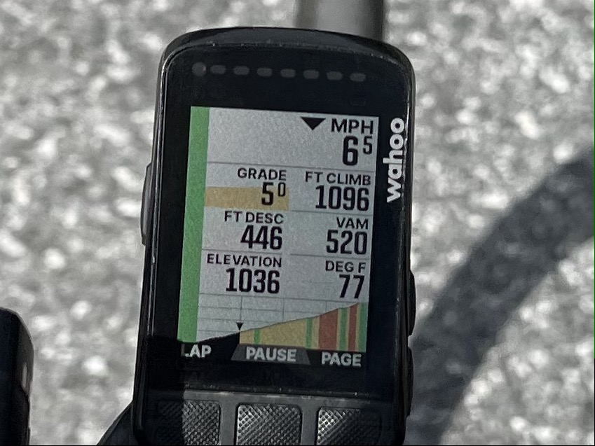
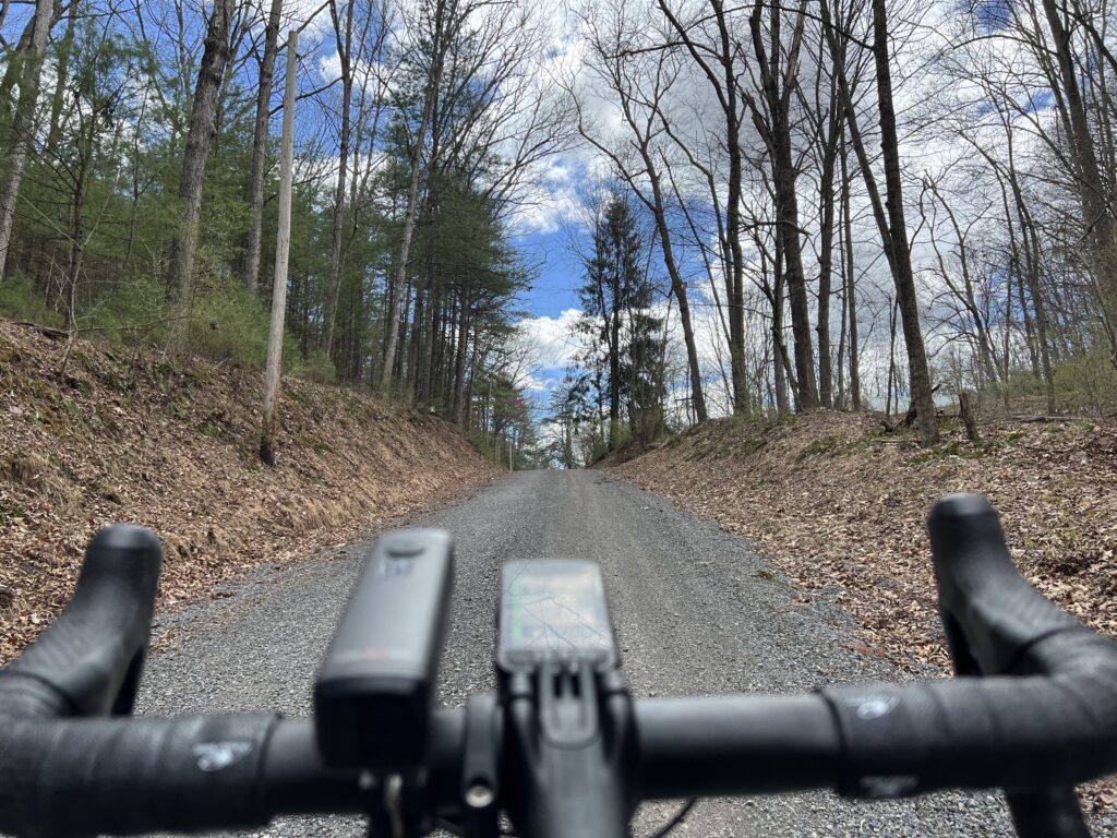
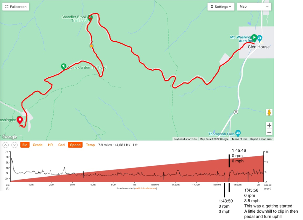
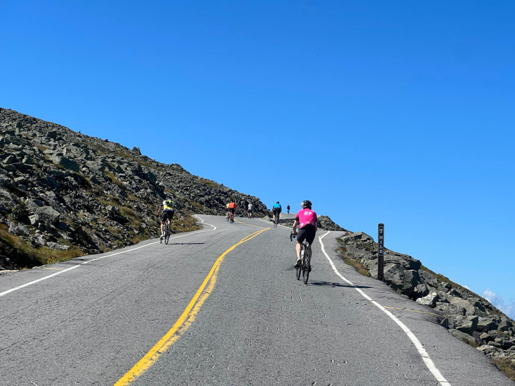
It was a warm day and I quickly was sweating profusely. I settled into my rhythm if such a thing existed. Perhaps if the road maintained a 12% grade a rhythm could be found. But it is more of an undulating climb usually between 10-15%.

Climbing on the lower section of MWARBH – Steeper (much) than it looks.

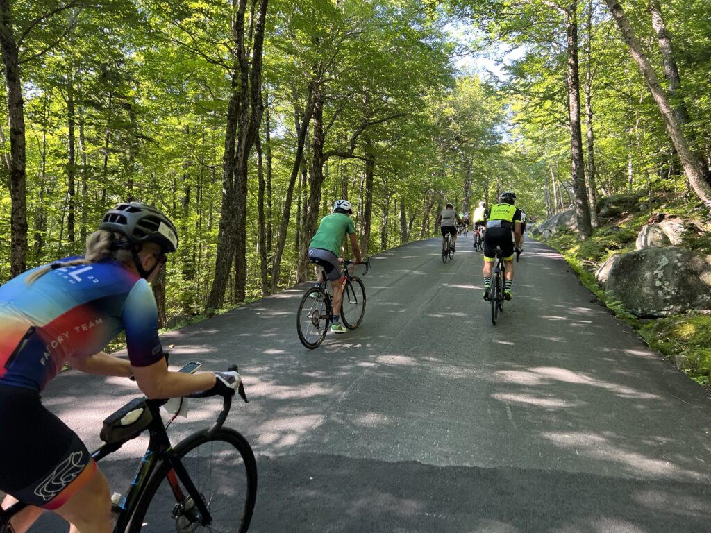
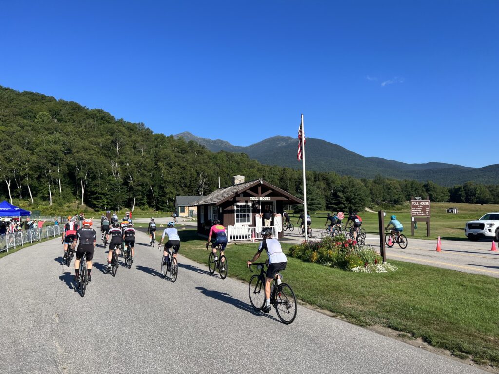
Quickly, those who were going to go faster went ahead on the flat section by the toll house which lasts about 250 meters. I was ahead of a few. Having started last and passed some riders, once we started climbing there weren’t going to be many to come past me.

Warm up at the Glen House

I started catching some from our wave as I went farther up the road. One guy had pulled over and was throwing up. I thought about him around Mile Six because a medical “Gator” when by headed to the summit with a bike on the back, and presumably, a rider inside. If you can’t continue and you’ve climbed even a mile or two, they will probably take you up to meet your ride because they won’t let you ride down.

There were a number of riders paperboying on the climb which was unsafe and annoying. One rider swung wide then turned back towards me and almost t-boned me. That would not have been cool.

Even with sweaty hands, I was able to take a few pictures. Very few.

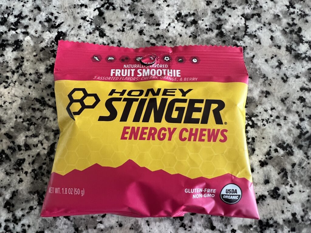
I took two bottles of electrolytes. One pack of energy chews. And one bottle of the Hot Shot (to prevent cramping). I went through them all by Mile 4. It was warm if not hot and by Mile 3 a cooler breeze was moving in through the tree line. I actually welcomed a headwind if it was cool.

My live segments on Strava showed I was on pace for 1:58. That’s 12 minutes off what I was doing 12 years ago so I guess I was losing a minute per year. I had hoped to break two hours and certainly beat last year’s time of 2:05. I maintained that pace for the entire climb and would come in about 1:58.

Around Mile 6.5, I shifted and was quickly pedaling nothing. The chain had dropped and without forward momentum, you go backward. Quickly. I started to fall over and was able to quickly grab the brakes. Somehow I was able to unclip and put a foot down preventing me from falling hard on the granite.

The pros and Top Notch riders lined up at the start at MWARBH

I took my bike and stepped off the road onto some rocks and sandy soil. This part is way above the tree line. The chain was off the rear derailleur between the cassette and the spokes. I tried manually putting it in place and turned the cranks by hand. It came off again. I lost two minutes getting it back in place. To get restarted on the 15% grade I walked my bike to the other side and then clipped in by rolling it across the road before turning up the mountain. I glanced at my Wahoo and saw my new ETA was around 2:01. Well, I wouldn’t beat two hours but still would be better than last year.

Two minutes and eight seconds lost to a dropped chain. Plus momentum.

That wasn’t the only mechanical I had today. Early in the ride, I noticed my right cleat was loose. I wondered what would happen if the whole shoe fell apart. Of course, that wouldn’t happen but the cleat could fall off and the ride would be over. It held together enough but clearly, I was losing some power because of it.

Mile 7 – Yes, I took this while climbing

Back on course my quadriceps really hurt. They weren’t yet to the point of a twinge where I knew that cramping was coming. But they were hurting. I needed to alter my pace towards the finish but was afraid to shift. I found my gear and was afraid to shift from it.

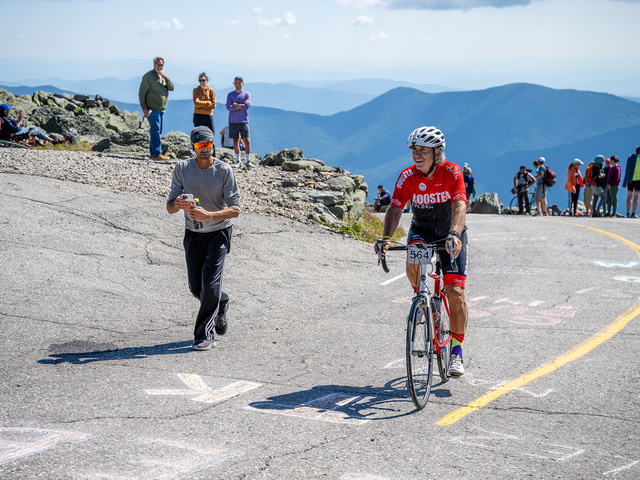
I came to the finishing straight and Bruce was on the left side. My first thought was he must have been here a while as he went off in the first group. He ran with me and pointed out the chickens (my family). I waved to them as I went by.

Chickens on the course

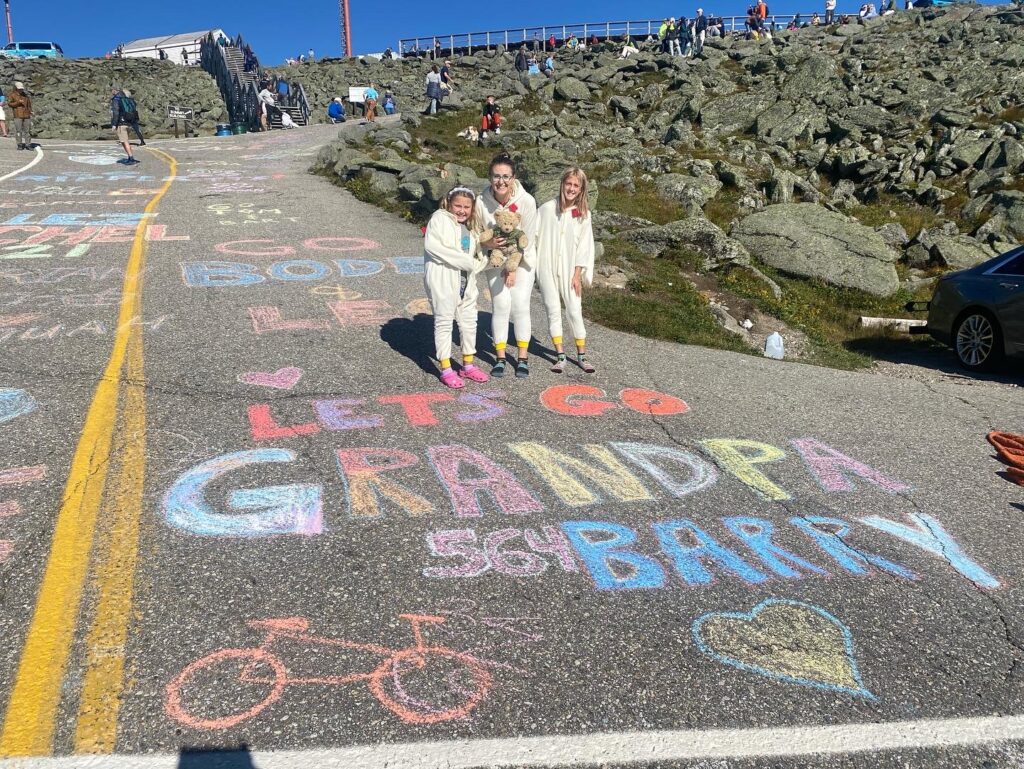
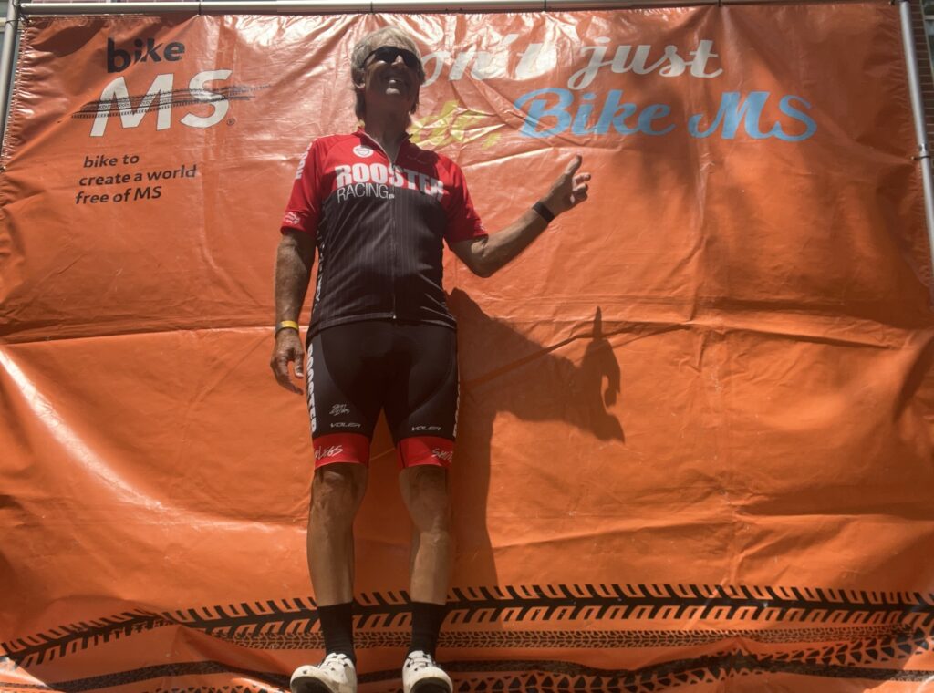
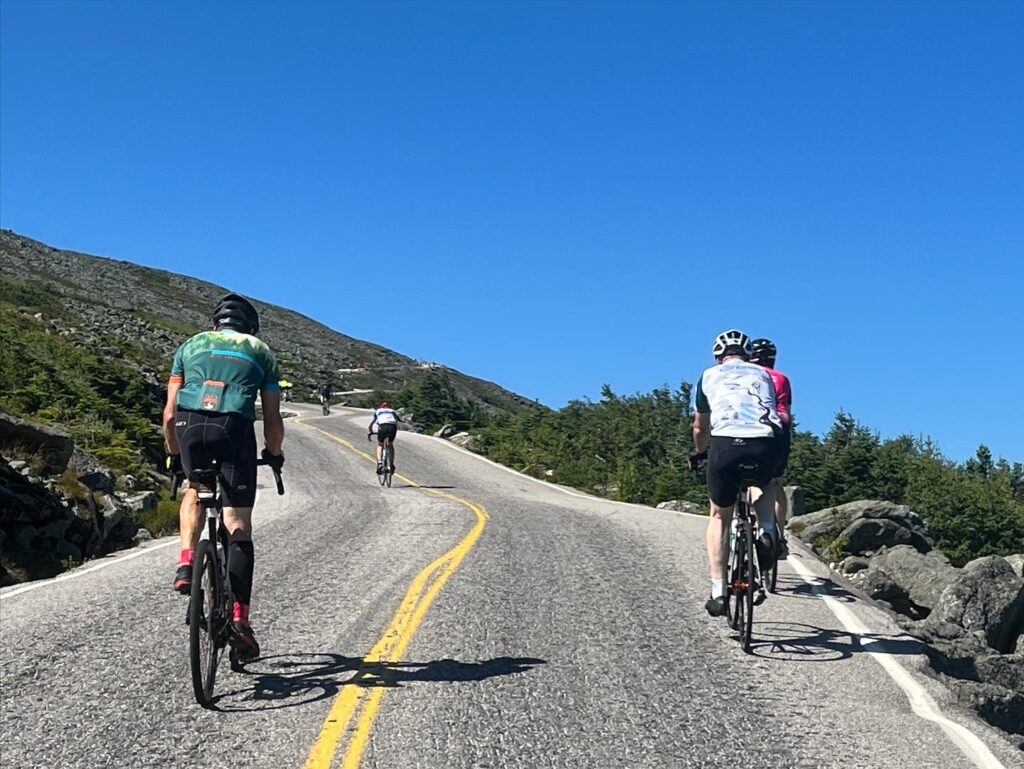
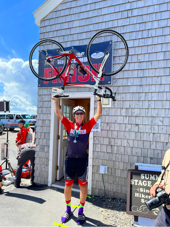
The finishing climb is a beast. Twenty-two percent. Unlike 2008 when I knew I’d fall over (but didn’t) I just said the pain is temporary. I heard my name called along with “Woodbridge, Virginia and Rooster Racing.” I was home. I made it.

Made it

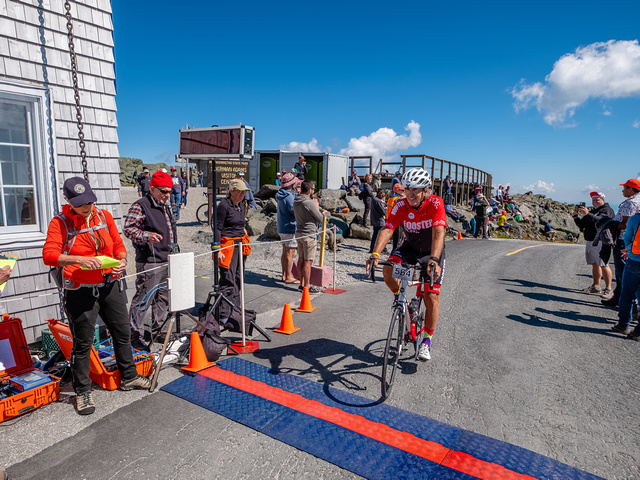
Across the finish line, two volunteers asked if I needed help. I didn’t. A young girl handed me a medal. Before COVID they would put the medal over your head. Today it was an outstretched arm. Another volunteer gave me a blanket. At 62° it was too warm to need a blanket. I handed it to Bryan.

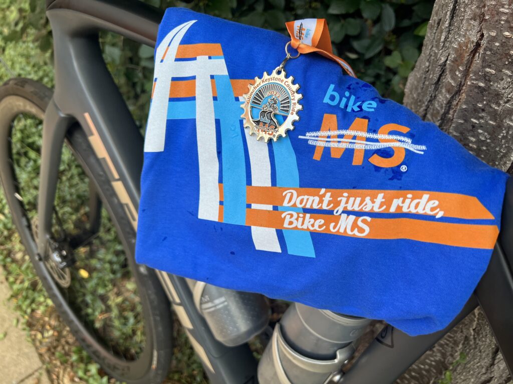
This was a big relief to me. There are different people running the event in the past as the rider guide, which used to be a church bulletin, said there would be medals for the top three age group finishers. I’m not much into participation medals except for this event. Everyone who finishes deserves a medal. I didn’t know if I would get a medal or blanket. I am so glad I got both.

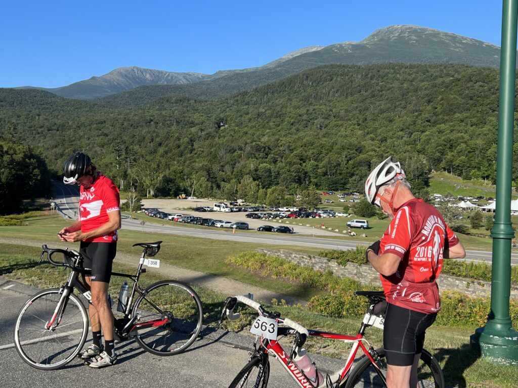
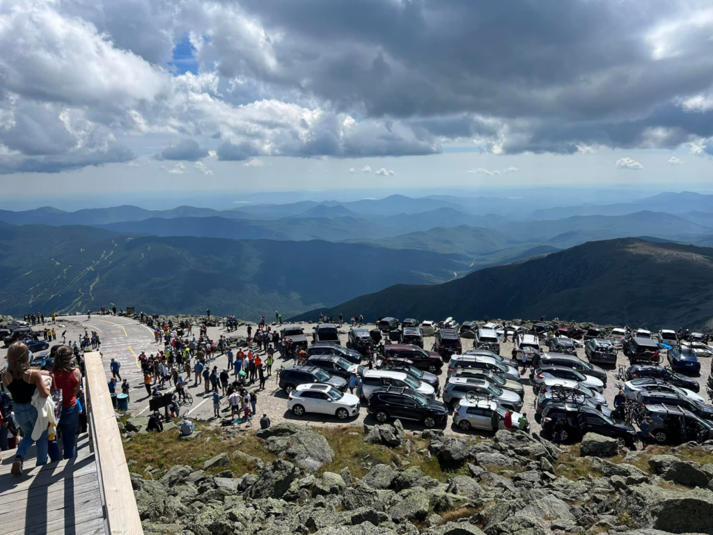
I spotted the Mount Washington Summit sign at the true summit. I wanted a family photo. There’s no real trail there – just big rocks. And I needed help on some of the rocks because my quads had no power left in them. The line for a summit photo was probably 45 minutes. And when we were finished with our photos they were just starting to open the auto road to go back down.

Bruce joined us for the ride down. As an aside he said he used to be a golf pro. And he and Bryan instantly connected. And started making plans for next year.

Three of the parking lots at the summit

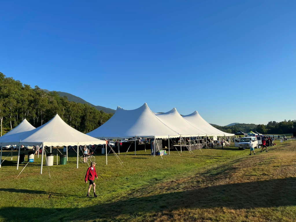
At the base lot at the Auto Road, we parked and went to check out the activities. I changed out of the completely soaked kit in the porta-john then went to pick up my Hart’s Turkey Farm dinner. A staple of this event for years has been the community Hart’s Turkey Dinner. Held in the big tent, it featured a couple of slices of turkey, mashed potatoes, salad, rolls, and dessert. I bought extra meal tickets for my crew in the past as we all enjoyed it.

In 2020 the event was canceled. Last year it came back but without the turkey dinner. This year it was back in a limited form. I thought the dinner was to go but the tent was set up with lots of seating and people were eating in the tent. A group was playing on stage and the podiums were set up to award places to the fast people.

I picked up my lunch. It had a small turkey sandwich that did not have much turkey on it. The bun was a standard hamburger roll. There looked to be a side of salsa (I did not try it). There was an apple and a brownie. The drinks were from a refrigerator and were Pepsi products. I had a beer ticket that I gave to Bryan to sample.

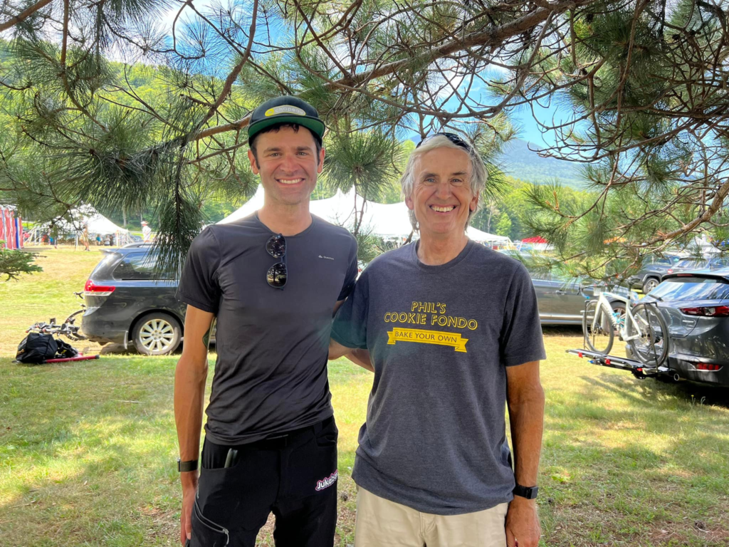
I found Phil Gaimon and he introduced me to Jeremy Powers. Jeremy is “Mr. Whoop” and immediately fixed my Whoop band as I was wearing it wrong. Phil did a quick interview with me.

Phil and I met in 2009. His memory of that day and my memory of that day differ greatly although he is probably correct. I had gone to the mountain with the permission of Dr. Hrant Semerjian to delay my cancer treatment. Phil remembers me telling him that I didn’t think I would be back in 2010 because, you know, cancer.

Phil and Barry

Did I say that? Maybe. Cancer makes you think about your immortality and it makes you feel like you’re dying. I was in a dark place when I was diagnosed and I don’t remember what I told people. But I may have said that.

I said goodbye to Phil and Jeremy and we headed out toward our destination of New London, Connecticut. My ninth MWARBH was now behind me.

Phil and Jeremy chilling the legs in the Peabody River


There was a race and what a race. Phil Gaimon took a Strava KOM but not a course record because Strava did not exist in the doping era. He won by seven seconds over Erik Levinsohn. That may have been the closest finish ever.

Bruce McDonald and Barry looking for the chickens

Courtney Nelson won the women’s division.

My data show that I lost two minutes and eight seconds due to the dropped chain. Realistically, it was closer to four minutes. The 2:08 was downtime but I had to get going on a very steep incline. And I had lost the momentum I had.

After the race

I was elated that I made my ninth climb but disappointed I didn’t do better. When I finally looked at the results I see I still had better times than 80 riders. The dropped chain cost me as many as 13 places. The loose cleat probably cost that and more due to the loss of power.

Looks like I finished 303 out of 383 finishers. Since we started in waves and I was in the last (6th) wave, it never felt like I was ahead of 80 riders.

At the top, we met a unicyclist. From the 703 no less (Falls Church). I have been beaten by them before. But with no people running the race they did not put the unicyclist in the last wave but was in his age group. So I never saw him before or during the race. Only our timing shows that my time was better. Not bragging. It was just interesting to note.

I was disappointed that there were no event posters for the riders this year. I have a poster from every rave I’ve done. Until this year. I was told they will have them next year.

Hi Chickens!!! MWARBH

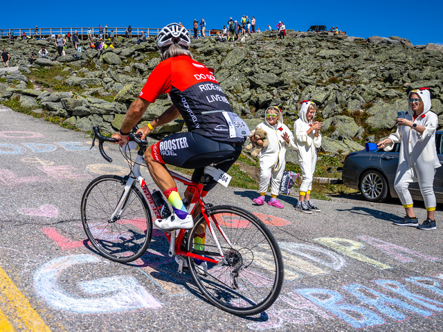
The event photographer, Joe Viger, does a great job. They had some killer shots of me taken last year from the top of the last climb looking down the 22% ramp. This year they captured me with my chickens, so that was cool – but I am smiling instead of popping all my veins.

DISTANCE: 7.9 miles
WEIGHT: 173 pounds (est.)

Saint Michaels – Part 2

SAINT MICHAELS, MARYLAND

I liked the ride from Easton to Saint Marys to Tilghman Island so much that I wanted to go back and do it again. But I picked a bad day. The temperature was 91° (32.8℃) and the humidity seemed to match.

Bike path around Saint Michaels

I left the house an hour earlier than last time and would be riding an hour earlier. I also modified my route to not go all the way to Tilghman’s Island but instead take another road to a tiny town named Neavitt. It is located at the southern terminus of Maryland Route 579 on the north bank of the Choptank River.

Neavitt, Maryland

Unlike Tilghman’s Island, which has a gas station and a general store, there appeared to be no commercial businesses here. Just some private dock slips at the end of the road. In addition, the road to Neavitt had no shoulders to ride on in contrast to the road to Tilghman’s Island. But traffic was extremely light so that was not a problem.

Neavitt, Maryland

The winds seemed stronger today than they were the last time I was here. The route was nearly identical. However, I was able to take a nature trail or bike trail out around the business center of Saint Michaels. It was pretty but even slower than sitting in traffic. I think.

Saint Michaels

On the way back I stopped just outside of Saint Michaels at Highs Dairy. This time I not only filled my water bottles but grabbed a Snickers. I love my energy chews but the chocolate candy bar was a welcome relief.

End of the path in Saint Michaels – it just ends without connecting to the road.

I turned onto the country road to the Oxford-Bellevue ferry. I now had a base time and hoped to better my time for a PR. But the winds were too strong or the heat and humidity were zapping me. Once I fell 15 seconds behind my pace I sat up and soft-pedaled to the ferry.

Oxford-Bellevue Ferry

On the ferry were two cars. The nice couple in one car brought over an ice-cold bottle of water and offered it to me. I did not hesitate even though my water bottles were basically still full. I would need all the fluid I could get on this day and the cold water was refreshing.

Oxford-Bellevue Ferry

I chose this day because my next available day, tomorrow, was a Wendesday. And the Scottish Highlands Creamery was closed on Wednesday as I learned my lesson the hard way. So I chose to ride in this heat and humidity for – ice cream.

Couple who gave me water

It was bascially two blocks from where the ferry docked in Oxford to get ice cream. And suddenly all the riding in the heat and humidity were worth it.

Scottish Highlands Creamery

The last 10 miles seemed to be downhill so maybe I was picking up some tailwind. I did go through one mile on a one-lane milled road under construction. But the ice cream seemed to fuel me just enough for the run-in back to start.

Oxford-Bellevue Ferry

Today was a 50-mile ride instead of a 60-mile ride like last time. But it still left me pretty drained. But I love the ride and I really love the ferry. And ice cream. Must do this again.


DISTANCE: 50.7 miles
SPEED: 16.7 mph
WEIGHT: 172 pounds

Cumberland Valley

CHAMBERSBURG, PENNSYLVANIA

Ultimately, this ride will simply be another day on the bike, another loop ride. It was done on flat to rolling roads in the heat. But it was the approach to the ride that has left me wondering.

It was in 2008 that the Tour of Pennsylvania came through this area. Officially, the name of the race was The American Eagle Outfitters’ Tour of Pennsylvania presented by Highmark Healthy High 5.

My drive here was on U.S. Rte 30 from Breezewood to Chambersburg and was it ever pretty. And mountainous. Descending off Tuscarora Summit there are two runaway truck ramps and not just one. I was thinking of the bike race of 14 years ago and can’t locate a race map for that stage from Camp Hill to Bedford.

Parkwood Drive leaving the plaza in Chambersburg

The description for Stage 3 included Tuscarora Summit and Sideling Hill which are on U.S. Rte 30. What I can’t fathom is that the route stayed on Rte 30 through Breezewood. I can very carefully ride through Breezewood on my bike but for a race, you’re talking about shutting down the entire road. And not just any road. This is the intersection of Interstate-70. They would not shut down an Interstate Highway for a bike race. They must have turned off near the top of Sideling Hill and were able to divert around Breezewood.

But that is a beautiful road and very mountainous. The average speed of the winner, James Driscoll, was 39.62 kph, which was faster than David Velleux, the winner the following day into Latrobe (39.03). It’s hard to imagine that Stage 4 was slower than Stage 3 but it was.

Surrounded by orchards

While driving across these roads and not imagining that I would or could ride a bike here, I have ridden the mountains from Bedford to Ligonier on multiple occasions which were featured on Stage 4. Maybe someday I’ll ride Tuscarora Summit

Hope Bug

But today I drove over these mountains to Chambersburg. I had found a route on RideWithGPS created by Franklin County Cyclists. It looks like it was a club ride and I would make one modification – two if I count the one I made at the finish.

Grand Point Road, Chambersburg

The ride started in a church parking lot. On a weekday, I’m unsure if I wanted to park in an empty lot without permission. But on a Sunday, I really didn’t want to park in their lot while they were having church. I modified the start to be a shopping plaza next to the Giant (grocery). The high wall on the side of the building provided a perfect shade spot that a tree could not.

Jeff Fisher Insurance Agency

I started just one mile from the “official” start of the ride. The plaza was next to a Sheetz which was perfect for the pre-ride restroom. I did not make any modifications to the route so when I selected it on my Wahoo I simply had to select “Route to Start.”

Funk Road, Chambersburg

Country. This was a 100%, well, 99% country ride. I was immediately in the country with the smells of cattle and corn. The roads were all lightly traveled and the traffic was 100% respectful.

Funk Road, Chambersburg

There were no real climbs but plenty of ups and downs. But there was wind. A headwind would define most of the first half of the ride as it was a westerly wind.

Funk Road

There were no defining features such as a great bridge or tunnel. No summits with miles of views out over the valley below. I was in the valley. But there were nice valley views looking at the ridge of the mountain I had just driven over.

There was a nice park about four miles from the finish. Norlo Park in Guilford Twp. has three cabooses and what looks to be a minature railroad. I’m a sucker for things like this so I liked the placement of this park near the end.

Barn on Horst Road, Guilford, Pa.

I would characterize this as a valley ride. After all, I was in the Cumberland Valley. It wasn’t flat although there were flat stretches. But the constant rollers would start to wear on me although that was probably more the heat (90℉) and lack of nutrition. I went through two bottles I had on my bike, one filled with Skratch mix, and the other with water. I had one pack of Stinger Energy Chews. And that was it.

Stump Lane, Guilford, Pa.

I thought around Mile 30 that I would stop at the next store and grab more water and a snack. But there was none. If I were to ride here again I would reverse the route. First, a reverse ride is a new ride. But more importantly, there was only the one store I saw on route. It was a Rutters gas/convenience store crossing US 30.

Letterkenny Army Depot, Chambersburg

On today’s ride that came around Mile 18. Barely one hour into the ride it was too soon to stop. Or at least I thought. Is it ever too soon for a snack? And that was the only place I saw to stop. On the reverse course, that would be at Mile 28 and would be perfect.

My only nutrition for my ride. I suck at this.

I wasn’t 100% of the modification I might need to get back to my car. I could follow the route and then go back the mile to where I parked. As it turned out, the route as designed would have taken me to the plaza where I parked before going the last mile to the church parking lot.

Norlo Park, Guilford Twp.

With four miles to go, it started to rain slightly which was very welcome. But it wouldn’t stay with me. But fearful I could get soaked, and that would not be welcomed, I ended the prearranged route and selected “Route to Start” on my Wahoo. Unbeknownst to me, it would have been the same exact route except when I reached the plaza where I was parked I was finished instead of going the final mile to the church. But I felt more comfortable knowing I was routed to my car even if it was the same way.

Nice country ride. Maybe in my travels through or near here I will ride it again. In reverse.


DISTANCE: 45.7 miles
SPEED: 14.7 mph
TEMPERATURE: 90℉
WEIGHT: 173

Saint Michaels

SAINT MICHAELS, MARYLAND

I’m not sure why I picked this. I think I was looking at cycling on Kent Island and my eyes looked at the map and saw St. Michaels. I’ve certainly heard of it but never been there.

Idlewild Park, Easton, Md.

I saw Tilghman’s Island and thought I’d do a ride from St. Michaels to Tilghman’s. But that wasn’t far enough. A quick search for cycling St. Michaels and I found the Bellevue Ferry. I haven’t had a bike ride with a ferry since White’s Ferry on the Potomac closed. Using RidewithGPS I had my route. It was a 60-mile route from departing from Idlewild Park in Easton.

On the way to St. Michaels

I was watching the weather for the week and planned to ride tomorrow (Thursday). But when I woke up this morning I looked at the next 36 hours and today presented a better chance of not getting caught in thunderstorms. I left home at 7:35 am.

What does this sign mean? It is next to the bike lane (a wide shoulder).
Bikes can use the road? Maryland, you are confusing.
Or maybe it’s a warning that the road narrows on the bridge ahead.

The park is small but with adequate parking and restrooms. For almost all of the 60 miles, I could ride a dedicated shoulder away from the traffic lane. There were just a couple of pinch points before St. Michaels. In the town, I needed to take the lane. It’s a very charming town.

St. Michaels, Maryland

The 11 miles to from St. Michaels to Tilghman Island were on a dedicated shoulder lane until I came to the bridge in town. My GPS was showing “distance to next cue” and I was counting down miles to my turnaround point. So when I hit the bridge I was shocked to see 4.4 miles to the next cue.

Tilghman’s Island

I thought about turning around then but didn’t want to cut my ride short. The road south of Tilghman was a two-lane road with no shoulders. But there was no traffic either. I soon realized the next cue was back at the bridge. It was 2.2 miles to the end or turnaround. Actually, it wasn’t the very end of the island but appeared to be fenced off at that point.

South of Tilghman’s Island

What appeared to be the end of the road opened into what was a parking lot for fishermen.

Sharps Island Light – Tilghman’s Island

I saw very little water on this ride which was disappointing only because in studying the map it looked like I would have water views for 60 miles. But while never very far away from the bay there was always woods or a cornfield. Lots of cornfields.

Tilghman’s Island, Md.

I turned it around and headed back towards the bridge in Tilghman’s Island before going back to St. Michaels. My decision was whether or not to stop for more water. I brought two bottles with me but still had most of one left. I passed a small country store and then saw a gas station store right by the bridge. I decided I was good until at least Saint Michaels.

Tilghman’s Island, Md.

It was a bit breezy if not windy. I thought I was fighting a headwind on my ride out but when I turned around I still had the wind hitting me. It was probably a cross-tail going out and a cross-head going back.

On the way from Easton to St. Michaels

Once I got back to St. Michaels I thought about stopping for that extra water. The town is very charming but I had to go through it before I found a quick place to stop. It was a car wash/gas station. I got a bottle of water which filled 1.5 bottles. I didn’t think of it at the time but should have grabbed a Snickers bar too.

St. Michaels, Md.

It was about two miles out of town before coming to the turn to the ferry. There was a sign and it was open.

It was about 4.5 miles on a two-lane road to the ferry.

Ferry Road

I had no expectations about the ferry other than it would cost $4. It actually cost $6.

Oxford-Bellevue Ferry

I arrived just as the ferry was ready to leave. There were two cars loaded and I rode my bike right up.

Ferry entrance

I rolled on taking notice of not to lean my bike against the bulkhead. What’s up with that?

Don’t lean your bike

There were two cars and two families on the boat. The ride probably took 12-15 minutes. Maybe less

I had read about this great creamery. For 50 miles I waited for that ice cream cone. I even told a couple on the ferry about it. When we docked I took off for the creamery forgetting to “resume” my GPS which I had paused to cross the river.

Scottish Highland Creamery

I studied the menu. Two scoops and you could mix them. I settled on Mint Chocolate Chip and then turned the doorknob to enter. It was locked.

Closed Wednesdays

Who closes an ice cream store on Wednesdays? This was so wrong.

Peachblossom Creek

No ice cream would make the nine-mile ride back to Easton a bit harder.


DISTANCE: 60 miles (50.5 via GPS; 0.5 not captured)
SPEED: 17.5 mph (fastest ride of the year)
WEIGHT: 174 pounds

Searching for Aurora Teagarden

MONTOUR FALLS, NEW YORK

The weather forecast for tomorrow for this region is for rain. I would have stayed in State College for the second day of the MS ride but this ride became a bucket list ride. I did not want to let a wet forecast ruin it. I moved my schedule ahead by a day and came here to ride.

Church in Montour Falls

I have never been on US 15 north of Williamsport, Pa. The drive was stunning. Heavily forested mountains. A beautiful lake near Tioga. It would be hard to find prettier scenery on my ride than I did on my drive.

Magnus Ridge Winery above Seneca Lake

I found a ride someone had done in RidewithGPS and downloaded that to my Wahoo head unit on my bike. I would follow his ride. I had a problem envisioning where to park and found an elementary school that I assumed would have plenty of parking. It did.

Montour Falls, NY

I chose Montour Falls because I had read that this was the town where the opening scenes of the Hallmark Channel’s mystery series, Aurora Teagarden, were shot. The actual shooting was in British Columbia but the opening scene or main street was here. It features a quaint downtown with a massive waterfall at the end of town.

Montour Falls, NY

I had visions of finding the town and the waterfall. I had no visions of finding Candace Cameron-Bure, the actress who plays Aurora Teagarden.

The falls at Montour Falls

I only went a couple of blocks and there I was. Standing in front of a rock formation on a hillside. This was no waterfall. In fact, there was no water. Actually, once I looked close I could see a trickle. But it was as though someone turned off the falls. This was very disappointing. The only thing that would have been more disappointing was if I had saved this for the end of my ride and for 48 miles I was looking forward to seeing it. At least this way I got the disappointment out of the way quickly.

A trickle falls at Montour Falls, NY

And now for the ride. Quaint downtown. I left Montour Falls via NY 14 which has a wide shoulder to ride safely. It’s about a three-mile flat ride to and through Watkins Glen. This is the tourist area of the region whereas Montour Falls has very little. At the end of the main drag, I came to the south end of Seneca Lake. The ride description was 20 miles of easy climbing followed by 20 miles downhill.

Dino in Watkins Glen. My brother, Brad, always liked Sinclair.

Actually, it was 1.5 miles of 3-4% grade leaving Watkins Glen to a plateau along the lake for five miles. Then it was turn to the west and gentle climbing for the next eight miles. The roads were mostly back roads with little to no traffic but there were “heavy” roads – tar and chip variety which makes pedaling harder.

Seneca Lake in Watkins Glen, NY

Once the road started downhill so did the headwinds. I knew it would be that way because I enjoyed a nice tailwind leaving Watkins Glen. I was paying for it now. The traffic was mostly respectful but on one road it seemed every vehicle was a truck pulling a wide trailer with a race car on it. On a Sunday morning. Near Watkins Glen. Who knew?

Going under Catharine Trail on NY-14. The trail is a crushed limestone rail trail.

The return back was on NY-14 again. And except for a couple of places getting squeezed, there was a should to ride safely. I changed my return to me directly to the car instead of the end of the route which would take me to the non-existent falls. I would have been so disappointed. But it was OK. It was a beautiful ride. Maybe next time there will be water in those falls.

Out in the country

The End of Glimcher

STATE COLLEGE, PENNSYLVANIA

The best rides aren’t so much where you’re at but who you’re with. And since 95% of my riding is solo I can classify the best solo rides are:

  • Point to point
  • Loop
  • Out and back
Start of the MS Ride in State College

I’ve been riding the Keystone MS-150 Ride, more recently called the Glimcher Ride, since 2016 when it was basically two point-to-point days. The first day was Hollidaysburg to State College while the second day was State College to Hollidaysburg. The roads from Spruce Creek in and out of State College were the same but two completely different routes in and out of Hollidaysburg to and from Spruce Creek.

Famous Cookie Stop – Rest Stop 1 and 5

But this year it was in State College and it was a loop route each day. It’s not fun and too far for this traveler. I was willing to travel to Altoona from Virginia but this was too much. I had signed up for the event before I realized it was no longer starting in Hollidaysburg.

The famous tractor just outside of State College

Lodging and the headquarters were at the Penn Stater. I registered after the special MS rate expired (rate good until …) and was priced out of staying in State College. I chose to stay with my mother in Somerset the night before which is 1:45 away.

Rest stop 1. Corn.

The alarm went off at 4:40 a.m. No snooze. I was gone by 4:50 and stopped at Sheetz for ice for my cooler and a breakfast sandwich. I arrived at the Penn Stater at 6:45 a.m. for the start of the ride.

Camp Kanesatake

I dressed in the car and got my bike ready to roll before I went to registration. At 6:55 a.m. I was putting on my “race” number. I went to the back of riders waiting at the start thankful they didn’t roll out at 7:00 a.m. At 7:08 we all rolled. I was on time.

Amish house near Arch Springs. Notice the horses.

There were five rest stops and this captured my ride to each. On the rollout, we came to a red light with cars waiting to enter the intersection. I stopped. Two riders from Blair Bicycle Club blew threw it. It was a bad look and unsafe. I yelled, “it’s a ride, not a race.“

Beaver Stadium. Passed this out and back on the ride.

Once I got the green light I quickly caught them and a number of others. I’m sure the front group was long gone but I picked my way through a number of riders before finding four riders wearing Quality of Life jerseys from Mechanicsburg, Pa. I didn’t join them but followed at 20-30 yards behind. 

Arch Springs

I wasn’t long at rest #1 which was the church with the famous cookie stop. Still cookies. I took one Snickerdoodle. I left rest #1 and found myself in cyclists’ “no man’s land.” I could see no one in front or no one behind me. I actually liked that. A lot.

John Deere.

I passed a John Deere tractor and regretted not stopping for a photo. After a descent and the turn to Camp Kanesatake, I turned around and went back up the hill. I got my photo and saw some riders pass. I didn’t try to join them but still passed 2-3 before the stop at Camp Kanestake. 

St. John Evangelical Church

This church camp had been the Saturday lunch from Hollidaysburg to State College coming at Mile 50. And the ice cream and Dairy Princess stop on Sunday. But today it was just a snack stop. I didn’t stay long. 

The guys in green

Again in no man’s land, I was gaining on a rider in Spruce Creek. And then a funny thing happened. At the end of Spruce Creek, he went straight which was the route we always took on Day 2 back to Hollidaysburg.  But I had downloaded the route from the MS-150 website and it had me turning left, under the railroad tracks then climbing the two-mile hill. I was alone. Again. 

I suspect they made a late change to the official route. This was one intersection that needed a volunteer to show people like me the correct way. But it’s OK. I enjoyed my solo ride. It added 2.5 miles to the ride.

Rest stop 3 was a lunch stop at St. John’s Evangelical Church. I overheard a couple of riders describing when and where they “burned matches.”  Oh please. They’re not pros doing a non-stop 3-week effort. But they can dream, I guess.

Lunch

Leaving rest #3 I caught the four green riders. I didn’t join them but simply followed at a distance and paced behind them. And then a group caught and passed us. This group could have been Team Fat Belly including a couple on touring bikes with bar end shifters. But they were moving as they passed out. We formed a large group for about one mile then came to a hill. And that was the end of Team Fat Belly. I was nose breathing but passed all on a climb. Three of the four from Team Green went ahead and I simply followed at 50 yards. 

Green guys

Rest 4 seemed to be for the 50 and 75 routes. Rest stops 2 and 3 were just on course for the 75-mile riders. I stopped, briefly. And it would be a solo ride home from there. 

Rest stop

I caught a rider before Rest 5 which was also the cookie stop for Rest 1. After a quick water bottle refill and then it was solo back to start. A moto caught me to tell me there was one hill left (which I knew). But he was a nice guy giving encouragement, I guess. I passed a young guy walking his bike up the last hill and passed 5-6 others as well.

Finish line at State College

I finished then took off my jersey to go under the empty finishing arch again, this time holding the bib that “I rode for my daughter.” I took off the bib and discovered I spelled “daughter” wrong. That’s what happens at 6:50 am. 

At the finish, there was no food or meal. They told us there were snacks next door which were veggies and Fritos. There was no banquet this year. It was so good in 2019 when Diane Kramer and two other women spoke. Back in 2019, I had asked at our table of ten what each person’s connection to MS was. No one had one other that this was a nice ride. That dinner brought home the message. Today there was nothing. On the ride, not a single person asked me about riding for my daughter. It didn’t seem to be an MS ride. It was just another ride.

Swag

So in the end, I asked for the swag. Although it was to be handed out tomorrow (t-shirt and plastic “medal,” I told the nice volunteer that I was only riding today. I did not tell her it would be my last day for this ride but it was. For me, it’s too far. Too expensive. Boring loop routes (been there done that). Registration seemed way down (124) and I’m guessing many Pittsburgh riders that came to Altoona found State College too far. 

I could have asked someone to take this

Next up will be an MS ride, just not this one. Maybe Florida. Maybe Virginia or Maryland. Or maybe even the Escape to the Lake. I support the fight against MS but I’m not leaving this event. It left me. 


DISTANCE: 78.8 miles
SPEED: 16.5 mph
WEIGHT: 175 lbs


While it was an MS Ride, something HUGE happened on the ride. I went over 90,000 miles ridden cancer-free. Since 2010. Thankful for every day of LIFE!

Sachs Bridge

THURMONT, MARYLAND

I had seen the Sachs Bridge a couple of years ago on a social media post and decided I should ride that bridge someday. That someday came today.

It was only a few weeks ago that Michele posted a three-covered bridge ride in Frederick Co., Maryland. I couldn’t make the original date but rode it the day before on my own. It was beautiful except for the four miles of getting in and out of Frederick which was a bit sketchy with traffic. But the roads and scenery are great.

Downtown Thurmont

The original ride was postponed due to weather and the next week I jumped in with the original group. Six of us rode the three-bridge route. I was the only one that had ridden it before and they seemed to appreciate someone with knowledge of the route being along for the ride.

Loys Station Covered Bridge

My own bit of adventure involves finding a route someone else has ridden, downloading it to my Wahoo bike computer, and following the roads. Even more adventuresome is simply mapping out a route and taking my chances.

The big problem in this adventure-seeking is one does not know the surface/condition of the roads or the traffic. We try to alleviate this by avoiding major roads and then we cross our fingers and hope the route is good.

Bridge at Simmons Road over Toms Creek

I was coming home from an Ohio trip and made a diversion to Thurmont which is only 12 miles north of Frederick. I parked at the Thurmont Community Park which has restrooms. I was ready to roll out by 8:00 a.m. on a day in which temperatures were to reach the high 90s.

I headed out of town on what are now familiar roads. At 3.5 miles out of town, I had mapped out a left turn on what I learned was a dirt farm road. I kept going past it. No problem. I took the roads I knew to Creagerstown and to the first bridge of my new three-bridge ride, Loys Station Bridge.

Bridge at Simmons Road over Toms Creek

Having been here twice in the last month there was no need to stop for a photo op other than to grab a quick photo. Then it was headed north on new roads.

Toms Creek Church Road

The roads are so nice here. The pavement is mostly excellent and these roads have so little traffic. A guy on a Trek Emonda caught me and we rode together for about two miles. He was headed to the Catoctin Mountains and then back to Frederick. I was headed north. When I told him I was from Virginia and stopped just for a ride he said “I like that. I really like that.”

Passing the Amish in no. Frederick Co.

At Simmons Road (MP 15) where it crosses Toms Creek, he said “I bet you turn right up here.” I said, “yep.” I turned and that was the last I saw of him.

Motters Station Road

All the roads were great. At MP 21 I crossed into Pennsylvania with no signs. I mean, there wasn’t a “Welcome to Pennsylvania” sign. I saw the pavement had changed and I noticed the first parked cars at a farm with Pennsylvania plates.

Civil War Hospital, Gettysburg

At MP 26 I crossed US Rte 15 via an overpass. The next mile carried slightly heavier traffic into Gettysburg (three miles farther) but I turned off after one mile. I went through part of the hallowed ground that makes up Gettysburg National Military Park.

Gettysburg National Military Park

I was on Millerstown Road. This was a road I had ridden from the opposite direction five times in the Civil War Century. Instead of following the road as it became Pumping Station Road, I turned onto Red Rocks Road followed by Water Works Road.

Gettysburg National Military Park

Water Works Road has an old bridge with bollards to keep vehicle traffic off it. I could and did cross on my bike. That took me to the Sachs Covered Bridge. And what a bridge it was.

Waterworks Road

Built in 1852, it is one of the longest bridges in Pennsylvania. It is in great condition (rebuilt after a flood) but only open to foot and bicycle traffic.

Waterworks Road

At MP 30 I was 60% done with my ride but also felt that it was pretty much over. The highest point was yet to come but this was rolling terrain and not mountainous. But each little rise would take its toll in the heat.

Sachs Bridge

The transition back to Maryland was the same as entering Pennsylvania. Pavement change. Different license plates. And that was it.

Emmitsburg, Maryland

I approached Emmitsburg and for a moment it looked like a scene out of France. A winding road next to a field. Off in the distance, the churches of Emmitsburg formed the skyline. I needed a French croissant.

Emmitsburg, Maryland

Actually, with only 11 miles to go, I needed water. I rolled through downtown looking for a convenience store but didn’t pass any although they have them. I didn’t worry about it because I knew that Roddy Road Bridge had a park.

Roddy Road Covered Bridge

When I got to the park I discovered they had no water. Just a picnic shelter and a port-a-john. Or outhouse. Whatever. It was just 2.5 miles to the car from there. Suck it up.

I got back to the car where I had a cooler packed from my trip. In it was ice-cold water and ice-cold Coke Zero. I was refreshed.


EPILOGUE – I did not research the history of Sachs Bridge before I rode. It is routinely listed as the most or one of the most haunted sites in Gettysburg or among bridges. Three Confederate soldiers were hanged here and are said to frequent the bridge and visitors. Users can do their own search.


The Ride of Silence

WOODBRIDGE, VIRGINIA

It was one week ago that I thought about the upcoming International Ride of Silence. I have attended a couple in Rockville, Maryland, and was at one in Dayton, Ohio. But I thought we should have something in Virginia.

I checked the website and only saw a ride at Radford. Nothing in northern Va. Nothing in Richmond or Roanoke. Nothing in Virginia Beach. Wow.

I decided to organize one. With little publicity we had six riders come out to our FIRST Ride of Silence. I wasn’t a novice at organizing rides. Nine years ago I had organized a “Tribute Ride.”

We met at C.D. Hylton High School. I chose this location because it is the site where Joseph James Callahan was killed in September 2013. He was riding on the bike trail in front of the school when a 17-year-old girl drove off the road, struck, and killed him. We rode for Joseph Callahan.

I also bought new flags for his makeshift memorial. The school has let it remain on the property for eight years and I’m afraid without maintenance they may remove it.

The program was simple. We wore black armbands in honor and memory of those who have lost their lives to drivers. We wore red if we have been struck by a vehicle. Half our riders wore red. Read that again.

I opened the “program” with remarks about the Ride of Silence. I spoke about Joseph Callahan and then about Jamie Roberts. We opened our circle to recognize anybody. Chelsea Johnson led us in The Ride of Silence poem.

Tonight we number many but ride as one
In honor of those not with us,

friends, mothers, fathers, sisters, sons
With helmets on tight and heads down low,

We ride in silence, cautious and slow
The wheels start spinning in the lead pack
But tonight we ride and no one attacks
The dark sunglasses cover our tears

Chelsea was with Jamie when she was killed in Kentucky in 2014. Chelsea spoke about how Jamie lived!

At 7:00 p.m. we rolled out. The route was simple – an 11-mile counterclockwise route of Spriggs Road (bike path), Hoadly Road (shoulder), Dumfries Road (bike path), Minnieville Road (bike path), and back to Spriggs Road.

After the event riders were invited to Armetta’s for a post-ride celebration and reflection. This will be the first and many rides to come.


The Trail or the Street?

It started on Twitter although it has been asked many times. Why do cyclists ride on the road or in the street when there’s a perfectly fine bike trail available? This time it was posed by Mark Kaboly, Senior Writer for The Athletic covering the Pittsburgh Steelers.

This could be an honest question wondering what decision-making goes into the process for a cyclist to choose the road. More likely it was a passive-aggressive shot at cyclists for daring to use the road. And it got the desired responses.

I know better than to engage in a “discussion” (argument) on Twitter but wanted to use the forum to answer the question myself. I don’t know the stretch of road in question but there are plenty of road/trail choices in Virginia I have to make every day.

I remember in 2012 when I rode more than 5,000 miles without a crash or fall over except for one. It was on the bike path on Rte 234 when a small dog on a leash crossed my path. I swerved right into the ditch to miss the dog and its owner. The overcrowding, slow traffic, and unpredictability of trail users add to the dangers one encounters.

Glass on the PW Pkwy Trail – May 19, 2022
I stopped and “swept” it clean using a downed tree branch with leaves
Thick sand and dirt at the Occoquan Creek on Va. Rte 234 (May 16, 2022)

Tractor-trailer stopped way beyond the line not only blocking the trail crossing but also the ped-head light itself
Crossing Va. Rte 234 at Minnieville Road (May 18, 2022)

Like today, on the trail on Va. Rte 123, I came to the shopping center. A car was coming out just as his light had turned red and the ped-head (for the trail) and the traffic light were green. I inched out watching him. His head was turned hard left to see if he could beat that traffic while making a right turn on red. I was in the intersection and he almost hit me without looking. These trail crossings are very dangerous.

Spriggs Road cutout to the trail
Here one cannot continue in a straight line and only have
a three-foot transition to aim for an 8′-wide path

And that was my response to Mark and just a couple of the responses. To continue reasons why cyclists may not take the trail:

7. Maintenance on the trails is almost non-existent. They build them once and then forget about them Many develop huge cracks, cracks enough to swallow a skinny tire or cause an inexperienced cyclist to crash. In addition, some trails, especially the Mount Vernon Trail south of Alexandria, are so rooted they are almost impossible to ride but that trail sure looks nice when you’re driving by on the George Washington Parkway.

Rte 234 Trail at Independent Hil. Crack. Crack. Crack. Crack (May 18, 2022)

Maybe the most egregious are the sewer pipes that extend above trail level. These can cause a serious accident yet the county merely paints them.

HAZARD! (Rte 234 bike path near the Kelly Leadership Center – May 18, 2022)
I have contacted the PW Co. Supervisor for Coles District about fixing this.

8. Cyclists may want to take the road because it’s faster than a trail. Bikes are transportation and a cyclist may need to get to an appointment on time – just like a driver.

9. A cyclist may be wanting or need the cardio benefits of riding hard and not easy. Worst are the trails on Hilton Head Island which weave around trees and are popular with our little cyclists. But for exercise value, these offer little compared to the street.

10. Strava. Yes, there is worldwide competition to be the fastest in a certain segment between two points. For many segments, the fastest route is on the road.

So there are 10 reasons a cyclist may choose to ride on the trail. Ultimately the decision is up to the cyclist, not a driver.

Near Little Orleans, Maryland on a backcountry road last week there was one car on the road. Behind me. The driver pulled beside me and yelled for me to go ride on the bike trail. What he didn’t know was the Western Maryland Rail Trail ends at the Indigo Tunnel but drivers see an unconnected segment at Little Orleans and assume it is one contiguous trail. It isn’t.

In my mind, I yelled at him to drive on the Interstate. And he told me he has the right to drive where he wants. Exactly. And we have the right to ride where we want (subject to restrictions such as super-highways). But that was in my mind only. We’re just not at the point that drivers understand that cyclists can choose where to ride. Sometimes it is on a trail and sometimes it is on the road even when the trail is available.

Sideling Hill the Hard Way

HANCOCK, MARYLAND

It was 1974 when I first drove National Highway (aka U.S. Rte 40) up and over Sideling Hill. It is a four-mile climb and my little car struggled to go up in 4th gear. Well, it never did. Sometimes third gear and always downshifting to second gear to take the horseshoe curve at the top.

On US 40. Sideling Hill cut for I-68 is in the background (Zoomed)

Interstate-68 was constructed and finished, at least parts, by 1991. It which followed some of old US 40. The most impressive feature on I-68 is the cut in the mountain so the highway could go through a gap instead of crossing all the way over the top.

Crossing the Western Maryland Rail Trail, Hancock, Maryland

There are only a handful of crossings over this ridge. One of those in Pennsylvania near Breezewwod is now the Abandoned Turnpike. The tunnel is one that I have ridden through probably a dozen or so times.

Old U.S. 40. The cut in Sideline Hill for I-68 is far off in the distance.

But today would be about the climb. I parked at the C&O Canal parking lot in Hancock. I began with a short climb and the first four miles of the profile looked like sharks’ teeth. At Mile 4 the climb began.

Old. U.S. 40 (now Scenic 40)

Although the speed limit was 55 (or was it 50?) mph the very few cars all gave me wide berth. Or often it wasn’t necessary as there was a wide shoulder I could use although it still had some winter dirt in the lane.

The climb on Scenic U.S. 40

This was my first real use of the new display of my Wahoo. As it displayed the profile of the climb each section was color-coded as to grade. That was pretty cool.

Wahoo display of the gradient ahead. The graph segments are 1/4 miles (400m).

I didn’t race up the climb but kept a steady pace. I concentrated on remaining seated as I often pop out of the saddle more than most cyclists. I would say this was relatively easy. I also left room for improvement if I would do this again.

The top of Sideling Hill

Once over the top and a quick stop at the scenic overlook, I began the descent and squeezed the brakes. It was windy, the road, while straight, wasn’t smooth, and there was a sharp turn-off just one mile down the mountain. Once on McFarland Road, I needed to squeeze the brakes a bit tighter. The road was steeper, 10% in many parts, and technical (lots of curves).

View from top of Siedling Hill, Scenic U.S. 40, looking was towards I-68.

I had mapped out a Pennsylvania portion and followed High Germany Road. It was only two miles to the state line but it was more climbing to the Mason-Dixon Line. The border was not marked other than by a Fulton County sign.

Mason-Dixon line. Really.

I turned onto a gravel country road which was okay because I expected some gravel. I did not know this road was not it. A review of the map shows this wasn’t supposed to be gravel. It should have been paved (according to the map).

High Germany Road

And then things started to unravel. I followed Buck Valley Road and my computer indicated to bear left which was a gravel road. I chose to stay on pavement until Wahoo was determined for me to make a hard left up a gravel road.

It’s gravel and it’s pretty.

It was sketchy and I was going deeper into the woods. I came to Sideling Hill Creek and there was no bridge. No crossing. Wahoo wanted me to follow a hunting trail but I turned around.

I was a little bit lost and a little bit scared. I was out of food and my water was low. I hoped for a cell signal enough to find a map and was able to get one. I could see the route I needed to get me to Orleans.

The road ends here. Literally.

When I came to the climb to Town Hill I decided to forgo it. Wahoo said my next turn, here, was in three miles so I knew the climb was 1.5 miles. My legs didn’t have it. I was beat up from 3500’ of gain in 25 miles. Since it was an up and back, or up and down, I decided to skip it and head back to Hancock.

At the Oak Barrell Cafe and Deli, Little Orleans, Md. (Right off I-68)

The Orleans Road was delightful. It was six miles but I don’t remember any traffic. The first three miles were rollers followed by a delightful three-mile downhill. It was probably a 4-5% downhill – not too fast where I needed to touch the brakes. It was the most enjoyable part of the ride.

Orleans Road

I came to Orleans and passed Bill’s place. I recognized it from my Pittsburgh to D.C. trip in 2004. I had planned my day on stopping here for lunch and I picked the week he took his summer fishing vacation. And it was closed. Today there were two cyclists here, outside. It may have been closed today too although more likely they were just milling around before leaving.

Bill’s Place, Little Orleans, Md.

I had mapped to follow New Germany Road and the one-mile climb away from the Potomac River did not look very appealing compared to the alternative. The alternative was the smooth-as-silk Western Maryland Rail Trail extension. I hadn’t been this far and hoped that I would have 18 miles of paved trail back to Hancock.

Western Maryland Rail Trail

I jumped on the trail and went the wrong way. Not crazy. I just wanted to see how far it would go in the opposite direction. Not far was the answer. It was less than a mile (0.8) when it came to the Potomac River. There is a beautiful bridge here waiting to be converted to trail use but it looks like it might remain closed forever. Apparently, West Virginia, on the other side of the bridge, is not real thrilled about spending money expanding the trail into the Mountain State.

The end of the line – Potomac River, Little Orleans, Md.

After turning around I followed the trail a mile and a half where it ended at the Indigo Tunnel. A ramp takes users down to the C&O Canal Towpath where one must ride a little more than two miles to pick up the rail trail again.

Indigo Tunnel

Paving the trail and opening it through the tunnel seems like a simple proposition. Except there is a colony of endangered bats that live in the tunnel. So for now the bats win and that’s okay with me.

C&O Canal

Except that I was riding a road bike today and the towpath is the towpath. Suggestion to the National Park Service. How about paving the two miles of the twopath so the users of the rail trail will have a paved trail the entire way?

A bike-kayak-everything rental on the WMRT

One back on the trail it was familiar territory. When I first started riding this trail the eastern portion was very rooted. This is from Hancock (MP 10) to Big Pool (MP 0). That was the first section completed. The western section, up to MP 22, was newer and the tree roots had not started peeking through the surface of the trail. That has changed in the last few years and today it was very rooted, especially near MP 20.

A look from the western side of Sideling Hill

But it was sure nice to have almost 30 miles of flat after all the climbing. The legs were sore but I avoided any mechanicals or crashes. Life is good!


IF I do this ride again. Pennsylvania is still doable but must stick to all pavement. Skip Schultz road by staying on High Germany Road to Harmonia Road. That probably would add 1.5 miles. Then stay on Buck Valley Road. There are no gravel shortcuts here. Lastly, make the climb to Town Hill B&B for the best views around. And take High Germany Road out of Little Orleans. It is a one-mile climb but followed by great downhills before merging back with the WMRT. It also avoids riding on the canal.


Verified by MonsterInsights