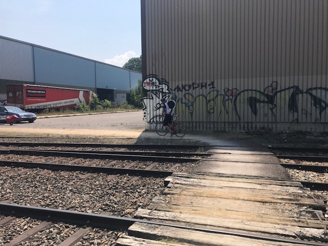
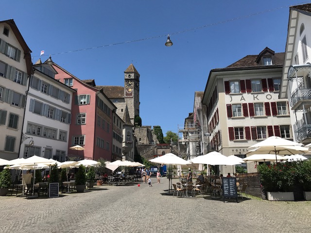
A Cancer Survivor's Journey to Find Peace on a Bike
Author: barrysherry
I love cycling. I hate cancer. I love to climb big mountains but I am more enthusiastic than talented (with apologies to Will). I've ridden in the Pyrenees, Alps, and Dolomites. I've climbed Mount Evans, Colo (twice) and raced in the Mount Washington Auto Road Bicycle Hillclimb (nine times).
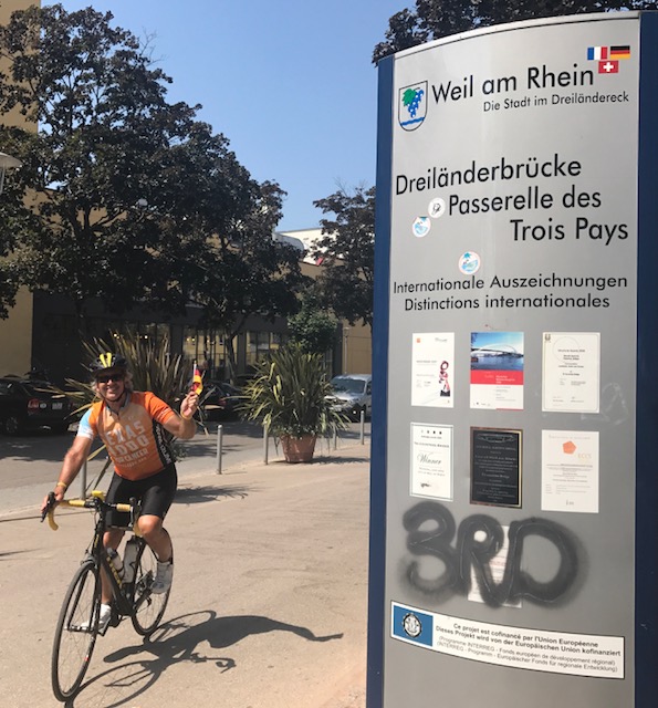
Three years ago Ben Z. and I went for a three-country ride. I asked him to come up with one again. He did.
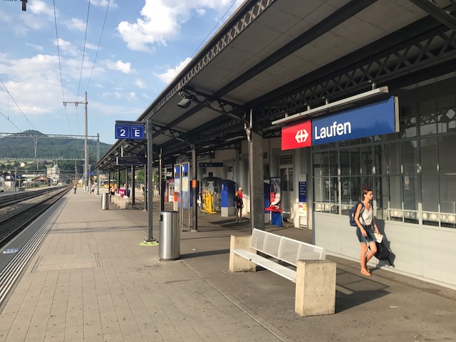
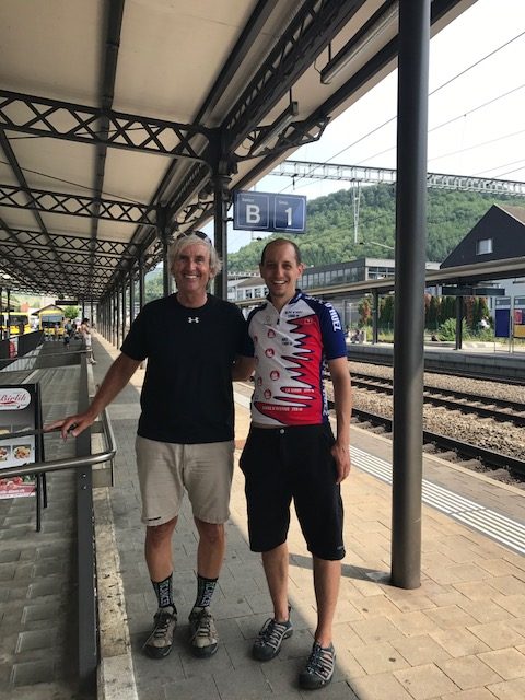
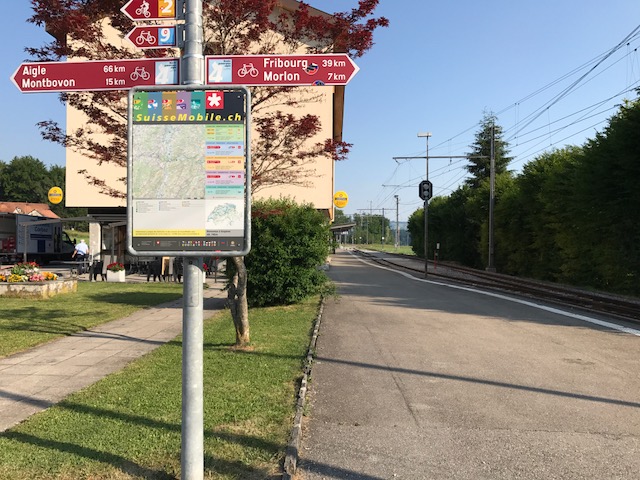
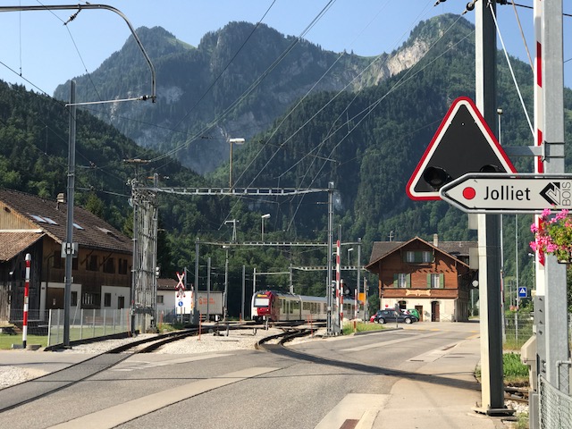
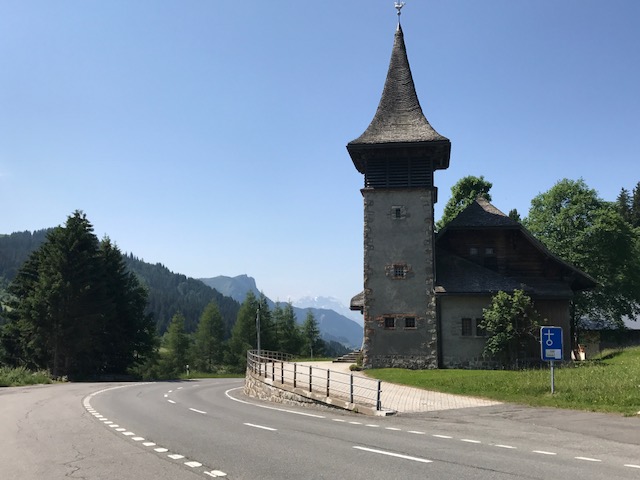
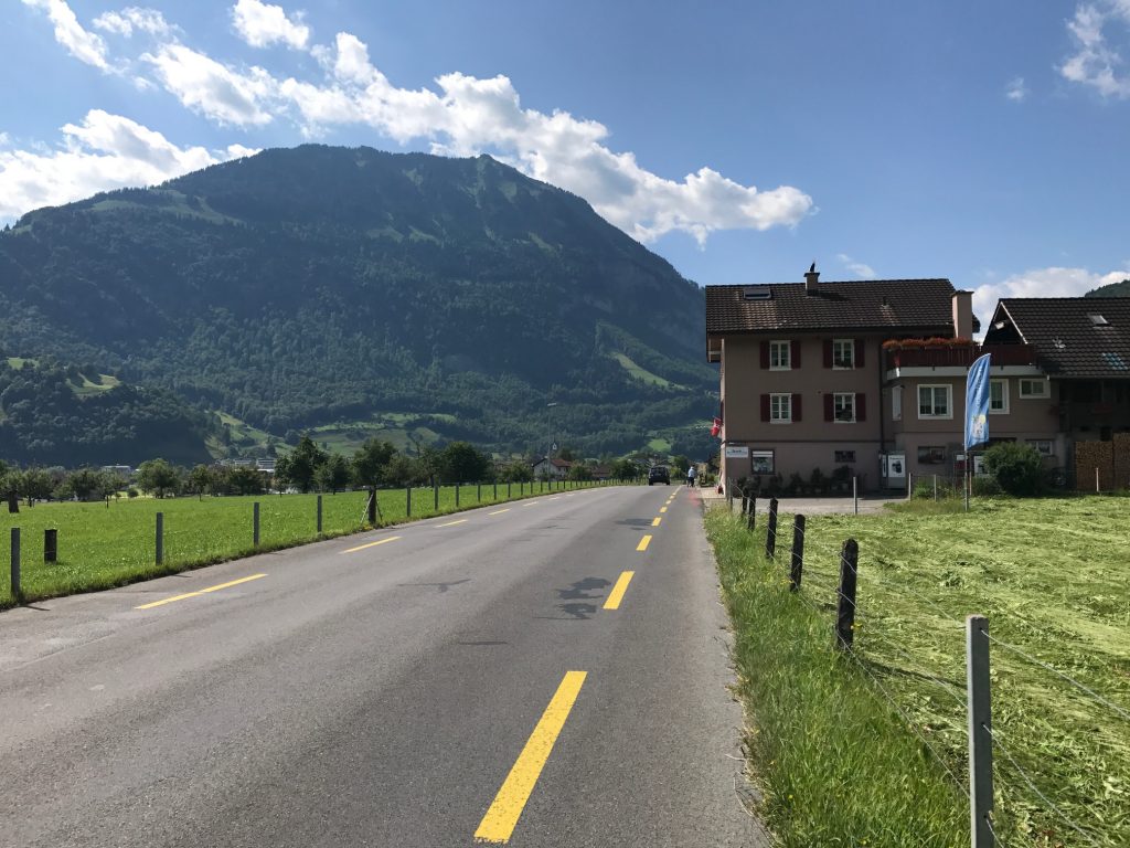
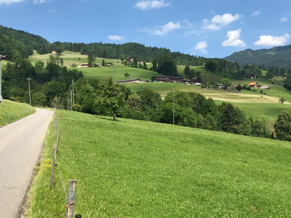
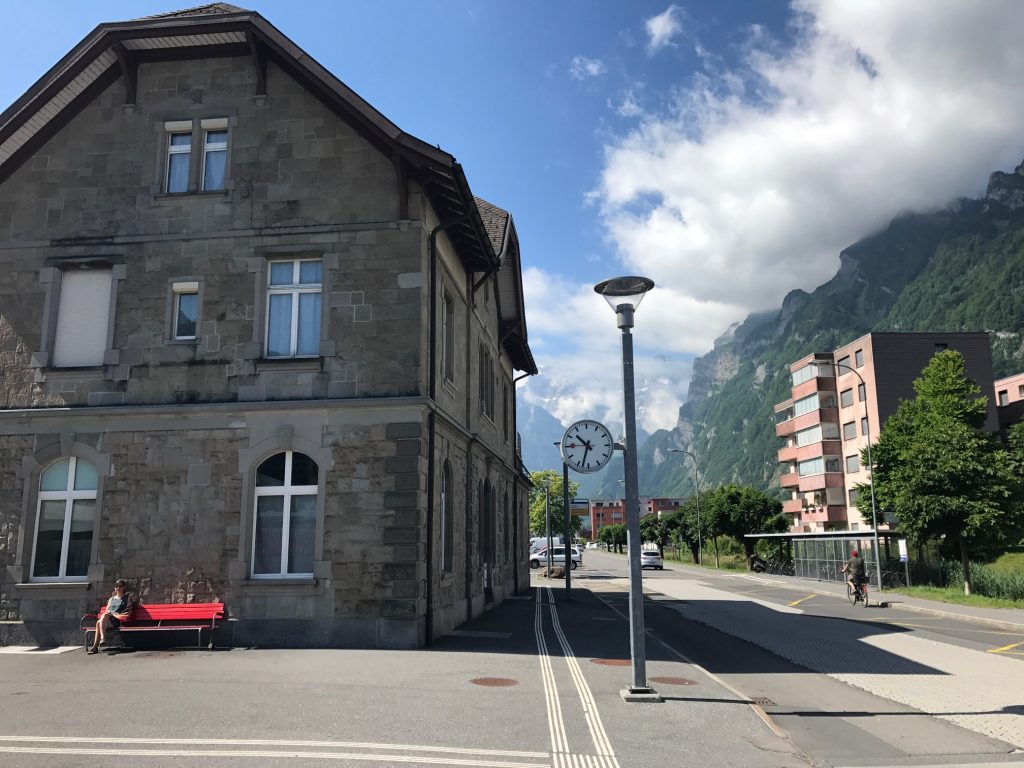
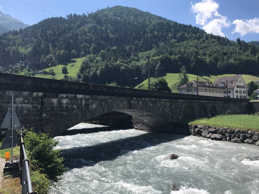
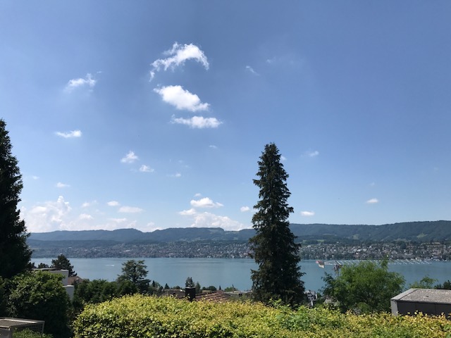
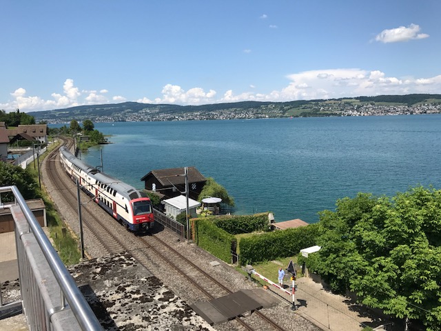
Train station, Laufen, Switzerland
We took a train to Laufen for the start. My train ticket was 13 CHF. My bike ticket was 20 CHF. For a country that is cycle-centric, or maybe it isn’t, I think their train bike passes cost at least twice what they should be.
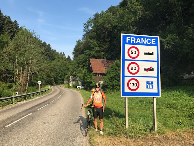
Welcome to France. I think. I think I can also read this sign. Speed limits in towns is 50 kph (31 mph); in the country it’s 90 kph (56 mph), and on super highways it’s 130 kph (81mph).
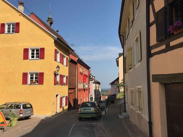
Laufen is near the French border of the Alsace-Lorraine region. We rode about 15 km before coming to a French sign. Ben pointed out another sign which noted that Swiss soldiers were not allowed to be on this road in uniform.
Ferrett, France
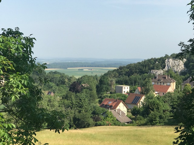
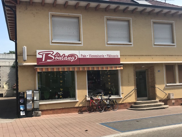
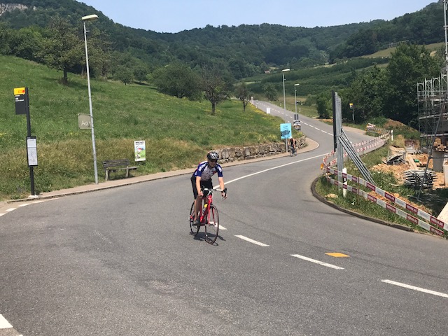
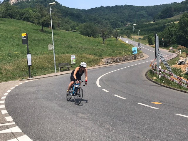
The road turned up and Ben rode ahead. We quickly established that on this day I would be first down the mountains and he would be first up. We went through some French villages although we were in the outskirts of a much bigger town, St. Louis, when I suggested we stop at a bakery.
Ferrett, France
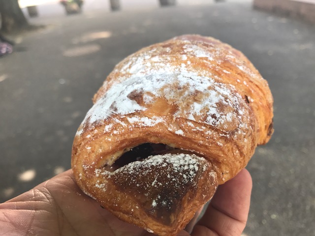
We both got a chocolate-strawberry croissant then rode to a shade location to eat. We ended up next to a school where students were practicing a dance routine. Never quite figured out what kind of school that was.
Bakery in St. Louis, France
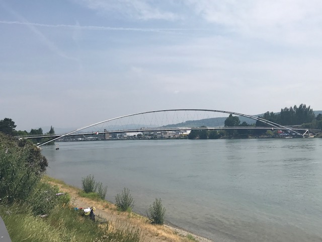
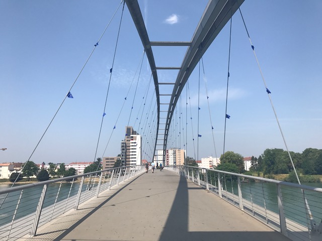
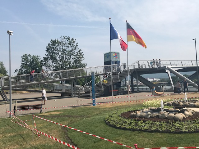
We found our way to the Three Country Bridge that connects France and Germany but looks at Switzerland. Close enough.
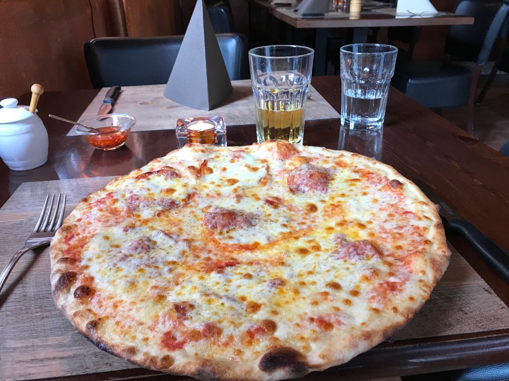
Deliciousness
Ben led us through Basel, looking for a road back to the town and the climb we did three years ago. We made some sketchy moves in traffic, i.e., probably not riding where we should have.
Three-Country Ridge
But we got through Basel and back into Germany until crossing back over at a dam on the River Rhine.
Hello Germany
It was hot, with temperatures in the low 90s. I carried two bottles and was going through those fast while Ben had just one.
Three Country Bridge that connects France and Germany
We looked for water – easier in Switzerland than France or Germany. I didn’t feel I was getting enough and I know Ben couldn’t have been.
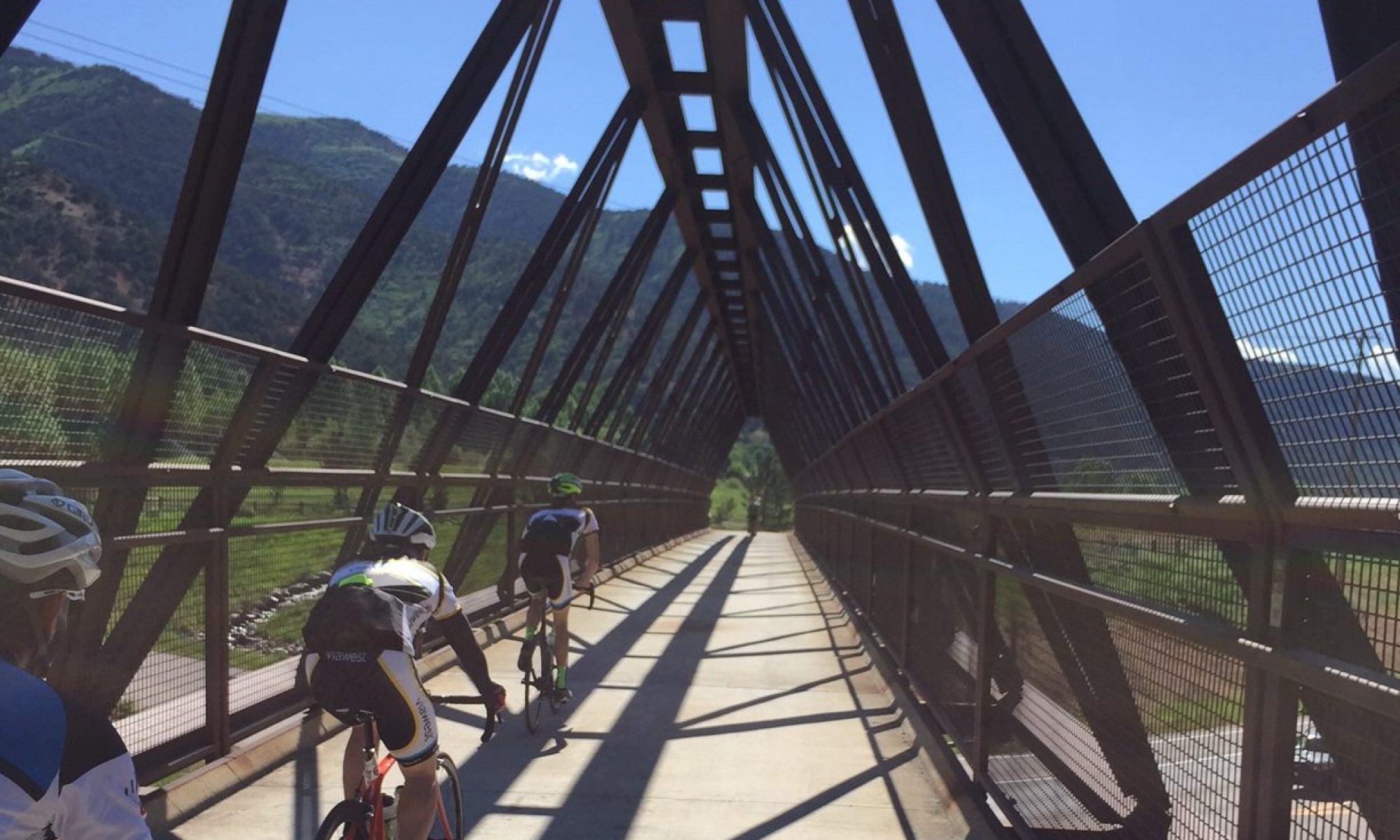
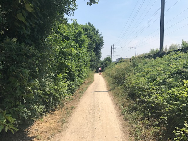
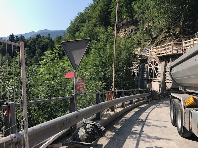
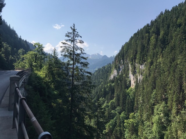
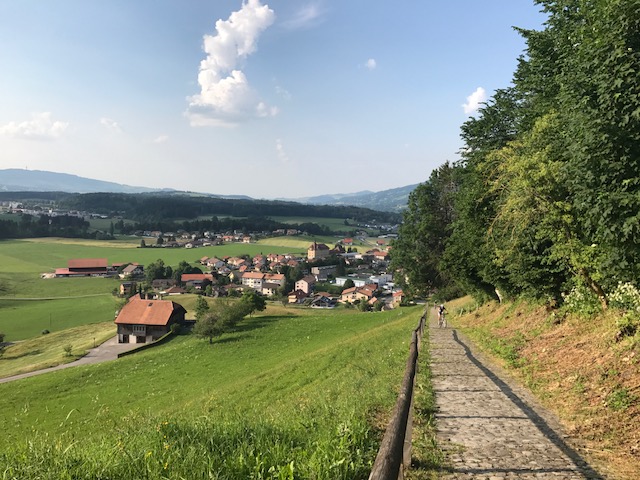
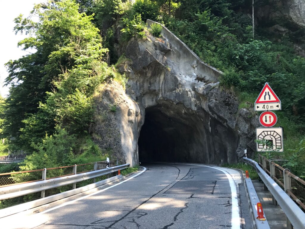
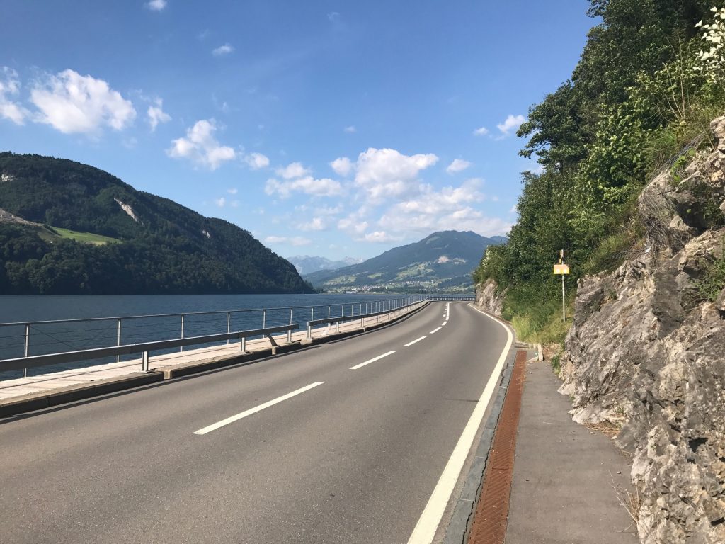
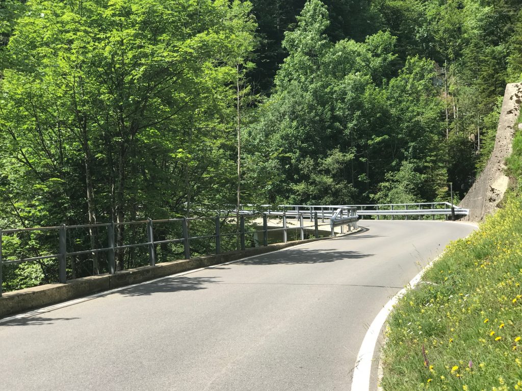
It wasn’t all pavement today
We began the last climb which would take us over the “hill” to Sissach. It was quite a formidable climb. Ben took off and 2-3 times pulled over until I dragged my butt up to him. I was in a granny gear and wasn’t going to work any harder. Or couldn’t work any harder.
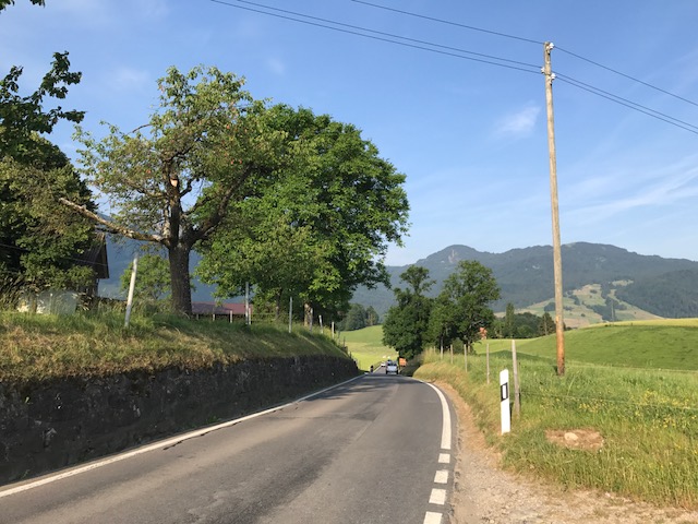
Kaiseraugst, Switzerland
But at the top Ben was lightheaded. His wife had biked up from Sissach (quite impressive actually) and he had planned lunch at a restaurant up the hill from the summit. A second summit.
Rheinfelden, Switzerland
Ben said he was so light-headed couldn’t control his bike. He rested and gathered himself and then we descended, with me being the fastest. Weight wins.
Ben
On the descent, I hit 75 kph which is 47.5 mph. Had I known I would have pushed it to 50 mph. But it was my fastest speed of the time I was in Switzerland.
Switzerland. France. Germany. It was a most excellent trip. Thanks Ben!
This was a bittersweet day. It would be a day of accomplishment but a little sadness as I knew my trip across Switzerland through the Alps would be ending. Actually, I was not sad at all.
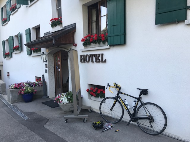
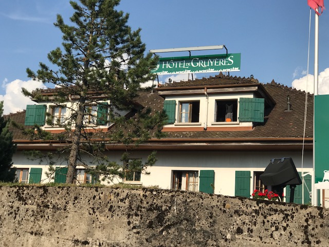
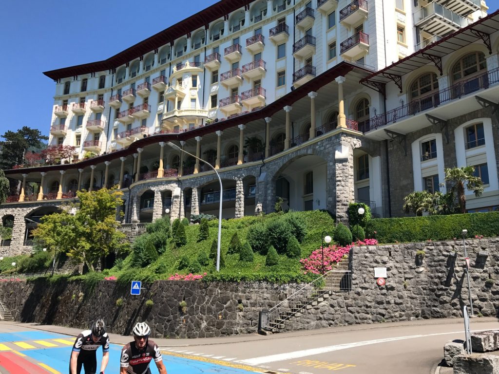
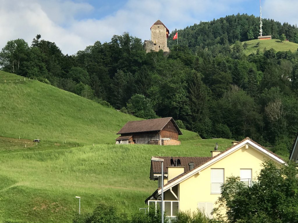
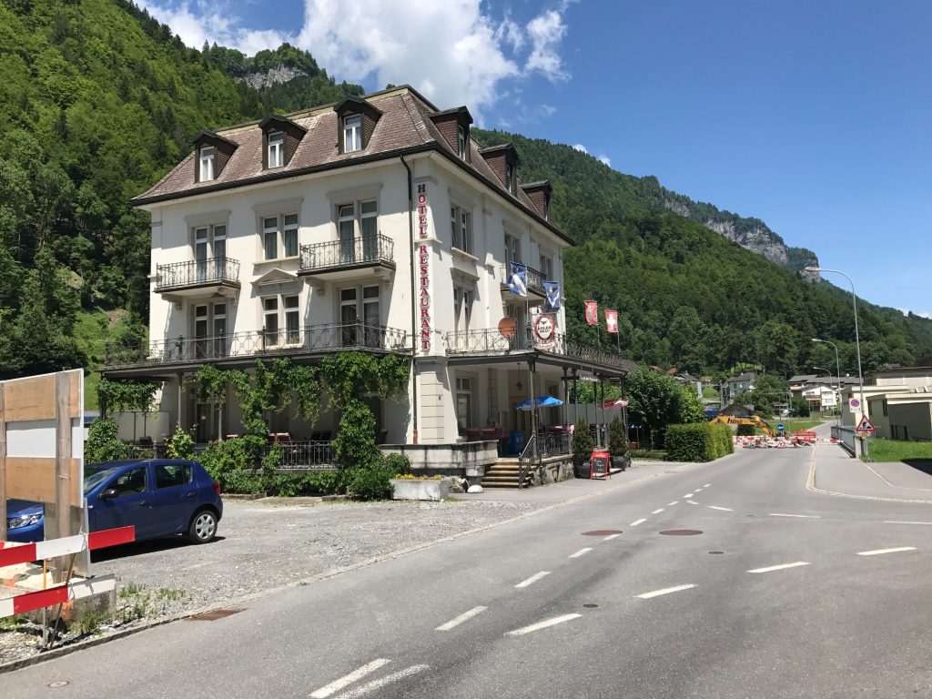
Hotel Gruyères, Gruyères, Switzerland
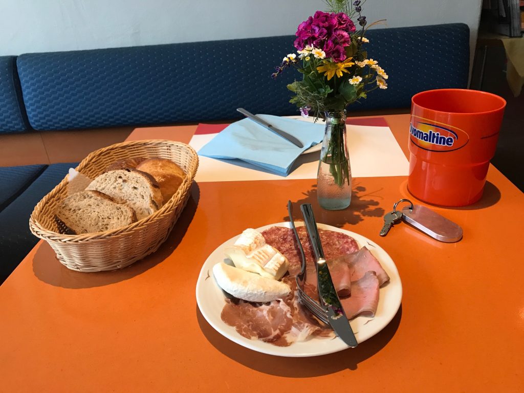
I had a nice breakfast at the Hotel Gruyères. It was a very pleasant morning but going to be hot again.
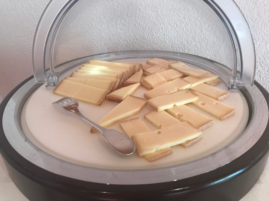
Cheese – Hotel Gruyères, Gruyères, Switzerland
I sat out on the patio enjoying the cool morning weather. I had no complaints about the weather. No rain the entire trip. And really never needed arm warmers. Perfect weather.
Hotel Gruyères, Gruyères, Switzerland
The first few kilometers would be downhill as I left the hotel and then try, for the last time, to find Cycling Route 4. It started OK as I was soon on farm roads.
Train station in Gruyères
In Grand Villard I missed a turn at a traffic circle but soon corrected it as I could see my Garmin showed I was “off course.”
Grandvillard – A Farm Village
The back road took me off the main road for a while. A mostly single lane, very lightly traveled road, I even stopped to watch a fox.
Grandvillard, Switzerland
Eventually the roads would converge and I would be on the main highway.
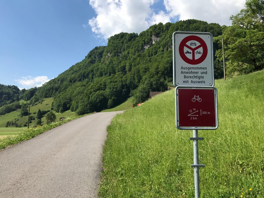
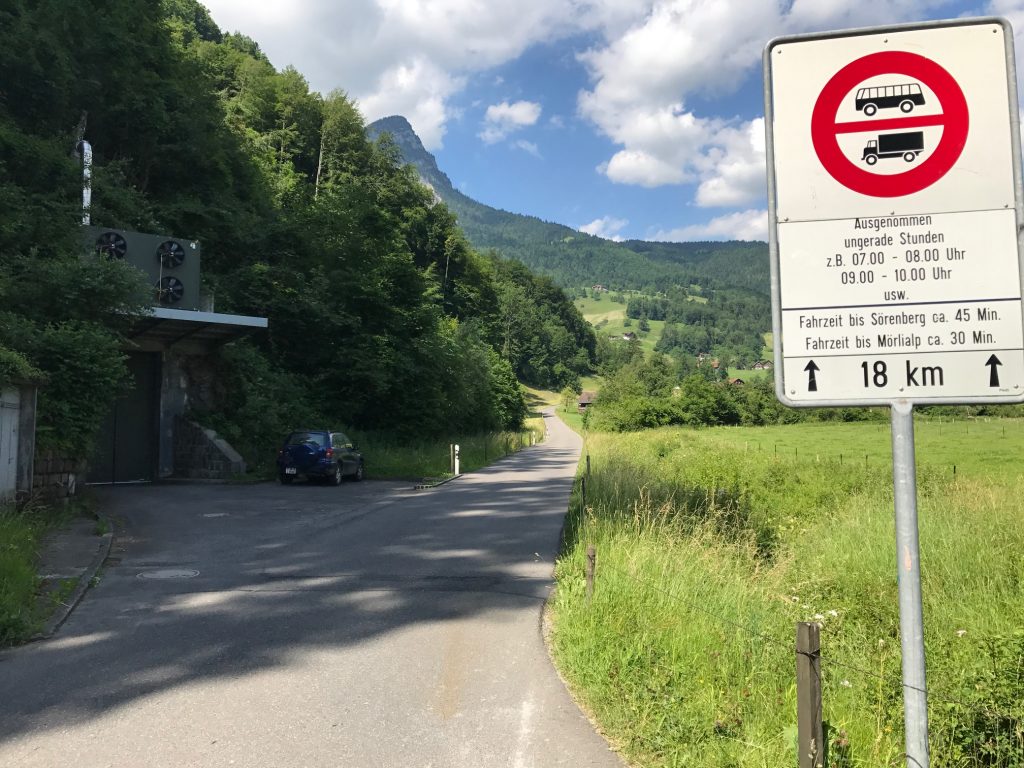
This road kicked up to 18% but only for a short stretch. Haut-Intyamon, Switzerland
I was tired. Physically, I didn’t feel tired but perhaps skipping dinner last night or just seven days in the Alps was wearing on my decision making.
Montbovon, Switzerland
I came to a construction area and did not see a turn. Garmin soon warned me I was off course. I went back and surveyed the area. Yes, I missed the turn to Route 9. There was no way through but I hoped the main road would be parallel where I should be.
Rossinière, Switzerland
It would not occur to me until the end of my ride that I wasn’t to follow Route 9. All week I have been on Route 4 and now I confused them. I still don’t know where I should have gone.
Rossinière, Switzerland
I was comfortable following Garmin but if there was a real Route 4 I wanted to be on it. But I stayed on the main road.
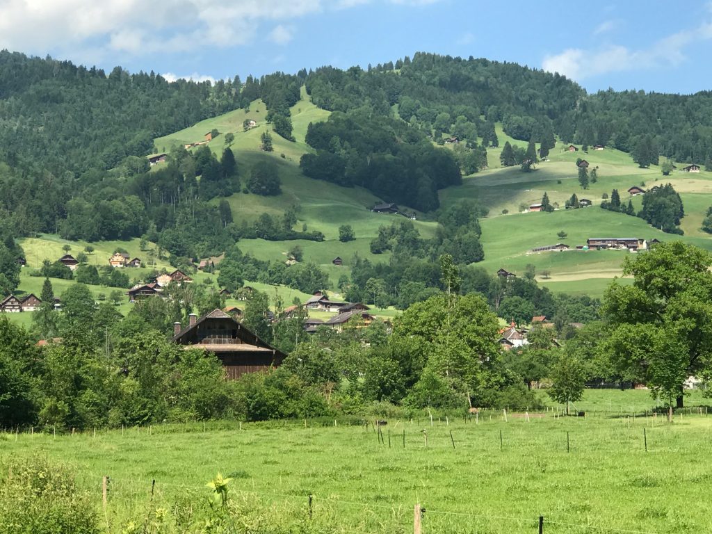
Château-d’Oex, Switzerland
I came to what I knew would be my climb over my last mountain. Then I saw a sign for Route 9 to the left. Down in a valley. I followed it for 300 meters and just knew it didn’t feel right. At the point I said “screw following the sign” not even aware it was the wrong sign. The mind was tired.
Château-d’Oex, Switzerland
I thought I was on the right road but who knows. But I began the climb confident I would get to Montreux.
Château-d’Oex, Switzerland
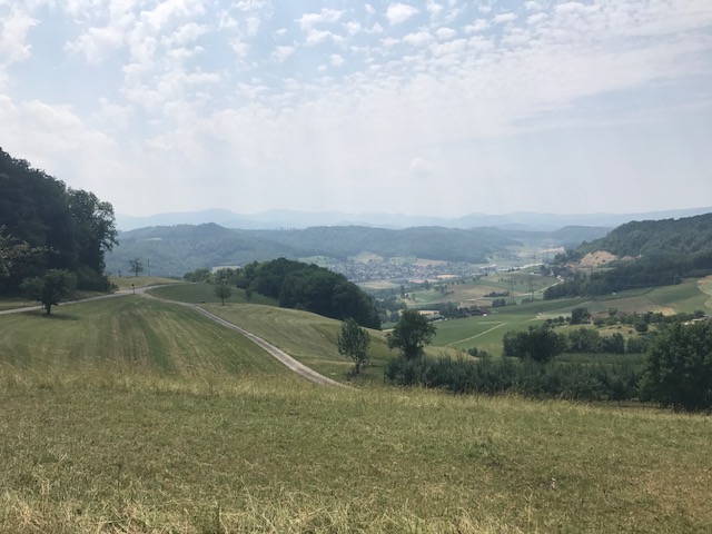
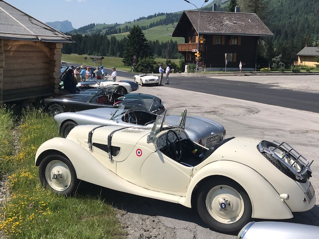
The views were great and I had no regrets. I was passed by perhaps 30 sports cars, many of those vintage cars.
Château-d’Oex, Switzerland
At the top was a ski area. I didn’t spend much time here but instead would begin my descent to Aigle.
Château-d’Oex, Switzerland
It was a great ride down. With hairpin turns, I never could really let the bike roll but I wasn’t here for speed. (Things losers say)
Ormont-Dessus, Switzerland
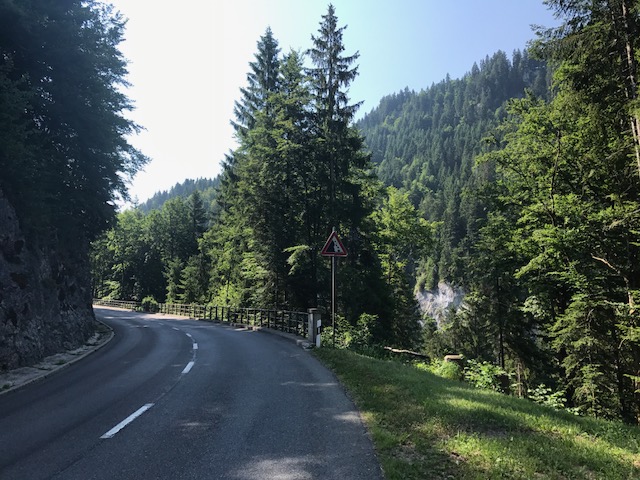
I came to one snow shed and plenty of picturesque vantage points. I enjoyed the descent constantly scanning taking in the views.
Snow shed
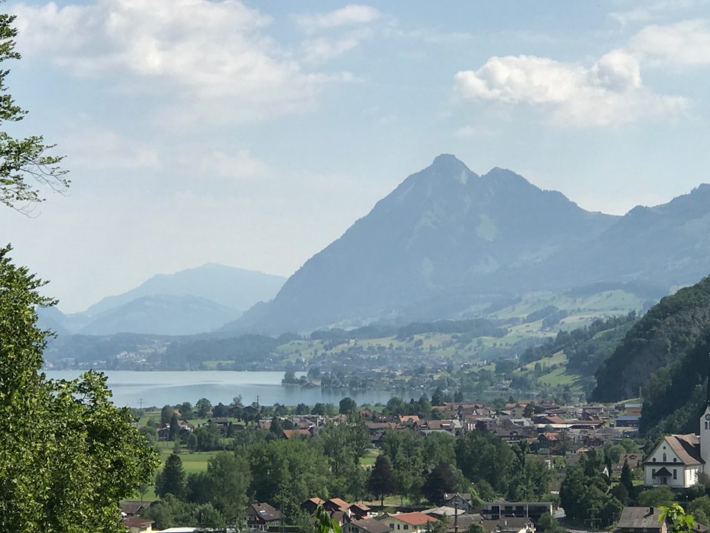
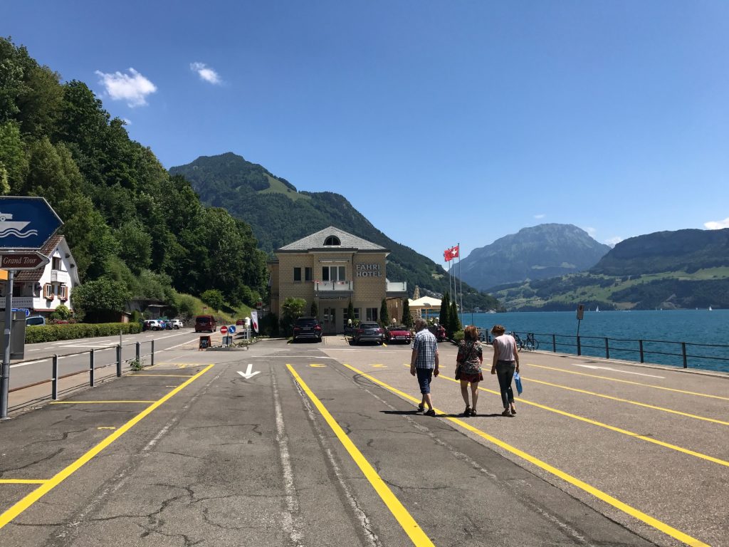
Reaching the bottom I could see Aigle and the figurative end of my journey.
Aigle, Switzerland
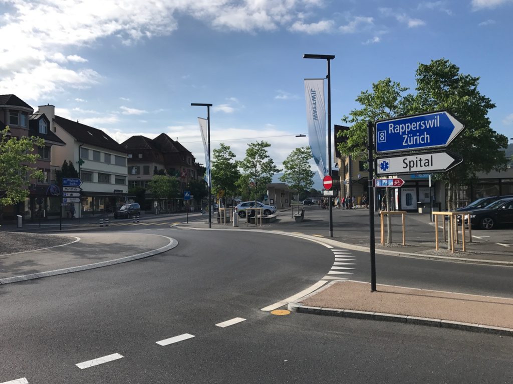
I also knew I was in France. Well, not really but very close. I had thought about riding an extra 10-15 km to “end” in France (and come back) but decided I needed to keep going to my real destination in Montreux. I had a train to catch.
One of three “bikes” in Aigle I found. The other two were pink and yellow.
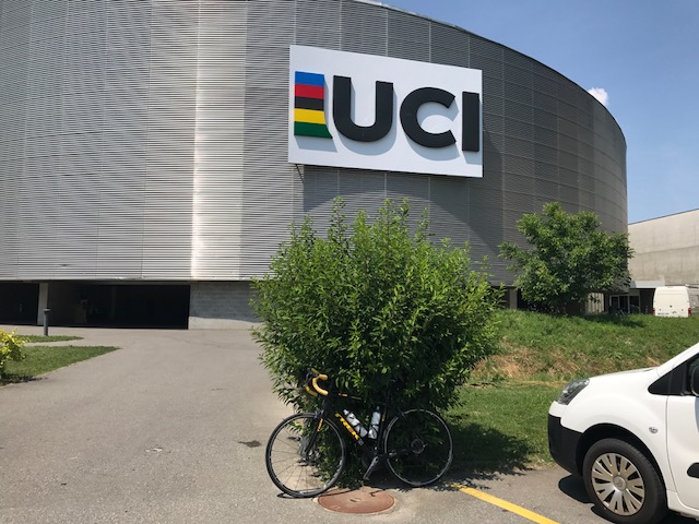
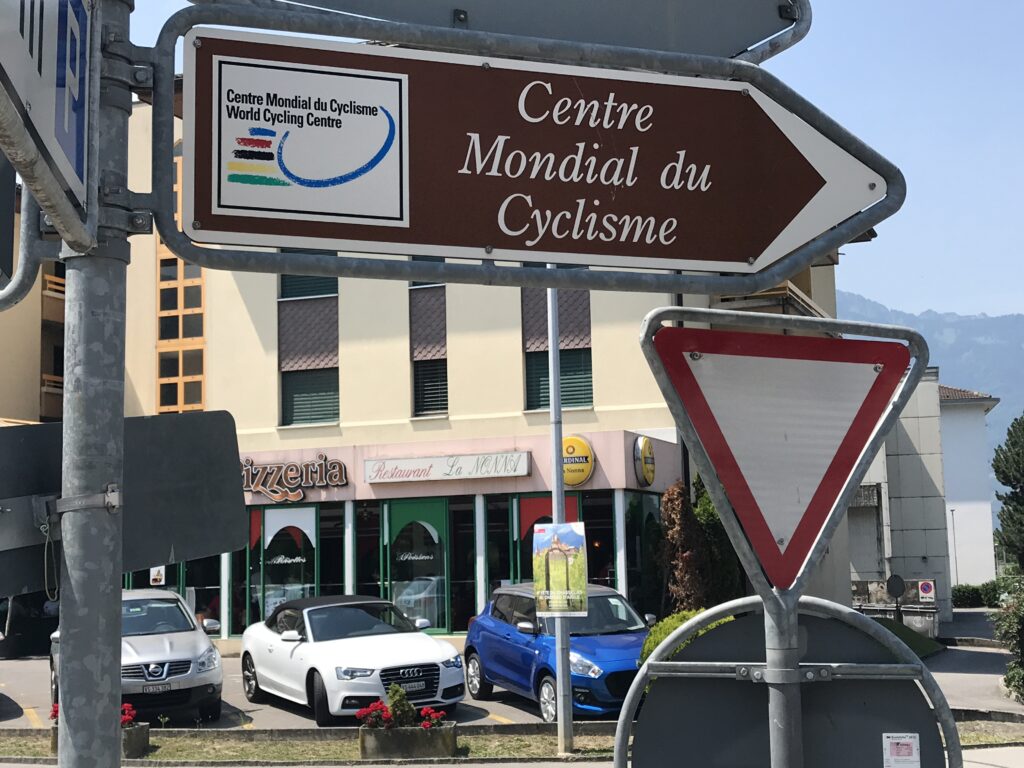
Beautiful vineyards on the hillside dotted the landscape. Aigle is the home of the UCI, Union of International Cyclists or Union Cycliste Internationale in French.
Those cars came down Bike Route 4
As I reached the flat section of the town I saw a sign for Route 4. Then it dawned on me I had been looking for the wrong signs. I felt fresh but I must have been tired to confuse the route signs.
The last Route 4 sign I would see. I still don’t know where the official terminus is. – Aigle, Switzerland
I saw the cars that had passed me coming off a mountain road. Route 4. The one I was supposed to be on. Oh well. I have no regrets about the route I took but wonder what I missed. And if I should go back someday.
This round portion of UCI is a velodrome – Aigle, Switzerland
I said goodbye to Route 4 and was going to head to Montreux. But I saw a sign for UCI and decided to see what it was all about. Well, it was about a building. A velodrome. I did not leave a pee sample. (But it would have been clean.)
Vineyards in Aigle, Switzerland
Since there was no longer a bike route, (it starts/ends in Aigle) I had mapped my route to Montreux. But I briefly lost my way. I started to get on Super Highway A9. Oops. I walked the bike back down the entrance ramp when I saw I could not jump the fence with my bike to an alternate road.
Veytaux, Switzerland
In Montreux I had planned to eat. Maybe to celebrate. Never really thought about dipping a wheel into Lake Geneva or lifting my bike but never had a chance. I followed a street into town, I knew I was getting near the train station and the street went under the tracks. When I emerged I was in a shopping area and saw an escalator up to the train station. I grabbed my bike, went up to ticketing, and just like that, it was over.
Which way to the UCI? – Aigle, Switzerland
Actually, it wasn’t over just like that. As I arrived ticketing I asked for my luggage and the woman didn’t know what I was talking about. But rather than create angst, I turned and there was a young man with my bag. I beat him. I pulled out money to tip him but he refused.
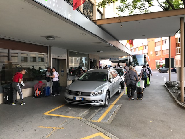
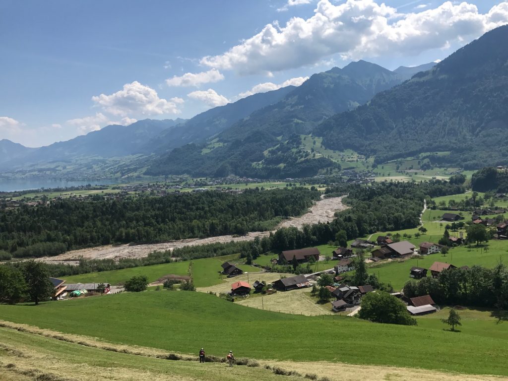
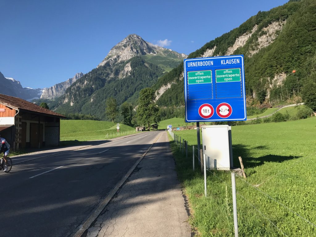
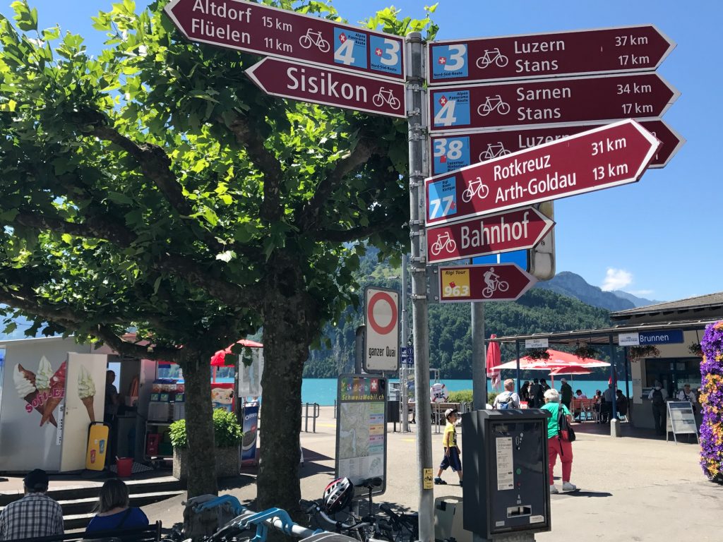
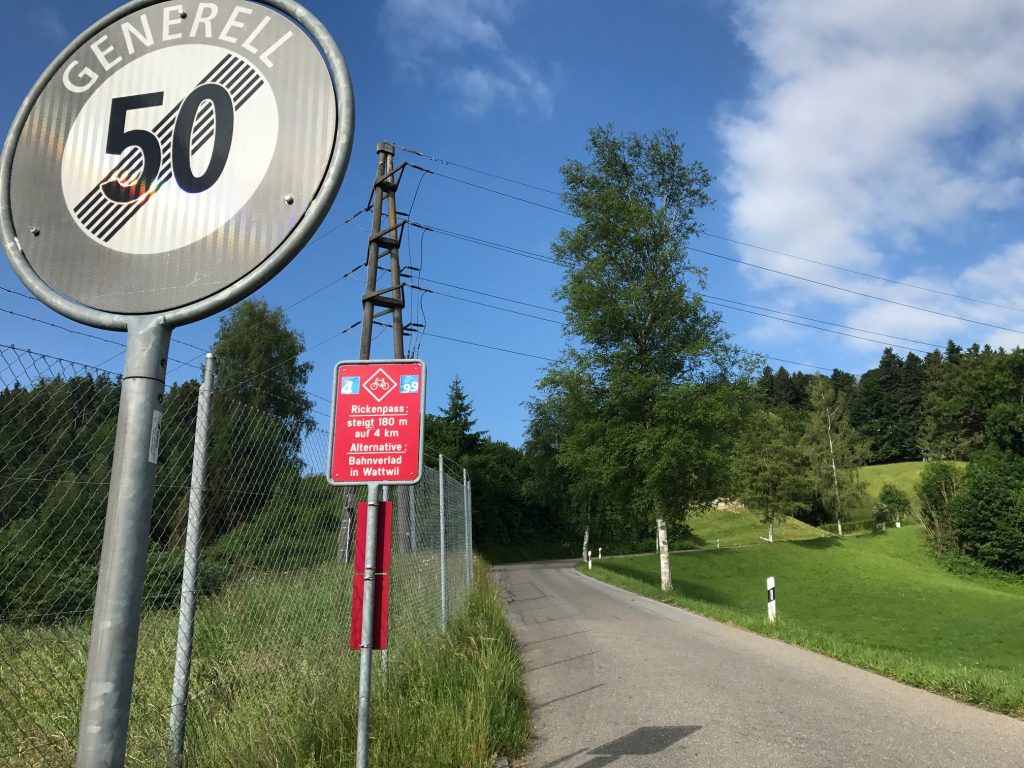
I knew it would be a long day and I hit the road before 8:00 a.m. for the ride out of Thun. It projected to be a lumpy ride and it certainly was. At 103 km, it was the longest day, and at 1,736 m, it would be the second most climbing.
Hotel AM Schloss
As I got ready to go outside the hotel there was a group of Chinese tourists. One by one they told their friends to come over and lift my bike. Then gave me a thumbs up.
Längerbühl, Switzerland
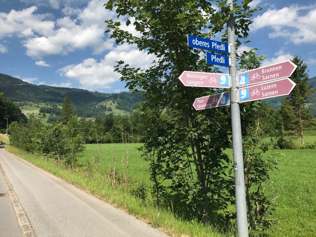
My plan was to follow the Bike Rte 4 signs first and the GPS I had mapped out second. And that mostly worked. Each night I looked online at Bike Rte 4 then tried to duplicate that on RideWithGPS.com and then download that to my Garmin bike computer. I didn’t always get it correct.
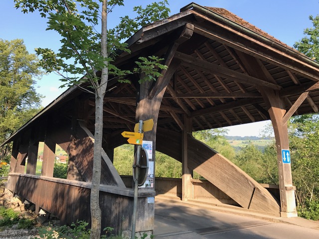
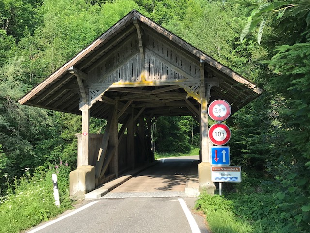
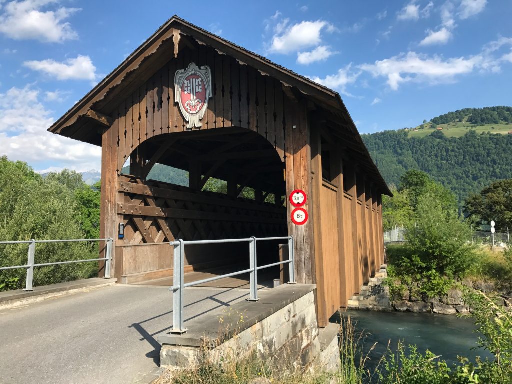
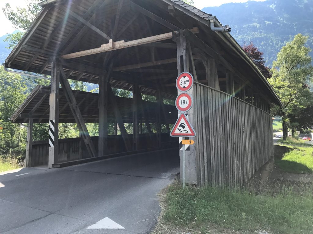
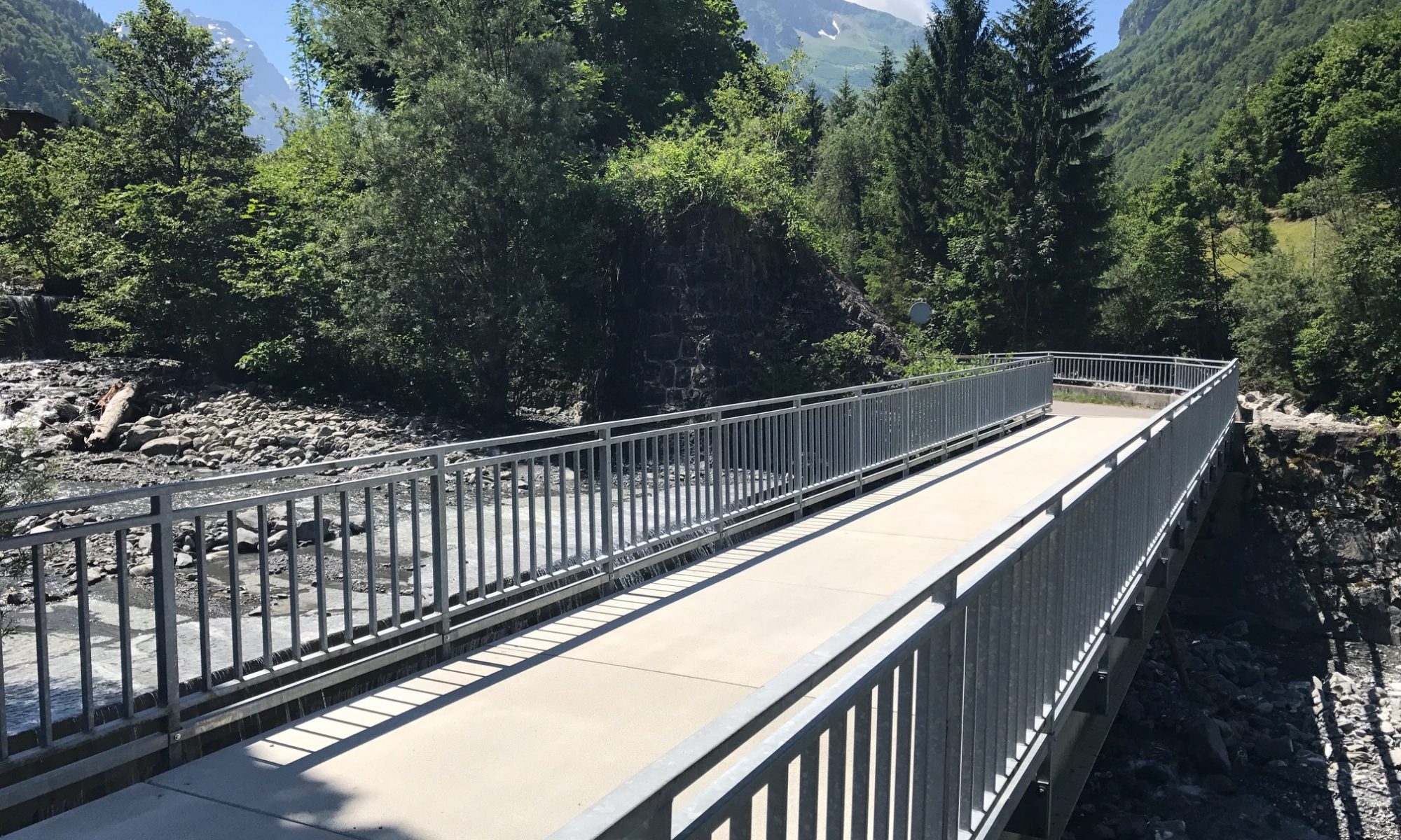
One of the many covered bridges on today’s ride
The first 5-6 km in Thun were pancake flat. Then, boom!, the road turned up. First I was on a small highway then Route 4 turned to a paved farm road. And it kicked up. Short but up to 18%.
At a house in the country but still near Thun
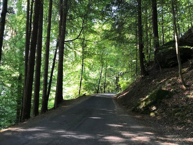
This was mostly an uneventful day. Halfway through I had a great descent out of one village – the kind you know the road is going to bottom out and kick up again. It was a great descent and beautiful forest as well.
Bike Route 4
It did. I went over a river just past an out of commission covered bridge, and entered the canton of Fribourg.
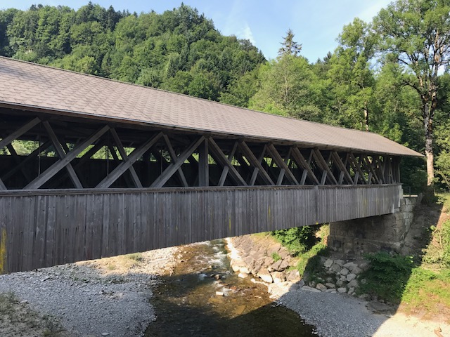
More covered bridges
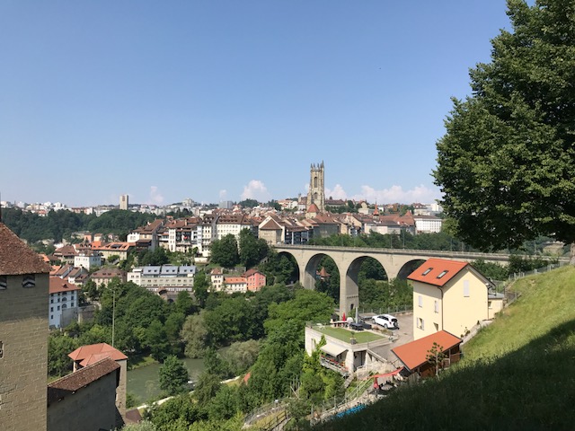
Fribourg city was an adventure. I followed the signs for a while but at the top of a bridge/retaining road was a traffic circle. The way back on Rte 4 was marked with an arrow but the way forward was not. I had to choose. I chose wrongly. I guess I made a turn at the traffic circle and, in the absence of a sign, should have gone straight.
Many bridges today
Sometimes when I choose wrong, if my GPS file is showing I am parallel to where it thinks I should be going, I just keep going hoping they will come back together. It was clear I was blazing a new trail in the wrong direction.
Fribourg
I stopped at a bike shop for directions. They weren’t perfect but they got me onto the trail where eventually I picked up a sign again. In all I probably spent 30 additional minutes in Fribourg trying to pick up the scent. Maybe even longer.
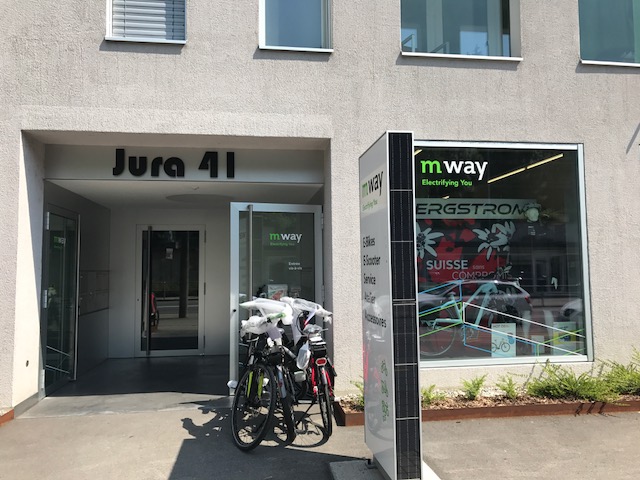
MyWay Bikes
The day was mostly full of rollers. And lots (five) of covered bridges.
MyWay Bikes – These guys got me back on track
It was pretty but did not come close to matching the scenery on Day 3 going up Klausenpass to Beckenreid. And there was this one kicker near Gruyères that went up over 20% but was no more than 75 meters.
Bike Rte 4
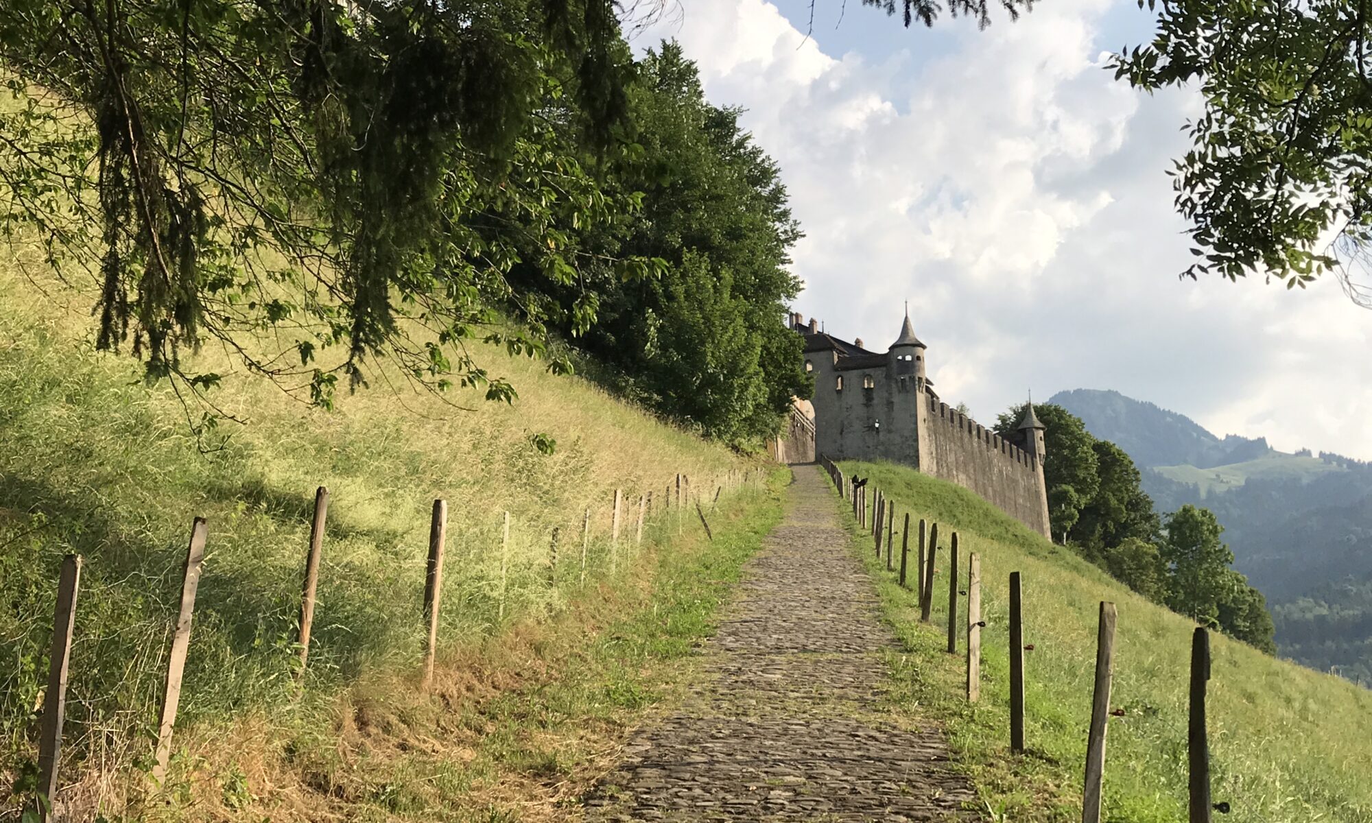
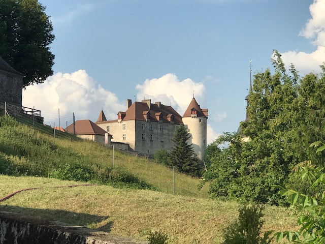
In Gruyères I found a bakery. I got a roll and some salami and a big bottle of grapefruit soda. Then I climbed the hill to the castle. Or chalet. I didn’t know it at that time but that would be my dinner.
Lake of Gruyères
Although the man who dropped my luggage in Thun asked if it could be ready at 8:30 a.m. (instead of 9:00), I still beat my luggage to the hotel. I wasn’t going anywhere. In fact, I just took a hot shower then sat naked on my bed until my clothes arrived.
Narrow Bridge – Morlon, Switzerland
In the early evening I decided to walk down into town. Clothed. By down I mean down. Two mountain bikers were coming up that old cobbled walkway. Chapeau!
The path down into town
Although there was a restaurant in town and a few at the chateau by where I was staying, I didn’t feel like paying the high prices of dining out. The bakery closed just 15 minutes earlier. So I decided I was done eating for the day and would wait for breakfast.
Castle in Gruyères
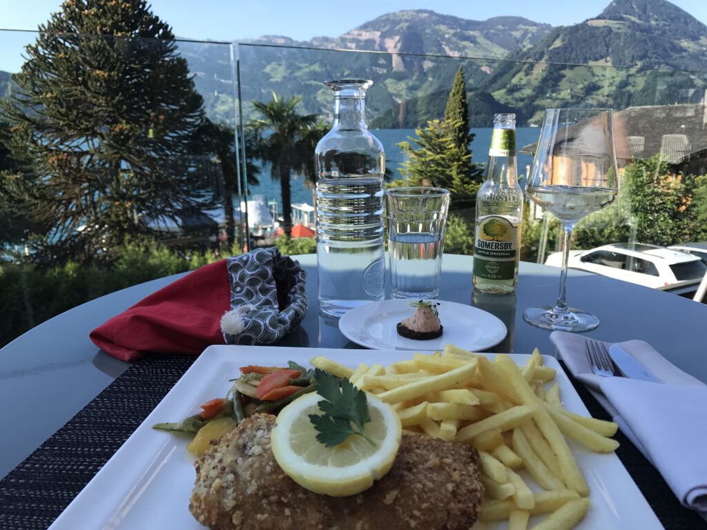
Dining out in Switzerland is generally expensive. On my third and fourth nights I had nice dinners but at a cost of 35-40 CHF ($36-$42) each. For one.
Bakery/store in Gruyères
But last night’s meal at McDonalds (8,90 CHF) in Thun and skipping dinner tonight would be kind on the budget.
Hotel de Gruyères. Notice the jerk who hung cycling shorts in the bedroom window.
This was the only place I watched TV. Three soccer matches. Confederations Cup between Mexico and New Zealand. A friendly (I think) between Italy and Croatia and Denmark vs. Germany. Not sure those last two games were live. They may have been old but they were new to me.
Laundry night at the hotel
A good night’s sleep and I will be ready to roll in the morning.
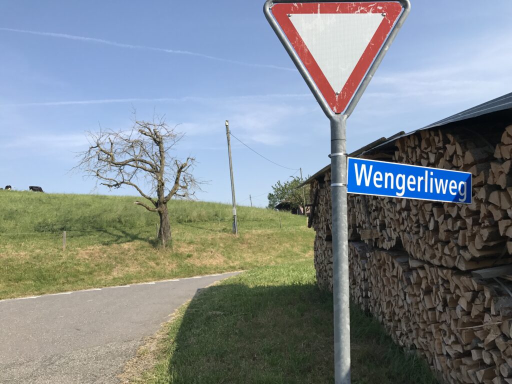
Wengerliweg – A street/road in Mamihaus, Switzerland
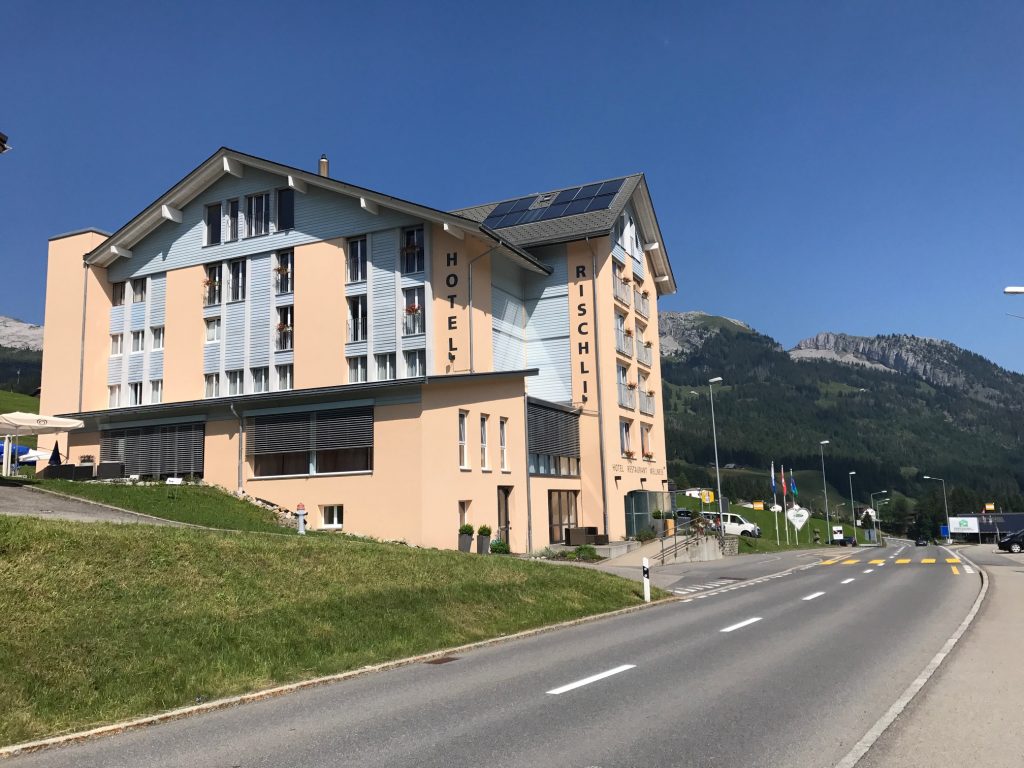
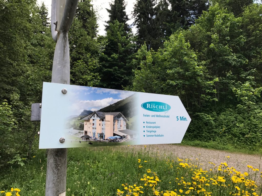
The stay last night was at the Hotel Rischli. I really enjoyed it. The desk clerk, Yvonne, was very nice. She had presented me with a complimentary transportation card that I could use for the aerial tram. But I did not use it yesterday.
Hotel Rischli, Söreneberg
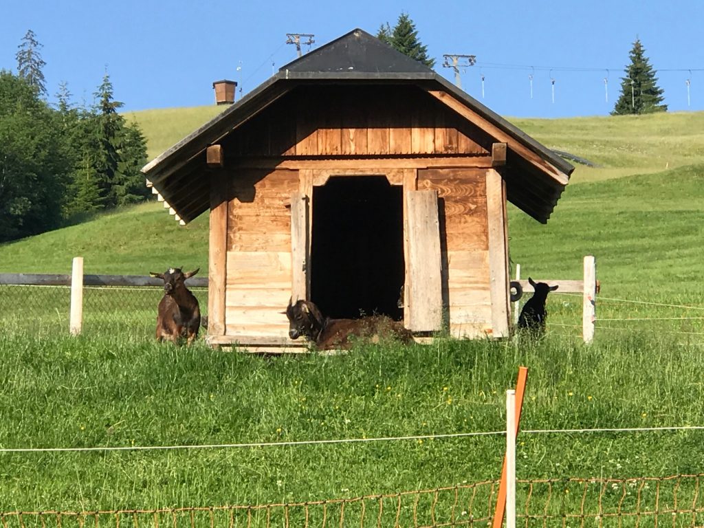
But first – goats. Just outside the dining patio was an enclosure of the cutest goats. They also had an enclosure of rabbits too. It made the stay more enjoyable.
Hotel Rischli, Söreneberg
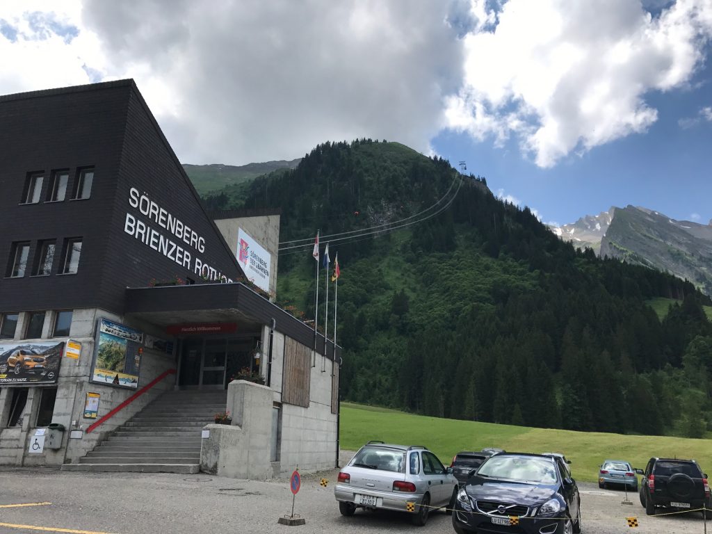
Yesterday I had gone by the gondola on my descent to the hotel. When Yvonne offered the transportation card I did not feel like pedaling the 4.5 km back up the mountain. But with a great night’s sleep, I looked at it differently, one from a fresh mind. And body.
Söreneberg
The ride over to Thul was supposed to be a short one and why should I be in a hurry. I decided I would bike back up to the gondola. Slow down. Enjoy the day.
Söreneberg
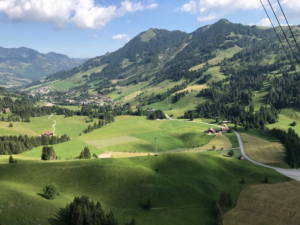
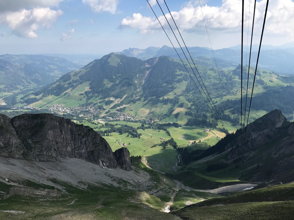
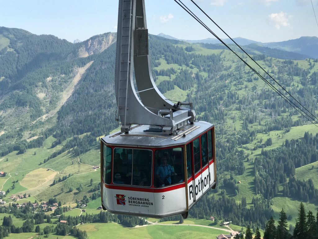
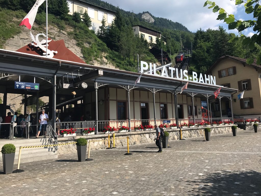
I had no clue where I was in Switzerland in relationship to other landmarks but in looking at the advertisements of the region I saw they also advertised a cog railway. I realized that I took that train with [Friend] three years ago and it dawned on me that at the summit we saw a gondola come up the mountain.
A nice way to the top
I rode to the gondola, presented my comp pass, and saved 38 CHF (which was about $40). The staff at the gondola put my bike in the engine room while I rode up to the summit.
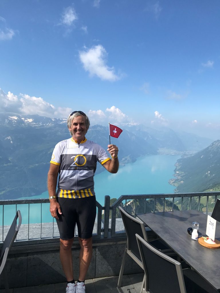
Barry in Switzerland. Overlooking Lake Brienz
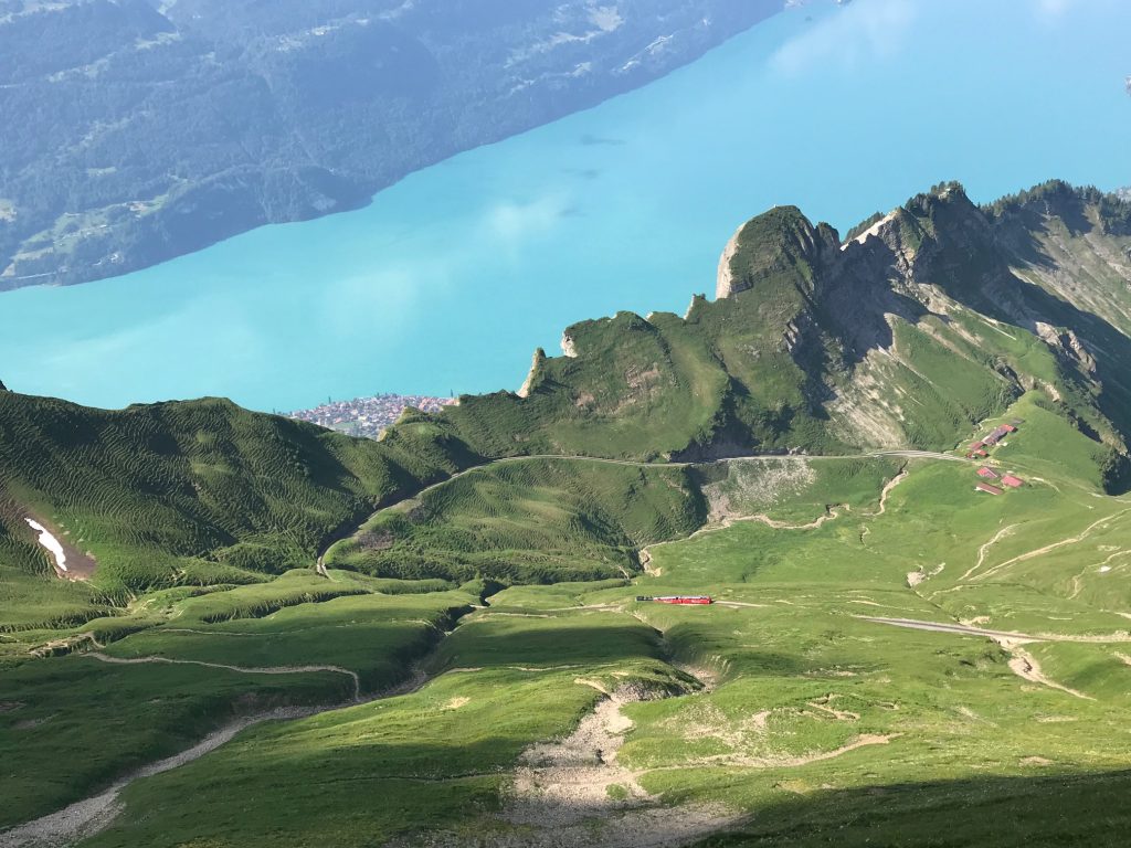
It was cool being back there. This time I could look down and see the cog railway engine sputtering away bringing back pleasant memories of this trip three years earlier.
The cog railroad train on the mounatin, Lake Brienz in the background
On the ride back down on the gondola, the “conductor” made sure to point out where there were mountain goats. He asked me if we have them in the U.S. and I told him Colorado (of course other states do too).
Söreneberg
It was a quick descent back to Söreneberg and a stop at the hotel. My luggage hadn’t been picked up so I decided I would carry an extra set of clothes just in case I got to Thun before my luggage. I couldn’t imagine I would with the trip being so short and now it was after 11:00 a.m. and I hadn’t left Söreneberg.
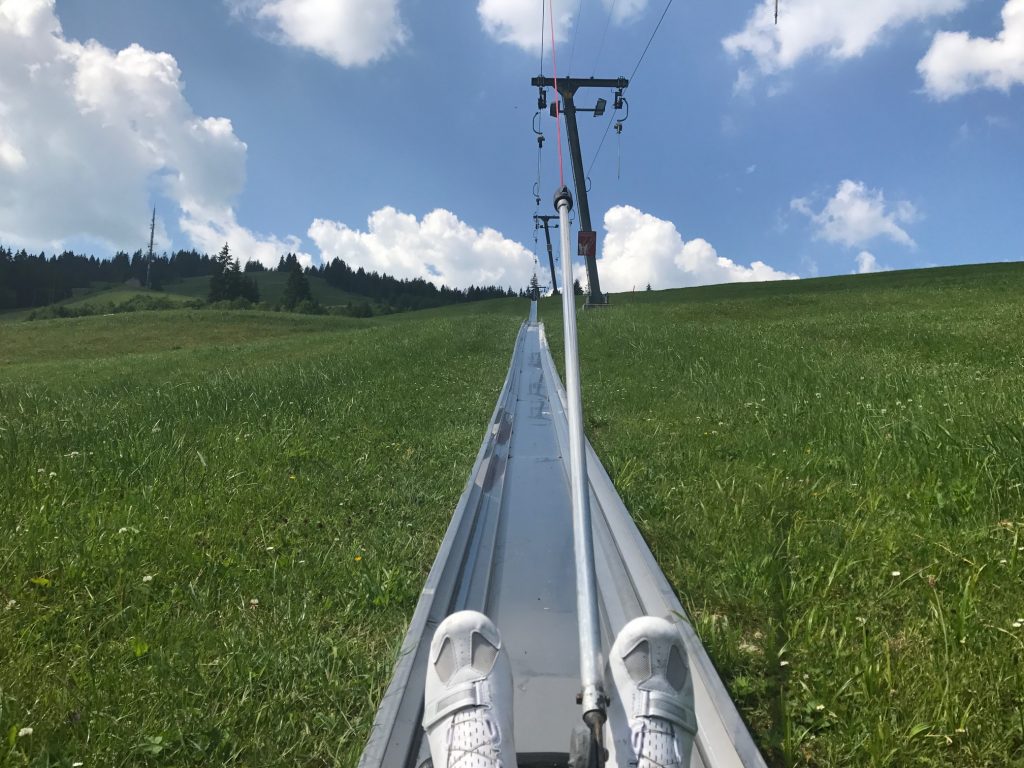
The Alpine Slide
But first, there was time for a ride on their Alpine slide. This one was cool because the ski lift dragged the rider and sled to the top on an enclosed course. The ones I have been on all used a ski lift to carry the passenger and sleds to the top of the mountain for the slide down. But this was a fully-enclosed course in which the rider rode up the mountain (towed by a cable) before sliding back down.
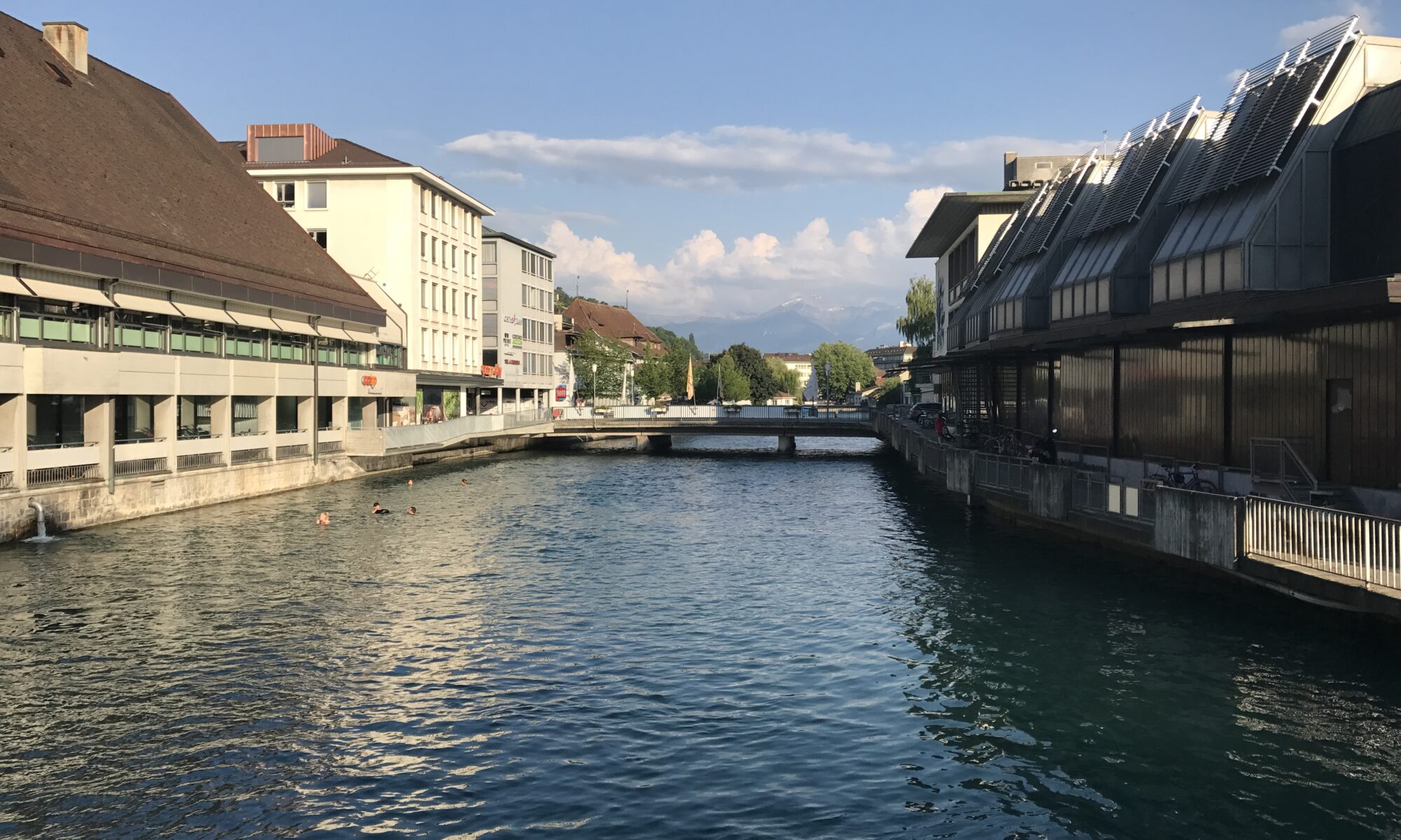
The River Aare in Thun is split by an island. The swimming channel was clearly slower than the other side. But one only needed to jump in and float and be carried away. Pretty fun!
Waldemme, Switzerland
Dinner tonight was at McDonalds – 8,90 instead of 35 or 40 CHF for a real meal. My only issue was I went for WiFi and a little A/C. But it seems WiFi is available only if you have a code that will be texted to you – if you have WiFi to receive the text. Sigh.
Marbach, Switzerland
The hotel was AM Schloss. It had no A/C and only a small window over a busy street. It was pretty miserable sleeping.
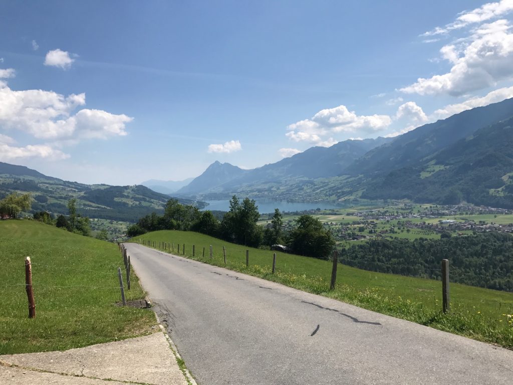
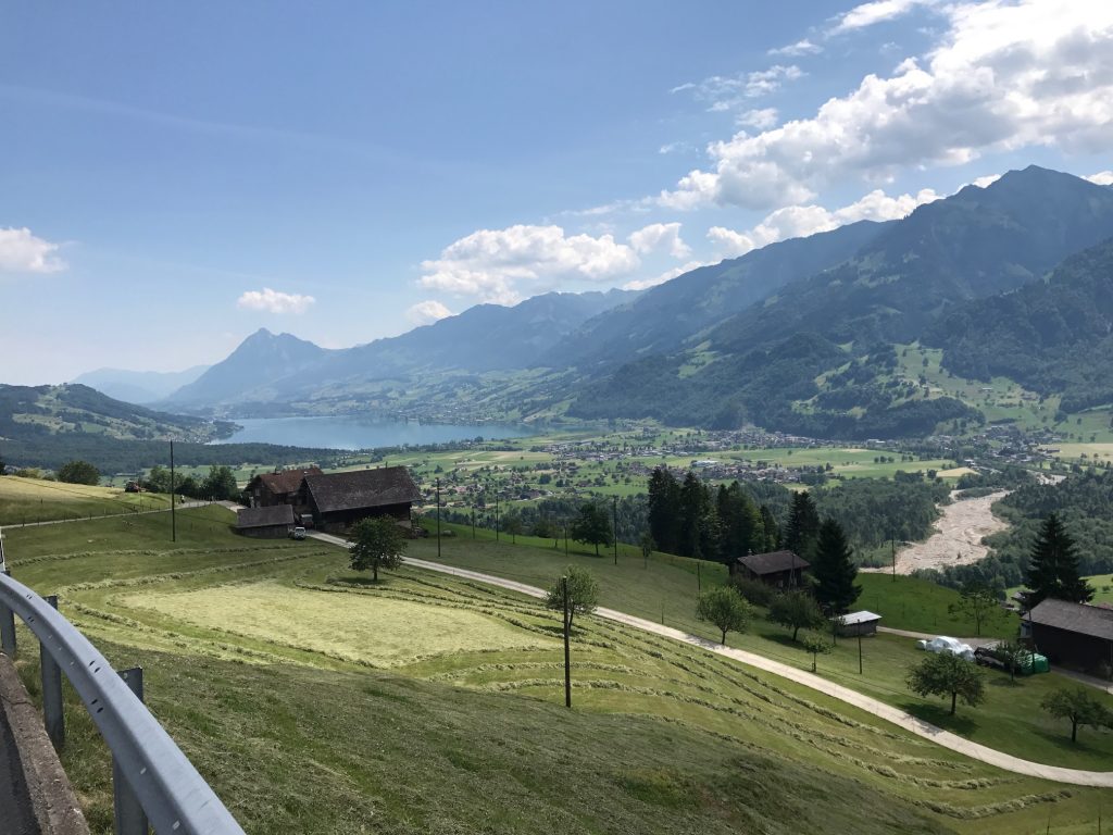
The day started with breakfast at the Seerausch Hotel in Beckenreid. It was the first hotel where they had a full buffet including eggs. So good but the view of Lake Lucerne was better.
Breakfast overlooking the beautiful lake
The Panoramic Alpine Route 4 would quickly take a lakefront road. There standing in the grass close to the lake was a topless woman talking to another woman. She was probably getting ready to catch some rays. I wanted to stop there for a photo of the lake but that would have been creepy in any language. So I went about 500 meters farther.
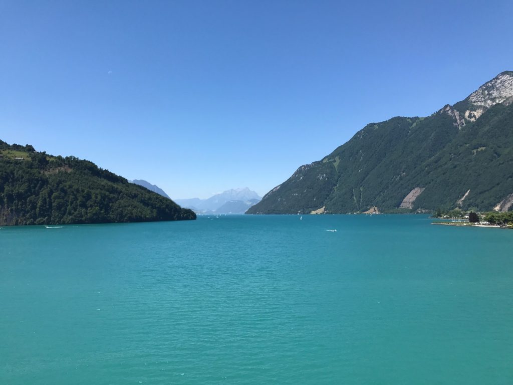
Lake Luzerne
The water of the lake is clear. The morning was perfect, about 68° (20° C).
Lake Lucerne
I would follow the Blue Route 4 signs where I could find them and rely on my Garmin as a backup. And I would need them.
Engelberger, Swizterland
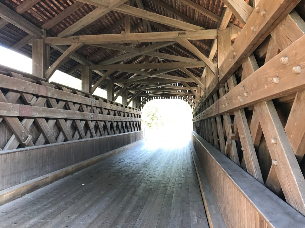
A real surprise was coming to a covered bridge. I couldn’t tell when it was built…
Engelberger, Switzerland
…but it sure had sweet decking (floor).
Buochs Airport, Switzerland
The first direction decision came at a culvert. There was a sign and I thought I followed it correctly but it took me in this 100-meter loop under the road I was just on.
Buochs Airport, Switzerland
I didn’t mind it one bit because it gave me a unique view of the mountains.
Stansstad, Switzerland
I got off course a bit in the little town of Stansstad. I did a two-block loop, looked closer at the signs, compared to Garmin, corrected it then kept going.
This was 10 meters from the turn for Route 4 at Lake Lucerne but sure is pretty (Hergiswil, Switzerland)
I crossed a bridge then followed Rte 4 on a lake road to Alpnachstad.
Stansstad, Switzerland
I followed the road next to the lake. There was a “sidewalk” which was really a boardwalk.
I was expecting about a 30 km (19 mile) easy cruising ride this morning and that is what I got. Cobbles. But for a short ride.
Saren, Switzerland
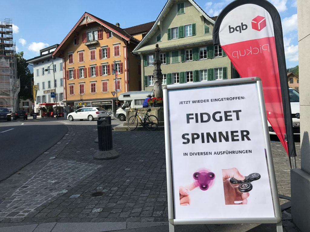
The town of Saren is beautiful. In the center was freshwater, which I would need. And the fad of 2017, Fidget Spinners, is global.
Wilen (Sarnen), Switzerland
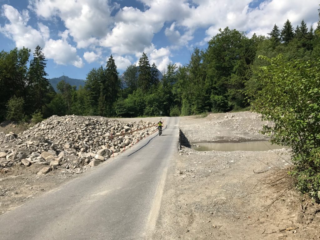
On my way out I entered a forested area then crossed what appeared to be a stream project. Had I looked to the right, and maybe I did, I would have seen what I was in store for.
Along the lake, I was back on a highway. Some roads have bike lanes which is really one meter to the right. The lines presumably make the drivers aware that we are there.
Giswil, Switzerland
At Giswil I came to a second covered bridge. It’s not quite Bedford Co., Pa., but I was a happy camper. Or rider. I love my covered bridges.
Giswil, Switzerland
Leaving Giswil, I uncharacteristically made a good biking decision. I stopped for a photo then jumped in behind two riders who looked like they were riding the Alpine route.
Giswil. Route 9 goes left and up; Route 4 continues straight. I made the wrong turn.
Ahead I could see a road climbing, steeply, to the left. I knew I had a left turn coming up. They turned and the one guy turned back. I passed him and started climbing. It was steep.
Giswil, Switzerland
I checked Garmin and it said I was “Off Course.” Well, sometimes one can be 10 meters off and it says I’m off so I was going to ignore it. I started climbing higher and could see I was going away from the route I mapped.
Giswil, Switzerland
The two men had stopped already and I asked (MAJOR LANGUAGE BARRIER – not sure they were German-speaking) if this was Route 4 (I held up four fingers). They said it was.
Giswil, Switzerland – Be careful reading the signs
I thought back to the turn. There was a sign but I didn’t look. The thought of going back down those steep 400 meters to check the sign then climb it again disturbed me but not more than taking the wrong route. I grabbed a quick photo and went back down.
Bike Route 4
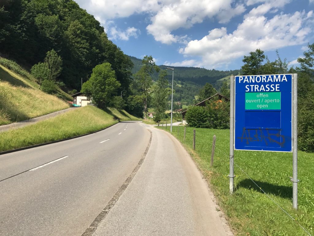
I was glad I checked. I was right. Rte 4 continued straight for another 400 meters before turning onto Panorama Strasse.
Hey, that looks like my RAV4
This road was mostly a one-lane road. Two cars could not pass. But there were some sections every 400-500 meters or so where a car could pull over to let one pass in the opposite direction.
Giswil, Switzerland
I looked up and figured I would pass by every house on the mountain. I was right.
Giswil, Switzerland
There was room for a car and a bike but only inches between a bus (city) and this bike. Thank you bus.
Giswil, Switzerland
I was sweating profusely. On the lower slopes were simply farms and no trees. I was exposed to the blazing sun.
Giswil, Switzerland
The climb was 11.8 kilometers (7.3 miles). Much of the way the grind was 8-9%.
Looking back to the washed-out stream I had crossed – Giswil, Switzerland
In my mind, I had calculated the climb to be 11 kilometers but as I watched Garmin I had a math error. I was off by one kilometer. It’s tough when you think you’re at the summit but you’re not.
Giswil, Switzerland
Somewhere, and I have no idea where the open section gave way to forest. It was a welcome relief from the sun.
Giswil, Switzerland
In the forested section, the Garmin showed higher gradients. It was registering 11-12% and even up to 18% (which I know it wasn’t – my body knows 18%). It wasn’t that steep. Long, yes. Steep, no.
Actually a 7-8% upgrade here – Giswil, Switzerland
Unlike Klausen Pass yesterday, where I was passed by 203 motorbikes, today I would be passed by 13 and only one “was in a hurry.”
Giswil, Switzerland
I went long stretches not hearing anything but birds of the forest and the occasional cowbell.
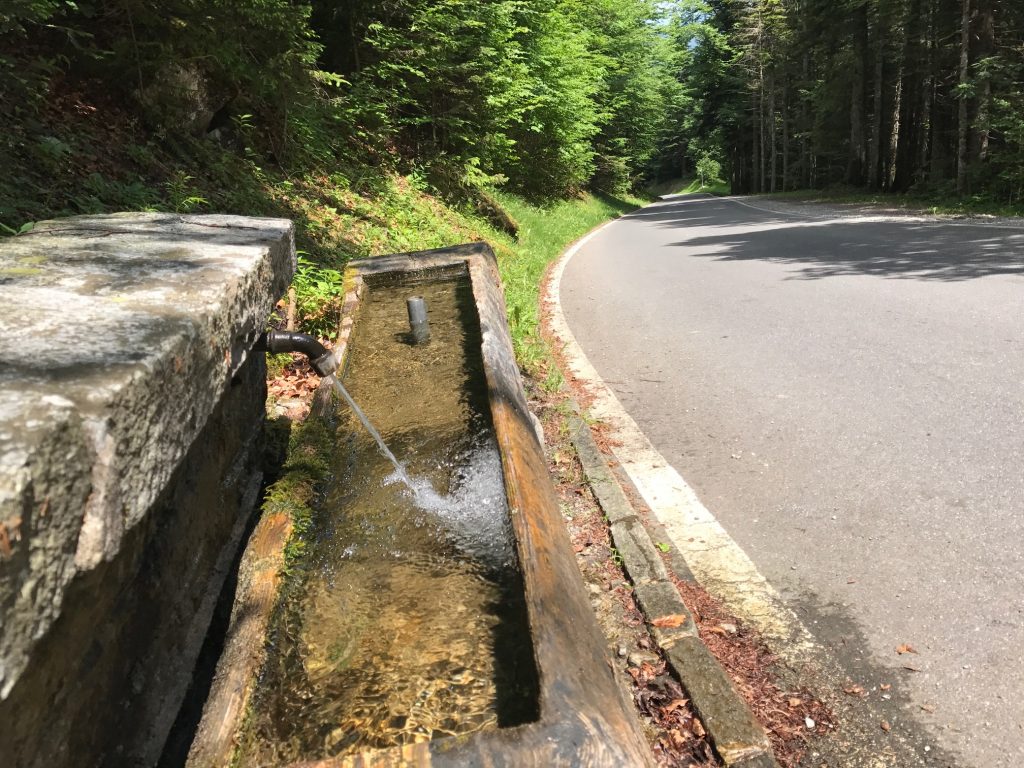
Giswil, Switzerland. So glad to find this water.
The higher I went the more cows I heard. I crossed a cattle guard and was in an open graze cattle area.
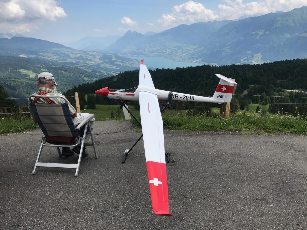
On this corner was an air sock and this guy sitting with his toy. He showed no interest in interacting with me even as I stopped and took an obvious photo. Giswil, Switzerland
I went through those two bottles and saw a water fountain. I stopped and filled up. Very cold water. They would last me another 2-3 kilometers.
Giswil, Switzerland
I came upon perhaps 40 school kids on a hike. For a while they seemed to be walking at the same pace I was climbing. But I soon passed them. A couple of kids tried to run alongside me but they didn’t last long although I thought they may beat me to the summit. They didn’t.
Giswil, Switzerland
What I thought was the summit was still 1200 meters from the top. A man sat there with his toy airplane. There was a windsock attached to a pole and he brought along his own windsock. I thought about asking him to take a photo of me climbing but he had no interest in even making eye contact.
Giswil, Switzerland
The views on the descent weren’t nearly as breathtaking as those on the ascent. Or maybe I simply had more time to take them in on the climb.
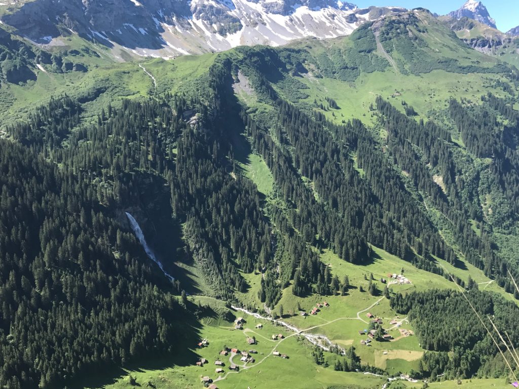
The gondola at Sörenberg
Right before Sörenberg I stopped at a cable tram. Interesting, but I didn’t know where it went. Although I would find out later.
Sörenberg, Switzerland
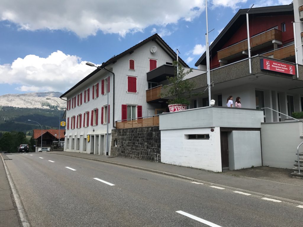
Going through Sörenberg I saw some young ladies in front of a school for Hospitality Management.
Sörenberg, Switzerland
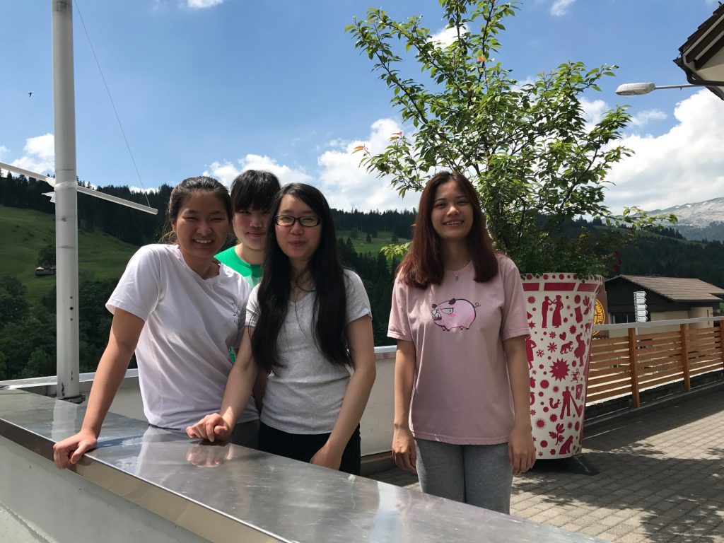
I stopped and asked if they spoke English (the sign was in English). They all did. Four young women from Vietnam. I also asked if I should go to Vietnam for bike riding and they laughed and said “Oh no.” I had read that Vietnam is a great destination for cycling this I found their response interesting.
Directions to Hotel Rischli , Sörenberg, Switzerland
I checked into the Hotel Rischli and the desk clerk offered me a discount card for the tram. As she was showing me the brochure it also included a cog railway. Then I realized this approach was the backside of the mountain that I had traveled three years ago. Had I spent my money to see the views from “up there” I certainly would have been surprised. And maybe pissed to learn I could have ridden for free.
Dinner at Hotel Rischli, Sörenberg, Switzerland
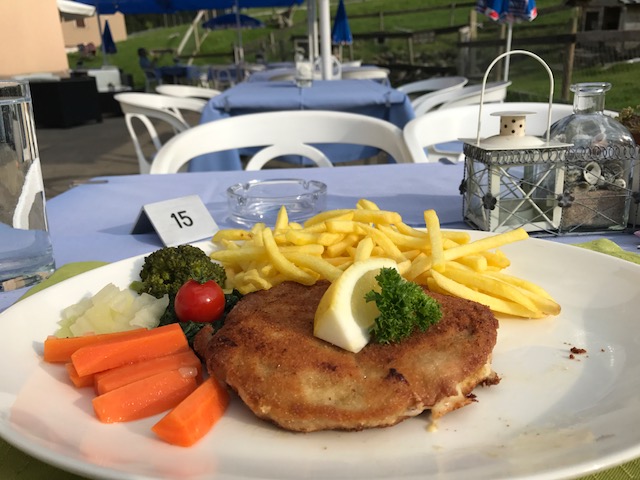
Dinner was out on the patio. I wanted to order Rösti although at the time I did not know the name. I settled for a Pork Cordon Bleu dish which is what I had yesterday in Beckenreid. It was delicious but at 35 CHF a bit pricey for this traveler.
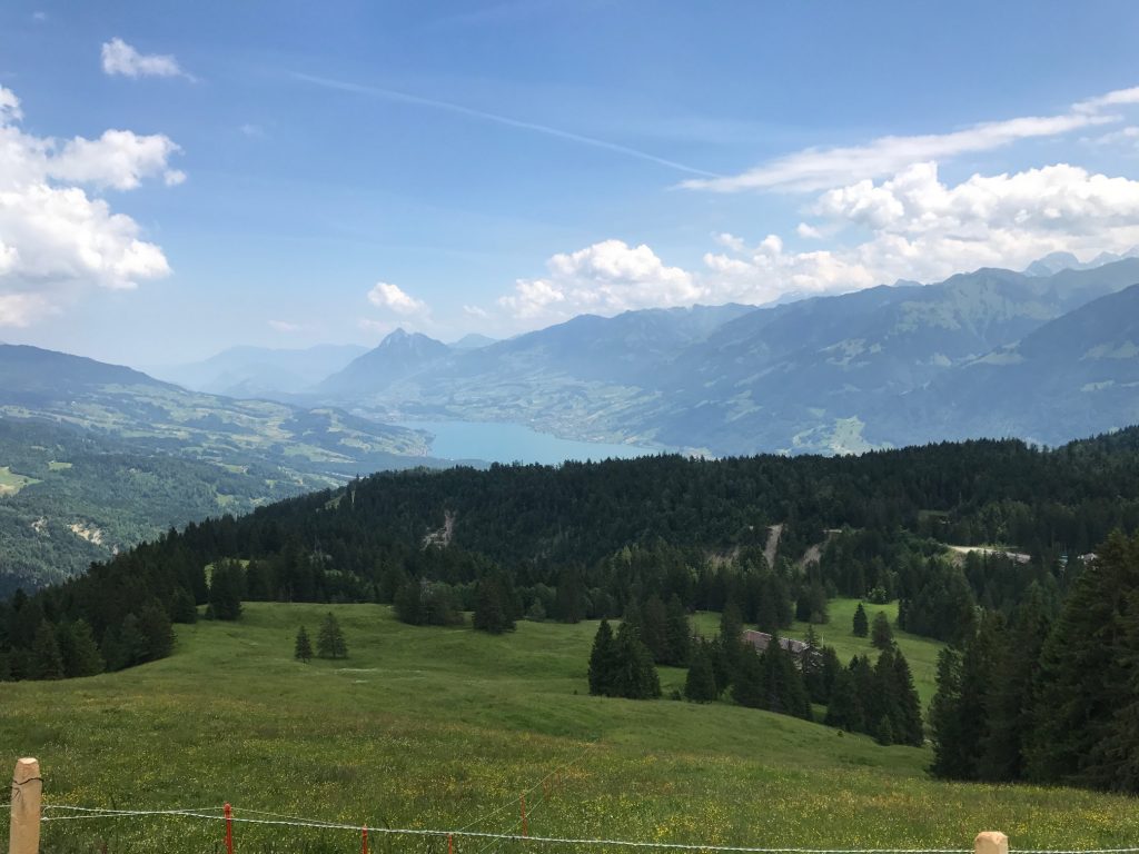
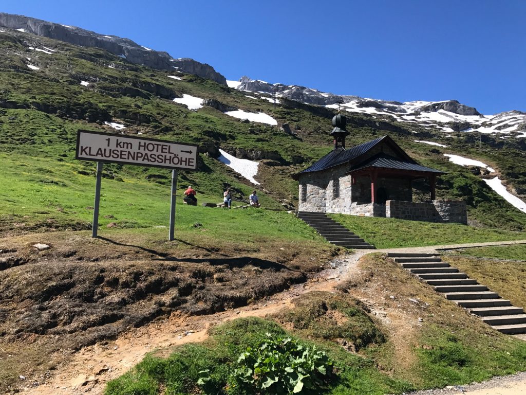
I am blown away at the view of Lake Lucerne and it’s hard to remember what an awesome day in the saddle it was. Or out of the saddle.
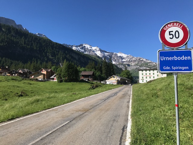
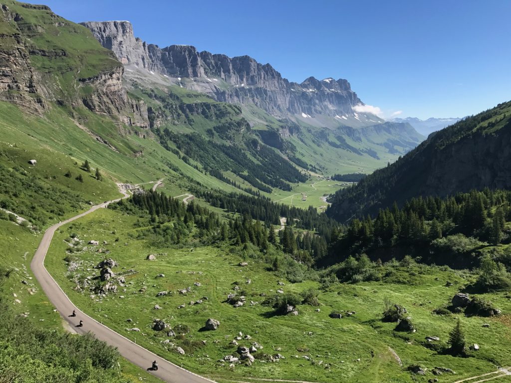
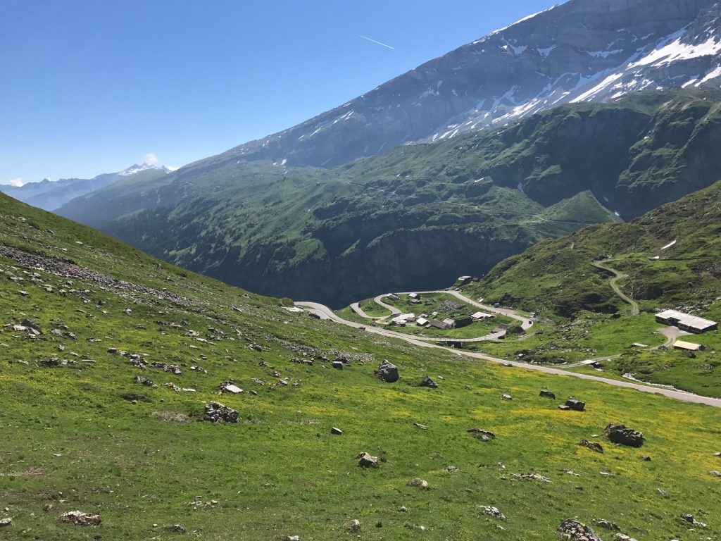
The start of the climb in Linthal
I began my day in Linthal. It was just 55° (13° C) at 8:00 a.m. I put on arm warmers which would last all of about half a kilometer. I was prepared for how tough a climb last night by meeting the couple from Zürich. I saw them this morning at breakfast too. “Tough,” he said.
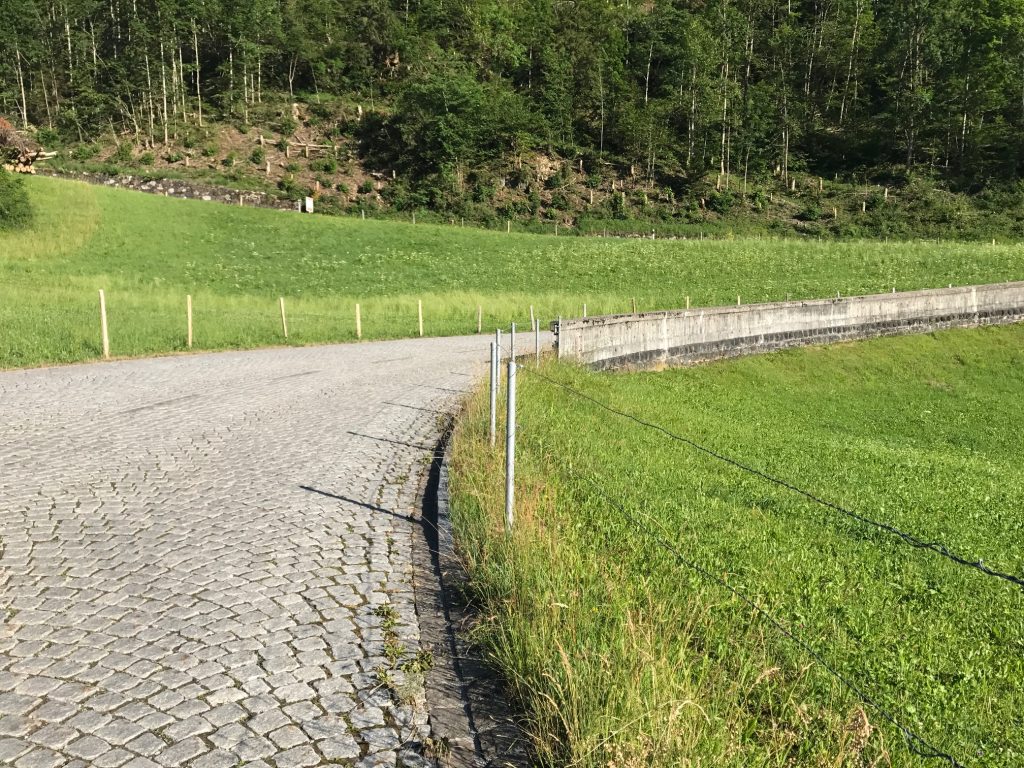
The cobbles would last about 150 meters through the first switchback. Linthal, Switzerland
I would be climbing the Klausen Pass. I studied the route map and knew what exactly to expect. Just not cobblestones.
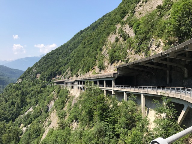
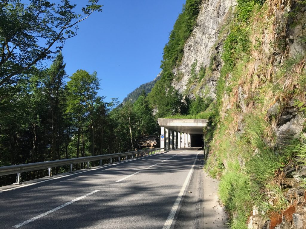
Snow shed
I would normally ride without stopping but I figure this will be the only time I am ever here. So I said I would stop for photos. The first was the snow shed and I also turned on my lights.
Gorgeous snow sheds or tunnels – Linthal, Switzerland
A house with a view – Linthal, Switzerland
The snow sheds had windows to the outside world and breathtaking views. However, I did not capture enough. As I climbed higher I sometimes thought there would be better vistas only to find the road went straight into the forest and I was no longer able to see the valley below.
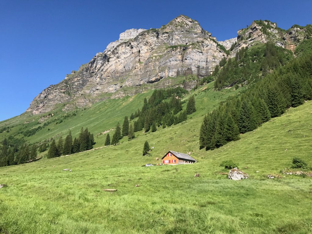
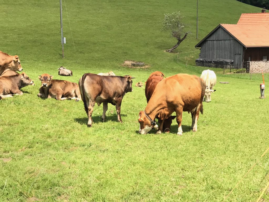
Cows. Lots of cows. – Urnerboden, Switzerland
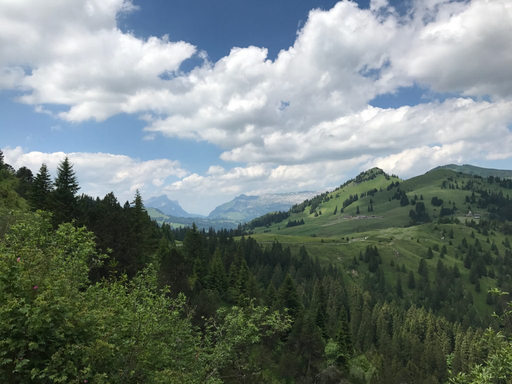
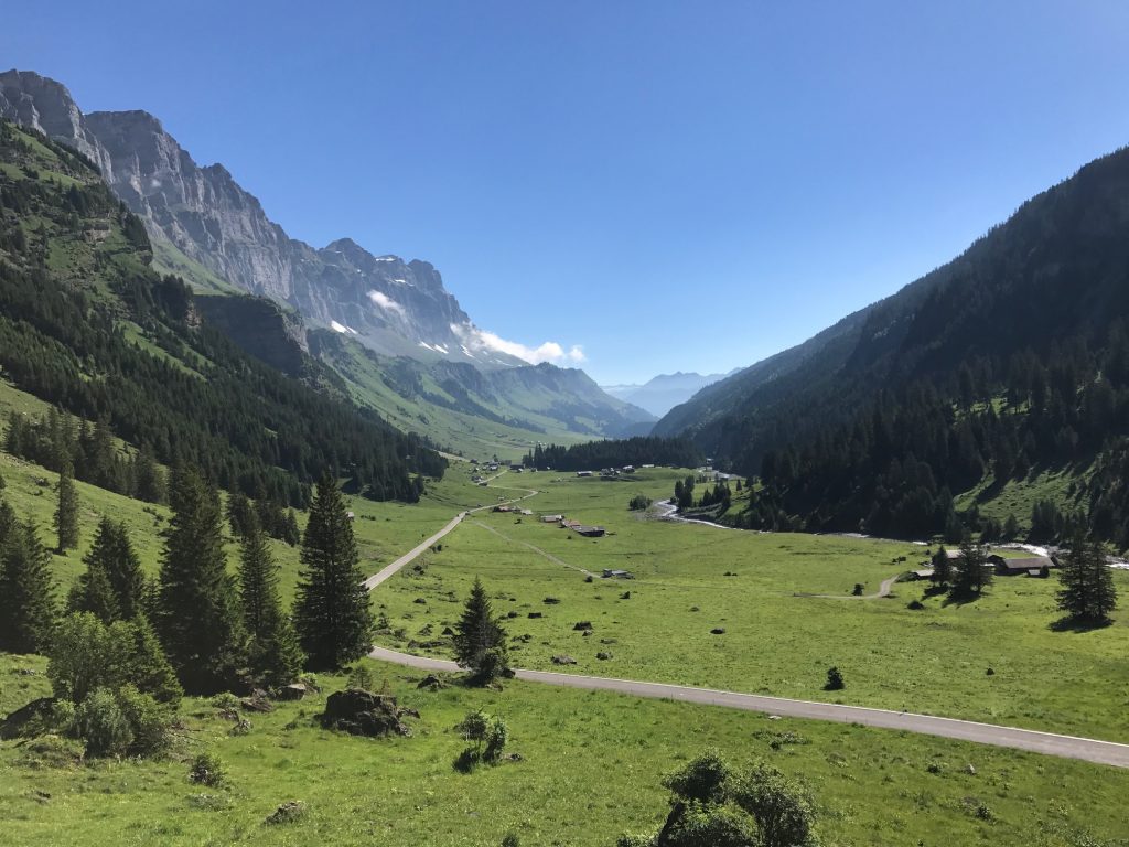
The climb up to the pass was 23 km. At 10 km it was a plateau (mostly), sort of like Big Meadows in Skyline Drive in Virginia. To the right, I could hear the symphony of cowbells playing in the distance. I wondered if they needed a director.
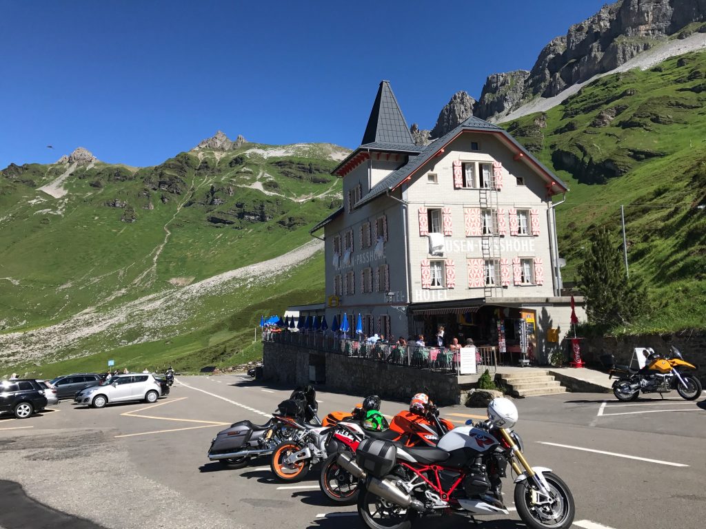
The white building to the right, ahead, is the Wilhelm Tell Hotel – Urnerboden, Switzerland
In the plateau area, a false flat mostly for about five kilometers, are free-range cattle.
Just another gorgeous view – Urnerboden, Switzerland
I would go through a small village of Urnerboden. To the right was the Hotel Wilhelm Tell. I didn’t think much of it at the time but this was said to be the birthplace of Swiss Hero William Tell. (The area, not the actual hotel.)
Urnerboden, Switzerland
The plateau area – Urnerboden, Switzerland
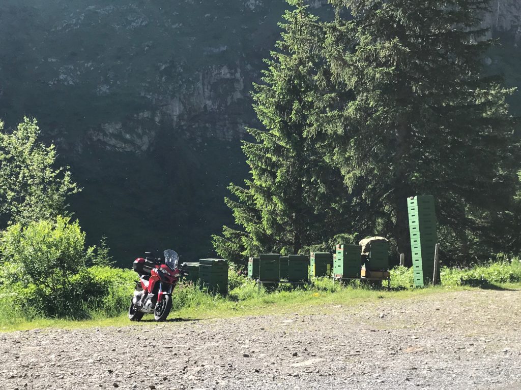
Bees, lots of bees. – Urnerboden, Switzerland
Looking down the road I climbed and three more motorcycles ready to pass me – Urnerboden, Switzerland
After the second section, the road kicked up again to the summit, this time about eight kilometers.
Switchbacks in the final section – Urnerboden, Switzerland
The solitude of the climb was interrupted by motorcycles passing me, one within inches. In addition were lots of sports cars, Porsche, Jaguars, even saw four Deloreans. Unfortunately, many drivers treated this road as their racecourse.
Looking back at the switchback section – Urnerboden, Switzerland
On the climb I passed two cyclists, a man and a woman, and got passed by three, two men and a woman. And 203 motorcycles.
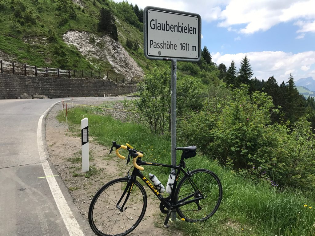
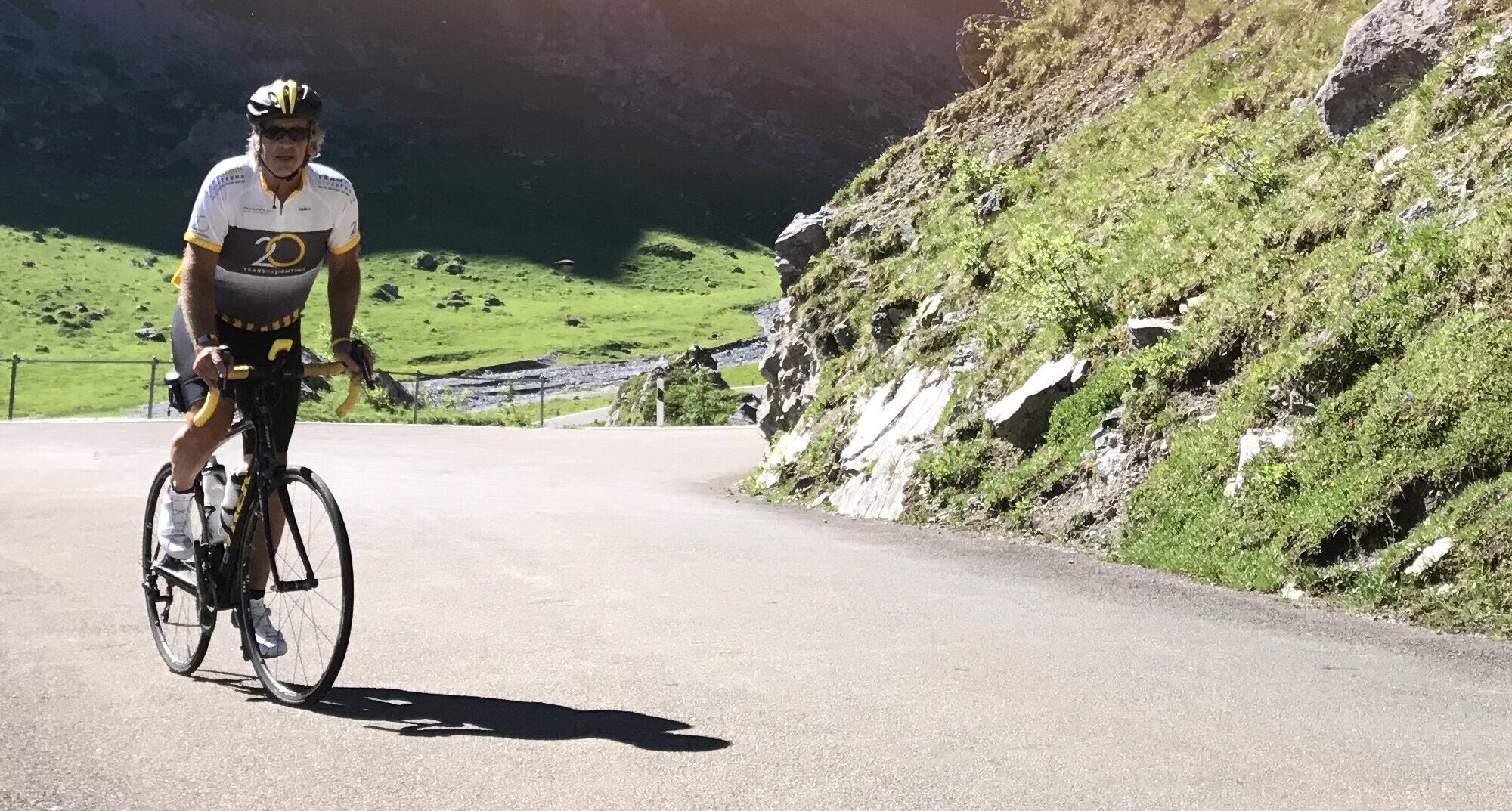
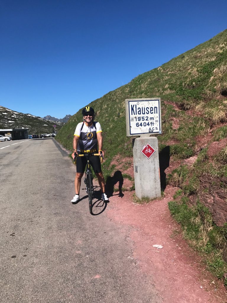
Barry at Klausen Pass
I would characterize the climb as hard but not the hardest. Four climbs: Mount Washington; Hurricane Mountain Road (NH); San Pellegrino (Italy); and maybe Henrietta Road (PA), all brought me to my knees making me think I should quit. This ride never did it. It was just a slog, a 2.5-hour slog to be sure, but I knew I would make it.
At the top – Unterschächen, Switzerland
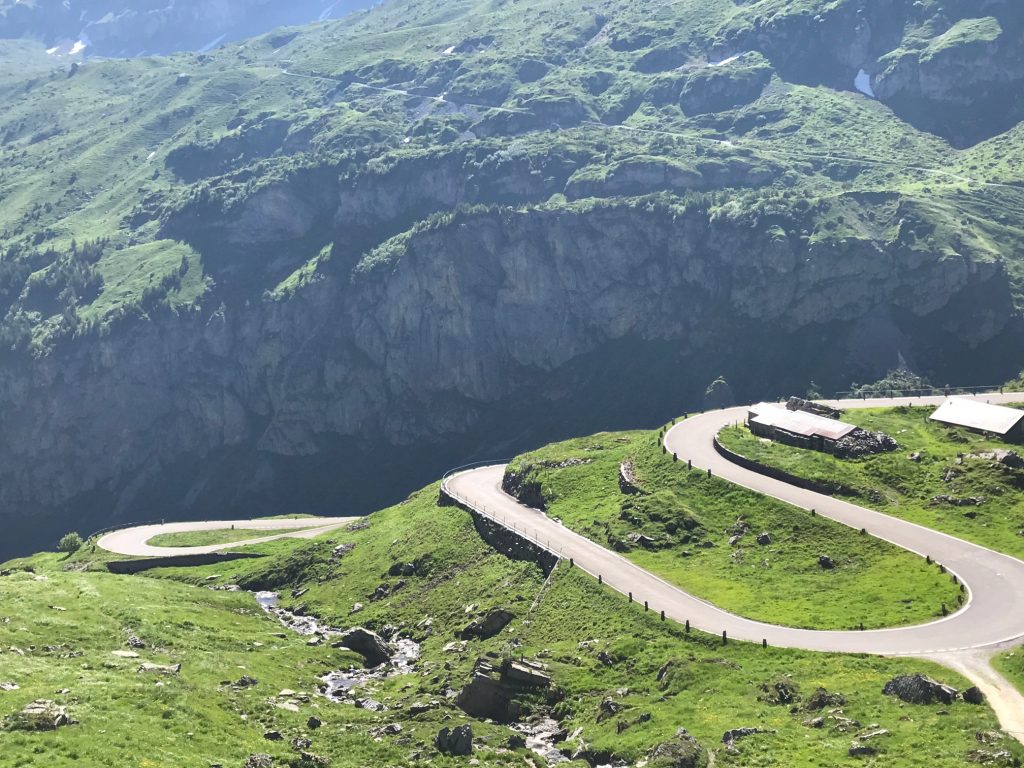
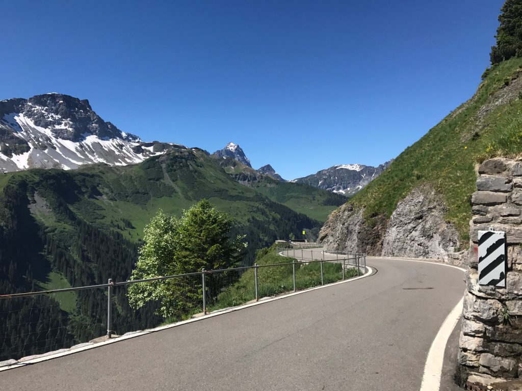
With the hard part over and drenched in sweat, it was time for the easy part of the day. The descent.
On Klausen Pass – Unterschächen, Switzerland
I thought I might bomb the descent but instead took it easy. The words of Wayne Stetina resonated with me when he told me four years ago that he never bombs a descent he hadn’t seen before. I decided I would take it easy.
Descent off Klausen Pass – Unterschächen, Switzerland
I stopped frequently for the views. In addition, the road was too beat up and too windy to let the bike roll.
It’s pretty far down there – Unterschächen, Switzerland
I held the camera and said “Cheese,” a universal word. – Unterschächen, Switzerland
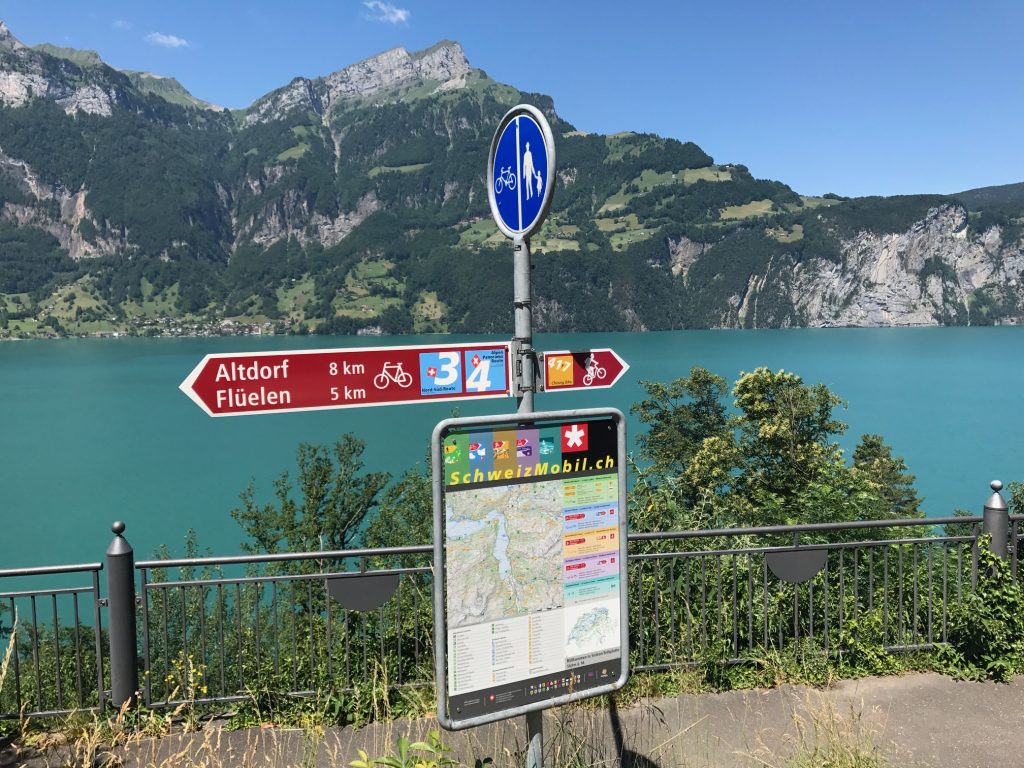
Altdorf, Switzerland
I descended into Altdorf, a beautiful town. And then I saw it. Lake Lucerne.
Lake Lucerne – Flüelen, Switzerland
Leaving town I found the bike path to avoid riding with the cars in the tunnels, of which there were five or six.
Lake Lucerne – Flüelen, Switzerland
The bike lanes in Altdorf were well marked. Once I was in a dedicated lane sometimes it was bike-only and sometimes it was for bikes and pedestrians.
Lake Lucerne – Flüelen, Switzerland
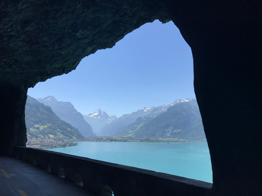
In the tunnels, often the bike lane would go in with the cars and the pedestrian path would be on the outside of the tunnel, high above the lake. Sometimes the bike lane would be outside as well. Simply gorgeous.
Lake Lucerne
The one thing to watch out for is bike paths could become sidewalks without notice. And there are penalties (fines) for riding on the sidewalks.
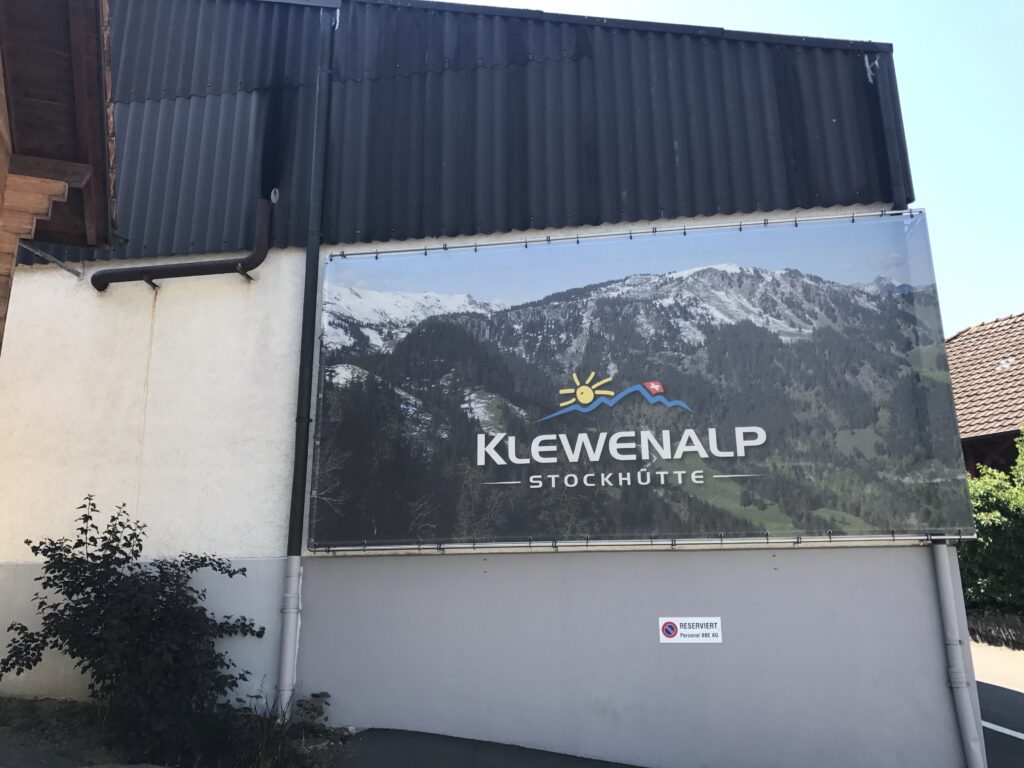
Klewenalp, Beckenreid, Switzerland
As the road got closer to Brunnen it was harder to determine where the bike lane was. But I managed to find my way, at times following two locals (I presume they were local).
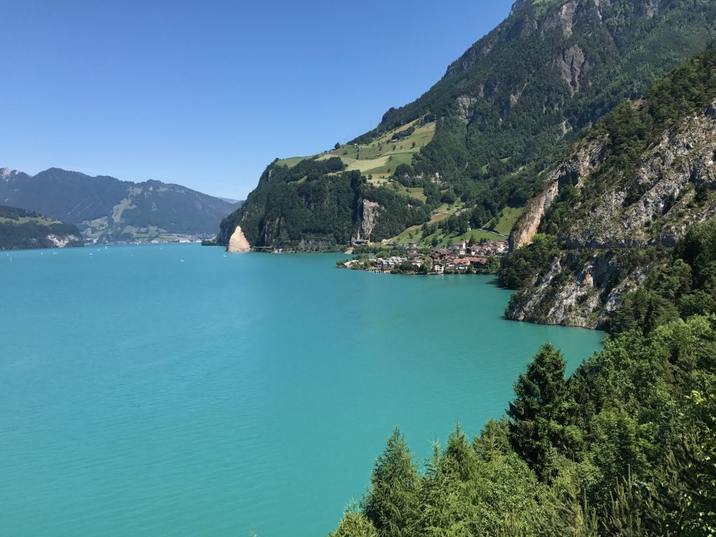
Lake Lucerne – Sisikon, Switzerland
Lake Lucerne – Brunnen, Switzerland
Brunnen, Switzerland
The signs in Brunnen, Switzerland
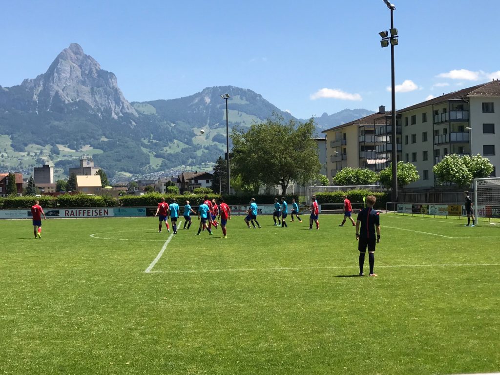
FCB – Brunnen, Switzerland
I came to a small stadium for FCB (Footballclub Brunnen). Either it was too late in the match to collect admission or the game was free but it was free for me. I wanted to see the referees of which there was one. Two thoughts: I was surprised they were using just one referee and my refs in Woodbridge are better.
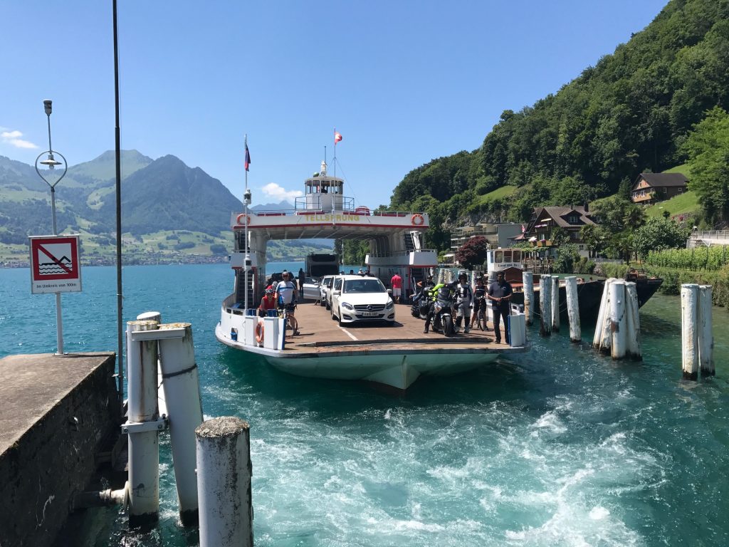
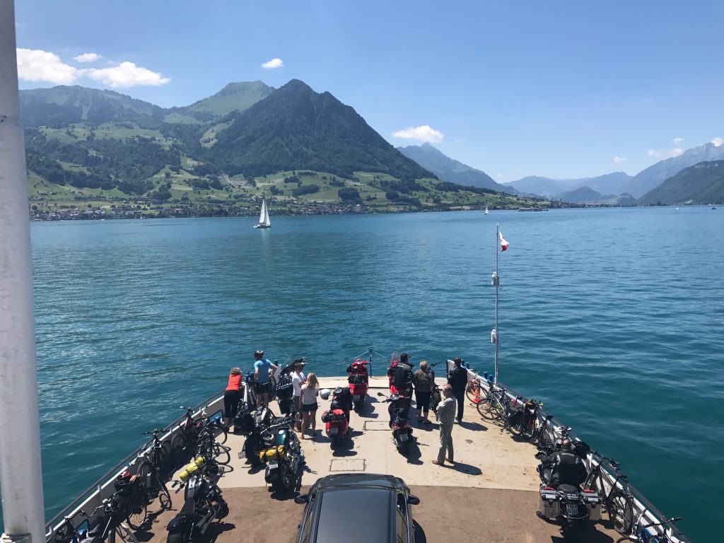
Ferry at Gersau, Switzerland
The rest of the ride was lakeside to the ferry at Gersau. What a beautiful road.
Ferry at Gersau, Switzerland
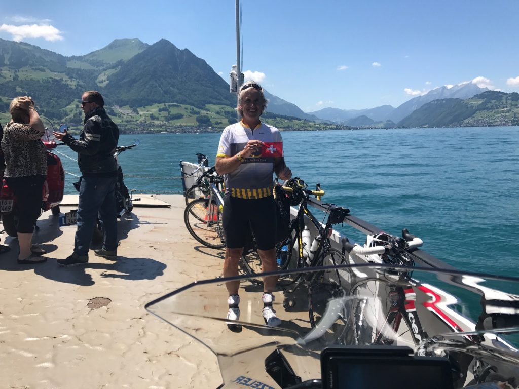
Onboard I saw a cyclist. Everything about her could have been American. She was on a Cervélo bike (which is Canadian and more likely in the U.S. than Europe), wore a Specialized kit (based in California), rode Speedplay cleats and had a Garmin 500 GPS. But she was a local who ride halfway around the lake (60 km) then took the ferry back.
Barry on Lake Luzerne
Disembarking at Beckenreid, I saw the hotel and rode right past it, looking for the Klewenalp. This where Ashley and I went with Ben Z. seven years ago.
Ferry from Gersau to Beckenreid – It was so enjoyable riding along the lake in Beckenreid.
Lake Lucerne
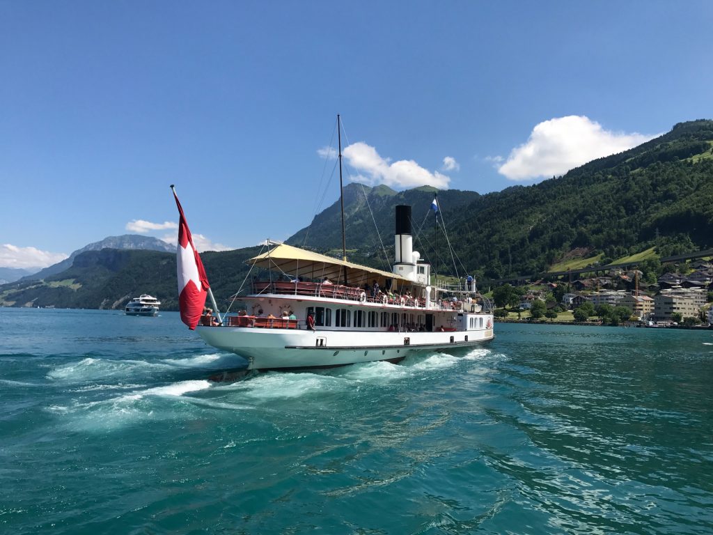
I found it, then bought some ice cream and watched the paddle steamer. We rode that boat in 2010.
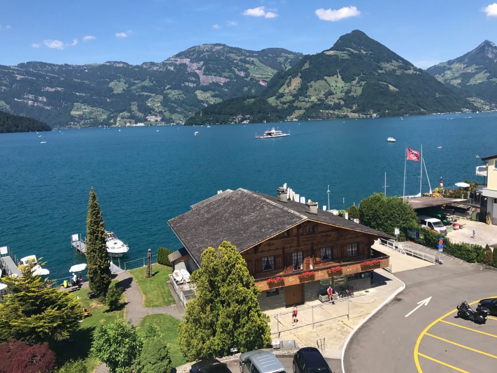
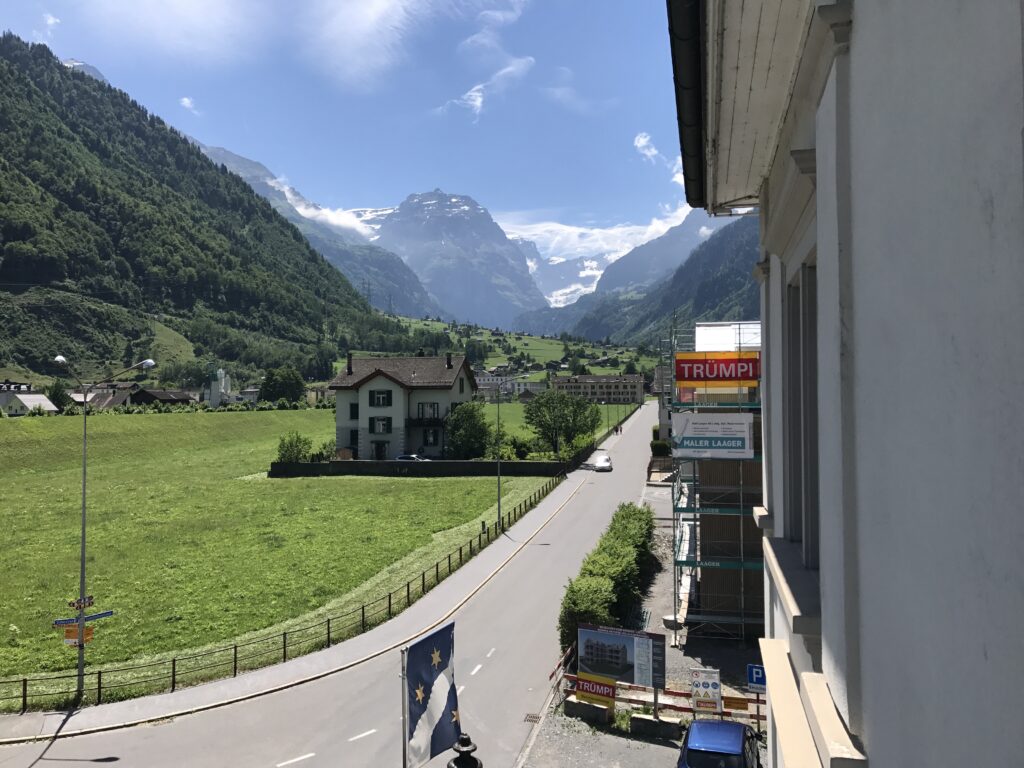
View from my hotel room – Beckenreid, Switzerland
Only then did I check into the hotel. I was told when my luggage was dropped off the guy wondered if I beat him. He said I always do. I didn’t know it was a race. But actually I arrived an hour earlier and had spent the time riding around. Tomorrow he doesn’t stand a chance.
It was a warm (hot) day. The hotel had their own private beach access to the lake. I went down and dove in. It. Was. Cold! I forgot I was swimming in glacier water. I did not stay in the water more than 10 minutes.
Dinner at the hotel
In addition to first class accommodations, the staff here was the best I found in Switzerland. There’s not too many places I would say I must return to but I would love to return here.
Breakfast this morning was at Hotel Cafe Huber in Lichtensteig. As I finished the owner came went to the bakery and gave me some bread to take with me. That was very nice.
Breakfast at Cafe Hotel Huber. Orange juice and sparking water would be added.
There would be two issues to deal with today. I never get saddle sores but developed those yesterday. Although better, they would stay with me today. And second, those signs…
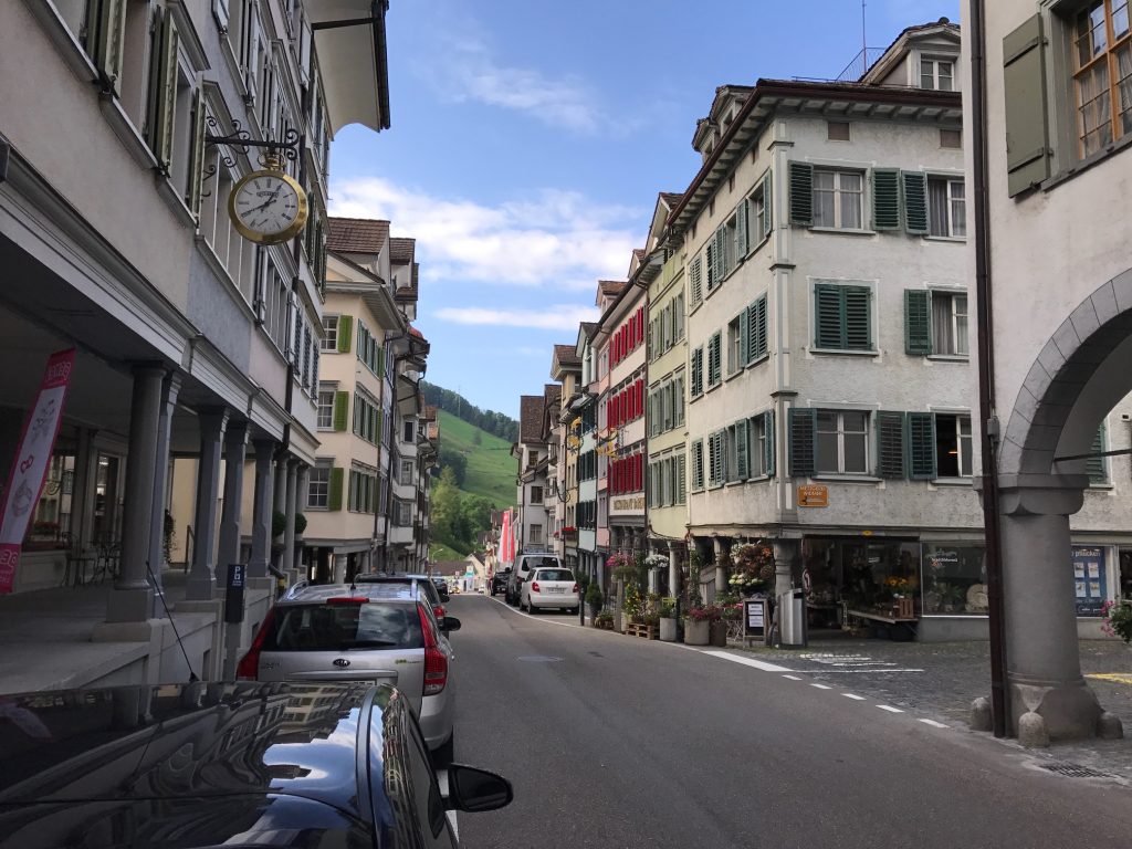
Lichtensteig
Or more accurately, lack of signs. On a cool morning, I rode downhill to Wattwil. That was my reward for riding uphill to Lichtensteig yesterday.
A view from Wattwil
When I came to the town I turned on the main street to follow Bike Route 4. I also had uploaded the route to Garmin. I had gone no farther than one kilometer when Garmin told me I was off course.
Bike Route 4 – to Zürich? (Wattwil, Switzerland)
I turned around and went back into town. I went another way when I saw the blue Route 4 sign. I lost that trail too. I turned around.
The start of the day’s climb. It’s steeper than it looks. Wattwil, Switzerland
I decided to follow my Garmin no matter what. Leaving town I turned on a road that was not marked with a sign. About one kilometer later, I had to turn and there was the sign. I was on the right route after all.
A cyclist farther up the hill. I would catch him. Wattwil, Switzerland
Two or three or 10 times during today’s ride I chose to follow Garmin where there was no sign. Eventually, I would be proven right. In contrast to yesterday, I did not ask anyone for directions today.
Hey look! Frisbee game ahead. Wattwil, Switzerland.
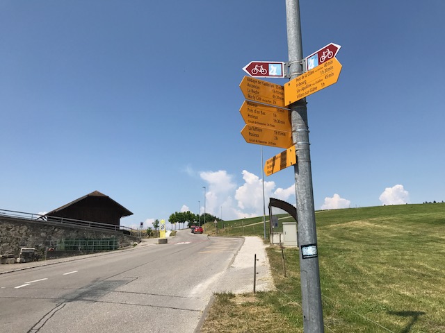
I had already decided that it would be next to impossible to follow this route solely by depending on the signs. They simply are not everywhere they need to be. I would not say the route is well marked but “pretty well” marked. Maybe best in the world but could be better.
Kaltbrunn, Switzerland
I had studied my route today and knew leaving town I would have a climb. Not too tough (compared to yesterday) and then a descent. The map showed flat or a slight climb the rest of the way. And that played out as expected.
Ricken, Switzerland
The descent offered gorgeous views of Lake Zürich (or perhaps that is Obersee, the “Upper Lake” portion of Lake Zürich) in the distance and the mountains ahead.
Flat farm roads ahead. With nice views. Benken, St. Gallen, Switzerland
At the bottom of the hill, I lost the signs and went with Garmin. I turned on a narrow road that was flat and straight. It was the right direction.
Schänis, Switzerland
I was just 25 km in (15.5 miles) and the rest of the day would be flat to trending upward. I would also be on these narrow roads with no traffic although occasionally riding back on a highway.
Where one of the Rte 4 signs leads. This river comes from Lake Walen. Bilten, Switzerland
I came to one turn for Route 4 and it went down to the river and followed a gravel road. I stopped for a snack from my pocket then waited at the top to see if any road cyclists were on this path. One coming in my direction looked at it and exclaimed in German “they must be crazy if they think I’m riding on that crap.”* He then headed straight and I decided to follow him.
Näfels, Switzerland
Along open road were just cyclists and walkers. I didn’t see any runners. And horses.
Näfels, Switzerland
I saw a young man, Marcel, and stopped and asked if he would be my photographer. I wanted a picture of me on my bike with the mountains in the background. He agreed.
Mugging for the camera with a Swiss flag. Näfels, Switzerland. Those are the Alps, not the Rockies.
Marcel and I had a nice conversation of at least 10 minutes, maybe 15, standing alongside this wonderful path. Well down, my friend!
Marcel – Näfels, Switzerland
I really can’t offer much more. The route signs were pretty good but not perfect. But the weather was perfect.
Netsal, Switzerland
At Glarus Süd there was a festival in progress. The bike route was blocked with signage to take a different route to Linthal.
Ennenda, Switzerland
I figured if the route to Linthal was marked, why not take it, but another couple came by and went passed the closure. So I followed them.
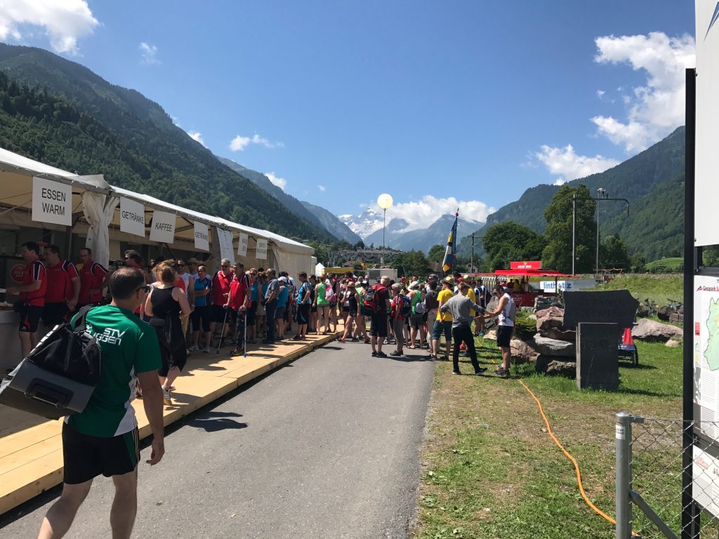
Festival in Glarus Süd, Switzerland
I was glad because I don’t know if I would have known how to get back on Bike Route 4 and it was a great alternative.
Glarus Süd, Switzerland
As I made my way through the people, one woman said “Nice velo.” I liked that!
Leuggelbach, Switzerland
I found myself pedaling slower than normal, a little in part due to saddle sores but mostly because my eyes were constantly scanning the scenery. No need to race this route and fly by. And it was a short day.
Hotel Bahnoff, Linthal
My hotel in Linthal is Hotel Bahnoff. It has a much larger room than the Hotel Huber and the Wifi is pretty good. Time to catch up and study tomorrow’s route as well.
Linthal, Switzerland
POSTSCRIPT: At dinner I sat out on the patio at the hotel. One table over came a Swiss couple who had just hiked whatever pass I am climbing tomorrow. They are from Zürich. We had nice conversation all evening during dinner.
Dinner at the Hotel, Linthal, Switzerland
___ *Ha! I have no idea what he said but that was certainly the gist of it. Seriously.
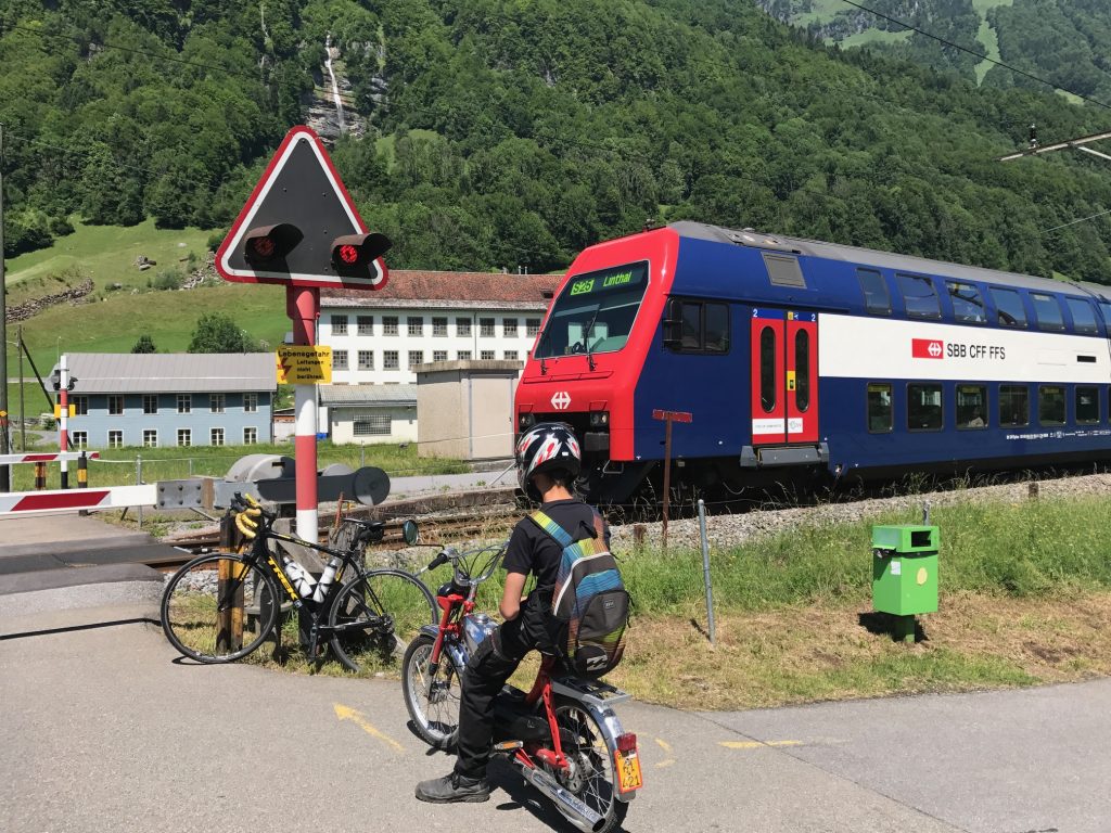
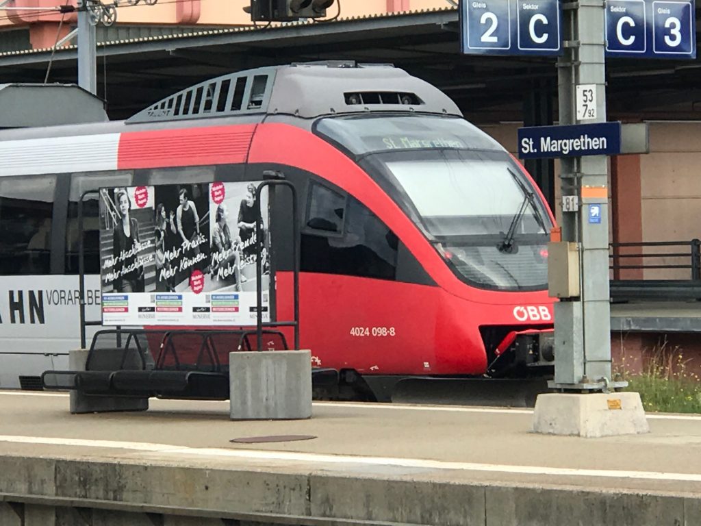
Today was the start of my Panoramic Alpine adventure. My friend, with whom I was staying, got up earlier than normal and took the tram to the train station in Zürich with my suitcase while I biked there. I beat her.
Train to St. Margrethen
After I boarded the train I thought I saw no identifying marks on the train and wasn’t 100% sure if I was on the right one. I thought I had remembered boarding on Platform 8 and we went with that. I wonder how many people board the wrong trains and don’t discover it until they are underway?
The Austrian side of the River Rhine
I arrived St. Margrethen then found one guy working behind the counter. I explained that I needed to leave my luggage at the luggage counter. At first, he didn’t understand but then took the bag to his backroom. I wondered all day if it would be delivered to my hotel.
Well hello Austria!
Jumping on my bike I went exploring for a gateway to Austria. The one I had mapped out I didn’t find but found another. After asking two policemen if it was safe for bikes, they showed me a bike path on the bridge and I quickly crossed the River Rhine. The river was much smaller and narrower than I anticipated.
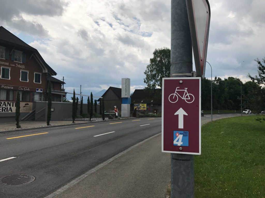
The first Bike 4 sign I found
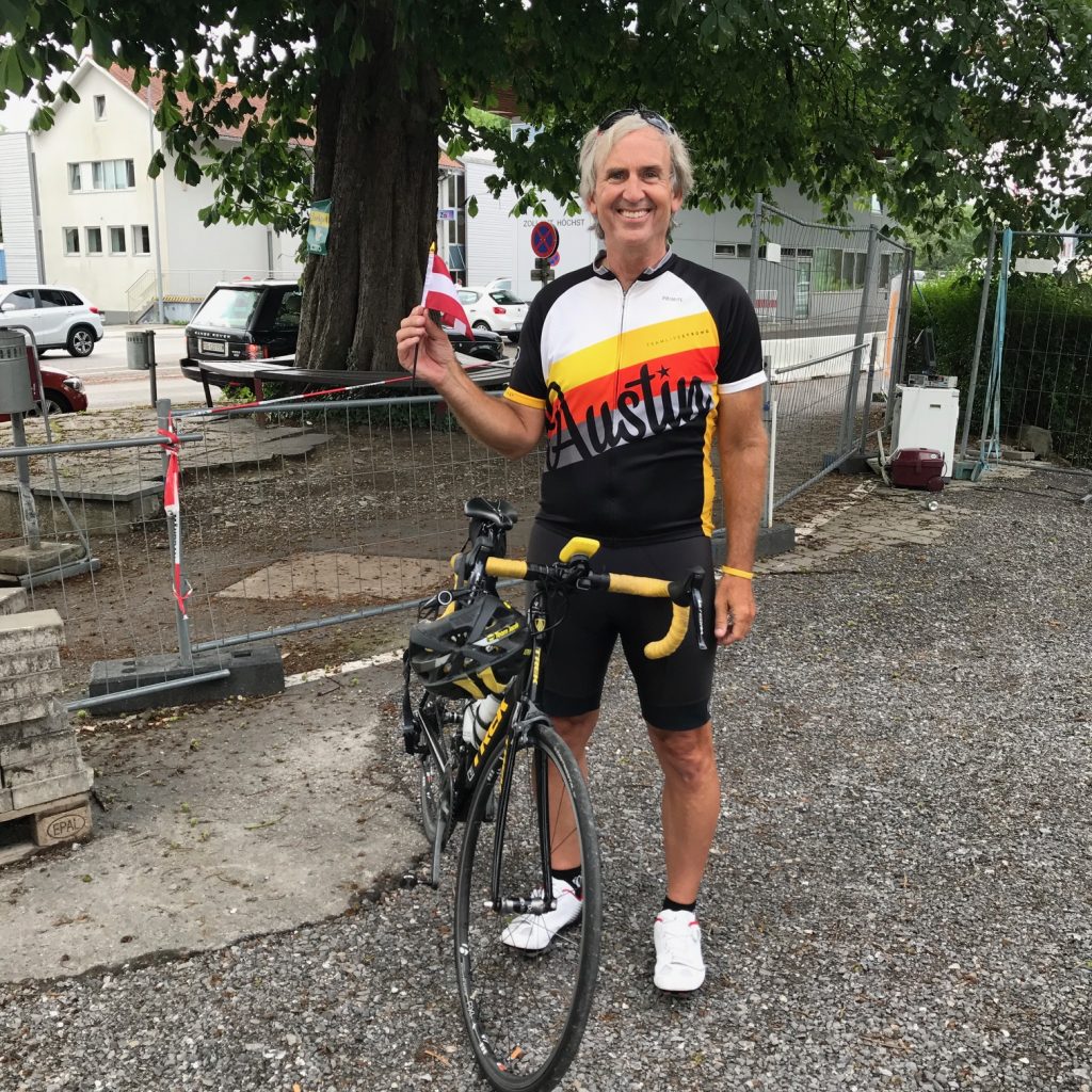
I found a willing participant to take my photo with an Austrian flag, then gave her the flag for her son. I then crossed back into Switzerland to begin my journey. Time spent in Austria: 15 minutes.
Bike shop in St. Margrethen
There was but one problem. And I hoped that it would not be a huge problem. Actually it wasn’t huge other than causing me a lot of angst. A lot.
On the first climb
I mapped out the ride on Ride With GPS but forgot to upload it to my Garmin. Stupid me. I planned to rely on Garmin today for directions. The hardcopy maps that Eurotrek provided me were in my checked luggage. At the train station. I would have to follow the Bike Route 4 signs.
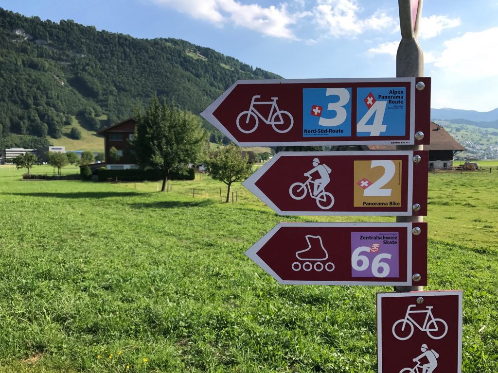
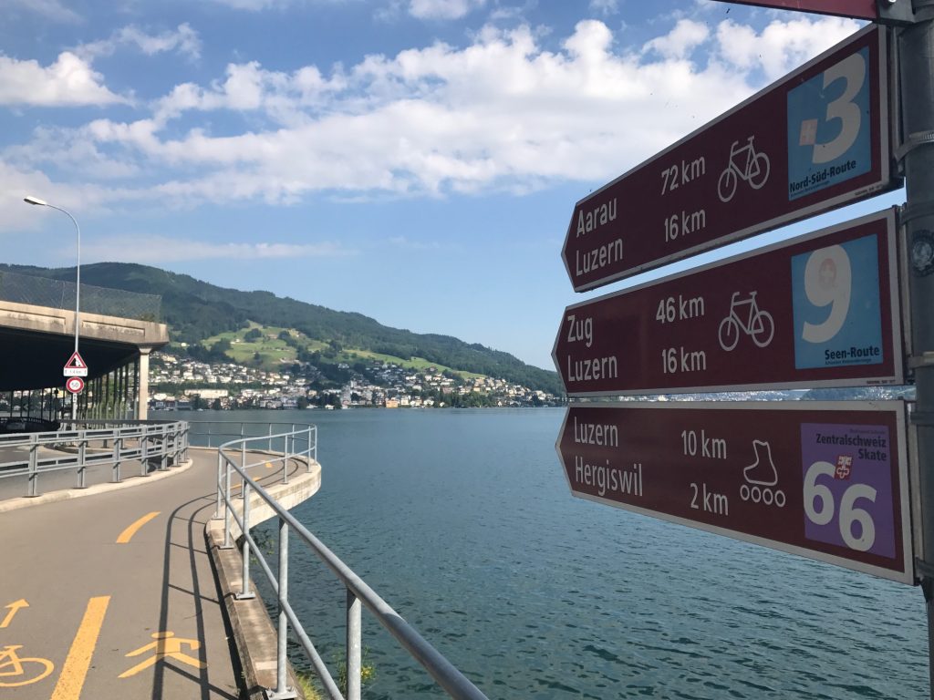
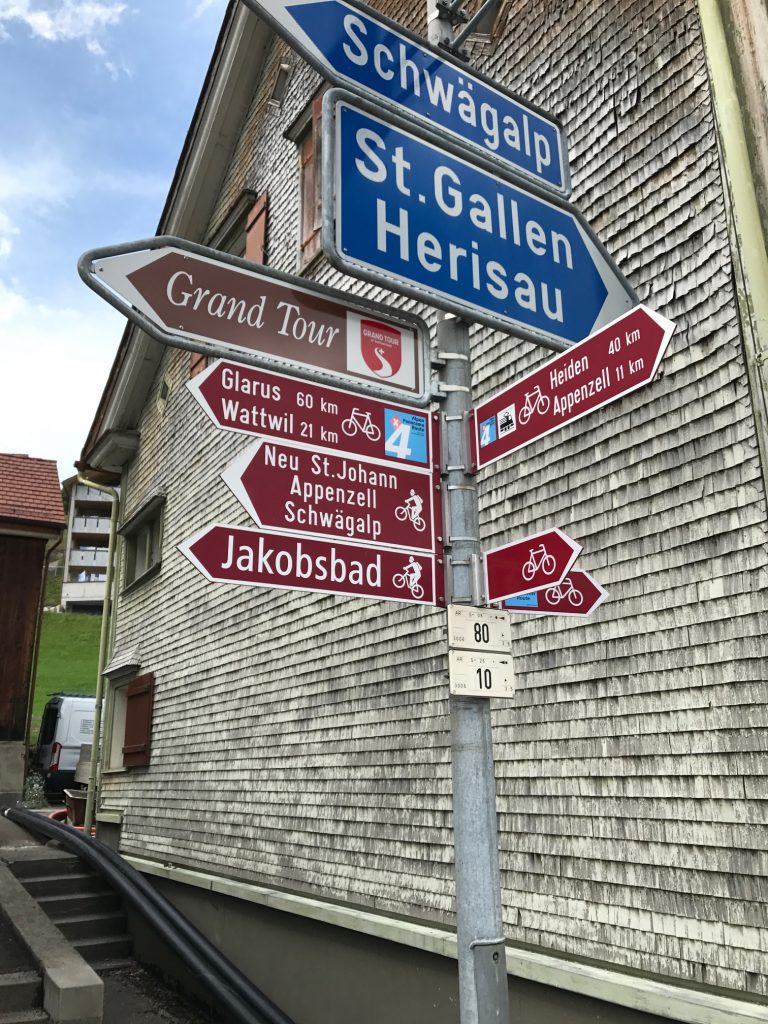
Panoramic Alpine Route 4 is a road bicycle route that is marked across Switzerland. My tour papers said it is well marked. I say that it is not.
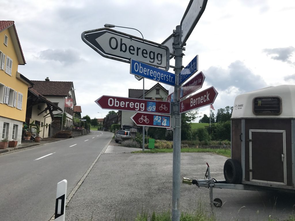
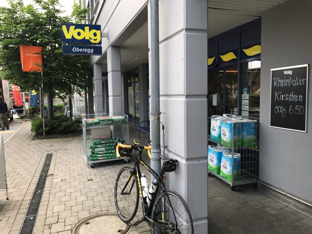
Street sign in Oberegg. I did not get to descend this one.
I found the first sign for Rte 4, followed it, then quickly lost it. In St. Margrethen. I came to an intersection and there was no sign which way to turn. I turned right. I did a loop.
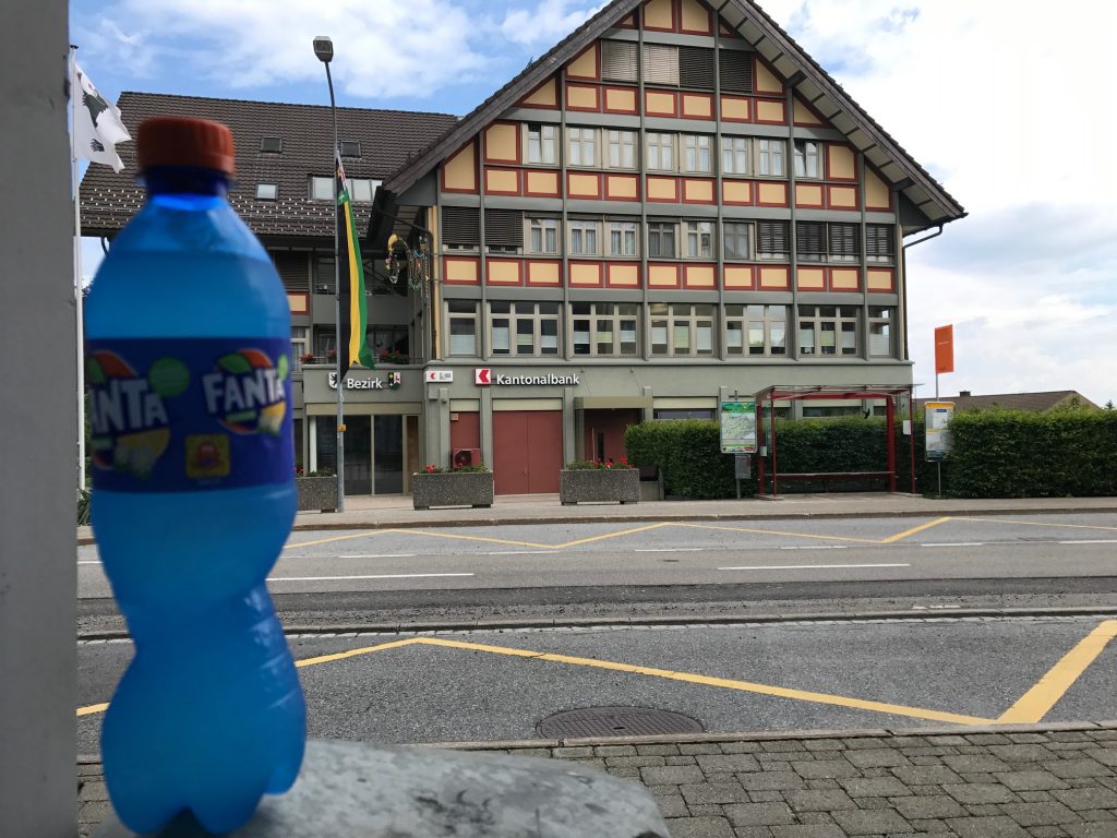
Stopped for water and thought I’d try this blue Fanta even though I don’t drink soda. I still don’t know what that was.
I saw a bike shop that were authorized dealers for Trek. I didn’t see any Treks inside. I asked them where to pick up the route (1). They sent me back on the loop I just did. They did not seem real interested that I stopped in.
Oberegg
I came back to the same spot. This time I went straight. Eventually I saw another sign. I was on the right road after all.
Water stop in Oberegg
Leaving St. Margrethen I turned onto a side street, if a mountain road with switchbacks is a side street. For the next seven miles I would be climbing while profusely dripping with sweat. Much of the climb seemed to be 10-12%. I won’t say I wasn’t prepared, I will just say I wasn’t expecting that. OK, I wasn’t prepared.
Cows playing bells
Climbing through heavy forest I welcomed the sound of cow bells. Lots of them. I didn’t welcome the smell of cow manure. Lots of it. But I guess that comes with cow bells.
I kept my eyes peeled throughout the ride for more signs. Mostly they were there but sometimes they were not or perhaps perfectly hidden. In one small town I completely “lost the scent” and asked a young man on a bike (2).
He knew nothing about Rte 4 but suggested I go back to the traffic circle and this time go straight. I came to a T and there were the signs. He also told me I may have to “Ask (my way) Across Switzerland.”
Trogen
Actually, absent any signs one would assume to go straight so that one wasn’t a problem. It’s where there were turns but no signs.
Maybe an ancestral home for me?
In Appenzell I last saw signs right before I reached the town but at the traffic circle there was nothing. So I went straight. I only went a few blocks and ran into two cyclists, apparently local, who knew nothing about this bike route (3).
Teufen
I went back to traffic circle and saw nothing. But I did see a police sign so I went to the police station and asked them (4). They knew nothing about the route but they knew Google maps. They printed out a map for me. But I still didn’t know how to get out of town.
Appenzell
I saw a bike shop and stopped (5). The owner vacations in Fort Lauderdale and was very gracious. He filled my water bottles and told me how to get to next town. I followed his directions – 1km and turn left – and those worked.
Bike shop in Appenzell
As we talked he told me I would turn left then go up this “little hill.” It was a mountain! Actually, looking at it now that I did it, it was only a mile. A little hill.
Appenzell
But going off course in Appenzell actually worked out. I saw some neat shit I wouldn’t have otherwise. The town center is pretty. Horses came by and one dropped a load. One of the staff grabbed a shovel and bucket and cleaned it up in less than one minute than ran and jumped back on the wagon.
I went seven miles to the next town, Urnäsch and came to a T. There was the Rte 4 sign and I had been on it the entire time. Not only didn’t I know it but I figured my bike friend just got me headed for Wattwill the best way he knew how.
Urnäsch. I was on the right road the entire time.
Maybe with so many miles in my legs made the last section seem the toughest. Near Hemberg I had been descending when I turned and started down another descent. I didn’t know this one would bottom out and throw another nasty ascent of a mountain at me. I had had enough.
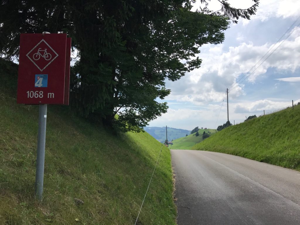
I guess this was the high elevation for the day. It was the only marker I saw about altitude.
On my scale of 1-10 for difficulty, a 10 is can’t or won’t do it. A 9 is have to stop but will carry on. An 8 is lots of swearing at the mountain. Today was an 8. A solid 8.
I got to Wattwill where I had to ask two more people directions (6,7). They were in front of a post office soliciting people about swimming pools. That’s not happening in front of a USPS office.
My hotel in Lichtensteig, Switzerland
They were both early 20s so I figured, correctly, their English would be superb. And it was. They directed me the last four miles (although they teased me with 4km) but I checked into the Hotel Huber. No A/C (still waiting for mountain air to cool down – it will) and WiFi only worked if I left my bedroom door open. But the bed is comfortable and that is what I needed most. And my luggage did arrive.
L’Angolino Pizzeria, Lichtensteig, Swizterland
In the end, it was a pretty hard day. It was made even worse by not having directions or a map with me. I ended up asking seven people in my Ask Across Switzerland tour. Dinner was at the L’Angolino Pizzeria and then off to bed – with the door open for Wifi and air circulation.
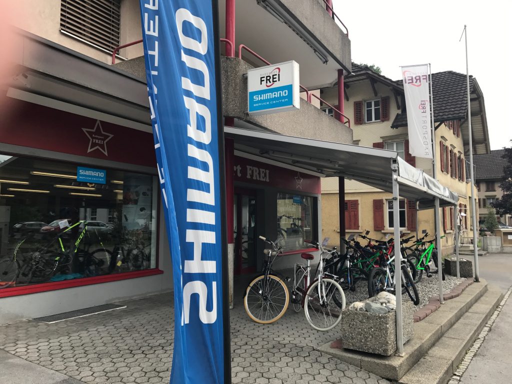
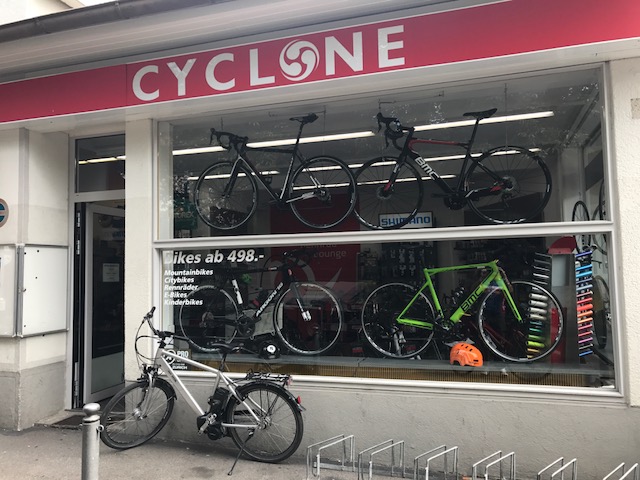
I arrived yesterday and quickly built my bike. Something was wrong. I felt a rattle in the fork although things were tight. I caught up to a cyclist at a light and asked for a bike shop.
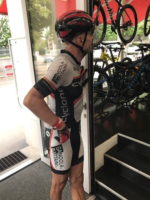
Unknown cyclist but nice guy who towed me to Cyclone Bikes
He took me to Cyclone Bikes where a young woman wrench (that’s cyclist talk for a mechanic) told me I simply had tightened the screws on the fork before the top. I just needed to reverse the order. I did and felt ready for the Alps. I also bought a CO2 cartridge.
Things worked perfectly after that and my exploring and warmup would be finished for the day. I went back to the apartment of [Friend] who graciously let me store my stuff while I biked across Switzerland.
Today was a beautiful day, I tried to map a ride which would do more than circumvent the lake although that looked like a nice ride. I added some of the hillier terrain in town.
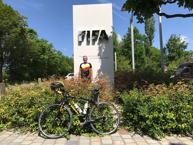
My plan was to head up to the zoo which is next door to FIFA headquarters. From there I would stay north of lake before coming back to it at its southeastern end.
From downtown I started climbing immediately. It’s about two miles all uphill all the way to the zoo. I visited the FIFA HQ then could not have Garmin pick up the way out of there. With the lake as a landmark, I started back towards the lake, although sooner than I wanted to.
Hotel Restaurant Erlibacherhof
But the route along the lake is nice. I came to a ferry, which took me by surprise. I should have adjusted but I didn’t.
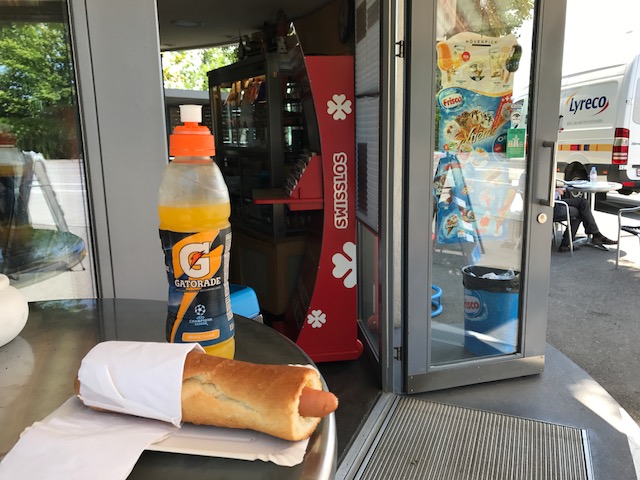
I went to the Kiosk concession stand by the ferry and had a nice conversation with the woman making me a hot dog. I admired the ferry and she said I should take it. I told her I was going around the lake and that would cut my workout short. What she should have done is what I thought of as I rode back towards Zürich.
She should have suggested that I cross the lake on the ferry then ride south back up to the ferry on the east side. Take it back over and complete a figure eight. In other words, I was going clockwise and could cross the lake then go counterclockwise back to the ferry and cross again, finishing clockwise. A perfect figure eight.
Instead I crossed at south end as planned and as I was riding up the west side of the lake I thought about the ferry more. When I got there I went to the front of the line and never made my final decision until the ferry worker waved me on. So I did an over and back. Same distance but not as sexy as if I had one a figure eight.
I really enjoyed the time crossing the lake but it would have been better one quarter of the way across and again at three quarters of the way.
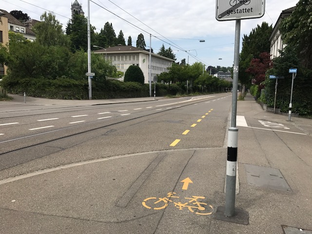
When you ride on the streets in Zürich there are sometimes bike lanes which is basically 1/4 of the full lane. Sometimes the lane ends abruptly and directs you up onto a sidewalk for a few meters or a couple hundred. Some are marked better than others.
Transition from walk to bike lane
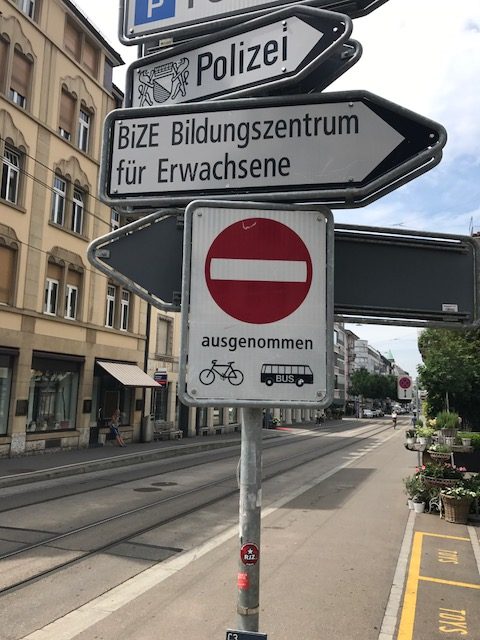
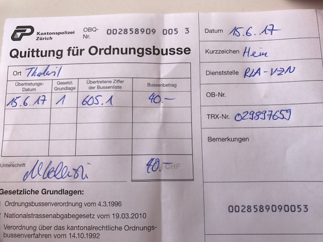
[Friend] had told me horror stories her cyclist-boss had said about the police. They set up traps and wait. I found one.
Going uphill on the lake road, I came to a construction zone. There was a red light and I was first at the light. To go, I would be first and slow up a hill, holding up traffic. There was no bike lane because of the construction.
To the right was a bike path. So I thought. There was nobody on it as far as I could see and it looked like any of the many bike lanes I had seen. I rode up it when I heard someone calling. It was a policeman. I suspect I could have ignored him (not heard him) but I went over to him.
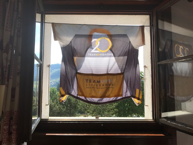
He started speaking Swiss-German which I did not understand. When it was apparent, and I was wearing my AUSTIN, TEXAS Livestrong jersey, he switched to English to tell me I was on a sidewalk. I apologized, told him I truly didn’t know, and hoped that would be end of it.
Instead he said that would cost me 40 CHF and asked if I had cash. I did not. But he would take a credit card. He explained how on a bike I might hit people. I started to ask “what people?” (there were none) but thought better of it.
I was pissed. I tried to do everything right and police should have some discretion to educate and not just punish. But he was young and perhaps hadn’t learned when to bend. He got his 40 CHF and left me with a negative feeling about biking in Zürich.
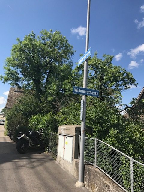
Nearing the apartment I turned on Widmerstrasse (or the street leading to it). I went under some tracks and there was a couple walking bikes. Strange, I thought. The road kicked up a little for 25 meters.
Couple pushing their bikes up the street with steps
And then it turned hard right. And straight up. I couldn’t even look down at Garmin. My guess is more than 25%. On my left the sidewalk was steps. Steps!
I think DO NOT ENTER except Bikes and Buses. I think.
I was less than two km from the apartment then went and sent [Friend] a text about my adventure. Told her that I told the cop I knew a good lawyer but they didn’t know her. She laughed at me.
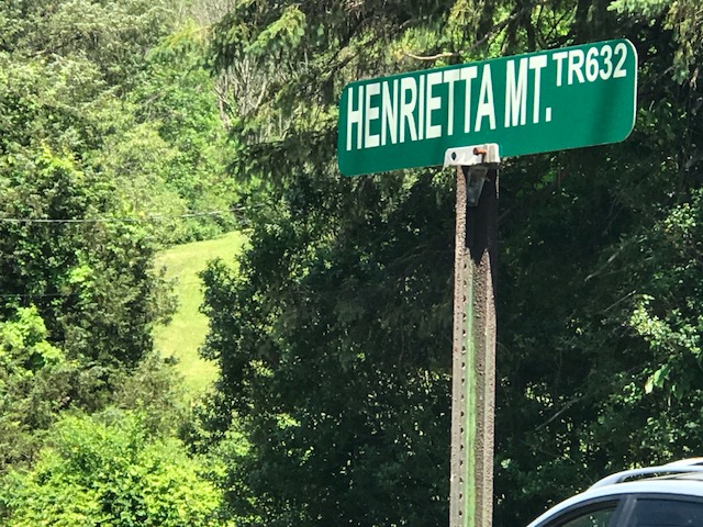
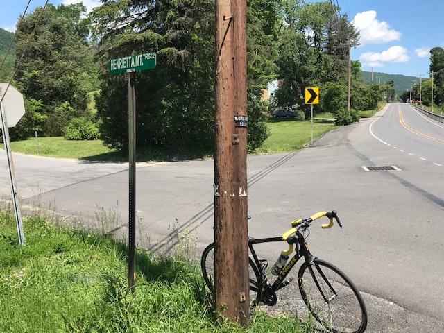
Probably eight years ago I asked some riders from Altoona what the hardest climb in the area was. I was thinking Blue Knob or Horseshoe Curve. One rider told me to find Henrietta Mountain Road. And today I did.
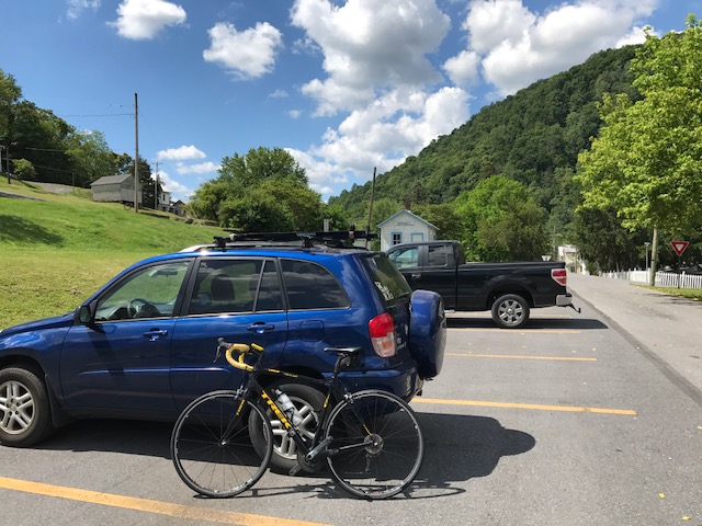
Parking at Hopewell
This was was tough. Although it wasn’t too long, just two miles. It’s always hard to compare climbs but I can compare it to some other two mile climbs or sections I have done.
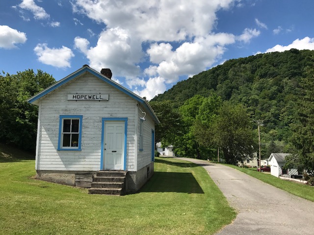
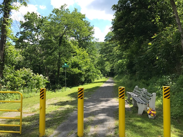
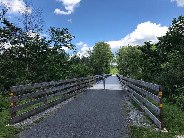
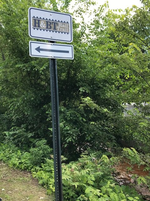
I started my ride in Hopewell (Bedford Co.) on the H&BT rail trail. More on that later.
At Saxton I found the infamous Henrietta Mountain Road. I did no research and instead, just rode. It seemed to kick up to 7-8% right away. But after a quarter-mile just past an intersection, the real climb began.
Henrietta Mountain Road and intersection with Rte 164
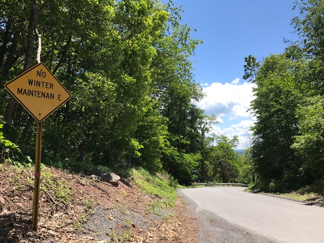
It seemed to kick to 12% then went even higher. I have no real pictures because I wasn’t stopping although my body wanted me to. The road was winding but with only one sharp turn I hesitate to call a switchback. It was heavily wooded on both sides. It was beautiful. But it offered no panoramic views because it was so wooded.
Summit of Henrietta Road looking back towards Saxton (the tough side)
I tried to not look up the road because every time I did I could see it was going higher. After two miles, although I had no idea at the time, I could see the top. And here I made a mistake by not researching the climb. I assumed the road went over the top and down the other side. So I simply turned around.
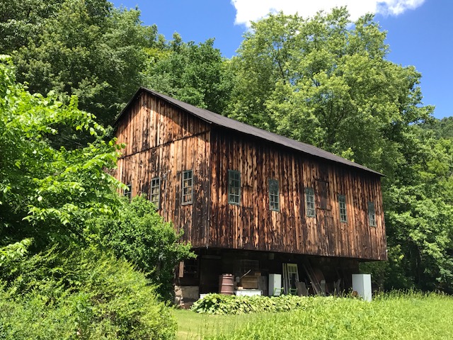
A barn on Rte 26
The descent back was steep. Rough pavement. And windy if not sharp turns. It wasn’t fun. I couldn’t let the bike roll. What I learned after the fact was I should have kept going. I could have gone another 3-4 miles where I would have joined Rte 164 coming out of Martinsburg. Then It looks like a straight descent back to Saxton. In other words, a fun descent. Oh well, next time.
Crushed limestone at Hopewell
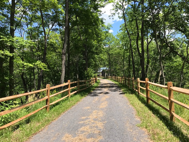
I rode back to Hopewell and explored the trail a little more. At Hopewell going north for two miles, the trail is crushed limestone in great shape. A road bike is fine although I wouldn’t want to ride 20 miles on this.
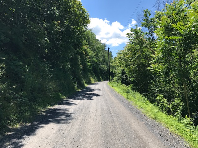
Gravel road headed south from Hopewell
Going south the trail was a road. A gravel road that led to a camping area. That was harder on the bike. I rode a couple of miles then decided I had had enough. Wrong bike for this surface.
H&BT trail near Cypher
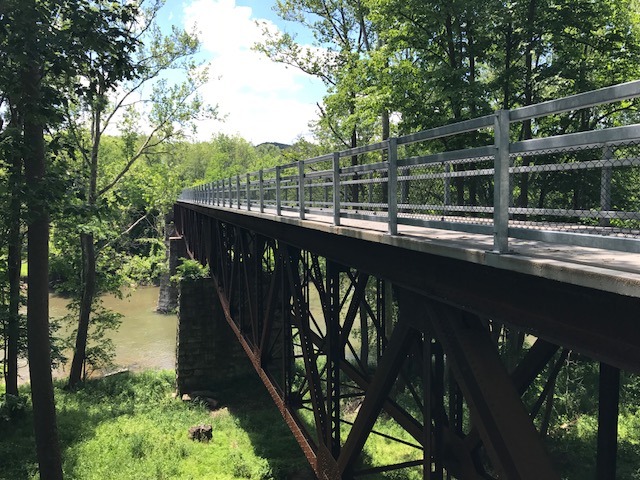
The signature landmark on the trail seemed to be the trestle over the Juniata River. I had decided the surface wasn’t right to pedal to it.
Bridge over Juniata River near Cypher
The trail head seemed to be on my way back to Somerset where I was headed. So I drove to Cypher to bike that section.
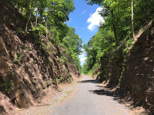
I don’t know if it was good or bad but the trestle was probably no more than a quarter mile away. But it was gorgeous. Maybe even more gorgeous was the cut in the hillside. The trail here was crushed limestone, again.
Bridge over Juniata River near Cypher
It’s a beautiful trail. If there wasn’t the section by the recreational area which was a gravel road, I’d have no problem recommending a road bike for the surface. But this trail needs wide tires. I may ride this on a mountain bike.