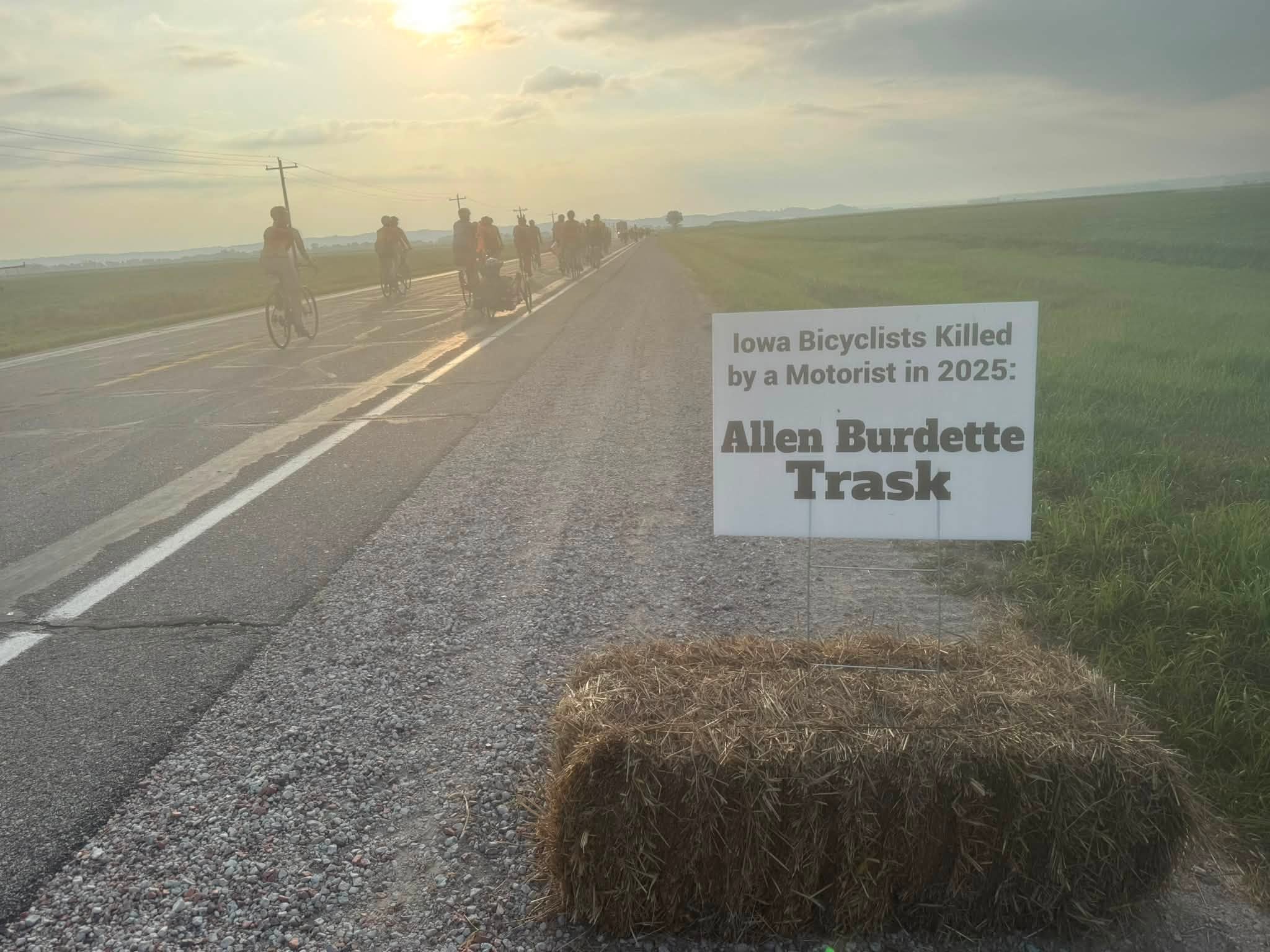
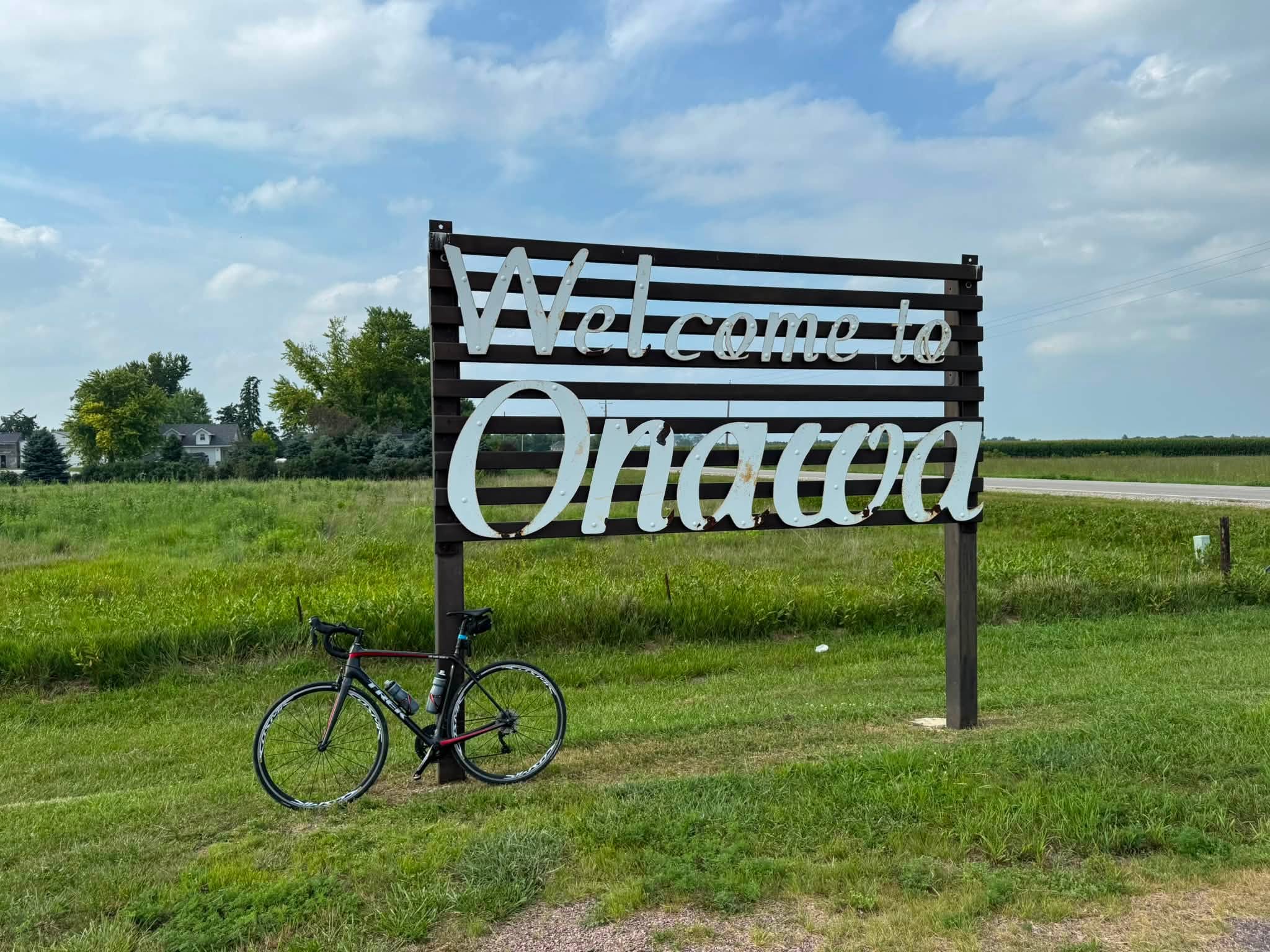
Welcome

I am a cyclist, genealogist, soccer referee, grandfather (x6), and cancer survivor. And I have ridden 105,000* miles cancer-free.

You have stumbled upon the personal blog of Barry Sherry. It is my private journal but made public. After keeping a journal for years I decided to push this out to the web. Maybe someone will find some information of value.

I have included the names, and in some cases, photos of others I have met in my journey. If you are mentioned and do not want to be, kindly contact me and I can change that.

Enjoy the blog. If you would like to know more about me, click my About Me page.

*as of Jan. 2024

Pine Creek Trail

JERSEY SHORE, PENNSYLVANIA

I was here once before, back in 2020, and the opportunity to ride with friends presented itself. The stars sort of aligned in that it was my grandson’s only week this fall without high school football. So when the Prince William Cycling Club posted this road trip, I signed on.

Riders at the start – Jersey Shore

When I rode five years ago, I rode the trail over two days. I parked in Jersey Shore, rode 30 miles until I found a parking area, then turned around and rode back. The next day, I went to the parking area and then rode to Wellsboro before heading back to my car, via the road on the return trip.

Pine Creek Outfitters loading our bikes

For this trip, we met in Jersey Shore and took a pre-arranged shuttle from Pine Creek Outfitters. Unlike my disaster shuttle experience in Jim Thorpe, Pa., in May, this one arrived on time and loaded our eight bikes on the trailer. We boarded a 15-passenger van for the hour drive to Wellsboro. And I got to ride shotgun.

Beautiful Wellsboro

I tried to remember this route since it was my return ride on Day 2 five years ago. But except for the one small town of Morris, it was as though I had never been here. But I was following my map on RideWithGPS as we drove, and it was exactly the route I took. Sometimes, when you ride in the opposite direction, it really is a brand new ride.

First photo op on the trail

The driver was very nice, but I may have been the only one to notice since I was riding shotgun. When we unloaded, I think I was the only one to tip him. It was a fair tip if everyone tipped him. And if I saw that no one else tipped, I would have given him more. Sorry dude.

Pine Creek Trail

At the trailhead, I briefly rode off towards Wellsboro on a yet-to-be-opened section that will go into town. I was also adding an extra kilometer in case the route would be 99 km. It was chilly, 50/10 degrees, and overcast, although not as cold as the start to the New River Trail last week in Galax, Va. (Michele says it is pronounced GAY-lax).

Pine Creek Trail

The trail has a crushed limestone surface, which is only “gravel” in the smallest sense. It is very fine and easily rideable with 32 mm tires, which many road bikes have. The downside is that there is always dust, and there was some, but not nearly as bad as on the GAP and sections of the C&O Canal Towpath.

Swinging bridge over Pine Creek (No trespassing)

We had a few stops. I like to take photos and didn’t want the group to feel like they had to stop for me. They did a couple of times, but in other places I rode ahead or simply caught up.

I rode ahead to position myself for this photo.

Within the first 10 km we passed a couple of riders who were stopped admiring something. That something turned out to be a bald eagle. We would see a second one later.

Bald eagle

The trail itself follows the Pine Creek. It is situated IN the gorge called the Grand Canyon of Pennsylvania. So, views you may normally get from heights you do not get on this trail. You are on a valley floor, which brings its own beauty.

Majesty of Pine Creek

There are just four trestles on this trail. When we came to the one at Glade Run, about halfway on the trail, it seemed unusually busy with small children. As we exited, we saw why: there is a campground here which looks very nice. The Pettecote Junction Campground offers traditional tent and RV camping as well as cabins and glamping options. It would be a perfect spot for two days on the trail – ride one direction and back to Jersey Shore or Wellsboro on one day, and ride the other on the second day.

Store at Glade Run. Closed for the season. The Moose should have told you.

We stopped at Wolfes General Store in Slate Run. The deli offered sandwiches that were too large for me. However, I did have a small backpack (mesh), and I should have eaten half and taken half with me.

Wolfes General Store (the trail is on the other side)

About 3/4 of the way, I started to get lightheaded. I stopped and got my gels from my backpack, and ate those. One was my in-case-of-emergency-break-glass one – a Danish gel from Cycelnerven last year in France. It was my last Danish gel and I really liked those. But I needed nutrition because I only bought a Snickers Ice Cream bar at Wolfes.

Wolfes even has candy cigarettes

It’s always amazing when you get a pick-me-up from nutrition. Once I took on that gel, actually two, I felt good to the end.

Pine Creek Trail

I was displaying kilometers, and we had a couple of discussions about how far this ride would be. I thought I had read 62 miles, which is right at 100 km (62.14 to be exact). In fact, as we returned to the parking lot, one rider asked me how many miles were in 100 km. I told her 62.14, and she went to the end of the parking lot and back to make sure she had 100 km. My head unit was already displaying 101 km so I had nothing more to ride for.

Signage at a restroom (pit) on the trail

It was a great day. A light rain during the night kept the dust on the trail to a minimum. The temperature did warm up to 70 – perfect for a fall bike ride. My legs were trashed because yesterday I hiked the mountain in Duncannon – a very bad idea. My Whoop band agreed – my recovery was just 26% going into the ride.

Pine Creek Trail

This is a destination trail. I encourage everyone to ride it once. This was my second time, and with the campground option, I’m not ruling out a third ride – next year.

Barry on the trail. Already working on my winter weight. Photo Credit: Sunny Phuong

___
LODGING – Hampton Inn & Suites Downtown, Williamsport
SHUTTLE: $60


Hike. Not Bike.

DUNCANNON, PENNSYLVANIA

This morning at the grocery store, a young woman started to write her number on a card to give to me. She said she has been a nurse for 20 years and wanted me to have her card if I need a nurse. I assured her that I wasn’t in need of a nurse, then went and climbed a mountain.

My travels took me to Duncannon, Pa., and a hike up to Eagle Edge overlooking the Susquehanna River. A description I read of this hike pretty much warned against climbing directly to Eagle Edge because it was steep. I will confirm that and second their advice. Do not try this (1) at all, and (2) if you do get a hiking partner (in case of a slip or fall).

Parking in Duncannon

I started from the town parking lot and remembered to turn left at a split. I had unwittingly joined the Appalachian Trail. As I climbed, I met two hikers and asked for local guidance. They may not have been local at all. They told me to keep straight on the trail, which, unbeknownst to me, was the AT and was descending quickly back to Duncannon. I gave up a lot of elevation before realizing that I had to turn around and go back up.

Rocks – there’s a trail in there somewhere

I came to the “trail,” although not marked, that looked like it continued up the mountain. I decided to follow that. It was not marked, although I could usually find where other people had walked. At times, it was all rocks, and I imagined in warmer weather, this must be home to timber rattlesnakes. I never stopped to rest, although Strava sure did use auto-pause a lot even while I was moving. There were sections where my climbing was on all fours. It was steep.

The white mark designates the Appalachian Trail

My legs were burning, and I went into bicycle climbing mountain mode. “One step at a time,” I kept repeating. My body screamed to turn around, but I sensed something good was up there. I didn’t know how much longer I could continue. And with each step into the heavens, I knew I would be retracing those going back down. And if possible, it may have been harder descending than climbing.

Trees blocking the unmarked trail

I also thought that if I was near the top of the mountain that I could make a loop and have a much gradual descent rather than retracing my steps. I was right.

View of the Susquehanna River from Eagle Edge

I expected Eagle Edge to be at the top of the mountain, but came upon it before reaching what I thought would be the summit (I hope that was Eagle Edge). I took a couple of photos and already decided that I could not descend the path that I just climbed. I remembered the trail description and kept hiking.

Hawk Rock (or Hawk Rock Overlook)

I started to worry that I would run out of daylight (6:00 pm) and be lost on the mountain. I had faith that following the trail would eventually take me back to the parking lot, even though I knew I was walking in the wrong direction. After 10-15 minutes I came to a fire pit which I had remembered was a landmark. I continued on the unmarked trail, climbing over two downed trees.

Fire pit on the trail

Yet I suspected all was good because there were a couple of freshly cut trees removed from the trail. So while not an official trail, someone had been here to maintain it.

It was then that I came to Hawk Rock, which is the destination for most hikers here. After 1-2 minutes, a young lady hiker arrived. I was glad to see a human and asked her for directions back to Duncannon. She pointed to the west, whilst I knew I wanted to head east. But I also figured she just came up from there, so I trusted her 100%.

At Hawk Rock (or Hawk Rock Overlook)

I then followed the trail, still headed west when I knew I needed to head east, when it did a 180°. I was able to finally feel that I was headed down and in the right direction. And I passed two hikers coming up the trail.

I was glad that I hiked this trail but I doubt that I will do it again. However, the next time, I would be confident that I knew where I was going. And I wouldn’t climb the face of the mountain up to Eagle Edge but rather take the longer way around. I’m not sure I would want to descend it either.

I don’t recommend hiking alone and suggest that you have a hiking pole or two. I found a rotted stick and broke it to be the right size. It helped, although it broke in half partway through my hike.

It wasn’t a bad day for some old guy needing a nurse while climbing through the rock gardens in Pennsylvania.


Panhandle Trail

MCDONALD, PENNSYLVANIA

A description of the Panhandle Trail from TrailLink:

The Panhandle Trail offers a direct 29-mile journey between the Northern Panhandle of West Virginia and the suburbs of Pittsburgh, Pennsylvania. Although the trail follows an old railroad grade through the hilly terrain, there was only so much the railroad builders could do to flatten the route across the Allegheny Plateau. Expect a steady climb to Bulger, the high point on the rural journey.

The Panhandle Trail leaves off from its western endpoint in Weirton, which borders both Ohio and Pennsylvania in West Virginia’s narrow Northern Panhandle. It makes a steady 16-mile climb through hardwood forests to Bulger, where the trail begins its descent to Collier Township in the western suburbs of Pittsburgh. 


I didn’t have a lot of time before my mother’s surprise birthday party and I wanted to ride 40 miles (64 km). I was looking at the Montour Trail, “mostly paved,” but RideWithGPS showed mostly gravel. I think it is mostly paved, but I have to figure out where that is. In the meantime, I found the Panhandle Trail.

This trail, as described, is a 29-mile trail from the western suburbs of Pittsburgh to Weirton, West Virginia. I would not have time for the entire trail and looked for a trailhead close to where I could easily attend my mother’s party. I headed to McDonald, Pa.

I wasn’t expecting much, and I wasn’t disappointed. I look for great scenery, great fixtures, including high trestles and long tunnels. This trail had none of those. The best trestle was passing underneath the Montour Trail.

Trailhead at McColl Road, near Weirton

I wanted a ride that was traffic-free. And a trail that was paved was perfect, even if boring compared to many other rail trails. The scenery was meadows and forests.

It was muggy and the forecast called for a possibility of rain later in the day, around 2:00 or 3:00. From McDonald, I figured I could ride to Weirton and back in three hours or less. I would have to deal with being sweaty for the party, but that’s why I keep skin wash in my car.

Panhandle Trail – Weirton WV

I headed out from McDonald and passed four riders, two of whom were on e-bikes, and the two e-bikers would pass by me shortly. I let them have about 100 meters, and kept them in sight to Burgettstown, where they stopped. I figured this might be a popular out-and-back for the locals.

Meadows along the Panhandle

I continued to West Virginia, seeing very few people. It was truly meadows and woods. I expected and was looking for a “State Sign” when I entered West Virginia, and was surprised when I came to a trail head and checked my phone to see where I was.

Panhandle Trail – state line between WV and PA. Washington Co., Pa is on the right; Brooke Co., WV is to the left.

I checked my Maps app on my phone and saw that I had been in West Virginia for a while, maybe 20-30 minutes. I saw a local and asked how far the trail went. He said perhaps a mile or two, then added that the trail just dead ends at some brush. I decided to turn around.

Weirton, WV

On the way back, I was very curious as to where the state line was. I held my phone looking at my progress on the map until I saw I was at the state line. Tucked away by a hillside was an old state line marker used by the train.

State line marker. If you know where to look … The Pandhandle Trail followed the Pittsburgh, Cincinnati, Chicago, and St. Louis Railroad (PCC & StL), a railroad created in the 1860s.

It was just a ride. I was riding well enough and much better than yesterday on the rooted mess (with gravel) that was the Allegheny River Trail. I was sweaty, so much in fact that I stopped to take some photos because I didn’t trust myself holding the phone while I rode (which is always a bad idea anyhow).

Montour Trail crosses the Panhandle Trail

With about 20 km remaining, the sky turned dark. The air got cooler. Oh boy. I hoped that I didn’t have to ride in it. I didn’t want to take pictures on the way out, preferring to make mental notes of where to stop on the way back. And with the sky threatening, I really didn’t have time for photos.

Burggestown on the return trip. The sky was turning dark.

I had passed a “water stop” on the way out that looked unique. Unbeknownst to me, it belonged to a legend. Jack Eckenrode started cycling at age 75 and won national championships in his 90s. The messages on the whiteboard would indicate that he loves having a water stop for users of the trail. And people love stopping there. I didn’t take water, only a photo.

I had hoped I could outride the storm, but I could not. My brother-in-law told me that where I was, there was nowhere to go. And he was right.

Cattails on the Panhandle

I had no choice. Even if I could find shelter, I was on the clock to finish and get to the party. I pedaled a little faster, but only the last five miles (eight km) trended downhill. While it seemed I had a headwind on the way it felt like a headwind going back to. In reality, it was probably a cross-head going out and a cross-tail coming back.

Railroad bridge with grass

It started to rain, a little bit at first and then it was a downpour. If you were caught in it you needed a light to be seen (I had it although a hole in the trail jarred it loose). I passed by one rider who was huddled under some trees. And yes, there was lightning.

Jack Eckenrode’s Water Stop – Bulger

I just rode as fast as I could safely until I got back to McDonald. It seems stupid since I was already soaked (squishy feet), but when I found a picnic table under a shelter at the start/finish, I ducked under it while the storm raged on for five more minutes, partly to protect my phone.

Panhandle Trail – McDonald, Pa.

On a day I was worried how sticky and sweaty I would be at the party, I found that this would be no problem. I did not need a shower today. Nature took care of that.


PAVEMENT: 4/5 (a little rooted near McDonald. Plus I found a hole.
SCENERY: 1/5
FIXTURES: 1/5

___
EPILOGUE: My phone took a beating. At first, I got a warning that the connector cord had water in it. When it was dry enough, I could charge and use CarPlay. Over the next week, CarPlay would work intermittently by the end of the week it didn’t work at all. Charging worked in that port, but data transfer no longer worked. On Monday, I submitted a warranty claim on the phone and by that evening had a new phone in hand. Lesson: On unsettled weather days, carry a zip-lock bag for your phone.

Allegheny River Trail

EMLEMNTON, PENNSYLVANIA

A description from TrailLink:

The Allegheny River Trail runs on asphalt between Franklin and Emlenton for 27.5 miles and on an isolated section between Foxburg and Parker for 2.5 miles. 


I spent the night before in Clarion, Pa. and was simply looking for a place to ride today. My introduction to the Allegheny River Trail came from TrailLink, which advertised a 27.5-mile asphalt trail. I don’t think my narrative needs to be lengthy.

Parking at the trailhead in Emlenton is easy and spacious

A paved rail trail sounded great to me. What was not advertised was a somewhat nasty one-mile gravel detour, which appears permanent. Perhaps landowners were able to buy some land from the railroad before it became a rail trail.

A “gravelly” detour

Four miles past the viewing platform, the trail veers onto gravelly North Kent Road for 0.75 mile through the Sunny Slopes community.

Temporary (or is it permanent?) end of trail (and start of gravel detour)

The gravel section is gnarly. When I came upon it, I wondered if it was the end of asphalt, but continued until I met a local and she told me the gravel road came back to the trail in 1/2 mile. Because of this gravel section, I would not recommend this trail for a road bike with tires smaller than 30 or 32 mm.

ART – Emplenton, Pa.

My brother-in-law calls the homeowner who appears to be blocking the trail a jerk. I don’t presume to know what went on, how the entire trail is on the right of way of the former Allegheny Valley Railroad, but one guy has property. His stance is obviously NIMBY. Or for this trail, NIMFY.

ART – Closer to Franklin as this area is exposed to the sun

It would not be that big of deal if the county or township paved the Sunny Slopes Connector Road. But that gravel section keeps this trail from being a premier destination trail.

ART passes by lots of camps and private homes

There are NO amenities along the trail. Carry enough food and water.

Mileage marker on the Allegheny River Trail

I had not read the description very well, if at all, when I came to the Rockland Tunnel. About 100 meters from the tunnel, the air got cold, and I knew I was approaching nature’s air conditioner even before I saw the tunnel entrance.

First tunnel

The two tunnels on this trail are VERY DARK because they both have curved or dogleg portions. It takes a while before you can see the light at the end of the tunnel. A light is a necessity to ride in the tunnel. Not by law, just by common sense.

Inside the Rockland Tunnel

The first section of the trial, to includes both tunnels, is very wooded. The second section, north of the Sandy Creek Trail, is wide open and is not shaded.

Roots

The first section is rooted. It was not as bad as the Mount Vernon Trail near D.C., but was just as bad as the Western Maryland Rail Trail in Hancock, Md., until it was repaved in the Fall 2024. It is nearly unridable in spots. That, along with a gnarly gravel section, keeps this from being a premier trail.

Sandy Creek Trail trestle

You never know what you will find on a new trail and I came upon a railroad trestle. At first, I thought it was an active railroad, but I would soon learn that it was part of a second rail trail.

Sandy Creek Trail at Belmar is also the intersection of the Sandy Creek Trail

I stopped briefly at the sign in Belmar before continuing on to Franklin, which was five miles away. When I reached Franklin, the Allegheny River Trail ended but it does continue into or past Franklin to Oil City as another trail. I turned around.

Steps up to the Sandy Creek Trail.

I returned to the Belmar sign and then followed the “trail” extension that led to the Sandy Creek Trail. Less than 100 yards of trail went underneath the Bolman Bridge. There, the trail looked to continue as a hiking trail but also connected to steps up to the bridge itself. There is bike path or rail on which you can push your bike while walking. I wonder in retrospect if it would have been easier to take my bike up the steps instead of pushing it because gravity was winning and wanting to push the bike back down.

Allegheny River Trail from the Belmar Bridge

I climbed the steps which wasn’t easy. Near the top, the clearance is low, and one has to duck even while walking.

Belmar Bridge on the Sandy Creek Trail

The Sandy Creek Trail is a 12-mile paved rail trail pretty much in the middle of nowhere. But it does have two fixtures worth seeing. The first is the 1,385′ (422m) Belmar Bridge that crosses the Allegheny River. I rode across the bridge and even took some time just to enjoy the view of the river from the bridge.

Belmar Bridge

Unbeknownst to me, if I took the time to ride some of the trail, I would have come to the Mays Mill or Deep Valley Tunnel, a 967′ (295m) structure that doesn’t sound like it’s in great shape. They have a tunnel inside the tunnel. The Sandy Creek Trail was originally the Jamestown, Franklin & Clearfield Railroad. I would be willing to check out this trail as a standalone ride, but it also isn’t a destination trail.

Allegheny River from the Belmar Bridge

Both tunnels on the Alleghenry River Trail appear to be a great shape, although there was a lot of water leaking near the south end of the Rockland Tunnel. The surface instead is smooth asphalt as opposed to the Abandoned Tunnels near Breezewood which are built on the decaying Pennsylvania Turnpike and are littered with glass.

Kennerdale Tunnel – North entrance

The trail was relatively empty, but the few people I saw tended to favor e-bikes, especially e-Mountain Bikes. And there were some people milling around at both tunnel entrances.

Indian God Rock, “A large boulder at the water’s edge with numerous inscriptions, including Indigenous petroglyphs, carved in the soft sandstone.” (TrailLink)

As I rode back through the gravel section, a homeowner asked me if I was okay on water. Even though I had 1/2 a bottle of water remaining, I underestimated what I would be drinking the final 14 miles (22.5 km). I violated my own rule: Never turn down an offer of water.

Observation deck near Indian God Rock

Summary:
Scenery: 5/5
Pavement: 2/5 (3/5 for the roots and minus one for the one mile of gravel)
Fixtures: 4/5 Tunnels are cool, but no trestles other than the Big Sandy Trail (optional)
Not a destination trail, but if I rode it again,n I would want my gravel bike.


Susquehanna Double Cross

DUNCANNON, PENNSYLVANIA

I was surfing on Facebook and one of those annoying and not-requested groups showed up. It featured a paddlewheel ferry on the Susquehanna River. I read quickly to see what kind of ferry it was, that is, was it passenger only? I saw they took cars plus horses and buggies, so I figured they would take a bike.

Parking in Duncannon. It’s a private lot but open for your enjoyment.

I went to RideWithGPS and looked for bike routes around Millersburg. I found a 44-mile ride that started at the ferry in Millersburg and ended there as well, with a ferry ride across the river from a campground on the west side of the river.

Private park in Duncannon overlooking the confluence of Juniata and Susquehanna Rivers

It was a bit difficult to find current information about the ferry, but it seemed to operate only on Friday, Saturday, and Sunday. I texted them and got confirmation that for today (Friday), the hours were 10-4.

Looking at the Juniata River bridge in Duncannon

I hoped to leave the house by 7:00 a.m. but I was a little late. My ETA kept creeping back as I drove north towards Harrisburg. As I got closer to Millersburg, I realized I didn’t have a lot of room for error if I started from Millersburg and rode the 44 miles on the route that I downloaded, should I have any problems. On a clock face, Millersburg would be around 2:00. Duncannon would be at the bottom, i.e., 6:00. I headed to Duncannon to start since it would be the closest starting point on the route as I drove north.

Bridge in Duncannon crossing the Juniata

I was very glad to make this alteration to the route.. The original route had a half-mile diversion to a Sheetz on U.S. 22. This section is quite busy, although there is a shoulder. There is no way to get back to the turnoff short of salmoning upstream against traffic on the shoulder. No thanks. Since I started in Duncannon, I did not need to start with a rest stop and was able to cut this part out.

Rolling hills near Duncannon

I found an empty lot, a private lot, that was posted as open for visitors. It was at the confluence of the Juniata and Susquehanna Rivers. You could feel the power of the rivers and appreciate the overwhelming beauty.

Bridge in Wheatfield Twp., near Duncannon

As soon as I started pedaling, I was on a narrow two-lane bridge that crossed the Juniata River. As quickly as I went through an underpass, I turned right to leave town and started climbing. There were no mountains today. There were plenty of hills. The longest hill was probably 1.5 miles.

Newport, Pa.

Most of the way from Duncannon to Newport was on backcountry roads. No traffic. Zero.

Bridge over the Juniata River

Newport is a neat-looking town. I followed my map and passed the Weis grocery store, which was listed on this route as a rest stop. It was here I crossed back over the Juniata.

Sidewalk on bridge at Newport over the Juniata. It was better than the steel grate deck,

The bridge over the river looked to be a long span without a wide berth or shoulder. I could see a sidewalk and decided that I would not ride on the deck. It was a wise decision. The deck was an open grate bridge. Those aren’t fun to ride on. I was glad I was on the sidewalk.

The Juniata from Newport, Pa.

Leaving Newport, I rode 2.5 miles on the Juniata Parkway, which was more like a lightly traveled highway, two lanes, and not a parkway. Turning off, I headed back into the woods. And saw the dreaded orange sign – FRESH OIL AND CHIPS.

BBQ/food on the Juniata, Greenwood Twp.

Ugh. Owl Hollow Road didn’t appear to have been done recently, as I never saw fresh oil. But there were plenty of loose chips, gravel, and I had to use caution even while climbing. The road was empty, maybe because it had been recently chipped. No cars. Just a lovely ride through the forest down to the river.

The dreaded Fresh Oil sign – Greenwood Twp., Pa.

I came down to U.S. 15 and alternately rode on the shoulder of 15 and Old Trail Road, a parallel road to 15. I came to the ferry campground and had to cross over a median on 15. That was sort of sketchy. I think the route was designed for me to cross at an intersection and then salmon on the shoulder for about 100 yards.

U.S. 15, Liverpool 15. Rode the shoulder.

The Ferry Campground looked very nice. I followed the road next to the river and saw the ferry was docked and boarding. I was hoping to enjoy an ice cream at the camp store before the ride, but instead walked onto the ferry.

Millersburg Ferry Campground

It is a ferry that has been operating for 200 years (“began as early as 1825”). Not these actual boats, of course, but the ferry business. There were two cars and one trike (three-wheel motorcycle), plus one bicycle on this paddlewheel ferry. And a bunch of people.

Boarding at the Millersburg ferry campground

Halfway across the river, the captain announced he was going to sound the horn. I expected a good, hearty riverboat horn, but instead it was a 1920s Model-T a-oooga horn. We were approaching two guys floating and fishing in a canoe, and the captain yelled out to them, “Please move, you are in our way.”

The front of the Millersburg Ferry

It appeared at first that they were not going to move. I wondered who had the right of way. But the canoe moved.

“Get outta the way!”

As we disembarked, the captain was very curious about where I was going. He knew I was going one way, he had greeted me by telling me I looked like a professional cyclist, but was concerned that I would miss the last trip and be stranded. I assured him that I had a bike and that I would be fine.

Millersburg Ferry

Leaving Millersburg, I was on State Highway 147. There was enough of a shoulder that much of the way back for the next 15 miles was on a shoulder. There were a few areas where I had to be in the travel lane, but I didn’t hold up traffic often.

Bike. Ferry.

In Halifax, I found a convenience store and was able to get water. I thought it might be the last store I would see headed back to Duncannon. But the next couple of miles had lots of options, which is why I liked starting in Duncannon. I stopped at a Sheetz. I was going to buy water, but had a full bottle on the back cage. I simply filled my front bottle with ice and poured the water from the second one into the iced-up bottle. And bought a Snickers.

Two of the Millersburg Ferries

After another mile or so, I was back on country roads. With two miles to go, I came back to Hwy 147. I wondered why I wasn’t routed that way initially but I think the trade-off of highway for country roads was the answer.

Highway 147, Halifax, Pa. Look closely, there’s a shoulder.

I had to cross the Susquehanna River at Clarks Ferry Bridge on U.S. 22. There is a shoulder, but at the end, it was very sketchy waiting for an opening to get to the left turn lane so I could get back to where I parked.

Powells Creek

What a nice ride. Mostly very rural roads and, of course, a paddlewheel ferry. I don’t think I will do this ride again simply because it’s too far to travel. But if someone wanted me to join them they I would agree. I feel strongly that starting in Duncannon is the key, first to avoid the Sheetz on 22 as a necessary stop, and second, to have the stores after Halifax as an option near the end of the ride.

Millersburg Ferry


TYPE OF RIDE: ADVENTURE
NUMBER OF RIDERS: SOLO

Easton

EASTON, MARYLAND

It began with a description I read of St. Michaels, Maryland, that included a ferry ride across the Tred Avon River. I first came to this part of Maryland’s Eastern Shore in July 2022 and have been back an additional 12 times.

On the ferry – with PWCC

My rides up to this year have been mostly a loop out to St. Michaels and then Tilghman Island and back across the ferry. The roads to Tilghman Island are somewhat busy, but with a gigantic shoulder, the size of a traffic lane, to ride on.

This year I was slow to get to Easton but when I lost my trip to France, Easton became my comfort ride. I did an out-and-back ride on June 9 and then started looking for some exploratory routes. I found a Metric (metric century is 100 km or 62.14 miles) called the Tri-County Ice Cream Classic. It went east, then northeast from Easton, before coming back through Easton, then out to the Oxford Ferry. Nice ride.

While I was riding it, I saw road markings for the Tour de Talbot. I found their website and saw they used more southerly roads to make a Metric but also included the ferry. I rode this on June 23 and loved the route. Once it got out of Easton, it was all on country roads that were virtually empty. And much of it was wooded.

House next to the Choptank River

I went back on my birthday for my birthday ride, which is where I (still) ride my age in miles. I took the last Metric route, added a 10 km loop in the woods, and modified two turns to add a couple more miles.

Long Ride at Easton

The last ride I did still had the first 11 miles, mostly with Easton proper, and with at least four miles in the heart of Easton with stoplights and stop signs. The remaining seven miles were still within a residential or light business area. But once beyond Easton, it was glorious. Country roads. No traffic. Much of it is wooded. And nearly all of it is flat.

Oxford-Bellevue Ferry (7.5.2025)

When I rode the “southern” Metric, I was unsure where there would be water stops. Going through St. Michaels is easy because there are probably four or five places to stop to get more water or food. But once I left Easton, I saw nothing. At Mile 35, I crossed U.S. 50 at Trappe and there is a Valero gas station/convenience store where I got water and ice for my bottles.

Valero station, Trappe, Md.

I reached Oxford before noon, which is when the Scottish Highland Creamery opened. I continued on to the ferry. Back on familiar roads, I was running out of water. I decided not to do the Metric but instead use my Wahoo’s Route to Start feature and take the shortest way back. At the turn, I saw an Exxon about 200 meters ahead. I went straight, got more ice and water, and finished the Metric.

Once I figured out where the necessary stops were, it made doing the 70-mile ride easy. In the last 20 miles, the route crosses a drawbridge and then a neat-looking wooden bridge over Leeds Creek.

Bridge over Leeds Creek

Easton has become one of my happy places, although it’s hard to beat a climb up Horseshoe Curve in Altoona. Every ride is better with a ferry ride and this makes it one of the best.

However, on August 7, I was riding with Tim, and we came to ride a Metric. When we came to the ferry, we found out it was closed. We headed back to Easton, up the Easton Parkway, then back to meet up where our planned route was.

Sorry folks. Ferry’s closed. Moose should have told ya. (Oxford Ferry, Aug 7, 2025)

Easton is just a great place to ride. This post isn’t about one ride but a general overview of an area. Going out to Tilghman’s Island is a nice ride. It is wide open in the sun and mostly on a wide shoulder with traffic. The Tour de Talbot route and what I modified is on mostly rural wooded roads. It is one of the most traffic-free areas I know to ride.

Teens enjoying the cool waters of Leeds Creek

Thanks and Final Thoughts

My THANK YOU card sent to my sponsors and posted on the Cycle for MS blog:

It has taken me a lot to get to this day. I like to thank my sponsors with a card. Last year I had some people tell me that it wasn’t necessary for them to receive a card but it was necessary for me to send it. Writing out a card and mailing it gives me a personal connection to each sponsor.

At the Col du Soulor (2011)

It was harder this year. I looked at clicking purchase on my order. Did I really want to spend $200 to thank my sponsors? Wouldn’t an email and multiple shutouts on Facebook be enough? Did I really want to spend any more money on this trip? And I clicked purchase.

Col d’Aspin (2010)

It was harder getting to this day because this was to be a day of celebration and of thanks. I am still thankful but the celebration never came. I am left to think what if? I put this day off because of lack of energy. Or enthusiasm. Thanking my sponsors is closure and it was hard to accept closure without a trip to France. But I finally got there and look forward to sending out the cards to my sponsors.

I remained in the WhatsApp group chat and was able to follow the progress of the group each day. It was where I was supposed to be riding each day. Part of me knew that most climbs were ones that I have done before so in that regard I wasn’t missing out on new climbs.

Barry, Conor, and Bo (2024)

And then came the first climb to Luchon. I didn’t mind missing it so much, except that it went into Spain for four miles or four kilometers. I missed riding in Spain, which I never have done and don’t plan to do. That hurt. I could have added another country to my list.

Barry at the Col de Azet (2010)

The second climb of the day from Luchon was up to a ski resort at Superbarneres. Adrian and I rode on a chilly, cloudy day that turned to rain. I would have liked to have done the climb on a sunny day.

Col de Azet (2010)

Their second day was from Luchon up the Col de Peyresourde, down to Louderville, up the Col d’Azet, down to near St. Lary to Aurrua, and then the beautiful climb of the Col d’Aspin.

In 2010 I went on the road over the Col de Peyresourde in both directions. In rain. I would have loved to see the climb from Lucon on a clear, dry day.

In 2010, I rode over the Col de Azet from St. Lary and down to Louderville. This year’s route would take the reverse approach. After descending and riding to Arreau the group would climb the scenic Col d’Aspin. I’ve climbed this side once (in 2010) but the other side twice (2010 and 2011). On the side from Arreau it is open with beautiful vistas. The road down the other side is heavily forested. Pretty in its own right but now without the wide open vistas.

The summit of the Tourmalet

The third day would be the Queen stage. The Col du Tourmalet. This is the climb that I would miss the most. I have climbed from Saint Marie Campon side twice and once from the other side. I would have liked a photo with the statue when there weren’t thousands of fans gathered around.

Didi painting the road

Well, that is all in the past. I hoped it would be in the past as one month ago, but it was 15 years ago. And there it shall remain, memories of many years ago.

Gutted

Gutted. That’s where I am right now.

I’ve spent the last two days packing, including learning how to use my new bike case. I uploaded old riding files from when I was in the Pyrenees in 2010 so I could torture myself with bad time comparisons.

Flying on Royal Air Marco, their online check-in did not work, so I arrived at Dulles four hours early. I handed the agent my passport, and she took longer than usual getting my boarding pass. And then she didn’t.

First, she and then a supervisor explained that I could not fly to France because the E.U. has a rule that your passport has to be valid for at least 90 days (and it may be six months). Mine expires in August.

I had looked at renewing it before I went but was warned that once I applied my current passport became null and void. I did not want to risk not getting my new one back in time, and besides, it is good until August.

At first, it seemed that a few people needed to talk. The one agent said she was going to call to get permission to send me. There was hope, but after about 20 minutes, the hope died out. I could not fly.

I called my wife, who was almost home, and said, “Turn around, come back to Dulles.”

I am so disappointed. Not pissed but very sad. Very. But I feel like I let so many people down. Yet I know that everyone who sponsored me did so for the cause – to fight MS. And that is still getting done. What is not getting done is me riding in France.

Is there still time? The answer is no. I have looked at the expedited passport application, but the Washington, D.C., Philadelphia, and New York offices are not taking walk-ins. And none have appointments available.

I looked at leaving later in the week, flying into Toulouse, and renting a car to drive to the Pyrenees. But that was only when I was still hoping for an expedited passport on Monday, which isn’t happening.

I notified George at MSIF. I am sick over this. I’m not the only one who has been caught up in this. My niece, Emily, flew to Zurich, and when she arrived, they told her she could not leave the airport. She spent 24 hours or so in a pod until she caught a flight home.

I planned for this to be my last mountain climbing adventure. I can’t do fundraising again. But we talked about the possibility of rolling this over to next year. I don’t know how I will be then. There are so many emotions that I can express but don’t want to in a public forum. I am numb right now.

Verified by MonsterInsights