Copper Mountain Loop

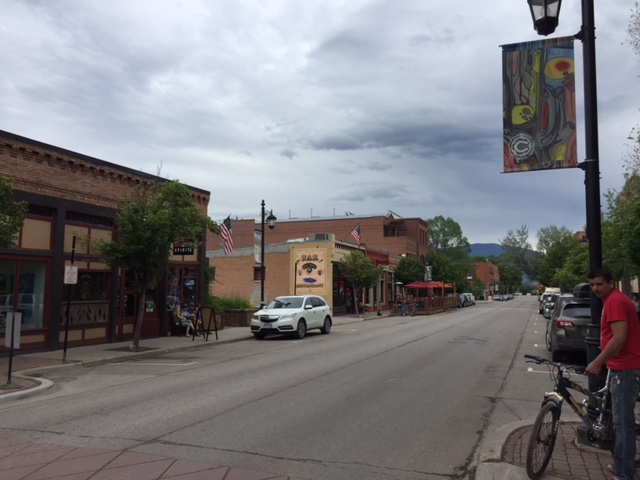
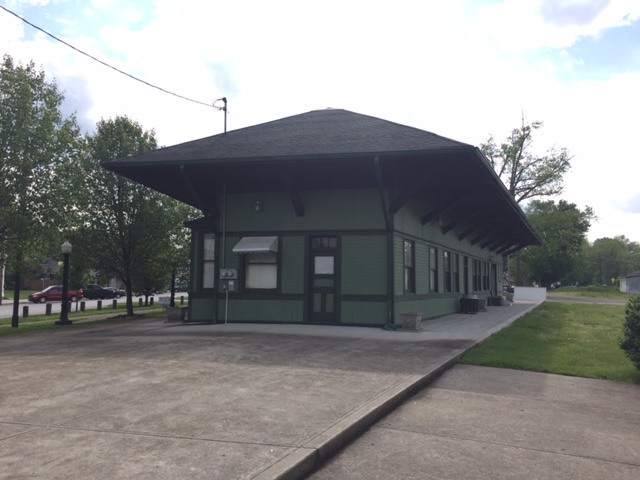
COPPPER MOUNTAIN, COLORADO

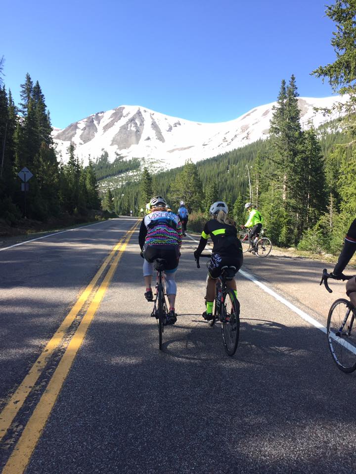
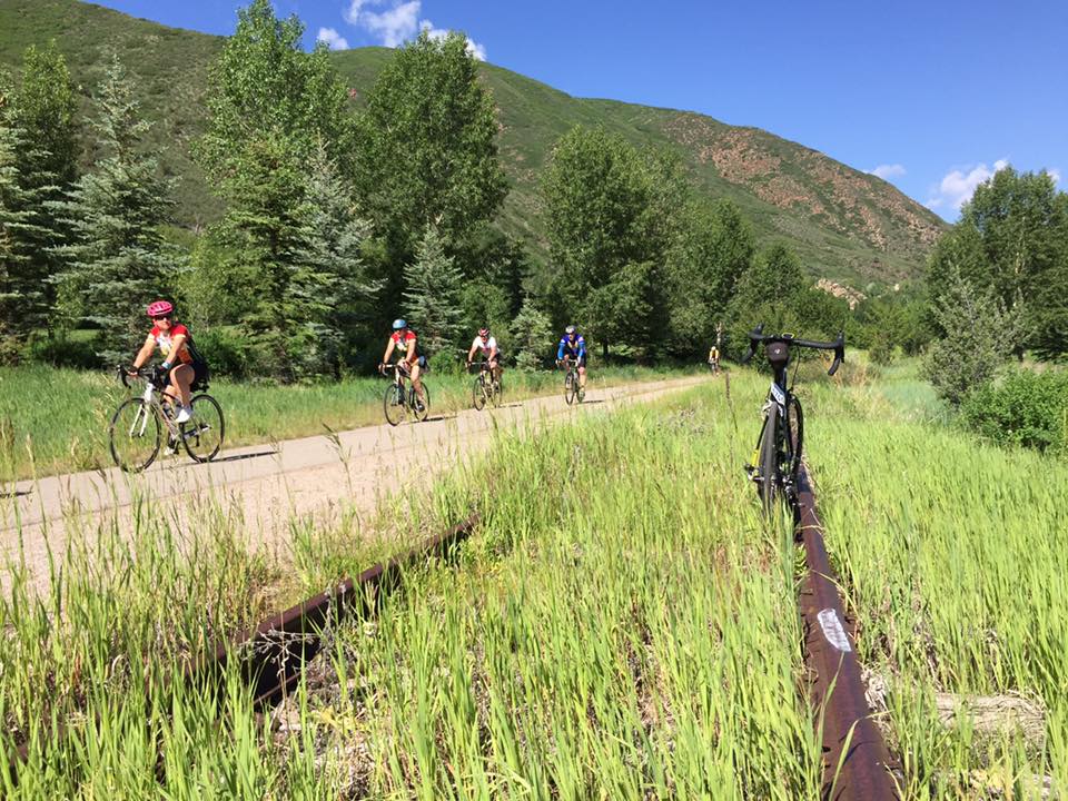
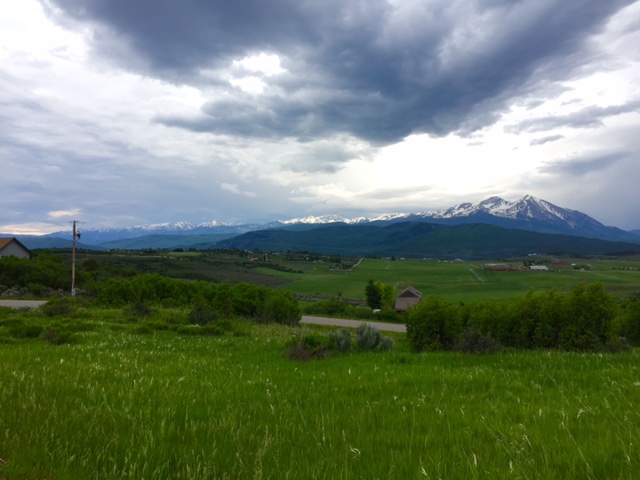
It’s another big day in the saddle with stunning scenery and three notable climbs. This 79-mile stage, made famous by our good friends at Copper Triangle, will take cyclists back over Fremont; past the Tenth Mountain Division Memorial; across Red Cliff Bridge; with a quick and punchy climb up Battle Mountain. With Fremont and Tennessee Pass in the rearview mirror, a stroll through Minturn and Vail await; followed by a slow and steady grind over Vail Pass – a first-time feature of Ride The Rockies.

RTR16_3_01
Morning at Copper Mountain Village

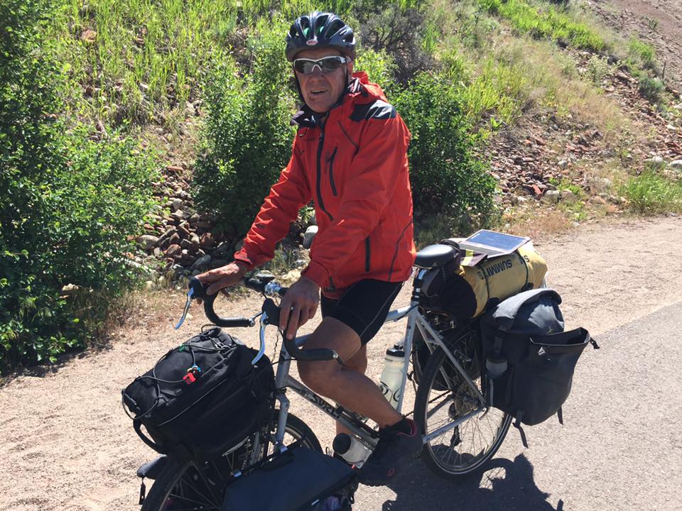
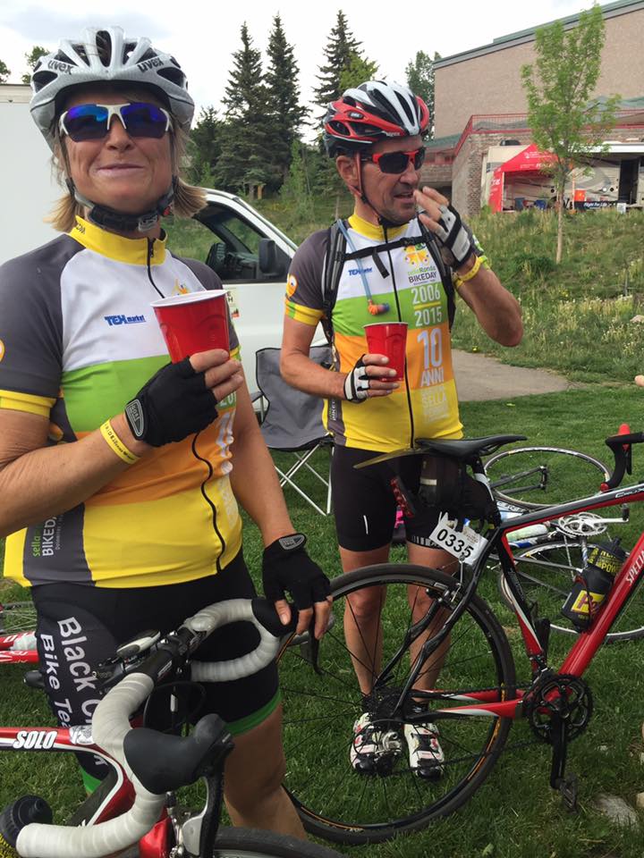
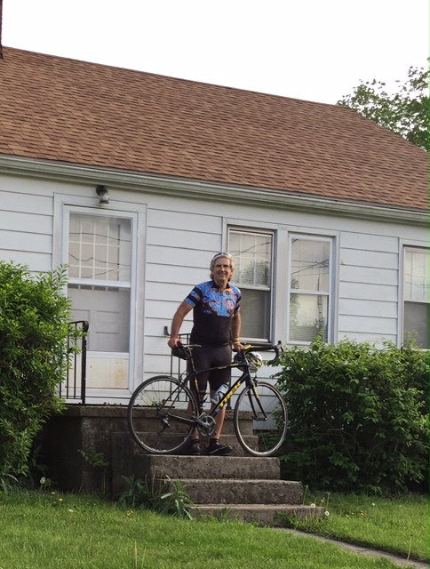
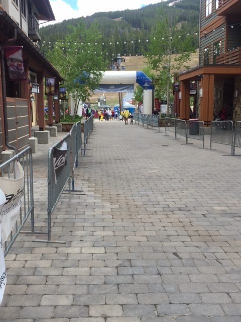
Arriving Copper Mountain last night my legs were sore. They didn’t quite reach the Jello stage but they were sore. I can imagine that many riders were in the same situation.

RTR16_3_02
Headed up towards Fremont Pass

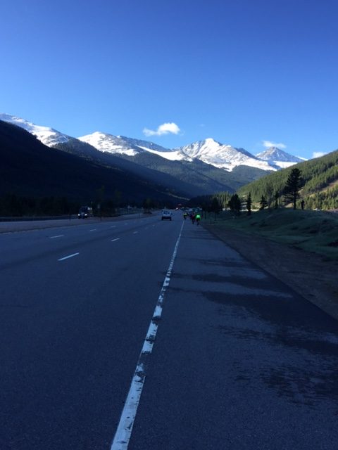
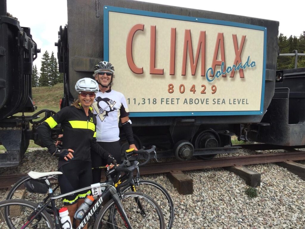
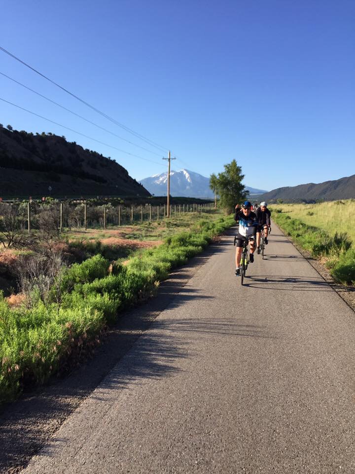
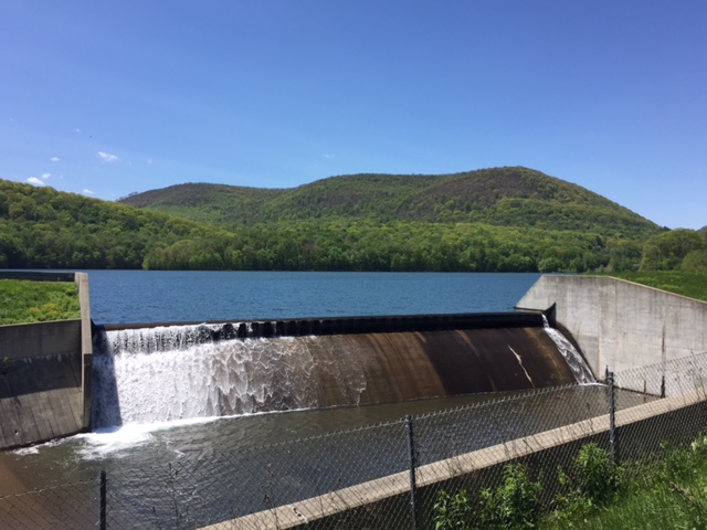
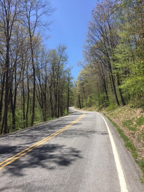
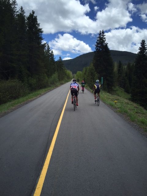
It’s a new morning and I am ready to tackle the Copper Triangle. Yesterday’s 11-mile descent from Fremont Pass to Copper Mountain is now today’s warm-up and a bit daunting. We would need a warm-up because it was 37° at wheels-down (7:30 a.m.).

RTR16_3_03
Flippin’ Flpajacks

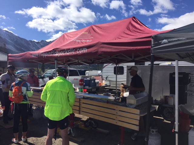
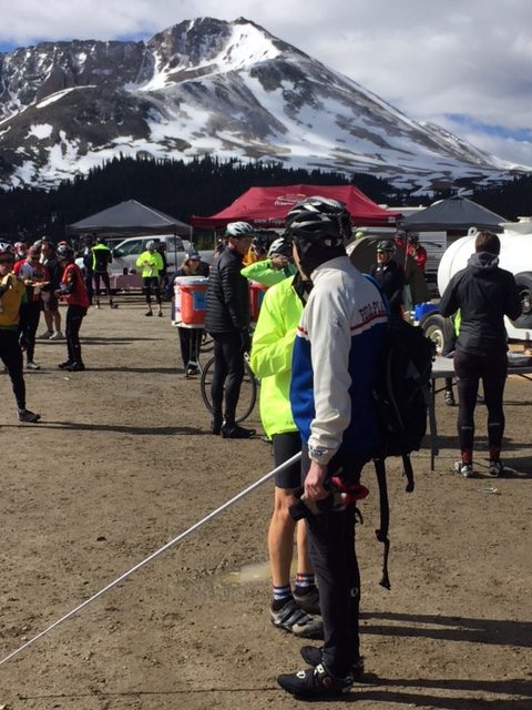
Christine Currie, riding with two uncles and her brother, met me and told me they were riding a less ambitious schedule. So we started out and headed up the pass. At the top I found Flippin’ Flapjacks, my first time eating here in four years. Usually, there is a long line but today I just walked up and paid the $6 for all you can eat. It’s well worth it.

RTR16_3_05
A blind cyclists at Aid Station 1 – Hopefully a stoker on a tandem.

After my hearty breakfast, we headed down off Fremont Pass. I thought I might get a good speed going but there was a curve at the bottom of the descent and one above-average cyclist was hogging the left lane. I did not want to pass him by crossing the yellow line So I settled on 47 mph.

RTR16_3_06
Red Cliff Bridge

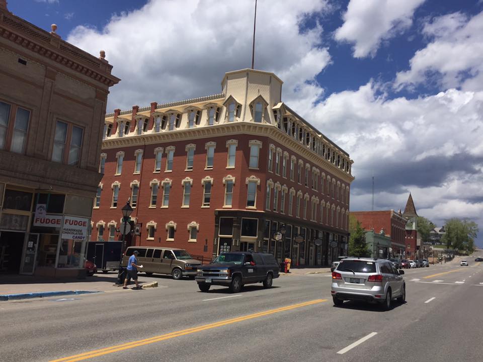
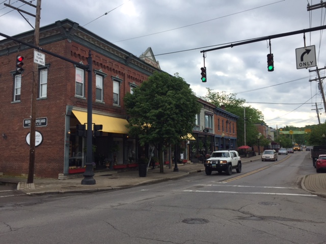
We rode to Leadville then turned right towards Tennessee Pass. As we approached the bottom of Tennessee Pass, Christine told me that two years ago she had spread some of her father’s ashes here. I wish we would have stopped but I rode ahead and let her have her private moment.

RTR16_3_07
Christine Currie riding beside Eagle River

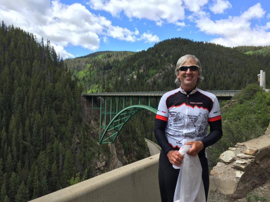
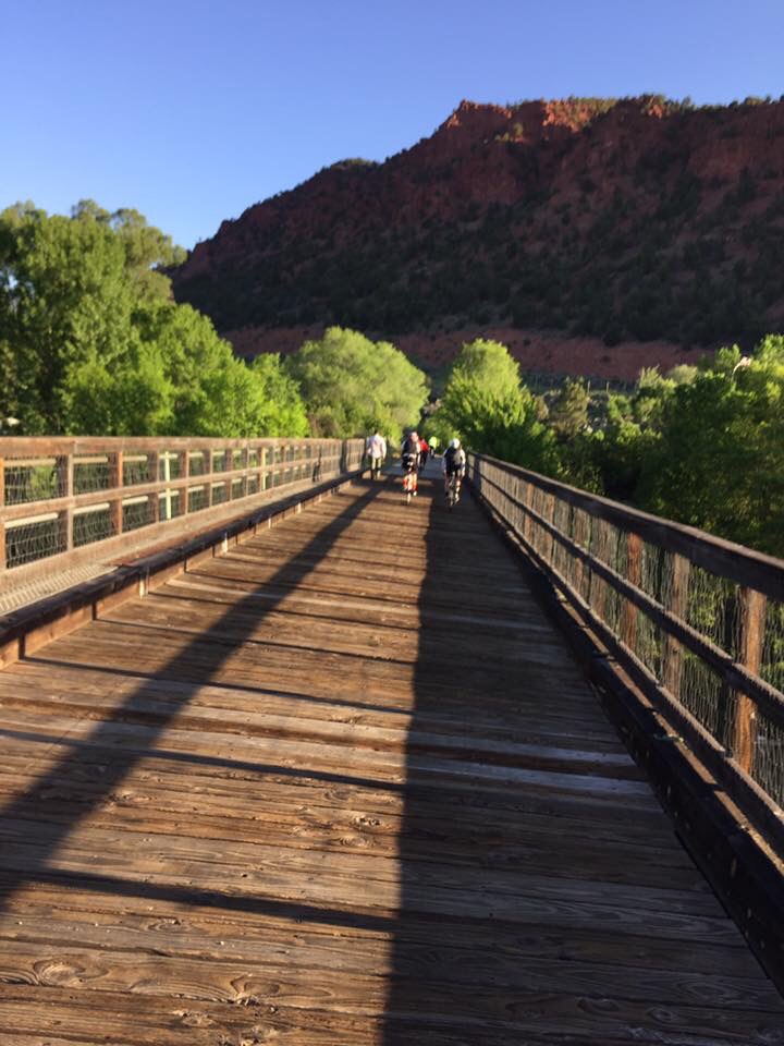
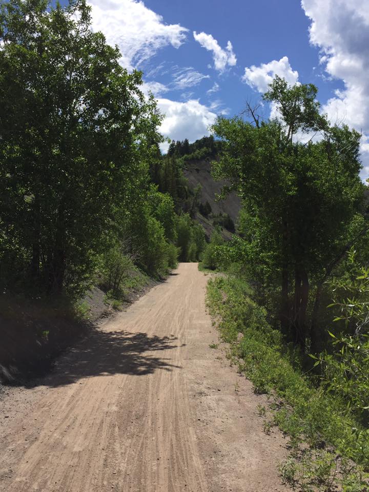
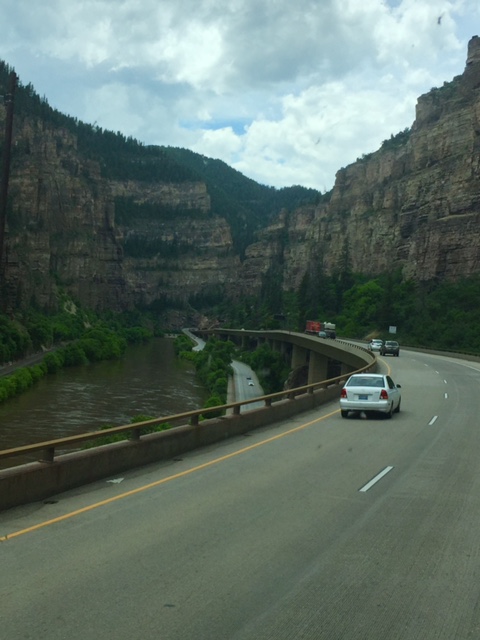
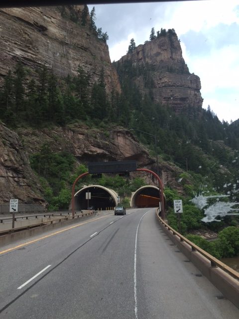
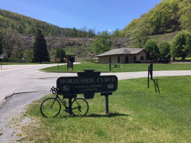
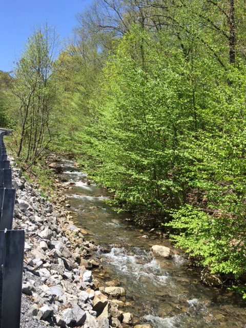
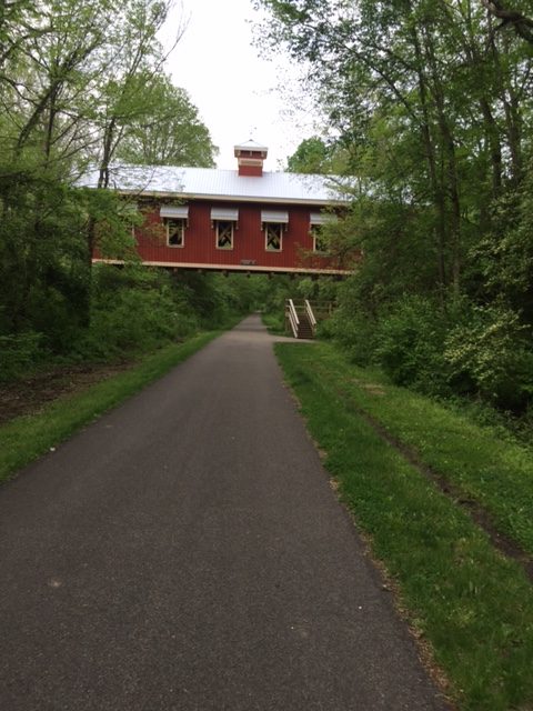
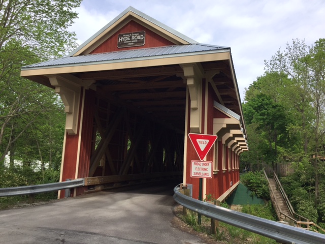
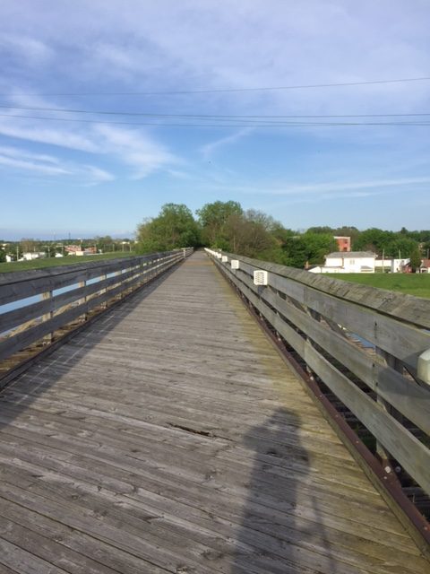
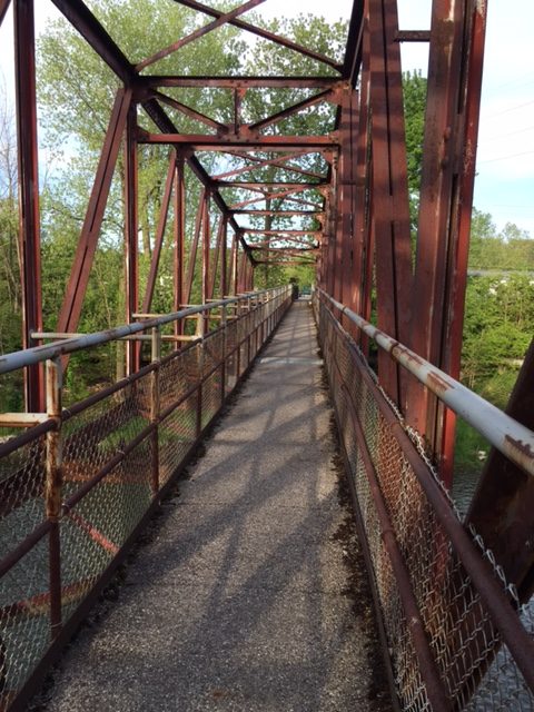
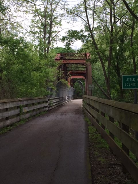
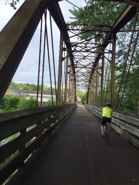
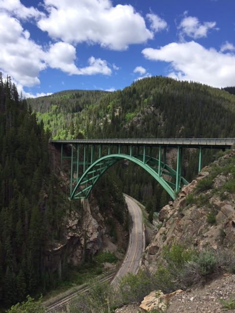
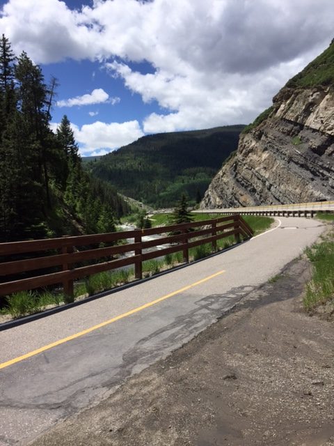
We did a brief photo-op at Red Cliff Bridge. The climb up Battle Mountain was nice but the descent down was even nicer. Beautiful vistas and many curves. Not sure if I prefer one steep straight descent or a winding curved road like this one. It was fun.

RTR16_3_08
Railroad tracks in Minturn

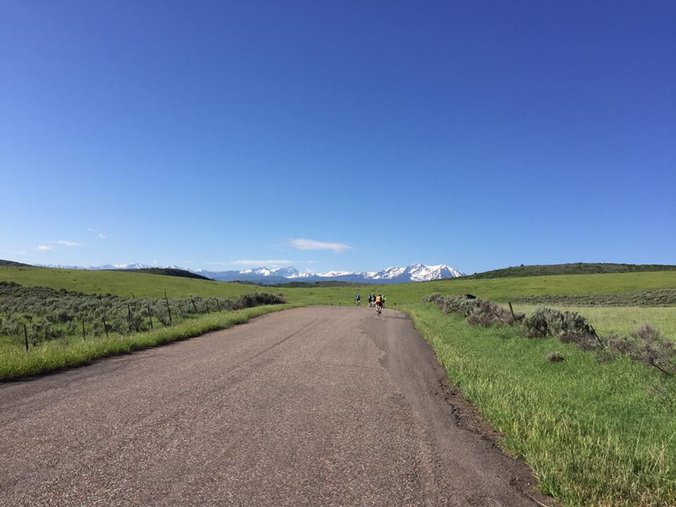
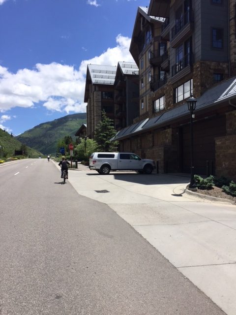
From Copper Mountain to Minturn, just before Avon, these 55 miles were a repeat of two years ago when we rode from Avon to Breckenridge. In the opposite direction. Of course the first 23 miles from Copper Mountain to Leadville were a repeat of yesterday’s ride from Leadville.

RTR16_3_09
Lower Section of bike trail near Minturn

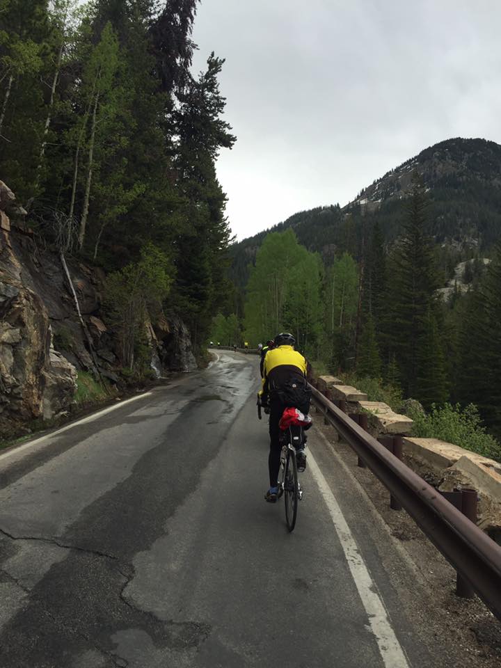
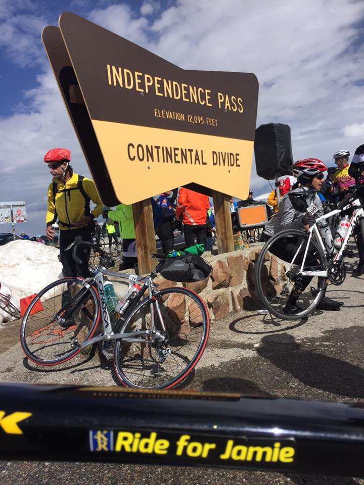
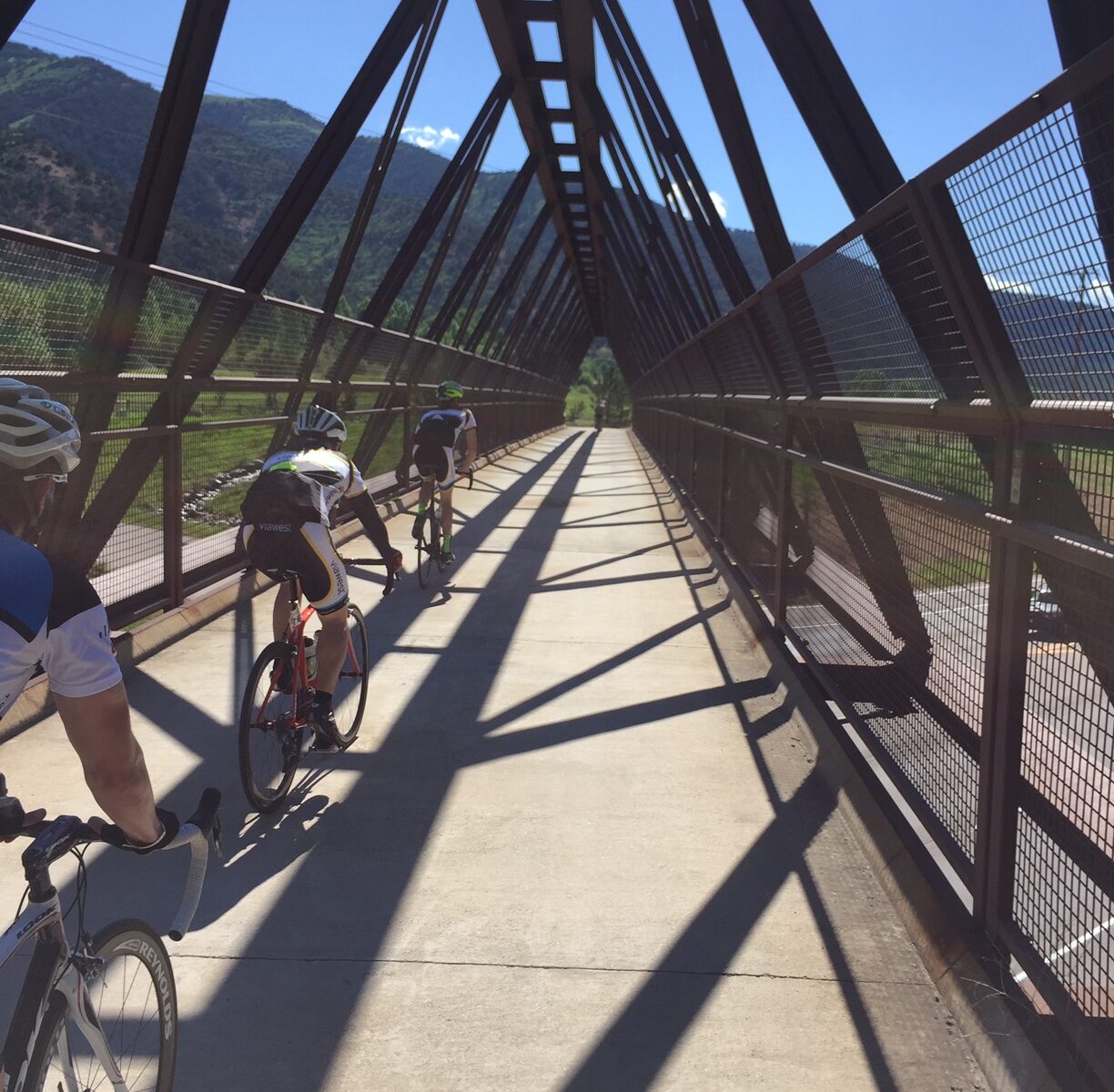
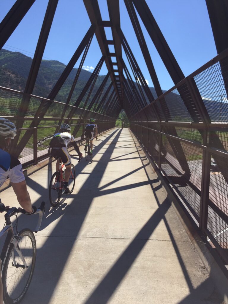
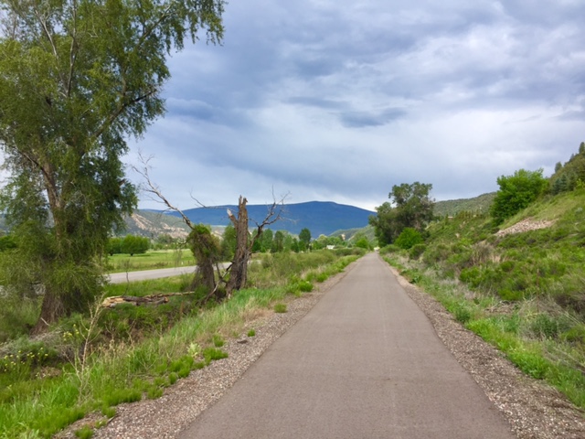
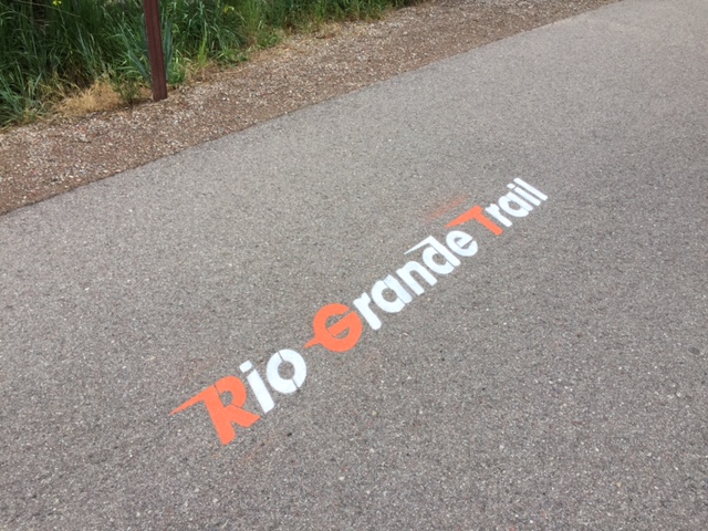
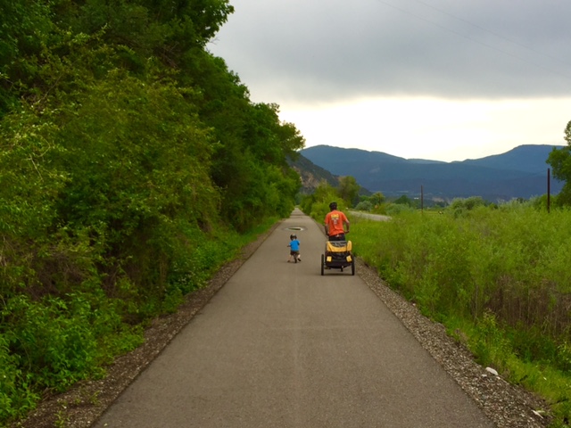
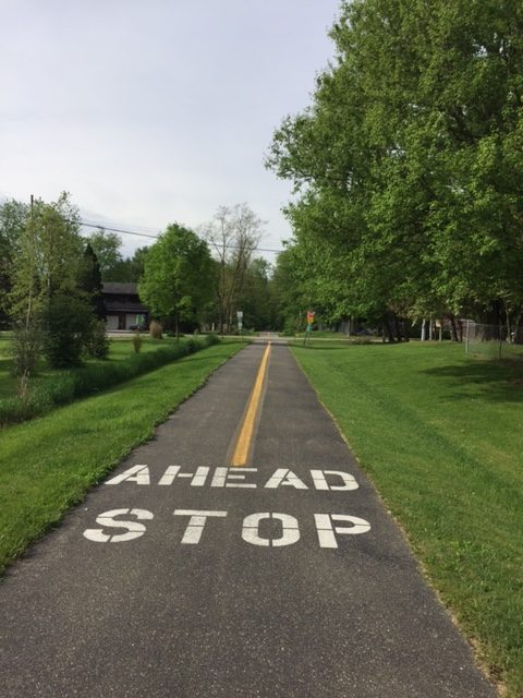
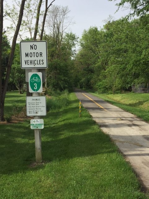
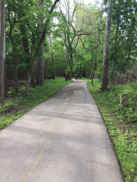
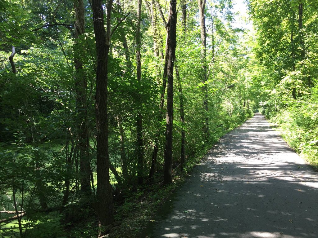
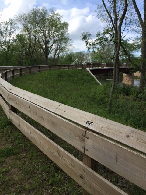
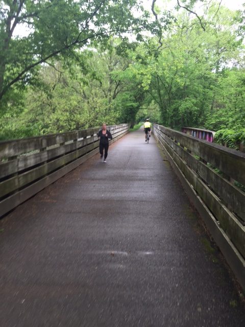
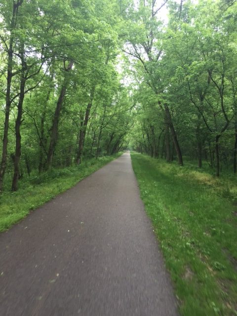
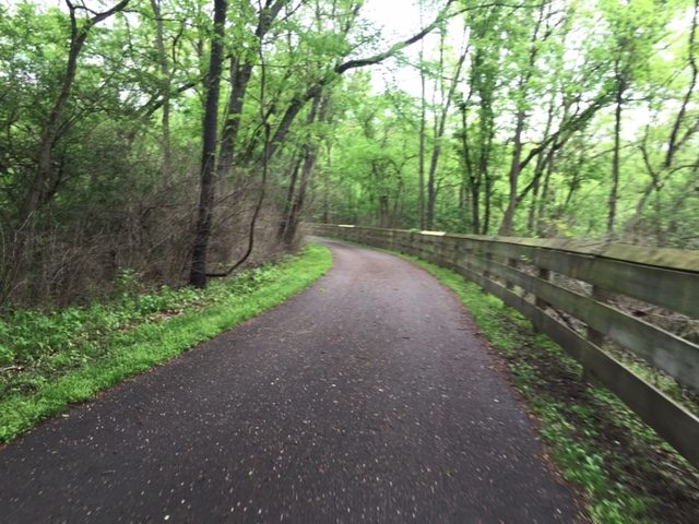
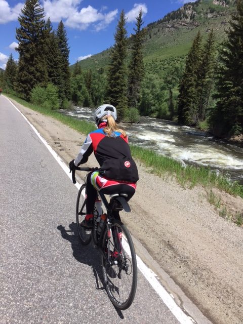
We followed the beautiful Eagle River to Minturn then turned up Vail Pass. Here we turned on a bike path which I tracked on Saturday while riding the bus to Carbondale. I was thinking I’m sure glad I don’t have to bike up that path. And now I was.

RTR16_3_10
Vail

Interstate-70 crosses Vail Pass. It’s a grind for vehicles with its 6-7% grade most of the way. Parallel to the interstate is a bike path. But it doesn’t have even grades. It follows the contour of the mountain, sometime 2-3% and sometimes 12-15%. It would be much easier to stay on the highway, minus all the traffic, of course.

RTR16_3_11
Vail

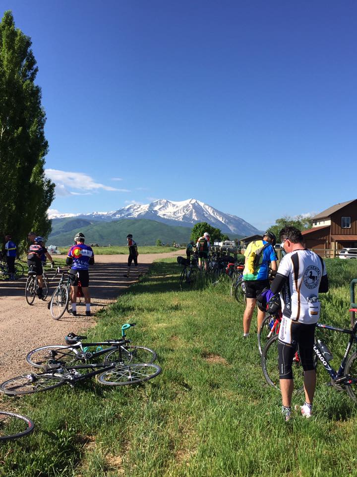
At an Aid Station just slightly up the climb, I stopped for a Smoothie. Two, in fact, as I poured them into my water bottle. I overheard the one piece of intel for the climb. Right after crossing a bridge (it was actually going under I-70), there is a sharp left turn and a steep hill. If you are in the big ring you will be stuck in the big ring. I shared that with Christine and we had no problem.

RTR16_3_12
Climbing Vail Pass

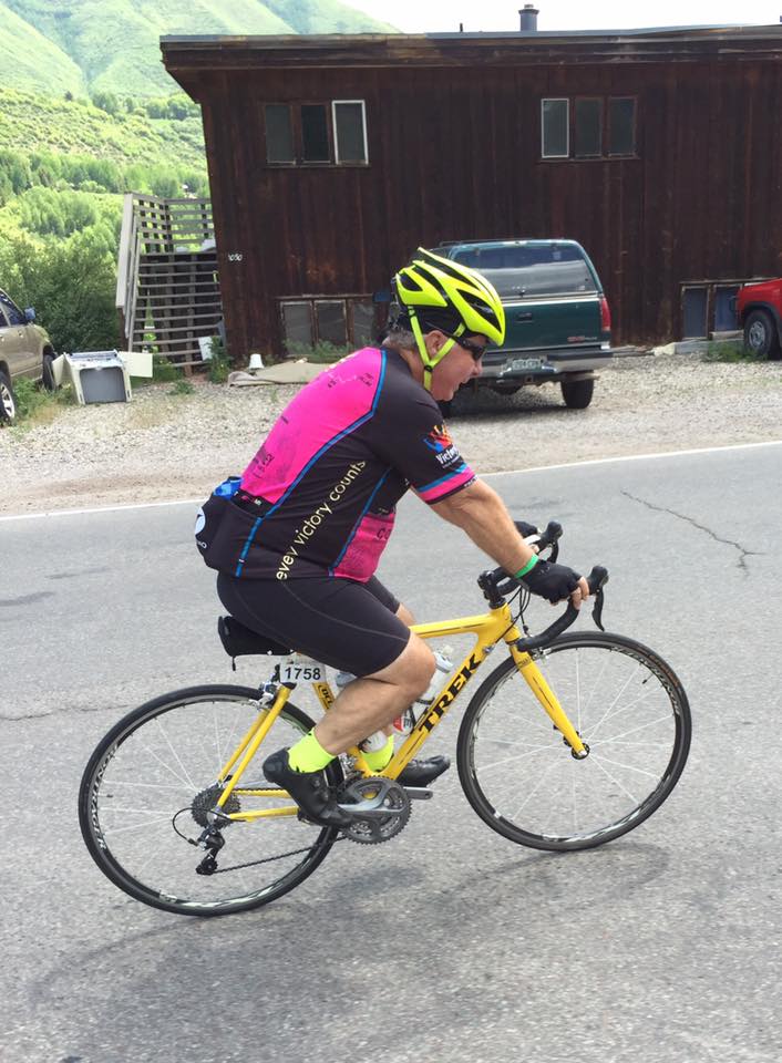
We climbed, getting passed by a few riders but passing many. This section was one of the harder ones. There was about 2500′ of climb over 10 miles, at altitude. And not graded like the highway was.

RTR16_3_13
Entering Copper Village

Reaching the top we decided we would pass the last Aid Station except we were held at the top. There had been an accident on the bike path on the descent and the trail was closed. We were held for 25 minutes then, once released, the state highway patrol released us just like we were on an alpine slide – two or three at a time with 30 seconds in between.

RTR16_3_14
Copper Mountain Village

Not to worry, after seeing and hearing the emergency vehicles, no one was of the notion to bomb the descent on a bike path. We rode a comfortable pace, passing just one super cautious rider.

RTR16_3_16
Scott Mercier

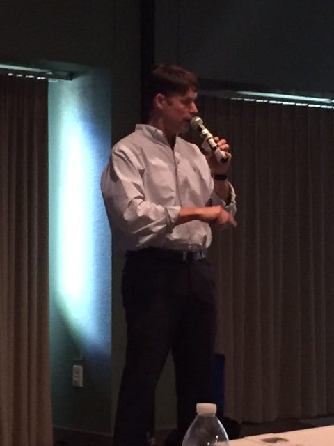
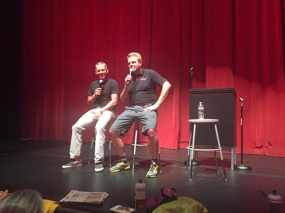
The afternoon seminar featured Scott Mercier. You probably never heard of Scott although he was in the Barcelona Summer Olympics in 1992. When he turned pro and signed with US Postal Cycling, he was offered a training program which consisted of EPO. He made a decision to walk away from pro cycling.

RTR16_3_17
Ron Kiefel, Barry Sherry, Scott Mercier

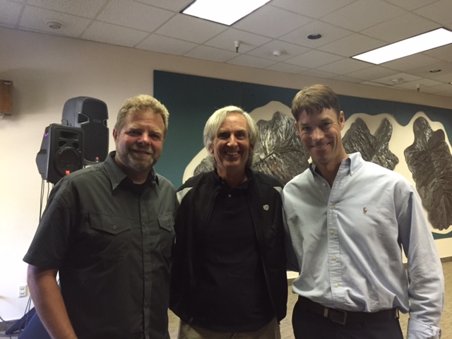
Scott was humorous and serious. His message was ultimately about integrity. He holds no bitterness to the hundreds who joined the European peloton in the 1990s and 2000s and accepted the team doctors’ training plans consisting of performance-enhancing drugs. In my four years of attending Ride the Rockies it was clearly the best seminar I attended. Well done Scott!

RTR16_3_15
Red Cliff Bridge in background

Copper Mountain

COPPER MOUNTAIN, COLORADO

Nothing screams Colorado quite like Independence Pass; the fourth highest paved roadway in the U.S., streaming with wildflowers and high alpine pools. The grade is tough and the road is narrow, but the views are well worth the grind. Once at the summit, cyclists will be rewarded with fast straights and brake-burning curves as they approach Twin Lakes. After touring the famous mining community of Leadville, it’s one last punch over Fremont Pass – home of the Climax Molybdenum Mine – before a fantastic descent to Copper Mountain Resort.

Riding through Leadville

I went to breakfast at the Limelight Hotel. I proudly wore my Pittsburgh Penguins jersey (cycling) in celebration of the Pens winning the Stanley Cup last night. While I was downstairs a woman saw me and told me she was a Sharks fan from San Jose. Sorry (not).

RTR16_2_01
Independence Pass

I rolled out of Aspen shortly after 7:00 a.m. Almost immediately the climb up Independence Pass began. I rolled past Aid Station 1 (too crowded). I passed many people saying “On your left, and Let’s Go Pens!” I wasn’t pushing myself but neither was I completely lazy when three women passed me. One was the Sharks fan from the hotel, Christine Currie.

RTR16_2_07
Independence Pass

The three of them broke up and I found myself riding with Christine. We rode together to the summit of Independence Pass. There we went our separate ways although not by design.

RTR16_2_05
Independence Pass

After 15 minutes I began the descent off Independence Pass. I am always chasing 50 mph and I figured if Christine had ridden ahead I might catch her. And I did. We talked all the way to Aid Station 3 then rolled out together to Leadville.

RTR16_2_02
Leadville

Once in Leadville, the trek up Fremont Pass was a repeat of two years ago. And I remembered it well.

RTR16_2_03
Climax, Colorado

From the top of Fremont Pass it was an 11-mile descent to Copper Mountain. I was chasing 50 mph but there was a pretty formidable headwind. I only hit 48 mph.

RTR16_2_04
Ron Keifel and Barry Sherry

We arrived at Copper Mountain. I helped Christine check-in. She thanked me for supporting her and told me that she didn’t think she would have made it today without me. Ron Kiefel was coming out and we talked with him briefly. I found my condo, at the Mill Club, then got a slice of pizza for dinner.

Christine Currie, Barry Sherry

I was dead tired. I wasn’t sure if I wanted to ride Copper Triangle tomorrow or just stay in my condo and rest for a day.


Aspen

ASPEN, COLORADO

This year’s tour starts in the shadow of Mt. Sopris and the charming community of Carbondale; a small town with big views surrounded by ranchlands and unending Colorado sky. The 50-mile day will treat cyclists to Missouri Heights – perched on a bluff – then meander along the Rio Grande Trail en route to Aspen.

It was 46° when Terry Moran and I rolled out of Carbondale at 7:00 a.m. We picked up the Rio Grande rail trail and followed it along the Roaring Fork River for five miles.  I told Terry I would commit to riding with him only on the last day to ensure that he made his flight. He said he figured as much as the climbs would separate us.

image
On the Rio Grande Rail Trail

We turned onto the first climb and Ride the Rockies was officially underway.  It was the last I would see Terry. The air was thin and I was breathing heavy. But I felt good enough to roll past Aid Station 1.  I caught a guy wearing a “Five Borough Ride” jersey and we talked all the way to station 2.

image
Terrance Moran at Ride the Rockies

It’s a funny thing about talking to people on the road. Often it is without introduction or names. If you roll into a rest stop together, as we did, there may or may not be an expectation that you roll out together. In this case, I lost my mark.

RTR16_1_01
The Rockies in the distance

Leaving the stop I had a brief conversation with the people at the Davis Phinney Foundation for Parkinson’s. Once back on the road we had a pretty good descent which led us back to the Rio Grande Trail.

RTR16_1_02
Aid Station 2

The trail splits the Roaring Fork Golf Course. I stopped for 10 minutes to talk to one of the guys at a cart path intersection.  He told me this is a private course and hard to get on to. He also stated that Lance Armstrong comes out to play occasionally.

image
Splitting Roaring Fork Golf Course

Eventually we were directed off the trail back to a road. A road which seemed to never stray far from the trail. Briefly I was with a man from Washington and a woman from Charlotte. But I noticed the trail and road never really separated. I told them I was going to jump back on the trail. It was more pleasant (no traffic).

RTR16_1_03
Riders coming through Roaring Fork Golf Course

Except for once when I jumped back onto the road to Aid Station 4, I just stayed with the trail. I didn’t stop at the station but went through it to pick up the trail again. Then we started to get serious separation. The trail climbed higher while the road stayed next to the river.

RTR16_1_05
The Wanderer

I met a cyclist coming from Aspen. Fully loaded. He said he was just wandering. He started in Tucson but couldn’t find a campground in Aspen. He thought he might head to Canada but really just wanted to know if he could buy a beer in Carbondale.

RTR16_1_06
Rio Grande Trail near Aspen. Dirt.

I stayed on the trail thinking I was doing better than everyone else. Then it turned to dirt. Oh well. It was only 2-3 miles into Aspen.

RTR16_1_08
Don Sheppard

Riding into Aspen I looked over and saw Don Sheppard on the road. I first met him in Italy two years ago.

RTR16_1_07
Micha and Neil

Once I reached the school I checked in with my friends from the Davis Phinney Foundation for Parkinson’s. While there seeing old friend, Lauren Hunt, two cyclists rolled in I had met this morning at the hotel. Micha and Neil had ridden the Sellaronda last year so we chatted about the route.

RTR16_1_11
Bike Corral in Aspen

I went to the hotel, the Limelight Hotel. It was 11:30 a.m. and my room wasn’t ready. I then escorted two cyclists back to the school/headquarters. I went back to check on the room. Still not ready. This time I went to eat. I found CP Burger. While I was waiting I heard the name Lance Armstrong called. When I ordered the young man told me when my order was ready they would call “Sidney Crosby.” I took that as an omen. The Penguins would win the Stanley Cup tonight.

RTR16_1_09
My receipt, not Sid’s – an omen before the Pens would win the Cup

The cycling seminar featured the real Lance Armstrong.  It was a Q&A session with tour host, Ron Kiefel. It was a full house. Lance said his only regret was the way he treated people. He wished he could do more with cycling, but he’s banned. And he worries about the Livestrong Foundation.

Lance Armstrong and Ron Kiefel

When asked about tomorrow’s route over Independence Pass, Lance called it “easy.” People laughed. He further explained that if the pro peloton rode it, the sprinters would stay together in the peltoton over the top. Easy for the pros.

Lance said he owed an apology to each of us; those who defended him over the years. But he didn’t stick around to talk or apologize. That’s Lance.


Carbondale

CARBONDALE, COLORADO

The day started out beautiful. Terry Moran and I left our hotel in Brighton, Colorado for the one-hour drive north to Fort Collins for the start of my 4th Ride the Rockies.

RTR16_0_01
I-70 (by bus) in Glenwood Canyon

Arriving Fort Collins, we were directed to a parking lot across from the Odell Brewing Company, which was the official ending point of RTR. We loaded our bikes on a truck and then boarded a bus for transport to Carbondale, the official start town of Ride the Rockies.

RTR16_0_02
I-70 West

The bus headed south to Denver then picked up I-70 and took that west. We had secured front-row seats on the bus and had awesome vistas. I had traveled as far as Idaho Springs before but that was the farthest west I had been on this highway.

RTR16_0_03
Carbondale, Colo.

This was my first time through the Eisenhower Tunnel and the view was spectacular. We went over Vail Pass and I was marveling at the bike path that was sometimes next to I-70. We followed I-70 through Glenwood Canyon, truly an engineering masterpiece.

RTR16_0_04

Our route took us to Glenwood Springs which looks like a nice place to visit someday. We went through Glenwood Springs and made our way to Carbondale. The sunny skies soon turned gray.

RTR16_0_05

Logistically, Day 0 is always the toughest at RTR. We went to the registration tent and got our credentials. Then we took our luggage and boarded a bus to our hotel. After dropping the luggage off at the hotel and waiting 20 minutes for the rain to subside, we took a bus back to RTR headquarters and picked up our bikes. The rain had stopped.

RTR16_0_06

I’m not sure what happened next. I told Terry I was going to go for a bike ride although I wasn’t leaving from the school. I had a backpack that I needed to offload. I followed a trail down to the hotel, stopping at a Subway for a sandwich to take back to the room.

RTR16_0_07

With gray skies, I set out on my “explorer” route. I had studied some maps and had a general idea where I was headed but wasn’t entirely sure. I found the Rio Grande Trail which is a rail trail built on the old Denver & Rio Grande Western Railroad. It connects Glenwood Springs with Aspen and runs 42 miles.

RTR16_0_08

I followed the rail trail until it moved away from the main road. Then I jumped on the road and began climbing. I had planned to follow the road until I reach Crystal Springs Road but once I did I kept going instead. The road continued up and simply looked interesting.

RTR16_0_09
A view from Panorama Drive

I came to a road called Panorama Drive. Who would want to follow that? Me, that’s who. I rode that for about five miles until I was back at the entrance. I then turned and found Crystal Springs Road. What a wild descent that was. All fun all the time. It was five miles of nothing but downhill. Glorious downhill.

RTR16_0_10

Reaching Highway 82 I trusted my instincts and went left. Looking at a map later, right would have worked even better. But left got me seven miles instead of two back to the hotel. My instincts were a little off.

RTR16_0_11

This simply allowed me to retrace some of the earlier route although I was confused about why I ended up there. But more riding. Back at the hotel, we got ready for an early night with an early rollout in the morning.

RTR16_0_12

Lodging was at the Days Inn. Mostly good but the bathroom was extremely tiny. Ride the Rockies starts tomorrow!


Never Been Out of the Cul de Sac

LEESBURG, VIRGINIA

My grandsons haven’t been riding bikes long. So my daughter, Bethany, sort of freaked out when I told her I would take them on a 4-mile ride on the W&OD Trail. “They’ve never been out of the Cul de Sac” she said.

I tried the calming response. “They would be with me.” Didn’t help much.

But they all came around to it We met right off the trail at Simpson Circle near Clarks Gap. I sat down with the boys and gave them my safety talk. We will stop at stop signs. There are only three on this route but I would go into the intersection, wearing my neon-green safety vest, and stand while they crossed. Don’t cross the yellow line unless we have to pass a walker or runner and then I would go first.

Aiden and Andy 1st Ride_05
Aiden, followed by Andy, going under Rte 9 at Clarks Gap

Aiden, 6, went off first. He takes to riding like he does most things athletically. He is pretty good and you have to protect him from himself. Bethany said sarcastically “we are working on building his confidence.” Andy, 8, is a little unsteady on the bike. Maybe he resembles his mother in that respect as she was slow to learn and then unsteady. That’s why we abandoned our ride ride half way down Cadillac Mountain when she was nine years old.

Aiden and Andy 1st Ride_03
Aiden

After a mile we came to a little uphill portion at Clarks Gap. Andy walked it. His seat was way too low and I adjusted it so he could get some power from his legs. Then we began the downhill.

Aiden and Andy 1st Ride_04
Andy with Aiden far ahead down the trail

This is a three mile stretch that goes to Leesburg. Some pedaling is necessary though but it’s easy pedaling. We stayed in our lines the entire way down. The trail isn’t crowded at this point and the few people who passed us generally encouraged the boys.

Aiden and Andy 1st Ride_02

We reached Catoctin Circle where Bethany was waiting for us. Then we went to lunch at Andy’s Pizza in Leesburg. Both boys said it was too easy and they wanted to ride more. Good boys!


My Ride For Dad

ALTOONA, PENNSYLVANIA

We got devastating news this morning. Meeting with team doctors from Conemaugh Hospital, they broke the news to us that my dad, who fell three weeks ago, had a 5% chance of walking again. It was a punch in the gut.

May16_01

As we were left to process this I decided to take advantage of the beautiful weather. It was in the high 50s, a bit on the cool side, but a sunny day. After seemingly weeks of rain, it was a welcome change.

May16_10

I pulled into a Sheetz parking lot. I bought a water then asked the manager if I could park for 90 minutes and go for a ride. She said “of course” and told me she remembered me from last year.

May16_09
Manager (in black) who helped me out

This is my go-to route. My happy place. I first rode it seven years ago as my escape from battling cancer. It was the one challenge that could take my mind of cancer.

May16_02

The ride is gorgeous. Three lakes, a 200-foot tunnel, then a 4-mile climb with an 18% wall that continues for half a mile. What a great ride.

May16_03
Blue lake and orange mine drain water. They don’t mix.

I approached Horseshoe Curve and something was missing. Trees. They had clear-cut the area around the curve. It was disappointing. I went inside the gift shop at Horseshoe Curve. I asked about the clear-cutting and the young woman inside told me they had a grant to remove all the trees. She mentioned Norfolk-Southern but I didn’t pick up if the railroad drove the removal or not. It was hard to see the trains passing through before the trees were cut.

May16_04
Lake 3. Horseshoe Curve in background. Clear cut.

I went through the tunnel and the climb began in earnest. I had come to escape the thoughts of my dad not walking but it didn’t work. There was a strong wind in my face before the tunnel and all I could think of was my dad. Wind in your face is nothing to curse but to praise. What I would give so that he could have the wind in his face.

May16_05

I started the climb. I brought the wrong bike. My other bike is geared better for climbing steep climbs. But I said I could do this.

May16_06
Horseshoe Curve and some mine water drainage

I went up the climb, legs burning, just hoping my dad could feel pain in his legs. That maybe my pain could help his. He was on my mind all the way up the climb.

May16_07

At the summit, I rode over to Tunnel Hill. I looked and thought the time was already one hour in and I was halfway done. No way I would be back in 90 minutes total.

May16_08
The Wall. Much steeper than it looks.

I started down Sugar Run Road. I thought of my post-cancer ride with Scott Scudamore and how we bombed this descent. Twice. I was hitting 45 mph. There were some crosswinds. But it was a great ride back down the mountain.

I did get back in less than 90 minutes. My go-to ride was nice but it did not get me thinking less about my dad. The reality set in that our ride in October was probably our last ride together.


Little Miami Scenic Trail II

SPRINGFIELD, OHIO

I left this morning for Pennsylvania with another bad weather forecast but surprisingly, as I passed Springfield, it was dry but mostly sunny. The weather forecast was showing a couple of hours with only a 15% chance of rain. I parked at Beatty Station just south of I-70 in Springfield.

LMT_2_01

It was 9:00. I met a guy named Dave getting his bike out. We chatted briefly. He told me he was waiting for his group. They would ride to Yellow Springs and back. He also volunteered that I might see them on the trail.

LMT_2_02

I headed north to Springfield. I wanted to see how far the trail would go. No far, I learned. When it became a signed road route I decided to turn around and ride south.

LMT_2_03

I passed Dave and his cycling friends still getting ready. The trail here is wooded. There are few intersections and just a straight wooded trail. Very pretty. In this section , unlike the southern section, it does not follow the Little Miami River.

LMT_2_04

Five miles in a came to Yellow Springs. My impression was this was a Bohemiam community. The downtown had neat buildings including a lot of art shops.

LMT_2_14

I continued on the trail. I went under a pretty neat covered bridge. The smell of lilacs permeated the woods.

LMT_2_05

I arrived in Xenia then turn around. Or maybe the outskirts of Xenia. But I wanted to get back to Pennsylvania and this was far enough.

LMT_2_10

On my return I found the covered bridge and decided to jump on the road. I was disappointed to discover the covered bridge was just two years old (2014). Oh well. It will be historical in 98 years.

LMT_2_07

In Yellow Springs I caught the cycling club. I had gone to Xenia. They had gone to Yellow Springs, one third of the distance I had ridden. I saw Dave again and then made my way through the group and eventually back to the car.

LMT_2_15

This trail is the third longest paved trail in the U.S. at almost 80 miles. It would be fun to come back and ride the entire route.


Great Miami River Trail Part II

PIQUA, OHIO

I began the day riding part of the Great Miami River Trail in Dayton. That did not go so well as the trails next to the river in Dayton were covered with mud and/or under construction.

Great Miami Trail between Troy and Piqua

That led me to this tried and true route (once before). I parked in Troy and headed to Piqua. The trail in this section is in great shape. Great asphalt and no roots. There were two puddles one had to go through caused by all the rain of the last 10 days.

Miami-Erie Canal (on left) - Photo Aug 2015
Miami-Erie Canal (on left) – Photo Aug 2015

Towards the end of the trail I passed a watered section of the Erie – Miami Canal. Then I head out Hardin Road to Lockington.

Barn on N. Hardin Road

I passed the Lockington Dam which has certainly fallen into disrepair. But I guess it lasted 80 years.

Lockington Dam
Lockington Dam

I stopped briefly and posed for a photo in front of the house where I lived 50 years ago. A teenage girl walked by with her mother or grandmother.

Lockington, Ohio – 1966. Brenda, Bernie, Betsy (being held), Naomi, Brad, Harry, Barry

I almost asked the older woman if she lived in the house next door 50 years ago but they were engaged and I missed that opportunity. But it was 50 years ago on the same sidewalk that I remember my dad sitting on my bike.

Old E.U.B. Church Parsonage, Lockington, Ohio

The road back in to Piqua was in great shape and surprisingly little traffic. Fifty years ago I would ride my bike on this road and not even be aware of cars. I guess when you’re 10-12 years old you don’t think about that those things. You just know cars won’t hit you. Or you just don’t think about it.

Dayton49

In Piqua I crossed the Great Miami River on N. Main Street. This is a pretty city. A neat downtown and a beautiful old building, the “Orr-Statler Block” building.

Dayton51

The Great Miami Trail is a river trail that comes into the city. There is also a rail-trail, Piqua’s linear park. The old Pennsylvania Rail Road (then Conrail) ran east-west and crossed town via a high trestle. There are stairs leading up to the trestle which one can bike across.

Entrance to the trestle at Linear Park

Trestle at Linear Park

Leaving town to the south, one passes a waste water treatment plant. Not observant enough to take a photo of sewage, I noticed what looked to be an atomic dome. This was apparently the location for the first municipal atomic plant in the 1960s. Piqua was the first atomic powered city although that didn’t last long.

Bridge over Great Miami River, Piqua

The last five miles back to Troy were pleasant. On this section of the trail one can make out an area next to the trail that was the old Miami-Erie Canal.

Dayton32

It has been reclaimed by the forest but the unnatural depression in the earth gives it away. This section was a much better section than in the city of Dayton. This was a nice trail and great diversion to the Lockington Loop.


Great Miami River Trail Part I

DAYTON, OHIO

I was excited about riding the Great Miami River Trail in the Dayton area. I wanted to ride next to the river and find the Wright Cycle Co., the historical museum site for the Wright Brothers.

Dayton Aviation Heritage National Historical Park

I  also wanted to visit the Dayton National Cemetery. I have two distant relatives buried there and my cousin, Patricia Lawmaster, posted that yesterday would have been her mother’s 93rd birthday. I wanted to get some photos for my genealogical database and for Patricia.

Stella Ruth Gallagher, Patricia's mother
Stella Ruth Gallagher, Patricia’s mother

I thought I would park at Deeds Carillon Park in Dayton. I figured it was safe and, as an added bonus, was probably 50 years since we visited as a family. It might be neat to see it again.

Dayton06

Ashley Snow (R), National Geographic's American Genius
Ashley Snow (R), National Geographic’s American Genius

I drove out to the Dayton National Cemetery. I found my gravestones then headed towards Deeds Carillon Park. On the way I looked up and was besides the Wright Brothers’ Museum. It was a no-brainer, I would park there. There would be no Deeds Park for me today.

Dayton03

Last year National Geographic aired a series called American Genius. The episode called “The Contest for Human Flight” documented the Wright Brothers vs Glenn Curtiss “the World’s Fastest Human.” My daughter, Ashley Snow, had a cameo appearance walking past the Wright’s bicycle shop. I knew I needed a photo in the same location.

Dayton10
Period house down the block. Not sure if it’s 120 years old or made to look like it.

I went into the visitor center and as greeted by a nice government worker wearing a beige and green uniform. She told me that this museum was covered the Wright Bros. up to their flight at Kitty Hawk. There was another museum across town that covered post flight Wright Bros. She also told me that in all, Orville and Wilbur owned five different bike shops at different times.

Dayton14
One must cross Wolf Creek as it flows into the Great Miami River on this narrow path

She called another ranger, Casey, to come open up the shop for me to tour. I wish I had asked a question about the history of the building. Which shop was this? Then what, store? Warehouse? Residence? Vacant Building? What involved in getting it restored? Oh well, maybe I have to go back.

Dayton16
Building a river experience

After touring the Museum, I headed out to find the trail. I only went a few blocks before I was at the river. I found stairs down and then started up the trail. Many blocks in this area were closed but this was open. I didn’t go far before I saw how crappy the trail was. Rocks. Mud. Three to four inches deep at times. It was not enjoyable and I soon climbed out of the river basin.

Dayton18
Rough pavement ahead

I made my way into the city of Dayton although it was more like dipping my toes in Lake Erie. I didn’t see much. I found the trail on the east side of the river and it was torn up too.

Dayton15
This section trashed my bike

But I finally found a way out on the trail and rode north. I knew I’d be riding later in the day and didn’t want to go too far. The trail became more remote. The farther from the city the better it was.

Dayton22
Dayton, Ohio

I passed a golf course named Kitty Hawk G.C. Wonder if North Carolina knows?

Dayton24

I turned around. I mostly retraced my ride back to the Wright Bros. Museum. Once finished it was off to find my favorite part of Dayton – Skyline Chili.

Dayton28


Little Miami Scenic Trail I

LOVELAND, OHIO

The weather here, and in most of the East, has been bad. It rained all day yesterday and initially was forecast to rain all day today. But at 8:00 when it was still dry I called my friend, Bob Berberich, and told him if we met by 9:00 we could get in two hours’ of riding before the rain.

LMT_1_01
Loveland, Ohio

Bob suggested we meet in Loveland, Ohio and off I went. This is a lovely old town which begs for more exploration but not today. We met and Bob showed me the Little Miami Scenic Trail.

LMT_1_02 LMT_1_03

The Little Miami Scenic Trail is a rail trail that follows the route of the old Little Miami Railroad. In this section, which we rode to Morrow, the trail followed the Little Miami River.

LMT_1_08

LMT_1_07

LMT_1_06

Very pretty. The trail was in excellent shape. Great pavement, no roots.

LMT_1_09

LMT_1_10

About two miles from our return it started to rain. No worries. I got out my rain jacket but never put it on. Just a light rain and we got out two hours in before the heavy stuff would come.

LMT_1_14

LMT_1_12

After a good ride it was time for some post-ride nourishment. When in Cincinnati, you must go to Skyline Chili.

LMT_1_16

LMT_1_15
Skyline Chili – 3-Way

Insert Map


Verified by MonsterInsights