Casey Key – The Hidden Gem

SARASOTA, FLORIDA

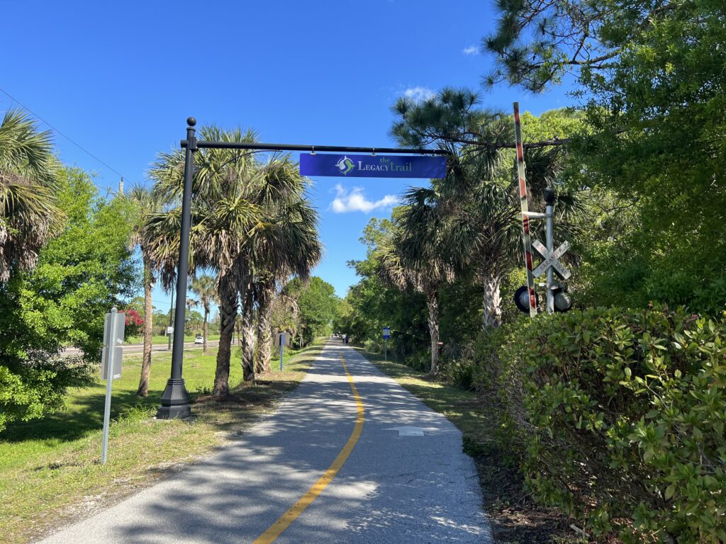
This started as a review of the Legacy Trail. So I can start there. I stayed overnight in Brandon, Florida, and was headed south to Fort Myers. I wanted to ride the Legacy Trail but did not do my homework as to my starting location.

The Legacy Trail

I told Siri to find the Legacy Trail using both Waze and Apple Maps. Neither succeeded. When I ended up in Venice I made my way over on Venice Ave. to where I thought I would find the trail.

At the southern end of the Legacy Trail near Venice

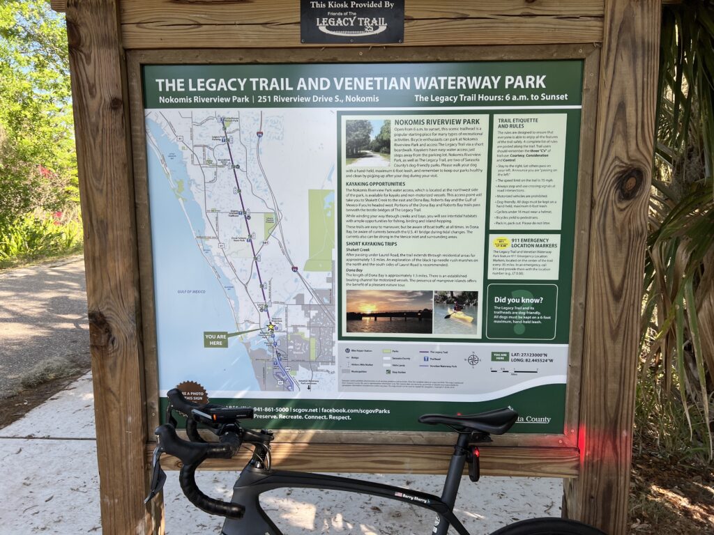
There is parking at the bus/train terminal in Venice. According to TrailLink.com (which I should have noted) there is additional parking:

  • Patriots Park (800 Venetia Bay Blvd., Venice)
  • Nokomis Community Park (234 Nippino Trail East, Nokomis)
  • Laurel Park (509 Collins Rd., Laurel)
  • Oscar Scherer State Park (1843 S. Tamiami Trail, Osprey)
  • Bay Street Park (300 Bay St., Osprey)
  • Potter Park (8587 Potter Park Dr., Sarasota)
  • Payne Park (2010 Adams Lane, Sarasota)

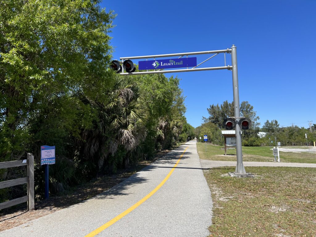
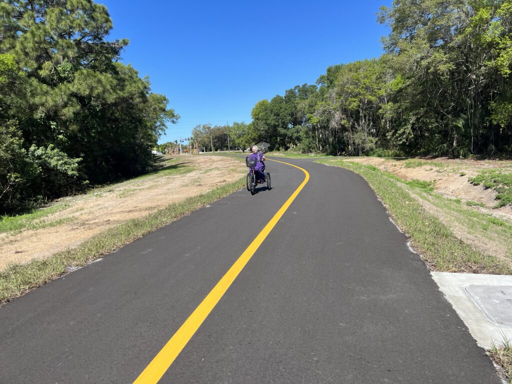
I ended up at Nokomis Community Park. I found the trail and then headed north. I intended to head south for 1-2 miles knowing I was close to Venice. I thought I had parked east of the trail so a left turn would take me south. I also learned about the directional arrow on my Wahoo (after two years of using it). The N is not at the top of the map/computer but at the bottom of an arrow pointing up. And so when I was headed north the N was on the bottom of the screen which, in my mind, confirmed I was going south. Confused? I was.

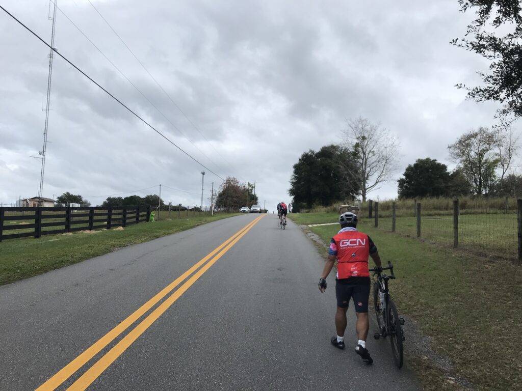
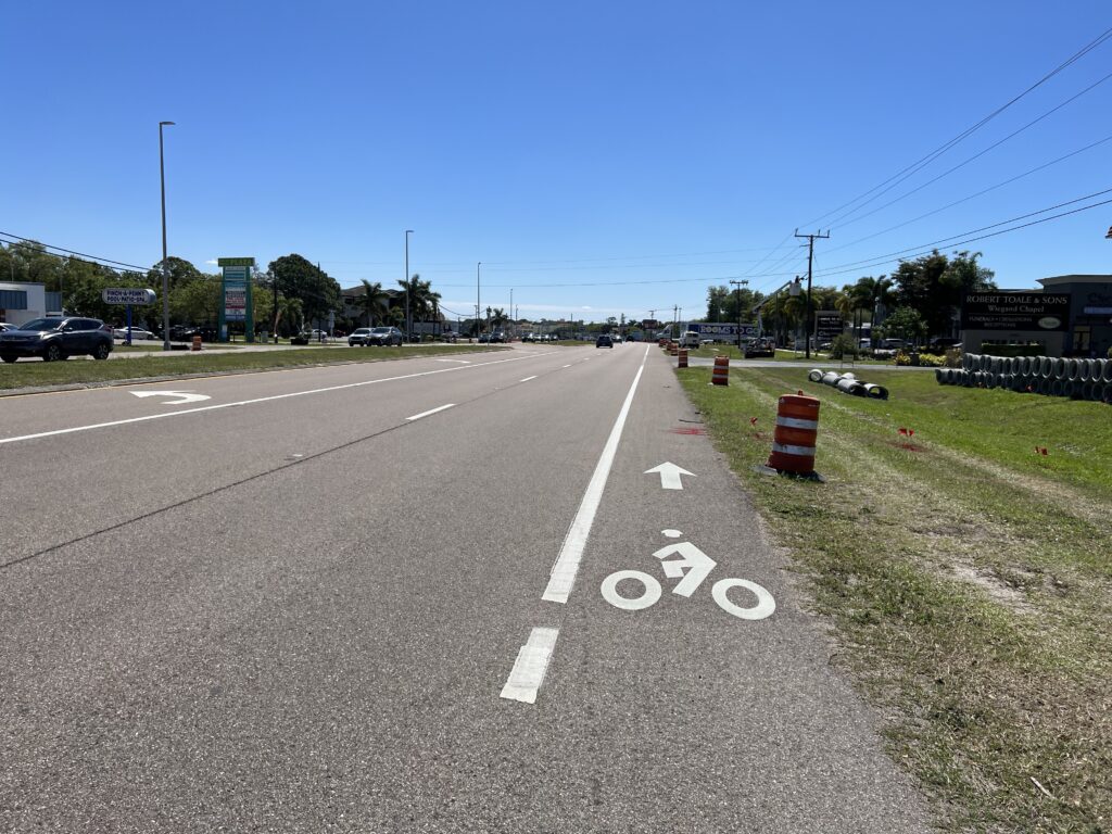
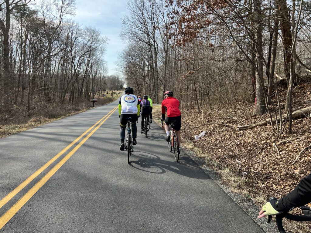
Did you know there is a 15 mph speed limit on the trail? You will as there are signs everywhere. Even this recreational rider, into the wind, had a hard time keeping the speed to 15 mph.

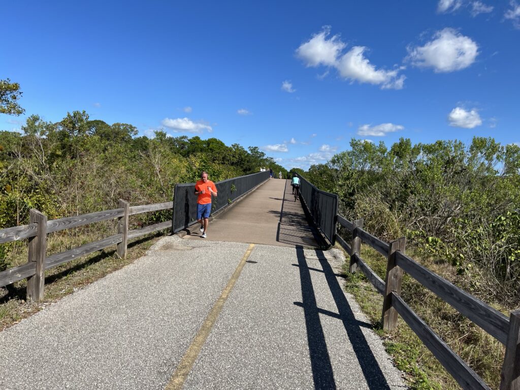
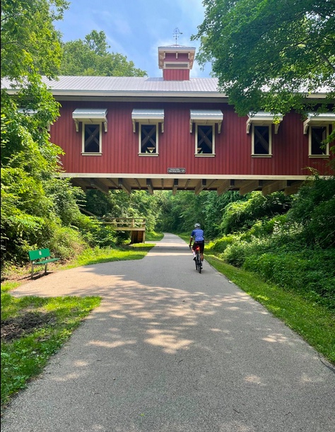
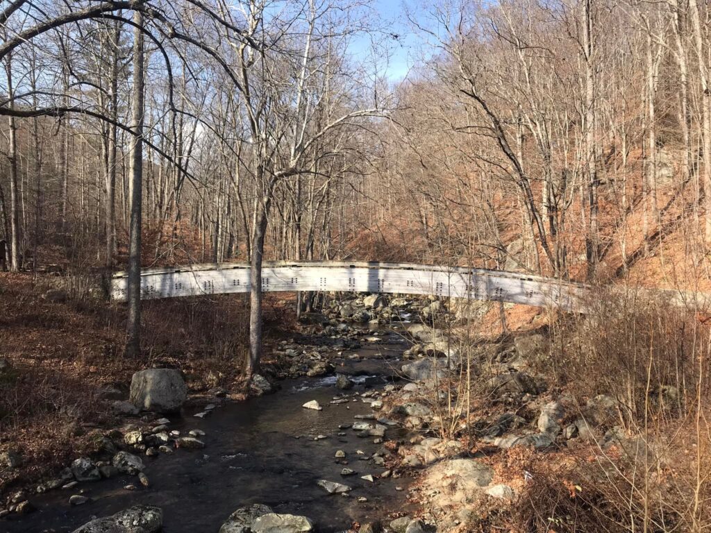
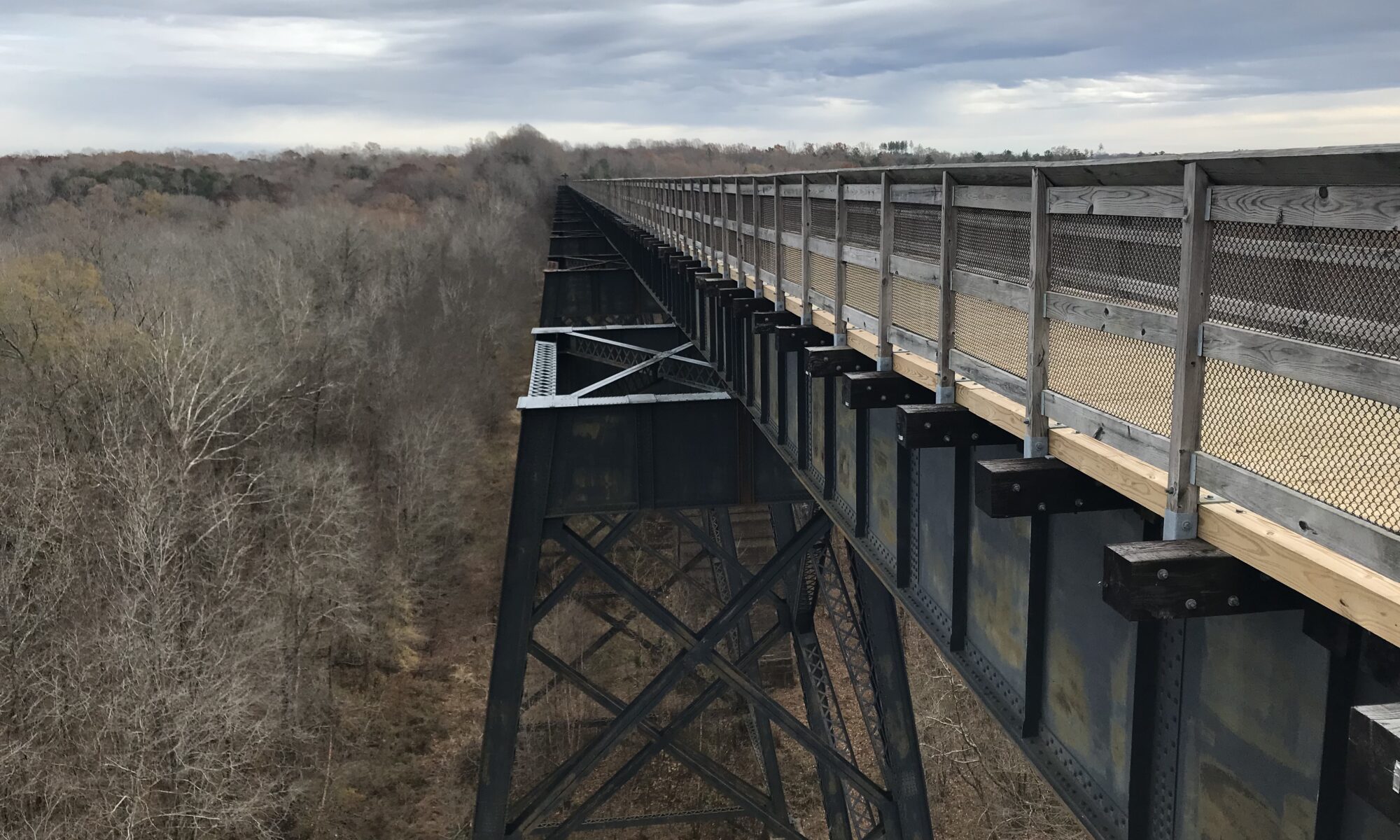
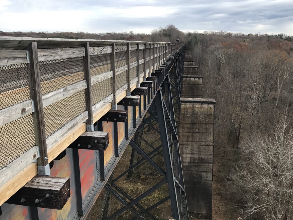
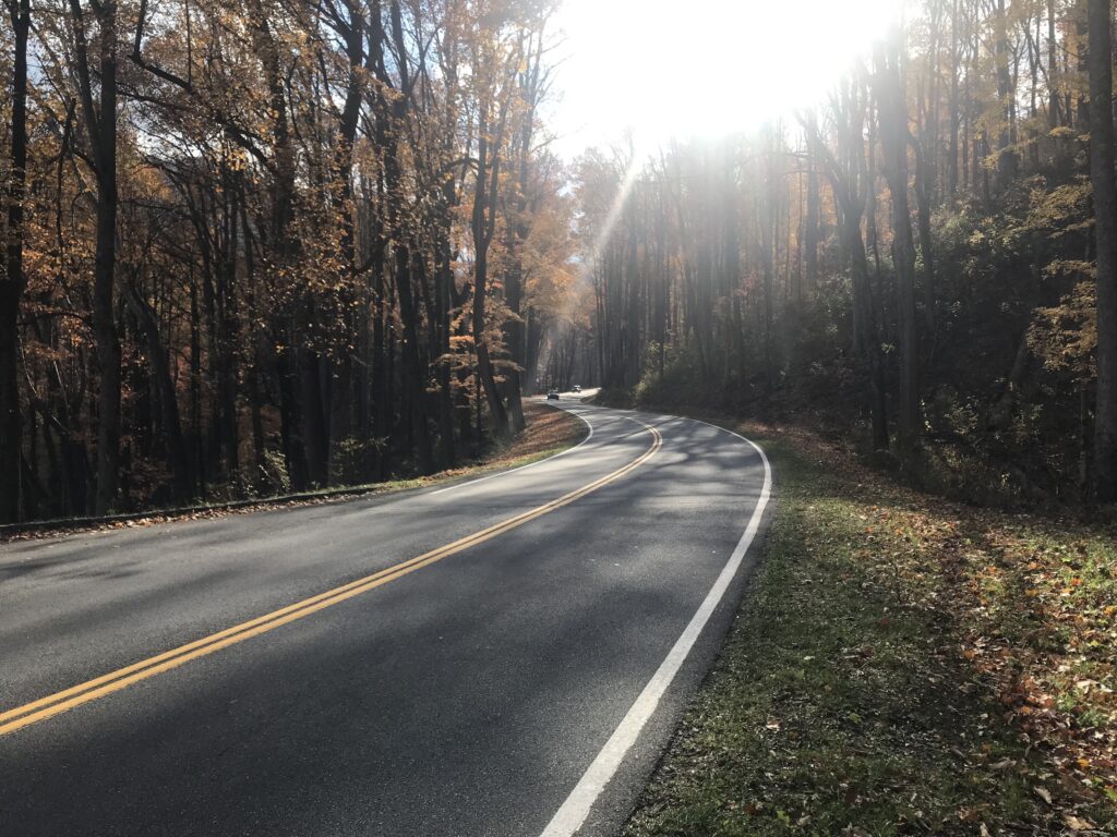
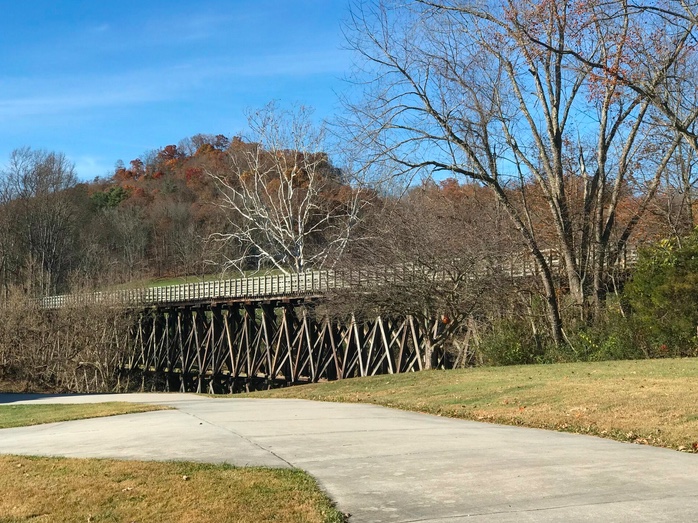
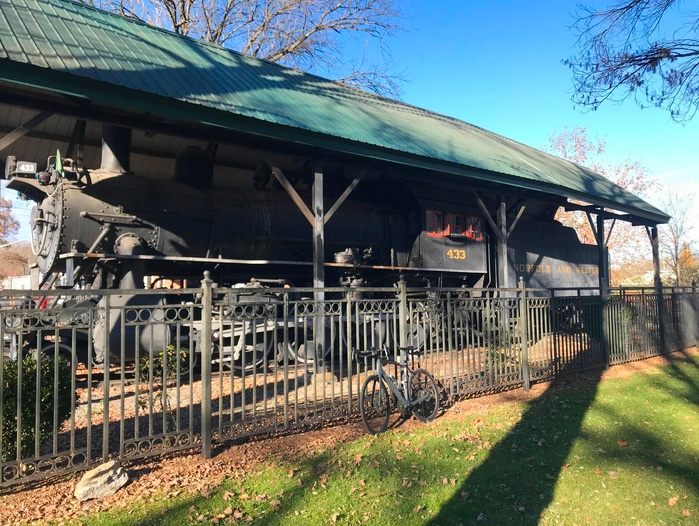
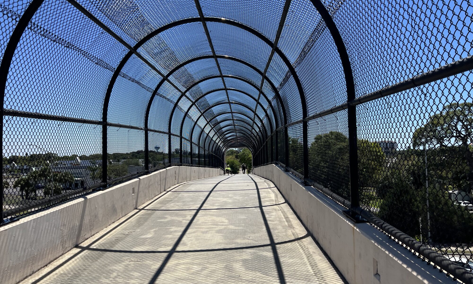
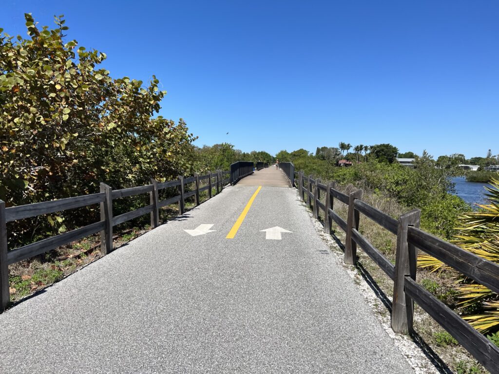
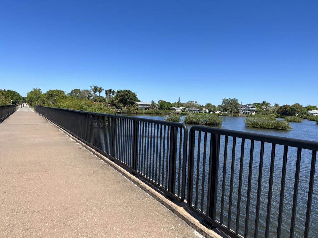
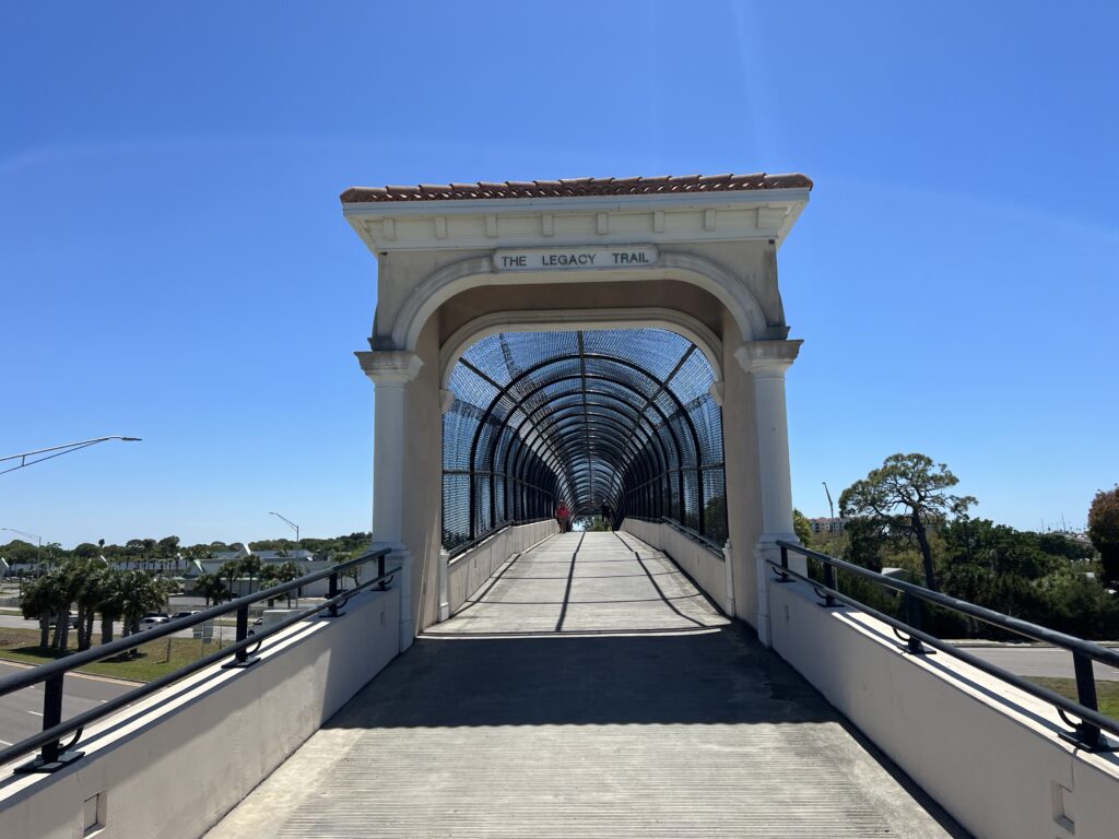
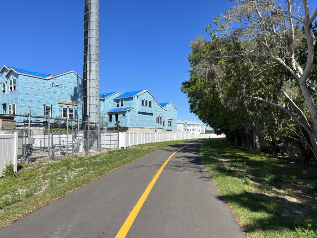
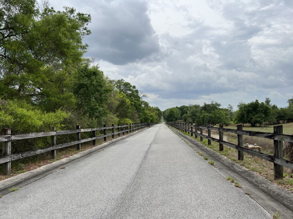
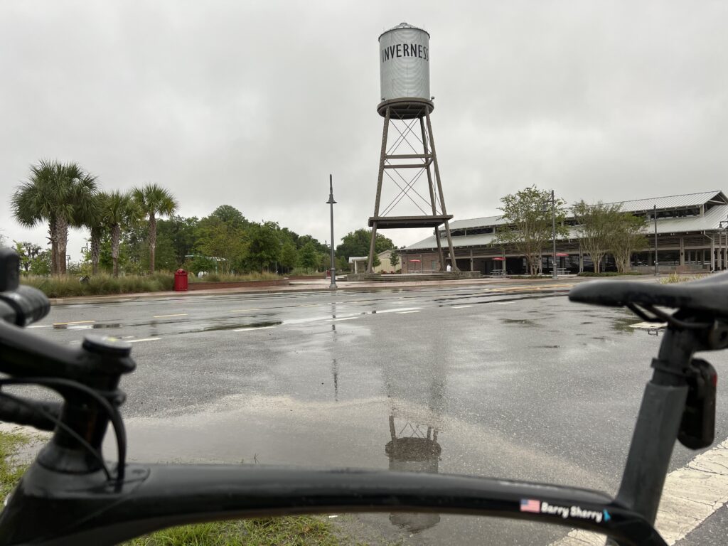
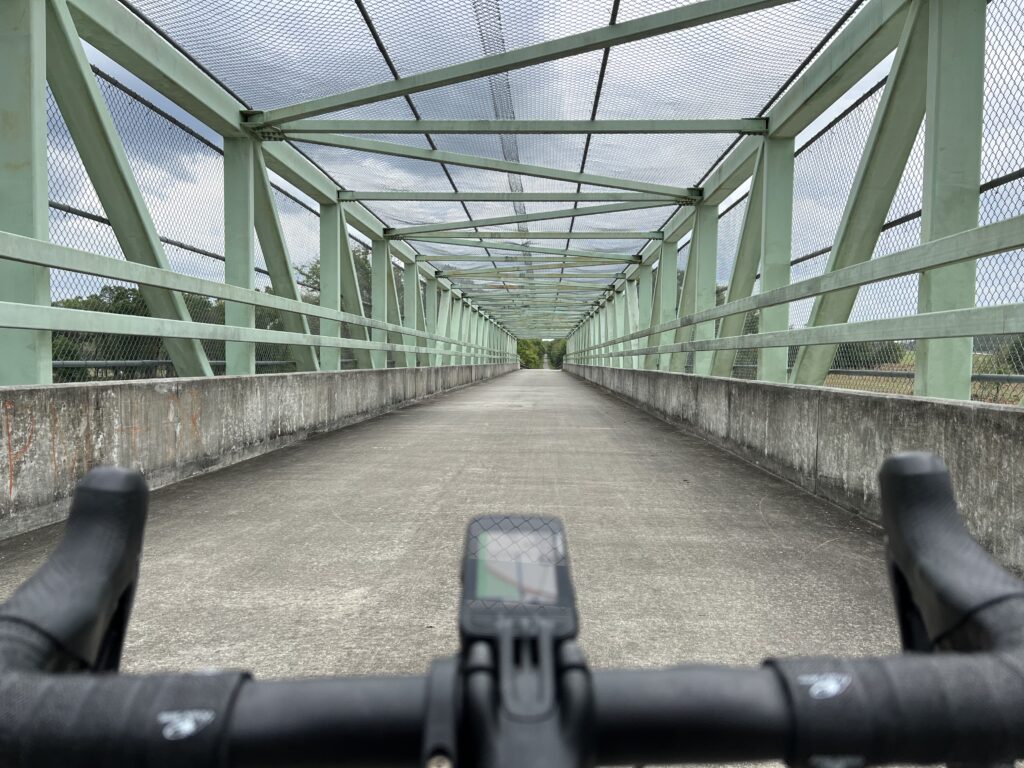
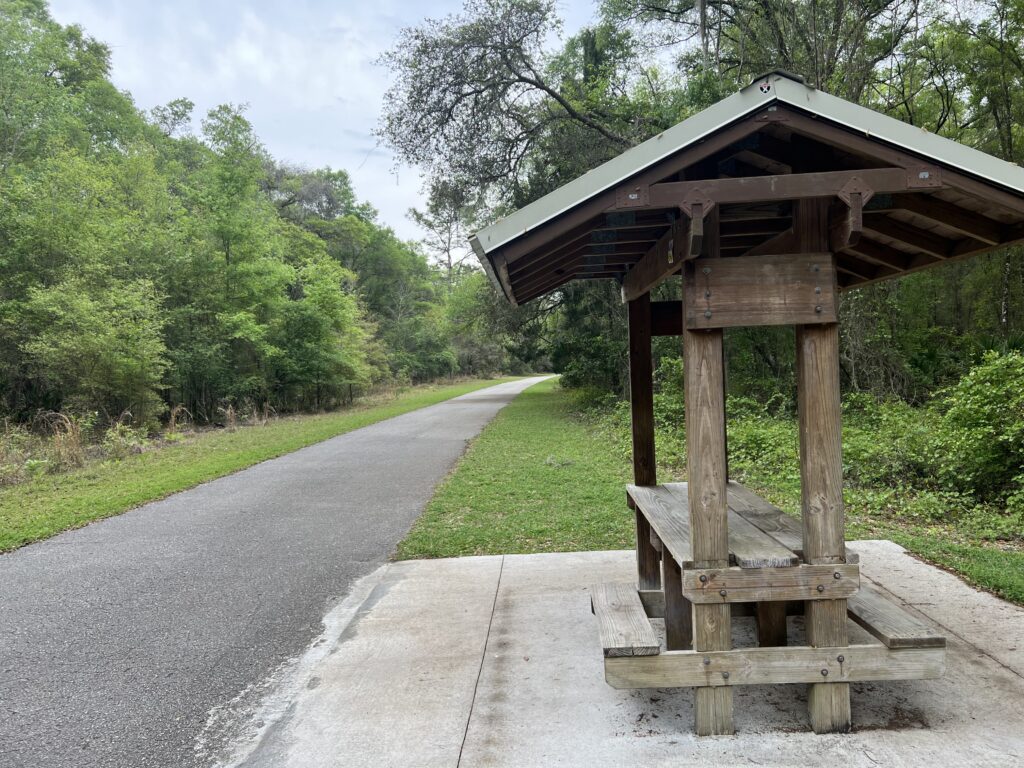
The trail is straight. The trail is flat except for two overpasses. The overpass by the train depot at the southern end might be the coolest fixture on the trail.

The Legacy Trail Overpass

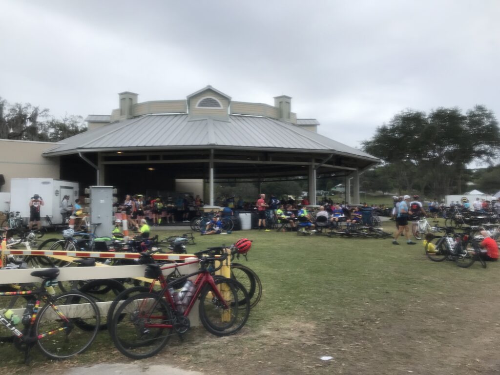
Being a Friday morning I can’t judge whether the trail was crowded by local standards. I saw very few runners/walkers and no dogs. Don’t they like dogs here? I also saw plenty of trikes. Not just three-wheeled bicycles but trikes ridden by the Amish.

Amish woman on a trike

My initial plan was to ride the length of the Legacy Trail and back. Then I would meet my friend, Darrin, for lunch. But the trail has a reputation as being straight and boring.

There were no alligators. Just a tease.

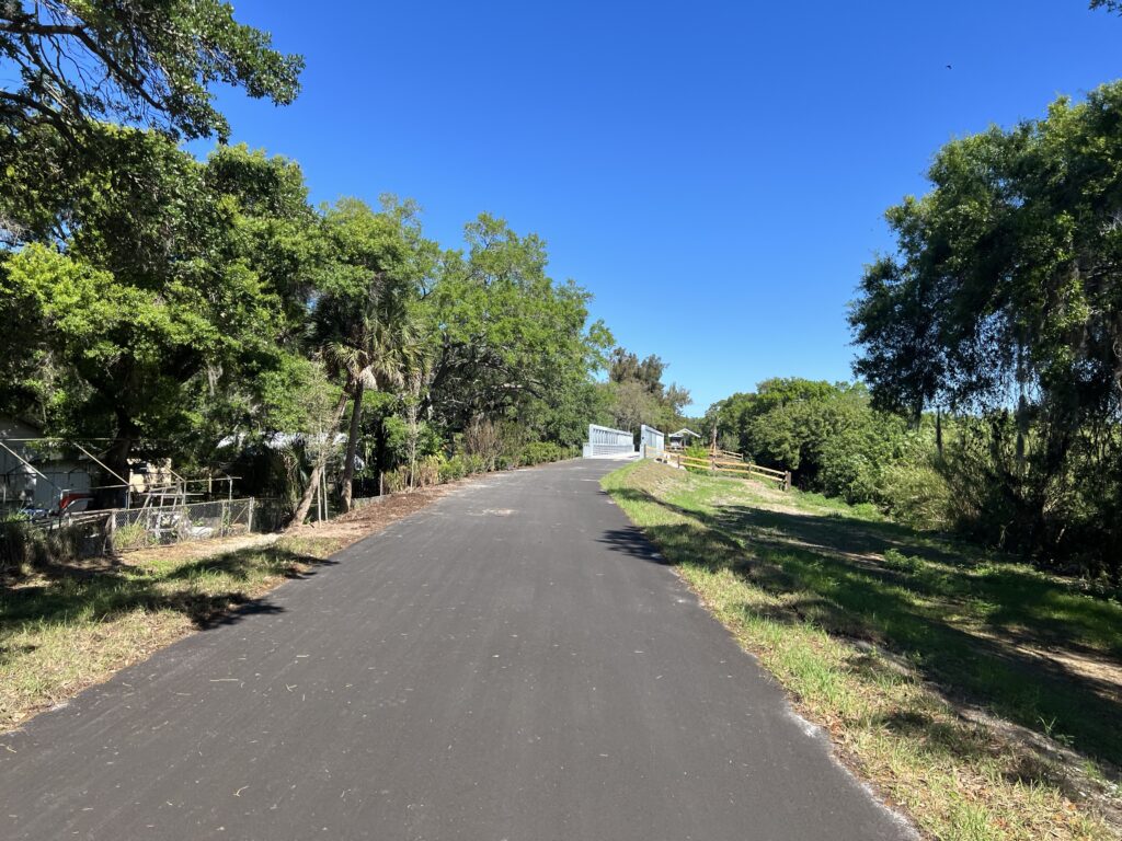
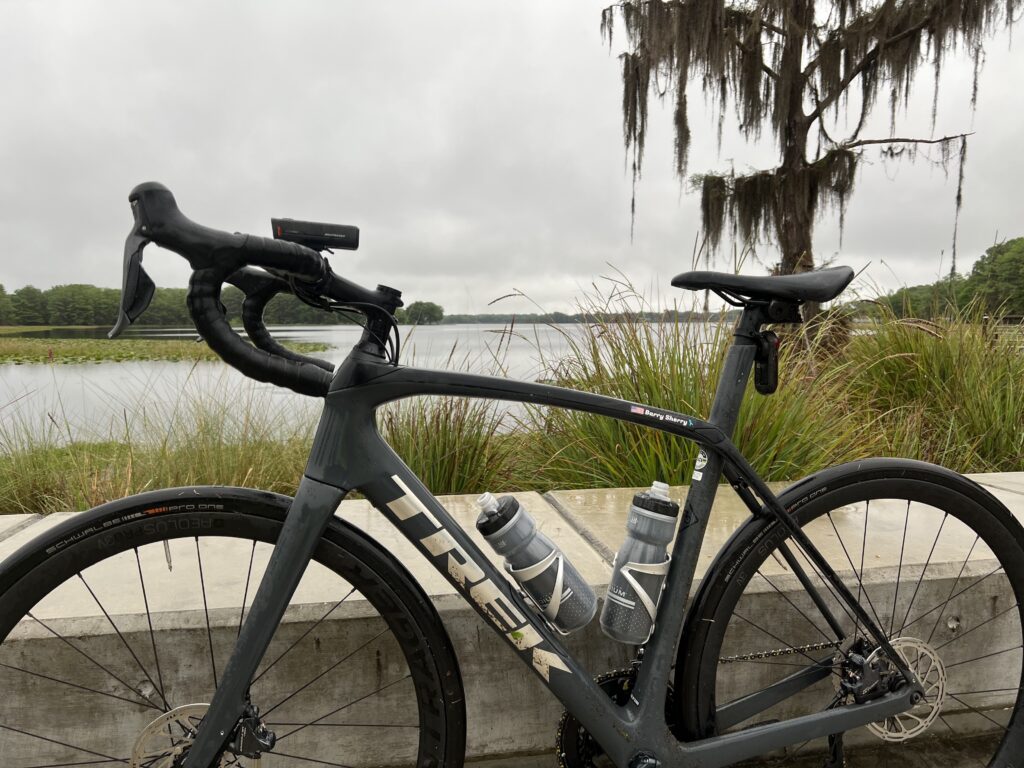
But any new trail to me is exciting the first time. The pavement was excellent, perhaps the best I have ever ridden. Smooth pavement and no tree roots.

A fixture on the Legacy Trail

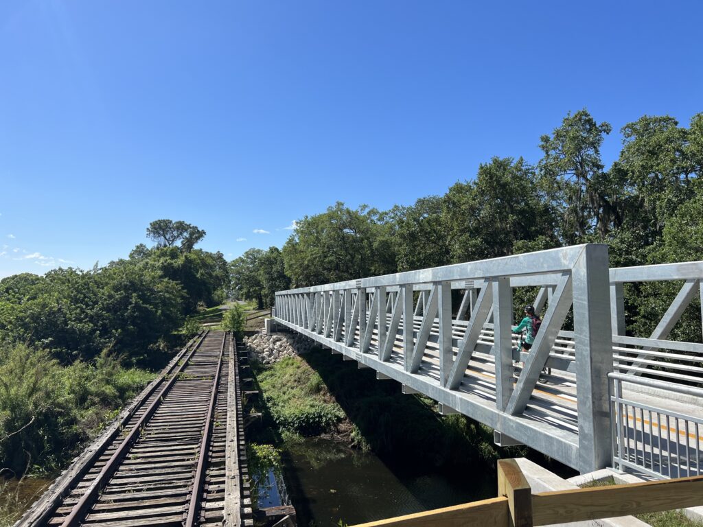
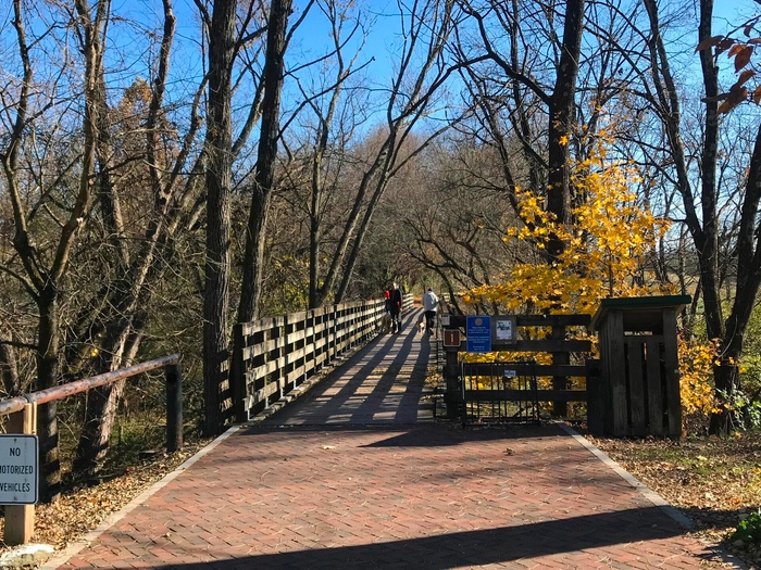
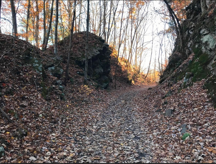
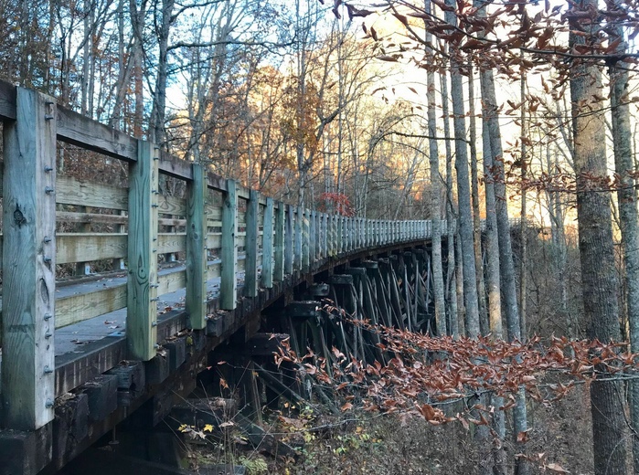
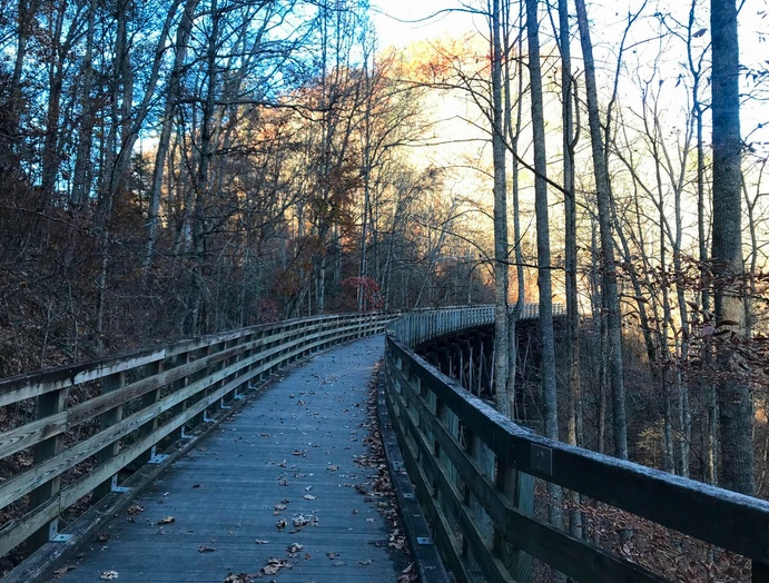
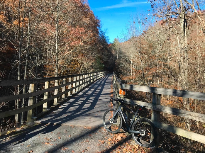
The trail lacks fixtures. No tunnels and no great trestles. There were a couple of bridges next to the old rail line but that was it if one was looking for rail history.

Legacy Trail Crossing

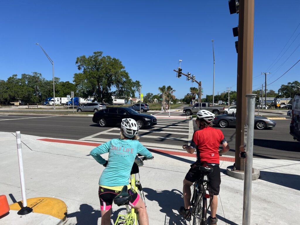
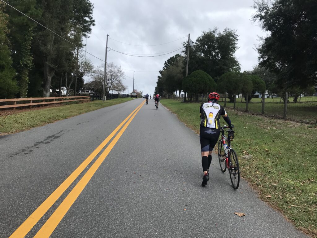
The trail crosses some busy streets and I stopped and waited for the ped-head light at each. Some seemingly were pretty long which adds to a local complaint of the trail – too many at-grade crossings.

Legacy Trail – Sarasota

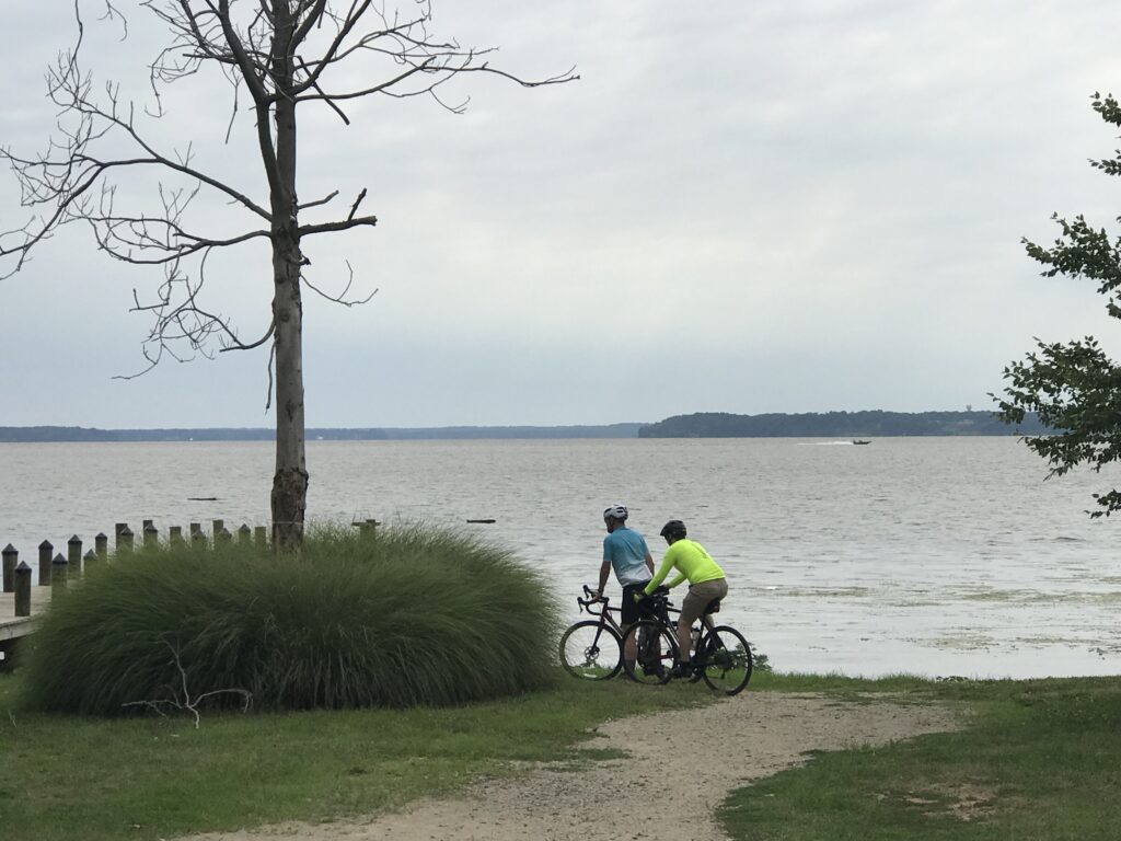
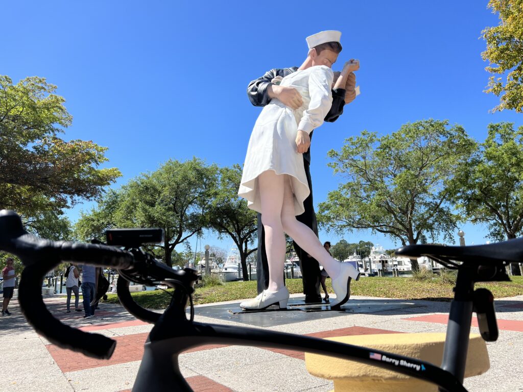
When I reached the end of the trail in Sarasota I headed over to the waterfront. I wanted a photo at Unconditional Surrender, the statue that commemorates the kiss in Times Square at the end of World War II.

Unconditional Surrender, Sarasota

I had already decided not to return via the Legacy Trail. Was it boring? Or was the coastal route more exciting?

Siesta Key

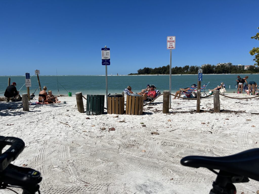
I headed out to Siesta Key. It’s a beautiful strip of land and overly crowded. There was a bike lane for much of it and I almost went down hard on it. At one point it was next to a sidewalk and I had to transition from bike lane to the sidewalk. I did not turn sharply but was going to ease over gradually. There was a lip and my tire caught briefly in it. But I made it and was very thankful I did not crash.

Siesta Key

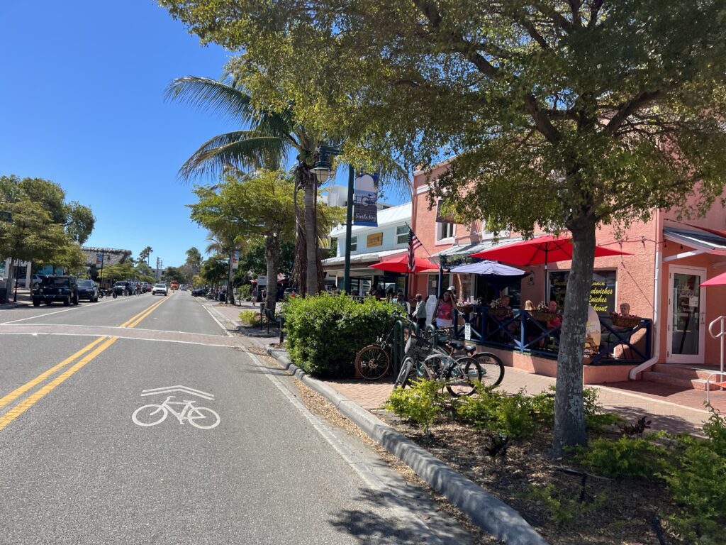
Leaving the island I came to the Tamiami Trail, aka Hwy 41. There was a bike lane on this high-speed highway. I will stop short of recommending any highway riding but for this stretch neither would I discourage it.

Tamiami Trail

I was on the highway for six miles going south then turned on Blackburn Point Road out to Casey Key. I crossed a one-lane steel grate bridge over the waterway and was on Casey Key.

Casey Key

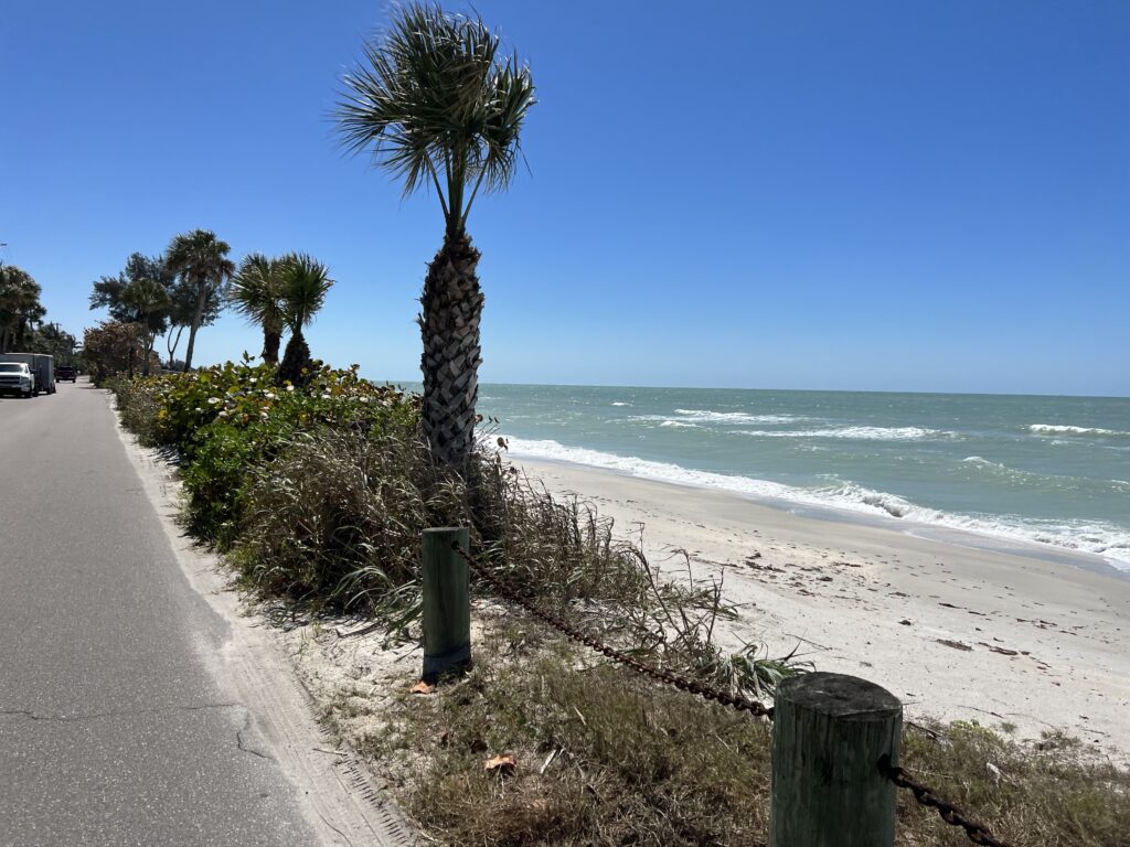
What a joy this ride was. The next four miles were the finest four miles I had in Florida. I regret I could not capture it in photos. On the right side of the narrow road was the Gulf of Mexico. On the left side was the waterway/bay (Gulf Intracoastal Waterway). If there was enough room there was a beautiful home, maybe even a small mansion. This really did look like the most perfect place to live. Or ride.

The Legacy Trail

I rode back over to where I parked and decided I needed to the last mile of the Legacy Trail down to Venice. I was glad I did.

Venice Train Station

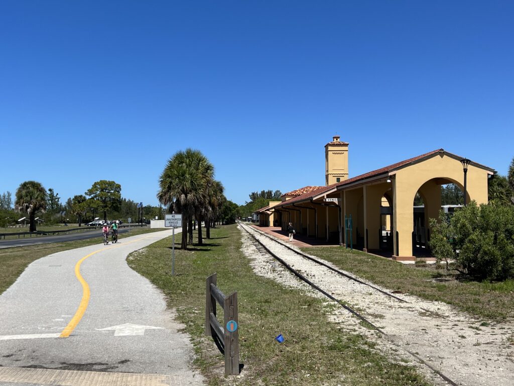
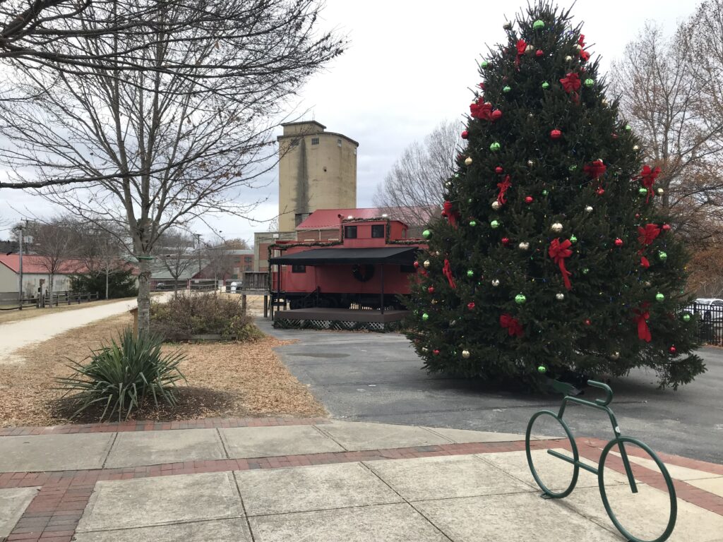
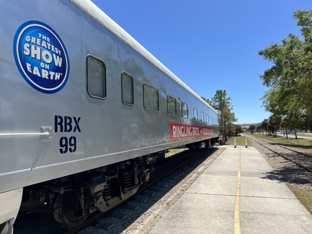
The last mile or first mile features the Venice Train Station which appears to be a city bus and commuter parking center. Here is where the feature fly-over ramp is also.

Legacy Trail

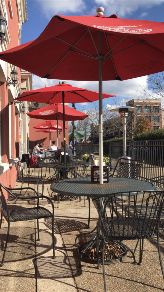
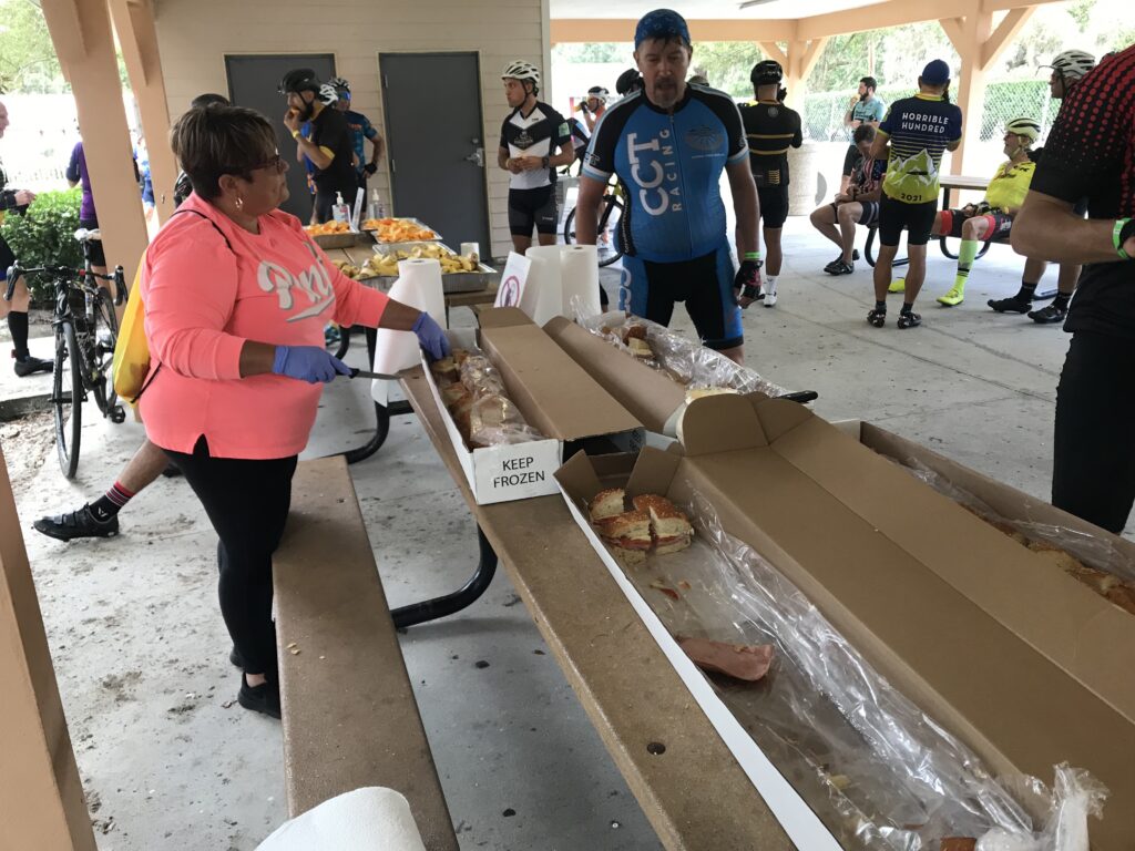
I finished the ride and then drove back up the highway to meet Darrin. Had I known where I was going and where we’d meet, I would have stopped in on my ride. Or if he knew he would have said to stop at Mad Moe’s in Osprey.

Barry and Darrin

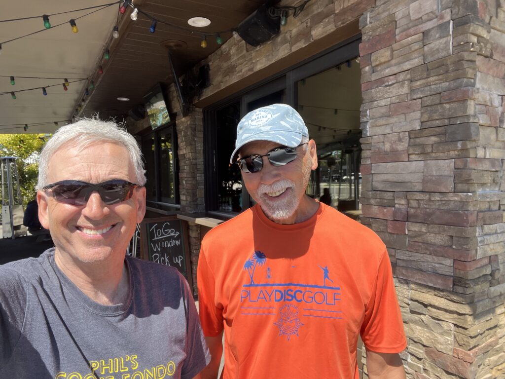
But it was a beautiful day and we enjoyed sitting outside.

Apparently, if you leave your bike too long in Sarasota they paint it

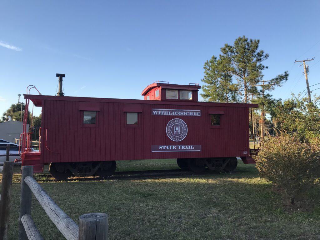
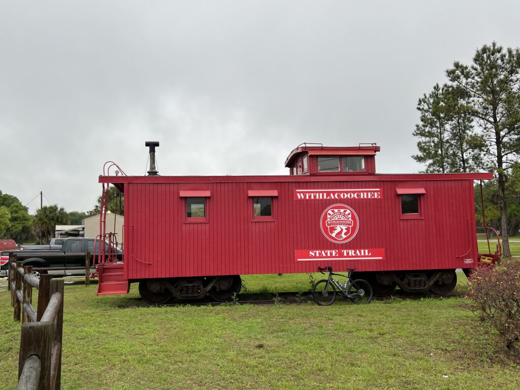
Don’t miss the Ringling Brothers car at the Train Depot.


Withlacoochee

BROOKSVILLE, FLORIDA

I haven’t had great luck on this trail. I brought my own luck. Weather

At 46 miles, the Withlacoochee State Trail is one of the longest paved rail-trails in Florida.

With a generally flat terrain and many access points, the trail is an ideal venue for all skill and fitness levels of cycling, running, walking and skating. An unpaved equestrian trail parallels portions of the paved trail. The trail corridor traverses three counties (Citrus, Hernando and Pasco), offering an enjoyable, varied journey as it runs through small towns, ranches and six distinct natural communities between Citrus Springs and Dade City.

Owensboro – Withlacooche State Trail

Pancake flat and very wide. It is a nice trail.

Withlacooche State Trail – Mile 0

I first came here in the late afternoon of November 17, 2021. I found the trailhead at Flora City. It has parking and restrooms. I was about halfway on the trail and my decision was to ride north or south. I met a local who advised me to ride north.

Withlacooche State Trail – Dade City

I was soon riding with a guy and enjoying the scenery, Inverness was around Mile 7 heading north. Definitely in the lake region. I continued up to Hernando before the need to turn around as I would be losing sunlight. I had a nice ride on the trail that day but didn’t quite make it to the end.

Withlacooche State Trail – Inverness

On March 23 I came to Brooksville. The trail wasn’t far away and I rode to it and went south to the southern terminus at Ownesboro. From there I rode 15 miles north to Nobleton before turning around. The trail here is very wooded.

Bridge over Cortez Bld – Fla. Rte 50 – Brooksville. Withlacooche State Trail

When I got back to the hotel I felt buggy. And for good reason. There were at least four bugs on my jersey or in my hair including an inchworm.

Withlacooche State Trail – Inverness

Nobleton is just south of Flora City, the segment I rode in November. I went back the next day and was going to finish the trail.

800 Miles to Richmond – Withlacooche State Trail
(Facing south so it’s 800 miles FROM RIchmond)

I started north and was retracing what I had ridden in November. By the time I reached Inverness, the skies had opened up and I was soaked. It wasn’t a lot of fun and that’s what riding should be about.

Inverness – Withlacooche State Trail

A neat feature on this trail can be found every mile. These are mile makers. They begin with the letter R followed by a distance. This was the Atlantic Coast Line Railroad and its headquarters was in Richmond, Virginia. It was wild to think that Richmond was only 800 miles away by rail. And I wished it was a paved rail trail. But it’s not.

The trail is wide. It passes lakes and swamps. For summer rides the heavy canopy presents needed shade from the Florida sun. Sadly, for me, it did not form an umbrella to protect me from the rain.

I would not necessarily make this a destination ride as it lacks fixtures associated with some rail trails. But if you are anywhere in the area and want to put in a few miles, definitely go here.


MILEAGE: 73.9

Shaking off the Dust

WARRENTON, VIRGINIA

It was a group ride with Prince William Cycling Club billed as “Shake off the dust and clean off the rust.” The departure location was the Old Bust Head Brewing Company in Warrenton.

I arrived on a cold morning (45º) with plenty of time but fiddled with my contact lenses. By the time I rolled up to the start at 8:59 a.m. (I could have moved quicker.)

There were about 40 cyclists but in two groups leaving at 9:00 a.m. I had to make sure to find the faster/longer group. If there was a division at the start I could certainly tell by the riders in each group. I also figured, correctly, that the faster group (15-16 mph and 40 miles) would be smaller than the 30-mile group. But we were in one large group and I needed to make sure as we rolled out. I also asked as we pedaled away.

There were nine of us. John (Orange Pinarello on Facebook), Charlie, Ed, Jamie, and Louis, three others, and me. I was the oldest.

On a group ride, no one says they check out everyone’s bikes but everybody does. Who’s on the neon carbon bike? Who has the oldest bike? Anyone with a classic bike? And who is riding a gravel bike on a road ride? Uh, that would be me.

I was perfectly dressed. But I guess we all were. Most worse leg or knee warmers. With an expected temperature of 60º, I wore my Roosters Racing kit. I had a light Roosters jacket which meant I was the guy in black/grey on a black/grey bike. I had knee warmers but my screaming color socks from Ridge Supply gave me a little color. And black “cookie” long-fingered gloves. No headcover under my helmet.

Only four of us said they uploaded the route to their computers and I don’t know who they were. I did and my Wahoo was working perfectly.

Store in Catharpin

Well, I wasn’t quite ready to roll. I didn’t have my gloves on. So I stayed at the back to get them adjusted then joined the group. We stayed together for a while. There was a split at the traffic light in Catharpin so the front group pulled over waited for the back group.

As we rolled into the country we gapped two riders. I do believe it was one rider and a sweeper. We were rolling along at 18-19 mph and someone asked us to slow the pace to no more than 16. I went to the front then did nose-breathing riding. Easy pace. After two miles I was told I caused a further split in the group. Damn me. We pulled over and waited for everyone to catch up.

We came to a country store where we caught the slower group. Since they left after us they obviously went a shorter way. They left before us and we caught them again in Cassanova but quickly turned onto our longer route.

It was at the store that John remembered where we had ridden together before. Two years ago I was riding from Manassas to home and he asked if he could ride along. He had remembered my Seinfeld story. At first, I was confused and then we both said “Delores!”

In October 2019, I was at Phil’s Cookie Fondo in Malibu, California. I happened to recognize the actress that plated Delores in the Seinfeld episode where he didn’t know his girlfriend’s name and it went too far that he could no longer ask her. So he had to figure it out. It was a classic episode and the actress, Susan Walters, posed for a photo with me. I talk too much.

Barry and Susan Walters

At 27 miles in, one of our riders, Bill, hit his wall. I told John I’d sweep and ride with Bill but John dropped back too so both of us did. We lost sight of the group. At Mile 34 we caught them as they had waited. I lost Bill and clawed my way to the front three riders. I guess I wanted everyone to know that I had not been dropped and could be riding at the front if I wanted to. I caught them at Mile 37 then let them go as this was a double left-hand turn. I wasn’t sure who knew the route and felt someone should wait for the stragglers to show them the way.

PWCC40 – Single file in Fauquier County

I counted seven riders then, after five minutes, decided to ride back to find our last two. I went 3/4 of a mile, uphill, before I saw them coming. Briefly, because so much time had elapsed, I had begun to worry that they took their own way back. But once I made contact we rode back down to the Battle of Coffee Hill then toured up Rogues road. Bill had to stop. Cramps. Badly.

Our game plan was for me to ride back to the start/finish (5.5 miles) then check on them. If they needed up I would go back and pick them up. I got back, called, and Bill had stopped completely and John was waiting with him. So I went and picked him up, This was Bill’s first outdoor ride of the year. It was my 60th.

The ride was supposed to be 15-16 mph. I came in at 17 and it would have been higher except for the 3-4 miles I rode sweeping with Bill. John’s ride was 16.5 mph so he lost 0.5 mph sweeping Bill. I may have lost that much too. I could not find someone in the first group to compare to but since we rode together that would have been my average.

But it was a beautiful late-winter day. And it served as a reminder that I have three weeks before my double-century ride in Florida. Need to get in the miles.

John thanked me for helping. If not me, then who? Hopefully, anyone in our group would have stepped up but no one did. I’m sure John would have but we had the luxury of him waiting with Bill for me to come back and pick him up. I had no room for John.


Reflections on the Year – 2021

WOODBRIDGE, VIRGINIA

Another year of riding. Another year of life!

Slowly, many of the events that disappeared in 2020 came back in 2021, most with modifications, and usually to the size of the groups. But I was able to join in some although the signature event, the Livestrong Challenge, in Austin, Texas, was canceled for a second straight year.

MY TOP TEN CYCLING MOMENTS/MEMORIES
(In no particular order)

  • Oh Vesuvius
  • See you later Alligator
  • Alpine Loop Gran Fondo
  • Texas4000
  • Clingman’s Dome
  • Ride to Conquer Cancer
  • Horrible Hundred
  • Sea Gull Century
  • 1000 Days 1000 Rides
  • MWARBH

10. Oh Vesuvius. I cramped on this climb in 2007 and then was pulled off my bike by paramedics on the climb to Reid’s Gap. I vowed someday I would get revenge. In December I went and rode these climbs. Vesuvius was no problem but Reid’s Gap – I simply did not remember how hard of climb that is. The last mile is equal to that of Mount Washington. But I made it. Next up is Reid’s Gap revenge.

Vesuvius, Va.

9. See you later Alligator 🐊 
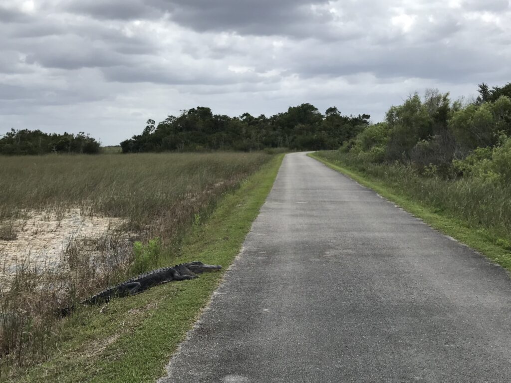
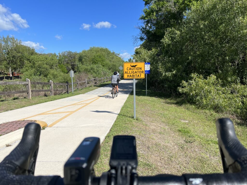
– In March I rode in Shark Valley in the Everglades and had to dodge alligators on the trail. What fun! I would like to ride this one again.

Alligator Shark Valley, Homestead, Fla.

8. Alpine Loop Gran Fondo. So satisfying in many ways. I PR’d on Shenandoah Mountain and Reddish Knob and Mole Hill. I finished second in my age group but my granddaughters were on course and at the finish to see me. This was very satisfying. 

Jeremiah Bishop and Barry Sherry

7. Texas4000. When Canada closed their border it forced the Texas4000 to reroute. They created a Smokys route which came through Virginia. We gave them a lunch stop in Linden and I rode with them on Skyline Drive. 

Texas4000. Shenandoah National Park

6. Clingman’s Dome. This was not quite a bucket list climb but in November I was able to ride from the visitors’ center at the Great Smoky Mountains National Park to Clingman’s Dome. Visibility was near zero at the top and this was the climb only. No descent. But still a great memory. 

My mother at the TN-NC State Line
She drove to the top while I rode up.

5. Ride to Conquer Cancer. Enjoyable ride in which I was concentrating on settings PRs (I was riding solo). At Libby Hill I did a PR which appeared good enough for the age group classification. But I don’t think their age groups align with Strava. But a happy ride fighting cancer. ♋️ 

Survivor Bib – Climb to Conquer Cancer

4. Horrible Hundred. This can be a two-day event and I made it that. We enjoyed a sensible paced group ride on Saturday then John Dockins joined me for the first 30 miles on Sunday’s century ride. 

Thanksgiving is coming. Horrible Hundred.

3. Sea Gull Century. A ride I always look forward to each year. Although I rode solo I enjoyed jumping in with some of the many Major Taylor Cycling Club groups. They were awesome people.

Sea Gull Century

2. 1000 Days – 1000 Rides. I started in 2019 to celebrate 10 years of survivorship. I rode at least 10 miles every day. And like a bad cycling Forrest Gump impression, I kept riding and riding. On September 26 I hit 1,000. By year’s end, it was 1,096 days and counting. 

Proud Grandfather. 1000 Days 1000 Rides

1. MWARBH. (Otherwise known as Mount Washington Auto Road Bicycle Hillclimb) I walked (rode?) away in 2014 after my eighth hillclimb content to never do this event again. Earlier this year I was drawn to the mountain. My time sucked (my worst ever) but it sure was satisfying to finish. 

The Summit – MWARBH.
Photo Credit: Joe Vigar Photography

Not quite a Top Ten but had many other memories as well.

TWO RIDES TO PUNXSY

Duman Lake, Cambria Co.

I have been doing a version of this ride from Somerset to Punxsutawney since 2010. It was always one way to a family reunion and I depended on my parents for a ride back after the reunions. I always looked forward to stopping in Northern Cambria to visit Don & Nancy (both now deceased) and with my dad deceased and my mother getting up in age, I think I probably rode this 70-mile route for the last time.

BEST REPRESENTATION OF UNCLE SAM

July 4, 2021 – Washington, D.C.

DID I MISS THE FERRY?

Historic White’s Ferry – June 20, 2021

The Historic White’s Ferry, connecting Loudoun County, Virginia, and Montgomery County, Maryland, remained closed for the year, denying commuters easy access and this cyclist many good miles in Maryland. Will it finally reopen in 2022?

BEST ROAD RIDING

Tim Casbere at Joplin Road

Joplin Road in Prince William County is a windy two-lane road that connects Quantico with Independent Hill. With no shoulders and blind crests and curves, it is normally too dangerous for cyclists. But a bridge was out and made this road perfect for riding. Unfortunately, the bridge repairs were completed by early April and the road is again, best left not ridden.

I WISH I COULD DO THIS AWARD

July 14 – Washington & Old Dominion Trail

CUTEST ANIMALS

Chickens on High Point

These chickens were on the summit of the climb over Shenandoah Mountain, U.S. 33, West Virginia. I love them like they’re family.

PASSED BY THE KID

On July 21 near Ashburn. Va., my radar showed a cyclist was gaining on me. I was surprised when this kid on a motorized skateboard passed me. He told me “these things can go really fast.”

WAIT – OHIO IS TOP TEN TOO

Barry at Yellow Springs. Photo Credit: Erin T

In July I rode from Springfield, O. to Cincinnati and back on the Little Miami Scenic Trail, a distance of about 80 miles each way. Paved rail trail the entire way.

BIRTHDAY RIDE

The Junction – Milford, Ohio

Last year I bonked badly on a mountainous birthday ride (one mile for every year) in Altoona, Pa. (they have mountains). I vowed this year I would do my birthday ride in Delaware. I didn’t make Delaware but I did make Ohio and rode from Springfield, O. to Cincinnati (Milford), Ohio.

ALMOST A GONER

Tim and Connor and the Potomac River

Tim and Connor went out on the pier into the Potomac River and Connor almost lost his bike. We would have saved the bike.

THAT’S A LOT OF FLATS

Before I rode on Sept. 24 I had a flat that I changed. At Fosters in Manassas it “blew” a second time so I changed it there. When I got home it flatted again so I gave up. Diagnosed it as a hole in the rim tape and replaced it the next day. 

Fosters Grille Manassas

HELPING THE HOMELESS 

I passed a woman on the bike path next to the Prince William landfill. I saw she was wearing trash bags so I went home and made a Care package for her. She refused all clothing but accepted the food. I’ve seen her twice since and she no longer makes eye contact. 

NEW AND DIFFERENT TRAILS

Withlacoochee State Trail

I rode the Mahoning Shadow Trail in Punxsutawney, Pa., the Creeper Trail in southwest Virginia (partial), and the Withlacoochee State Trail in Florida (partial). 

NEW FRIENDS

Nah. Didn’t make any. 

OLD FRIENDS

Tim and the Great Shiplock Park

I rode with Tim more than anyone, although most of my miles are solo. But Tim and I enjoyed the roads in Fauquier County and did a couple of longer day trips. We rode the Abandoned Turnpike in Pa. and from Williamsburg to Richmond. 

OLD FRIENDS TOO

Barry and Margaret – Naples, Fla.
Barry and Joe

I did squeeze in a day in Naples, Fla. and see Joe B. (USPS colleague) and Margaret (Roosters). And rode in Culpeper Co. with Margaret in June.

Barry and Margaret (Jun 1, 2021), Brandy Station, Va.
John D. and Barry Sherry at Rest 1

And rode with John (USPS colleague) at the Horrible Hundred in Clermont, Fla. I did see my friend, Erin, in Ohio (no photo).

ALL-WEATHER

Montclair. Ice.

There were crap days and I tried to choose my routes carefully. This one in Montclair I messed up. But with no significant snowstorms, I was able to ride every day in 2021.


THE NUMBERS

KOM or King of the Mountains. Two years ago I was very happy when I grabbed four of those. But this year – 121!!!! To be fair, many are “trash” – small segments with 10 or fewer participants. But there were a couple where I was best out of 1,000. However, when I ride on the W&OD and there are 30,000 riders competing for a segment, I typically don’t crack the Top 100 although I always strive for #1 in my age group.

THE TOTALS

DISTANCE – 10,367 miles (16.684 km). This was my second-highest annual total, second only to 2020 (10,500).

From RideWithGPS

There is a slight difference between the two tracking programs. (10,367 vs 10,369).

DAYS RIDDEN: 365 (1,096 consecutive days since Jan. 1, 2019)

WEIGHT: 172 (just a little bit up from end of last year)


OUTLOOK FOR 2022

I have no goals. The consecutive days ridden streak was specific to 2019 for my cancerversary which kept going to September 26 when I reached 1,000 straight days. It could have ended there but the weather wasn’t awful enough to stop. But it won’t continue in 2022.

The Cookie Gran Fondo in Malibu by Phil Gaimon has been postponed for two years now and I still have my registration fee paid for 2020. Hopefully, that will work out for October. Likewise, the Livestrong Challenge in Austin has also been postponed for two years. And it would be nice to return to Austin.

With the uncertainty of how COVID will be handled by foreign countries, this doesn’t look like a year to travel to Europe. And my biological clock is ticking.

Above all, I hope for a safe year. Some adventures. But above all, safe riding.

Vesuvius Revenge

VESUVIUS, VIRGINIA

Fourteen years ago I first rode this climb as part of the short-lived Blue Ridge Extreme Century. It was at Mile 50 before we encountered this climb and when I saw a friend walking near the top that was enough for me to join in. My memory, which may be wrong, tells me I went back in 2008 for a different route. But I think we climbed this again and I flatted near the top. I was dragging a low tire and had to walk it to the top for a repair.

I had forgotten about this climb completely until July when the Texas4000 came through. Their route included a descent of this climb. I briefly thought about incorporating this climb as training for Mount Washington but never did. With nice December weather upon us, I put together a 50-mile ride which I thought, tracked what I did 14 years ago. It did not.

Vesuvius has a few homes and no parking. But it does have a church – the Vesuvius Baptist Church. I parked there. I sought permission but the door was locked when I knocked on it.

With a start temperature of 45º, I opted for knee warmers, a headcover, gloves, and a jacket. I started from the parking lot and was immediately on the climb. I remembered nothing about this climb. I was getting warm but had no problems going right up it.

Headed towards Crabtree Falls

Although I had unzipped my jacket, at the top I stopped and zipped it back up. The descent here was fabulous except winds were sustained at 29 mph making bike handling difficult. I stopped briefly at Crabtree Falls and felt and heard problems with my rear brake. I decided not to touch it the rest of the ride. Descending would be with one brake.

Crabtree Falls. South Fork Tye River.

I routed myself a bit too far. I ended up on Patrick Henry Highway. While not too busy in Nelson County, it was still named after a Virginia/U.S. Patriot. It was a highway. It was 8.5 miles to the Ski Barn. I was on a gradual climb with a nice one-mile descent. I loved the ride but would not recommend it or plan to ride it again because it was Patrick Henry Highway.

Crabtree Falls

The Ski Barn was Beech Grove was familiar. It was a rest stop twice for the Extreme Century rides. And from there it would be a six-mile climb to the “top” at Reid’s Gap.

While I rode today to prove myself on Vesuvius, equal to that was the climb to Reid’s Gap. Fourteen years ago I was pulled off my bike on this climb. What I remember: I came to a section and saw other people walking. At that point, I decided I would too. I did not walk too far before remounting and continuing. On the right side of the road was a setup. There was a tent. Definitely a tent. There was an ambulance or fire rescue vehicle parked. And a paramedic yelled to another, “you get his bike, I’m going to get him.”

They pulled me off my bike and made me sit in the tent. They had iced towels they put around my neck. They gave me fresh water. After 10 minutes they told me I could leave but offered, and even strongly suggested, that I be SAGged back to the finish. I refused.

I got back on the bike that day and rode a couple of hundred yards then walked a little more before finally remounting and riding to the top. And that is my memory of that August day.

Patrick Henry Highway near Beech Grove

My Wahoo showed the distance to the next turn which was six miles (5.7 actually). I thought how bad could this be as I started up the climb. The road was busier than I thought and I think most drivers in a hurry were headed to Wintergreen Resort. This is a steep climb. The Virginia Hill Climb Championships have been held here, maybe all on the Wintergreen property to avoid the public road.

I remembered the description in 2007 as the “18% grade of Reid’s Gap.” And I remembered the paramedics. And not much else.

The lower slopes of the climb are gentle. The first two miles probably average two percent grade and the third mile averages three percent. It really kicks up at the entrance to Wintergreen. It is 1.1 miles from there to the top and averages 12.4%. That’s steeper than Mount Washington (12%) although it’s for the final mile and not 7.6 miles.

Reid’s Gap

I hurt. I was going slow. But I was going. I rode my standard road bike setup and not my climbing setup for Mt. Washington. At the top, I turned south on the Blue Ridge Parkway. I did not realize that my climb simply continued. In all it was a 17-mile climb when I was expecting six.

I bonked. I had two bottles with me and went through both. I had one pack of energy chews. Gone. Depleted. I was pedaling but no longer feeling my body. It was surreal. Maybe worse was that I was thinking one I got to Reid’s Gap my body would catch a break. I didn’t know I had 11 more miles of climbing left, even if it was just 3-4% grade. The Blue Ridge Parkway has a rough surface, a “heavy” road as we say in cycling terms. I was spent.

Normally I love forward to the final descent. What a perfect way to end a ride. But I determined not to use my rear brake which made the descent sketchy. I took it much slower than I normally would have. But I made it. My clothes were a mix of sweat and snot. I quickly changed out before driving home.

Pumpkin farm. Thousands of rotting pumpkins. 🙁

The Reid’s Gap climb left me pretty beat. I never remembered that the last mile was 13% with grades even higher in spots. But unlike 14 years ago, I powered, albeit slowly, to the top. And this day left me feeling better about that hot day in August 2007. That was a tough climb then and now.

QUICK THOUGHTS: I last rode this before we had GPS bike computers and therefore, did not have comparison times. Nor was a sure of the exact route that I created to ride today. We definitely did not ride on Patrick Henry Highway. I could have shaved six miles by tracking Rte. 680 at Tyro to Beech Grove. That looks like the road that comes into Beech Grove that we took except it has about one mile of unpaved surface on it. I don’t remember any gravel from 14 years ago. I doubt that I do this ride again but that modification to the route is worth looking at.


High Bridge

FARMVILLE, VIRGINIA

“There have been higher bridges not so long and longer bridges not so high but taking the height and length together, this is perhaps, the largest bridge in the world.”C.O. Sanford, South Side Railroad’s chief engineer, 1852

High Bridge

I first stumbled upon High Bridge, or High Bridge State Park, while on a charity ride in 2013. Our route for the day didn’t take us anywhere near this site but that was the problem. Our map didn’t take us anywhere. The organization wasn’t organized and after making a 30-mile loop we were back to where we started. Someone (me) saw the trail and the signs to High Bridge and we made a deal. Let us ride over the bridge and we’ll call our 50-mile ride to nowhere a ride to somewhere and drive the rest of the way to Raleigh.

Train station, Farmville, Va.

It was an early Spring day in 2013 and there were lots of users out on the trail. I wanted to see it without people so I chose a day in December. And I didn’t see any users until I was nearing the end of my ride when a couple went by on bikes. It was a gray day with temperatures in the upper 50s. I would have preferred a few more degrees or sunshine but I could not control that.

Farmville, Va.

I chose to park in a shopping plaza next to a Cook Out restaurant. I wanted to see a little of the charming town of Farmville and not just stick to the trail. Although the prettiest part of the downtown I bypassed by staying on the trail. It’s charming nonetheless.

High Bridge

In preparation for the ride, I read some trail reviews on TrailLink.com. What junk reviews. One user complained because Mile Marker 0.0 is in the middle of the bridge and they count up from there – in both directions. He stated he wouldn’t be back. Who really cares?

MM 0.0
The center of the bridge

Other users complained because the bridge is the only fixture on the trail. They don’t make trails based on your model train layout. Another complained that the crushed limestone was really gravel. Well, duh!

High Bridge Trail

It’s a rail trail. Almost all of its 33 miles are flat (a feature of most rail beds turned rail trail). There are no great vistas along the trail except for one and it’s really great – the bridge. The surface is crushed limestone which was mostly packed solid making for a very passable surface even for a road bike – which I rode today.

High Bridge

Farmville is a charming college town. Longwood University is located here. From Farmville to the bridge is 4.5 miles (7.25 km). The trail is not a thru-trail, unlike the Great Allegheny Passage which connects Pittsburgh with Cumberland (and to Washington, D.C. via the C&O Canal Towpath). Is it a “destination” trail? Maybe, depending on your perspective.

Downtown Farmville, Va.

I don’t know that I would plan to vacation here, unlike the Pine Creek Trail in Pennsylvania’s Grand Canyon. Thirty-three miles is a little short for a destination trail. As mentioned previously, there is but one fixture, High Bridge, but that alone makes a trip here worthwhile.

High Bridge

I enjoyed the peace and quiet of today’s ride. It was weird not seeing any other users except that couple near the end. I saw four dogs roaming around. One had a really bad coat of fur but also a ribbon around his neck. They didn’t approach me and while I thought of approaching them, I did not. Likely as not to be someone’s pets that were off-leash.

High Bridge Trail in Farmville, Va.

Bottom line: If you’re anywhere near the trail, take a ride, a walk, or a run on it. The bridge is awesome.

Farmville, Va.


DISTANCE: 14.5 miles
WEIGHT: 172 pounds

Horrible Hundred

CLERMONT, FLORIDA

The Horrible Hundred can be a full weekend of fun. On Saturday they offer “familiarization rides” which are group rides that cover some of the roads. This is followed by the main event on Sunday. So two days of riding.

Clermont, Florida

The 8:30 ride on Saturday is listed as 17 mph and 50 miles. I did that one twice before. The last time was in 2018. On that ride, we seemingly had 100 riders and way too much testosterone. We had a bad touch of wheels and some riders hit the deck hard when one of the guys at the front braked hard to take a nature break. That would be the last time I would jump in with that group.

Saturday group ride – Howey-in-the-Hills

In 2019, I jumped in with a mid-ride group (16 mph) and had an enjoyable ride over 35 miles or so. And this weekend I would again find the 8:45 group. Our leader was Stacey (I believe). We had a great group that stayed together. Other than Stacey, maybe not the most friendly group but I didn’t ride to make friends. Nor were there any jerks. I told her that this ride was the best part of the weekend.

Saturday ride at a quick stop

Officially the Sunday ride starts at 7:30 a.m. and I arrived at 6:30 a.m. I could not find a parking place at the official lots. Not to worry, I went another half-mile away and rode in. And there were many riders already on course at 7:00 a.m.

John D. and Barry Sherry at Rest 1

I was in line at the porta-johns when I received a text from John D. He was two people in front of me. He had driven up from Sarasota but was unsure how far he could ride.

Food at Rest Stop 1

It turned out that John could only ride 35 miles, instead of 70. He had hip replacement surgery earlier this year and wasn’t back to riding many miles. We were passed by a couple of huge groups. They were very sketchy and I didn’t join them because I was afraid of a touch of wheels that would bring down a number of riders.

Thanksgiving is coming

A few miles later we came upon a crash scene. Half the road was shut down and a number of cyclists had stopped although may not have been involved in a crash. But paramedics were working on one rider who was lying in the road. It was probably caused by a touch of wheels but you never know.

Group start in Clermont

We came to Rest 1 and stopped to refill bottles and take on some food. Once on the road again, John was looking for the turn back to start. That was around Mile 30. He would have five more miles back to start and I would have a decision to make.

Rest 1 – Notice the Limited Vision Cyclist

I was riding solo and catching people. Then I noticed I had someone on my wheel. He should have said something and even passed me and took a pull. But basically sat on my wheel for 3-4 miles until Rest 2 (almost). When he pulled in he came over and gave me a fist pump and thanked me for the pull. He said I was a strong rider (sucking up).

Rest Stop 2

Leaving Rest 2, I jumped on the back of a group from Clearwater. We were going into a strong headwind at 22-23 mph. I stayed with them for 2-3 miles then decided to let them go. I’m not sure if you say I got dropped or let them go but I’m going with the latter.

Food at Rest Stop 2. Sandwiches.

At Mile 54 was the moment of truth. If John had been with me I know we would have gone for the 70-mile route. But I stopped to check the weather because it had become gray. But the weather app showed 15% of rain for the next few hours so I decided to go for the 100.

Rest Stop 3 – Pirates
Ye Olde Poop Deck (far left)

From my first ride five years ago, and I may be misremembering, I was expecting a 30-mile loop. That would be the difference between 70 miles and 100 miles.

Rooster at Howey-in-the-Hills

After a rest stop in Howey-in-the-Hills, the loop was completed in just 17 miles. And I didn’t mind.

Rest Stop 4 – Sugarloaf Mountain

I came to Sugarloaf Mountain with a wind in my face. I did not expect a PR and I did not disappoint. But I was only two seconds off my best on the lower portion. I had ridden this in March and set my PRs on that day. Today was not the day for it.

Someone pushing their bike up Sugarloaf. Love the GCN Jersey.

After I left the last rest stop at Sugarloaf, I saw that I had about 10 miles to go. I had ridden 80 and was happy to see that the shortened Howey loop apparently cut off 10 miles.

Pirate Rest Stop – 4

Likewise, when I came to the road back to Clermont, I saw that the 70-mile group turned while the 100-mile continued – apparently for a 10-mile loop or simply a different route. I decided to finish the 100.

John cresting a hill

I was in a group of four when we came back to the first rest stop. They stopped. I continued. I just wanted to finish.

This guy was cramping so I gave him my bottle of HotShot.

I came to one more route marker for the 100-mile ride. I decided to turn and take the 70-mile route back. I thought it would be shorter and I did not care if I finished with 96 or 97 miles. There was a time I was anal-retentive that a Century ride must be 100 miles. Not today.

Lunch

But the joke was on me. It was 100 miles.

Very good meal

The lunch was great although I was certainly by myself. Options were a pulled pork sandwich, grilled chicken breast, or a veggie burger (I think).

Lunch

I had looked in vain from Stacey, the ride leader from yesterday, simply to thank her once again. But there were way too many people.

Walking up Sugarloaf

It was a good day. Afterward, I headed back to the hotel in Apopka. I washed all my kits from this trip to take home some nice-smelling clothes. And watch the Steelers vs. Chargers tonight.

We like pirates


DISTANCE: 101 miles
TIME:
SPEED:
WEIGHT: 171 pounds

Good job changing the T-shirt

Clingmans’ Dome

GATLINGBURG, TENNESSEE

It wasn’t a bucket list climb but was certainly one that I wanted to do. I was traveling with my mother, age 90, and we diverted slightly, on our way to Florida. By slightly, I mean 115 miles. Or I guess 129 to include the seven-mile access road to Clingman’s Dome.

Sugarlands Visitor Center

Bad weather would have scrubbed my plans but the weather forecast looked good for Gatlinburg with a high temperature of 70 forecast – for Gatlinburg, but not for Clingman’s Dome. It was in the low 50s when I decided to push off from the Sugarlands Visitor Center.

U.S. Rte. 441

The instructions to my mother were simple. Follow the highway (U.S. 441) 13 miles to the top of the mountain then turn right to Clingman’s Dome. If she started to go down the mountain she went too far. I realized as I was riding that I should have had her leapfrog from pull-off to pull off and she would be more comfortable knowing where I was.

West Prong Little Pigeon River

I wore a long-sleeve Under Armour underneath my Schleck jersey along with a light vest. Gloves and a thermal cap complemented my kit.

First tunnel

Newfound Gap Road (U.S. Rte 441) from Gatlinburg to Cherokee, North Carolina is a 36-mile road. At Newfound Gap, which is the border of Tennesse and North Carolina, there is a seven-mile access road to Clingman’s Gap. It is a two-lane road with no shoulders but plenty of pull-offs. The speed limit is generally 45 mph and I reasoned, maybe incorrectly, that the majority of traffic would be park goers in no hurry. But this is also U.S. Rte 441 and the only way over the mountain. Surely there were some drivers trying to get over the mountain as quickly as possible.

The Loop – The road goes under, or over, itself

As I started climbing I also got passed by a few cars. I would play a game and simply count the number of cars that passed me on this ride. And I would tweet out how courteous the drivers were. This lasted 91 cars, The 92nd came by me and almost hit me. I reacted badly. I screamed out.

Walker Gap Prong

I don’t ride on the white line. I’m not coordinated enough to do that as surely I would go off the road. But I ride constantly about 1-2′ to the left of the white line. And this driver seemed determined that he would drive right in the middle of the lane whether I was there or not.

Morton Mountain Tunnel

We used to always think these were aggressive drivers meaning to punish cyclists. But some are surely distracted drivers who come upon cyclists quickly. And if you were driving 45 mph, you come upon a cyclist traveling 8-10 mph pretty quickly. Assuming there was no cell service to be messing with a phone (maybe there was?), I believe the driver was aggressive and not distracted. But it sure scared me.

Appalachian Trail crosses on the Clingman’s Dome Road
(And also in the parking lot at Newfound Gap)

I would start my count over. I got to 31 before a second car passed me very closely. Then I got to 161 before a pickup truck driver tried to put its hood underneath my left elbow. Literally. I looked at the driver. I yelled. Then I moved to the center so he knew he didn’t have room to pass in the lane. It was quite harrowing.

Ice on the road to Clingman’s Dome

Part-way up the mountain was a construction zone. Traffic was being held for one-lane travel so at times I basically had the road to myself. But when the traffic was released by the construction flagger, I pulled off the road and let the entire group pass. There may have been 50-60 cars at a time that I would let pass while I stood safely off the road. And I did not include them in my totals of the number of cars that passed me. I was glad to pull over and let them by while waiting for that empty gap to resume riding.

Newfound Gap – Tennessee-North Carolina State Line

About three miles into the ride I pulled over to unzip the vest, removed the gloves, and my headcover. I was sweating pretty nicely on this November day. Near the top of the Newfound Gap climb, I pulled over to zip up the jacket and put my gloves back on. It was getting cold.

Newfound Gap

I was glad at the gap to turn onto Clingman’s Gap access road. I was surprised to see that it was closed from December 1 – March 31. I hadn’t even thought of that. But I beat it by 15 days. I hoped there wasn’t a lot more climbing, picturing the road traveling alongside the mountain top. Of course, I knew it still climbed. It was a slog. The entire ride wasn’t overly difficult but it sure was a constant slog.

You can see what the observation tower looks like on a clear day on the sign

As I climbed to the top visibility dropped to about 100′. I saw my car but my mother wasn’t in it. I went a bit farther and saw she was at a restroom. I went to the base of the observation tower and found some willing person to take my photo.

I really wanted to keep riding to Cherokee. It was all downhill and who wouldn’t love a 20-mile downhill. But it would also mean trusting my mother to drive down the mountain and I wasn’t going to ask her to do that.

My mother at the TN-NC State Line

I sincerely doubt I will get the chance to ride down either side – back to Gatlinburg or ahead to Cherokee. I have no desire to ever ride this one again. I do not recommend this climb. The road surface is great. The scenery is wonderful. But the traffic is crap. Cyclists have the right to be on the road. But I don’t want to be dead right.


Creeper Trail

ABINGTON, VIRGINIA

The Virginia Creeper Trail had intrigued me for a while. I did not plan to ride it, especially this time of year. But a trip to Florida and I decided to get a taste of it. The experience on the trail would determine whether I want to make this a destination trip at some point.

Creeper Trail – Abington, Va.

I was traveling from Pennsylvania to Florida and had my mother with me. We left Somerset and there were three to four inches of snow on the ground and on the road. My consecutive days ridden streak was now at 1,049 straight days and I hoped to be able to finish a third consecutive year of a ride every single day. I would need a ride today.

Bridge 1

It would be a long day in the car and I tried to stop with my mother at least once every two hours. I saw we would pass through Abington, Virginia. I knew the Creeper Trail went through or to Abington but I didn’t know much more. But I would figure it out.

Creeper Trail covered in leaves

It never warmed up but the 44 degrees were much warmer than we left behind in Somerset. I told my mother I would need about 45 minutes and we took a break from our trip from Somerset, Pa. to Gatlinburg, Tenn.

We parked at a trailhead and thought I might have an option of going north or south (or east or west). But Abington is the terminus so there was one way to go.

And the direction was down. The trail goes 34 miles to Whitetop Station in the Mount Rogers National Recreation Area, at the Virginia-North Carolina border.

Bridge 3

The trail is a crushed limestone trail. In November the gravel is mostly covered by leaves. I was on my Trek Domane road bike and had no problems on the trail. I saw some neat fixtures (trestles).

Abington, Va.

We had parked in a lot and my mother took the opportunity to walk out on the first trestle. I was gone for 55 minutes as I was not making good time on the leaves. It was a very nice diversion and I certainly would ride it again if I’m in the area. Given my distance (178 miles) from the trail, I don’t know that I would return just to ride this trail. But if I was in the area I certainly would.

A View from the Creeper

There is a shuttle in the area that one can use to go to one end and ride back to the car. I thought the grades on this trail were a little steeper than some of the trails I have been on and that would be a fun option to explore. But this was a nice ride on a chilly Fall day. My 1,049th consecutive ride.


Sea Gull Century

SALISBURY, MARYLAND

Officially this was my seventh Sea Gull Century. Officially because last year it was canceled but I rode it anyway.

Start line in Salisbury

Each Sea Gull brings new experiences and memories. In 2016 I met and rode with some members of the Blair Cycling Club. In 2017 I just rode solo. In 2018 I basically towed Sandra for 60 miles and she never thanked me or said goodbye. In 2019 I met Andrew and Stacey which was refreshing. Last year was unofficial and backward.

Major Taylor Cycling Club, Columbus

I didn’t know what 2021 would hold. Let’s start with breakfast. I stayed at Tru by Hilton in Georgetown, Delaware. Although the breakfast area was fully lit, they would not turn on the juice machine or pancake maker until 7:00 a.m. I left at 6:10 a.m.

Major Taylor Cycling Club, Columbus

I went through the drive-thru at McDonalds and went with the standby of hotcakes (no sausage). Actually, I was quite happy with the breakfast.

Snow Hill, Md.

In Salisbury, I parked on the street next to the stadium. I liked this spot. Much better than a big lot or a field. It was gray and 62º. I wore arm warmers and took a rain jacket which I would not need. I was wheels-down at 7:40 a.m.

Rest Stop, Assateague State Park

Today I wanted to be real conscious at doling at my effort. Easy in the first third is the adage. And in the first hour, my perceived effort was a two (out of 10). My heart rate seemed to never go above 115. I was riding easy.

Snow Hill, Md.

I looked for a place for a natural break and found it behind a truck parked in the woods. When I rolled out I jumped in with a Major Taylor Cycling Club group from Columbus. These people were truly delightful. I enjoyed riding and conversing with each rider.

Country Riding

This ride attracts a number of Major Taylor Cycling Clubs from all over the east coast. Most (all?) are people of color and today I found my niche riding all day with Major Taylor riders.

The first rest top was in Snow Hill, Maryland. The police had a separate route for cyclists to the rest stop and it reminded me of RAGBRAI. It was so crowded you (almost) needed to dismount and walk your bike.

Please Don’t Run me Over

I had integrated with a group before the second rest stop. While almost everyone went to the rest stop I continued straight. I caught onto a new group. This one was a little awkward. I was looking a Strava Live Segments and knew I could set a PR on a two-mile segment if I could pass this large group. It was a large group and since we were on a country road with good visibility of oncoming, the group was spread across the entire road.

Assateague State Park

I had to fight my way through the group to the front. I heard someone say “he is really moving.” I take that as a compliment. I was also going into a brutal headwind. I got the PR, went about one mile further then pulled over and removed my arm warmers. This was strategically done simply to allow them to catch me without admitting they were catching me. Then once they went past I went and caught up to them.

Mile 80 Rest Stop

We hung together until about 10 miles before Assateague Island. I went off the front and didn’t see them again. When I arrived at the rest stop I met a rider from MTCC-New York. “Webb” was cramping and I pulled out one of my Hot Shot drinks to eliminate cramps. He was surprised I gave it to him and asked what he owed. I told him if he liked it he could buy some and the next time he sees a cyclist with cramps he could pay it back. He drank. His cramps went away.

Yodeling and Cycling
Any thoughts of buying this kit ended today when I saw it

I left the rest stop solo. Again. Once over the bridge, I joined four riders from MTCC-Philly. The five of us, four men and one woman, were taking equal pulls. I thought we might have 20 miles of this.

Webb drinking Hot Shot

After 2-3 miles a larger group passed us and soon we were part of a much larger group. For the first time today, we had a tailwind. We only averaged 21 mph on this segment but that includes creeping through Berlin. It took me 60 miles but I finally found the group I wanted to ride with. But it would not last.

Verranzano Bridge

We stopped at Mile 80 at the rest stop. As usual, I wasn’t staying long. I waited a little bit to see if a group would form. None did so I headed off willing to slow pedal and be caught. After 10 miles on this 18-mile segment, I shifted from wanting to be caught to not wanting to be caught. I wasn’t.

Salisbury University Cheerleaders at the Finish

I went through the tunnel at the college, stopped long enough to take a photo of the Salisbury University cheerleaders, grabbed some ice cream then slowly rode back to my car. It was a really good day and I loved all the MTCC riders I met. One of my favorite Sea Gulls yet.


DISTANCE: 102.5 miles
SPEED: 17.7 mph
WEIGHT: 171 pounds

I actually rode 0.2 faster last year solo but today included the last mile of getting back to the car. It’s not all about speed and I purposely rode slow today. But if it was, I am still very happy with this ride.

Verified by MonsterInsights