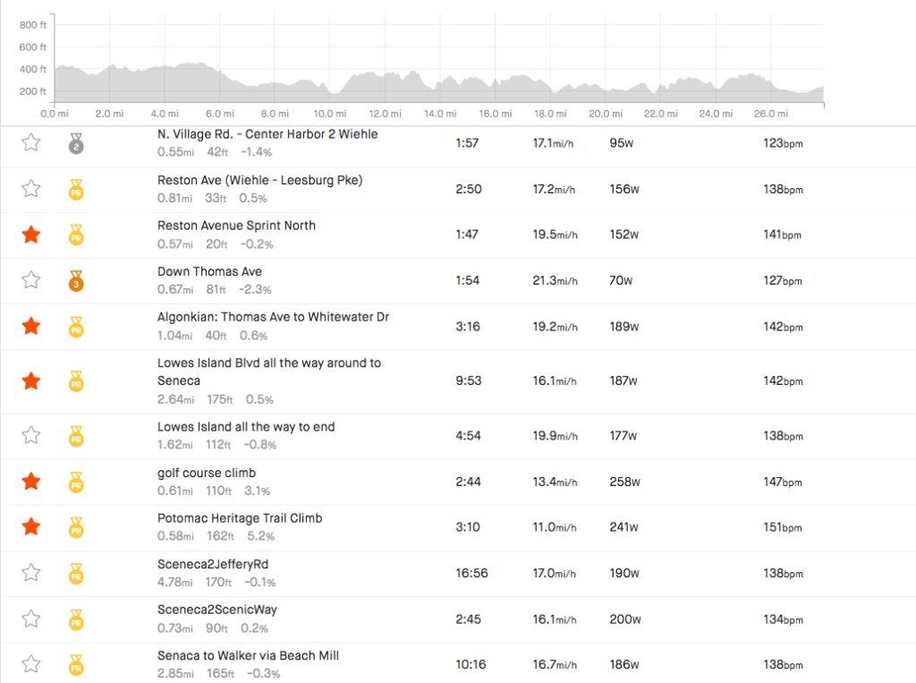
I have been here perhaps 10 times. Maybe 15. I’m sure I could look it up but I’m lazy. But I wanted to bring my friend, Tim, with me.
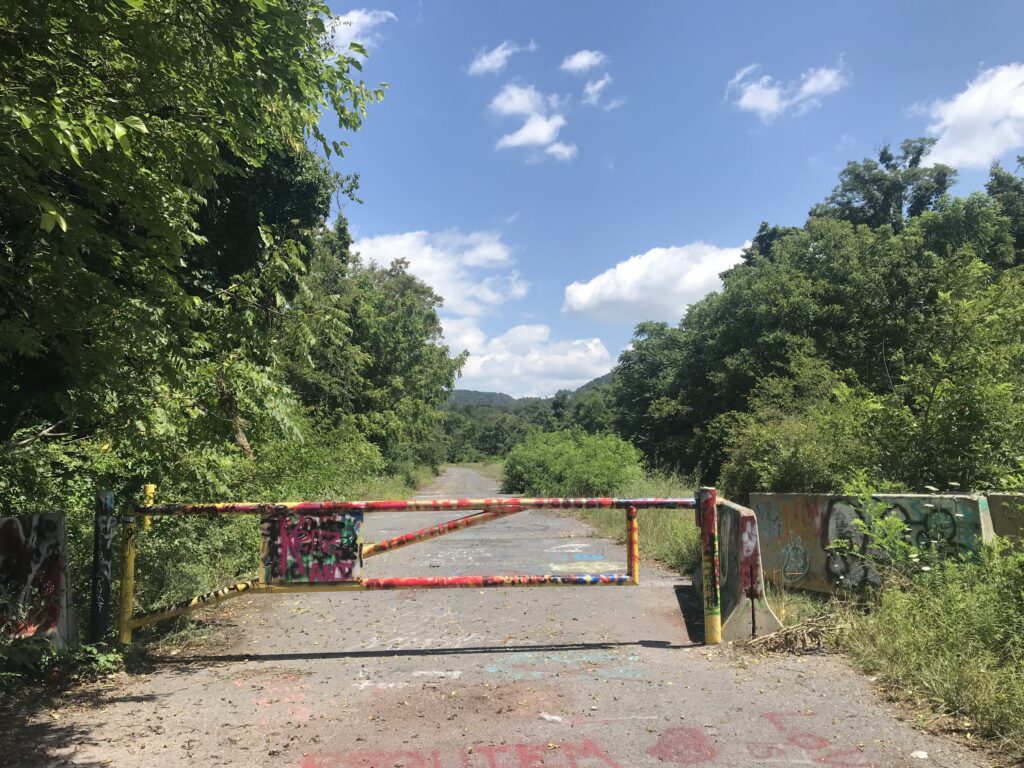
Gate at entrance to Abandoned Turnpike
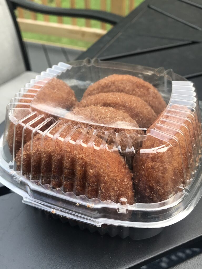
We left Woodbridge at 6:30 and drove out I-66, stopping in Linden at the Apple House Restaurant for some apple butter cinnamon donuts. We arrived in Breezewood at 10:00 a.m.
Apple cinnamon donuts from The Apple House Restaurant
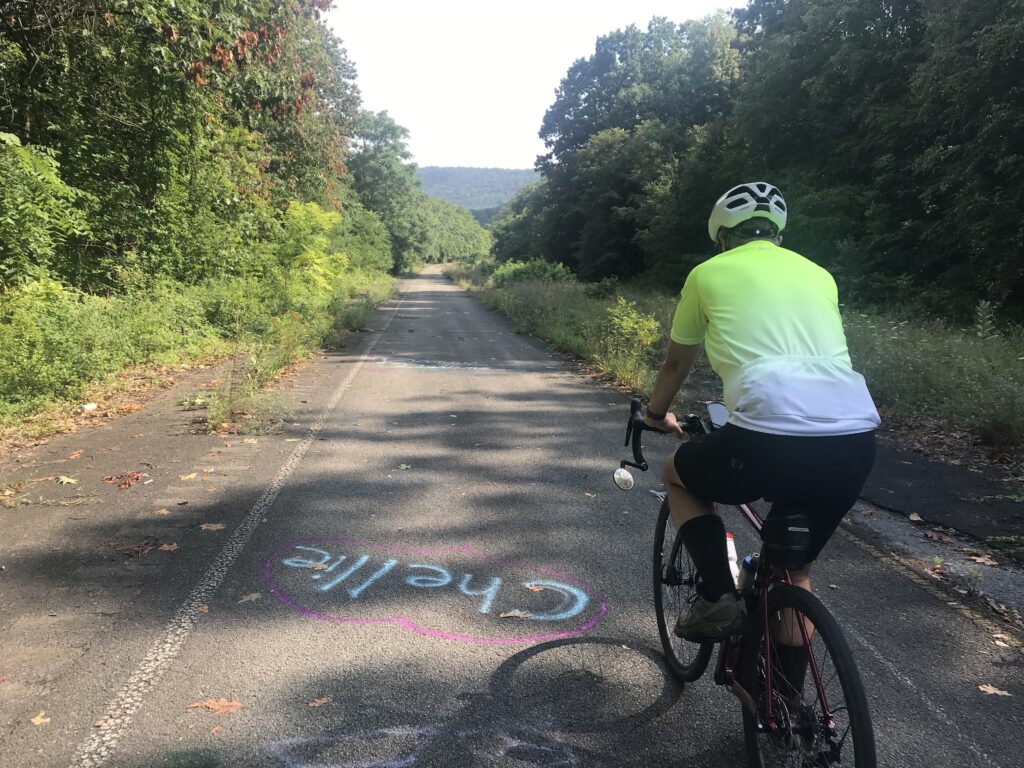
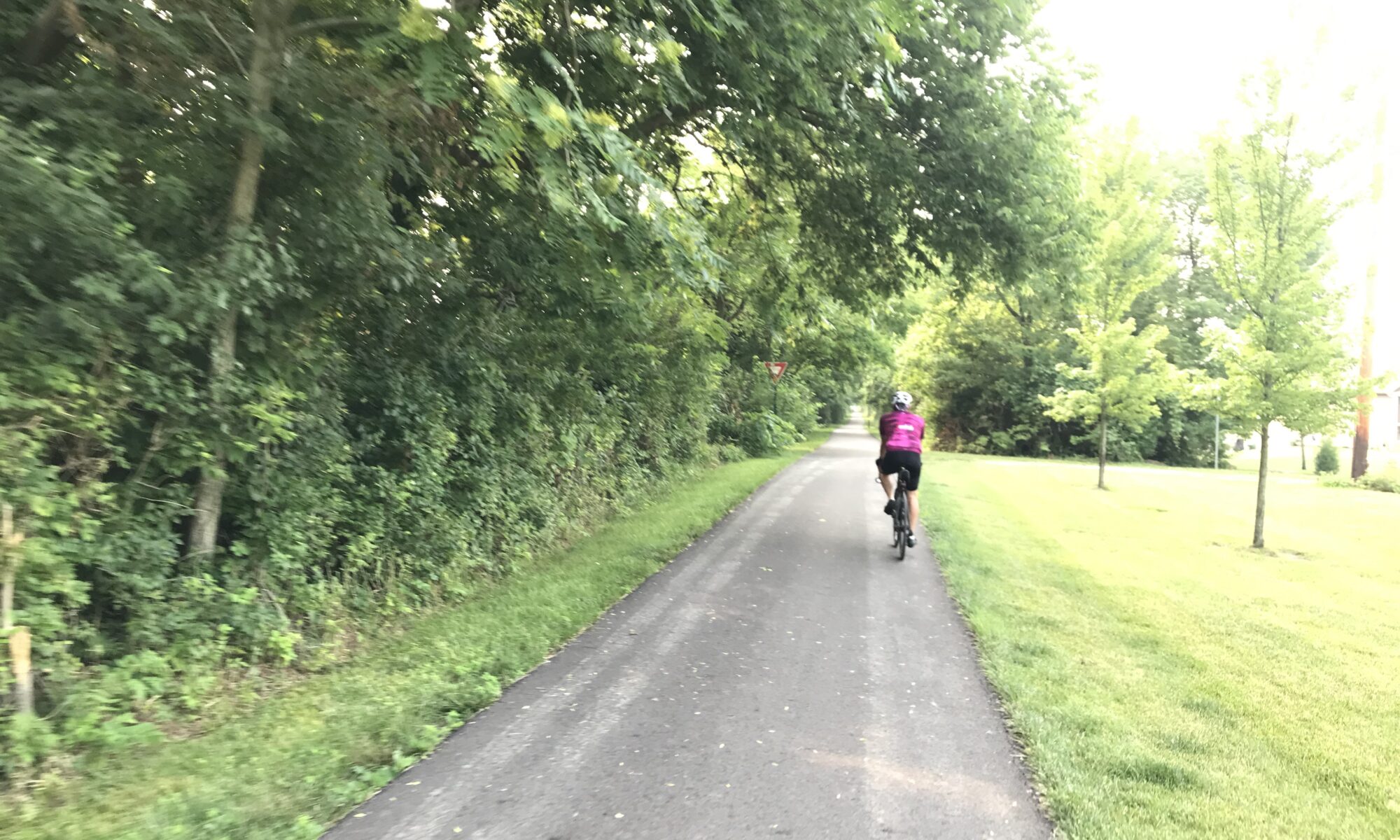
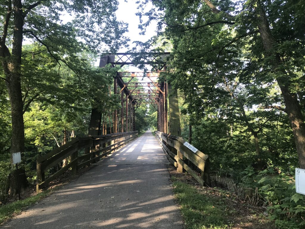
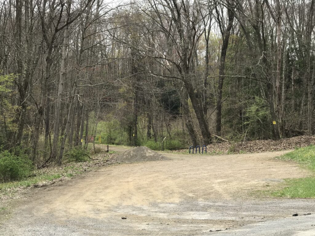
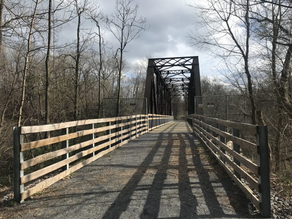
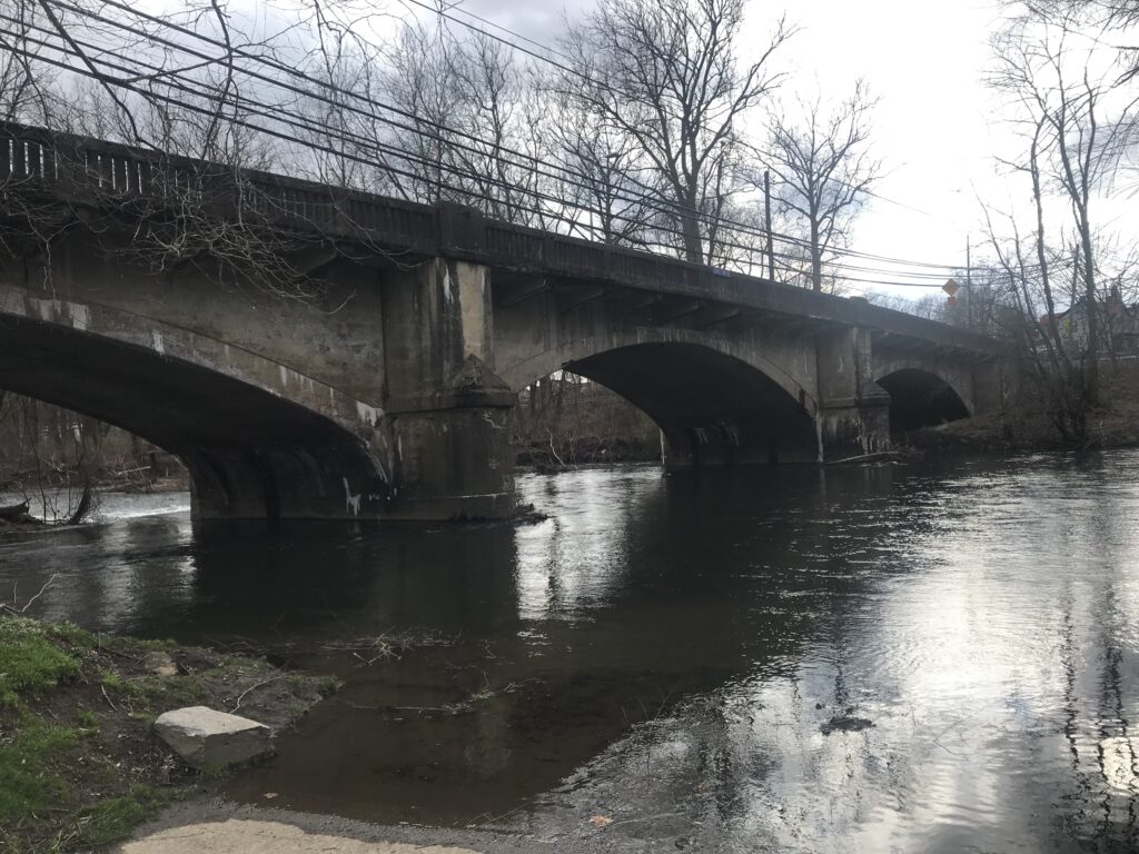
The entrance to the Abandoned Turnpike used to be a dirt singletrack. I was never able to ride up the pitch and only once dared to ride down it. Today I noticed that it had been widened and paved with some asphalt. Both Tim and I were able to ride up the path to the beginning of the trail.
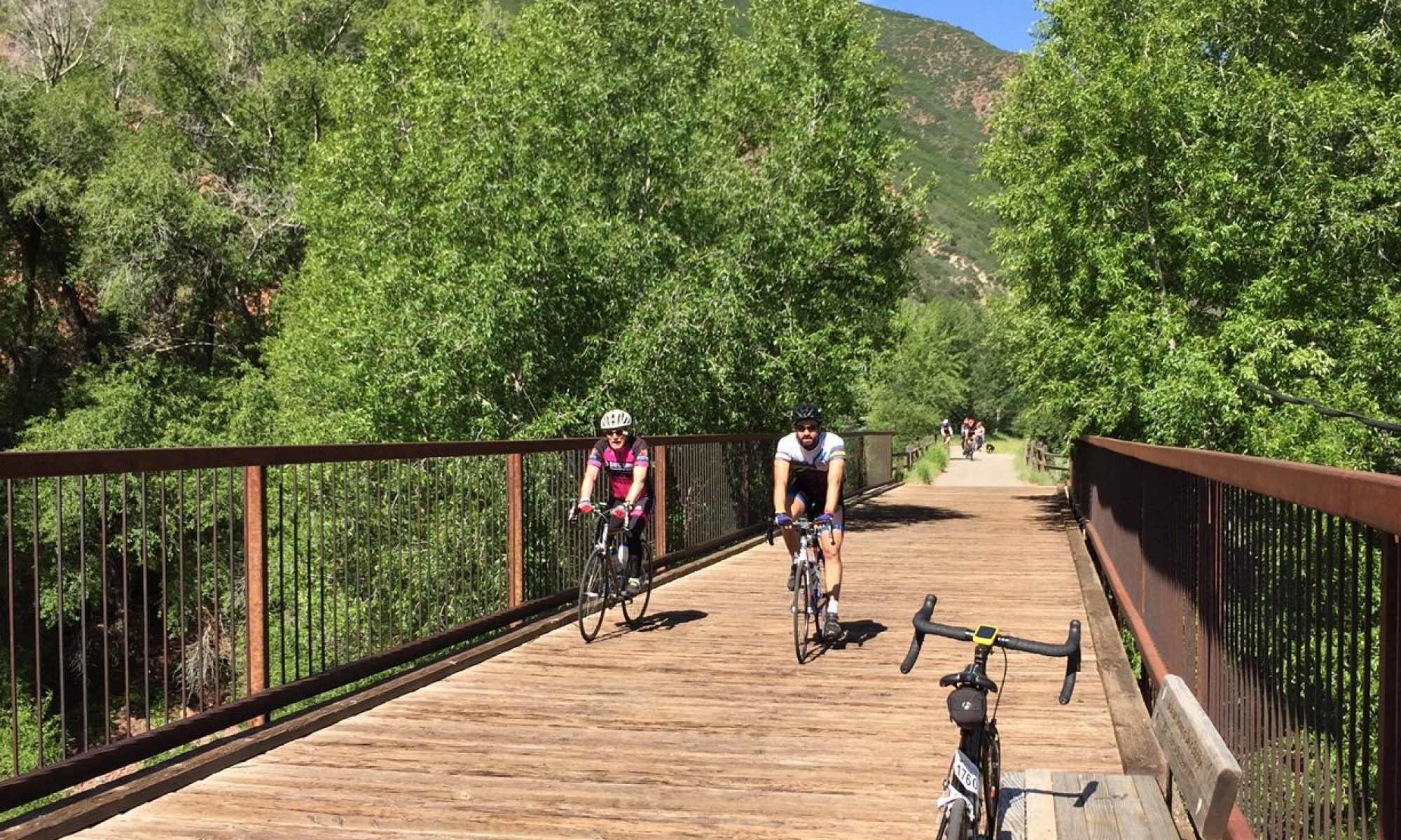
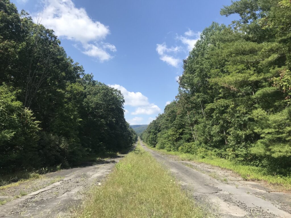
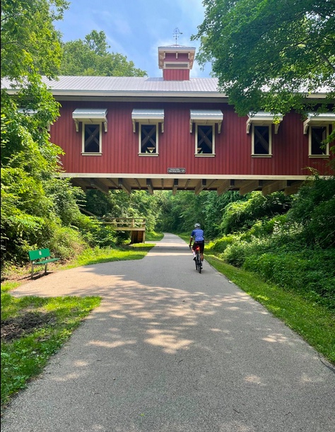
Riding down the turnpike
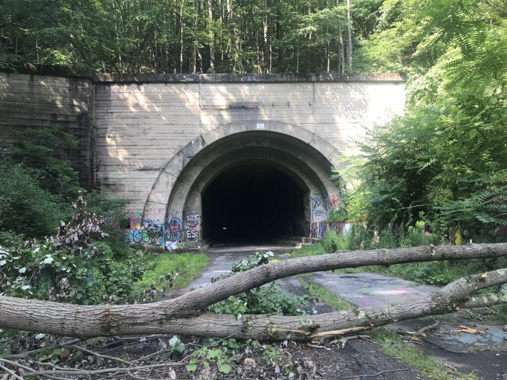
There was a gate across the road and the jersey barriers were arranged that one could not take a bike. We had to do the Limbo, ducking under the bar with our bikes.
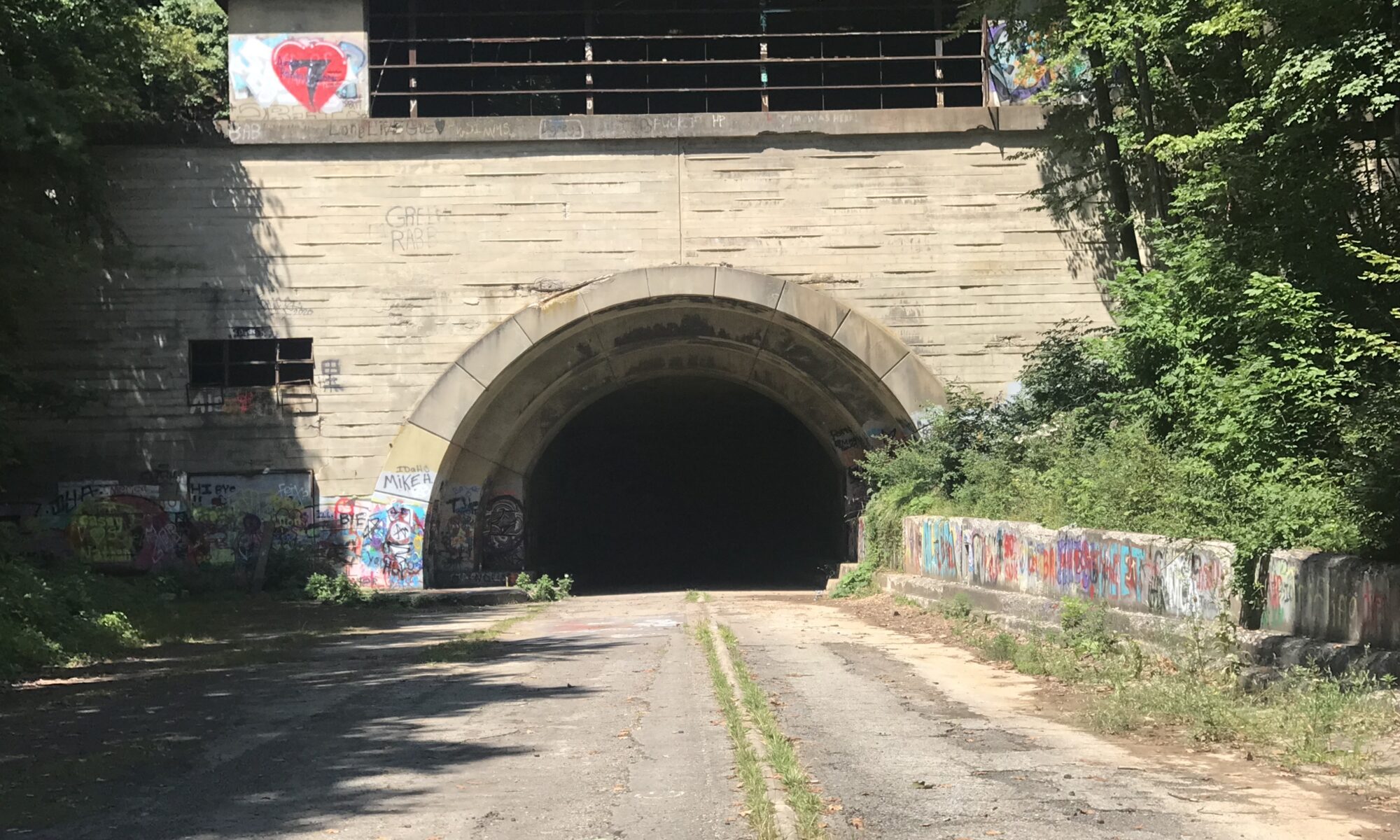
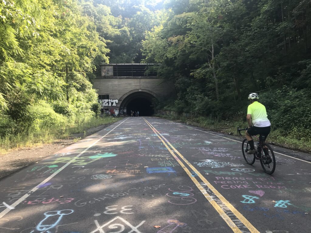
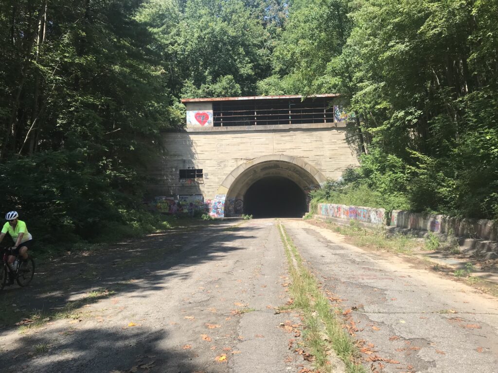
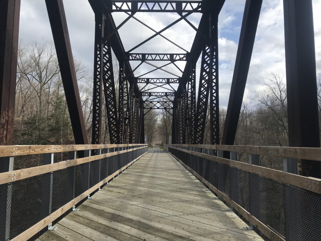
Approaching Ray’s Hill Tunnel
We were only in about a mile when we passed two guys coming back. One was riding slowly and the other was pushing his bike as his had a flat. I offered any help and was willing to give him a tube but he said he would walk. They were almost back to the cars.
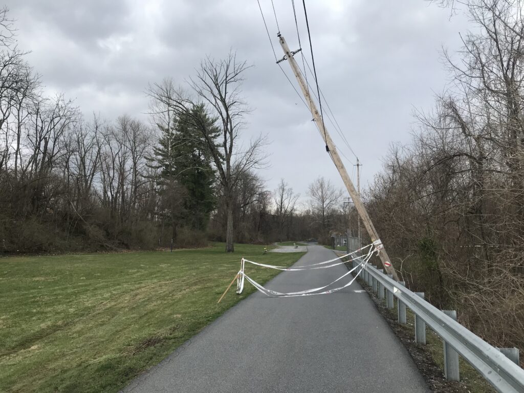
Tree down
I mentioned to Tim that there is a lot of broken glass here and to always be vigilant. We rode our Trek Checkpoints with knobby tires so I was feeling pretty secure. I also thought that the turnpike looked like it had been swept at some point. Although there was broken glass, it wasn’t nearly as bad as it had been.
I talked to a family from Carlisle at the entrance to the first tunnel and Tim went ahead without me. Brave guy. In the tunnel I hit something, probably falling cement from the ceiling.
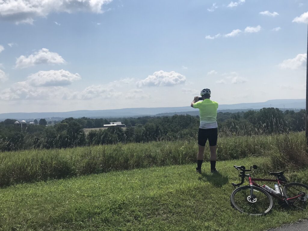
Overlooking the valley
The distance, end to end, is just 8.5 miles so an out-and-back ride is just 17 miles. That seemed too short of a ride. So I added a valley loop and created two KOM segments on Strava that I could compete for. Tim could too but having never ridden this before Strava would not show his first effort as a PR.
I went ahead on Hess Road and captured both KOMs. I consider these as garbage KOMs. First, is because very few people ride here. Second, no one knew these were segments before I created them. But I have ridden here before and would be happy with PRs. But they were KOMs and I will take them.
Between the two tunnels
We finished the loop and headed back inside the tunnels. As I came out of the second tunnel I could feel some squishiness in my front tire. I looked and told Tim that I was flatting and was going to ride ahead.
With less than two miles to go, I had hoped to ride as far as I could before it was unrideable. Being so close I didn’t want to take the time to change the flat thinking it would be faster to ride than perhaps walking. And walk I did.
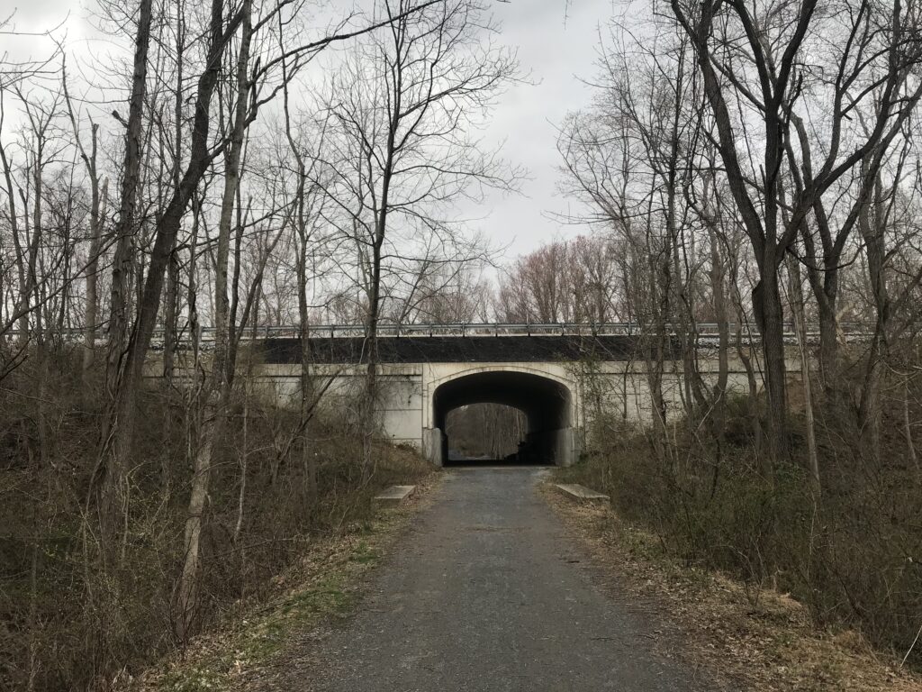
Sideling Hill Tunnel
It was about 3/4 of a mile when I could no longer ride. At that point, I had to walk. I could have changed the flat but I was so close, or so I thought. End of the ride for me. But I should have changed the flat.
Although I blamed glass, I think it was just as likely broken asphalt or broken concrete inside the tunnel. I found no debris in the tire.
2012 – Garmin 705. State of the art, a little bit large, color screen. Pricey. $700 retail price I got mine for $500. Don’t buy version 1 of the newest technology. You will pay.
2013 – Garmin 500. Small compact unit. Ultimately, it died and Garmin gave me a $100 or $150 credit towards the purchase of my next one.
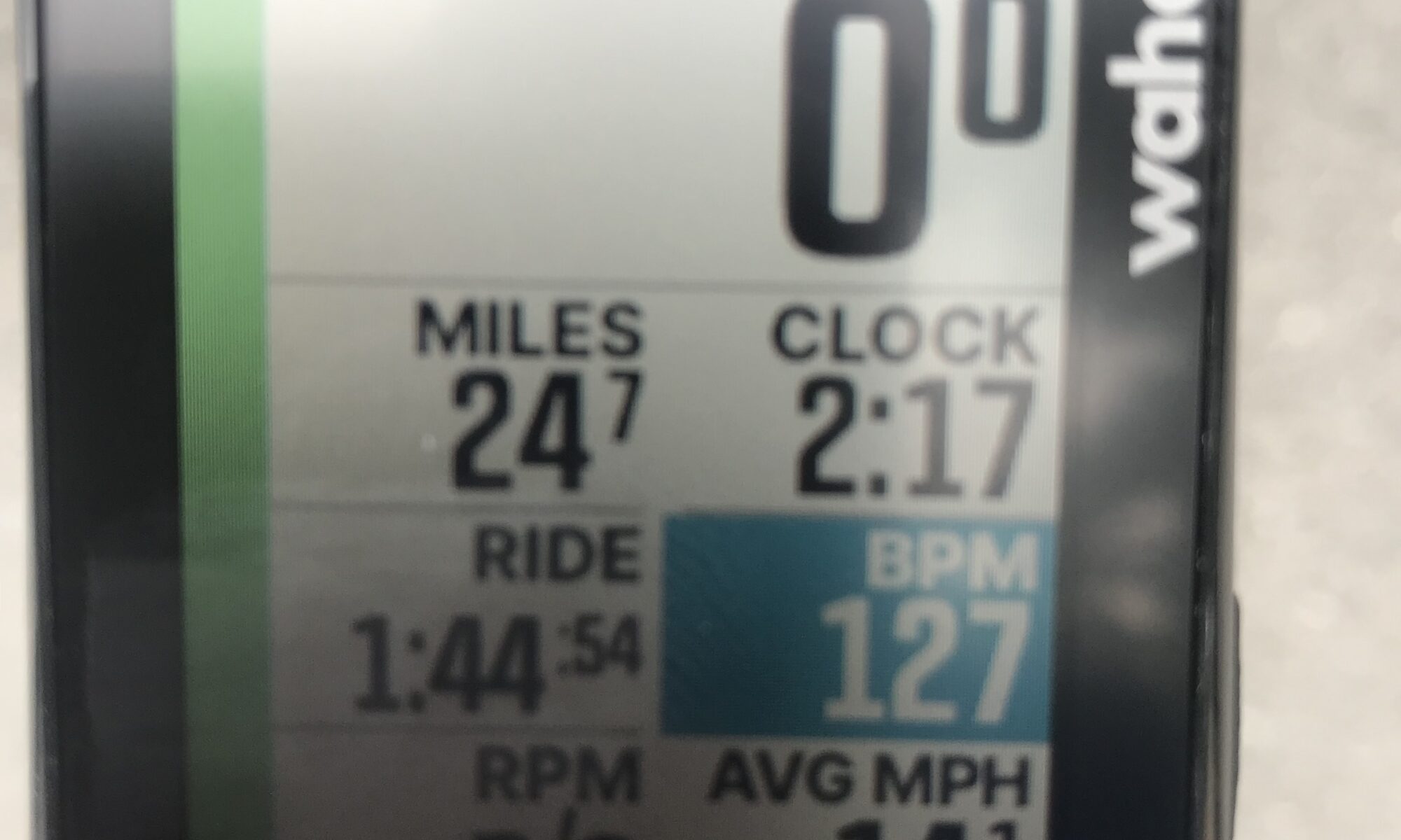
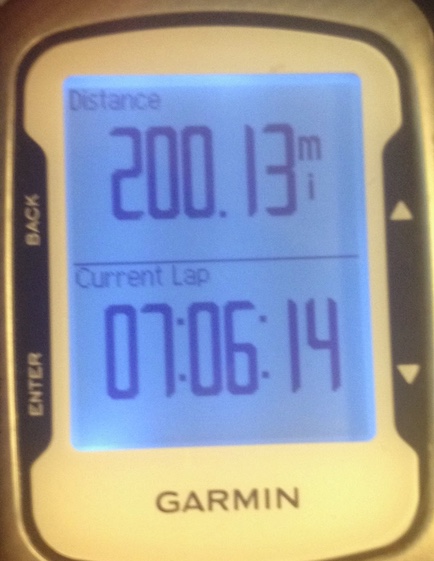
My Garmin 500 When I rode 200 miles it would not offload the data
2014 – Garmin 510 – Small compact unit. Basically, it was the same as the 500 but could sync wirelessly.
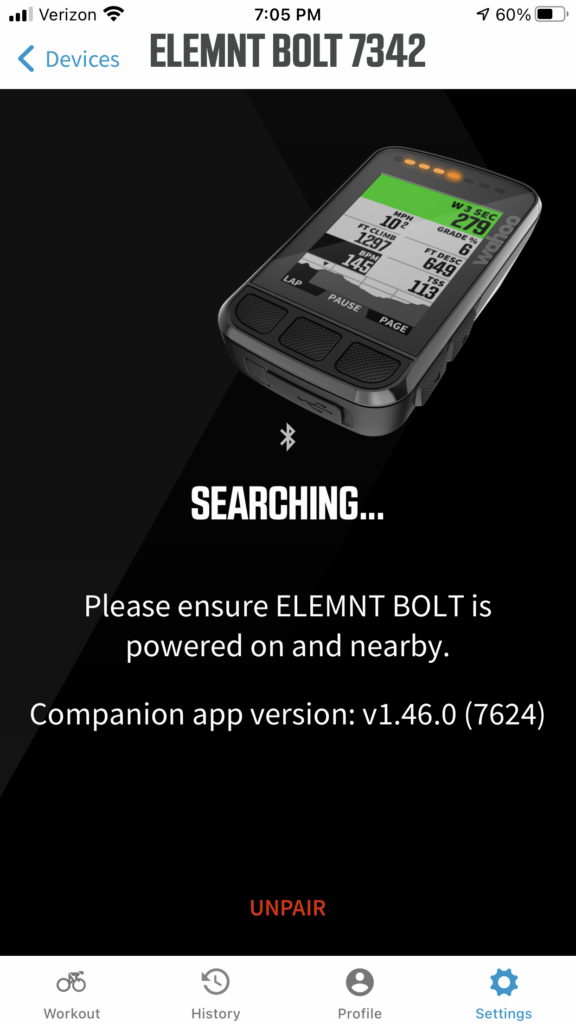
2019 – Wahoo ELEMNT Bolt – Small compact unit, similar to Garmin. It had a black and white screen. There were some differences between Garmin and Wahoo.
First, Garmin was and is programmed using buttons on the unit.
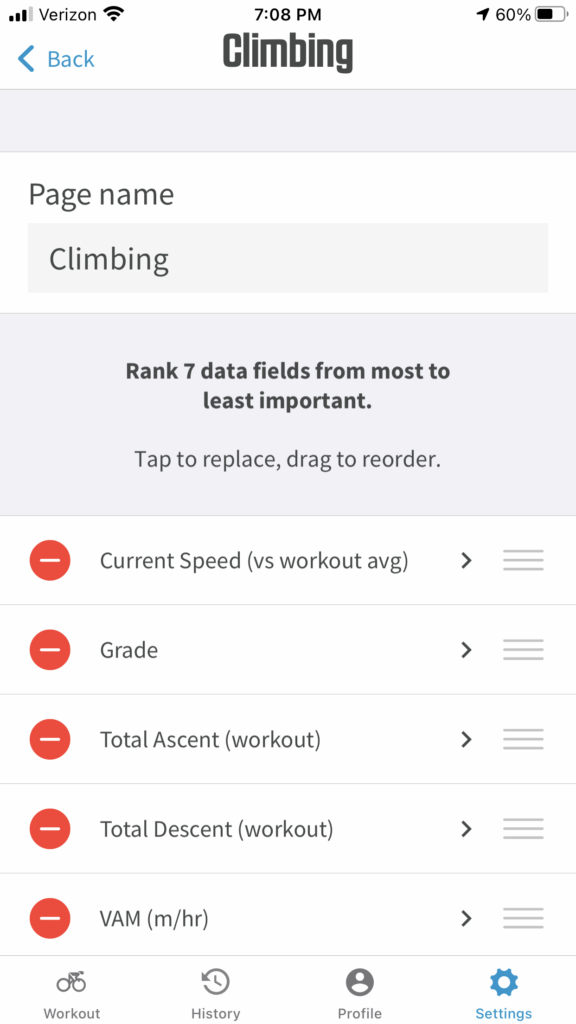
Wahoo is programmed using your phone’s app.
Wahoo ELEMNT Bold Phone AppChanging the Climbing Fields on the phone app for the ELEMNT Bolt
Second Garmin displayed digits down to the hundredths and appeared to be very accurate when uploading to a website. In other words, if you rode 10.01 miles then your upload will show 10.01 miles.
Wahoo shows distances in tenths. Almost immediately Wahoo would display 0.1 miles. Actually, it’s not “immediately” but likely 0.05 miles which is rounded up to 0.1. If you wanted exactly 10 miles and waited until the odometer shows 10.0 miles, most likely the upload would be a little short, e.g., 9.95 miles. If one is anal-retentive or obsessive-compulsive about exact mileage figures then you will probably not like the Wahoo.
Third, Garmin had a return to start mapping feature which would presumably route you back to your start location using the shortest routes.
Wahoo ELEMNT Bolt had a return to start feature which would retrace your turns. If you did a 15-mile ride and were five miles from your start, Garmin would route you those five miles. Wahoo would send you back the 15 miles from where you came.
Fourth, the Garmin 510 had a “turn by turn” mapping feature which let you preload rides onto the unit. But it did not have maps. So 200 meters before a turn it would beep and display TURN RIGHT. The Bolt had maps and was far superior.
Mapping is important to me. I had multiple failures loading routes to the Garmin 510. I did not have confidence that my preloaded route would work. Sometimes it did, sometimes it didn’t. The Bolt always worked.
And fifth, and the reason I bought the Bolt, the Bolt had the capacity to display Strava Live Segments while my Garmin did not. In fairness, I could have bought the newer equivalent Garmin unit (which may be the Garmin 530) which would display Live Segments.
And a word about accuracy. In this high-tech world, we expect our units to find us with feet if not inches by bouncing a tracking signal to a satellite in space. They are not always that accurate. When I first got my Bolt I mounted it next to the Garmin and for about six weeks I ran both units simultaneously. And rarely did the two head units produce the same data. If I did a 50-mile ride one might display 50.04 and the other 49.86. And it wasn’t the case that the Bolt was always greater than the Garmin. Or the Garmin always showed more than the Bolt. It depends.
There seemed to be no rhyme nor reason as to which unit would display the greater number. Initially, I would choose to upload the unit that showed the greater distance (LOL) but eventually decided it really didn’t matter. And when I put the Trek Domane SL5 into service in last January 2020, I went with just the Wahoo Bolt.
I love my Wahoo ELEMNT Bolt. It is the low end of their units. The ROAM has more features.
2021 – Wahoo ELEMNT Bolt – Color edition (July 2021)
My Bolt case was showing signs of wear and I purchased a new one. In the past 20 months, I discovered two major changes.
First, the newer Bolt now has a color screen. It is also sharper in its display.
And second, the “map/route to start” for lost cyclists now maps to start. I have not tried this feature to see how it really works.
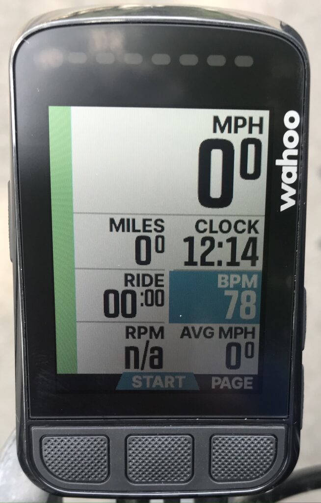
Wahoo ELEMNT Bolt – Photo 1
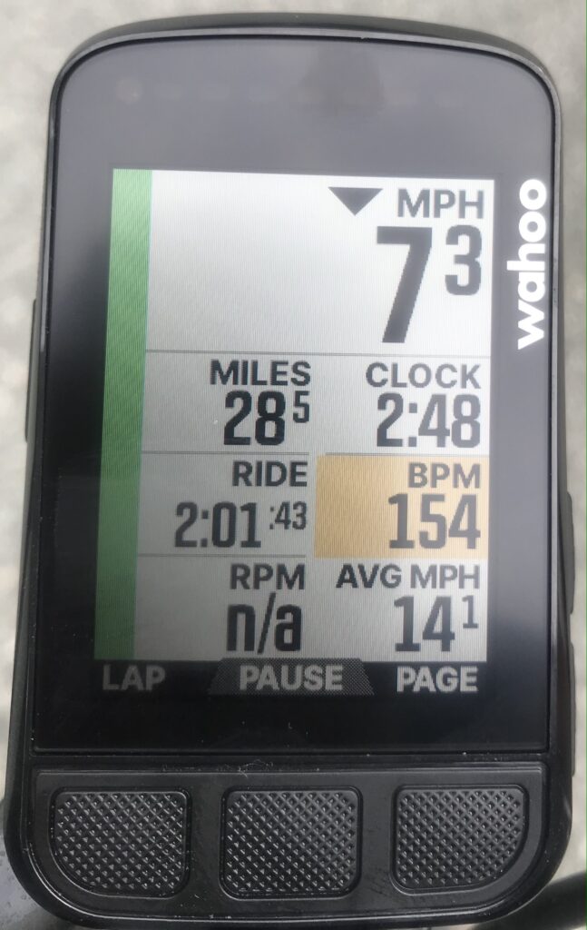
Photo 1 – This is the base screen for the Bolt. The colors here define heart rate and traffic.
The Bolt pairs with the Garmin Varia radar/taillight unit to show traffic approaching from the rear. IMHO, the Bolt does a better job than Garmin’s own unit, in my case, the Garmin 510.
The Garmin 510 defaults to a full screen view when no traffic is present. When traffic is picked up by the Varia unit, the screen shrinks to about 7/8th size showing a “lane” as a strip on the far right of the unit with a dot moving up the lane so one can see how close the vehicle is.
The Bolt has a “lane” on the far left which is always visible. In my older unit, black and white, it was a darker lane. But it showed vehicle icons instead of dots Not big deal. But the reason the unit is superior is because the Bolt beeps at the presence of traffic and displays colored lights at the top from yellow to red (take cover) to green (all clear).
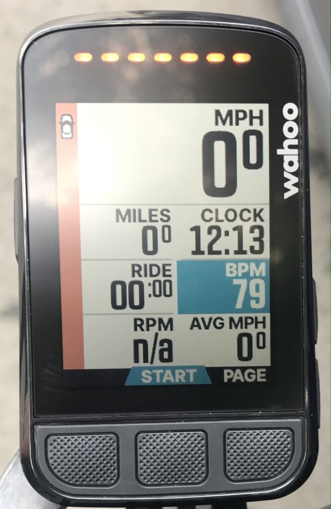
Wahoo ELEMNT Bolt – Photo 2
Photo 2 – The Bolt’s traffic lane has changed from green to yellow and displays a vehicle icon near the top (it’s close). The unit also beeped and displays yellow lights at the top of the unit.
Wahoo ELEMNT Bolt – Photo 3
Photo 3 – The heart rate zones can be set up by the user and on the basic screen colors will correspond with the zones.
Wahoo ELEMNT Bolt – Photo 4
Photo 4 – Hear rate zone is Zone 5. I am in the red. Except I really wasn’t. This was paired to the Wahoo TICKR which never was accurate for me. At first when I went into the red I would stop even though I was nose-breathing. I would take my heart rate manually it would be around 100-110 bpm. Ironically, I found the Bolt paired better with Garmin’s heart rate monitor than its own TICKR.
Wahoo ELEMNT Bolt – Photo 5
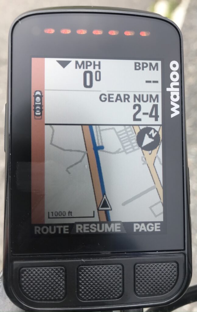
Photo 5 – Mapping works great in the Bolt. Not only does it display roads, major roads in yellow, but it also displays bike paths, in blue.
Wahoo ELEMNT Bolt – Photo 6
Photo 6 – Live Segments from Strava. This is the summary screen after completing some segments. Notice the neat crown for a KOM. Not shown is the progress screen. On a segment the displays shows your PR (but can toggle to race the KOM), total time, distance remaining, time relative to the segment (e.g., plus or minus 3-4 seconds) and a projected finish. When I got this unit it was not set up like my first Bolt and that would have been a game changer. But some fiddling with the phone app and I have it set up the way my first unit was set up. Everything is perfect.
Also not shown: I have the unit set up to show incoming phone calls and text messages. I could also choose emails but chose not to. Emails can wait.
Bottom line. I love this unit. At $280 maybe a little pricey but paired with Strava’s Live Segments, it has made riding so much more fun.
2022 – Wahoo ELEMNT Bolt – (Warranty)
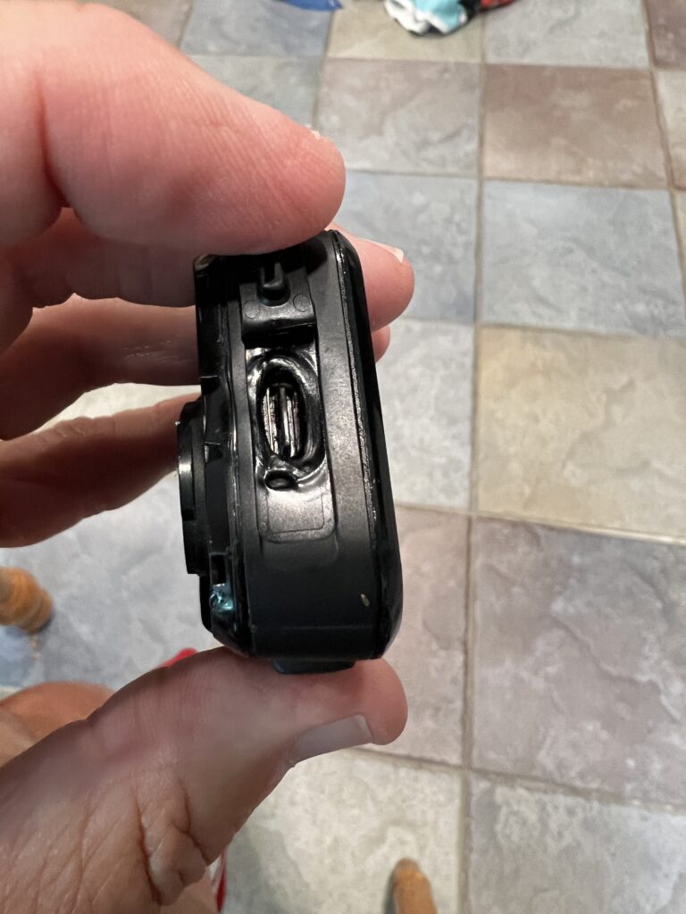
Meltdown
Uh, we have a problem. The unit was on the charger overnight and in the morning I unplugged it to put it on my bike. The cord seemed to stick and was hard to pull out. I didn’t have my reading glasses on or my contacts in and my thought was last night in the haste I used a USB cord instead of the C cord to charge it. Perhaps I forced the wrong cord on it.
The flap that covers the opening would not close. My granddaughters were with us yesterday and the unit was just on a table. I thought that maybe one of them was “playing” with it and bent that flap so that it will not close.
When my ride ended I put on my reading glasses and took a close look. I used the right cord and it look like it had burned a little. The unit itself definitely overheated and had a meltdown. And it was deformed enough that the cover flap would not close.
I contacted Wahoo with photos. Within an hour I had a return slip and was on my way to FedEx. Four days later I had a new replacement in my hand from Wahoo.
I don’t know what happened with that old unit but their customer service is the best. Period.
Planning for this day began weeks ago, accelerated last week, then almost blew up today.
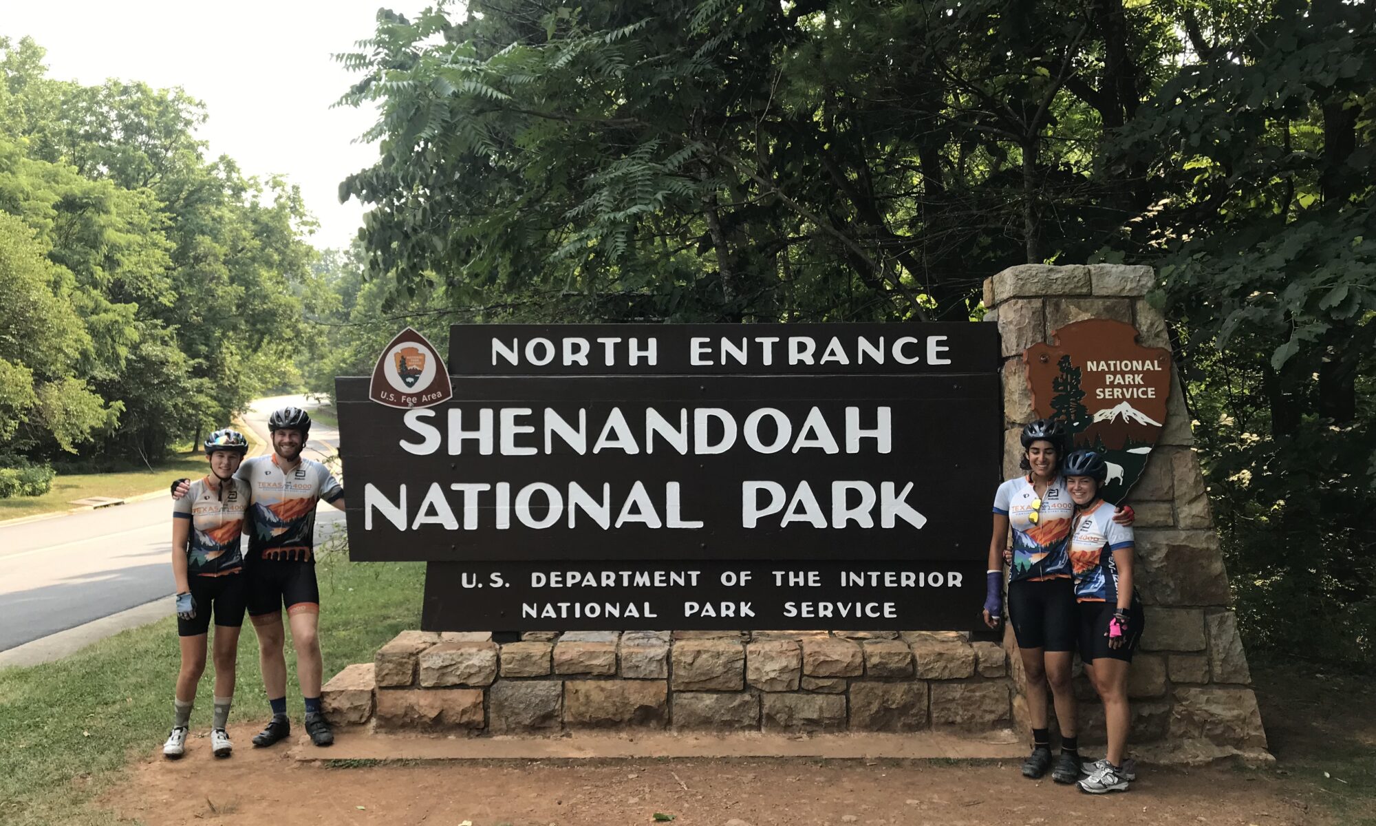
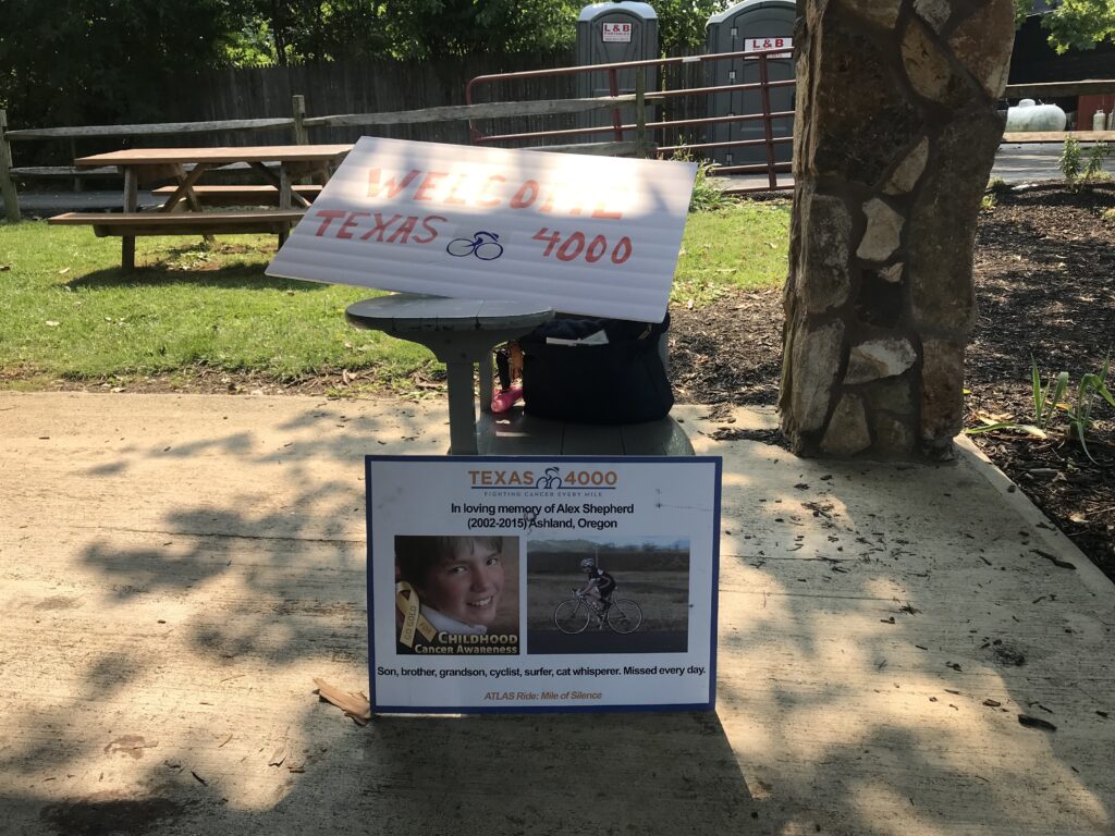
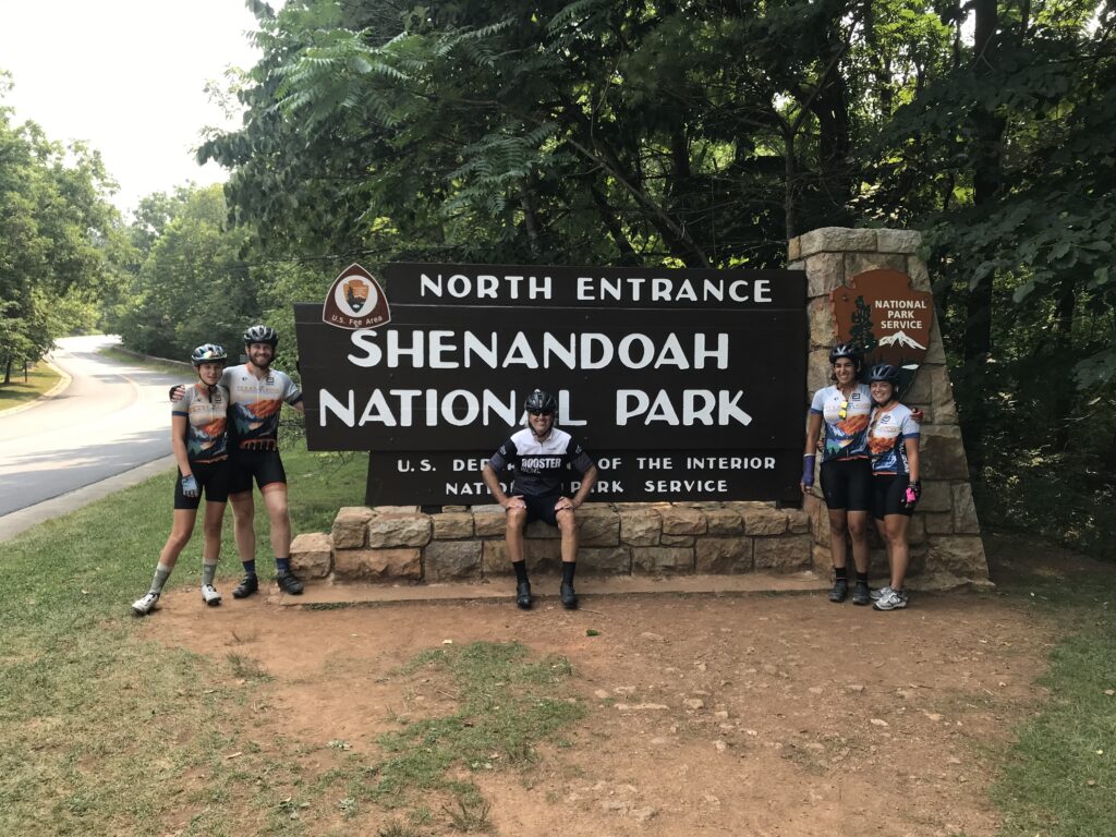
Welcome Texas 4000
At 3:00 a.m. my alarm went off. I ignored it but never really got back to sleep. I had offered to provide lunch today for the Texas 4000. With everything in place I received a text at 10:00 p.m. last night that the location I worked hard to secure would not work because the satellite view showed there was not enough room to turn their van and trailer around.
Ready to roll with a pocket full of Twizzlers
We would leave the house without knowing where we would be setting up. All of us, lunch providers and the Texas4000, would have to be very flexible about where we met.
Apple butter cinnamon donuts from The Apple House Restaurant
Cheri and I left home around 7:00 a.m. to set up the lunch stop. Our destination was Linden which was around Mile 75 of their 150-mile day. We were still on the road at 8:15 a.m. when I got a text that the first group was way ahead of schedule and would be in for lunch at 9:00 a.m. It was “lunch” because they ate at 3:30 this morning in preparation for a 4:00 a.m. rollout.
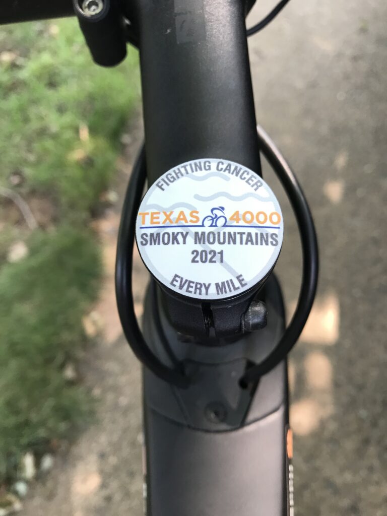
My Texas 4000 Stem Cap
Rather than take Interstate-66 to Linden, we took Watermill Road which is a beautiful backcountry road as I knew the roads they would be riding today. I didn’t know how many groups were on the roads (I figured three or four – answer: three) and whether they would be ahead of us or behind us on Watermill as they came down Mountain Road.
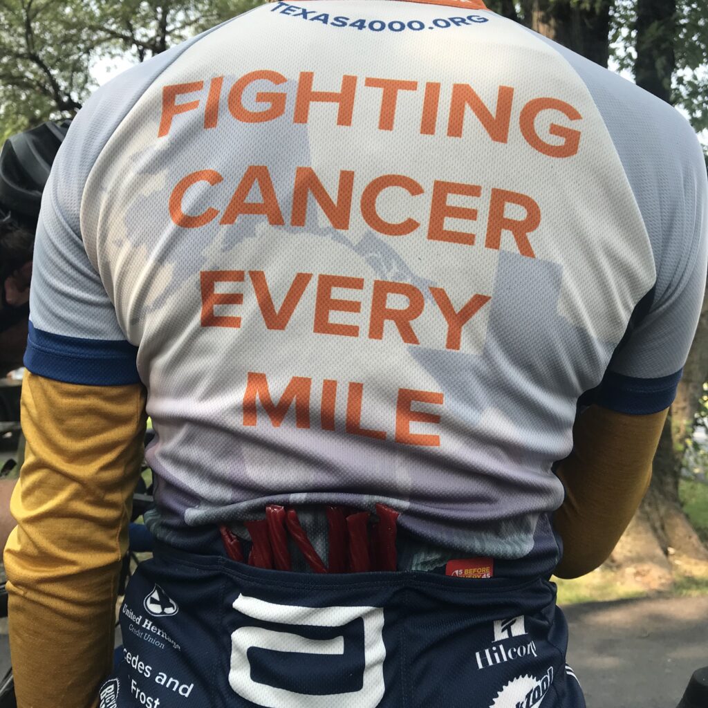
We came upon four riders for the T4K. I have a T4K jersey that I bought in 2016 and we gently passed going wide very lightly tapping repeatedly on the horn. Cheri waved the jersey out the passenger window. We heard a shriek. “That is so cool!!!”
As we continued to drive on Watermill we came upon a second group. Again, a gentle pass of the group with a multiple light horn tap, enough to let them know we were friendly and that they should look. This time it evoked a louder reaction. Both groups would say that was a real pick-me-up as they were already on Mile 50 of a 150-mile day.
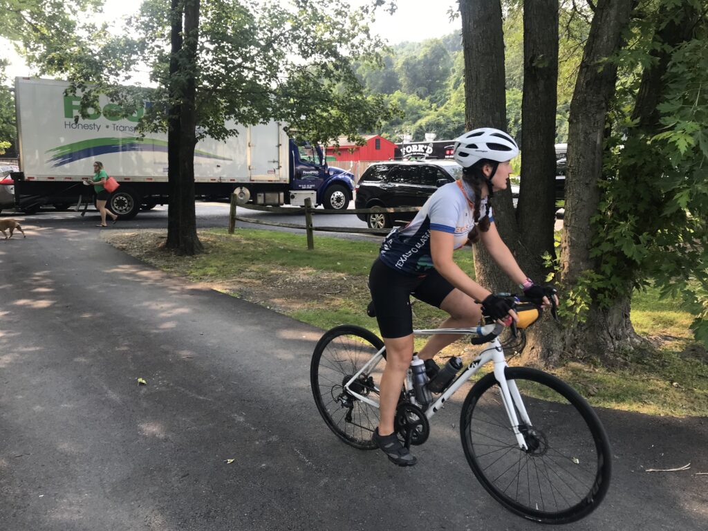
Still unsure of where we would meet them and set up lunch, we stopped at the Apple House restaurant in Linden. I would be quick and left my wife, my phone, and the keys in the car as I went inside for donuts. The manager had promised that they would donate donuts but since I was unsure of who was working, I grabbed my Texas4000 jersey as a way of explanation.
Austin, Autusa, Kirsten, Morgan
Aaliyah, the cashier, disappeared for a second and went to get two dozen donuts. I opened the door to the restaurant and motioned for my wife to come in “but leave the car unlocked” and she did. The car had power-locked behind her. A sick feeling instantly hit me.
The keys and my phone (which could unlock the car) were in the car. We were at least one hour from home and our extra key and no way to get there. I felt sick to my stomach. Minutes earlier I had been texting with Adrian from the Texas4000 about where to meet and now my phone was in the car.
Austin, Autusa, Barry, Kirsten, Morgan And there is my Texas4000 jersey
Still in my hand, I hung my Texas4000 jersey on the rear of the car facing James Monroe Highway (Rte 55). Almost immediately Lindsey and Serena from the T4K popped in driving one support vehicle.
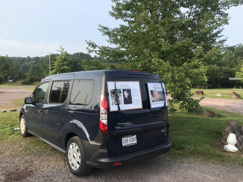
Texas 4000 van and trailer
Shortly thereafter the van and trailer with Adrian came into the lot. Adrian had been my point of contact the past month and we were looking forward to meeting. But I felt like crying. All the food was locked in our car. Striking out on calling a locksmith, Aaliyah suggested calling 911. Cheri did. We only needed to have a child, pet, or life-saving medication in the car which needed extraction. So we did.
Deputy sheriffs from Warren Co., Va.
Two deputy sheriffs from Warren Co. showed up within 6-7 minutes. While it seemed like hours, they were able to get their super coat-hanger into the car and press the unlock button.
Riding through beautiful downtown Front Royal
With both support vehicles of the Texas4000 and still nowhere to go, I went back into the restaurant and got permission to use their picnic tables. And we hurriedly started setting up.
The rest stop was short since the riders were on a long day. A Challenge Day they call it and today would be 150 miles and about 15,000′ of climbing. And most of the climbing was in the second half of the ride.
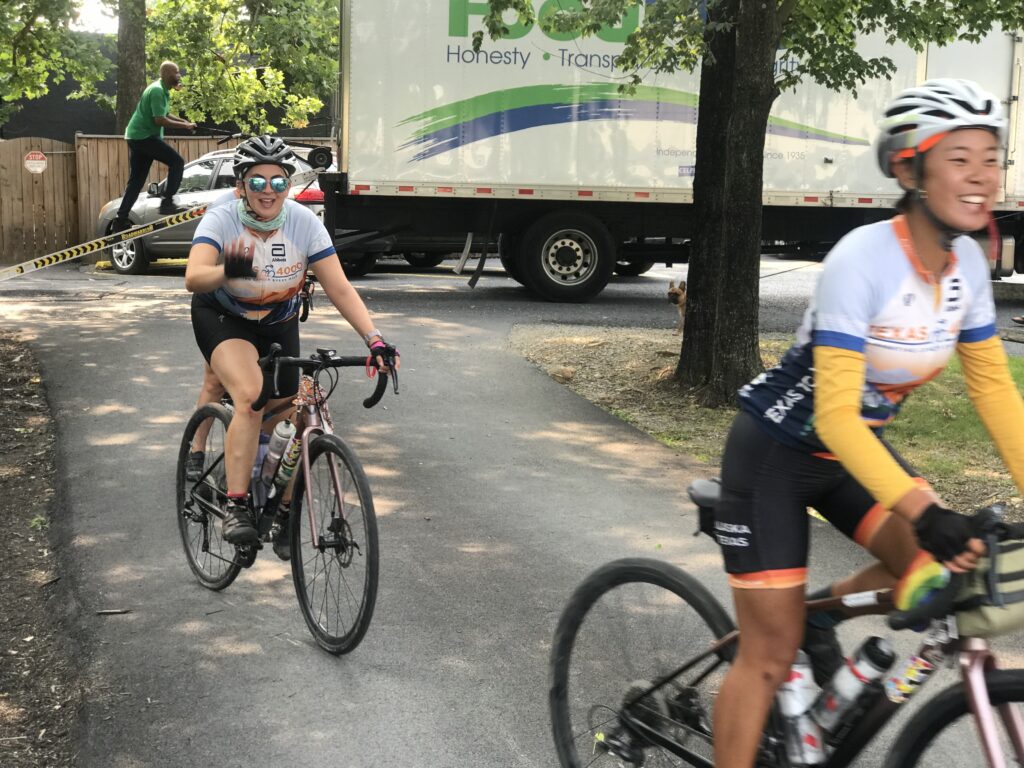
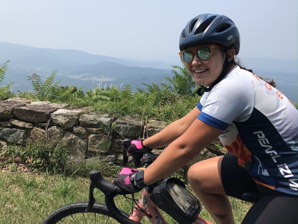
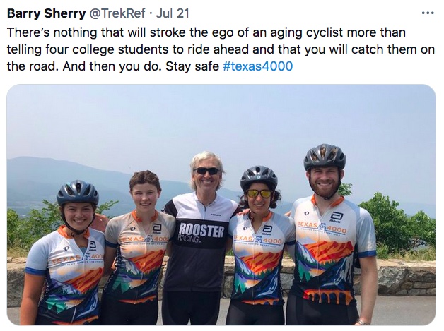
Austin, Kirsten, Autusa, Morgan (crashed by Barry) at the Skyline Drive entrance
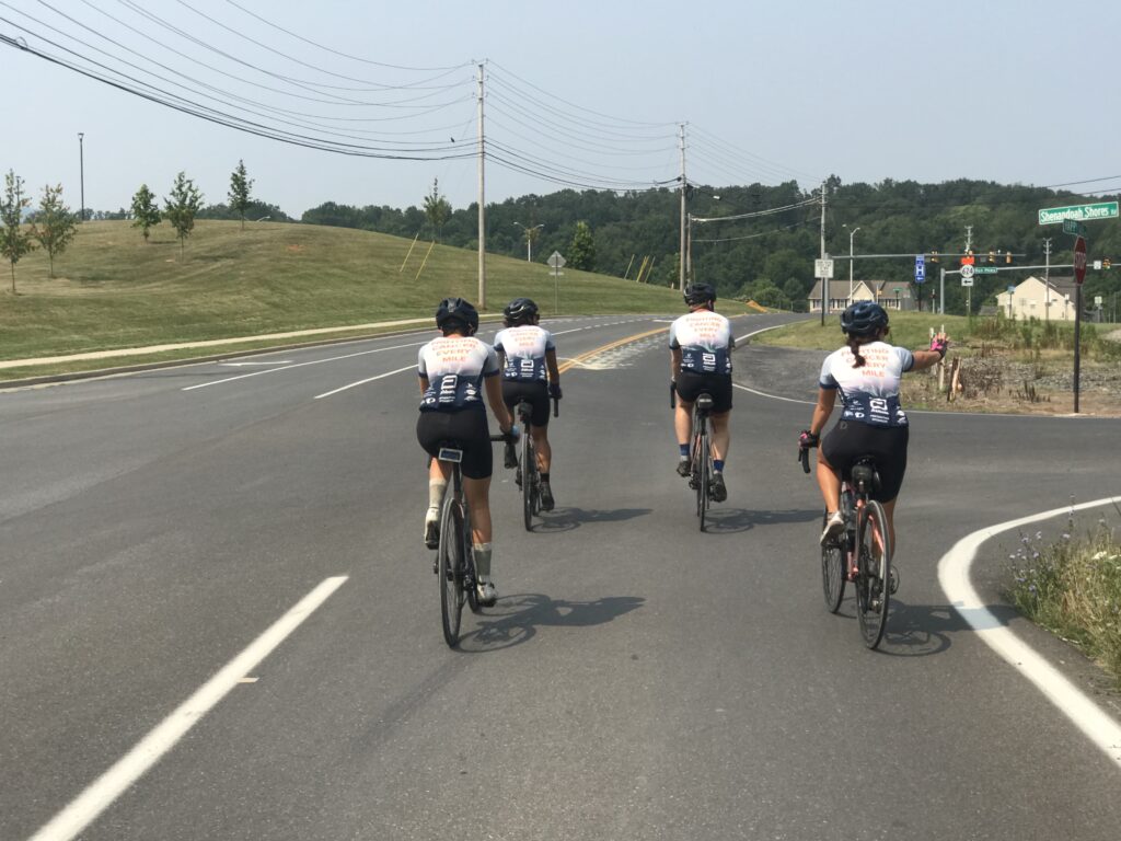
Two groups came and went while the third, “The Renegades” were still on the road. What I had hoped to do initially, I finally could. I jumped on my bike and rode east for almost two miles until I found them so I could bring them in. I had hoped that we would be set up early enough I could ride against their route for 20 miles then bring them to the stop. Two miles would have to do.
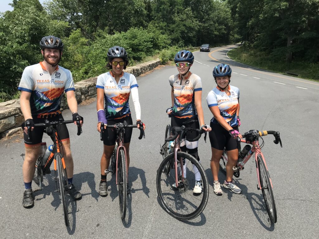
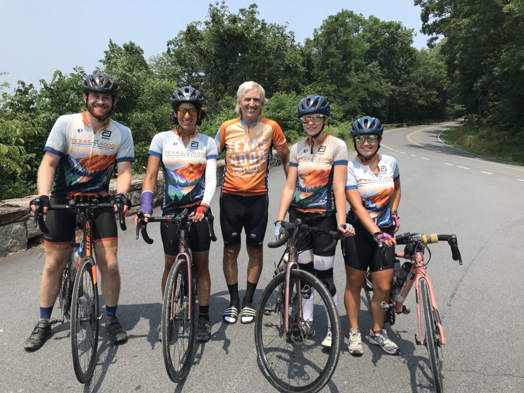
I rode until I saw Austin, Autusa, Kirsten, and Morgan. As soon as they passed I did a U-turn and took them to the lunch stop. Once refueled, they got ready to ride. They invited me to roll with them. I had some cleanup to do but told them to go ahead and I would catch up.
Morgan
Once I was rolling I wondered if that was a good idea to send them ahead. Maybe I messed up. But after 4-5 minutes I saw their orange and white jerseys up the road.
Morgan told me that their hosts almost never rode with them and they really enjoyed having new people jump in. And she added, “especially a professional.” If I had milk in my mouth I would have spewed it all over her laughing.
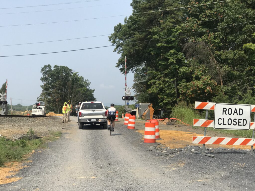
We had to cross through a closed construction area
I was able to ride with them until their first rest stop in Shenandoah National Park on Skyline Drive. I would have ridden all day in a perfect world but my wife was up the road waiting and I wasn’t going to ask her to leapfrog with the T4K all day just for more miles for me. She had done enough preparing and setting up the lunch stop for which I was grateful.
Austin, Autusa, Kirsten, Morgan
To my new friends of the Texas4000, thank you for your fight against cancer. Be safe and godspeed as you continue your ride. #fightingcancereverymile
The alarm didn’t go off. It didn’t need to. I was up at two minutes before 4:00 a.m. and decided I would drive to Pennsylvania and ride a portion of the Great Allegheny Passage Trail.
Supporters of the Big Savage Tunnel at Deal
Although I have ridden on the trail many times (all in sections except one through trip from Pittsburgh to D.C.), today would be different. I was going to provide “trail magic.”
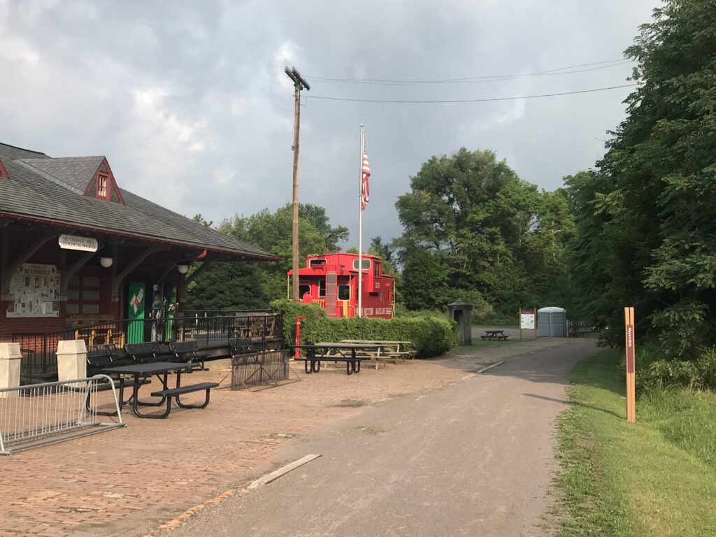
Near Meyersdale
Trail magic occurs when people on the trail experience the magic through the kindness of a stranger. Usually, it will be food or water. But it could be a ride too. I left home and stopped in Cumberland to load up on ice. I had purchased water and snacks before and was all set.
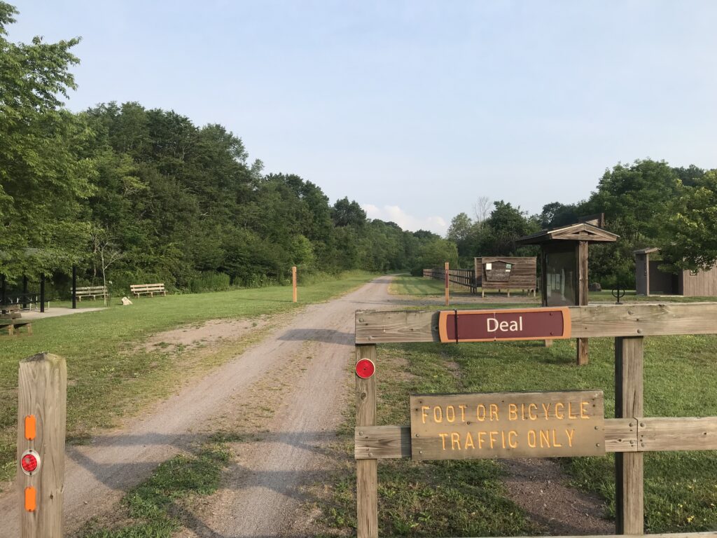
Trailhead at Deal
I parked at Deal Road. At 7:45 a.m. I pedaled off towards Ohiopyle. My trail magic was directed at the Texas4000. Although their website indicated that they would be on the trail this day, I never ran into them. It would have been a grand gesture but just didn’t work out. Just south of Markleton I turned around to head back.
Eastern Continental Divide
Although disappointed, I was prepared for this possibility and would make the best of it. It was a beautiful day. I was on a bike. It would be a great day.
Near Meyersdale
When I had passed Rockwood there was a volunteer standing at her “welcome center.” She asked me to sign the guest book and I told her I would on the way back. So now, on my way back, I stopped and signed the book. Name. Address. Comments: “Pave it.“
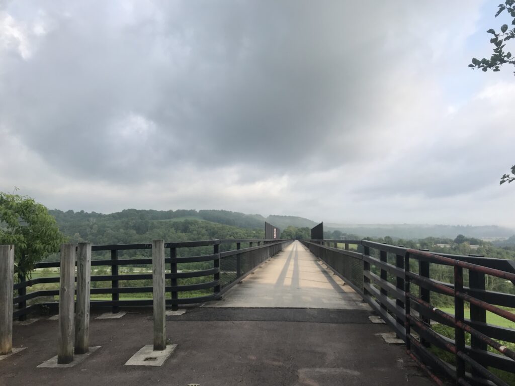
Salisbury Aqueduct
This trail is so nice but how much nicer would it be with a fresh coat of asphalt. I rode my gravel bike (Checkpoint) but with road tires (32s). And that was easy enough. 28s or 25s would have been OK too. But crushed limestone is a tad bit harder to pedal than asphalt. Mostly for me, it’s the dust. My water bottles were coated with fine limestone dust and it tastes gritty even if it really isn’t.
Meyersdale Station
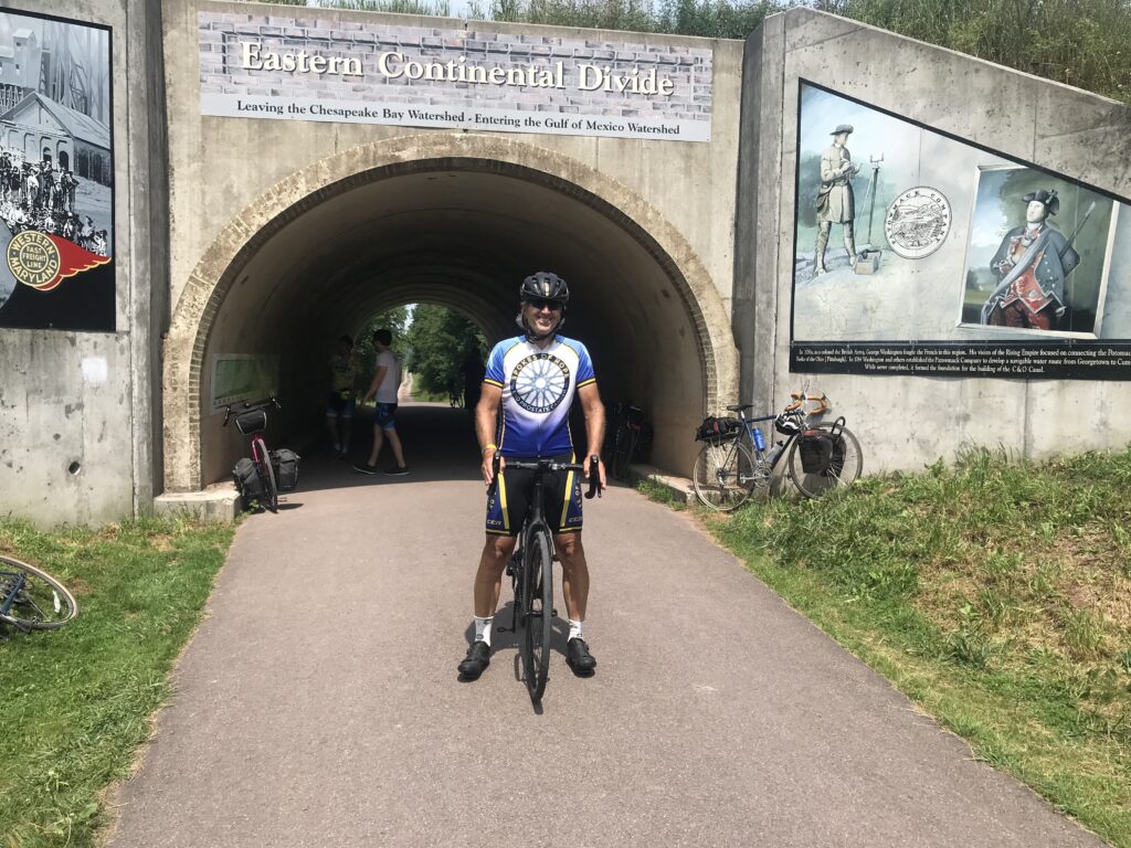
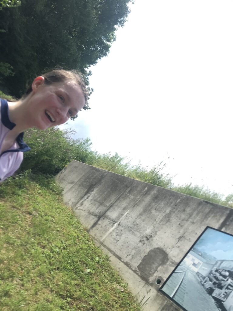
I caught a young woman, Hannah, near Garrett. She was leaving Rockwood when I was signing the guest book and was far enough up the trail that I assumed she had jumped off at Rockwood rather than continue on the trail. I asked her where she was headed and she said the Eastern Continental Divide. I told her I was too if she would let me ride with her. She said that would be fine.
Hannah. Not sure if this was an accidental selfie but it was on my phone.
Hannah was from Cedar Rapids, Iowa, but is now living in Morgantown. She came to Ohiopyle to ride her first Century. So we talked all the way to the Continental Divide. When we turned I insisted that she stop and get some trail magic. And she was happy too. I had ICE – and the temperatures had crept up to the high 80s. I gave her a cold Gatorade to take with her as well.
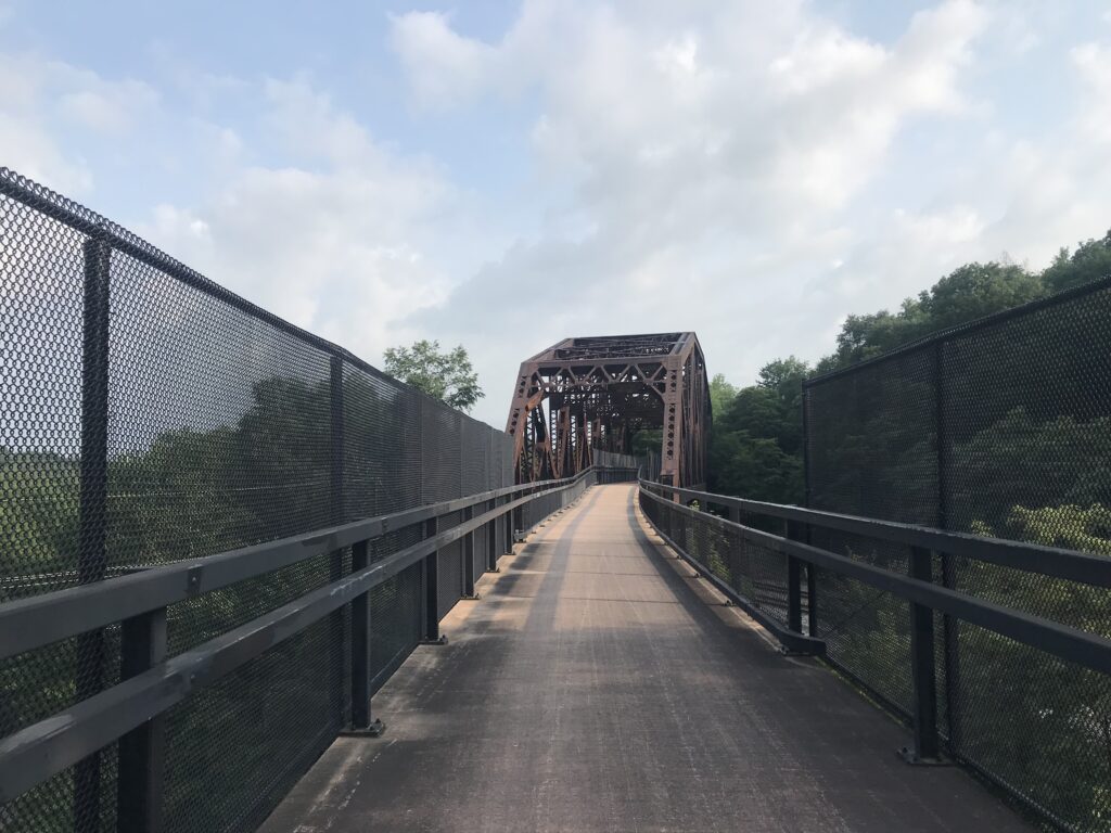
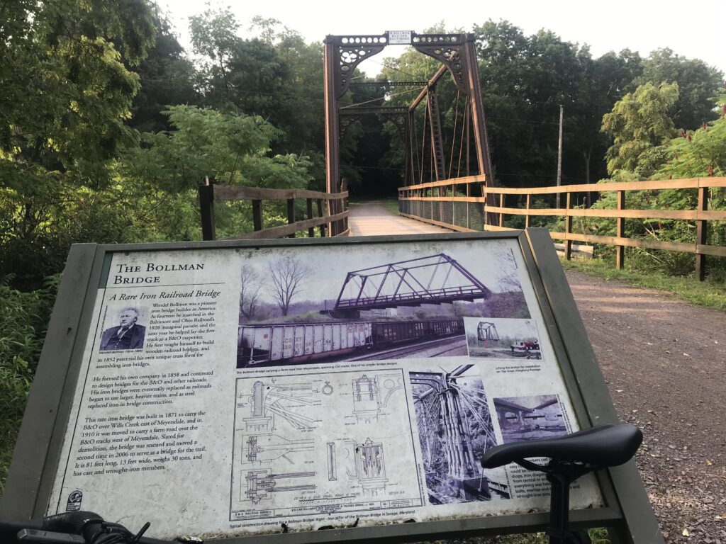
Bollman Bridge
As Hannah was leaving I rode with her another four miles towards Meyersdale before wishing her the best of luck and turning around. Then I returned to the car. It was just in time as two women and a man were sharing what little water they had left. I invited them to my car for some trail magic. Ice. And water.
My car at Deal
It didn’t work out for the Texas4000 on this day (I learned they were wheels down at the ungodly hour of 5:00 a.m. and I just missed them at Deal) but it did for other complete strangers. That was fun this trail magic thing. And an added bonus. My name is on a plaque at this stop.
I needed a place to stay returning home from Dayton, Ohio. I viewed trail maps and looked for a paved rail-trail. And I found the T. J. Evans Trail in Newark, Ohio.
Skyline Chili, Pinkerington, Ohio
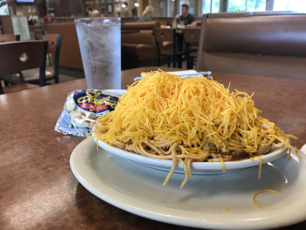
After another 80-mile day on the Little Miami Scenic Trail (and hot too), I had dinner at the Skyline Chili in Pinkerton, Ohio – the same place I ate on the way out. But with the big miles behind me, instead of a large plate, I got the regular size.
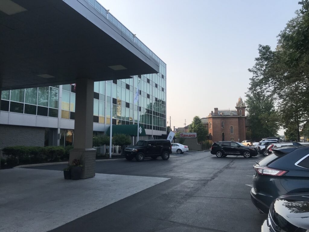
Doubletree Hotel, Newark, Ohio
I drove to Newark and checked into the Doubletree Hotel and Suites. While not my usual Hilton preferred property, this one was very nice and I was glad that I stayed here. With the Tour de France ongoing, I decided I would have an early breakfast (6:30 a.m.), go for a bike ride, then shower and watch the last hour of Stage 11. This was a double ascent of the famous Mont Ventoux and was won by Wout van Aert. It was a very good stage.
Newark, Ohio
I was out wheels down at 7:38 a.m. It was a very pleasant July morning even if the humidity was a little high. I had mapped out a ride to take me to the trailhead which was four miles away. I visited the downtown area in Newark and think this city (population: 47,000) is beautiful.
TJ Evans Trail
I came to the trail and found the people on it were quite friendly. And why not? This is Ohio. The trail was quite wooded and had no significant structures.
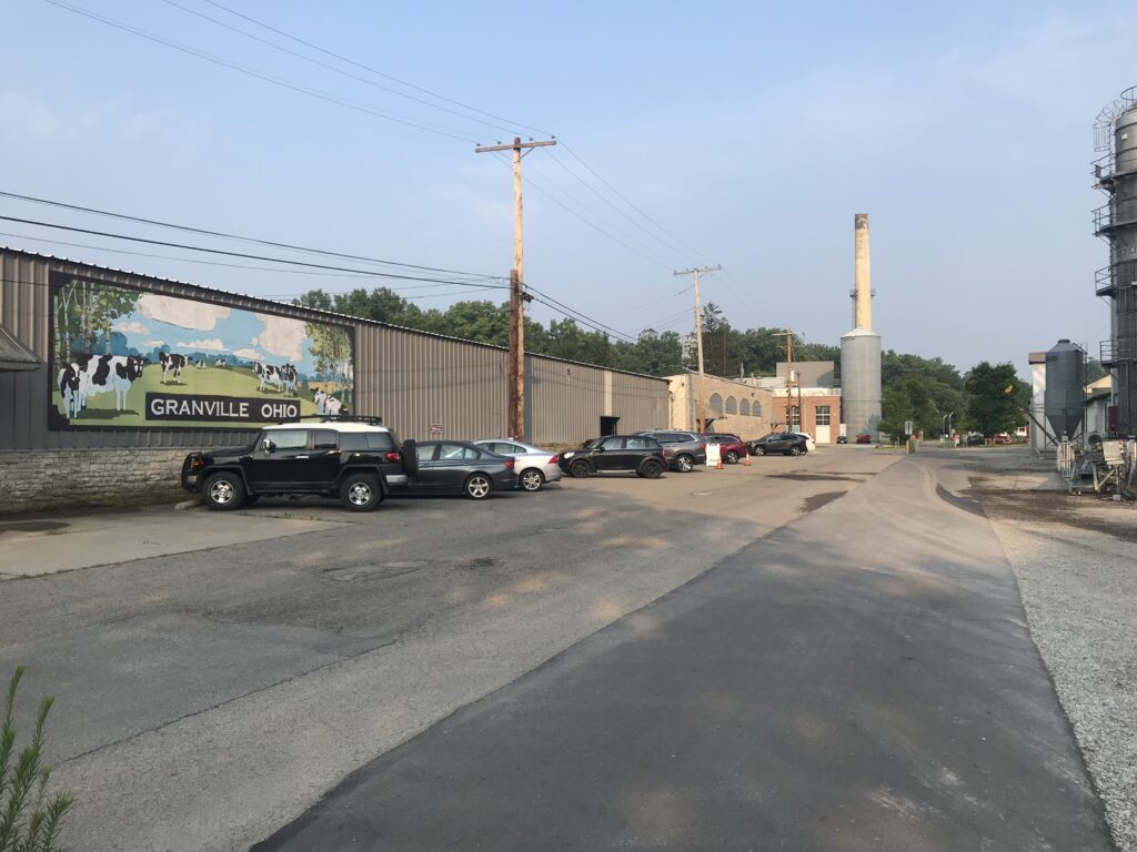
TJ Evans Trail in Granville
In Granville, I saw a guy enter the trail just ahead of me. I was catching him and saw he was wearing a Trek jersey. Maybe I just wanted to name drop but I caught him and then asked him if he had heard of Toms Skujins.
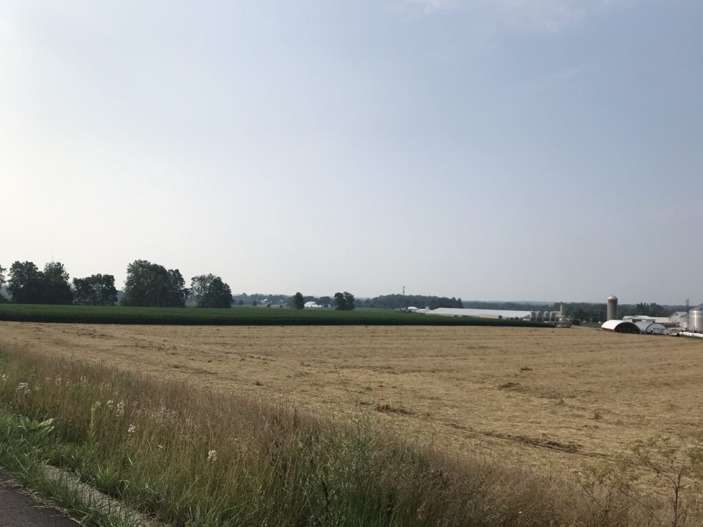
A section of the TJ Evans Trail goes by fields near Johnstown
Ed and I talked all the way to the end in Johnstown then turned it around to come back. We chatted almost exclusively about cyclists (the Schlecks, Jens, and even Lance), as well as riding in Europe. Ed hadn’t been (yet) but his brother has many times.
Ed riding next to Raccoon Creek
Approaching Newark, Ed told me of a local hill climb and said he was riding over there next. He asked if I wanted to come along. Of course, I did. We headed over to Fern Hill Drive (Granville) and I hung back while Ed went aheead then followed at a distance. For a flat state and county there are some hills to be found. I saw 10-12% grades on the street.
Granville
As we came to the end of the trail, Ed asked if I would be interested in a different way back. I jumped at the chance. The trail took me most of the way to Newark before Ed turned around and I found my way back to the hotel.
Newark, Ohio
If you go: The T.J. Evans trail is paved and in great shape. Most of the trail is wooded. There are no great railroad structures on the trail. Given its short distance (14 miles) and lack of features, it would not be a destination trail for most people, but if you’re in the area, or traveling like I was, it’s definietely worth a ride.
The Little Miami Scenic Trail runs from Cincinnati to Springfield, Ohio. It is a 78-mile paved rail-trail and is a “destination” trail, i.e., one that you would travel to just to ride. I had ridden on parts of it before. But I had never ridden the entire length. I decided it was time to ride the entire trail.
Little Miami River – Yellow Springs
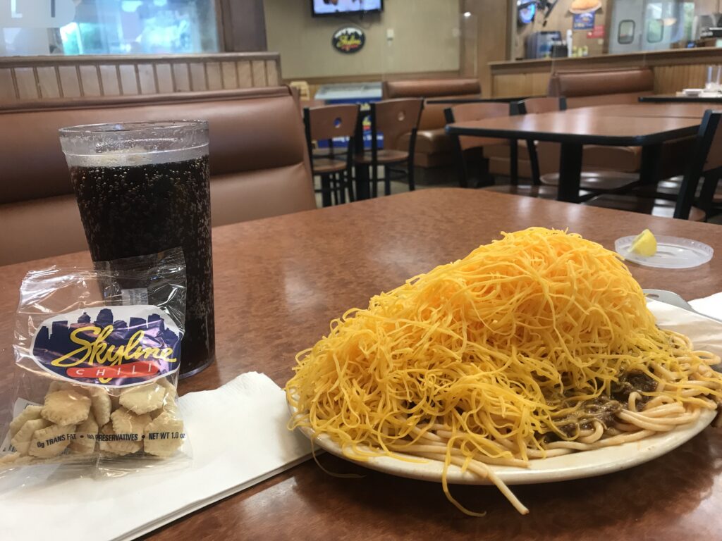
I had ridden with a friend, Bob Berberich, twice previously and I would meet him somewhere. I went to Springfield, Ohio, and stayed at the Fairfield Inn and Suites. I had scouted out restaurants in Springfield beforehand and knew they did not have a Skyline Chili but Columbus had five locations. Before arriving in Springfield, I stopped in Pinkerington for my carbo-loading.
Spaghetti, chili, and a pound of cheddar
It was 6:00 p.m. when I arrived in Pinkerington at the Skyline Chilli restaurant. Perhaps foolishly, I went for a large four-way figuring I would need all the calories I could get. It was a bit much.
This unmarked intersection is the start/finish in Springfield, Ohio
I checked into the Fairfield Inn and Suites. Very nice staff and I informed them what I was planning to do – bike to Cincinnati. They figured that might take me five days. Needless to say, they were a bit surprised and impressed when I said I would be back tomorrow. I had called ahead and asked about leaving my car for a day and they said that would be fine.
Ghost town in Springfield
Most hotels are not fully staffed to resume serving breakfast and this was no exception. However, they had oatmeal and that was enough. I also grabbed a couple Nutri-Grain bars for my pockets to fuel me on my ride.
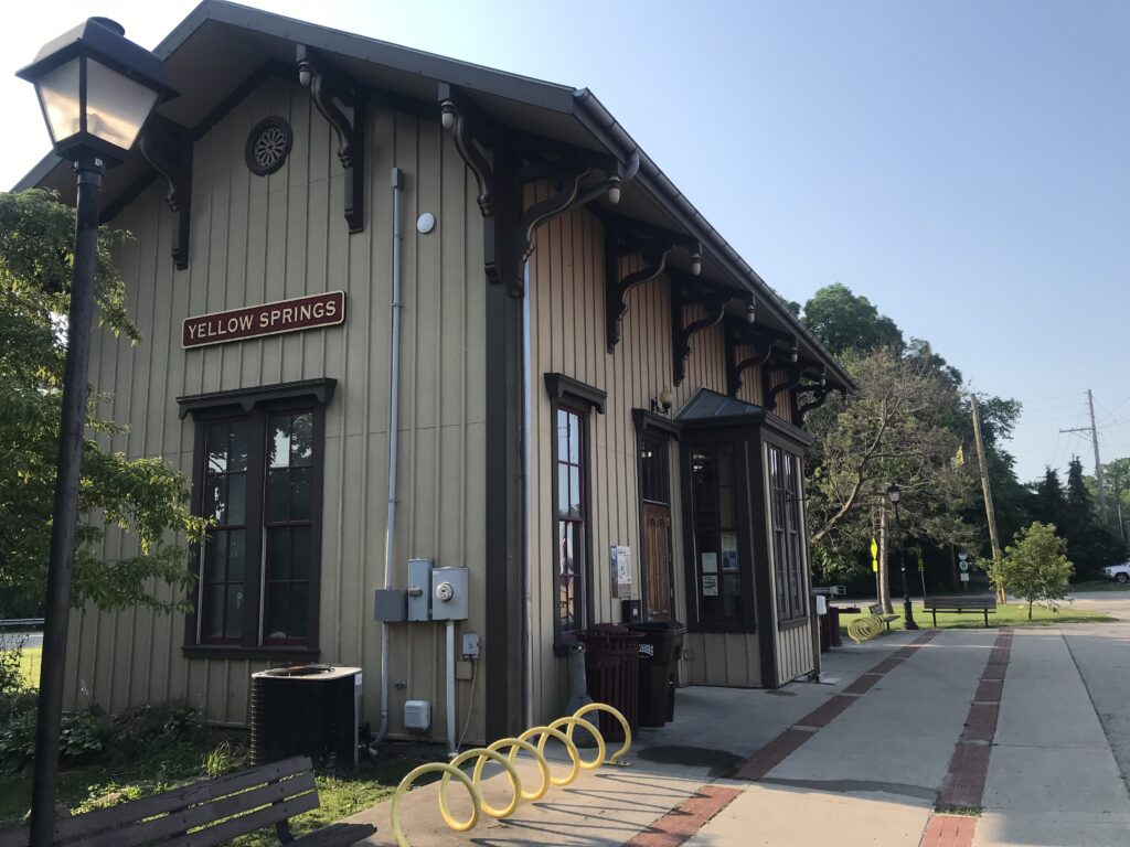
Train station in Yellow Springs
I am not into bike-packing. I have no paniers or racks on my bike. I don’t want the extra weight. I would travel as minimal as I could. But that would mean a small backpack.
Corwin
In my small backpack, I would carry a change of clothes (shorts/t-shirt/underwear), deodorant and toothbrush, a clean cycling kit for tomorrow, and flip-flops. Sunscreen. Even then, maybe that was too much.
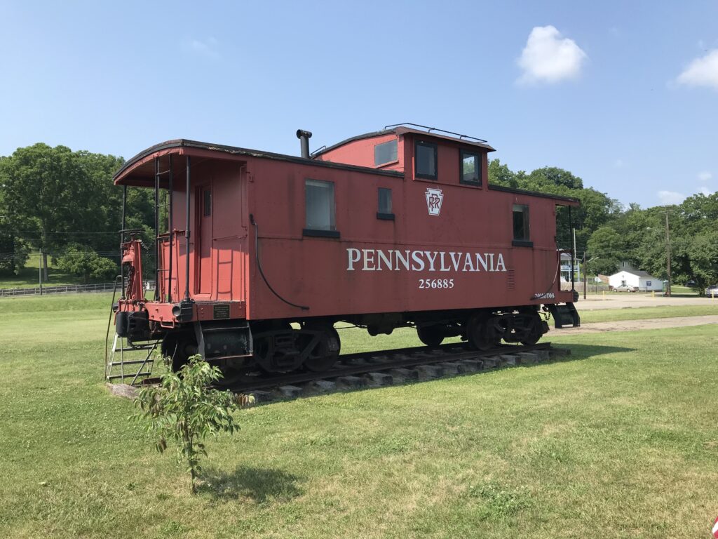
Caboose at Morrow
It was 69º when I rolled out at 7:52 a.m. Sunny. I had mapped out the route using RideWithGPS and sending it to my Wahoo computer unit. Of course, that would be super easy once on the trail. But the first four miles would be on city streets. Two were “main drags” while the rest were residential streets.
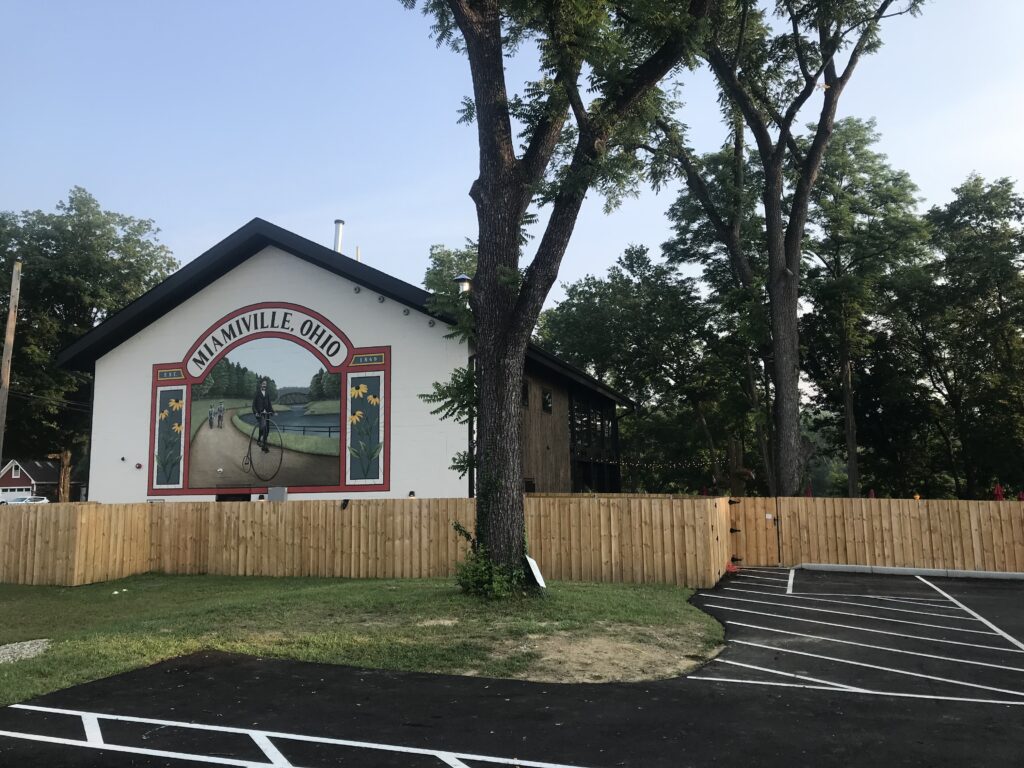
The Miami Trailyard – a very nice outdoor cafe in Miamiville
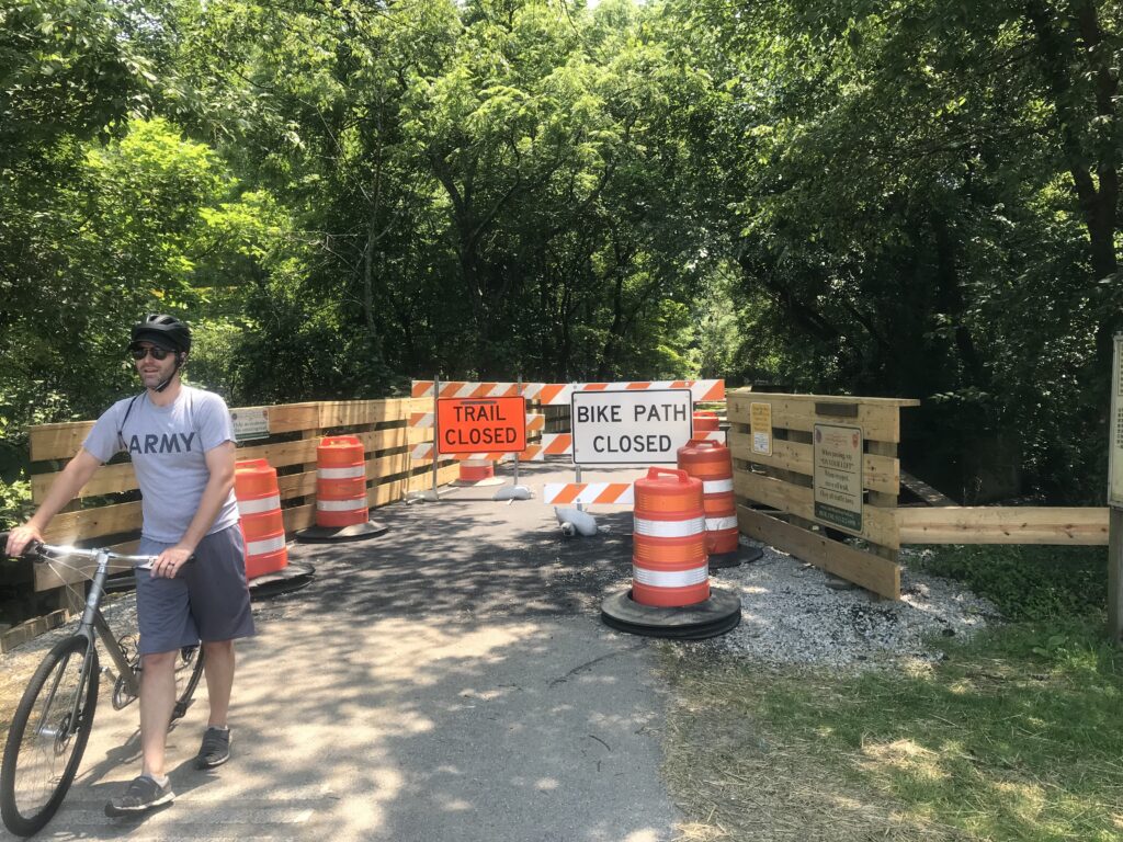
I came to the northern terminus of the trail. It was not marked – I just happened to know it was there. I jumped on it and went 50 meters and it was closed. Detour. The detour did not last long, also 50-60 meters and then I jumped on the trail again. This time for good. I had ridden this section before and recognized where I was.
The trail in Morrow
Once south of Springfield the trail is mostly forested with a heavy tree canopy covering the entire trail. Although not recommended, one could probably get away without applying sunscreen because of the shade.
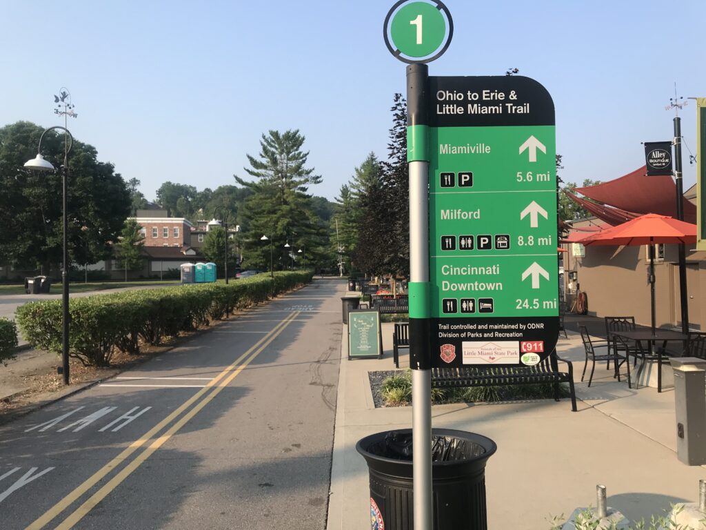
Directional sign in Loveland
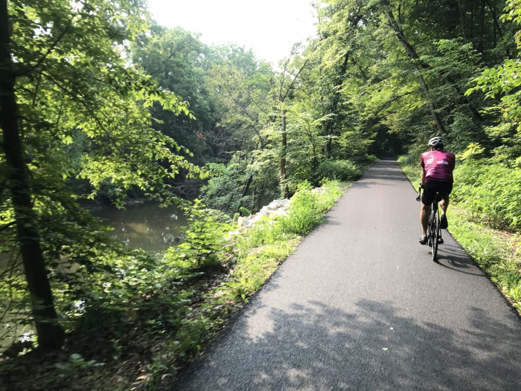
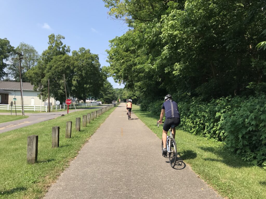
The first 20 miles to Xenia are on a wide asphalt trail. It could safely accommodate riders 2×2 in each direction. The pavement was good with barely any sections with uproots on the trail.
Little Miami River at Morrow
In this section are two towns. The first, Yellow Springs, is 10 miles from Springfield. The second is the city of Xenia at 20 miles.
Covered Bridge at Yellow Springs
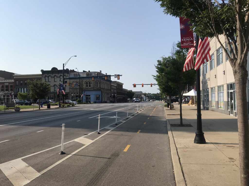
In Xenia, the trail goes right through the downtown area (which is very nice). On my way south I missed the trail crossing to the other side where it became a dedicated bike lane. Somehow I did not see the bright green crosswalk.
Downtown Xenia
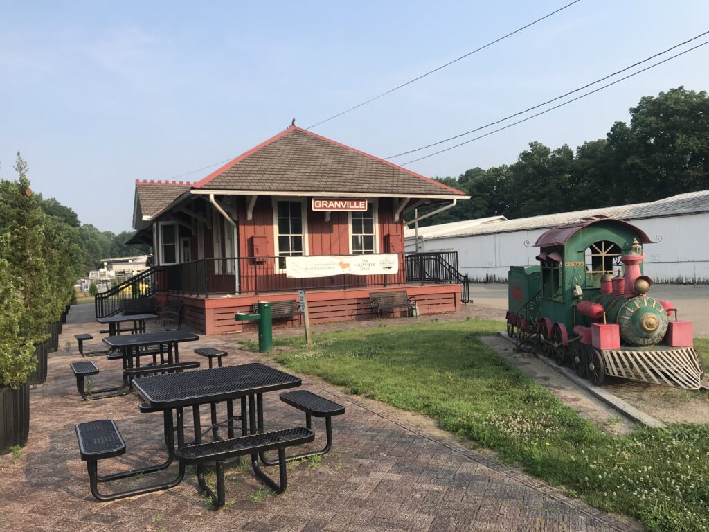
All trails, and there are many here in “Trail City,” lead to Xenia and Xenia Station. What a beautiful old station here. While it is great for cyclists it is sort of sad to think these trails were train tracks and were the lifeblood of this community.
Xenia
The route south of Xenia starts by entering Little Miami State Park. Here the trail becomes narrower and a little rougher. There are some rooted sections as well.
At grade railroad crossing in Loveland
Except for one lonely mile marker left behind by the railroad, there were no markers on the side of the trail. But there were large painted mile markers every half-mile. And all distances seem to be the distance from Xenia.
The only railroad mile maker remaining – Waynesville
I had planned to meet Bob for lunch at Kings Mill and was having problems finding distance charts. Finally, at Corwin, there was an information board with mile markers. (I cannot find the map online.)
Detour on the trail north of Loveland. But one could get their bike through there safely.
I saw Corwin was MM 14 and that Kings Mill was 36. With 22 miles to go, I texted Bob and told him I’d be in at 11:45 a.m. And I got there at 11:45 although I underestimated the climb and distance from the mile marker to the restaurant since my calculation was to the trail head.
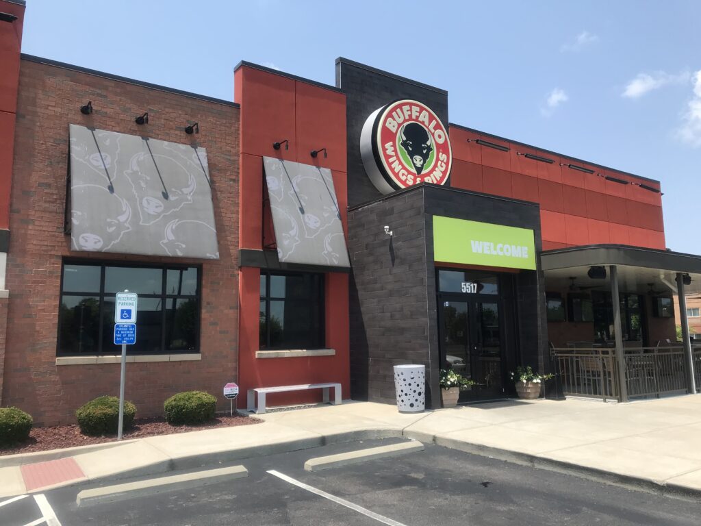
Lunch – Buffalo Wings and Rings, Kings Mill
After lunch, and the temperature was up to the low 90s, I went back to the trail expecting another 20 miles or so to go. I passed through Loveland, which is probably the nicest trail town here (Mile 40).
Todd Fork
I came to a river crossing of the Little Miami and saw some “kids” (who were probably 18-year-olds, so adults, no?) at the end of the bridge. Some were crawling over the railing.
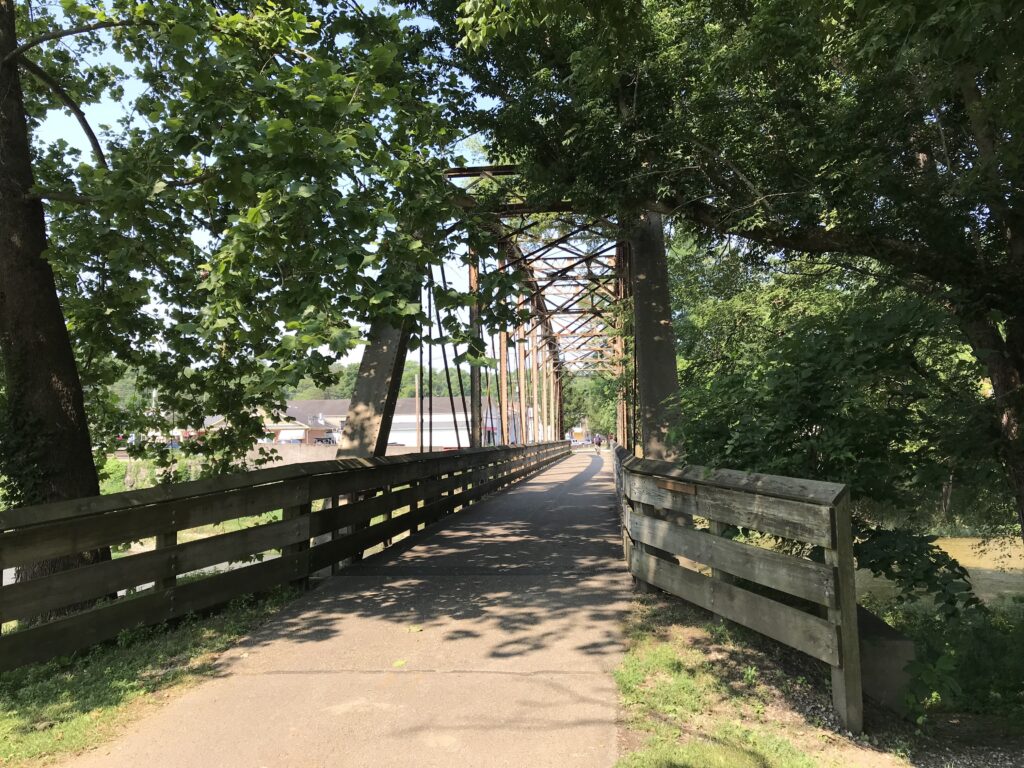
Crossing the Little Miami – notice the kids at the far end climbing down (Loveland)
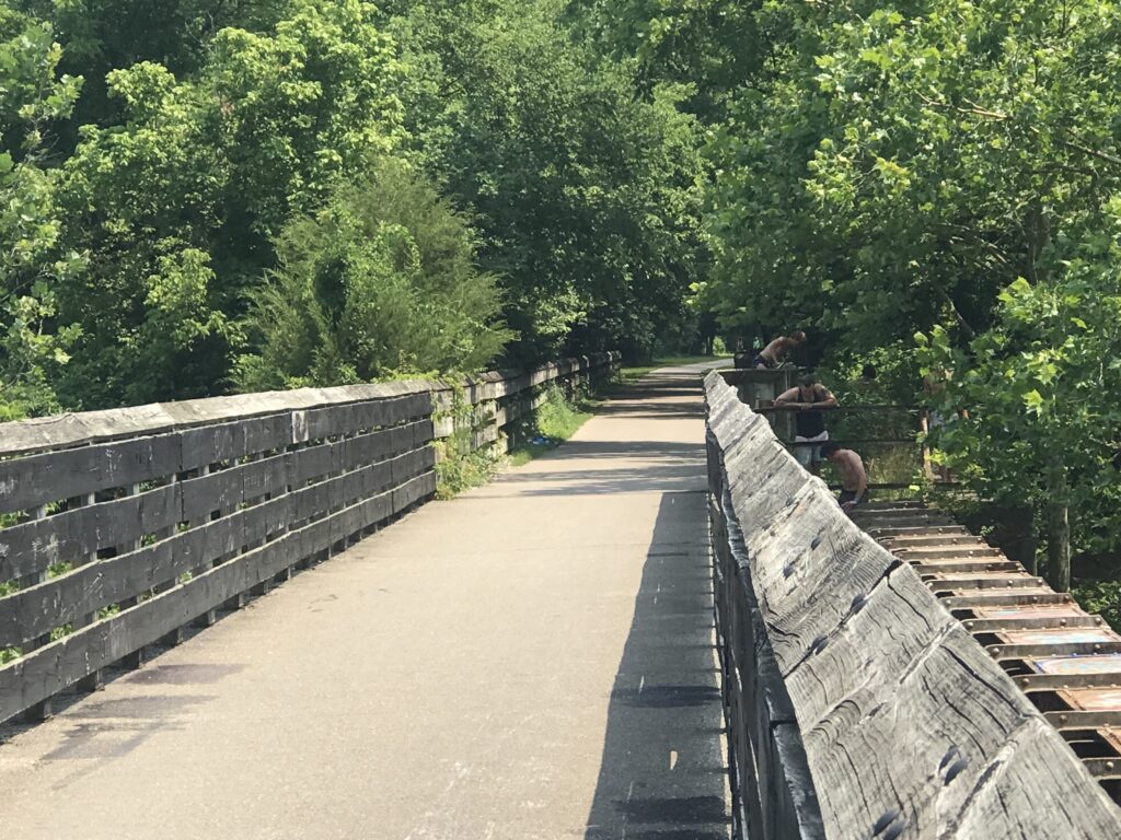
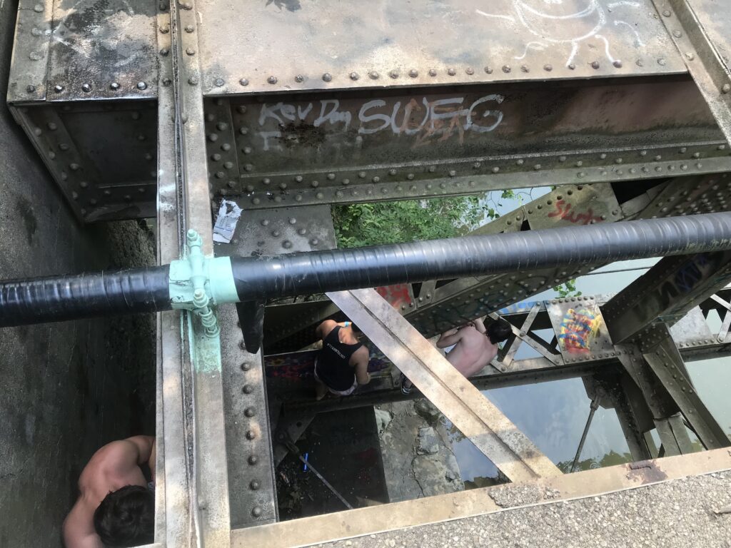
I went to the end and talked to a couple of the kids. They were scaling the fence then carefully climbing down the trestle to a girder. From there they would carefully edge their way out on the girder to the middle of the bridge and jump perhaps 30 feet into the river. Collectively, they’re braver than smart.
Carefully crawling out on the girders – Loveland, Ohio
The last miles went fairly fast. I passed the Milton Trailhead and went down to Newton where I exited. The trail appears to officially end about a quarter or half-mile farther but I was exiting.
Interstate-71 – Oregonia
A family on four bikes was taking a wide turn into my lane so I moved over and greeted them. The mother/wife replied, “I like your cookies.” Not sure a woman ever told me that before. (I was wearing a Phil Gaimon “cookies” kit.)
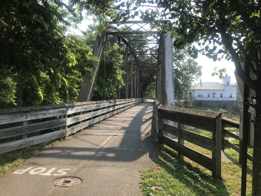
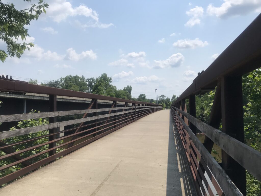
Trails End – The Bridge from the trail over the Little Miami River.
It was five more miles to the hotel on Round Bottom Road. This was the only sketchy part of the ride. I would describe it as part country and part residential although that’s not quite accurate. Maybe a mix of light industry and country. And busier than a country road should be. With no shoulder, I was not comfortable riding this road.
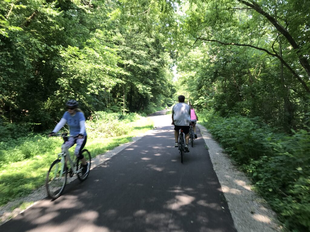
Cyclists in Morror
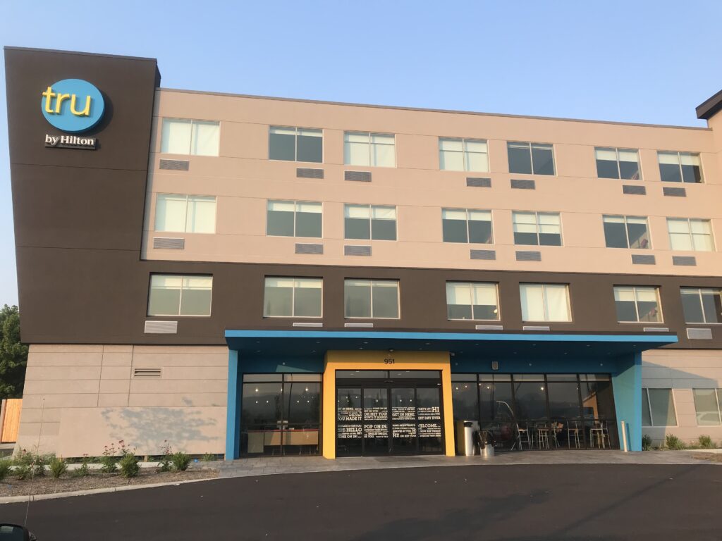
I checked into the Tru by Hilton Hotel which was near the Interstate. The restaurants were too far to walk so I continued to ride. Quaker Steak and Lube had outdoor seating so I chose that. The one problem was their outdoor seating was smoking. C’mon Quaker Steak – you can do better. I sat outside braving the occasional smoke because that’s where my bike was.
Tru by Hilton – Milford
In the morning I scrounged for oatmeal as the breakfast offering was scarce. I filled my water bottles at their water cooler which had the worst tasting water from a cooler I ever had. I suspect it wasn’t an actual cooler with bottled water but had a direct line to the hotel water which was pretty awful. Of course, I never tasted the water and didn’t discover this until 10 miles into my ride.
Loveland, Ohio
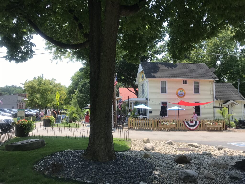
It was 74º when I rolled out on Tuesday morning. Very pleasant. I took South Milford Road into Milford passing by a nice retirement community and beautiful homes on Mound Street.
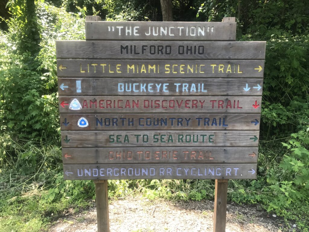
The Junction – Milford, Ohio
I came to the edge of downtown which looked really nice but I was right across the Little Miami from the trailhead and just went to the trail.
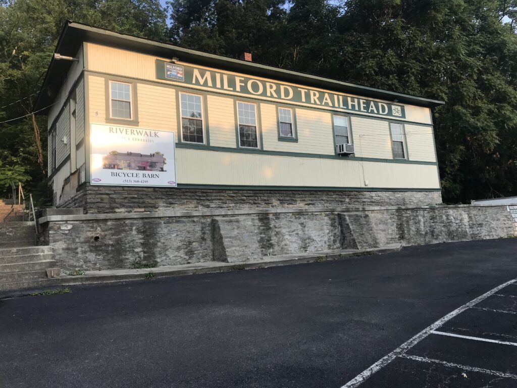
Milford Trailhead from the parking lot
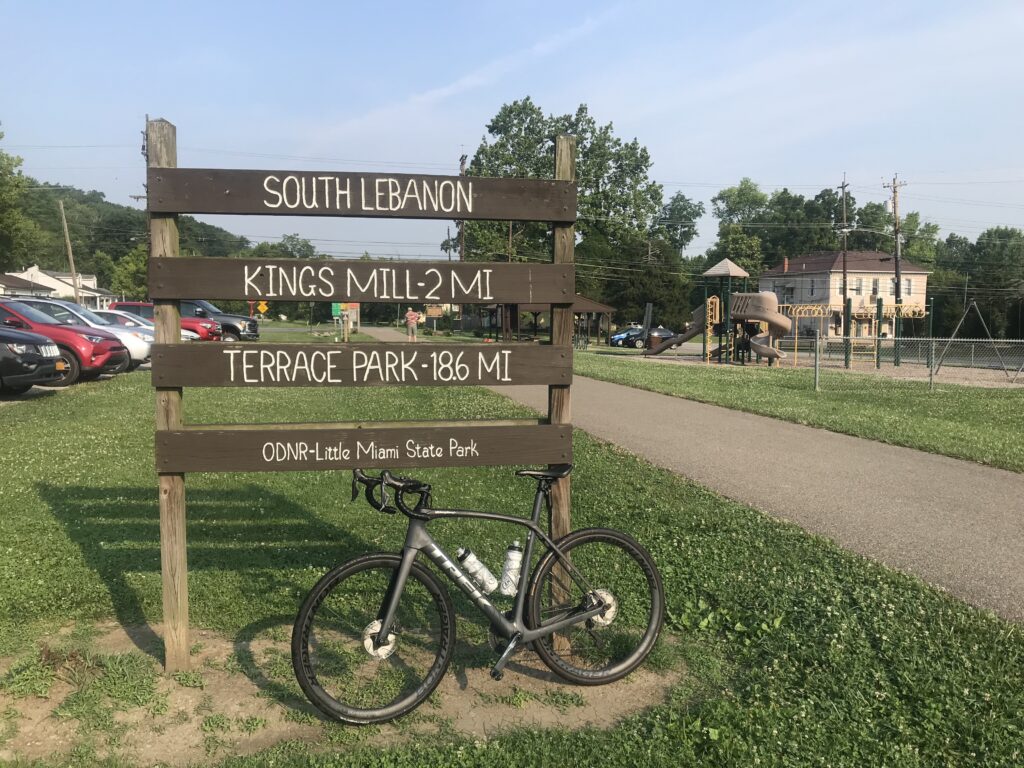
It was a lovely morning as I went north. I was 22 miles from the trailhead at South Lebanon and met Erin T. at the trailhead. With 54 miles to travel, I would backtrack my route from yesterday with two exceptions.
South Lebanon
The first deviation came in Xenia, the Town of Trails. Erin was out of water and I wasn’t drinking mine. I brought a measured amount of ScratchLabs drink mix for one bottle and I could not taste it as I drank. The taste of the water was enough to keep me from drinking and I needed to be drinking.
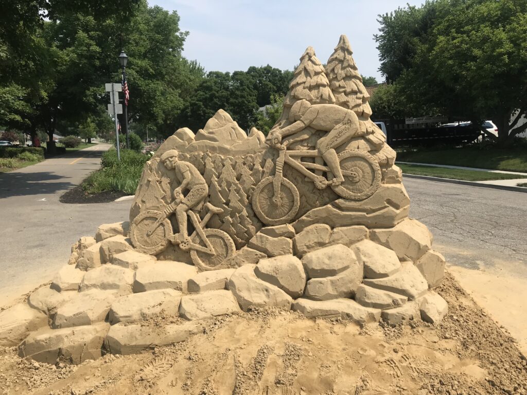
Sand sculpture in Xenia
We went into a Speedway gas station/convenience store. With temperatures in the 90s, Erin took her bottles to the ice dispenser on the soda machine (or here I guess it’s the “pop” machine). I went to the cooler and bought a gallon of water for $1.99. The small bottles were $1.49 each. We went outside, filled our bottles with cold water. I had dumped out my hotel water. I then gave away half-gallon of water to a passing customer.
Train station in Morrow
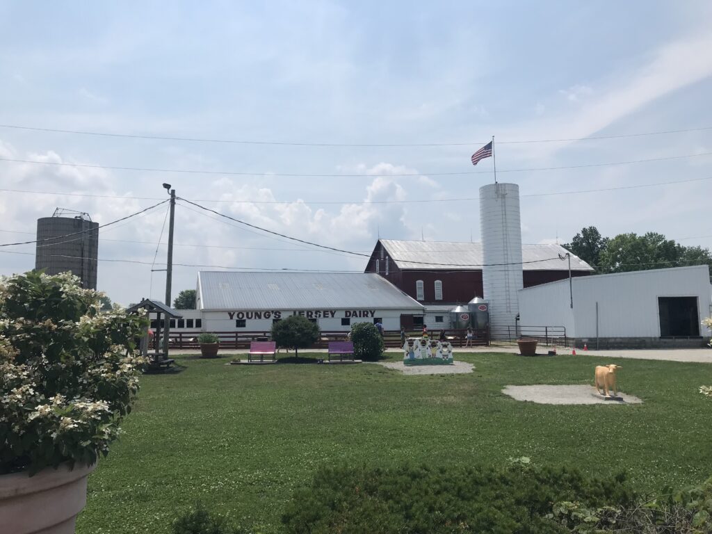
The other deviation would be a stop at Young’s Dairy Farm. I did not have a big breakfast at the hotel and did not find packaged bars at breakfast to fill my pockets. I was hungry. I was hoping Erin would want to stop for lunch and we came to a pizza place (two, actually) in Yellow Springs. But she wanted to keep going.
Young’s Dairy Farm, Yellow Springs
At least three times I have been told to be sure to stop at Young’s. So this time I did. We saw a sign and turned on West Jackson Road. A man on a three-wheel recumbent bike had turned on the road ahead of us and it gave us a feeling that this road was safe if he would ride on it. Young’s was almost one mile away. And it is worth a stop. It was very busy but if I get back here again I will be stopping.
Young’s Dairy Farm
Back on the road, we stayed on Ohio 68 rather than backtrack to the trail. I knew they would intersect although I was surprised at the distance which was 3.5 miles. But they did come back together. We then had four miles through Springfield back to my parked van at the Fairfield Inn and Suites.
Barry at Yellow Springs. Photo Credit: Erin T
Bottom line. This is definitely a destination trail. Almost 80 miles of paved bliss. Out and back in two days was a great ride.
Create segments that you will enjoy or will test you
Flag the obvious outliers after a fair review of their rides
In the beginning, there was the bike. And it was good. And then there was a second bike and they probably raced. But soon there were thousands of bikes or millions, and people started looking at others and stating “you’re doing it wrong.”
Some cyclists started looking down on others because of how they sat on the bike, the bike they rode, or the clothes they wore. Eventually, “the rules of cycling” were codified, if you will, into The Rules.
For many cyclists, this list of 101 rules became the official rules of cycling to be followed no matter what. For others, they are viewed as what many thought they were intended, a satirical look at the idiocy of some in our midst who worry about crisp tan lines and sock lengths (while criticizing the UCI for worrying about sock lengths).
Cycling can be expensive. It can be exclusive. We need more people riding and our attitudes turn off some potential riders. And so Phil Gaimon rewrote the 101 rules into just 11. These are The New Rules of Cycling: AKA Philuminati.
Phil took 101 “rules” and came up with 11. Basically, do what you want. Wave to people. Have fun. Don’t be a dick.
With that as a background, I was a little dismayed to find “The Un-Written Rules of Strava.” I am not going to dignify a new list by including here. But I stumbled on someone’s rules for Strava. Or the “Un-Written Rules for Strava.”
I disagree with almost every one of the unwritten rules starting with the spelling of “unwritten” (unwritten and not Un-Written).
The author states that you are not to go overboard in writing the titles for your activity. Who cares? “Ride in the pouring rain” is fine as is “Trip to the bank.” It’s your ride, use what you want. In fact, I have an automated title creator from Bandok.
Just a title from Bandok that was auto-generated
Make the title what you want. Running Magazine even had an article about the seven kinds of Strava title-makers. The more it is fun the more people will ride. Keep in fun. If long titles work for you, use them.
The Un-Written Rule keeper wrote down his rules and published them so we may disagree on more than the spelling of the word. How about a discussion on whether these are actually written rules. Hmmm.
He continued. Never flag a segment.
I have seen lots of segments where people in positions 2-5 are all grouped together within seconds but the “winner” (or KOM) for a segment was a full minute or two ahead of everybody. The author says to accept there are faster cyclists out there and don’t be a snitch.
There are plenty of cyclists faster than me. Most, in fact. There are some segments where I won’t be in the top 4,000.
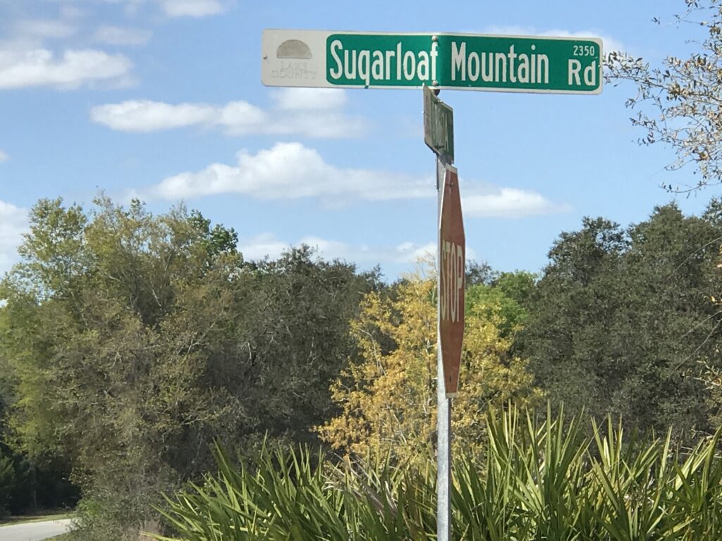
Sugarloaf Mounatin, Florida (yes)
I look at the segments and ask if it could have been done on a bike. And how far does it stand out? On Strava you can see one’s entire ride. And it’s easy to determine if the effort was real. The presence of a heart-rate monitor is telling.
But I really have the problem with the author’s reasoning. He says to accept there will always be someone faster and don’t be that guy to report them. Cycling tried this in the 1990s and 2000s. It was called doping. No one was to call out another cycling for doping. In part, most were doping but even the clean riders were supposed to accept that someone else was faster. It didn’t work for doping and it doesn’t work for Strava.
I have flagged a handful of rides and in each case there was a clear ride portion of a few miles, usually averaging 10-15 mph. And then there was a segment, always at the end, which averaged 50 mph or more for the last couple of miles. In one ride where the user held a local segment (a half-mile from his house) the user’s last 15 miles were on I-95 in Northern Virginia where his top speed was 79 mph.
In all that I’ve flagged it appeared that the user inadvertently left their recording device on. I don’t believe for one second that any of the users decided they would get in their car to set a new Strava KOM. But more than just accept there is always someone faster, we also want realistic goals to chase.
The author then opined about what segments and how many are acceptable to create. He said on one 15-mile route that he rides there are 30 segments created. I say great! It doesn’t matter to him. Ignore them. Hide them. In my case, everywhere there is a decent enough uphill segment I create a segment. I want to challenge myself on my rides.
I have created a lot of local segments. And I always hope that I am not the default KOM when I create it. This gives me a goal set by someone other than myself. And if I pass someone for the KOM, they get a message or see that they are not the KOM any longer on a segment they probably didn’t know existed. And they can go out and reclaim, hopefully by just a few seconds, so I can try to recapture it again.
Lots of Segments – I did not create any of them
So the more segments the better. I’ve created some fun ones. Some challenging ones. And I know some on my local rides that I just ignore.
At the end of the year, Strava tells us how many kudos we’ve given and how many we’ve received. Strava wants users to be engaged. But the author encourages users not to give kudos for boring rides. Because he decided.
I saw one user who gave thousands of kudos (and usually always finds mine). He stated simply that he gives kudos for anyone who gets off their coach and exercises. Bravo Vince! I now do the same but, so far, only for outdoor activities. I don’t know what’s going on when I see a computer image of Alpe d’Huez. I’ve ridden the Alpe and it doesn’t look like a computer screen. But I will get there (giving kudos for indoor workouts).
So that’s it. One user felt it was necessary to write un-written rules for Strava. Don’t use titles to which he will disapprove. Don’t give kudos unless it’s for something epic. Don’t create too many segments. And don’t flag faster rides obviously done in a vehicle. So basically, I do Strava wrong.
Now off to create more segments. Hopefully those are on his route. I do Strava right. For me.
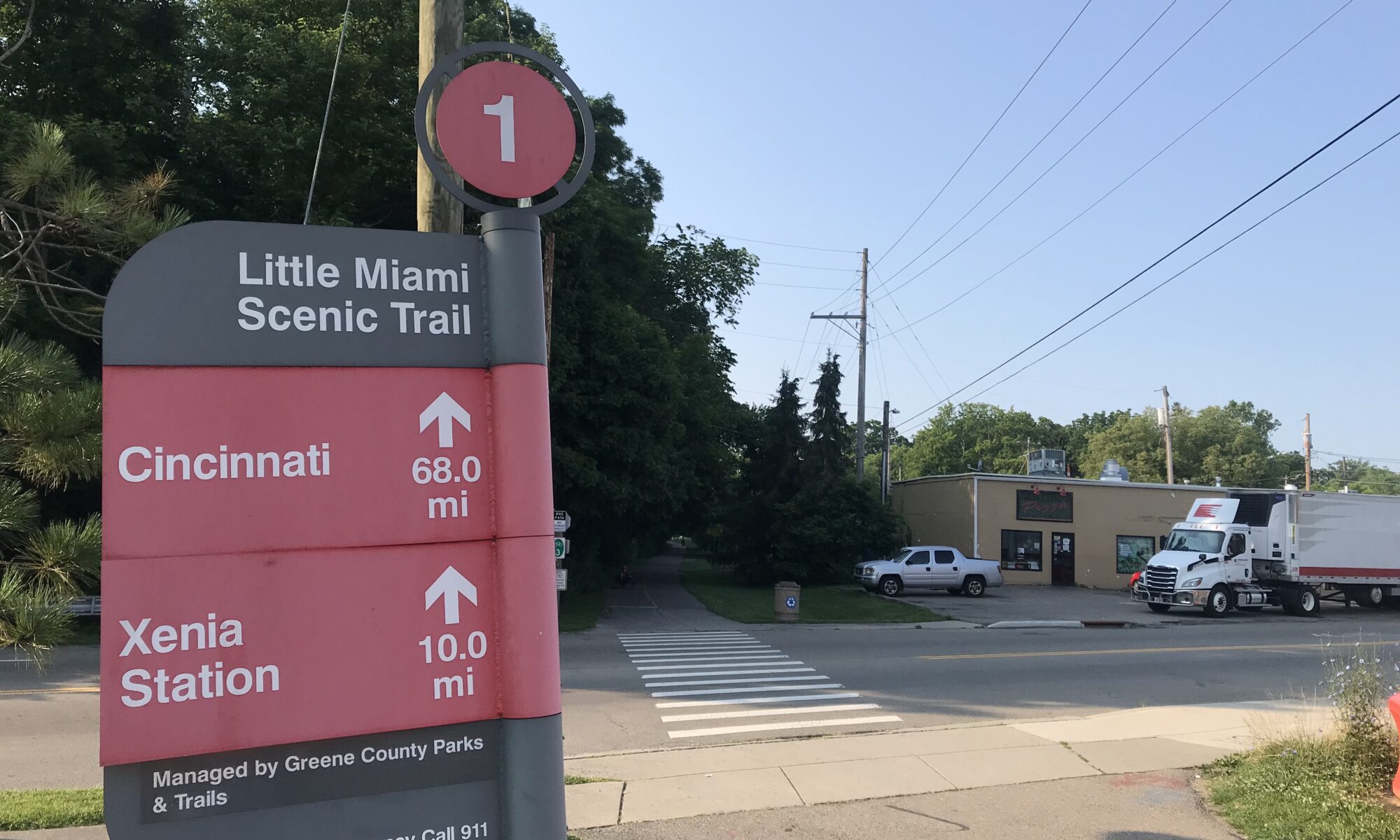
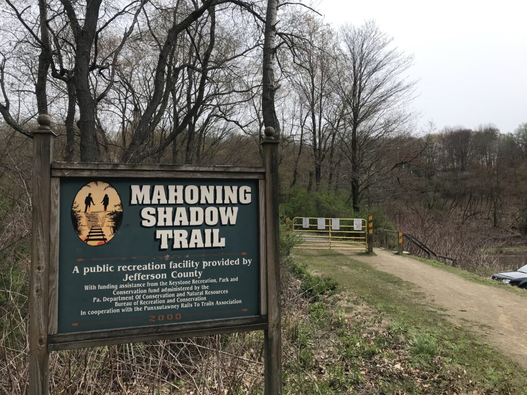
The roads here have one quality. They go up. Turn a corner and the road goes up (occasionally down too). But there is one place they don’t. The Mahoning Shadow Trail.
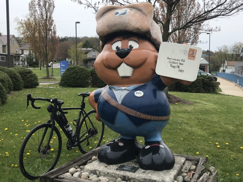
Water Street, Punxsutawney, Pa.
The MST is a 15-mile rail trail that follows the Mahoning Creek to the west and goes deep into the forest to the east. I wasn’t sure how much time I had to ride so I asked for recommendations from my Punxsutawney friends. The consensus was the cool things were to the west.
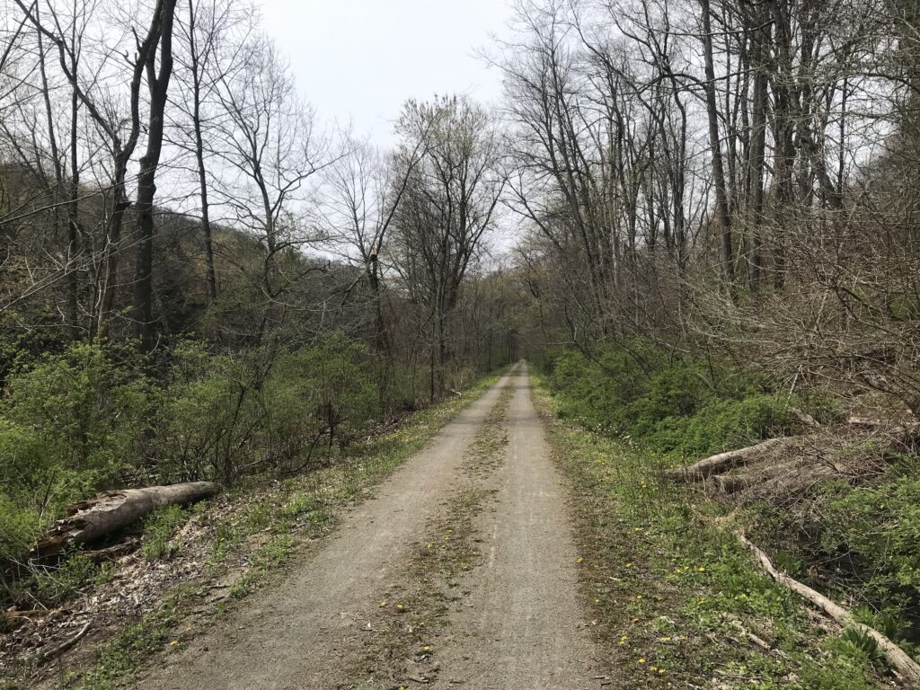
I parked at Punxy Phil’s (I would eat there too) and joined the trail at the west end of town (well, the west end of downtown). The trail is a crushed limestone trail but there were large stretches where it was barren of limestone. More like packed dirt which actually was OK.
At time is was almost two single tracks
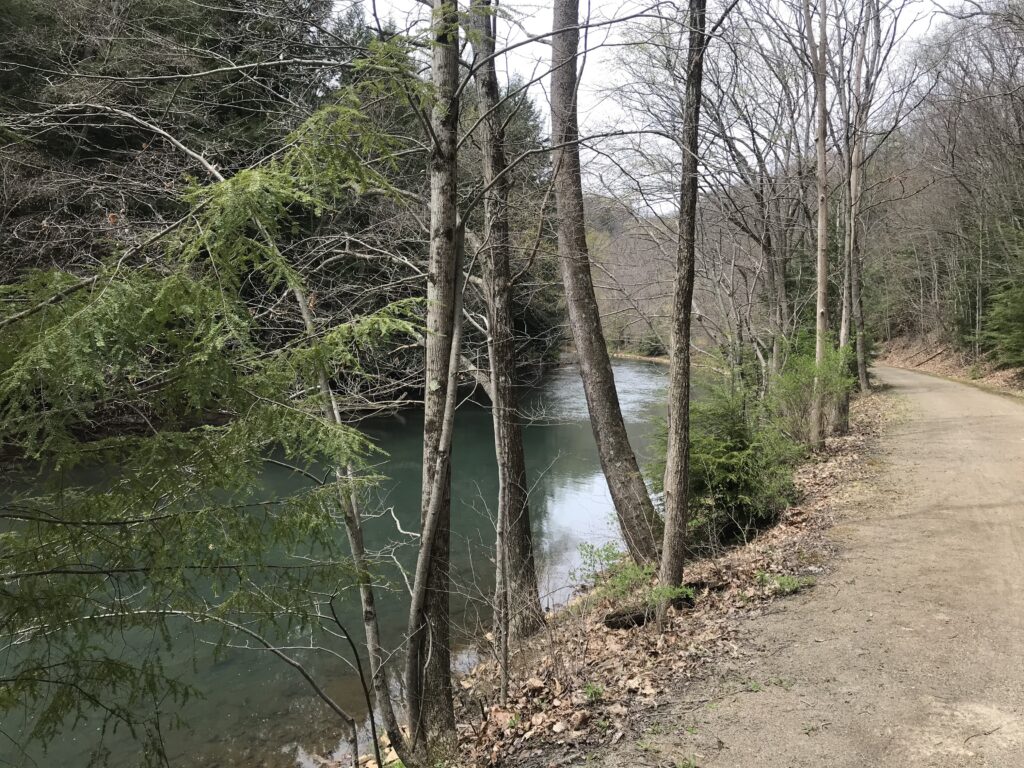
The Mahoning Creek is a beautiful creek with lots of sections of what appears to be deep pools of water. And this was a logging creek 150 years ago as loggers could float their logs to Pittsburgh from here.
Beautiful Mahoning Creek
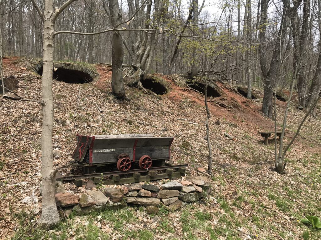
This became a coal mining area and one passes abandoned coke ovens in the hillside. They were used to burn coal into coke for iron furnaces.
Coke ovens
I passed perhaps 12 other users on this section from Punxsutawney out to Valier (or Fordham). I made mental note of the best photo ops for the ride back into town.
Reaching Punxs’y I carefully noted the signs as I had read reviews which stated they were lacking. And I concur. I don’t know Punxs’y but I’m not a complete stranger either. I knew where the trail entered and exited the town and if I couldn’t follow a marked on-street trail I was OK navigating there by myself.
On the trail in Punxs’y
The signage is bad. Period. Entering Punxsutawney from the west I found myself on the levee next to Mahoning Creek. Or on a paved path. The path here is very narrow but on this cloudy and cool day, it was OK because I didn’t meet anyone coming from the other direction.
On the levee next to the Mahoning Creek
I lost the “scent” of the trail but headed back to where I knew it was. I found the skateboard park but turned around when I didn’t see a trailhead. I left, went back to the main road (East Mahoning Street), and decided I would ride the main road to Cloe. At Cloe, I could pick up the trail.
On the road, it’s a climb. A real climb. The roads here go up and go up some more. But I like to climb so I was OK with taking the highway. But once on East Mahoning Street, I saw a sign marked Bike Route and decided to take it. And I found a trailhead for the MST. And I still don’t know if it’s THE trailhead – but it worked.
Punxs’y Phil is everywhere
It is two miles alongside the Mahoning Creek before reaching Cloe. And here the trail leaves the Mahoning Creek.
This is also a trailhead /parking and a decision for me. Where does the trail go? I hadn’t studied a map to know and my gut said to turn left (on Rte 36) and I would find it in a couple hundred yards. At the stop sign in the lot there is a small blue arrow – straight.
Trail marking. Apparently. Perhaps add a small MST sign to the blue sign?
What is this? Is this a directional sign for the MST? I didn’t know but it puts one on the Cloe-Rossiter Road and I was OK with riding to Rossiter and back on the highway and calling it a day.
I went a few hundred yards past Cloe Lumber and saw a sign to the left for the MST. I think. Or maybe it was just bike route. But I jumped on it and was now on the eastern portion of the MST.
No longer following a stream it did cross Canoe Creek. On a map I was next to Ugly Run but never saw it. I was in a deep forest. There is nothing here except trees. And more trees.
MST – towards Winslow
At the end I came to Winslow Road. I wanted to jump on the road for the ride back but wasn’t sure where it would take me. I decided to ride the trail back. And I would just ride. (And it was a good decision not to take the road.)
Winslow Road trailhead
I followed the trail back to Cloe, crossed Rte 36 and decided to ride as far as I could in Punxs’y before the trail ended. I passed where I had entered and this time exited at the skate park. I also rode through the grass. For this rider, the trail is not well marked.
Once in town, I decided to take surface streets back to Punxy Phil’s. It was nice riding through town.
Downtown Punxsutawney
My short review of the trail is this. It lacks the railroad infrastructure of high trestles or tunnels some iconic trails have. But the MST can’t do anything about that. It also lacks facilities but you are never more than 7.5 miles from Punxsutawney where you should be able to find anything you need – water, food, restrooms. The signage is not good in town. But you will find peace and quiet and solitude riding out towards Winslow with a fast ride back. IMHO, it is prettier riding towards Valier simply because you are next to the Mahoning Creek most of the way.
It may not be a destination trail but definitely one you should ride if you are in Punxsutawney.
Equipment: I rode my Trek Checkpoint (Gravel bike) with 700×32 tires. There were no issues with tire size. 28s would have been fine and 25s would be too.
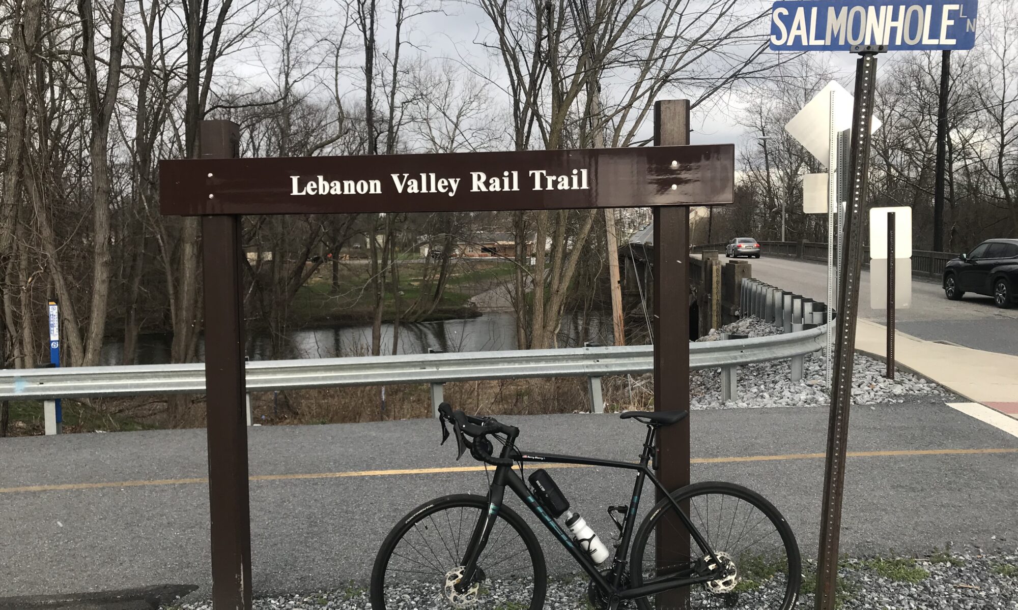
I was returning home from Allentown, Pennsylvania, and had not yet ridden today. With only a little research, too little, I came here looking for the Lebanon Valley Rail Trail. I didn’t have much luck.
Jonestown, Pa.
The Lebanon Valley Rail Trail looks like a nice 18-mile trail but it isn’t here (mostly). According to TrailLink.com “Two short, isolated sections of trail totaling 3 miles have also been constructed north of the main segment. The first segment in Lebanon begins at Union Canal Tunnel Park, where parking and picnic benches are available, and extends north just less than 2 miles to Long Lane. The second segment begins in Bunker Hill near PA 72 and Swatara Creek and extends through Jonestown to US 22.“
Bridge over Swatara Creek, Jonestown, Pa.
So I came to Jonestown seeking a one-mile rail trail. That’s not quite a destination but it was on my way home.
Bridge over Swatara Creek, Jonestown, Pa.
It was cold. It was April. It was spring and it was only 43º. The windchill was 36º. There were snow flurries in the air.
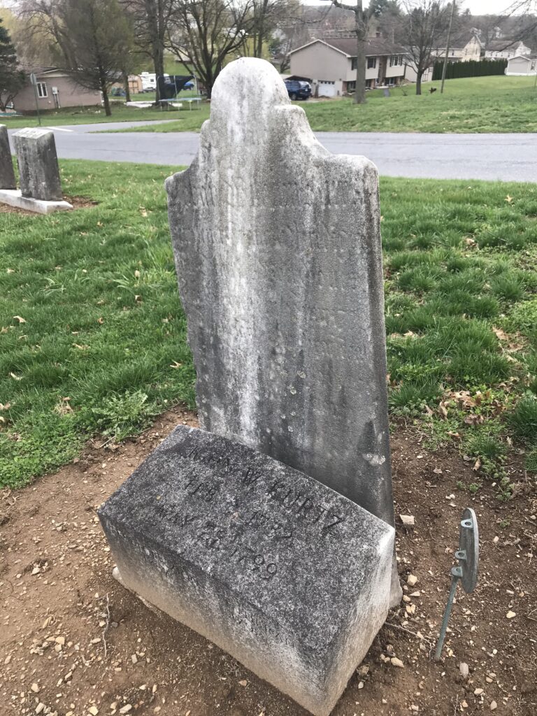
Gravestone of Johan Wilhelm Kurtz
I found the sign for the Lebanon Valley Rail Trail and parked in a small lot. I started down the trail and went 1.2 miles when it abruptly ended. And that was it. I went over to Ebenezer Road and took it back to Jonestown.
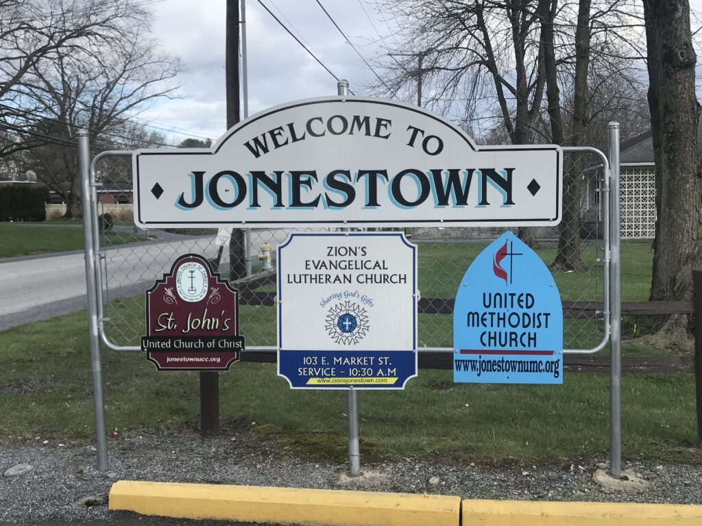
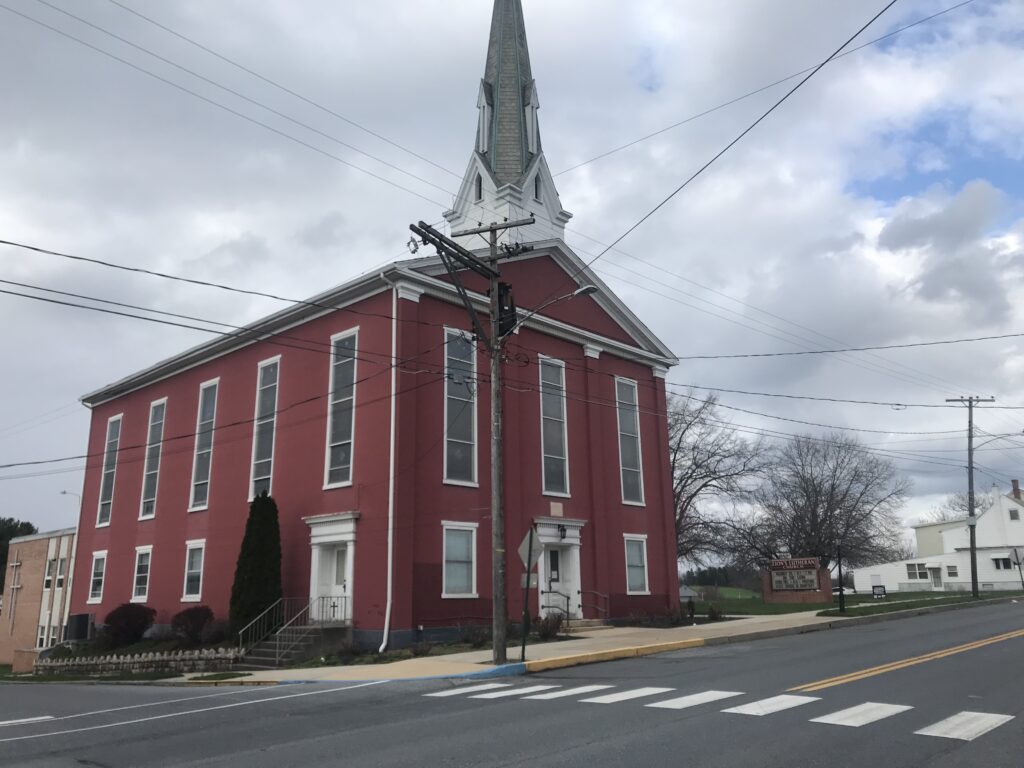
Zion’s Lutheran Church, Jonestown, Pa.
I rode through Jonestown looking for some nice streets. It’s a small town. I was leaving on Old U.S. 22 and turned back to town. I went to the large cemetery and found the gravesite of my great-great-great-great-great-grandparents, John William and Regina Kurtz. John (1732-1799) was a German Lutheran pastor and served the church well in Eastern Pennsylvania. He served the Zion Lutheran Church in town and I visited it as well.
Swatara Creek at West Market Street, Jonestown, Pa.
I headed back to the car then decided to follow the trail in the opposite direction. A power line pole was leaning precariously over the trail. I had to ride through the field to get around it. The trail was only extended for a half-mile when it ended. So end to end the trail in Jonestown is less than two miles long.
Lebanon Valley Rail Trail, Jonestown, Pa.
It will be great if this segment connects with the main segment of the Lebanon Valley Rail Trail. But it wasn’t a wasted trip. This is also one of my ancestral homes.
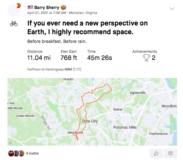
I came here for one thing only. A PR on Sugarloaf Mountain. Having ridden the Horrible Hundred event three times I thought I would be able to set a PR because I am down 40 pounds plus since I last rode it (and set a PR that day).
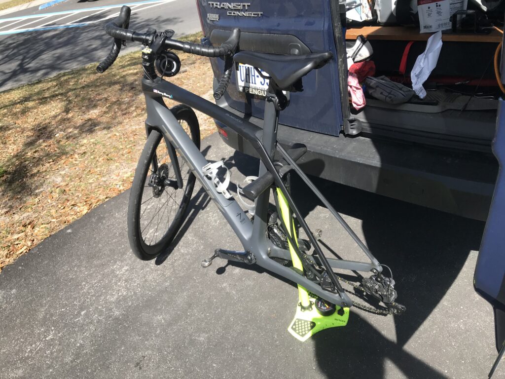
But first there was some unfinished business. I had a new tire (Continental 5000) with me and decided I would replace the one that flatted yesterday on the Seven Mile Bridge.
My bicycle pump doubles as an impromptu bike stand
I had mapped the route of the Sugarloaf climb and uploaded it to my Wahoo. I took off into the wind. I hadn’t gone far before I was off exploring some new roads. And then I came back to familiar roads.
I was following the route when I came to Sugarloaf Road. I remembered a left hand turn but the road did not look familiar. Oh well, I rode anyhow. But it just didn’t feel right.
Sugarloaf Mountain Road
No Strava-Live segments were coming up on Wahoo and then I realized I had come up the backside of Sugarloaf. I have ridden down this way three times. But never up it. Damn. I mapped this out in the wrong direction.
Not sure what is happening but I think it’s a triathlon
I was very conscious of the wind today. It was strong. I came to the top of Sugarloaf and was amazed looking ahead at my descent. This should have been my climb. But I remember standing at the top of the 90-meter hill (ski jump) in Lahti, Finland, in 1995, and thinking what a hill. And I get to ride down it. Of course, I was riding at speed while processing this and just kept riding.
Where trails were provided I chose them
My speed crept up. I saw 48 mph on the computer and I always felt on the edge of control. As the road started to flatten out I saw a cyclist riding up the hill. I nodded because I could not take my hands off the handlebars to wave.
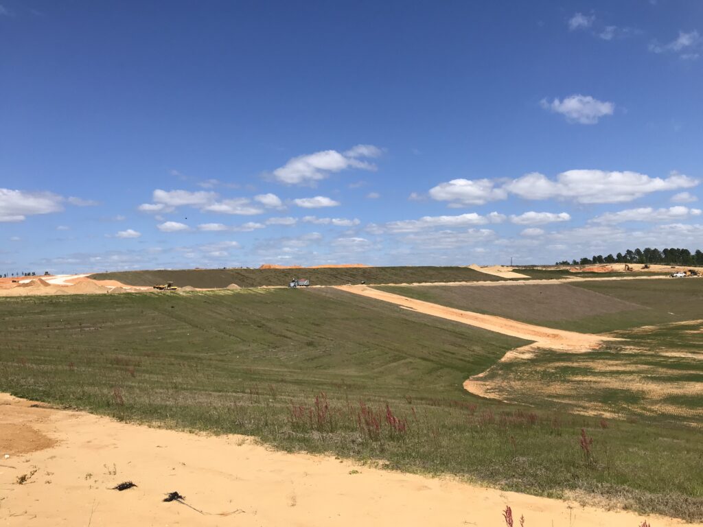
Moving the hillside
At the bottom of the hill, instead of turning right and following what I had mapped, I turned around. I had to try Sugarloaf the right way.
I saw the rider up ahead of me on the hill. And I was gaining. Wahoo started with a GO! But did it twice. I had marked two segments and I really was interested in one. I briefly saw I was ahead of my PR time but then didn’t see that anymore. I need to unstar one of those.
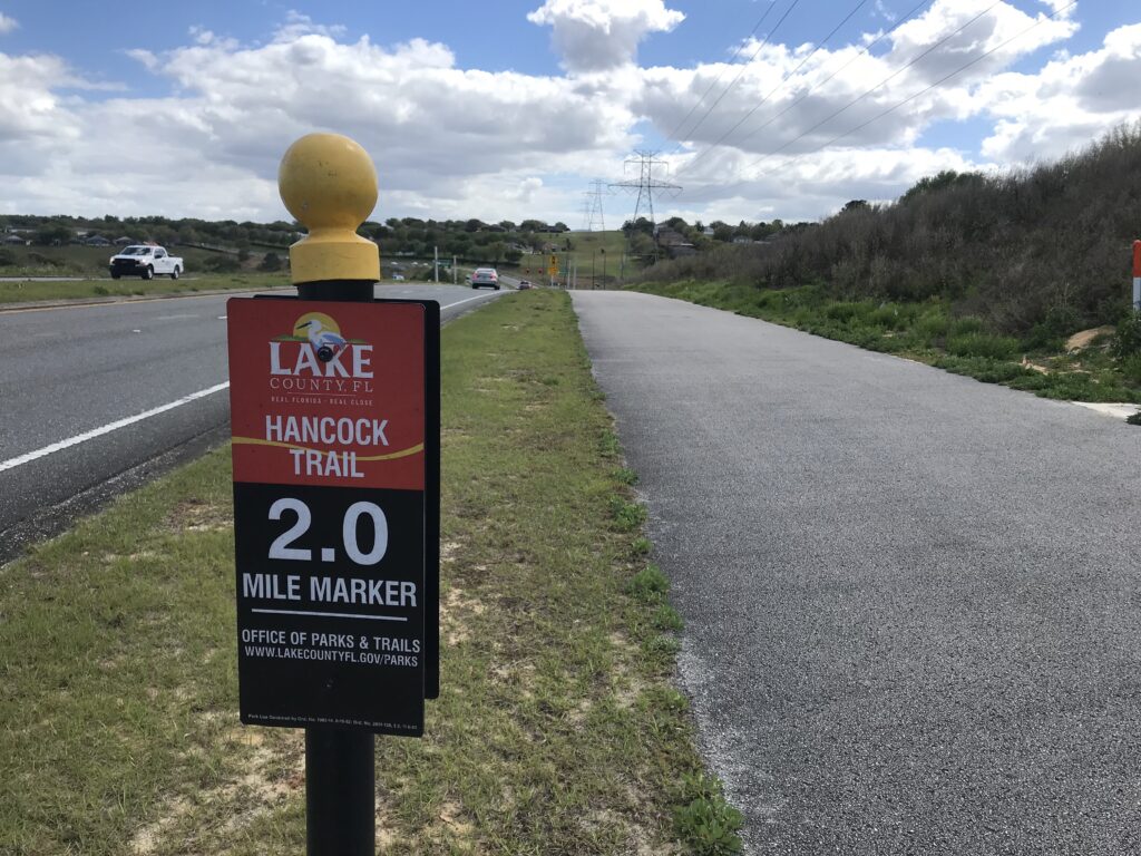
The Hancock Trail
I had a speaker on my bike and was blasting 50s music from SiriusXM. I could see the rider was a woman and I was gaining quickly. As I got close I said “there’s no sneaking up on you.” She looked at me and said “You make it look easy.” If she only knew.
At the top I went another quarter mile to a house which offered free water. I thought she would come over the top but she didn’t. I would learn that she turned around and went to ride it again. Hill repeats. Ugh.
A true sign
Turning around and going back down, I wanted to hit 50 mph. But that cross wind was a serious problem. A safety problem. I pedaled and then got into a tuck. Again, I saw 49 mph and then had a serious wheel wobble. With the winds this was too fast. I looked to slow down.
Free Water on Sugarloaf Road
At the end of the hill a truck pulled up and some cyclists got out. I thought it was strange they drove out to ride the hill but I don’t know their stories. From there I followed Wahoo and for the next 10 miles followed the Route of the Horrible Hundred – backwards.
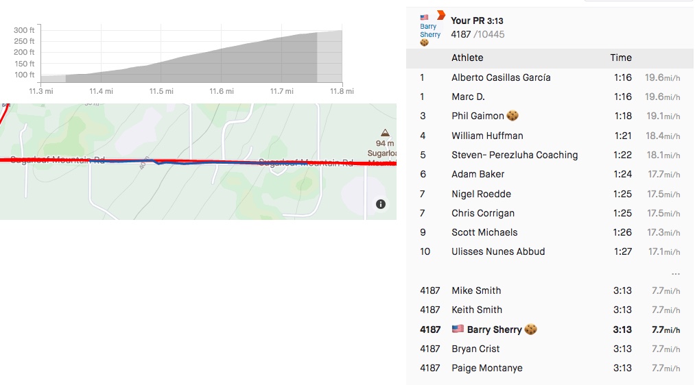
I finished the ride and then checked my results. I set a large number of PRs but the one I wanted – Sugarloaf, I lowered by 28 seconds. I was happy. I was now #4000 instead of #6000. I jumped 2000 places. But for context, that’s out of 10,000 athletes. So I’m in the top 40% instead of the bottom 40%. I still suck.
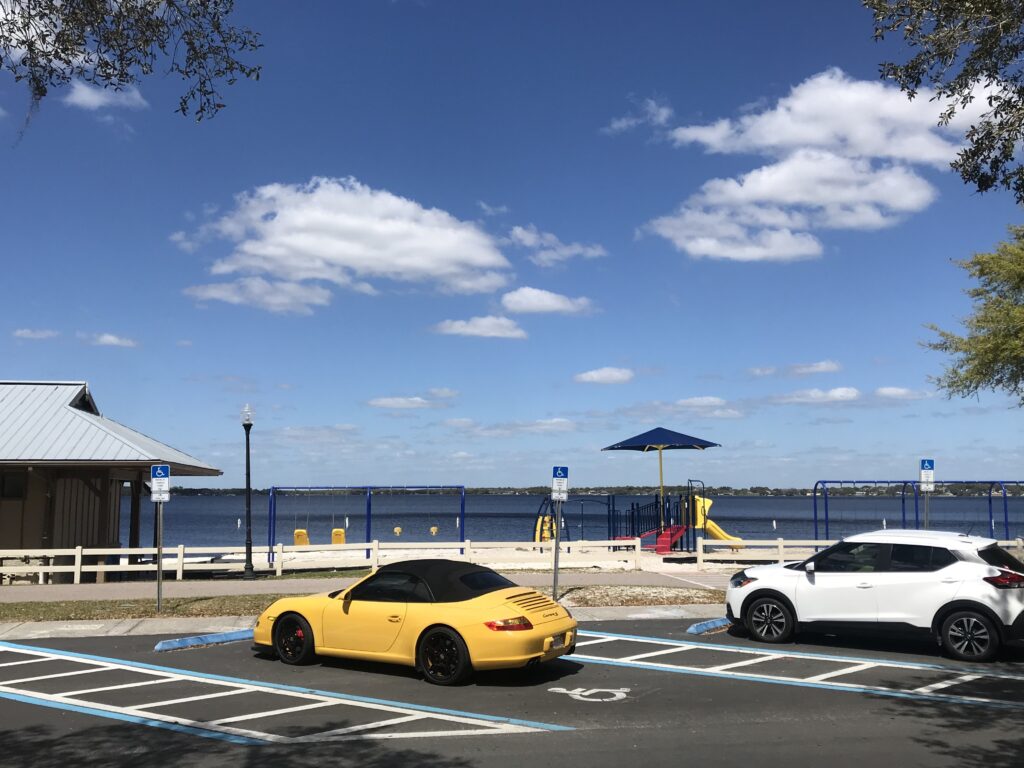
Waterfront Park
Maybe if I hadn’t climbed Sugarloaf from the backside first I would have been better. And maybe if there was no wind (I’m not asking for a tailwind) I would have shaved more time off. But the wind, even a crosswind, was formidable today.
Looking at other segments, Up the Ridge Westbound – horrible pave and I was second age group – missed age group#1 by :02. If I had known I would have gone for it. On Sugarloaf-Downhill I was #1 age group. I can still go downhill fast.
There are thousands of cyclists who ride these roads. I never came for a #1 in any group. I just wanted to see what I could do on Sugarloaf. I’m not done here. Next time I will ride in the right direction. And hopefully without the wind.
Distance: 31.1 miles Average Speed: 14.7 miles Weight: 172