America’s Most Beautiful Bike Ride

SOUTH LAKE TAHOE, CALIFORNIA

Recovery continues.

Last year I set some cycling goals for my recovery. Well, not so much goals as trips. Return to Mount Washington. Go to France.

The excitement of doing this ride faded as time got closer. An unfavorable weather forecast and the feeling that I wasn’t quite ready to pack everything I needed contributed. My bike was being repaired and this was to be my dry run of tearing it down and flying with it before I flew to France next month. I became apprehensive.

My bike was not ready and my local bike shop gave me a rental/demo and that was the bike I would fly with. I flew into Reno yesterday then drove to South Lake Tahoe for check-in. It was cold and rainy. I hoped for better for the ride although the forecast was a high of 52° and showers.

Check-in

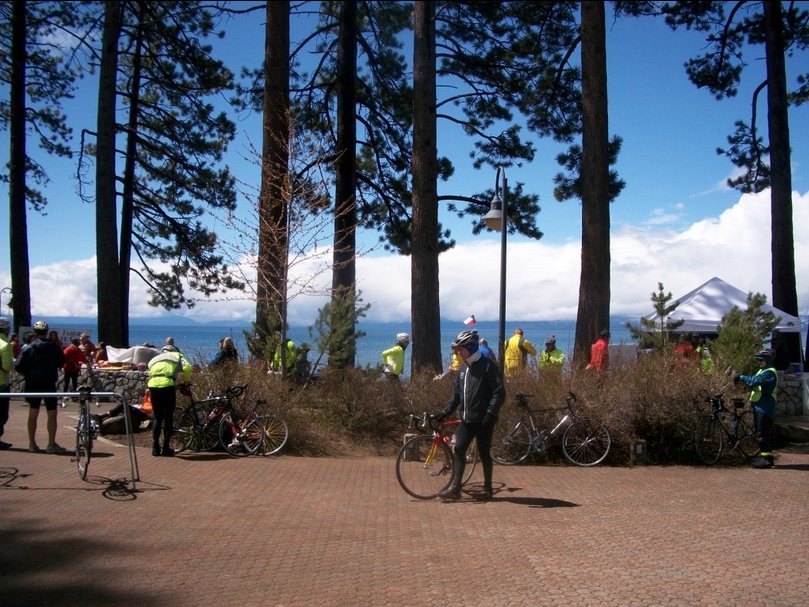
Out of the hotel by 5:00 a.m. this morning, I crossed the mountain to Stateline, Nevada where the ride would begin. It was cold and raining, hard at times. I grabbed my jacket but at 5:55 a.m. the rain stopped. I decided not to wear my cold weather shoe covers. Nor did I wear a base layer under my jersey. And I simply forgot my headcover to go under my helmet. I would regret those decisions.

Pouring in the parking lot

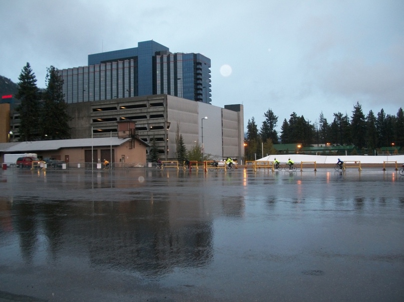
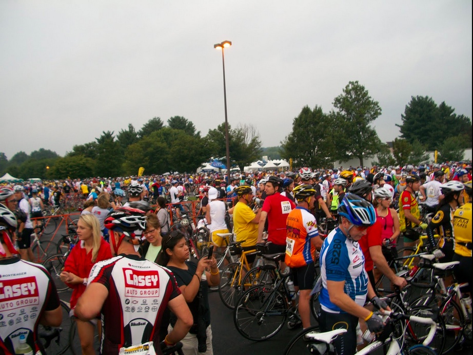
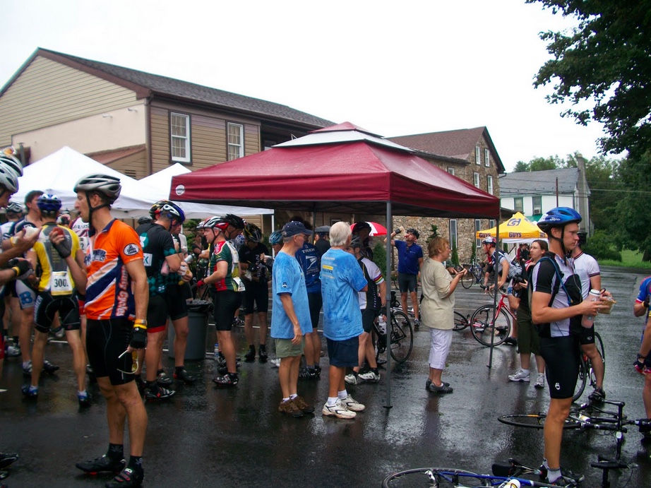
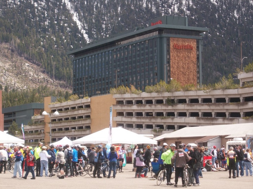
I was in line at 6:00 a.m., the earliest departure group from the Horizon Casino. I wasn’t that close to the front but think that in addition to the 15-minute interval start times they may have been sending us off in 5-minute groups as well. It was “wheels down” at 6:07 a.m. Then it started raining. On the roll-out, and it was an easy ride, we passed a bank that displayed the temperature — 38°.

There was something about today that I never experienced before on a ride. In the first 10 miles, it was effortless and that was due to more than just a basic flat profile. I felt I could ride forever. 

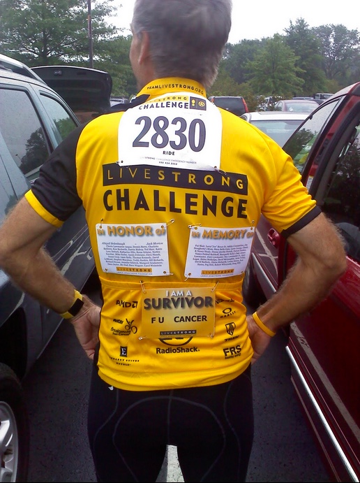
There were 3,300 registered participants but I wonder how many Californians and Nevadans simply bagged it because of the bad weather? This is Team in Traning’s (TNT) premier century event and 1,500 slots were taken by the TNT riders. Their bib numbers were purple whereas everyone else wore red. Throughout much of the day, I felt like we were crashing their party although we had them outnumbered. It just didn’t seem that way. So I joined them. I “low fived” TNT supporters at many places along the course. I yelled “Team” when I saw them and I encouraged the hundreds of TNT riders I passed on the road.

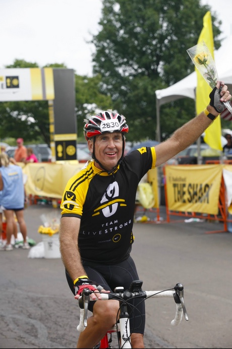
I would have liked to have been a TNT rider but was told by one of my ref crews a few weeks ago that the fundraising goal was “too high” to go to Tahoe. I asked a DC rider and was told $3900. Having raised $10,000 for LIVESTRONG, I didn’t think I could go to the well again for a free trip to ride. Also, I was not committed to the training aspect, listed as 4-5 months, to get riders ready for their first century ride. I’ve done plenty at that distance and while it would have been fun helping train or coach others, I didn’t have the time available for such a commitment.

I talked to a lot of people along the way. Almost everyone I passed I said “Morning” to (an abbreviated form of Good Morning) and for many, I asked where they were from. Many of the TNT folks had jerseys with their locations so I made it a point to talk to National Capital Area and Western Pa. riders. Go Stillers!

Around mile 7 or 8 one rider was beside me and we must have been going the same speed.

“Where are you from?”

“Marin”

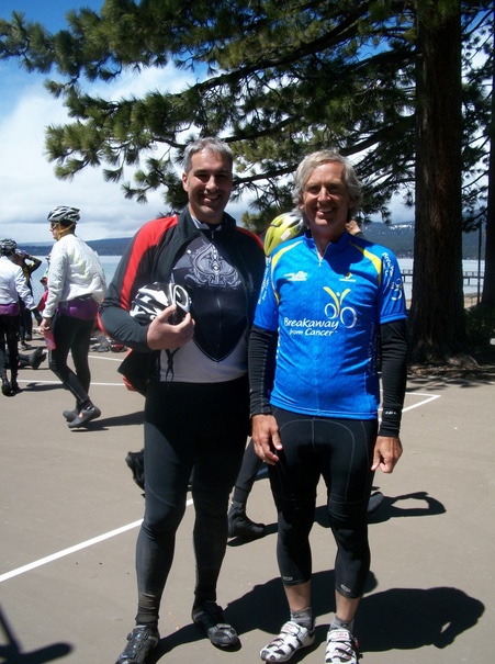
Nice. We struck up a conversation and Rodrigo Garcia Brito would be my ride partner the rest of the way. It started like most conversations but we soon were riding the same speed and we just stuck together.

Facing a long day in the saddle, cold and wet, one could complain or simply go have fun. I went to have fun.

On the climb up Emerald Point

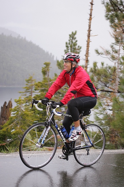
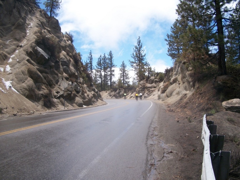
The climb up Emerald Bay was nice and we passed many riders. I checked my heart rate. It was in the 130s. Rodrigo said his was in the 160s. It was effortless going up the 9-10% grade. I knew then it would be a good day. While I froze.

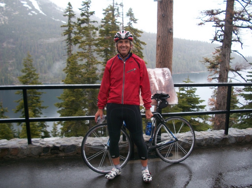
I told Rodrigo that I remembered being here 15 years ago and there was a scenic view stop on the right. We had been on spring break vacation. We came to Tahoe and there was lots of snow in the mountains. Bethany was 15, Ashley 10, and Andrew 7. In town, we had seen some guy and it was almost that he was stalking us. Everywhere we went he was right behind. Creepy.

We drove up to Emerald Point and admired the view and the snow. As we were leaving this stalker drove up. He got out of his car and promptly fell on his ass. It was one of those moments that you shouldn’t laugh but the kids about busted a gut laughing so hard. And we did too. We never saw him after that.

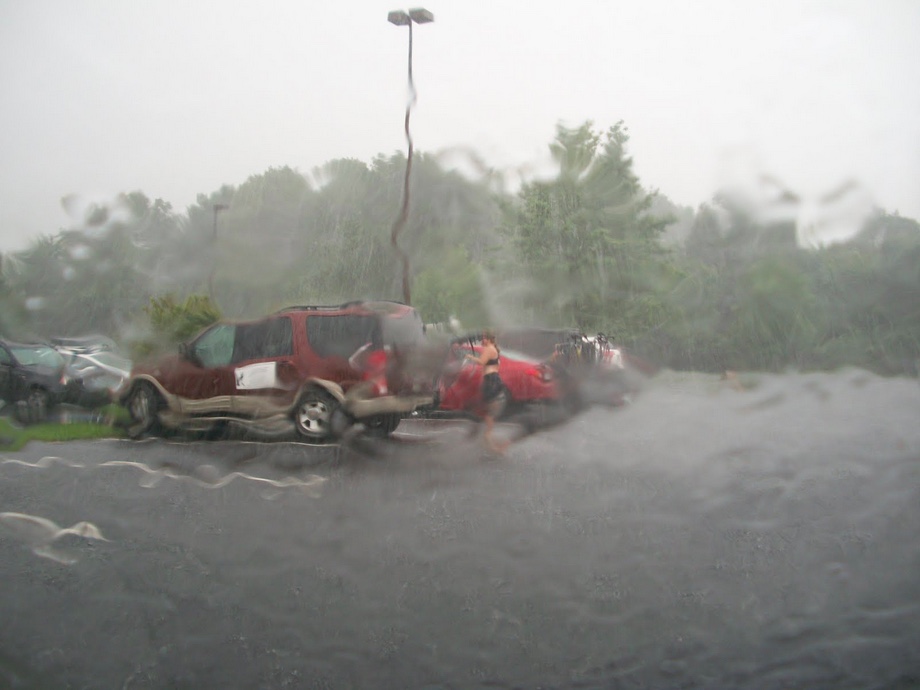
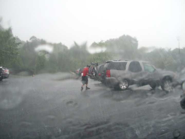
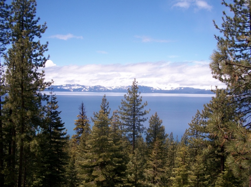
I knew that I would have to stop for a photo op. And we found it. It was the first rest area too although we did not stop to rest or take on any food. Just a picture. In the freezing rain.

For my kids

We continued in the rain with a brief stop on a descent when Rodrigo’s sunglasses fell off. I stopped and eventually went back. By then a number of people had gathered. First, a car came by and just crushed his glasses. Second, by stopping, one rider crashed. Oops.

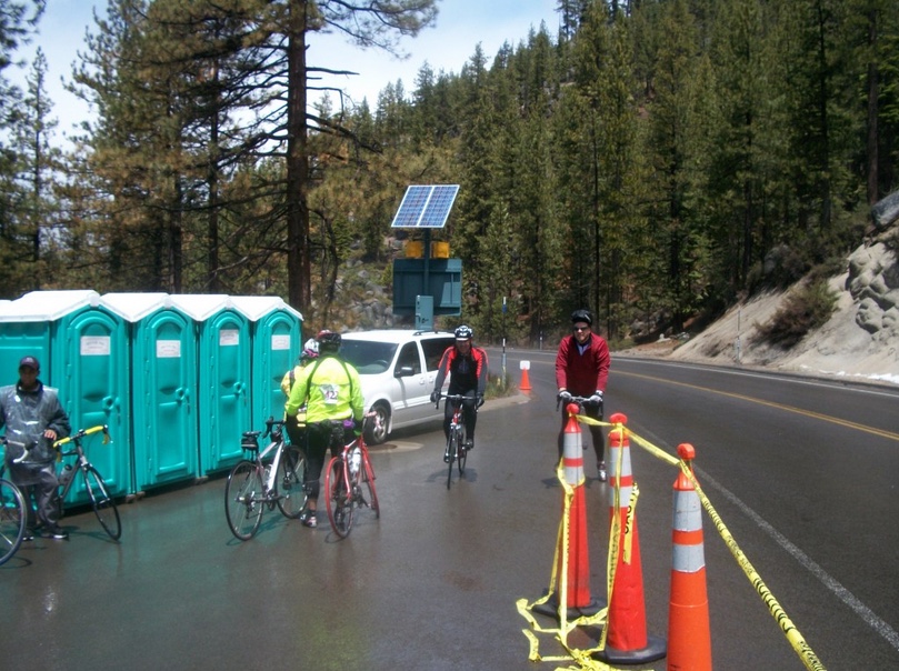
We made it to our first rest stop, used the porta-johns, took on some food, made a seat adjustment, then took off. We were both near hypothermic. I was shivering, shaking, and just couldn’t warm up. Riding in the cold was fine but that 10-15 minute break cooled us down. It would take about 10 minutes to warm up once we were back on the road.

Pretty impressive bike stand

Rodrigo is a big guy. He appears very strong and this was evident when we turned on Route 89 at Tahoe City to head to Truckee. With all the rain it was not a time to follow someone’s wheel like we normally ride. All you got was a mouthful of road spray.  Rodrigo gapped me and kept going, at times was about 100 yards out in front. I couldn’t match his pace on this downhill portion. But we came back together.

Snacks in Truckee

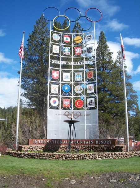
On the way back from Truckee to Tahoe City along the Truckee River, it was uphill and we stayed together. More than 50 miles had passed quickly and we stopped briefly at the Squaw Valley entrance – this the site of the 1960 Winter Olympics.

Squaw Valley

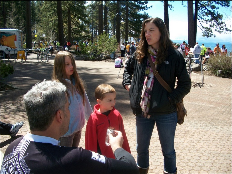
Although we saw some dark clouds ahead, we rolled into King’s Beach just as the sun was coming out and it warmed up to 50°, which seemed like 80°. Nice. We were greeted at the rest stop by Rodrigo’s family. His wife brought him new glasses. Very nice. And she warned of heavy rains ahead. Not so nice. And she would be right.

King’s Beach Rest Stop

We spent a lot of time at this stop. It was the lunch stop and I had a turkey sub. And lots of snacks. The food here was great. Rodrigo spent time with his family. We ate.

Rodrigo’s family

On the day I spent two hours off the bike. That is very unusual for me as I like to stop at 2-3 stops for a natural break, refill the bottles, then grab some food and eat while on the bike.

A Wall of Food

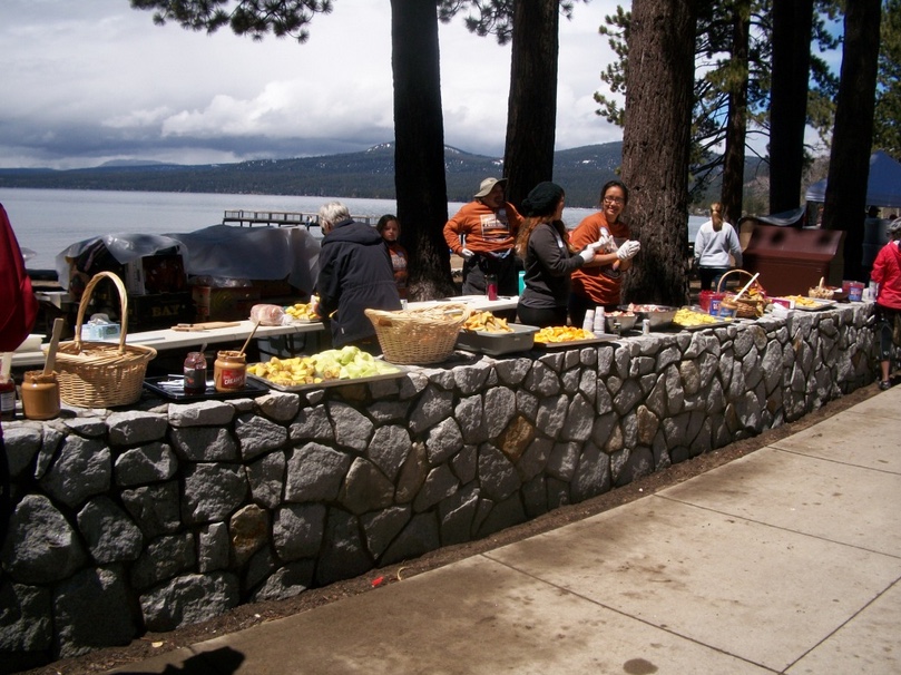
With Rodrigo’s wife and kids here, plenty of good food, and the warmth of the sun even though it was only in the low 50s, we probably stayed close to one hour at this stop.

Rodrigo and Barry

As we rolled out, Rodrigo, a one-time veteran of this ride, warned me about Incline Village. A number of the rich and famous have second homes here and I have been told that includes Brad Pitt and Bruce Jenner and the Kardashians. Maybe/maybe not. But Mike Love (Beach Boys) and Michael Milken do live here. (Read it on Wikipedia so it must be true.)

There’s a fake eagle suspended by wires above this house

If there was a place that I lost speed compared to the normal terrain it was here. Although there was a three-mile stretch of straight road along Crystal Bay, there were plenty of stop signs each with a volunteer or policeman to make sure bikes stayed in single file and each one stopped completely at the stop sign. A bit ridiculous that four bikes with no traffic following couldn’t roll-up side by side, slow down to 2-3 mph, then take off. But those are their rules and we played by them.

We turned back onto Rte 28 for the ride up Spooner Summit. Here a real break occurred in the riders. Riding casually, we had been passed by two women of the DC Chapter of TNT. We soon caught them and they had joined a group of six or seven, all riding single file on Rte 28. We stayed together until the road turned up. One of the women dropped. So did Rodrigo. The woman I was following passed everyone until there was just the two of us.
It started raining again. Heavy this time. The rain turned to sleet. There was just the two of us until she dropped. Then it was just me on the climb. 

I passed one woman who asked how many miles we had ridden. I looked down and told her 82. She didn’t believe me and then I said “if you’re riding 100.” She said wasn’t. There were 72 (no trip to Truckee) and 35-mile (boat across the lake) options too.

Just minutes before this photo this rest stop was covered by hail stones

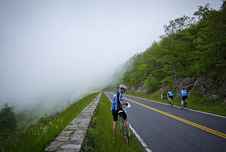
One week ago I sucked. It hurt going up Skyline Drive and it hurt more going up Massanutten. I thought Father Time finally caught up to me. And I was ready to quit. Visions of leading C and D rides danced through my head.

View from rest stop on Spooner Grade

And now at Mile 80, my legs felt as fresh as the first thing in the morning. Never have I ridden 80 miles and my legs felt like this. I wish I knew the secret. No, it’s not EPO or Clenbuterol.

Going up to Spooner Junction

What was different about the three or four days prior to this ride that was different about SkyMass? Too much riding? Too little riding? Nutrition? Altitude?

Not only did I climb well, the entire ride was from 6,000 feet to 7,100 feet except for the dip to Truckee which was 5,900 feet. I thought less O2 in the air meant fewer blood cells and less recovery. More soreness. I don’t know.

Tunnel on U.S. Rte 50 back to South Lake Tahoe, Ca.

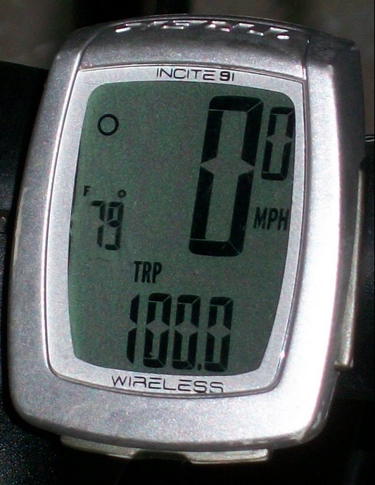
From Spooner Summit it was about a 14-mile descent to the finish line with a few rollers at the end. I had been warned that the route was not quite 100 miles so I passed the finish line and circled back to make it 100.

Finish Line

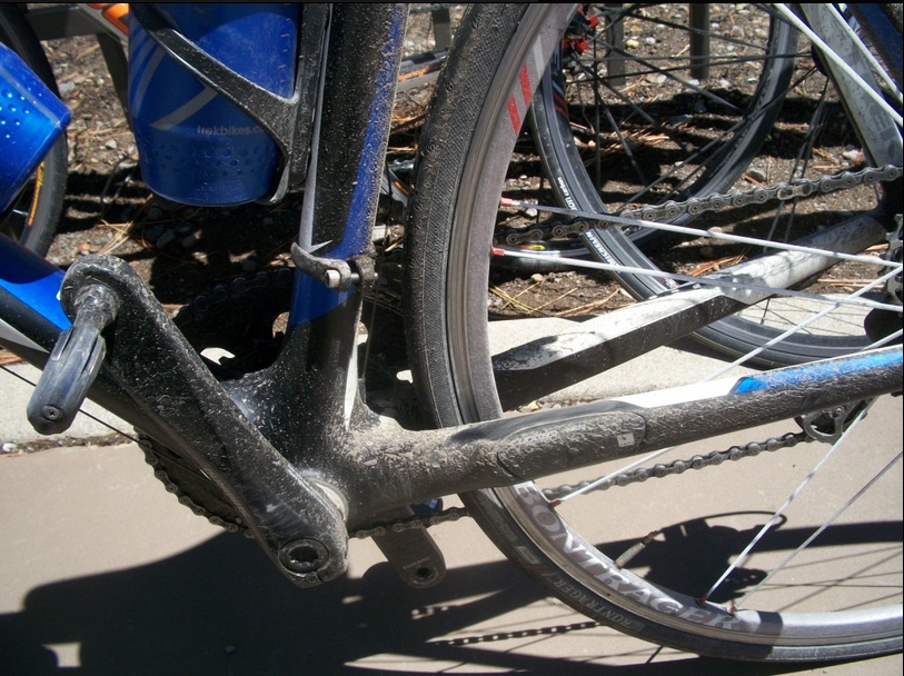
I’ve never been dirtier from a ride than this one. Just lots of sand along the road made worse by the rain. We rode 32 miles in steady or heavy rain but 68 miles without it. Of course when we weren’t being rained on we were still soaked. My white cycling socks will never be white again and I wonder if they will ever dry out.

Brand new bike never been ridden before. Filthy. Sorry.


But I’ve never felt fresher after a ride than this one. No soreness. It wasn’t my best time on the bike but I wasn’t going for time. I just never felt better during or after a ride of this length. In addition, the weather conditions made it a test of willpower.

Logistically, I wanted to do this as a test trip before I go to France. That passed. I built and tore down the bike and am comfortable with those minor repairs. Last year I went to France with Trek Travel and they supplied the bikes. In a few weeks, I will be going on my own and carrying my own bike.

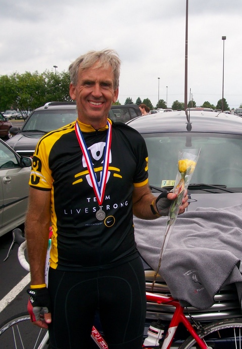
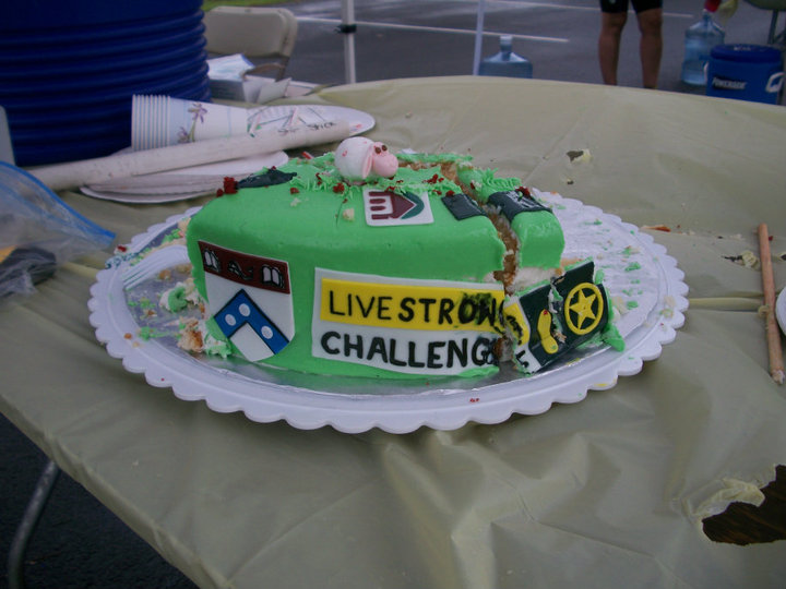
This was a day reserved for appreciating beauty and celebrating being cancer-free. Not only was this one of my recovery goals it was also National Cancer Survivors Day. I never thought I’d do a six-hour century (riding time) here and I didn’t try. With the slow down and stops in Incline Village, the most stop lights I have encountered on a century ride, and a slow rollout at the beginning, I had no dreams of anything less than seven hours on the bike.

Post Ride Meal – Reno, Nevada

Just one week after suffering on SkyMass, I felt great on the bike. Father Time, I guess it’s not my time. Yet.


Escaping Father Time

FRONT ROYAL, VIRGINIA

SkyMass is always a good test of fitness. And sometimes a giant slap in the face.

Starting at the water’s edge in Front Royal, one begins with a 7.2-mile climb on Skyline Drive. That is followed by a two-mile descent and then another eight-mile climb. A two-mile descent follows then another three-mile climb. You get the picture.

This was a Potomac Pedalers ride and I had hoped there would be 30-40 riders at the start. Instead, there were eight. And one had to turn back after 10 miles when his rear derailleur cable broke.

On the first climb not long after entering Shenandoah National Park, I shifted and my chain briefly came off the front chainring. On a flat road this is no problem as I can soft pedal and bring it back onto the sprocket. On a 7% grade this is more of a problem. I quickly lost my momentum and could not unclip quick enough. Gravity won. I steered into a ditch and hit the ground pretty hard but nothing was hurt except my pride.

SkyMass 2011

With the group now in front of me, I simply had to ride at my own pace and catch them 10 miles later although they were never more than a couple of hundred yards ahead of me. I see you – I just can’t catch you.

Skyline Drive. SkyMass 2011

With Mike turning back, there were seven on the ride and three guys went ahead. Four of us would loosely stay together for the rest of the ride.

Thorton Gap. SkyMass 2011

At Thorton Gap, where US 211 crosses under Skyline Drive, we saw an approaching storm that would largely miss us. We followed 211 down to Luray (LOO-ray) and then over to Massanutten Mountain. Here the road kept getting harder. It was only a 3-mile climb which started out as 6-7%, pretty much the same grade as much of Skyline Drive. But the last mile kicks up to 10% then 12%, then 15%. There was even a stretch of 18%.

Shenandoah Valley

I had decided to let the group ride ahead and at one point, maybe twice, I looked up and saw our group leader of the day, Greg Gibson, off his bike either walking or simply resting. It was quite a test.

Thorton Gap. SkyMass 2011

We regrouped at the top and hit the descent off the mountain into George Washington National Forest. The Fort Valley Road featured no more climbs but a series of rollers. I found that while I stayed with the group when we came to some risers I just couldn’t match their pop over the top. I sat up and let the group ride on and decided to meet up at the rest stop.

Storm is Coming. SkyMass 2011

After the stop, we rolled off together. Again, I couldn’t match the accelerations at the end of the rises. The group was kind enough to wait at the last turn as we turned onto Mountain Road. That featured our last climb of the day and like the earlier one on Skyline Drive, a brief shifting moment led to a stuck chain and this time, a hard fall on the floor. Bloodied and beaten, Mike, a British rider waited for me and we rode home together.

Blood!

My injuries were minor; a lacerated pinky, and some road rash on my elbow, and a little on the knee.

At the end of the day, my speed was 14.5 mph which was 0.5 less than when I rode this 13 months ago. With each ride, I wonder if Father Time will reach out and grab me, and today I worry more than ever that he did. One year ago I was just five months from cancer surgery. And I rode faster than today.

I think on that day we stayed together the entire time and I don’t remember a mile when I wasn’t pulling, or more likely, hanging on someone’s wheel. Today I doubt that I was on someone’s wheel more than 15 miles of out 80 and 10 of those were the last miles home as Mike and I rode together.

Maybe it was just a bad day in the saddle. Or maybe Father Time has got his grip on me. Maybe two crashes, which were really fall overs, took their toll on me. I do note that I rode over 5,000 miles last year with only one such incident — with a woman and her dog. And today I had two on one ride.

At the end of the day, I still completed a tough route which was better than sitting at home on the sofa.


Shepherdstown Loop

RANSON, WEST VIRGINIA

A windy day with temperatures in the 70s. I left Ranson and rode on Flowing Springs Road.

Bad roads come in different shapes and sizes and this is a bad road. It’s a two-lane country road with blind curves and no shoulders. A safe speed may be 45 mph but this is signed for 55 and the cars probably do 60-65. I would not recommend riding this road again. There must be a better way.

Main – Shepherdstown, WV

Rolling into Shepherdstown and I thought how much money I spent here. Eight years’ of college tuition payments for Bethany and Ashley. It is a lovely Civil War era town but goes back to the founding of the country when some lawmakers pushed for Shepherdstown to be the Nation’s Capital.

I followed country roads past Cress Creek golf club and the doubled back to Martinsburg.

Bike path, Martinsburg, WV

Leaving Martinsburg, I took the bike path back to Ranson. The new Rte 9 recently opened the entire way from Charles Town to Martinsburg and features a bike path that parallels it. I was alone.

It was windy and after the ride, I felt whipped. But it was a day on the bike which beats a day on the sofa.


Easter Ride

RANSON, WEST VIRGINIA

Listening to the weather forecast this morning they determined that no prior Easter in Washington, D.C. had ever reached 80 degrees. Today it would. Of course, this was also the latest Easter in recent memory. It was a beautiful day for a ride and to try my new route to Charles Town.

The middle portion of my trip would remain unchanged — that from Aldie to Airmont via Snickersville Turnpike. But those 11 miles would be the only constant. 

Snickersville Turnpike

I had determined that from Airmont to Charles Town was about the same distance whether I cross on Va. 9 at Keyes Gap or took Va. 7 over Snickers Gap. But traffic, not distance, should be the determining factor in finding the best way.

I’m not sure how many times I have crossed on Rte. 9, less than 10, but it’s never a fun proposition. Entering just west of Hillsboro, Rte. 9 is two-lane, 55 mph, with no shoulder, sharp curves, and a two mile climb, although only the second mile is where the road kicks up.

Bluemont, Virginia

My maps showed that if I stayed on Snickersville Turnpike and crossed the mountain at Va. Rte 7 it would be much safer. One doesn’t need to actually get on Rte. 7, which is a major four-lane road over the mountain, until about 1 kilometer, or 0.6 miles, from the top. Plus there is a decent size shoulder, although I wouldn’t necessarily call it real wide. But I knew I didn’t have to ride on Rte 7 except for that mile going over the top and then just over one mile (two kilometers), where I would cross the Shenandoah River.

Snickersville Turnpike

At the southern end of the trip, I had taken the Prince William Parkway to Rte 234/Sudley Road past the Manassas Battlefield to Gum Springs Road. Following Gum Springs I took Braddock Road, which in these sections, is a very rough unpaved road for more than two miles. It connected with U.S. 15 for one mile and U.S. 50 for another 1.7 miles. My goal was to avoid these two major U.S. routes, both of which were two lanes and neither of which had much of a shoulder.

I headed down Bristow Rd which is a two-lane road with no shoulder but most drivers are pretty good about respecting cyclists on this road. It turns into Linton Hall Road which was the only part of the route I did not like. Four lanes, it is curb-to-curb with no shoulder, a 45 mph speed limit which meant most cars were doing 55 mph. The total distance on this portion was 10 kilometers (6 miles).

It was a short trip through Haymarket to Antioch Road at which time I stopped to call home and then was met by another cyclist, “Kenny.” We chatted as we rode off together. It was fun for a while but then I soon realized I was near the red zone. He was setting a pretty fast pace and I was struggling to stay on his wheel. I enjoyed his companionship but was relieved when he turned to ride up Ridge Road. 

The Yellow House on Snickersville near Bluemont

With just one missed turn, I made my way to Aldie and Snickersville Turnpike. The day was gorgeous and the spring blossoms were on the trees. Snickersville is a roller coaster and for every screamin’ downhill section, you pay on the other side with a climb. It softened up the legs for sure.

I stopped at the general store in Bluemont and surveyed the dark clouds on the mountain. I knew I’d be getting wet sometime. Some things you can’t avoid.

Bluemont General Store

With temperatures in the 80s, I really didn’t mind the rain at the top of the mountain and as quickly it came it seemed to leave – or I left it. At the bottom of the hill, I crossed the Shenandoah River and turned on Casselman Road. I followed the Shenandoah River briefly then turned and was surprised to find my route turned to dirt. A gravel road. Oh well. It was 2.5 miles (4 km) over the dirt before I was on Wickcliffe Rd. 

Gravel. I am not a fan.

I came to Kabletown Road and followed this to Old Cave Road to Charles Town. But I saw lightning in the distance. Dark clouds were looming ahead and I knew I was going into it. Again. I looked for shelter but found none and rode through about 10 minutes of the worst of it. Lightning followed by an almost immediate crack of thunder. It was scary.

Bluemont General Store

I was drenched, but I was safe, I made it to Charles Town.

On the day it was an 80 mile ride which was a bit longer than the old route but almost all of it, more than 10 km (6 miles) is because of the Haymarket portion. I traded a couple of miles of dirt roads on Braddock Road for faster traffic on Linton Hall Road. I need to think if that’s a fair tradeoff.

The climb on Rte 7 is more formidable than the mountain crossing on Rte 9 and is safer too so this way is definitely in the books as the route to follow. I have to look for more paved roads and less dirt in Clarke Co., Va. but those 2.5 miles weren’t that bad.

Even with the thunderstorm, it was a great day on the bike.


Nokesville to Summerduck

NOKESVILLE, VIRGINIA

My annual mileage is actually behind where I was one year ago when we had 60″ of snow and I was slow in recovering from cancer surgery. This winter wasn’t severe but we’ve had many days colder than normal.

I was invited to join Joe Penano and some riders from The Bike Lane team on a 70-mile ride out of Middleburg, Va., but was afraid that I wasn’t up to their level of fitness and would slow them down or get dropped. Instead, I opted for a Potomac Pedalers ride where I would know no one.

It was listed as a BB/A ride and I hoped it would be more BB than A. Or that we would have enough for two groups and I could join the BB group. Even then I was worried that I did not have the fitness to keep up with the BB group.

Maybe, even more, was the first time I when I first did a PPTC ride from Nokesville I did a BB ride and got dropped. I learned that A riders sometimes jump in the BB rides and naturally ramp up the pace. I was hoping we’d have enough for two groups, an A and a BB.

There were 10 of us. One group.

Our ride would take us to U.S. 17 to Summerduck in Fauquier County and back to start.

We started fast and went faster. Ten of us were in a paceline although I wouldn’t say we were maximized for speed. Each person as they moved up front took monster pulls instead of my preferred 20-30 seconds at the front. When it was my turn I pulled for about a mile (monster pull) then moved over just as the group was ready to hammer a downhill. My bad. I lost contact although the group did sit up and wait for me to come back.

About five miles from our rest stop we hit a hill and I was in last at the bottom. At the top, I was only 10 meters or so behind but did not have the recovery to hammer the pace. Ten meters grew to 40 and then 100. Then I lost contact. I pulled out my cue sheet and knew I was in trouble. I had switched Garmin to kilometers while the cue sheet was in miles. But a quick math lesson and I found myself back to the group at our rest stop. There was another rider behind me and he came in 3-4 minutes later.

Averaged 18.5 mph, I didn’t think I could continue this pace for the second half of the ride and was content to ride home alone. But we took off and I stayed with them. My mind kept thinking just get to me Sowego Road or Brentstown Road or Fleetwood Drive. Then I would sit up and soft pedal home.

The ten of us stayed together and the pace increased. We eventually dropped a rider and around 80 km. I lost contact and dropped back 30-40 meters but was able to catch the group at Brentstown Road. One or two riders waited for the dropped rider and the rest of us took off. I was still hanging in there until we hit a rise and a felt a sharp twinge in my quad. Cramp! Crap!

I immediately sat up and pulled myself out of the group. I knew then to soft-pedal the rest of the way and be content with what I had accomplished.

Only once did I ride this year as much as 16 mph and that was the Reston Bike Lane ride which always moves. I had hoped for 16, or dare I think, 17 on this ride. I came home at 19.0 mph.

I spent a lot of time in Heart Rate Zones 2 and 3 (two hours 23 minutes), 24 minutes in Zone 4, and two minutes in the red. I worked hard.

Clearly, my fitness is lacking but it was a great ride with an A class group.


Last Sunday of Winter

THE PLAINS, VIRGINIA

It’s the last Sunday of winter and time to celebrate with a ride. This one was a Potomac Pedaler’s CC ride which is too slow for me. While there was also an A/BB ride on the list, I’m not feeling like the BB rider I can be and if only A riders showed up I’d be dropped quickly.

My goals were simple and they evolved as I rode. 

The Plains, Va.

(1) Be a nice guy and ride slow with everyone else. That worked for the first mile or two but as the road turned up and I soft-pedaled soon I was passing everyone else as though they were going backward. 
 
(2) Don’t let the heart rate go above 130. Soft pedaling works but eventually it just gets too tiring going slow uphill and it feels good to pedal harder.
 
(3) Don’t shift into the small front ring. Check — did that. Climbed every hill without shifting into the small ring.
 
(4) Don’t be the jerk who rides off and leaves everyone behind. Well, technically I didn’t because I found “Mike” from Arlington to come along with me.
 
(5) Find a new route to/from Charles Town. I think I did that, riding through Evergreen Golf Course.

We met and parked alongside the train tracks in The Plains, Va. For a large group ride parking is a problem but not today as the group was no more than 12-15 riders even though temperatures were in the mid 50s and it was sunny.

Hopewell Road, near The Plains

I soon made my way through the group and was looking at just two riders in front of me, Holly and Mike. Neither have last names. I caught both then led them through Evergreen Golf Club eventually dropping both on Mountain Road. Remember #1. Or #4. I slowed and the three of us rode to Aldie together.
 
At Aldie I decided not to take a lengthy break at the store so Mike and I headed out, never to see the group for the rest of the day. Since the route was listed as 47 miles and I wanted to do at least 50, I suggested we change the route and stay on Snickersville Turnpike. Mike agreed and we were treated with extreme rollers for the next 10 miles.

Snickersville Turnpike

I really thought that with the additional miles we added that we dropped behind our group. We intersected at Foxwell and St. Louis Road. In St. Louis, Va., I stopped and asked a Loudoun Co. sheriff if a group had gone by and he said that none had. We continued on.
 
Back in the main group, they had a front derailleur issue at Mile 4, a flat at Mile 9, two rear derailleur issues on Snickersville Turnpike, and a bottom bracket issue as well. We might have waited until sunset and not have seen them. It was a good decision to go on by ourselves.

Atoka Store

Mike and I stopped at the Atoka Store which is halfway between Middleburg and Upperville. No group. At this point we just decided to follow the cues and ride it home.

Mike, no last name, from Arlington

As we rode into The Plains I was still one mile short of 50. I simply rode out another half mile, turned around, and came back content with another 50-mile ride.
 
Maybe there will be evening riding this week. We just went to Daylight Savings Time. Or maybe not. But this winter was not severe like last winter. It was cold but the roads were passable most of the winter.

Frogtown Road

Refereeing and related activities as well as the Steelers run to the Super Bowl took up many riding days from me. But still, since January 1, I have ridden 303 miles. That’s not a bad winter but spring and summer will be 20 times better.


Mileage: 50.1
Average Speed: 13.9 mph

A New Year’s Day Ride

HOOVERSVILLE, PENNSYLVANIA

The temperature was 37° when I headed out for my New Year’s Day ride. The road in Camp Harmony was mud covered by ice. I tried to stay on the side in the mud rather than risk spilling on the ice.

Memories abound at Camp Harmony. Last year I was one month removed from cancer surgery. My exercise last year was to walk up Plank Road during a blizzard. And dealing with post-surgical issues.

This year I had to ride. Bundled up, I started up Plank Road to Slagle Hill Road. It started raining. I thought my ride would be cut real short riding in a cold rain but I lasted longer than the rain.

Plank Road

My descent down Slagel Hill could have been fun but the road was treated with a dirty black gravel mix, presumably with salt. But unlike treated Virginia roads which are noticeably white, these roads were black. In short, the descent was pretty treacherous.

Lake Quemahoning

At Mile 4 I stopped to photograph the steel grate bridge, presumably called the Green Bridge since this was Green Bridge Road. At Mile 8 I could have turned up Plank Road and made a nice 10-11 mile loop but I continued to Hollsopple. I had ridden this stretch three times last summer; once in a Somerset-Johnstown-Ligonier loop, and twice on my way to Punxsutawney. It’s much nicer in the summer.

Green Bridge

I followed Whistler Road next to Stoney Creek. Stoney Creek flows from here to Johnstown. A cyclist on this road is a rare site – even more a cyclist in January.

Hooversville

At Hooversville I saw a suspension bridge and knew I had to follow it. It crossed the Stoney Creek over to Hooversville Road. 

I then took Hooversville Road up to Plank Road then back to camp just as the rain started to come down harder. A 20-mile loop is a great way to begin 2011!


St. Mary's Century

LEONARDTOWN, MARYLAND

“The Lone Wolf”
“What the hell am I doing?”
“Just Hanging On”


Titles for this blog entry go racing through my mind.

Wheels down at 8:15 a.m. which was later than I wanted as the course opened at 7:00 a.m. I completely underestimated the time it would take to drive here. I headed out of town with little knowledge of where I was going. Although I was handed a cue sheet, I don’t like to use those. Besides, if I got lost I could always program Garmin “back to start.”

Well marked if you’re looking for it

I started out on an empty road and saw no one ahead and no one behind. I figured starting so late I missed any chance to jump into a group. I was resigned that I would ride by myself so I turned around to get a cue sheet then did a 180 and decided to forgo it. I would simply take it slow and enjoy the scenery.

The markings on the road were very small and it was easy to blow past a turn and go for miles waiting for the next mark, which would never come. But I found my first turn and stopped to take a picture of the road and the sign marking – an Amish horse and buggy.

Horse and Buggy sign

While I was stopped fumbling with the camera, I was passed by two guys. I thought that if I hurried I might be able to join them but they went by pretty fast. I counted and they were 17 seconds ahead and wondered if I should hammer it to join them. And what they would think. I let them go.

Settling in enjoying the scenery, I came upon an Amish horse and buggy. Or horse and wagon. I respected the driver’s desire not to be photographed and be recognizable by snapping a picture from the distance. From the rear. (At least this is my belief. I could be wrong.)

Horse and Buggy – No sign

Over the next couple of miles, I passed eight buggies including one charming family of eight. On the back, and they could see me approaching, were two older girls facing backward on the top bench and three smaller boys sitting one bench down. Up front were dad and mom driving with a baby in between. It was actually pretty cool in an Amish sort of way.

The horse took off on the downhill section, approaching the steep uphill. And I did the same. I was side by side by passing with a wide berth. I didn’t want to scare the horse. Then we hit the 12% grade wall. And I flew by that horse. Ha! (Of course, I wasn’t pulling a family of eight.)

It was Amish market day as I assume every Saturday is. I passed one young Amish man on his bike and just wanted to stop and show him my bike. But I didn’t. I wondered what he would say about a carbon fiber bike with a Garmin GPS unit on it.

Just as I was catching a group of riders, riding a bit too slow for me though, I was passed by the same two riders: John Phillips and his boss, Enrico. I didn’t know who these two guys were and I caught their wheels. I can only imagine that they were wondering why I was hanging on and I wondered if they were trying their best to drop me. They didn’t. Eventually, I said I was willing to work and took a couple of pulls. We were now in a group of three.

As is typical of group riding, we didn’t say much or introduce ourselves at first. Why should we? We may ride together for one mile and then split. But eventually, we did. At the first rest stop.

Coltons Point on the Potomac

The first stop was at Coltons Point on the Potomac River. Here the Potomac is five miles wide, not real far from the birthplace of George Washington across on the Virginia side.

Rest Stop #1 at Coltons Point

After a brief stop to fill the water bottles, and it would get hot today, we headed back out to complete the first 50-mile loop. The more I rode the more I felt I wasn’t going to be able to hang on with these two guys. Although I had jumped in with them, they were much younger than I first thought and I thought that would wear me down.

We neared the end of the first 50 miles and came to a bit of a climb — more a roller than a climb but one where I have some problems keeping a fast pace with younger riders. I started to lose contact with John and Enrico and actually felt good about it. But then I saw Enrico sit up and wait for me. Nice gesture but damn — that meant I was going to have to ride hard the entire day.

John at the Rest Stop at St. Mary’s College

Back at the start at the College of Southern Maryland in Leonardtown, John told me the farthest he had ever ridden was 70 miles and that was just a few weeks earlier. I was impressed that he would try to increase his max mileage by 50% on one ride. Enrico had just flown back from Italy and wasn’t feeling well and decided to call it a day.

We had ridden the first section at 19+ mph without the benefit of a large group. I was hoping to ride more sensible in the second half. That was way too fast for me today.

River Festival at St. Mary’s River

Now without Enrico, John and I left the rest break with six other riders and it appeared that we would stay together. But at the first rise in the road about three miles in, John and I pulled away. We weren’t hammering it, just keeping it comfortable.

And that would be it – John and me, for the next 50 miles. There was one stretch where a group of four was catching us and I told him we would sit up and they could latch on, which we did. But there was no real formation in that group and the leader was hammering it. After a couple of miles, I told John I was going to drop back and ride at a more reasonable pace. He did too. And about 50 meters later, the group broke apart.

Rest stop at Piney Point

The remnants of that group all pulled into the rest stop at St. Mary’s City together. I don’t know what happened to them after that. Perhaps they departed before us or passed us when John flatted about five miles later.

The day was hot (upper 80s) and four rest stops hardly seemed like enough places to fill our bottles. On our way out to Piney Point, we passed a small beer store and stopped in for a Coke. It’s not quite the same as the Cokes I had in France in July but it was good enough. It was the pause that refreshes.

John is a younger, stronger, and faster rider than me. But around Mile 85 he had pulled for the last time this day. It was just the two of us working together and we had not been passed by anyone the entire day, save for the group of four that soon splintered after we dropped off.

I was in front for a mile or so and pulled to the side to let John pull. But he was no longer on my wheel. I looked and saw him about 200 meters behind so I soft-pedaled. And this would continue all the way back to the college.

Party at the finish line

I (we) caught another rider and I went to the front thinking I was pulling both but realized I had dropped both. I could have gone on home solo, and I think most roadies would have — in some ways, it is survival of the fittest — but sitting up and waiting seemed like the right thing to do. It was the right thing to do.

We made it back, John accomplished his first century ride and said the last 15 miles were the hardest miles he had ever ridden. Funny thing, our bodies. After a summer of long-distance riding, it knows how to dole out the energy stores for a 100-mile ride. John’s body simply had never been pushed to that limit and quit around Mile 85.

Brusters Ice Cream

The organizers of the St. Mary’s Century are very proud of their work, and they should be. It was just $40 and they provided a nice T-shirt, four fully stocked rest areas, and showers at the college. Except for our (the 100 milers) first rest stop at Coltons Point which had a port-a-john, every other rest stop at fully functioning restrooms, including some nice facilities at Piney Point.

The welcome package was full of information on St. Mary’s County including discount coupons. At the finish, they had a band plus a grill with hamburgers and hot dogs and Brusters Ice Cream.

With many century options available to me and wanting to sample each one, I don’t know if I will be back to this one but highly recommend it to anyone if they have never ridden it. Well down, Paxvelo!


DISTANCE: 103.3 miles

TIME: 5:53

SPEED: 17.5 mph

King of the Mountains – Men’s Division

GEORGETOWN, WASHINGTON, D.C. 

After some incessant nagging, Kelley Noonan and David Vito invited me to ride with them. I had been used to seeing them on The Bike Lane shop rides out of Reston on Saturdays but it has been a while since I have been there. The last time I saw Kelley was when she was wiped out on our group ride on May 2. I last rode with David on April 17. I looked forward to seeing them again.

Although I wanted to bike from home to meet them, I didn’t leave myself quite enough time to bike the entire distance so I drove to The Bike Lane in Burke and rode from there. I intercepted Kelley and David at Gallows Road on the Washington & Old Dominion bike trail and we rode from there to the Custis Trail to Crystal City then across the Key Bridge into Georgetown.

We met with a group of cyclists riding from Revolution Cycling. It was their shop ride. While they had two groups, and I would have preferred to ride with the faster group, Kelley and David were looking for an easy spin preparing for the Patriot Half Ironman in two weeks. Kelley had warned me that the pace would be slow as some riders were not comfortable in a group.

Kelley was right. On the route towards Great Falls (Md.) I dropped to the back to find Kelley, and she and a couple of riders were missing. I rode back to the front and told the ride leader, Katie, that we had dropped Kelley. So we waited and had the group reform.

Once we got rolling again, we weren’t far from “the hill.” David and Kelley had either warned me or told me that I would like the hill up to Great Falls. One mile long, it wasn’t overly steep, but enough to shed all the other riders. David had said I would win the King of the Mountains on this hill.

Just as we approached it, and it has a subtle rise, not a wall, announcing its presence, David pointed it out and we took off. David is less than half my age and I figured, even if he’s not a true climber, I still had no chance. There’s no way my legs could produce the power that young legs can. I did what a savvy veteran would. I let him pass and then I sat on his wheel up the entire climb.

I kept wondering when he was going to drop me, and at one point he did pull away by 10 – 15 feet (4 meters) or so but that was it. And then I got back on. I also figured I couldn’t hold him off if I tried to drop him too early. One big problem I had was that I didn’t know where the hill ended. I know, “at the top” but with each rise and each curve, how close were we to the top?

And then it happened. Sarah Brown, who probably weighs no more than 85 pounds, came flying by us. She is a new rider, maybe 23 years old, stands about five feet tall, and has the skinniest legs I have ever seen. She has no weight or body fat on her at all. Maybe worse, she couldn’t have been on our wheels when we left everyone behind and must have decided after we were gone 100-200 yards that she was going to catch and pass us.

Sarah Brown, Princeton

I told David to go, and I think he tried, but neither of us could catch her. I found out later that she ran cross country and track in college. I bet she flies.

Nearing the top of the climb, I was able to pass David and take second in the KOM – but first in the Men’s Division. Or first in the Over 100 Pounds Division. Or the Over 25 Division.

Maybe at one time, when I was 25 like David, it would bother me, but I am just happy to be alive and do what I can do. I’ll gladly lose to Sarah (weighs half of what I do) or David (is half my age) and still be in the top group climbing the hill.

On a day when the temperature hit 92º, I ended up riding 65 miles. I loved another great day in the saddle.


Note: Photograph from Princeton Athletics website, http://www.goprincetontigers.com

LIVESTRONG Challenge 2010

KING OF PRUSSIA, PENNSYLVANIA

With very tired legs and a body to match, I arrived at the hotel shortly after midnight and was asleep by 1:00 a.m. I got up at 5:00 a.m. and headed out of the hotel to Montgomery County Community College for check-in at 6:00 a.m. And no breakfast.

I went to get my ride packet and the volunteer handed me a top contributor’s jersey. That’s all. Thankfully another volunteer corrected her and told her that I get level C (jersey) and the gifts with levels A and B too. But I didn’t get the iPod and will dispute that with them afterward.

Last year I checked in and they rang cowbells and made an announcement that I raised $2900. It was actually more. It was a very welcome introduction.

This year I raised $5,000 and nothing. Sort of disappointing. Maybe more disappointing was that I had qualified for the recognition dinner last night but had to miss it as I was en route from Mt. Washington, New Hampshire to Philadelphia.

I returned to my car and started the assembly of my jersey. I wore the new LIVESTRONG jersey and added my race bib, my honor bib, my memory bib, and my survivor bib. Before I rode I posted a picture of my bibs on Facebook with this heading “Really wish we didn’t need these events.” Then I made my way to the start line.

Livestrong-Philly (2010) Jersey and Bibs
Lots of people honored one person. I honored a bunch!
More names were written on the back too.

At the start line, I could hear Lance Armstrong address the crowd but could only see the back of the stage and his legs. He addressed the 3,300 cyclists and said that he looked forward to a day when we could gather and just ride. He said, “I really wish we didn’t need these events.

After the comments from Lance, the ride went off 10 minutes late at 7:40 a.m. It was announced that he would ride 100 miles but I heard he cut it short at 45. It was dry at the start but around Mile 20 it would start to rain and it rained steadily and hard at times.

Some of the 3300 Cancer-Fighting friends at Livestrong-Philly

The start was slow, it took perhaps 4-5 minutes before I began moving even though the front of the 100-mile riders had already departed. The first 7-8 miles consisted of working my way farther and farther toward the front. I blew by the first two rest areas and reached the intersection of where the 70-mile group turned but the 100-mile group continued for 30 miles.

I was told that shortly after I went through the intersection LIVESTRONG closed the 100-mile route due to the weather that was moving in. There weren’t too many of us who got to ride 100 on the day. Call me lucky.

Raining at Landis Store. Love how the riders tried to crowd under the tent for protection even though they were soaked.

I was a little sore from yesterday’s climb up Mount Washington but not so much sore as simply without power. When I came to Landis Hill, the longest and steepest hill on the route I wanted to walk like I saw others doing, but knew I couldn’t. I had all the excuses — Mount Washington, four hours of sleep, a 12-hour drive, no breakfast — but knew I had to keep going. And I did.

Rest stop #9 (or #10?). This was at mile 90 and was marked SURVIVOR REST STOP. I stopped hoping for some survivor swag but no one there knew why it was called that. So I ate cake.

A number of people complained about the rain. My standard response was that fighting cancer isn’t bright and sunny. Metaphorically speaking, I expect a rainy day.

I was most disappointed that no one commented about my bib – FU Cancer. In a crowd of people who hated cancer, not one person. One did say “I like your bibs.” And that was all.

Yellow rose at the finish line – Livestrong-Philly 2010

When I saw the sign for 30 miles to go I started rehearsing what I would do when I crossed the finish line. Last year was tough. For many survivors who cross the finish line, it is the end of a difficult journey. For me, it was the realization that my journey had just begun. And it was tough.

A Century must be 100 miles, no?

Crossing the line as a survivor is emotional. I can’t explain it but you can ride 99 miles and be fine and when you come to the finishing chute in the last mile it becomes very emotional. I wish for none of my friends to ever know what I’m talking about. Today would be different. I was looking forward to crossing this finish line with positive emotions.

After riding all day with no power left in my legs (thanks, Mount Washington) at Mile 90 my legs came back. I started passing people. Tons of people. I both wanted this moment to last but yet wanted to get to the finish.

With one mile to go the sun came out. It would be the only time I would see the sun all day. I entered the right side of the chute for survivors. My final 200 meters went way too fast. Or I went way too fast. I hope they had photographers to capture the moment because I grabbed a rose and held it in the air and almost ran over some people who had stopped. Oops.

On the day the Challenge was only 97 miles. So I rode the extra distance, with the rose between my teeth, to make it 100. It had to be 100.

Livestrong-Challenge Philly 2010
The Rose and the Jersey are from the Livestrong Event
The blanket and the medal are from MWARBH

After I changed out of my soaking wet clothes, I went to the luncheon in the tent.  I wore my Mt. Washington Auto Road Hillclimb shirt. Strangers came up to me to ask about the race. Was I doing it? (Yes, already did – yesterday.) What gearing did I use? (24:28)  Did you know my friend rode it yesterday? (Uh, no, I don’t think so.)

Wear a bid that says “FU CANCER” and none of the 3,300 cancer fighters wanted to acknowledge it. But put on a Mount Washington shirt and strangers come up and talk. Even with people who hate cancer, they don’t want to talk about it.

Livestrong Challenge Philly 2010 – It’s raining pretty hard

Right after I got back to the car a deluge occurred. Just another day fighting cancer.

Livestrong Challenge Philly 2010 – It’s raining pretty hard

Verified by MonsterInsights