
EASTON, MARYLAND
It began with a description I read of St. Michaels, Maryland, that included a ferry ride across the Tred Avon River. I first came to this part of Maryland’s Eastern Shore in July 2022 and have been back an additional 12 times.
My rides up to this year have been mostly a loop out to St. Michaels and then Tilghman Island and back across the ferry. The roads to Tilghman Island are somewhat busy, but with a gigantic shoulder, the size of a traffic lane, to ride on.
This year I was slow to get to Easton but when I lost my trip to France, Easton became my comfort ride. I did an out-and-back ride on June 9 and then started looking for some exploratory routes. I found a Metric (metric century is 100 km or 62.14 miles) called the Tri-County Ice Cream Classic. It went east, then northeast from Easton, before coming back through Easton, then out to the Oxford Ferry. Nice ride.
While I was riding it, I saw road markings for the Tour de Talbot. I found their website and saw they used more southerly roads to make a Metric but also included the ferry. I rode this on June 23 and loved the route. Once it got out of Easton, it was all on country roads that were virtually empty. And much of it was wooded.

I went back on my birthday for my birthday ride, which is where I (still) ride my age in miles. I took the last Metric route, added a 10 km loop in the woods, and modified two turns to add a couple more miles.

The last ride I did still had the first 11 miles, mostly with Easton proper, and with at least four miles in the heart of Easton with stoplights and stop signs. The remaining seven miles were still within a residential or light business area. But once beyond Easton, it was glorious. Country roads. No traffic. Much of it is wooded. And nearly all of it is flat.

When I rode the “southern” Metric, I was unsure where there would be water stops. Going through St. Michaels is easy because there are probably four or five places to stop to get more water or food. But once I left Easton, I saw nothing. At Mile 35, I crossed U.S. 50 at Trappe and there is a Valero gas station/convenience store where I got water and ice for my bottles.

I reached Oxford before noon, which is when the Scottish Highland Creamery opened. I continued on to the ferry. Back on familiar roads, I was running out of water. I decided not to do the Metric but instead use my Wahoo’s Route to Start feature and take the shortest way back. At the turn, I saw an Exxon about 200 meters ahead. I went straight, got more ice and water, and finished the Metric.
Once I figured out where the necessary stops were, it made doing the 70-mile ride easy. In the last 20 miles, the route crosses a drawbridge and then a neat-looking wooden bridge over Leeds Creek.

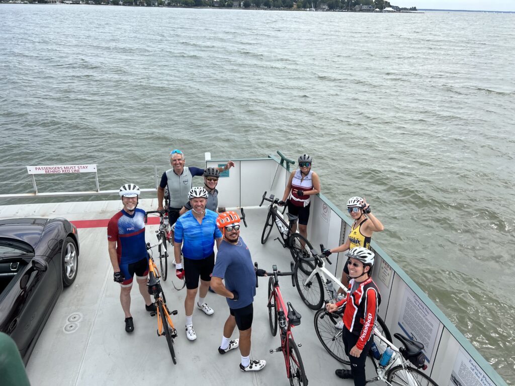
Easton has become one of my happy places, although it’s hard to beat a climb up Horseshoe Curve in Altoona. Every ride is better with a ferry ride and this makes it one of the best.
However, on August 7, I was riding with Tim, and we came to ride a Metric. When we came to the ferry, we found out it was closed. We headed back to Easton, up the Easton Parkway, then back to meet up where our planned route was.

Easton is just a great place to ride. This post isn’t about one ride but a general overview of an area. Going out to Tilghman’s Island is a nice ride. It is wide open in the sun and mostly on a wide shoulder with traffic. The Tour de Talbot route and what I modified is on mostly rural wooded roads. It is one of the most traffic-free areas I know to ride.

Recent Comments