Five Bridges

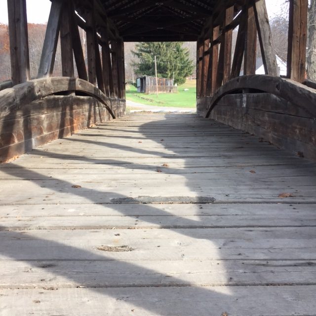
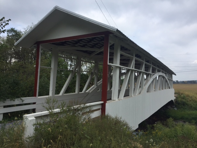
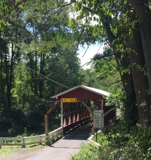
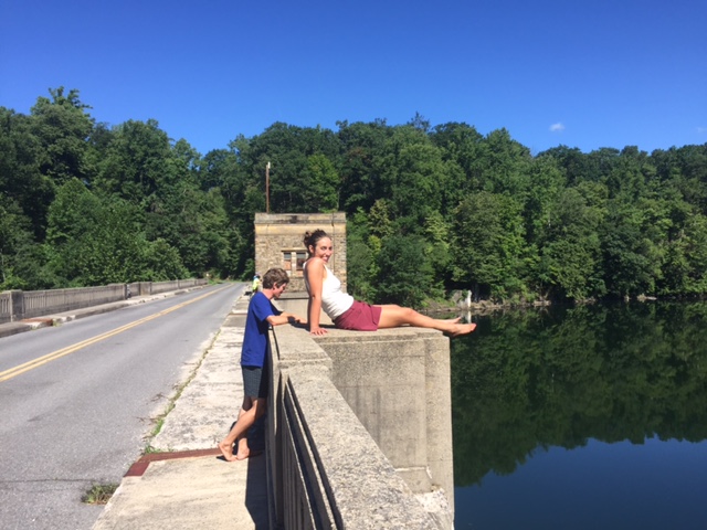
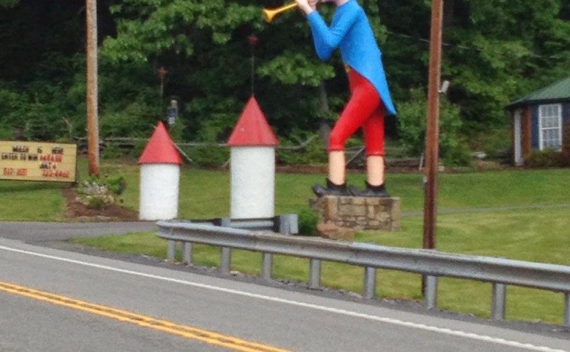
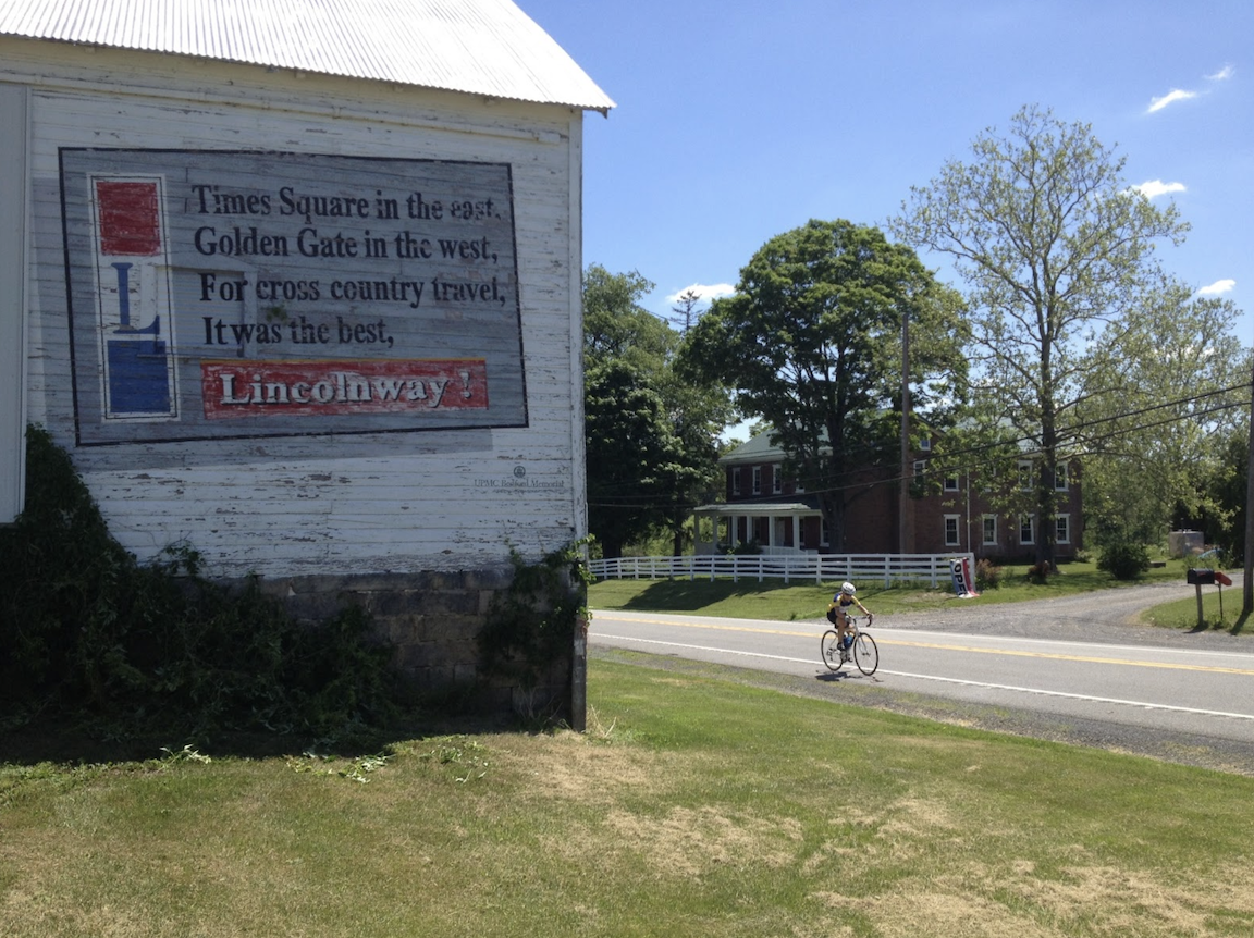
NEW PARIS, PENNSYLVANIA

A relatively short ride, just 21 miles, but so darn pretty. I was on my way home from Somerset to Virginia and wanted to get in a ride. Any ride.

Cuppetts Covered Bridge

My go-to covered bridge ride in Bedford County is an eight bridge loop but I didn’t have time for that. So I stopped in New Paris.

Cuppetts Covered Bridge

It was well past peak foliage season but still pretty. Upon leaving New Paris I was quickly on the closed Cuppetts Covered Bridge. It is weathered but none the less for the wear. Not sure who but it was also decorated for the Fall season.

Ryot Covered Bridge
Ryot Covered Bridge

Crossing the guardrail to get back on Rt 96 I followed it north. Just before starting out I saw a wide tractor coming. Rather than pull out in front and have him breath down my neck, I waited until he passed to take off.

Knisely Covered Bridge

Although he was a few hundred yards down the road I found myself catching him. We both turned to the Ryot Covered Bridge although he turned into a farm.

Snooks Covered Bridge

After the Ryot Bridge I turned onto the Dunning Creek Road and came to the Knisely Covered Bridge. One can walk through it but there is no road on the other end. One can ride but watch the floorboards.

Bowser Covered Bridge

Farther down the road is Snooks Covered Bridge. Once past that is the Bowser Covered Bridge. I left Bowser and followed a flat run in to the little village of Osterburg doing a small loop then retracing my ride.

The view on Covered Bridge Road

I had a tail wind going out and the dreaded head wind coming back. The temperature was in the low 60s and I wasn’t ready for much lower temperatures. But it was a gentle reminder that we were into Fall and Old Man Winter couldn’t be far behind.

Cuppetts Covered Bridge

But for today it was a peaceful day visiting Five Bridges.


Eight Bridges

SHELLSBURG, PENNSYLVANIA

This time I got it right.

With rain hanging in the air from Greensboro to Boston, I tried to find a window when it was dry enough to ride. In addition I was coordinating this ride with Rocky Sprow. We agreed on the start time of 12:30 p.m. and met at Shawnee State Park.

Rocky brought his friend, Ed, with him. The last time we rode together I had some girl strip naked in front of me and jump off a dam. I couldn’t promise anything quite as exciting as that today.

Herline Bridge - Longest bridge in Bedford County
Herline Bridge – Longest bridge in Bedford County

We headed out of Shawnee State Park towards Manns Choice. The roads were mostly dry but the sky was gray.  We found the Herline Bridge just five miles into our ride.

From Herline we went on Rte 31 and US Rte 30. We were on the shoulder on Rte 31 for 5.5 miles to the Jean Bonnet Tavern and another 1.5 miles on US 30. This was the sketchy part of the ride but best get it over in the first part. This is marked as Pa. Bike Route S – a major route across the state. But as I often say, “just because you slap a sign on it (designating it as a bike route) doesn’t make it safe.”

Claycomb Bridge
Claycomb Bridge at Old Bedford Village

We found the the Claycomb Bridge  at Old Bedford Village then followed Old 220 out of Bedford. From this second bridge to the third would be 11 miles – our longest stretch between bridges. Up ahead we could see rain on Blue Knob. It did not look like we would survive without getting rained on.

Bowsers Bridge
Bowsers Bridge

We went through Osterburg which was the location where I followed the Covered Bridge Route last time and missed four bridges. This time I stayed with what I knew was right.

Snooks Covered Bridge

The third bridge was Bowsers Covered Bridge and then it was only two miles farther to Snook’s Covered Bridge.

bedford_5

After Snook’s it was just another two miles to Knisley’s Covered Bridge. I rode through each bridge and this was the most challenging. The floor boards have large gaping cracks in them and I rode diagonally to avoid getting my wheel caught in one. But I rode it through it.

Kniseley Covered Bridge

In an area where drivers are usually very nice, we were on Dunnings Creek Road. A driver came up behind us and laid on her horn for about 30 seconds all the while she was passing out. Wow. A young lady too which blew away our stereotypes. May she have a better day than whatever it was that was disturbing her.

Ryot Covered Bridge
Ryot Covered Bridge

The Ryot Covered Bridge was just ahead, about 2.5 miles from Knisley. We survived less a little hearing.

Once onto Rt 96, yet another 2.5 miles just before entering New Paris (“Named for the Capitol of France”) we came to the Cuppett Covered Bridge. It is not open to traffic but one needs to just carry the bike over a guard rail and it has good flooring. I biked through it.

Cuppett Covered Bridge

So that was it. From Bridge 3 to 7, we saw five covered bridges in less than nine miles. We also had been trending uphill but one big hill was still to come.

There is a one mile climb from New Paris to Shellsburg. It probably averages 4% for the climb but the steeper sections seem to be in the 6-8% range. Rocky and Ed were on my wheel but I kept a good pace up, for me. Not sure what I was doing but I saw my heart rate in my red zone above 170. Usually only Mt Washington brings that out of me. Then it went over 180. I’m not sure I’ve recorded higher on a bike. But it felt good. And they were no longer on my wheel.

In July last year I went up with Chey Hillsgrove and Chelsea Johnson in more than 10:00. Today I did it in less than 6:00.

We descended to Shellsburg then went over to Colvin Covered Bridge. Then it was a turn towards home. We passed the Hillegass Camp. Rocky said he spent the summer of his 6th grade year here and learned to swim in Shawnee Lake.

Colvin Covered Bridge

Eight covered bridges in 43 miles. I could have added a ninth (Turner’s) by adding a couple more miles but it is down a heavy gravel road. This route was perfect. The sun came out. Perfect temperature, no rain, eight bridges not four, and good riding partners.


Half the Bridges

SHELLSBURG, PENNSYLVANIA

Shawnee Lake
Shawnee Lake Beach

It was a perfect day for riding – perhaps a little cool at 70 degrees and a cloud cover which would soon burn off. I parked at Shawnee State Park and thought I would ride a clockwise direction. As I exited the park I decided I would ride counter-clockwise, mainly to see most of the covered bridges towards the end of the ride instead of near the front.

Herline Bridge
Herline Bridge

Rte 96 to Rte 31 was lightly traveled. Once on Rte 31 was six miles of heavier traffic. There is a small shoulder which provides enough of a cushions.

Bedford13

The first bridge was the Herline Bridge. It is set back off Rte 31 about half mile away. The Herline Bridge is the longest covered bridge in Bedford County. It spans the Raystown Branch of the Juniata River.

Bedford14 Bedford15

At the intersection of Rte 31 and U.S. Rte 30 in the Jean Bonnet Tavern which dates back to 1779. I did not stop today although I have eaten there before.

Old Bedford Village
Old Bedford Village

After the merge on US 30 I had two miles of pretty sketchy traffic. Like Rte 31, there is a small shoulder most of the way but the traffic can be busy. It is marked as Pa. Bike Route S but is not bike friendly. Thankfully, there was only two miles before turning off in Wolfsburg.

Old Bedford Village
Old Bedford Village

I rode over to Business Rte 220 and rode to the entrance at Old Bedford Village. Here was bridge number 2. It also spans the Raystown Branch of the Juniata River.

Covered Bridge Route - A local Alleghenies Route
Covered Bridge Route – A local Alleghenies Route

Having visited two bridges in the first two miles I knew I was in for the ride portion. Or the slog portion, if you will. I followed Bus. 220 north. I was lightly traveled. Eventually it became William Penn Highway, again, lightly traveled.

Arriving Osterburg I knew the route I had mapped and had ridden before. But before I came to my turn I saw some arrows on the road marked for BBC (Blair Bicycle Club). It followed Bobs Creek and I decided to follow it thinking it would eventually take me to Bowser Bridge. It would not. I was following Bobs Creek downstream when I needed to follow it upstream.

Bedford22

I spotted a Bike Route sign for a covered bridge. I thought it would take me back to Bowser Bridge. Oh it did not. I’m not complaining. It took me across Sawmill and Hammond Hill Roads, beautiful roads I would never have ridden on my own.

I found out later that sign is for a 16 mile loop ride as part of cycling the Alleghenies.

But at Fishersville it took me UP Crissman Road which is a nasty climb that I was not expecting. As I summited the climb, I was in an apple orchard and thought for a moment I was at the orchard close to Shellsville. I know there is a climb there.

But I was rewarded with a mile and half descent. Pretty sweet. Reviewing the ride afterward, at the bottom if I would have made a right instead of a left turn I would have seen the Ryot Covered Bridge and may have ridden back for the Kinsley Bridge. But I wasn’t sure where I was and I knew south (left) was the direction I needed to head.

Cuppert Bridge
Cuppert Bridge
Cuppert Bridge
Cuppert Bridge

Actually I thought I was farther north than I was and was looking for the road to take me to Ryot Bridge. I was surprised when I found the Cuppett Bridge. It is not open to vehicle traffic – a good thing since there are guard rails at the Rte 96 end. But I was able to ride through it. This was bridge number 3 and spans Dunning Creek.

Cuppert Bridge
Cuppert Bridge

Leaving New Paris on Rte 96 I passed the road to Gravity Hill but it had very fresh oil for a new chip and seal surface. For cars. Not for this bike.

Vincent Van Gas
Vincent Van Gas

There is a one mile climb to an apple orchard which leads to a one mile descent to Shellsburg. In Shellsburg I stopped at the Vincent Van Gas pump. This was Rte 30 art commissioned by the Pennsylvania 250 celebration in 2008. The paint is starting to weather on the left (west) side.

Colvin Bridge
Colvin Bridge

I followed Mill Road to the Colvin Bridge. This was bridge number 4 and spans Shawnee Branch.

Colvin Bridge
Colvin Bridge

Bedford33

Shortly thereafter I was supposed to turn left. But there is no road there. Oh Google (Maps) – you’re such a kidder. I will have to have that updated.

I enjoy making “courses” and uploading those to the Garmin. Today I discovered a neat feature – “Distance to Destination.” It was neat watching the countdown except that when I went “off course” by not turning on a non-existent road it was stuck as 3.00 miles until I came back on course.

Skip Back Road
Skip Back Road

In the end I hoped to ride eight bridges. I just got half the bridges. But I learned quite a bit about the roads – which to take and which to avoid. And that’s always a good lesson.

Shawnee Lake
Shawnee Lake


Extreme Skinny Dipping

BEDFORD, PENNSYLVANIA

I met Rocky Sprow and his friend, Ed, at Fort Bedford. It was a beautiful morning.

Bedford Springs
Bedford Springs

We rolled out past Bedford Springs. It is a beautiful property with a nice golf course. We followed country roads for more than 20 miles to Lake Koon and Lake Gordon.

Bedford Springs
Bedford Springs

When we came to the spillway at the dam we stopped to view the lake on one side (Lake Koon) and the spillway on the other (empties into Lake Gordon). I met a young couple and had a conversation with them.

In a few minutes these kids would get naked and jump!

The young woman surprised me by jumping up on the top of the railing overlooking the lake. I went over to take a picture because I told her I thought “she was nuts.” We talked for a few minutes looking down at the water. I thought the distance looked similar to jumping into the River Aare in Bern, Switzerland.

Lake Koon
Lake Koon

The couple had been getting ready to jump and we weren’t leaving. I was enjoying talking to them about jumping at that time in Switzerland that I jumped. Finally, the young man somewhat impatiently said to me “well, we were getting ready to jump naked into the lake once you leave.” And I said, “we don’t mind if you jump.” And they did. They stripped quickly, dropped their clothes on the dam roadway, and jumped. Total time from standing to jumping was about two seconds.

Bedford_7
Rocky Sprow and Barry Sherry

Once they surfaced I yelled down to them and asked if they wanted their clothes taken down to the lake. They said they did so I gathered up their clothes and took them lakeside. They were still (hiding) in the water so I got their attention and showed them where I left them. I also noticed a pair of shorts were near the end of the dam. I think the young man probably left a pair there and when they were done, he would walk up, grab the shorts, then go retrieve their clothes in the middle of the dam. So glad I could help!

We remounted then followed the road another couple of miles until it dipped into Maryland at U.S. Rte 220. We were in Maryland for just two miles. We made a loop then hooked up with our original route to follow it back to Bedford.

We crossed the dam again and saw no evidence of our naked dam jumpers. We continued on.

The route back was a bit punchy on the way back. I secretly decided to win every KOM from my friends. I think I did (of course it helps if they don’t know what I’m doing to them).

Bedford Springs Old Course

Back to Bedford, it was a great day. Of course, not every day do two young people strip naked in front of you and jump off a dam. Stay classy Bedford, stay classy.


A day of bridges was wonderful. The rain, not so much, but mountains tomorrow!

Ligonier the Long Way

LIGONIER, PENNSYLVANIA

I suggested to (encouraged, begged) Team Portland that the best cycling route from Bedford to Ligonier would be US 30. That route is less than 48 miles with 5,000′ of climb. I was eating breakfast with my parents when Aaron Hoxworth texted me and told me they were already wheels down and headed for Rte 31 and not Rte 30.

Abandoned Storyland

Out the door I got a boost from my dad as we drove to the end of Longview or the Seven Mile Stretch on US 30 and began my day. It was chilly with some rain in the air. I headed down the mountain to Shellsburg, stopping to take pictures along the way. I rode through Shawnee State Park and got on the road behind the cyclists at first catching four girls, er, young women.

Shawnee State Park

Approaching New Baltimore they at first continued straight on 31. I saw the chalk on the road for a turn and called them back. It wouldn’t have been a disaster had I not been with them. Pa. Bike Rte S leaves Rte 31 for a bit but does come back into it. They would have had much of their climbing on the busy Rte 31. But if they had a check point in New Baltimore they wouldn’t have passed it.

It’s about one mile farther to follow the bike route (8 vs 7) up the mountain but the difference is enormous. Rte 31 is a busy road which climbs and descends at the same time. It kicks your butt. The bike route, once the climb begins, continues climbing. It is 7.6 miles with 979′ of gain (2.4%) to where the routes intersect (not the top of the mountain). Rte 31 (Glades Pike) is 6.7 miles with 1273′ of gain (3.6%). Harder, for sure. It rides much steeper, of course. The climbing portion of the bike route is 4.6 miles (797 or 3.3%) which is still easier. And to the top it is 6 miles at 1340′ (4.2%) but there are sections of 10-12%.

 Kelsey Taylor, Patrica Martinez, Helen Smith, Katrina Farrell

In New Baltimore I called them back to a covered bridge which they missed. Slow down. Take pictures. Enjoy the ride.

Kelsey Taylor

Katrina Farrell had flatted at the base of the climb and the support van swung back. While they were changing the flat (unlike Sunday and yesterday I didn’t help preferring that they gain the experience) I was talking to Chelsea Johnson, one of  the support drivers. I asked for turn by turn directions for the day and after Somerset was told they were headed somewhere (my term) connecting with a Pennsylvania Trail System to Linn Run State Park.

Patricia Martinez

That was neat except it wasn’t. In the early 70s we lived on Linn Run Road. I know the lower section in Rector, Pa. to be good, the section in the state park to be paved but bad (rough pave), and the section above it to be dirt and gravel. Further, I was 99% sure that any trail system was for snowmobiles. Or hunting and hiking. Maybe mountain bikes could get through.

Katrina Farrell
 A slight panic set in as Chelsea asked “what do we do now?” I knew nothing more to tell them to do except ride and see what happens. I decided I would ride to Somerset then back to Friedens and call it a day. I didn’t want to climb and descend on the route I envisioned – a route to nowhere.

Rte 31 was busy with lots of truck traffic. It is the route between two turnpike towns, Bedford and Somerset. Rte 30 has some truck traffic but much less. Rte 31, although signed as Bike Rte S was not an enjoyable ride.

PA Rte 31

Up ahead, the group containing Jamie Roberts, Ki Young Kim, and Dan Johnson had stopped for a rider who needed sagged. She was hurting and openly wrote on her blog that she did no preparation for the ride, in fact, her longest ride ever before Sunday was 12 miles. Be forewarned. I shook my head. Why an organization would simply take someone’s money without ensuring they met training metrics is almost beyond me. Almost.

Our group stopped with them for a necessary hygiene break. But when Jamie’s group, down to three riders, was ready to roll and the four young women I was riding with weren’t — they were enjoying the grass and the shade of the barn they were relaxing next to — I went with the first three.

Jamie Roberts, Betsy Sherry, Ki Young Kim, Dan Johnson

We passed Aaron’s group (flat) and rolled towards Somerset. As we descended into town I had us stop at my sister, Betsy’s, house. I thought we would do a quick photo op outside the house thinking Betsy would not be home but she had just gotten home. She welcomed Jamie inside and Jamie got clean indoor plumbing and ice in her water bottles. We stood in the yard and got to watch the other teams go by. As we rolled out, in last, we all met at Sheetz. My advice had been “never pass up a Sheetz.”

Jamie Roberts, Ki Young Kim, Barry Sherry, Dan Johnson

While at Sheetz the riders’ phones blew up with a group message which basically stated the van went ahead and that there was no road or trail system which the riders had planned on. Ah, Google Maps.

Aaron turned to me and asked if I knew how to get them to Ligonier? Although I had decided to stop in Somerset I thought it best to ride with them to Ligonier.

We went up Rte 985 where miles of construction work was taking place. Although we had been split into groups, we came back together at the work site. I had everyone roll out together as I took them around some of the construction using known back roads. Back on 985 we started to separate so we stopped once more to reconstitute. At this point I told the riders I was going to navigate a little by memory and a lot by feel. We turned left into an unincorporated community (Gray) and made our way over to Rte 30.

One rider was struggling and so we were missing two at this point. From our vantage point, we could see the next turn about 1/2 mile ahead in the valley below. I gave Aaron the simple directions (“turn right then follow the road”) and I dropped back while sending the other 10 riders ahead with Aaron.

I met up with Caitlyn Epps who was sagging the struggling rider. We lost a lot of time waiting and I was convinced that by the time I got to US 30 all the riders would be at the summit. Or over the top. I was surprised that as I climbed I caught and passed five riders. I think a lot of riders were beat up by then riding three days in the mountains.

At the summit I led the first group of four down the mountain. I averaged 37.5 mph for the entire descent. I need to up that. In Laughlingtown riders kept coming so we formed a big group and rolled into Ligonier together.


The Diamond in Ligonier

It was a hard day but didn’t need to be so hard. Rte 30 may not look so appealing but in addition to being much shorter, it is full of wonderful things to be discovered. Flight 93 memorial. A 1930s gas pump painted like the Indiana Chief Tecumseh. Another as Vincent Van Gas. The Pied Piper. My mind went to how this could be a scavenger hunt and 20 miles shorter.


Abandoned Turnpike

BREEZEWOOD, PENNSYLVANIA

I told the 4K for Cancer Team Portland team that I would probably meet them on the abandoned Pennsylvania Turnpike. I think I told them that.

I drove to Bedford then biked on US 30 to Breezewood. I did this, in part, to see if it was scarier than hell. It wasn’t although getting through Breezewood was no treat. Curb to curb and uphill, I chose to go in and out of service stations and then wait for traffic to break before riding on ahead.

The western entrance to Pike 2 Bike is just over the first rise on US 30. There is a small sign marking the entrance and a trail that leads to the turnpike.

Western (Breezewood) entrance to Pike 2 Bike
Right up that dirt path

Once on the turnpike one is on 50 year-old (at least) pavement. It’s all ridable but some sections are better than others. I came to the first tunnel and felt the cold air coming from the entrance about 100 yards away. Once I entered I thought my headlight wasn’t bright enough. And it is spooky in there if not downright scary.


I thought any moment I would meet the 4K as I was running late. I came to the second tunnel and still no signs of the 4K. This tunnel was much longer than the first. It took a while to be able to see the light at the end of the tunnel (literal).


At the end of the tunnel and still no 4K, I went to the end of the turnpike. Nothing. This was my first time at the western end. There are no signs or markings to show where this begins. Just a driveway. Actually, 100 yards away is a driveway with a sign stating private but that trail is 100 yards away.

Western Entrance to Private Drive
Actual entrance which looks similar is 100 yards south

I tried to call Mary Natoli, a rider on the 2013 ride and alum who helped this group on Sunday, to see if she had anyone’s contact information. Getting no answer, I started to look up the 4K office to see if they had contact info when the 4K van pulled up followed seconds later by 3-4, then 7-8, then 15-18 riders.

Source: Joanna Wang
Runfastandeatlots.blogspot.com

I asked them how their ride had been and they said very hard. They had been on miles of gravel and I asked who’s cue sheet did they use. One they made. Oh kids, don’t deviate from my maps. Sigh.

Source: Joanna Wang
Runfastandeatlots.blogspot.com

We came to the first tunnel and too many riders climbed to the top of the tunnel. It was hard to watch. I have the fully developed risk gene – they don’t.

We rode out together to Breezewood. I gave them my three rules for riding in (western) Pennsylvania.

  • Always stop at Sheetz
  • Know that Pennsylvania has a 4 foot law (passing)
  • No motorist knows about it

We were only about three miles from the end of the turnpike trail and Aaron said the team reported from the support van that it was raining very hard at the end. And we weren’t in it. That would end. It really was raining hard at the end.

I rode with Aaron Hoxworth, Helen Smith, Jamie Roberts, and Jocelyn Godlberg to Sheetz in Breezewood. After a restroom break, we rolled out, still in the rain. A car pulled up, rolled down the windows and the driver yelled “Go 4K Team Portland! Our son is with Team San Francisco.” They had Iowa plates. (They were the parents of Jeffrey Robson.)

Jocelyn, Aaron, Helen, Jamie
My 4K Teammates for the Day

Crossing the Juniata River we ran out of the rain. And we had a flat. I was riding with Aaron and Helen, having passed Jocelyn and Jamie on the descent over the river. Then I noticed we were missing the two girls. I doubled back and found Jamie and Jocelyn changing a tire.

When I arrived I used my tube and changed Jamie’s flat because tubes are precious commodities to riders on the 4K. Either that because I was so impressed she knew how to pronounce Juniata. She also told me she liked coming up here, Juniata College in Huntingdon, Pa., and described in detail eating at Panera in Altoona. Panera was where I took my friends on my first recovery ride after cancer and it holds a special place for me.

Jamie was conscious not to leave any waste behind. Rather than try to put her tube back in my bag, she wore it around her neck. I told her up ahead about 1/2 mile was a “trading post” which surely would have an outdoor trash can. We rode there and she offloaded her spent tube. Then the five of us rolled on into Bedford where I said goodbye for the night knowing I’d ride the next day with them.

Bedford, Pa.

Ligonier. Almost.

LIGONIER, PENNSYLVANIA

With apologies to Joanna Freeman for borrowing her blog title, Made it to Ligonier (Almost).

This was the day that I really looked forward to. I was meeting a cancer group, Team Portland, and escorting them from Bedford to Ligonier. It was a cold 43 degrees as I rode out of my parents’ house in Friedens for the ride over the mountain to Bedford to meet the 4K.

Out of the box I hit the mile and a half climb on Pompey Hill Road and its 18% grade. Damn it. My legs weren’t ready for that shock. But once that was over it was a matter of getting on US 30 and making my way, mostly down, to Bedford.

I joined the group at the Cannondale plant tour, already in progress. It took me just a few minutes to ask someone if this was a plant or a museum as the guide kept explaining how they used to make bikes there. They still do – just not as many. And it missed how much of the work is now outsourced.

New Cannondale Bikes in Bedford

Although the planned route was listed as 62 miles, I knew with two major climbs it would be a long day. I had hoped to go around the first small climb that goes to Schellsburg on US 30 by going to Manns Choice on PA 31 and over the lake at Shawnee State Park. It would add three miles but avoid the nasty climb. Instead, we did the nasty climb and stayed on 30.

We were joined for the first five miles by some employees from the Cannondale plant. See, they don’t make as much there as they used to, above. It was great having them ride with us.

After leaving Schellsburg and passing the Buffalo farm, it is a six mile climb up Allegheny Mountain. Four miles up we stopped at Lookout Point. I told anyone who listened that there used to be a “Ship Hotel” here years ago. It was hard to explain.

As we rolled out for the final two miles I was delighted that we passed the only building on the route, an antiques barn, and it had a painting of the ship hotel. You don’t see those things when you fly by in a car.

Joanna Freeman

After summiting the climb we continue on the stretch of road known as Seven Mile Stretch or Longview. At the end we descended to the Flight 93 Memorial. I had arranged a visit with the National Park Service on a tight schedule and was a little nervous when only one group entered the park. I rode back up the hill to Longview and saw more riders on the side of the road. At first it appeared they were taking a break. I was not happy as we needed to move the group along. But then I saw they were talking to someone and that made me smile.

On some day schedules, and speed, are important, but the mission is talking with people. And they had met a woman from the Flight 93 Memorial Garden. In fact, after they left I stayed and talked some more.
Eventually we gathered all the riders and the Park Service let us out a back gate onto Buckstown Road. Hoping to make time I also routed the group over a small road called Covered Bridge Road.
Call it my screw up because my local intel failed to mention it was a gravel road and I hadn’t pre-ridden it. And it would get worse.
Gobblers Knob road was also gravel but it was actually closed. The temporary road had heavy gravel on it. We only had 200-300 yards and I powered through it but most riders walked it.

We got through Friedens and over to Beulah Church where Pattie and Margaret Cramer served a full picnic “lunch” even though it was 5:00 p.m. After dinner the team leaders knew some riders could not make the final climb. Some were unsure and some certainly could. But the leaders wanted to have a team meeting as it was only Day 3 and they yet to do that. They decided to shuttle all the riders to Ligonier.

I would take anyone who wanted to go with me, and some did, but the team was all for one and one for all. I went on solo.

I stopped for pictures and kept thinking they would pass me. It was only between Laughlintown and Ligonier that they passed me and I soon arrived in Ligonier as they were unloading their first group.

I had almost 90 miles on the bike while my friends had 40. I got the bragging rights.

Bike the Pike

BREEZEWOOD, PENNSYLVANIA

Since last year I have been intrigued by the route the 4K for Cancer Team Portland took from Waynesboro, Pa. to Breezewood. Before this year’s departure I contacted Team Portland and suggested I could help. They believed me.

I designed a ride that would keep them off US Rte 30 and got them over to the abandoned section of the Pennsylvania Turnpike. I had hoped to be packed for Ride the Rockies earlier in the day then drive to Ligonier and leave my car while I biked to Somerset in preparation for meeting the 4K in Bedford tomorrow.

My planning did not work out so I was very late getting on the road. But that gave me an opportunity to meet the 4K Team Portland. When I contacted Daniel Gray and he told me they were near Houstontown, Pa. I knew I could get to Breezewood and ride backward and meet them.

Yes, this is the Pike 2 Bike Entrance

I had never been on the abandoned pike. Although I found the entrance, I mistakenly went down the wrong road before realizing there must be a path to the pike. And there was.

Climbing the path I came to the pike. Ten miles of abandoned turnpike. Two tunnels (very dark — need lights). I rode through the first tunnel and was most of the way to the second tunnel when I came across the 4K coming in my direction. 

Abandoned Pike

I kept going to the second tunnel when I met the last four riders of the 4K. We then explored the tunnel’s maintenance section before riding on through.

Looking out window in Maintenance Room in Tunnel

Once back on the road I followed the 4K on the Pa. Bike Route S between Breezewood and Everett. Although it is about the same distance as US 30, it has some very nasty climbs. I knew the section between Everett and Bedford was the same. 

4K Riders on the Pike
Sarah Robbins

I was able to convince all the riders I found to skip the last bike route section from Everett to Bedford and just ride on Route 30. They did. The US 30 route was two and one half miles shorter than the Pa. Bike Rte S route. Until I mapped both, I thought the bike route had a lot more climbing. It does but spread out over the longer distance it’s about the same gain per mile. Route 30 has one long grade whereas the back roads features a lot of ups and downs. At least I saved them 2 1/2 miles.

Photo Credit: Joanna Freeman

Tour of Pennsylvania

BEDFORD, PENNSYLVANIA

Officially, “The American Eagle Outfitters’ Tour of Pennsylvania presented by Highmark Healthy High 5.”

This was the first in hopefully what is the start of an annual event. The Tour of Pennsylvania. It joins the Tours of California, Georgia, and Missouri but was unique in that it was for Espoir riders, those elite international professionals ages 19-24. With $150,000 in prize money, it was believed to be the largest purse in the world for young riders. But it was a signature event for Pittsburgh 250, a commission to celebrate Pittsburgh’s 250th anniversary in 2008. Much of the sponsor money came from this budget and it also helped celebrate the 250th anniversaries of Bedford, Latrobe, and Ligonier thus they all played prominent roles in hosting the tour.

The race started on Tuesday in Philadelphia with a prologue time trial and criterium. On Wednesday it was a road race from Downingtown to Carlisle. On Thursday it was a stage race from Camp Hill to Bedford.

Friday’s race was from Bedford to Latrobe on U.S. Rte 30. This is a road I have traversed many times. While “only” 60 miles (95.76 km), this was predicted to be the stage to break open the race because of its two large mountain climbs. The first was out of Shellsburg up Bald Knob to the top of “Seven Mile Stretch.” As a kid, I remembered this route for the “Ship Hotel” which was a hotel built on the side of the mountain. It is only a memory now because after it closed and before it could be preserved, it burned to the ground in 2001. Arsonists surely.

I volunteered to be a course marshal in Bedford. I left the house at 5:30 a.m. for the three-hour drive to Bedford. Check-in time for volunteers was 9:00 a.m.

We had our orientation and I tried to decipher what the tour would really be about. I had followed the results on the Internet but the television coverage on Versus was a day behind and spotty at best. I had only seen the time trials.

I was especially curious if the cyclists had the entire road to themselves or just one lane westward. Answer: the entire road.

Our volunteer coordinator was Dave “Lumpy” Williams. He explained how good the Pennsylvania State Police were at sealing the highway to oncoming traffic. The front part of the caravan was all policemen and they forced any oncoming traffic to pull over and wait until the race passed. Our job was to be at intersections and make sure that vehicles did not enter the race course once the race was underway.

Lumpy was a very likable guy. When he talked about the race and used its proper name, he always ended with “presented by Highmark Health High-5” then did an “air” High-5. It never got old.

I volunteered to be as far out of town as I could get. Nothing against Bedford but some of the locals wanted to stay in town and I had my bike with me and wanted to ride. The positions were mostly for Bedford so Lumpy gave me the most distant one he had. I rode out to the intersection of Old U.S. 30 with U.S. 30.

Our job was also to be part ambassador. This was a role I was well suited for. Rather than tell a local they couldn’t use “their” road until the race passed, we could talk up the race and explain what it was all about. I met two families who had come out to the end of the street and I chatted with them the entire time.

On U.S. 30, two miles west of Schellsburg at the “Buffalo Farm”

As soon as the race passed my course marshal location, I rode back into town where I had parked then got on the Pennsylvania Turnpike and went to Somerset. I then tried to get to Jennerstown as quickly as possible and almost lost. I was relieved that when I got to Jennerstown the caravan wasn’t there yet but make no mistake about it, these boys fly. Even climbing Bald Knob then Laurel Mountain, and some major hills in between, they would average more than 24 mph on this stage.

At the start of the day I had hoped that I would be assigned near the top of a mountain where one can see the cyclists going a bit slower. But the traveling road marshals were to be dropped off at the more remote locations including Laurel Summit, so I thought.

It was bright and sunny in Bedford when I left. Not so at the summit. It was chilly with light rain but mostly just chilly. The riders probably loved it while climbing, not so descending and I don’t think anyone had newspapers to hand to the riders to stuff in their jerseys for the cold descent to Ligonier.

When I arrived at the Laurel Hill summit parking was hard to find. There weren’t a lot of fans on the mountain, maybe 50-75, but enough had come out to cheer on the riders. There were even some cyclists who rode there, from Ligonier perhaps.

I found a couple of officials manning the KOM (King of the Mountains) point. I introduced myself as a volunteer. I was wearing my official American Outfitters Tour of Pa. staff shirt. The official told me I wasn’t needed there to help so I could go ahead and simple spectate.

And I did. The first riders, a group of 13 came over the summit to the delight of the crowd. But then three cars slipped into the race from the ski resort. The State Police quickly moved to remove them from the course and I quickly moved to seal off Laurel Summit Road from any other cars. I think it was supposed to be manned by a traveling marshal who just didn’t make it up the mountain in time. No other cars got on to the course.

Cresting Laurel Hill (Mountain)

The peloton was about 18 minutes down. That was a sizable gap. Once they cleared the crowd dispersed. And I followed. I had hoped they would have two-laned the eastbound lanes of Rte 30 between Ligonier and Latrobe and I would have a chance to pass the peloton before they reached the finish. No chance. As it was, I drove down the mountain but still didn’t catch the rear of the race until Kingston Dam at Latrobe. In fact, I never saw the race convoy, just lots of cars traveling 25 mph. Done for the day, I went back to Ligonier to go riding.


Stage 4: Bedford to Latrobe (Friday, June 27, 2008)
(Start time: 10 a.m.) This 60-mile stage will push the riders to their limits with the most elevation gain and the hardest of all climbs in the event. After departing the town of Bedford, the roll will be easy for only 15 miles before turning upward for a difficult climb to Bald Knob Summit, the first KOM for the day. Bald Knob Summit is a 5.5-mile climb with grades of 10% to15 % and will surely decide the day’s top climbers, as they make their way up and over the Allegheny Mountains. After a slight rolling descent, the riders will again go uphill and crest the Laurel Hill Summit at mile 40 for the second KOM of the day. This 2-mile climb is shorter but with a very intense mountain pass that will also see grades of 15%. The descent into the last leg of the day will be fast, but will also have a flat section, rolling through Ligonier and following the river into Latrobe with a tricky sprint finish in the downtown area. This day is likely to be the hardest stage and will certainly separate the field, revealing who the potential leaders will be for the week.


I parked in Ligonier and first rode out U.S. 30 east towards Laughlintown, passing Ligonier Beach, the massive swimming pool next to the Loyalhanna Creek. It’s as pretty as it was when we lived there 40 years ago and even then it was 40 years old.

I came to State Route 381 and turned down the tree-lined road to Rector. It is bordered on both sides by post and rail fence, most of it belonging to Rolling Rock Farms and perhaps still, the Mellon Family. When we lived in Rector in the late 1960s, Richard King Mellon also lived here. It is here where they have the Rolling Rock Hunt.

Once in Rector, I rode up Old Linn Run Road as far as Devil’s Hole. Devil’s Hole is hard to find if you don’t know where to look. For years it had been a public swimming hole and sometimes people would drive from miles around to swim there. It was fed by a mountain stream and the water was always cold. In the late 60s and early 70s we helped to dam it every spring.

A large rock across the steam was the one that we would dive from. The water naturally in the pool area was about 3-4 feet deep. But each spring the locals would lift rocks and build a dam just downstream, often reinforcing it with plastic. Once it was dammed another 3 feet or so high the water in the middle was easily 6 feet deep. We sometimes would swim for hours and always our lips would be blue and our teeth would be chattering.

But a number of years ago the property owners, probably wisely, posted it with No Trespassing signs. In this day and age of lawsuits, who could blame them? The approach has been built up with a mound of dirt and had been grown in.

Linn Run Road used to connect all the way to Valley School of Ligonier but that too (the road, not the school) has been closed and probably has reverted to forest.

I turned and went back to the only intersection in Rector. I then passed the United Methodist Church and parsonage which is where we lived until 1971. I took Weaver Mill Road in front of the house to the top of the hill. It is short but steep. I remember getting my first 5-speed, one of those banana seat bikes with high handlebars. I was so proud the first time I was able to bike all the way up to the top of this hill. It was a little easier with the Trek Pilot 40 years later. Or I’m a little stronger.

I turned on Byers Lane and went over to Linn Run Road. I took Linn Run Road up to Linn Run State Park, but only as far as the Adams Falls area. Two things struck me about my ride up to the park. First how good of shape Linn Run Road was in. I never remember pavement this good on this road. And it wasn’t just my carbon fiber bike that does deliver a nice ride. The second was how bad the road was. Once I reached the state park the road deteriorated quickly. Had the road been in good shape I would have ridden much deeper into the park. But instead, I turned around for the nice descent back to Rector.

Once back to Rector Green I took Darlington Road which would take me up to Rte 711. This is an extremely steep hill which we would avoid in the winter when there was snow on the road. I wondered how steep it was and whether I could make it. Answer: Steep and yes. *
But I pedaled on up the mile hill without difficulty. I turned on 711 and took the road back to Ligonier. Before I reached the town, I turned on Peters Road which cuts over to Rte 30. It also cuts through Laurel Valley Golf Club one of the premier private golf courses in the world.

When I returned to Ligonier I hadn’t yet pedaled for 20 miles so I went down around the high school, the school I attended in 10th grade in 1970-1971. I cut through the parking lot and ended up on Carey School Road. It is a short climb, maybe 1/4 mile, but pretty steep. On my descent, I went 45 mph.


As far as the race:

Canadian David Veilleux (Kelly Benefit Strategies-Medifast) proved to be the fastest on Stage 4, taking a convincing victory ahead of new race leader Christoff Van Heerden (Konica Minolta) and Dutchman Dennis Luyt (Global Cycling). The peloton endured a soaking wet stage, with the sun only coming out at the finish line in Latrobe, where spectators gathered to watch the tricky sprint finale in the downtown area.

“There is less than a second between us and so I think tomorrow is going to decide everything,” said the French-Canadian stage winner Veilleux. “It was really hard today, constantly up and down even between the two KOM’s. The goal today was to stay with the climbers.

“My team has been riding great this week and I am looking forward to the next couple of stages,” he added.

The relatively short stage was also considered the toughest of the race. The fourth stage, under 100 kilometres in length, was intended to further open the time gaps between the top GC riders. While the terrain did separate the field, the top overall contenders are still only separated by one second each.

In the end Stage 4 left Van Heerden as the new overall race leader. The South African leads the race overall just one second ahead of Veilleux and American Stefano Barberi (Z Team).

Notes: The course was U.S. Rte 30 from Bedford to Latrobe
Won how: 12-man bunch sprint
Profile created by Barry Sherry (unofficial)
Credit: ProCyclingStats.com

Credit: VeloNews: 18 Oct 2012

EPILOGUE: David “Lumpy” Williams died of a heart attack Tuesday, October 16, 2012, in San Rafael, California, at age 61.

Verified by MonsterInsights