Cumberland by Dust

CUMBERLAND, MARYLAND

Fifteen years ago I was all about riding these great rail trails. They are still fun, for a change, but not generally my preferred riding.

Cumberland_08
Canal Place, Cumberland, Md.

The last time I was here with a bike the trail wasn’t open from Cumberland to Frostburg. Andrew and I took the train, the Western Maryland Scenic Railway, and put our bikes on the train. And that was cool.

But the rail trail has been open for years now. It is one of a handful in the country where a rail trail shares the right of way with an active railroad. Plus it also shares a tunnel.

I started at Mile 0 at Canal Place where the Great Allegheny Passage (GAP) and the C&O Canal Towpath meet. From here is it 184 miles to Washington, D.C. and 150 miles to Pittsburgh.

Cumberland_05

The first two and one half miles are paved. I brought the mountain bike and was starting to wonder if this is now a paved route. (It should be.) The pavement ends once one reaches the bridge at the Narrows.

Cumberland_04

The trail opens up, following the Western Maryland Scenic Railroad. Before 1975 this was a two track right of way. Today it is one track for the train and a crushed limestone path for bikes. And walkers.

Cumberland_15

At Mile 5.5 (I think) I came to the Brush Tunnel. I believe this was the big hang up in completing the trail from Cumberland to Frostburg. The lawyers for the railroad didn’t want anyone close to the tracks, especially in a tunnel. In the end, the tracks and trail both go through the tunnel, separated by a cable guard rail. And a warning sign not to be in the tunnel when a train approaches.

Cumberland_01

Although this was my first time on a bike, I have been up this trail before. Almost two years ago we took, Andy, Aiden, and Annabelle on a steam train ride up to Frostburg. And years earlier Andrew and I took our bikes up to Frostburg on the train.

Cumberland_16

The train had too much crushed limestone for my liking. Snap. Crackle. Pop. Every revolution sounded like Rice Krispies. And the dust was something else. My bike was covered in dust as was the water bottle.

Cumberland_20

About two miles from Frostburg the train tracks turn up towards the town and station while the “main line” continues straight. When I reached the Frostburg I was planning to turn around. But I checked the map and saw the Borden Tunnel was only a couple miles up the road. That was my new goal.

Cumberland_19

After reaching the Borden Tunnel I kept going. How far was the Mason Dixon line? A new goal.

Cumberland_02

I reached the Mason Dixon line. It is now a small park instead of just a sign which it was the last time I had been through here on my bike four years ago. Then I turned around.

Cumberland_18
Mason Dixon Line

At Frostburg I took the road up to the train station. There wasn’t much happening because the train has been closed since spring due to a landslide above two miles east of here. So no trains make it to Frostburg.

Cumberland_17
Near the site of the landslide closing the train

Back on the trail I was just shaking the lactic acid from my legs and adjusting my Garmin on my bike. A couple passed me. That shouldn’t have happened. Didn’t they see I was merely adjusting things and then going to ride?

Cumberland_13

I decided I would pass them back and they would never see me again. I did and they didn’t. I took off and rode @ 20 mph for most of the next hour. On limestone. On a mountain bike. It was a dusty day but otherwise very pleasing day on the bike.


My First Bike Ride With Dad

FROSTBURG, MARYLAND

I bike. My dad bikes. (Badly)  His bike riding is the subject of many jokes, all behind his back, of course.

I learned to ride a bike in our backyard in New Salem, (Armstrong Co.) Pa. when I was 6 or 7 years old. I never remember riding a bike with my dad.

Big Savage Tunnel

As a dad, I rode with all my kids, even subjecting Andrew to two days of a planned D.C. to Pittsburgh ride on the last day he was 12 years old. But I never remember riding a bike with my dad. I don’t think I did.

We grew up below the poverty level. The two bikes we had were bought by my brother and me. Bernie actually sold magazine subscriptions enough to get a bike. I was a paperboy for the Piqua Daily Call. When I got enough money I bought a bike. We never had bikes for a family ride.

In Piqua, Ohio, my brother, Bernie, and I would ride together to the Piqua Country Club where we were caddies. We even somehow managed to ride to the public golf course, Echo Hills, with golf clubs on our backs. I was 12 years old. But I never remember riding a bike with my dad.

My dad pulling off the trail

A few weeks ago I mentioned to my dad about going for a ride on the Great Allegheny Passage, a rail trail that goes from Cumberland, Maryland to McKeesport, Pennsylvania, and soon connecting to Pittsburgh.  A large portion is in Somerset Co., Pa.

My dad expressed desire at going but said that he could never keep up with me. I told him not to worry about that.

Inside the Borden Tunnel

Although Dad had complained of back pain, he assured me that riding a bike would be no problem. After all, he rode 1.5 miles on the stationary bike in the doctor’s office, he reminded me. So we made a plan to ride on the trail. We would park cars strategically so he would only have to ride one way. And I would make it downhill. I thought.

Artwork at the Eastern Continental Divide

Our plan was to ride east to west going through two tunnels and crossing the eastern continental divide. My sister, Betsy, would join us as well. There was one thing wrong with that plan. Other than the section from Cumberland to Frostburg, the Frostburg to Deal section had the highest climbing of any section on the trail. We would ge going uphill. Damn me.

Arriving in Frostburg, I was shocked at how heavy his bike was as I unloaded it from my van. Dad had better bikes but at least one was stolen from his R.V. while my parents were camping in York, Pa. He ended up finding this old heavyweight bike at a garage sale. It had the one requirement he wanted – coaster brakes.

My Dad’s Beater Bike

I love climbing. I am more enthusiastic than talented yet the satisfaction of reaching the top is, well, satisfying. My dad is not a climber. Although the rail trail is just a 1-2% railroad grade it’s not like we’re ascending Mount Washington and its average 12% grade. But to my dad it was.

We had gone but 300 yards and my dad says “I think I’ll walk now.” I can’t describe how I felt. I was annoyed that I drove up this weekend and we rode all of 300 yards and he was walking. I was annoyed at myself for starting here. In fairness, this was one the one section of the trail that wasn’t true to its railroad past and did climb up to 4% or so for 100 yards.

Dad enjoyng the view

Once over the hump we settled into a pattern of riding for about 1/2 mile and then resting It was sort of funny. Sort of.

I do not know how I will be at 82 years old. Or if I will be. I don’t appreciate how the cardiovascular system works and how it may not replenish the red blood cells as fast. I do know that we didn’t see any other octogenarians on the trail.

Entering the Big Savage Tunnel

The trail was full of wildlife. Five turtles, four snakes, (including one rattlesnake), three rabbits, two chipmunks, and one deer. One guy showed us where the mileage marker had been removed because it also marked a rattelsnake den.

Borden Tunnel description

We entered the Bordon Tunnel which was unlit and I think surprised my dad. When he saw through it he said “We can see right through it.” Only once inside did he realize how difficult it was for the eyes to adjust. Dad was in front of a guy who had two lights on bright and he was able to stay in front of those lights. 

At the longer Big Savage Tunnel he had gone about 100 yards and I heard him say “Is this only 3/4 mile? – I can walk this.” Don’t walk. Don’t walk. I kept riding, leaving Betsy to stay with him. At the exit I climbed to the top of the portal to take pictures of them exiting, not knowing when they would exit.

Exiting the Big Savage Tunnel

But Dad had a brief acclimation to the tunnel which caused some dizziness but quickly adjusted and rode his bike through the tunnel. He made it through safely.

We stopped at the Eastern Continental Divide, the location where rainfall to the east flows to the Chesapeake Bay and Atlantic Ocean watershed and to the west to the Ohio (River), Mississippi, and Gulf of Mexico watershed. It was here I saw an elevation map for the trail painted on the wall. Frostburg was much lower in elevation than Meyersdale, something I hadn’t accounted for. That was my first realization that I had screwed up.

Family photo. Dad. Me. Betsy.
The guy taking the photo said “look mad.” Only Betsy played along.

At the Divide we had another mile to go before reaching Deal. It was here we parked his Jeep as a bailout measure. It was a good measure. He was tired and for someone who had only ridden 1.5 miles on a stationary bike, the 11 miles we just covered, on a trail, was quite an accomplishment. These were 11 trail miles by an 82-year-old with a couple of stents.

Storm clouds were rolling in, the temperature was dropping, and it was a good place for him to stop. I loaded his bike in his Jeep for the drive home. And that concluded my first bike ride with Dad.

Betsy riding beside Dad

Betsy and headed on to Meyersdale where she had parked. It was another seven miles. Arriving at Meyersdale we found my dad, who had driven there, probably to make sure Betsy got back to her card safely.

Our journey over 18 miles took almost 4.5 hours. A little more than four mph.

After dropping off Betsy, I headed back up to the trail to Frostburg. We had been hearing thunder for two hours but could tell it was two mountains over. Yet rain was near us and we had just a brief exposure to it. But going back through Deal the trail was soaked although I hadn’t got caught in it, it did make for harder conditions.

My attire for the day was “relaxed” and I wore sandals and had platform pedals on Andrew’s bike, which he never rides anymore. I went up the rail at a good pace. There are days on the road bike when I don’t average 16 mph yet I made the 18 miles back in little more than one hour. I averaged almost 16.5 mph. I say I smoked it.

I can reflect on the ride. In 82 years this was the first day I rode my with dad. And in Deal, we walked around, where I found a plaque commemorating trail builders. I think a commemorative brick back at the tunnel had been promised, but in the end, they simply erected a plaque. There on the plaque were the names of two trail builders – Barry & Andrew Sherry, a reminder of the days this dad used to ride with his son.

Trailbulders plaque in Deal, Pa.

After uploading my ride data, I got an email that RideWith GPS made the Meyersdale to Frostburg section a timed segment. I’ve never been first on any segment but there I was in first. I smoked it going back.

First

The Bear

MEYERSDALE, PENNSYLVANIA

Oh, Lord, you delivered Daniel from the lion’s den
Delivered Jonah from the belly of the whale and then
The Hebrew children from the fiery furnace
So the Good Book do declare
Oh Lord, Lord if you can’t help me,
For goodness sake don’t help that bear
(Lyrics from The Preacher and the Bear)

I have more than 9,000 miles on my butt riding on the road since I’ve been on a mountain bike. But my niece, Emily Cramer, just bought a new mountain bike and was excited to go riding with her.

Emily ready to ride

In 2003, I rode the Great Allegheny Passage from Pittsburgh (McKeesport) to Cumberland, Md. then on to Washington, D.C. but the section from Meyersdale, Pa. to Cumberland wasn’t open yet. Now it is. I suggested we could do the segment from Frostburg, Md. to Garrett, Pa.

My dad dropped us off in Frostburg as we had left my van in Garrett for our return trip. I took Andrew’s mountain bike and it felt good getting on the trail but I forgot how dirty and dusty it is. The trail from Frostburg heads up the mountain until reaching the Eastern Continental Divide.

Light at the end of the (Borden) tunnel

We first came to the Borden Tunnel. We didn’t have lights and thought we’d be okay. But once it became pitch black it was weird. One doesn’t realize that part of our balance comes from sight. If you don’t believe it, try standing on one leg for 60 seconds. Then try it with your eyes close and see how you wobble. And so it was as we pedaled. The sense of moving forward disappeared. You could feel yourself pedaling but without seeing trees or walls or buildings it was very hard to tell if you were moving. Except you were pedaling. Weird, weird, and more weird.

We exited the tunnel and came around a corner when we saw it. A pretty large bear up ahead on the trail, perhaps 75 meters. We stopped but I could not get my camera quick enough. And my first instinct was not to photograph it but think about how best to protect us if it should turn towards us. But it didn’t. It looked at us and then turned and continued to cross the trail then head up into the woods.

How wild! I always wanted to see a bear in the wild but always thought, and hoped, it would be from within the safe confines of my car. Not on a bike on a trail.

Mason Dixon Line

At this point, we were probably no more than 300 meters from the state line dividing Maryland and Pennsylvania. We had to pass where the bear had crossed the trail and gave a quick look to see if he was still around. I didn’t see him. We came to the state line, took a picture, and moved on. Quickly.

Barry and Emily

Compared to seeing a large bear, nothing on the ride could then compare. We went through the 3,294 foot (1 km) Savage Tunnel. I was looking forward to seeing a wall of donor bricks but didn’t see any.*

Big Savage Tunnel

We reached the high point on the trail at Eastern Continental Divide where it goes under Pa. Rte. 2011, McKenzie Hollow Road. I pedaled up this road seven years ago. This was much easier. Although it was “downhill” from there, that’s a 1-2% grade on crushed limestone so there’s no coasting. 

Eastern Continental Divide

And the only pavement on the trail is 50 meters on either side of this crossing.

Keystone Viaduct

We crossed the Keystone Viaduct, the Bollman Bridge, passed the Meyersdale train station, and crossed the 2,200-foot Salisbury Viaduct before returning to the van parked in Garrett.

Salisbury Viaduct

The beauty of the trail is outstanding and it was great riding through and over some of the engineering marvels in the area.


____
*The Big Savage Tunnel Recognition Plaque is in the final phase of review.  When complete, it will be erected at the Deal Trailhead. 

Pittsburgh to Washington D.C. – Day 2

A Painful Journey

There’s a saying that the Tour de France is not won during the day but at night. The point is how well one can sleep and recover after 100-150 miles of racing. I would have lost the Tour.

Sleeping was very difficult. It seemed that every muscle in my body ached and I already developed saddle sores. This is something a rider who is fit would not have to worry about. I simply did not prepare for such an endeavor and I was paying for it.

I began the day with a breakfast at my parents then loaded my Camelbak correctly this time. I left my dress clothes and figured to pick those up later. I filled the bladder with as much ice as I could then poured in the water. It holds 100 oz. of water.

My dad said to me “You’re riding your bike home? I can drive you home.” He didn’t understand the journey; my goal of riding from Pittsburgh to D.C. “Do you want me to drive you to Frostburg or Cumberland?,” he asked. I told him that I wanted to go back to where I left off at Ohiopyle.

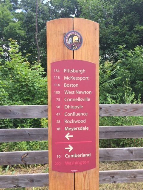
My route on this day would take me to Meyersdale where the trail would end. There was a 30 mile gap between Meyersdale and Cumberland that was uncompleted. I had studied the overland route but wasn’t feeling certain, especially since I messed up something so simple as getting out of Pittsburgh yesterday.

I asked my sister, Betsy, who also lives in Somerset, to go to the atatrail.org website and print my detour instructions for my final review. I had printed many cue sheets but for some reason these were missing. Betsy handed them to me and said “you know, there’s one route in there that says ‘we wouldn’t want to ride this on a bike’. That’s the one you’re riding today.” Well, thanks Betsy!

We drove over the hills to Confluence on our way to Ohiopyle. It was very foggy and a little cool. I thought it was a perfect day for riding and hoped the fog would stay on the hills for much of the morning.

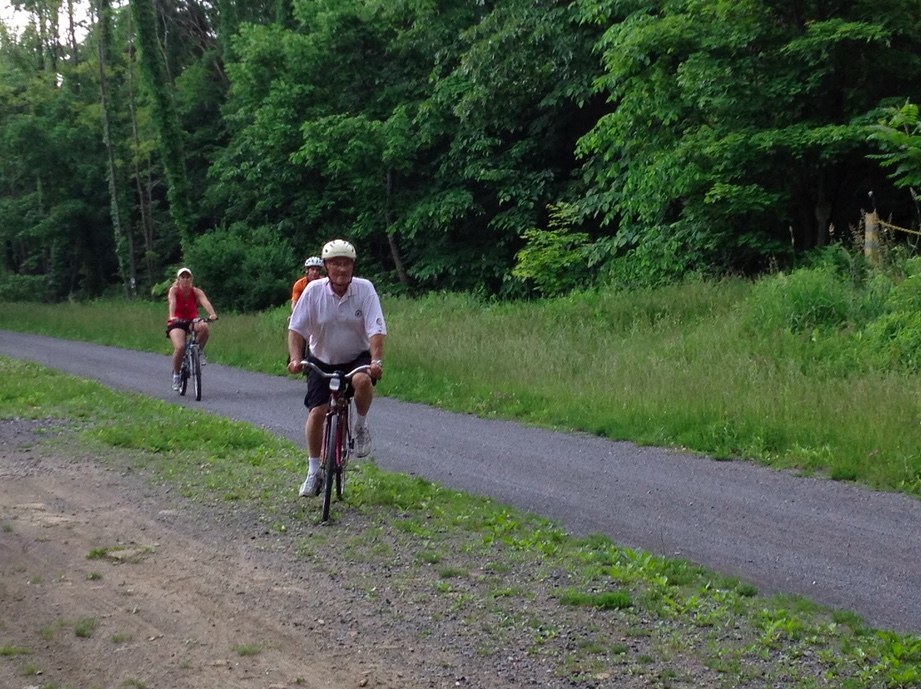
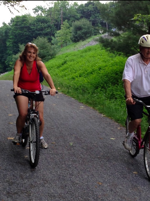
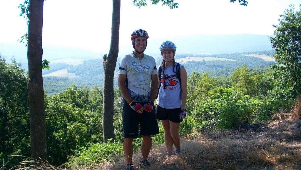
We reached Ohiopyle and I began to unload my bike. There was a couple who had just unloaded their bikes and the man said to my dad “hey, I know you.” Just two and a half weeks earlier we had attended the “States” Family reunion near Punxsutawney, Pa. This was my second cousin Alyson Reitz (nee Spicher) and her husband. They had driven down from the Punxsutawney area for the day and wanted to ride the Ohiopyle area. They were contemplating riding “down” to Connellsville and back or “up” to Confluence and back. I told them to definitely ride up to Confluence (with me) because the second part of their trip would be downhil. So for the first 12 miles of my second day I had some company.


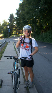
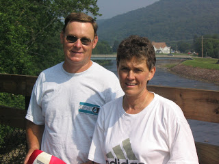
Ken and Alyson Reitz
Alyson is the author’s second cousin

Riding with someone is so much easier than riding alone. Although they told me to ride ahead so I didn’t slow them down I wasn’t about to. First of all, I needed their company to keep going. Second, while I was riding back to Washington, D.C., riders mistakingly thought I was in a hurry and would want to ride faster than their pace. They forget, they may be in a sprint while I am in a marathon.

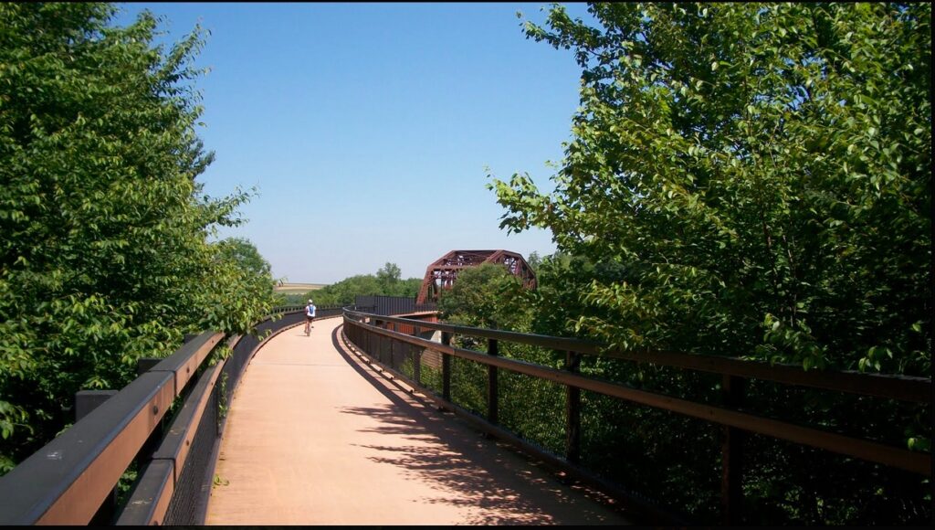
We rode together. When we reached Confluence, which is at the confluence of the Casselman and Youghiogheny Rivers and Laurel Run, we parted company and I continued on to Markleton and crossed the high and low trestles at Pinkerton.

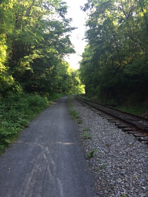
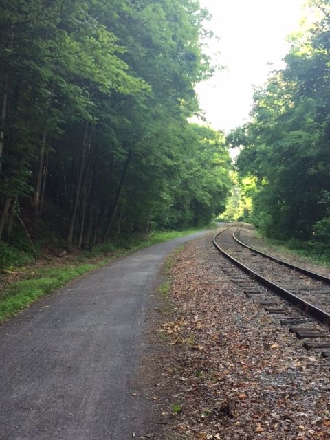
From here it was a matter of just keeping my speed up as best I could. I had ridden this stretch twice before so there wasn’t a lot new to see. When I rode it before it was Meyersdale to Ohiopyle so I usually averaged 14-15 mph since it was slightly downhill. Even downhill on the Allegheny Highlands Trail one has to pedal to keep up speed. This is not an asphalt trail but consists of crushed limestone. But now I was going uphill so I needed to work even harder.
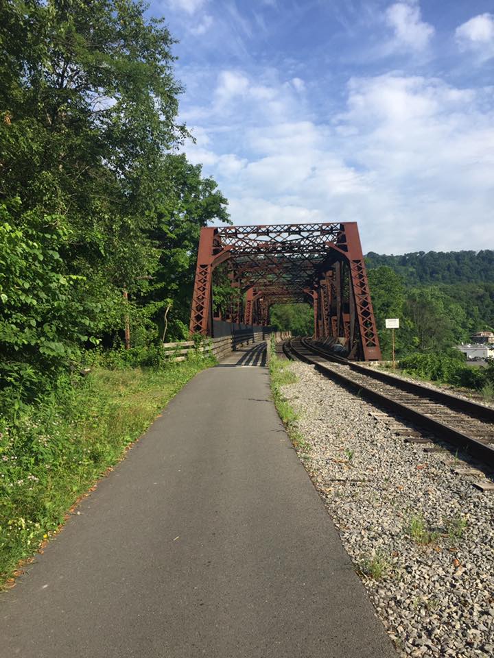
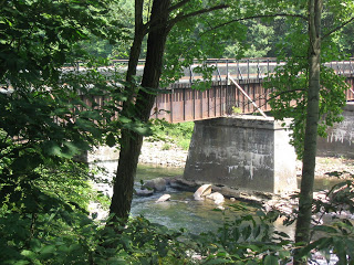

Pinkerton Trestle

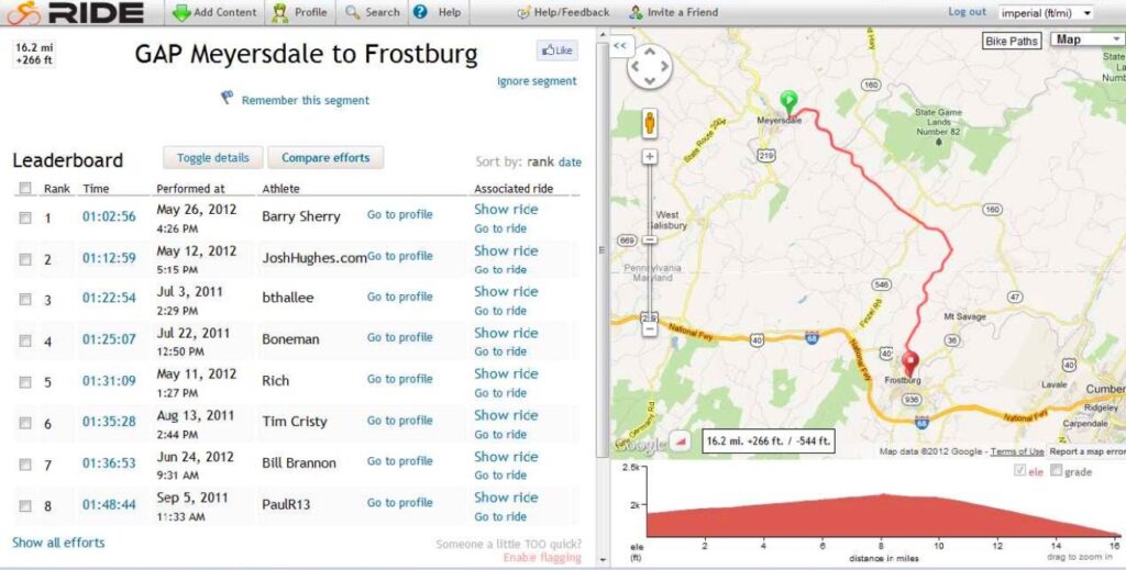
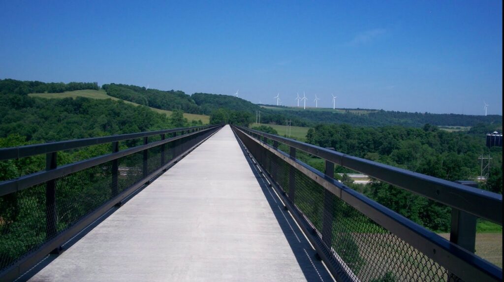
I should have made much faster speed. The 42 miles from Ohiopyle to Meyersdale should have rolled away in three hours or so but it was more like four. I was tired but also relieved, in part, when I came to Meyersdale. I stopped to admire and photograph the Salisbury Trestle.

Crossing the valley 100 feet bleow is enjoyable not only in the view but also because the deck is concrete and I was finally off the limestone trail, never to see it again on this trip. I really enjoyed riding across the 1900 foot long trestle. At the Meyersdale end one has to navigate the vehicle barricades that allow only bikes to get through. Here I didn’t do so well. At first I thought I could stay clipped in and zig zag ride through the posts but then realized I had to stop. Quickly.

I hadn’t unclipped from the pedals and that always spells disaster. The bike stopped. The feet were stuck to the pedals. When that happens, the rider falls and this rider did but it was a soft fall. The gloves protected the hands and the bike, thankfully, was okay. It was stupid and was one of those things that happens when the body and mind gets tired.

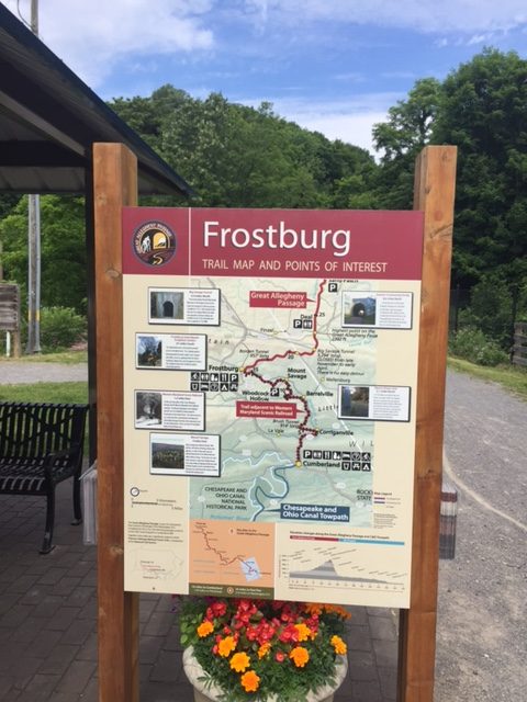
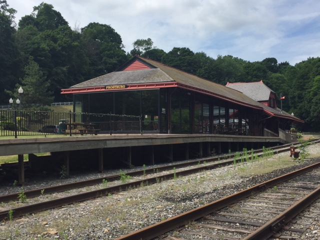
At the Salisbury Trestle the improved trail ended although one can continue riding for another mile or so to the old Western Maryland train station. But here the trail is just an old road bed and is very rough. I was riding a Trek Navigator which is a hybrid, neither road bike nor true mountain bike. But it has fatter tires like a mountain bike and lacks the high gears of the road bikes so it is much closer to a mountain bike. When I reached the station I turned down the street and rode it downhill until I came to a Subway sandwich shop. I had driven through Meyersdale one month earlier and scouted this location for food.

Here I was able to wash up my hands and face and ordered a 6 inch sandwich. I drank some soda but before leaving filled my Camelbak with ice and topped it off with water again. I had depleted the 100 oz that I started with. I had ridden almost 45 miles uphill from Confluence and the big mountain climb was ahead.

The thought of climbing the mountain was not a pleasant one. The unimproved trail may have continued another five miles past Meyersdale but no one seemed to know for sure. Least of all was the girl at Subway. I had calculated the distance to Frostburg as 18 miles. When I told her that I was headed to Frostburg on a bike, she couldn’t believe it. I asked her how far away it was, not entirely trusting my memory. She said, “in a car traveling 60 mph, probably one hour.” I said oh no, that would be 60 miles and I know better than that.

Really Off the Beaten Path

I wasn’t sure how to leave Meyersdale. I could climb the hill in town back up to the WM Station and try to head out the unimproved road which was to be the new rail trail. But I didn’t want to head out on an unimproved rail bed for a couple of miles only to find a gated or closed trestle. So I headed out on the road which I knew would cross the mountain. I started down in the valley and in a couple of miles passed under the trestle which would be the next to open on this trail. It looked finished but may not have yet been open.

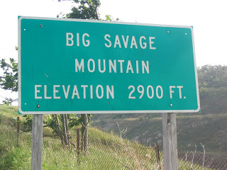
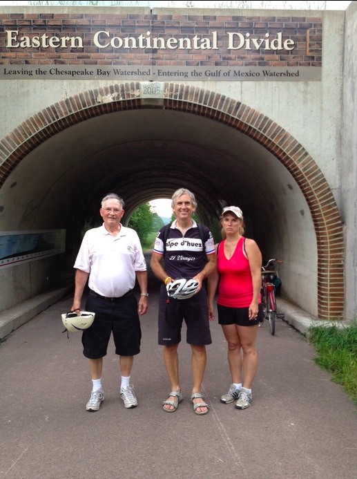
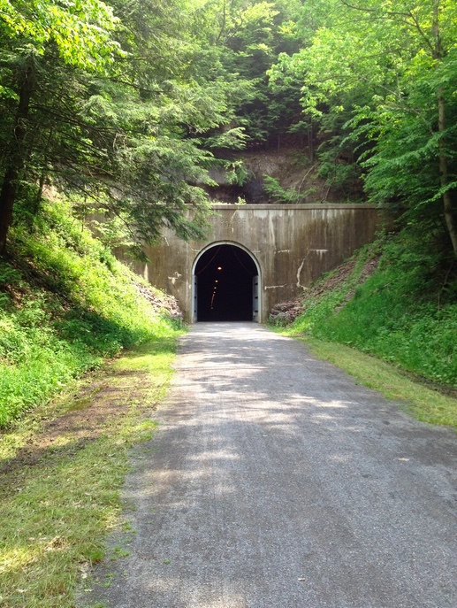
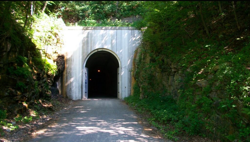
The stretch from Meyersdale to Cumberland was the “missing link” in a completed trail from Pittsburgh to D.C., if you ignore the 20 miles coming out of Pittsburgh. A couple of trestles remained to be finished and most importantly, the Big Savage mountain tunnel was yet to open. But in August 2003 there was one way over the mountain. Back country roads up and over the mountain.

I started the climb. I had yet to use my granny gear and part of me said to save it for when you really need it. But I decided that climbing Savage Mountain qualified and I dropped down into granny gear. Well, I didn’t. I had a lot of clanking and grinding but my front sprocket would not drop down into first. I decided to stop and manually move the chain which worked. The climb was steep in places but also offered a brief downhill or two. They weren’t for long and while it was nice to coast and catch my breath every downhill also meant that I had to climb that much again.

I was taking on fluids as much as I could and did not cramp up. In fact, in Confluence I took on two bananas which I would do every day. One to begin the day and one as a snack. At one time I was thinking if it was 18 miles to Frostburg and if I had to walk it, at 2 mph, it would be nine hours so I would still make it by midnight. The mind plays tricks when the body is so tired. My dad had said to call if I wanted to spend another night with them. For all the hard riding I had done today, Meyersdale and even Cumberland still weren’t that far from my parents in Somerset.

Had I been able to get a cell signal I would have ended the day. I was in a lot of pain. But I had to keep going as there was no signal out here in the mountain wilderness.

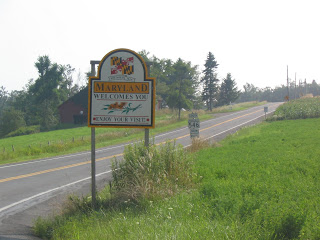
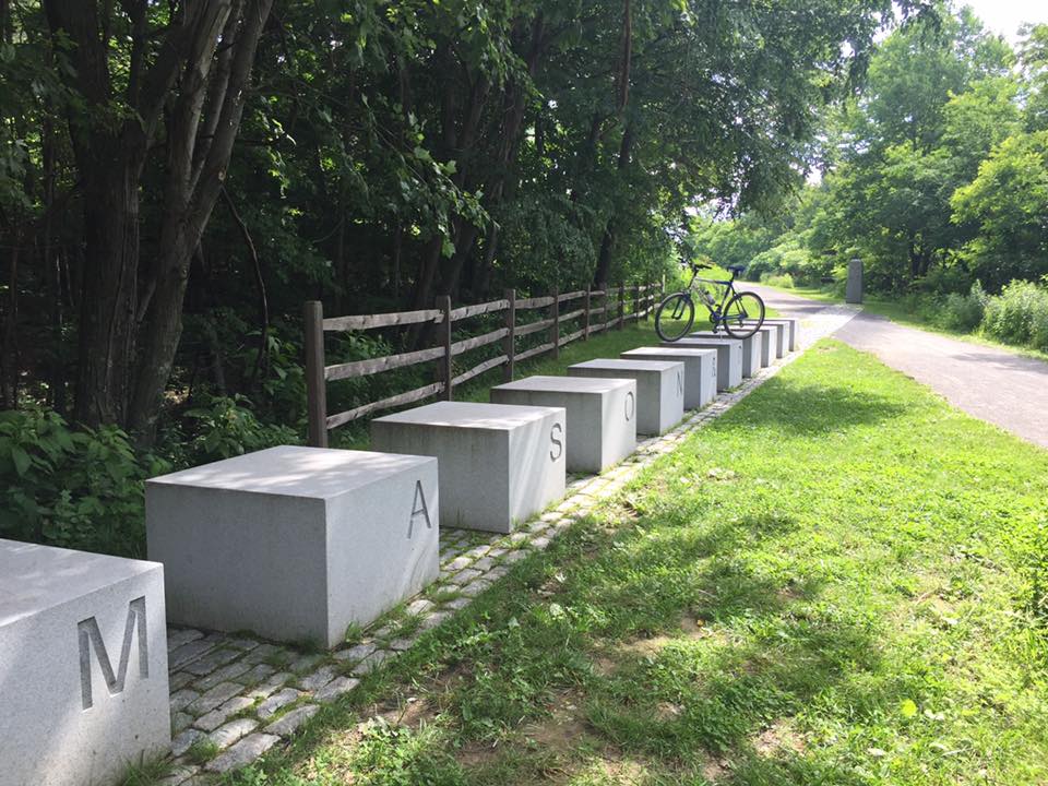
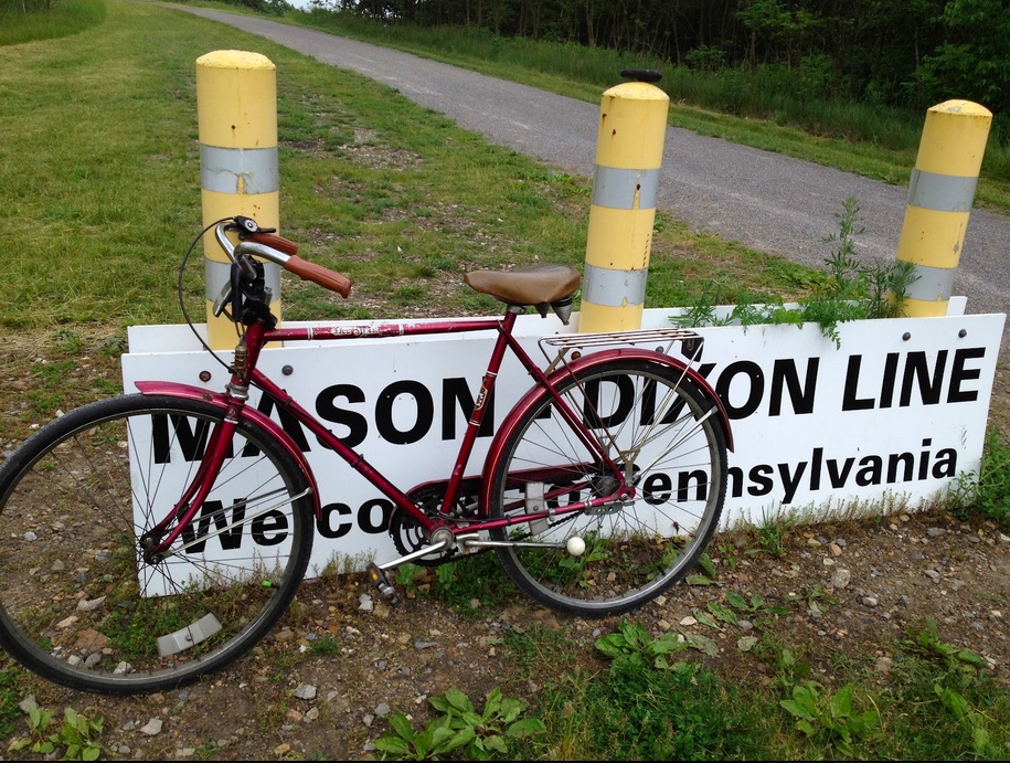
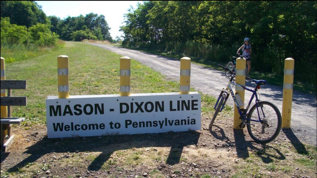
I kept my pace, keeping it going at a steady 3 mph. I started thinking six hours or 9:00 p.m. But as the grade lessoned I was able to start thinking more rationally. I had another 24 oz Gatorade on my bike and decided that the Gatorade would be my champagne when I reached the Mason-Dixon Line (otherwise known as the Pennsylvania-Maryland border).

There was very little traffic but when one car with Maryland plate passed me I was able to sit a little higher and work a little harder. I knew I was close to leaving Pennsylvania. I came to the top of the road, but not the mountain, but was almost there. For the first time I could see towers on the mountain over near Interstate 68 in Maryland. It was about 4:30 p.m. and I called my dad and told him I was out of Meyersdale. (He wanted me to call him at Meyersdale but there was no cell signal there.)

Mason-Dixon Line

I saw the sign that said “Frostburg 7” (miles) and knew that it wouldn’t be midnight. I rode another mile then reached the Maryland border and drank my Gatorade. I still had work to do. I climbed higher though Finzel then reached U.S. Rte 40. Here I began a fast descend down a hill in preparation for climbing the summit of Savage Mountain. I kept working to get up the mountain and then stopped at the top to look around.

I was 100 feet above I-68 watching trucks struggle to climb this hill. I crossed the summit at 5:30 p.m. and descended quickly into Frostburg not worrying that I was doing 39 mph in a 25 mile zone. Descending down the mountain I didn’t brake nor did I pedal. I simply coasted and enjoyed the couple minutes of satisfying ride that came after 12 hours of hard riding from Pittsburgh. The day was almost over but would you believe that one must make a final climb to get into Frostburg?

I rode through Frostburg and descended down the mountain on US 40. The temperature on top of the mountain was 86 degrees so it had been a warm day for riding. When I came to Lavale, Md., I decided to call it a day at the Comfort Inn. But the night was not so comfortable.

Verified by MonsterInsights