A Test of the Knee

SAXTON, PENNSYLVANIA

It’s hard to believe that it has been 12 weeks since my knee replacement surgery. I don’t think my knee is where it should be but I will withhold judgment until my next doctor’s appointment.

Since surgery, I have ridden less than 200 miles in total. In many years I am over 1,000 miles and sometimes over 2,000 by this time. But I am not completely “without legs.” I have been riding a stationary bike almost every day, often for up to an hour at a time.

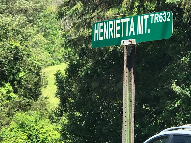
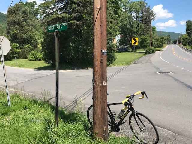
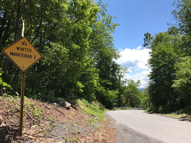
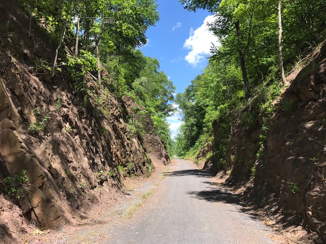
This road. Henrietta Mountain Road. I found it only because some Altoona locals told me about it a few years ago. And I rode it last year. It compared to some of the toughest two-mile climbs I have done.

Last year I struggled. I even thought about stopping on the climb. Or turning back. But this year I seemed at peace with it.

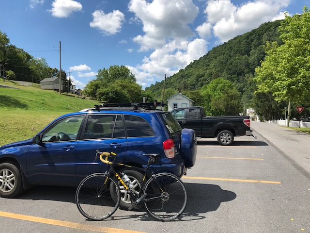
I drove to Saxton and looked for a place to park. I found one at the intersection of Pa. 26 and 913. The car was off the road but otherwise out in the open. I pedaled to the foot of the climb. Just after starting and no more than one-half mile in, I wondered if I had locked the car.  I had left my car keys (I had the clicker), wallet, and laptop computer all in the car and available to anyone if it wasn’t locked.

Although I didn’t remember locking it, of course, I always lock it. I decided it would be foolish to go back to the car. There are somethings that you do automatically and locking your car is one of them, right?

The lower section of the climb starts at 6-8% then gets tougher. Soon the grades were 12% and some reached the 20s. I stayed seated, mostly, but occasionally got out of the saddle. It was hot (87°). For the two-mile climb, only six cars had to pass me. The road is lightly traveled.

At times, I could feel the knee clicking. I could hear the rhythm of the knee. But it didn’t hurt so I pushed on.

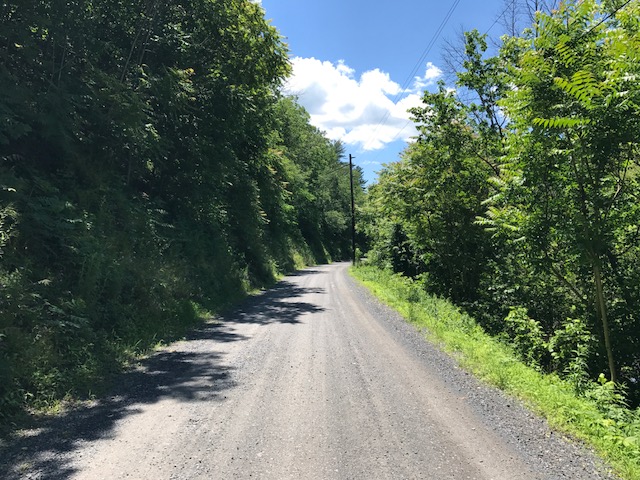
The road is steep. Period. I didn’t “paperboy” but I crept. I didn’t stop. I just kept the momentum going.

I did not review the route. The first/last time I turned around at the top. Today I went over the top. I expected to level off and come into Rt. 164 at the top of the mountain, and have a great ride back down. Oh boy, was I wrong.

It was a nice descent into a valley although I did not lose all the elevation I had climbed. It just felt like it. I followed Henrietta Mountain Road to the end, catching two Amish girls with a horse and wagon.

I came to Rt. 164. Instead of being at the top of the mountain, I was at the bottom. And here the road is high-speed, with a 55 mph speed limit. There were guard rails on both sides and no shoulder. And uphill of course because I had to cross back over the mountain. I regretted this route.

But I survived, with a note not to ride this way again. On the descent, I pedaled until I ran out of gears. I hit 49 mph. I so wanted 50 but with a 50 tooth front cassette, and a swollen knee, I just couldn’t find it today.

Back to the car but fully satisfied. I opened the car and found it was unlocked. Sick feeling. But checked. Keys there. Wallet there. Laptop computer there. The car was undisturbed. Whew! Dumb by me.

In the evening the legs felt sore. Like they had a workout. It’s been a long time since I was able to push myself on a climb like that. So glad I did. And looking at the map there may be another way back if I do this one again.

A Mountain and a Rail Trail

HOPEWELL, PENNSYLVANIA

Probably eight years ago I asked some riders from Altoona what the hardest climb in the area was. I was thinking Blue Knob or Horseshoe Curve. One rider told me to find Henrietta Mountain Road. And today I did.

Parking at Hopewell

This was was tough. Although it wasn’t too long, just two miles. It’s always hard to compare climbs but I can compare it to some other two mile climbs or sections I have done.

That’s pretty good company, I would say.

I started my ride in Hopewell (Bedford Co.) on the H&BT rail trail. More on that later.

At Saxton I found the infamous Henrietta Mountain Road. I did no research and instead, just rode. It seemed to kick up to 7-8% right away. But after a quarter-mile just past an intersection, the real climb began.

Henrietta Mountain Road and intersection with Rte 164

It seemed to kick to 12% then went even higher. I have no real pictures because I wasn’t stopping although my body wanted me to. The road was winding but with only one sharp turn I hesitate to call a switchback. It was heavily wooded on both sides. It was beautiful. But it offered no panoramic views because it was so wooded.

Summit of Henrietta Road looking back towards Saxton (the tough side)

I tried to not look up the road because every time I did I could see it was going higher. After two miles, although I had no idea at the time, I could see the top. And here I made a mistake by not researching the climb. I assumed the road went over the top and down the other side. So I simply turned around.

A barn on Rte 26

The descent back was steep. Rough pavement. And windy if not sharp turns. It wasn’t fun. I couldn’t let the bike roll. What I learned after the fact was I should have kept going. I could have gone another 3-4 miles where I would have joined Rte 164 coming out of Martinsburg. Then It looks like a straight descent back to Saxton. In other words, a fun descent. Oh well, next time.

Crushed limestone at Hopewell

I rode back to Hopewell and explored the trail a little more. At Hopewell going north for two miles, the trail is crushed limestone in great shape. A road bike is fine although I wouldn’t want to ride 20 miles on this.

Gravel road headed south from Hopewell

Going south the trail was a road. A gravel road that led to a camping area. That was harder on the bike. I rode a couple of miles then decided I had had enough. Wrong bike for this surface.

H&BT trail near Cypher

The signature landmark on the trail seemed to be the trestle over the Juniata River. I had decided the surface wasn’t right to pedal to it.

Bridge over Juniata River near Cypher

The trail head seemed to be on my way back to Somerset where I was headed. So I drove to Cypher to bike that section.

I don’t know if it was good or bad but the trestle was probably no more than a quarter mile away. But it was gorgeous. Maybe even more gorgeous was the cut in the hillside. The trail here was crushed limestone, again.

Bridge over Juniata River near Cypher

It’s a beautiful trail. If there wasn’t the section by the recreational area which was a gravel road, I’d have no problem recommending a road bike for the surface. But this trail needs wide tires. I may ride this on a mountain bike.

Cut in the hillside by Cypher

______________________

Verified by MonsterInsights