
CURRITUCK, NORTH CAROLINA
Every ride needs a ferry. And this could be a near-epic ride. A medium-distance ride (80km/50mi) and a 40-minute ferry ride.
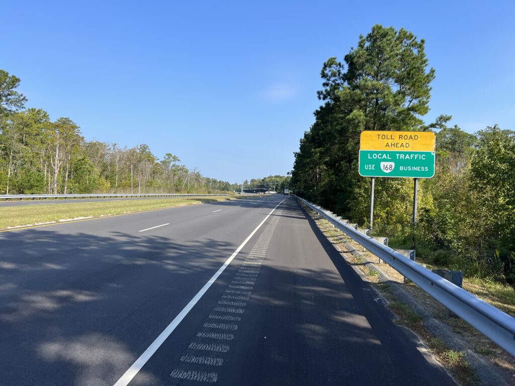
Using the tools in RideWithGPS I mapped out a ride between the two ferry terminals of the Currituck-Knotts Island Ferry. I choose a couple of points on the map and RideWithGPS then mapped out the route. It usually avoids major roads, and indeed, instead of riding on NC Hwy 168 it routed me over the road at Moyock and brought me back to 168 at Northwest for about 1/2 mile which was unavoidable.
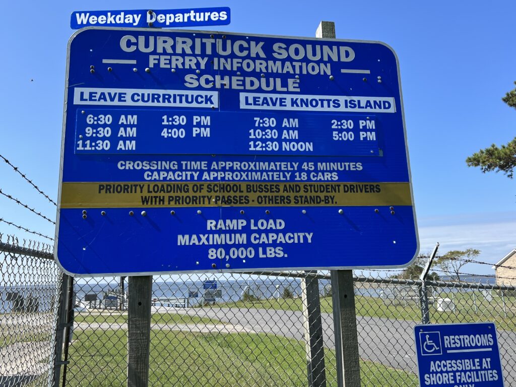
The schedule was my main planning point. The ferry runs every two hours and one would not want to just miss a ferry and wait for 90 minutes or more for the next one.
I mapped my ride from Currituck to Knotts Island. This was in a clockwise direction and had nothing to do with prevailing winds but was solely based on wanting to finish with a ferry ride. Although it was negligible today it would make sense to check winds to see if one could catch a tailwind towards the end of the ride.
From Knotts Island my feasible choices for meeting the ferry would be 10:30, 12:30, or 2:30. The only real workable time was 12:30 so I planned for a 9:00 departure and estimated that I would arrive at the Knotts Island ferry shortly after noon.
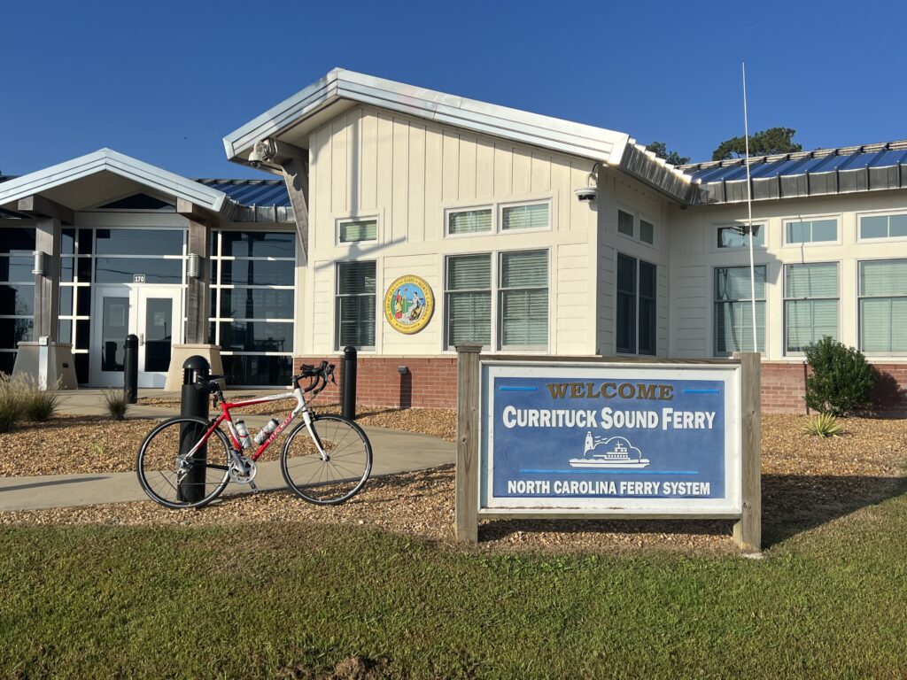
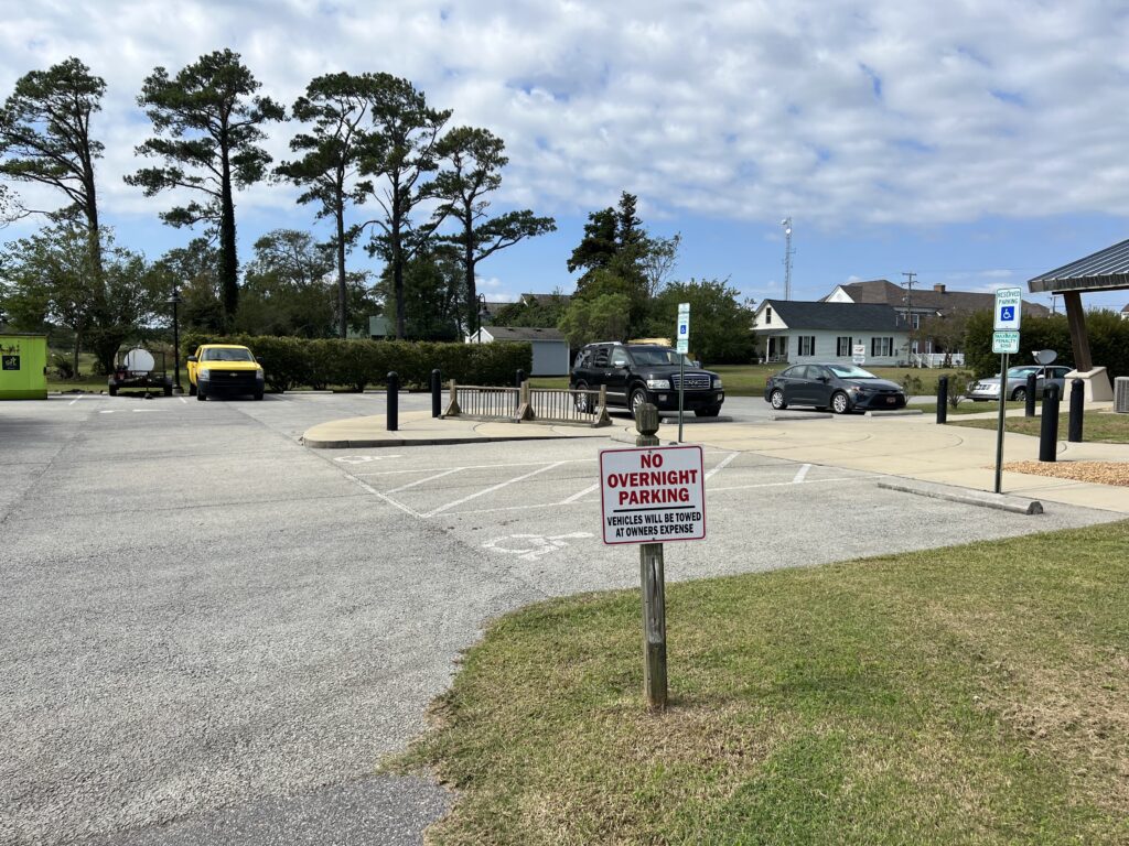
I was unable to determine the parking situation at the ferry. I looked for parks nearby where I could start my ride but when I arrived I pulled into the ferry administration building at Currituck. There was a small parking lot behind the building with a sign warning against overnight parking. I read that to be that daytime parking was okay so I parked.
Some cars were coming off the ferry at 8:30. This must have been the 7:30 departure from Knotts Island and was running late. I thought that if they were departing soon it would behoove me to take the ferry first thing and ride my route counter-clockwise. That way I would have no downtime waiting for the ferry or angst in case I was running late. But a quick check of the sign and I saw the next departure was at 9:30. I rode my originally planned route.
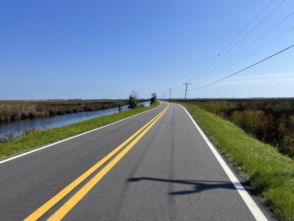
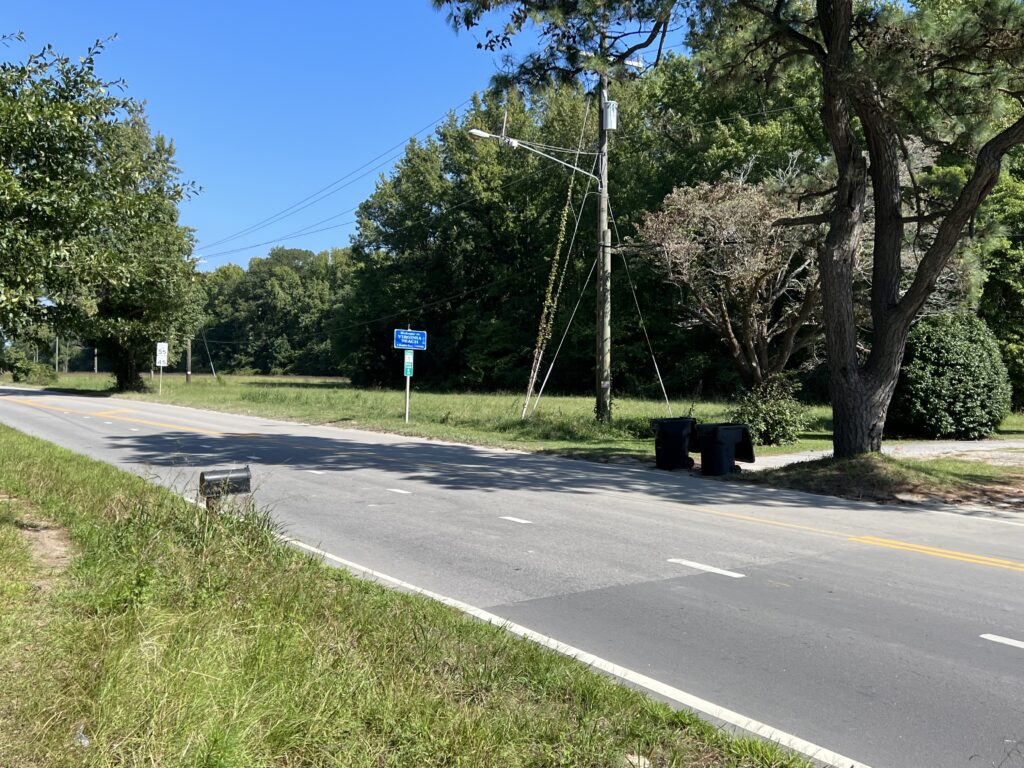
Almost immediately I was on NC Rte 168 but only for half a mile. Then I turned onto secondary roads. The back roads were great except for a major hiccup. Gravel.
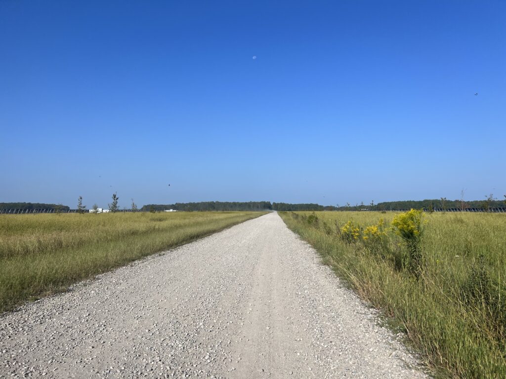
RideWithGPS uses Google Maps and Google Maps showed the route as 100% paved. It wasn’t. I came to Cooper Garret Road. I stopped. It was gravel. And it wasn’t packed dirt. It was heavy gravel with a sand base.
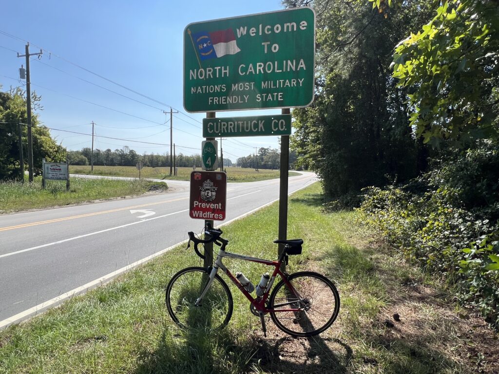
But there is a Welcome to Virginia Beach sign.
I opened up Apple Maps to see if there was an easy alternative. I didn’t see one. I slowly trudged through the gravel knowing it was a little more than two miles until South Mills Road and hoped that it was paved.
I was on my Trek Pilot with skinny tires. The 25 mm tires cut through the sand and made controlling the bike difficult. I was afraid I might have a flat. And I was losing the time that was necessary to make the ferry on time at Knotts Island.
I got through the gravel and back to paved roads. Barring any mechanicals or more road surface surprises I calculated that I should arrive at Knotts Island about 12:05 – 25 minutes to spare. Well, I forgot about the wind.
(Only on this road for 1/2 mile)
There were strong winds blowing and if they were headwinds I could be in trouble. But they were mostly cross winds headed to Knotts Island with a tailwind the final 10 miles.
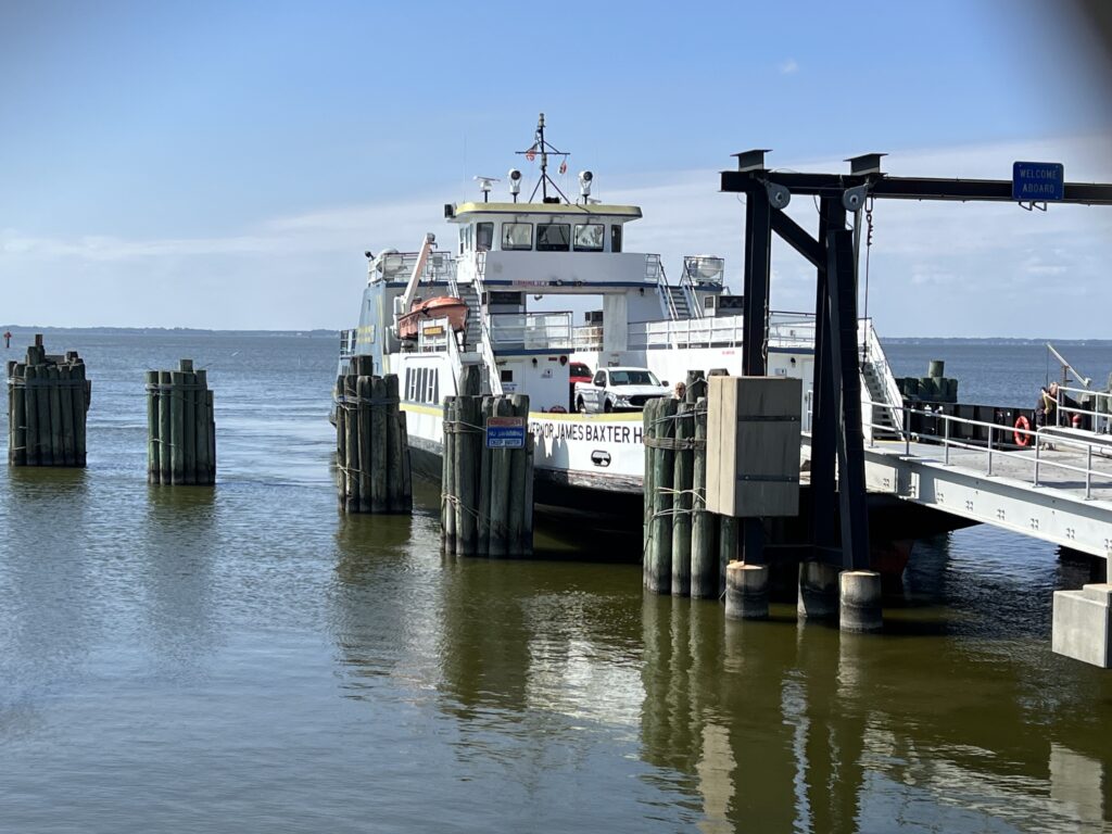
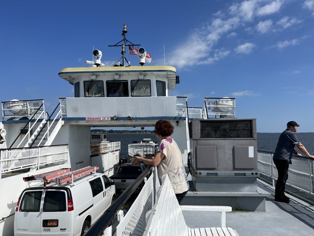
I pulled into the waiting area for the ferry at 12:00 pm. Slowed by gravel and then pulling over three times for photos, I still had 30 minutes to spare.
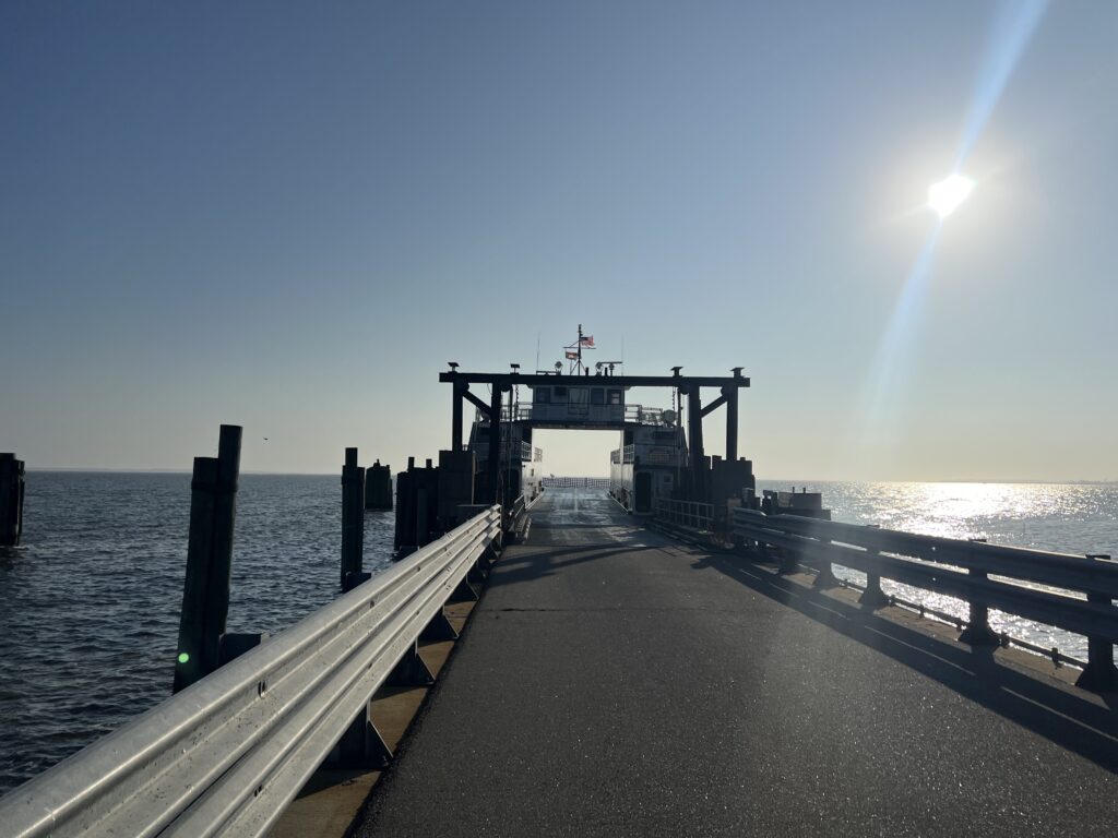
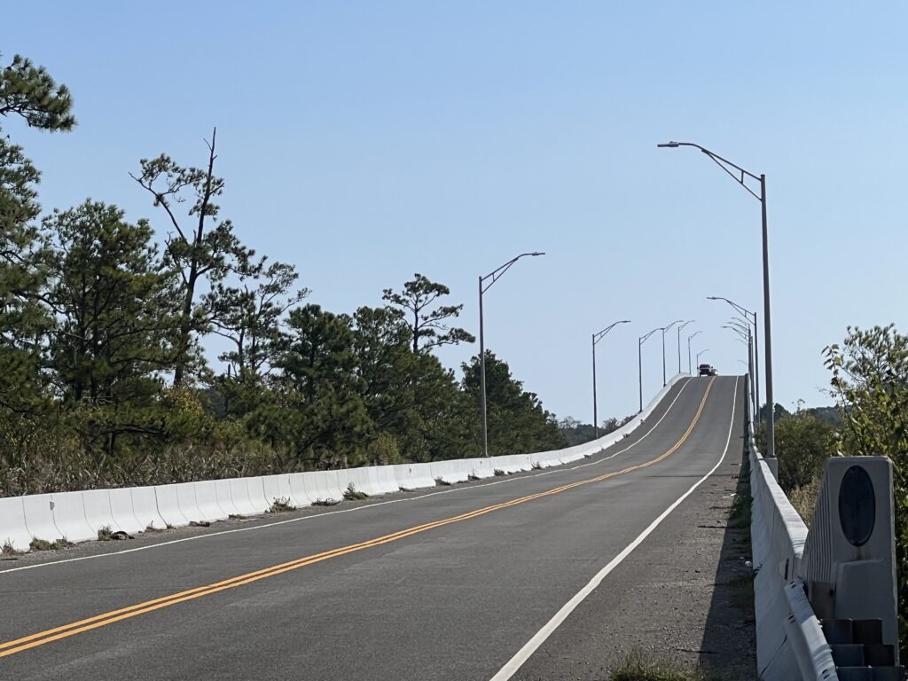
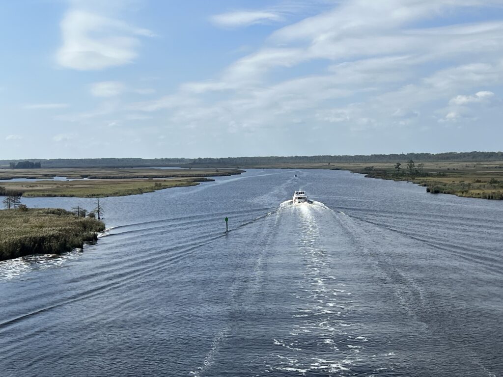
The ferry is free. It departed at 12:30 and made the crossing in 38 minutes. There was an RV, two cars, three motorcycles, and me on the boat.
I doubt that I will ever do this loop again but I would love to. If anyone reads this and wants to ride it I’d turn right at the tracks in Moyock (before the tracks) onto Oak Street. Go three blocks to the end at Shingle Landing Road. Cross the highway and it becomes Camellia Drive. Follow that to South Mills Road and that will avoid that gravel. Avoid the gravel
I rode this on a Tuesday morning in October. There was virtually no traffic on Hwy 168. On a Saturday morning, the departing traffic from OBX would be horrible and must be avoided. While the website seems to indicate the ferry runs daily, it must be noted that the sign on the schedule is for a weekday schedule. When we stopped on a Saturday there was a sign indicating that it was closed for the day. High winds were not a problem so before I would do this again I would double-check to make sure the ferry was operating. It may not operate on weekends.
ROAD SURFACE:
TRAFFIC DENSITY: 2 (Light)
AGGRESSIVENESS: 1.5
Recent Comments