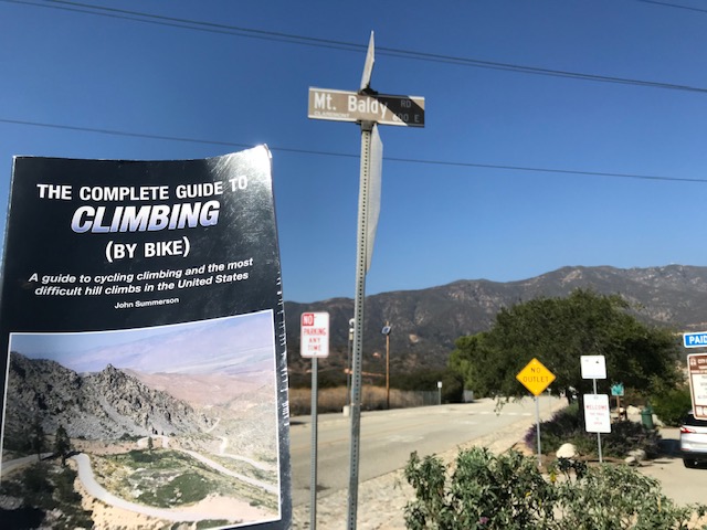
CLAREMONT, CALIFORNIA
I was warned. In reading John Summerson’s book, The Complete Guide to Climbing (by bike), he wrote that this was the toughest climb in southern California (not sure what is tougher up north). At 13 miles it was the equivalent of the Col du Tourmalet (France).
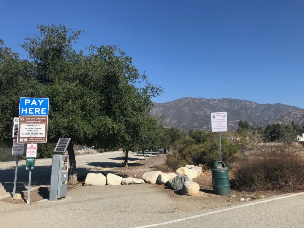
I read a little about the profile but can’t say I remembered much as I rode. I found a parking lot; a PAY parking lot which sold a four-hour pass for $5. And that, four hours, would become my target. It would have to be.
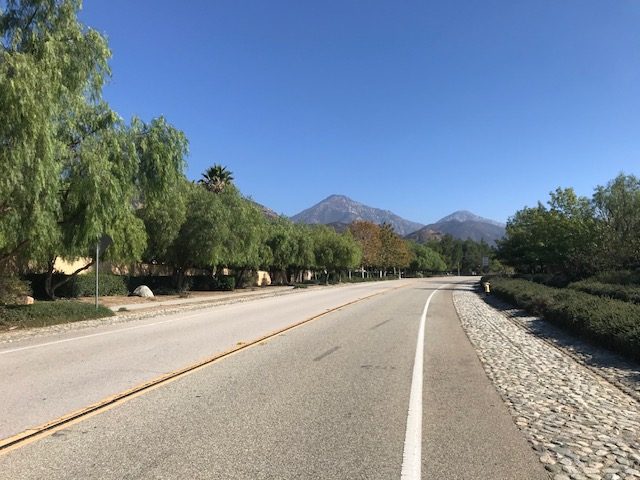
On the road, and the climb began immediately, I started doing the math. Mostly it was about how long it would take me to get back down and that would leave me with the remaining amount to climb. I wasn’t sure of the length (great planning, huh?) but figured it was 13 or 14 miles. I figured it would take 30 minutes coming back.
And I decided I would take three hours to climb. Knowing that would help immensely the last three miles.
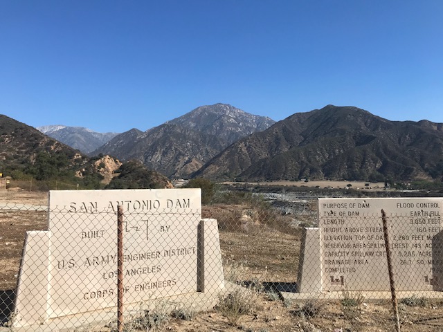
At two miles in I came to an empty dam. I bet this is beautiful when the lake is full. (Actually, it is a dry dam, used only for flood control. Sure would make a pretty lake though.) I only had one water bottle but it was full of ice topped off by one of the small water bottles from the hotel. I carried two small bottles in my back pocket.
I took a dam photo (San Antonio Dam) then poured some water from the small bottle into my water bottle. When I had it filled I went to put the empty bottle in my back pocket and promptly dumped all that ice water on my back/rear. It felt good but it didn’t feel good knowing most of my water supply was already gone. I emptied the second bottle into my water bottle and that would have to suffice on this warm day (70s).
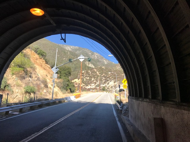
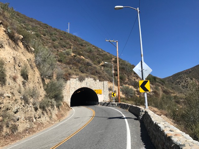
I had decided to ride easy, ride smart. Normally I would not stop but it would be OK for a photo opp. I stopped at the first tunnel. It seemed that every landmark I remembered the road would turn up after that.
The road turns up after the tunnels. The road turns up after Mount Baldy village. It just kept turning up. Early on I saw a sign for “Mount Baldy village – 8 miles.” I wasn’t sure how much farther I would ride after the village but that would be my first target.
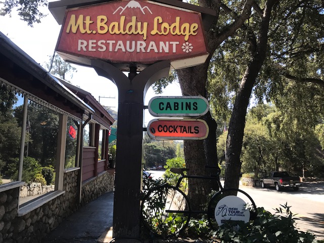
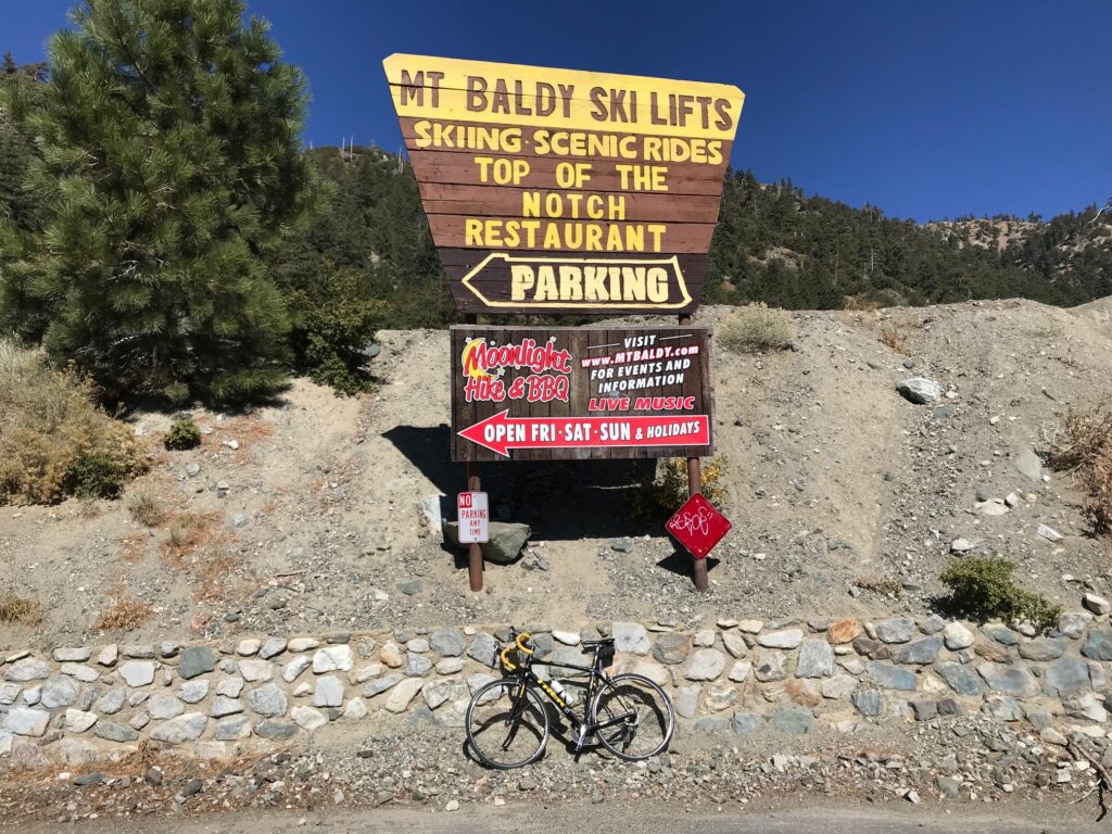
I just kept plugging away. It was hard. When I reached the village I saw the Mount Baldy Lodge Restaurant and a sign for the Amgen Tour of California. I decided it needed a photo. An added bonus was I found a water bottle dispenser so I could fill my empty bottle. I would need it.
Like yesterday, the sweat in my right eye was burning. I was fighting vision issues and rode squinting with the eye closed at times. I thought maybe yesterday it was sun screen and was careful not to apply any above my cheeks. It was my own sweat.
After passing through Mount Baldy village I stopped at a rest area (two outhouses), grabbed some toilet paper, and rinsed off my glasses which were a sweaty mess and made it very hard to see. I was a mess.
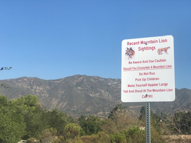
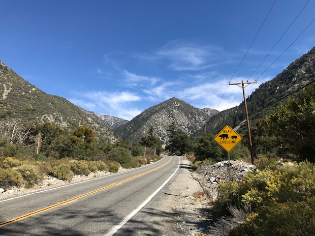
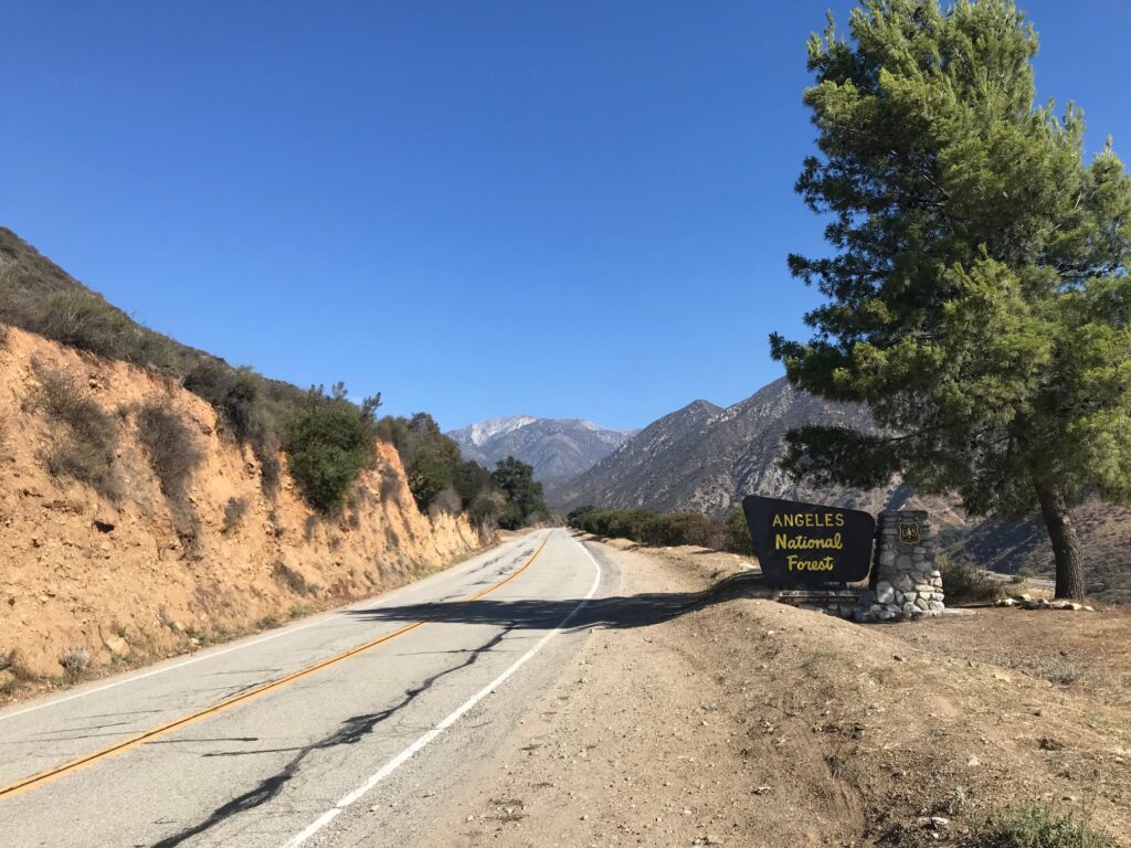
I continued up the road and saw a sign for Mount Baldy Ski Area – three miles ahead (5 km). And the road turned up. The road from Claremont to Mount Baldy village is 50 mph with a surprising amount of traffic. Most seemed to stop at the village. Above the village only bears and the occasional car seemed to travel.
The road really did turn up and I followed switchbacks the entire way. I was watching the clock and wanted to finish in three hours (going up). My cutoff time would be 1:15 p.m. I had one hour to make three miles. Yes, three miles per hour. Or 20 minutes per mile.
I started watching the clock. I would say to myself, in 17 minutes I will check my distance. Fifteen minutes. Eight minutes. After 20 minutes I would check to see if I had gone one mile. And I had. I knew even at this snail’s pace I would make it.
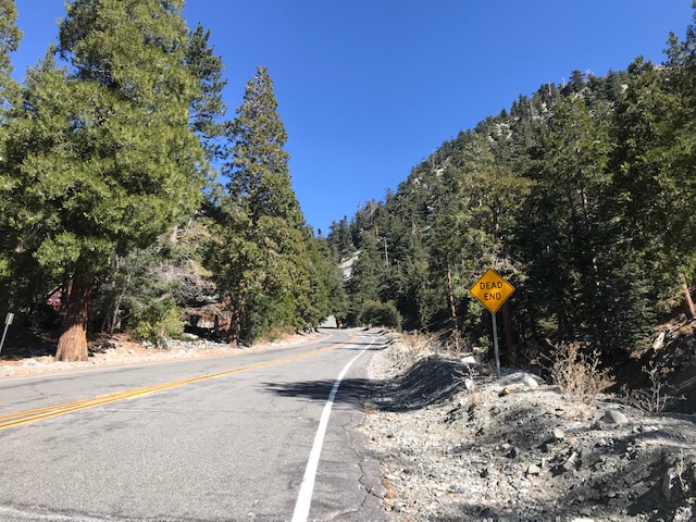
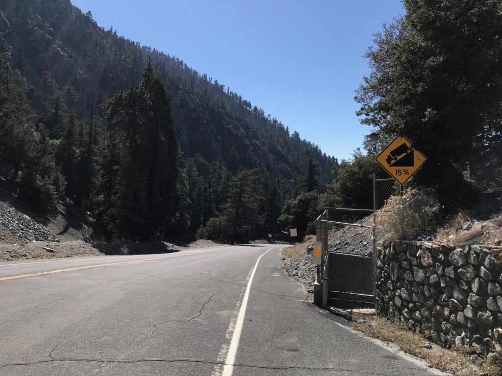
After two and a half miles I came to a campground or picnic area. Exiting it I saw a sign that read “Dead End.” I figured I was close. Right after that, I saw a 15% “ramp” which lasted about a quarter-mile. I had the road to myself and I started to “paperboy” the climb. (Instead of going straight up I went to the left and back to the ride, increasing the distance but decreasing the grade.
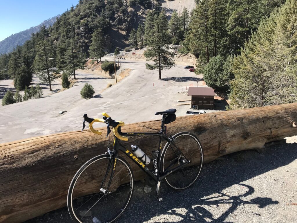
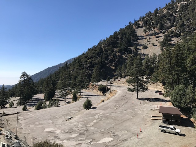
I reached the top and there was nothing here. Nothing. I saw a parking lot with more switchbacks and followed those. And then I saw one more ramp, it was closed, but I rode up it anyhow. As far as I could ride and I had done it.
I had fought myself the entire way. This climb was hard. Damn hard.
I started down and saw a rider coming up. Walking. I turned around and climbed up to meet him. He was from Alaska and had biked Alp d’Huez before (I told him this was tougher). He was out of water but declined my offer to have me pour my water into his bottle. He was not that desperate. I told him he had about 200 yards to go.

Then I went down. The top part was pretty technical until back down to the village. I hit speeds in the mid 40s (mph) but was also going into a head wind. Total time down was 30 minutes after a 3 hour ride uphill.
And with that, a true bucket list climb was finished. I’ll take it.
https://rwgps-embeds.com/embeds?type=trip&id=29035502&title=Mount%20Baldy&sampleGraph=true https://www.relive.cc/view/1927302192
ABOUT MOUNT BALDY (from The Complete Guide to Climbing, John Summerson, 2007)
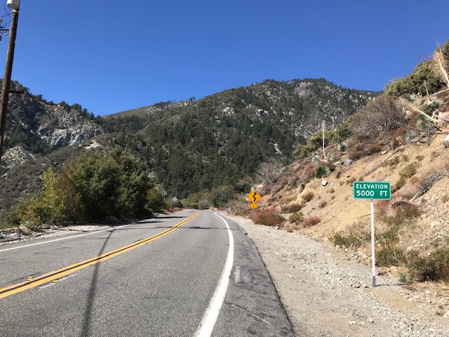
Total Elevation: 4,775′ (1,455 m)
Length: 12.9 miles (20.76 km)
Average Grade: 7.0% (15%)
Rating: 3.57 (hors categorie)
100 Toughest US Climbs: #11
This is perhaps the toughest climb in Southern California along a scenic two lane road with a variable grade. The first few miles are fairly shallow with a steeper ramp. The grade increases just after the two short tunnels which appear around the five mile mark. You soon reach the village of Mount Baldy where the grade eases back a bit. Just beyond the village however the true nature of the hill reveals itself as the last four miles average almost 9%. The final section contains ramps of 12-14% through steep switchbacks. The climb ends at the top section of the parking area. Mount Baldy is significantly longer and almost as steep as the famous Tourmalet in France.
The last 300-400 yards just past a campground/picnic area is a straight-up 15% climb. It hurts.
EDIT/EPILOGUE – Mt. Baldy was a bucket list climb for me. The timing was perfect. It wasn’t even good. It was combined with an event the next day – Hillclimb Worlds in Santa Barbara. No serious cyclist planning to race in the Hillclimb Worlds would ride up Mt. Baldy the day before. I did.
Recent Comments