Keystone MS-150

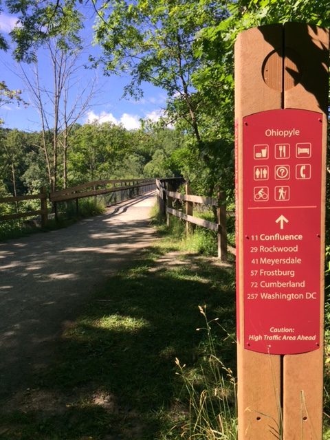
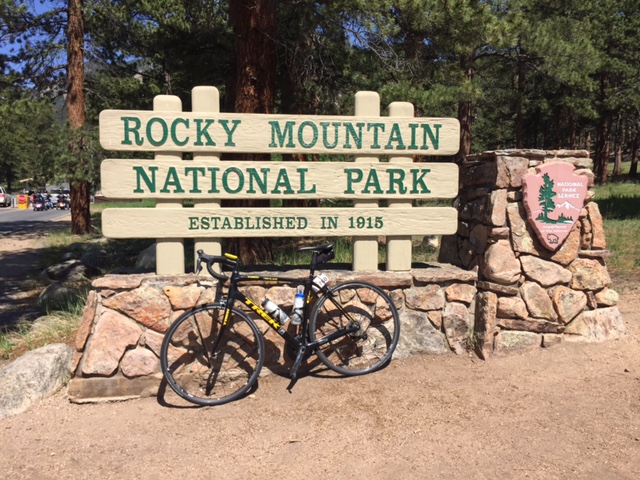
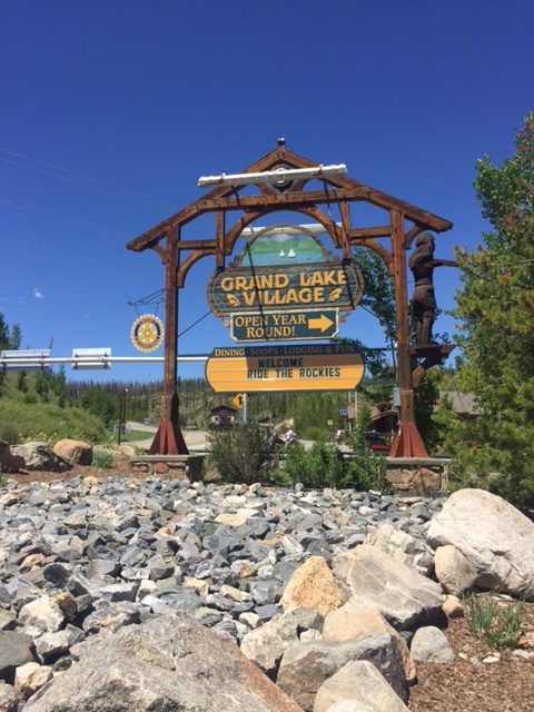
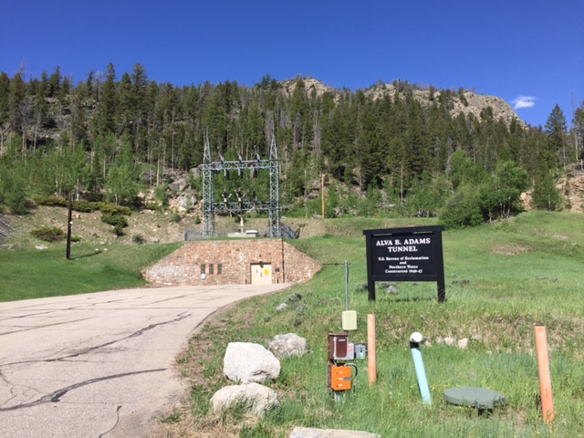
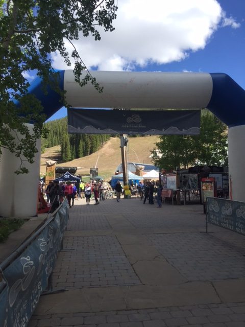
HOLLIDAYSBURG, PENNSYLVANIA

This was a two-day event held July 23-24. The route was from Hollidaysburg to Penn State University as the official meeting site was the Penn Stater Hotel.

MS-1-2

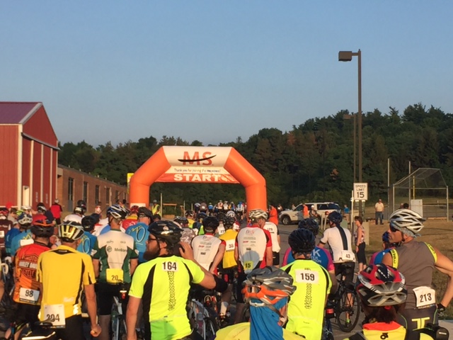
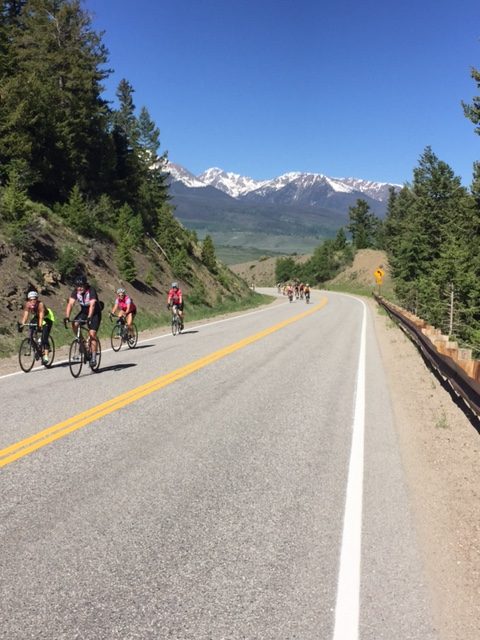
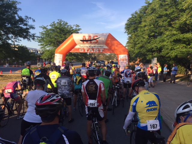
We rolled out at 7:00 a.m. in waves. I was in the third wave. The first mile or two was sorting out faster from slower riders and getting in with the right pace. For a while I was sitting in with a guy on a recumbent and his friend, who was riding with his bib straps undone. I was going to say something but figured if his friend never told him then maybe he rides that way. Later I saw him at an aid station and they were pulled up.

Kristi is 31; Kayla is 25

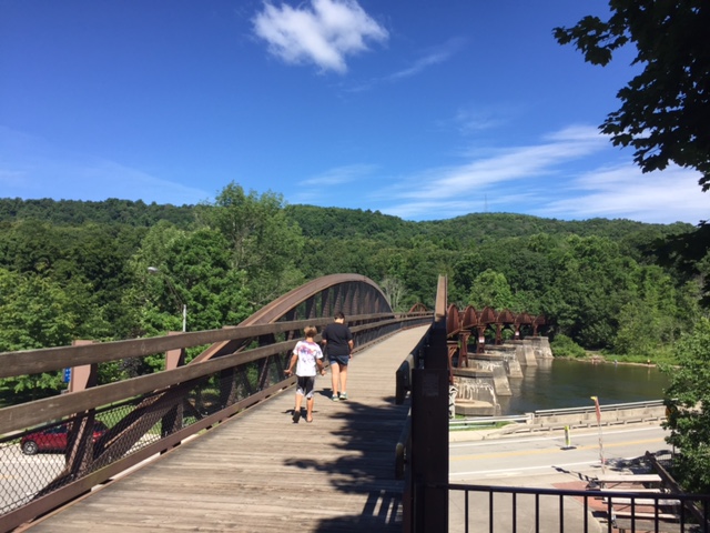
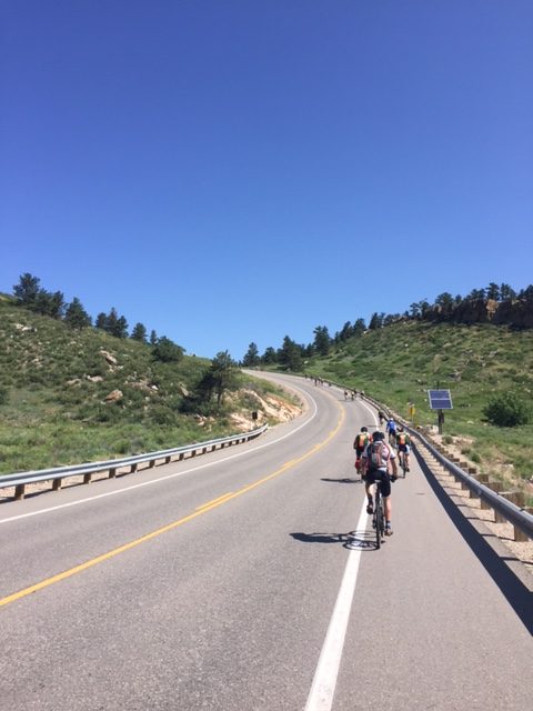
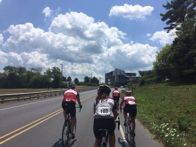
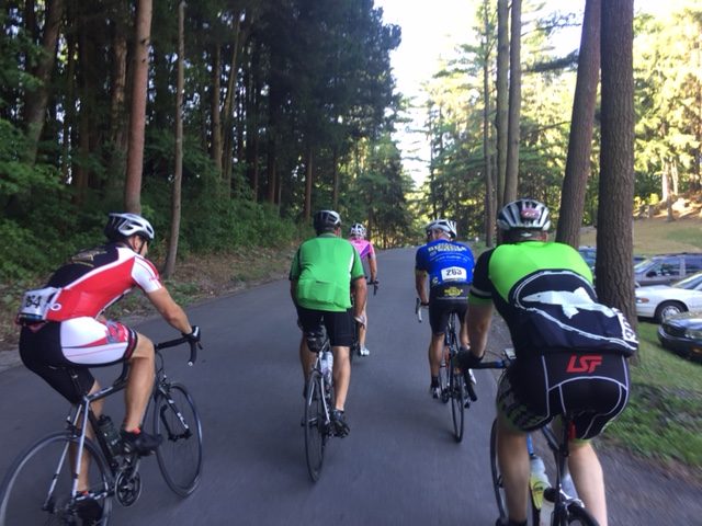
Once on Reservoir Road I was pedaling a comfortable pace when a group of about eight riders came by. I jumped in with them. The pace was a little higher than I wanted but I was committed and didn’t want to drop out. But two riders did. Then a couple more. Then two more. And just like that, I was out in front by myself.

MS-1-3

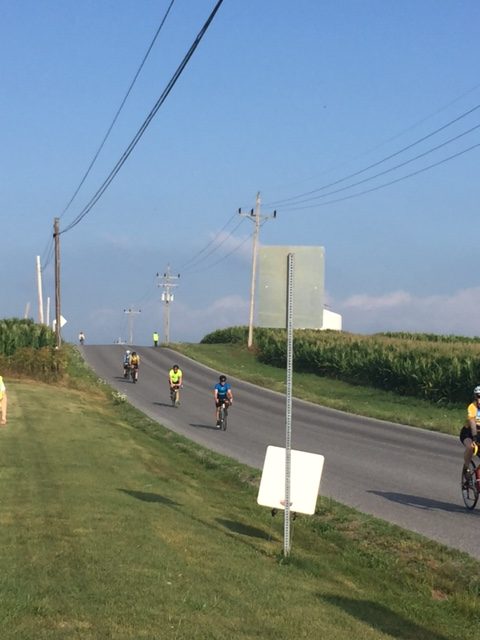
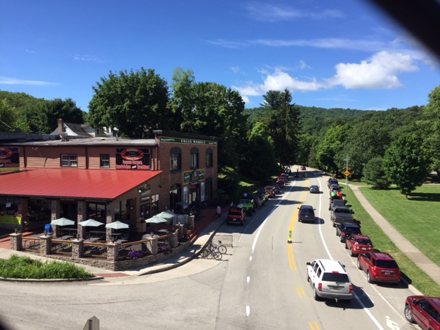
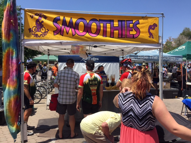
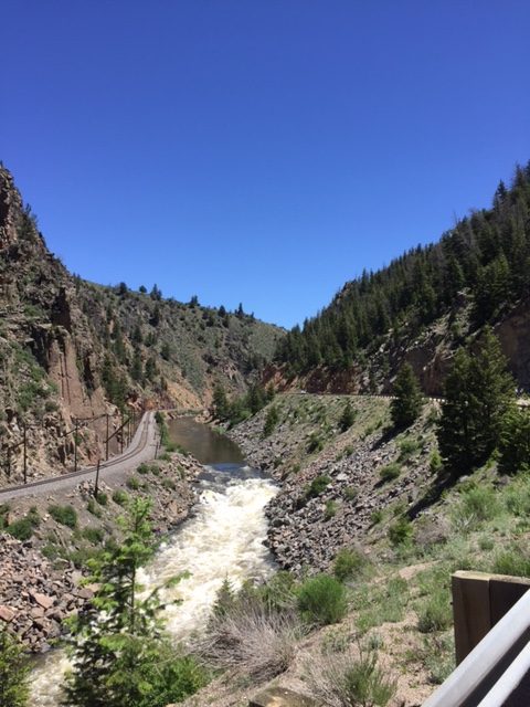
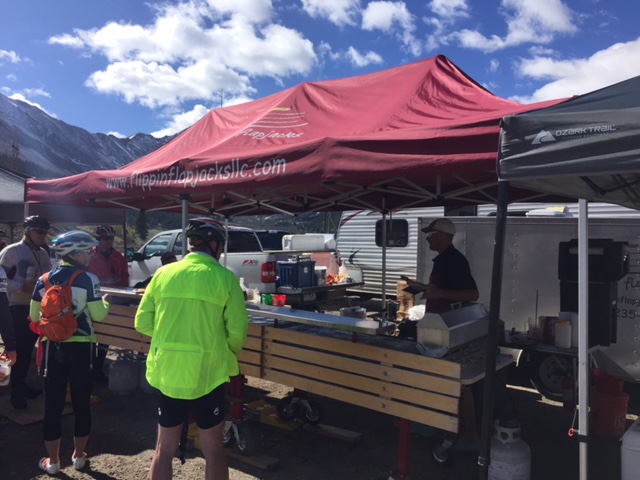
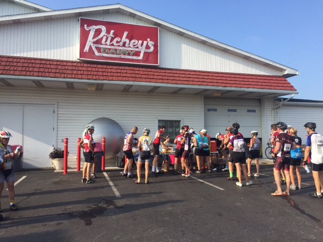
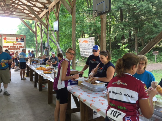
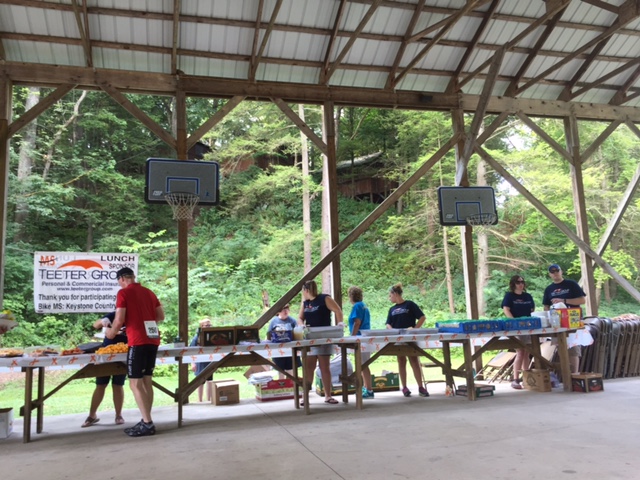
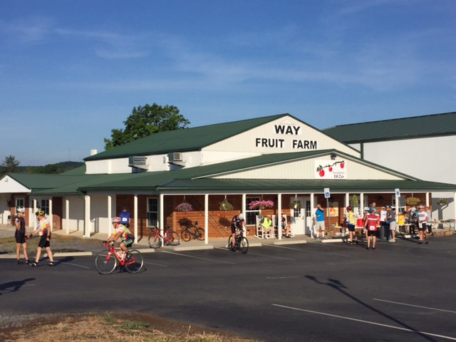
We rode through Roaring Spring to our first aid station at Ritchey’s Dairy. I wasn’t there long and head out through Martinsburg. When the one traffic light turned green four riders went in front of me and I was right behind them. We were riding the same pace and I was sitting in. I was willing to do some work but two guys were pulling and the other two were sitting in and I was behind them. I enjoyed a free ride to Williamsburg to the second aid station.

MS-1-4

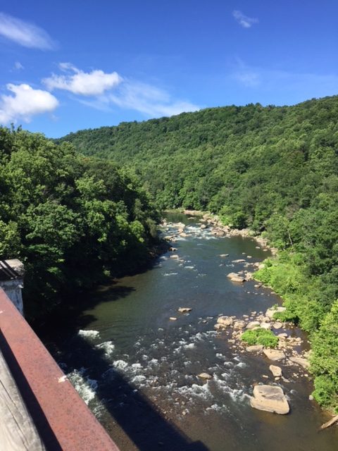
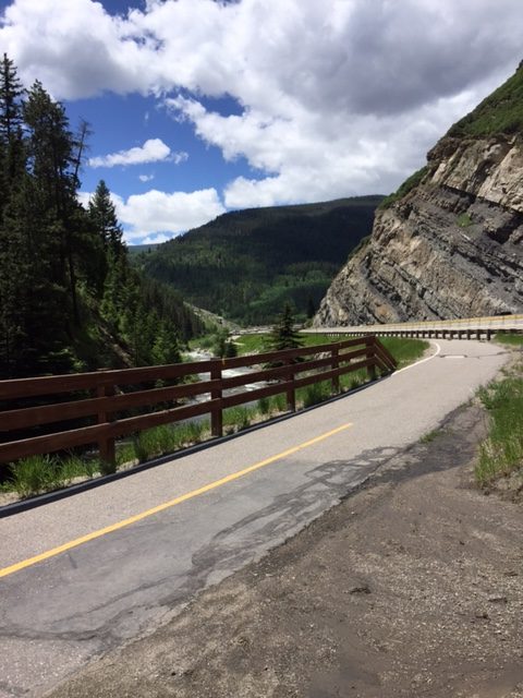
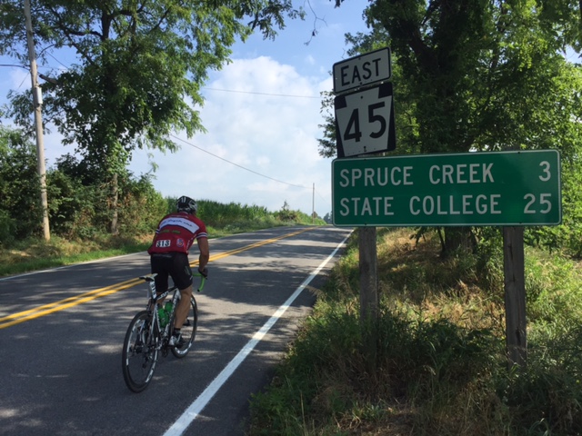
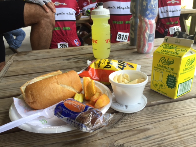
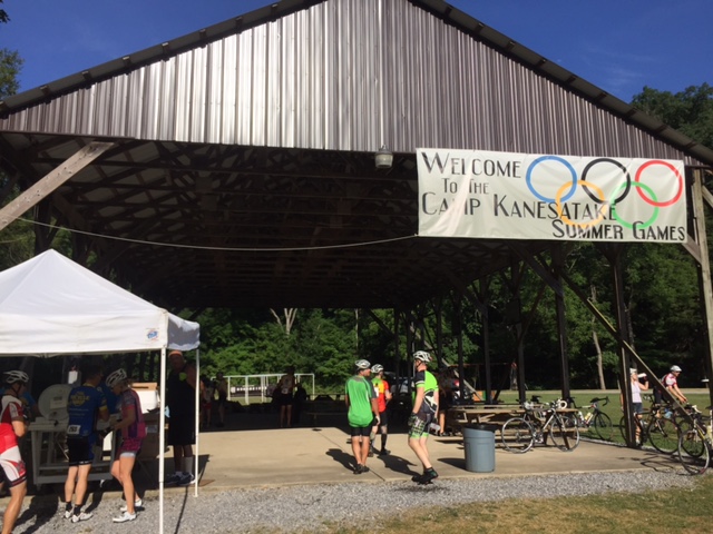
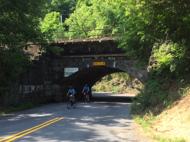
Ugh. I wasn’t feeling well and spent more time at the aid station than I wanted. Once one the road I rode solo and picked my way through the riders. We rode up through Spruce Creek to Camp Kanesatake, a Christian camp in Spruce Creek. Lunch was served and was delicious.

A free ride to Williamsburg. Sue Roadman (R).

As I got ready to roll out I noticed the group of four that gave me a free ride was rolling out too. I made a conscious decision not to sit in with their group and I really didn’t feel like riding at any pace other than my own. I let them go up ahead.

MS-1-6

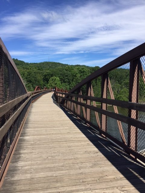
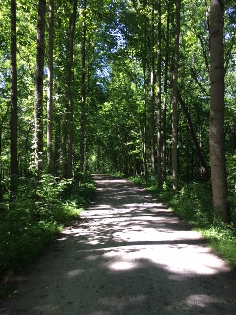
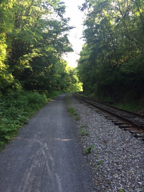
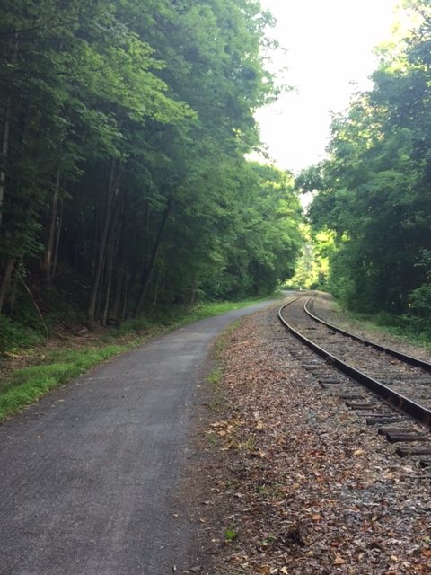
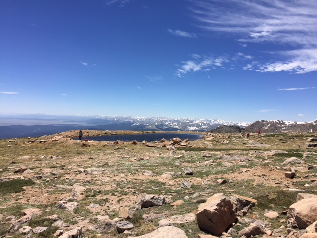
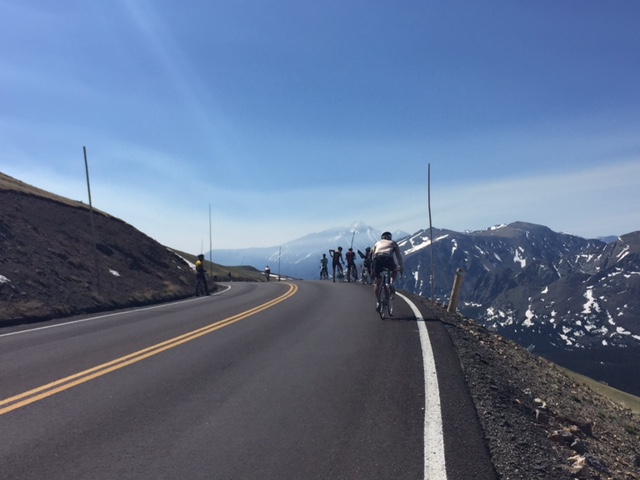
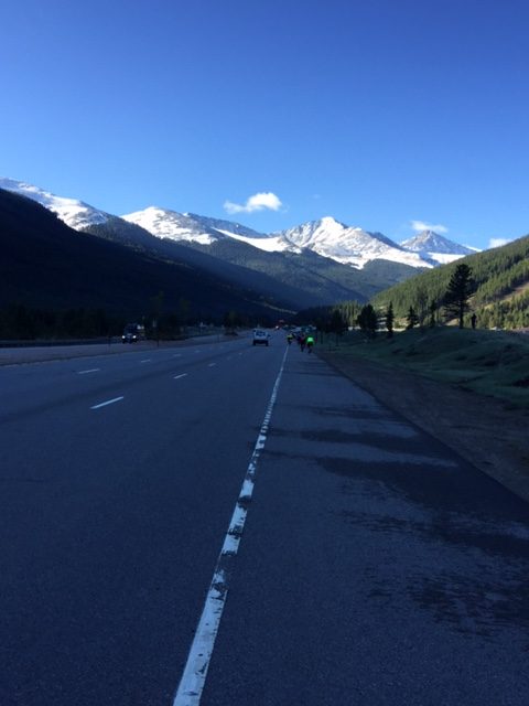
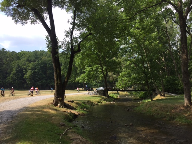
The next 14 miles were surreal. I saw no one up the road and, occasionally, looked back to see if anyone was gaining. I was all alone. There was an occasional turn marking to let me know I was on the right road and/or someone at an intersection.

MS-2-1

I did catch a glance at someone about a quarter mile up the road. For a while I wasn’t gaining, and the road, with curves and forest, made it difficult to see anyone. Eventually, about 13 miles in, I saw I was gaining and recognized the rider as the one woman in the group I was with earlier.

MS-2-2

I thought when I caught her that I would offer to ride with her to Penn State. She was struggling. When I did catch her I chided her group about dropping her. Before I could tell her my plan, we came upon a rest stop. Never got her name but she splits time between Bedford and Boulder so we talked Ride the Rockies.

MS-2-3

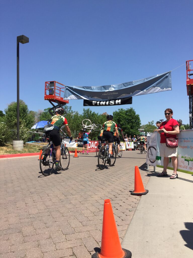
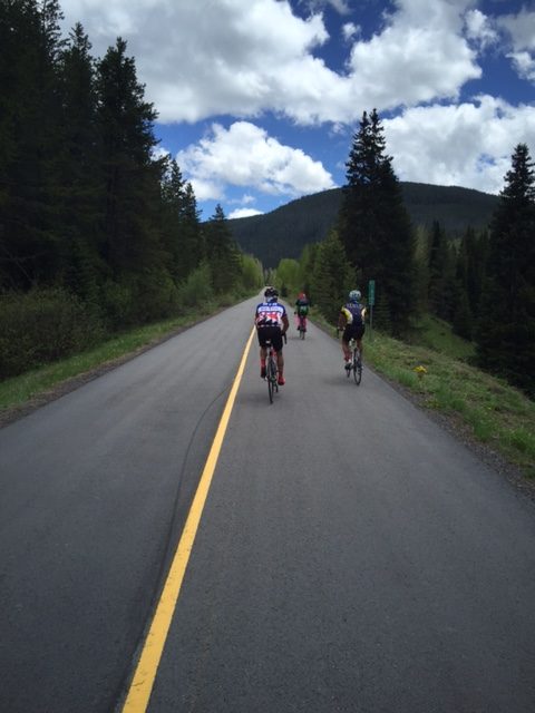
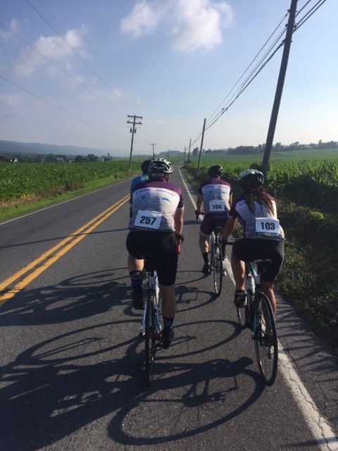
A group from the Blair Bicycle Club rolled out together and we both jumped in for the ride to Penn State. I talked with some of the riders and we kept a reasonable pace for the final 13 miles.

MS-2-4

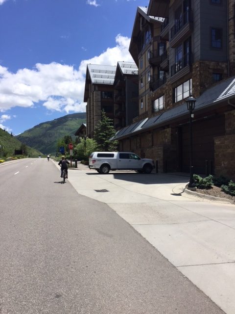
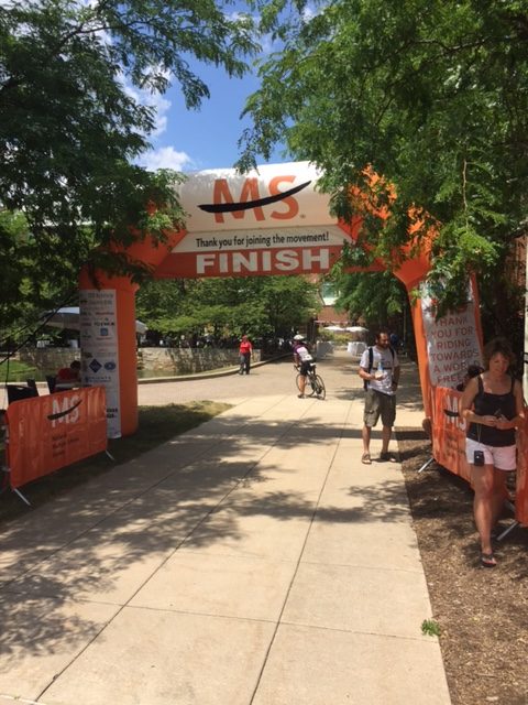
At the Penn Stater I showered then took a shuttle to downtown State College and grabbed something to eat. When I was done I made a a phone call back to the hotel and I was picked up within 12-15 minutes.

MS-2-5

A delicious breakfast was served. I was in line to leave by 6:45 a.m. and was in the second group to roll out. Like yesterday, the first couple of miles was just sorting out different riders’ speeds.

MS-2-6

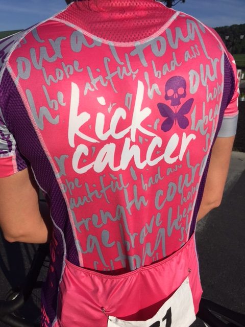
I talked to Tina Kunstbeck who was wearing an awesome Kick Cancer kit. And then I was riding in Tina’s group. For 45 miles.

MS-3-1

At the first aid station we rolled into together but I was not about to presume that I would ride with them. They rolled out then 30 seconds I left. I didn’t think I would catch the group of four but I did. Although we hadn’t been riding a pace line before we began in earnest.

MS-3-2

One of the guys asked me how old I was. I told him 61 and he said “I sure hope when I’m old I can ride as well as you.” That made me giggle. I think it was a compliment.

MS-3-3

We arrived at the third rest stop which was also a lunch stop. I went inside and got lunch and discovered my group had rolled on. Oh well. No malice intended and they may have even tried to find me before leaving. But it was all good.

MS-3-4

I like to take pictures. I missed three good photo ops today while riding in the group because I was not free to hit the brakes and take a photo. Now I could.

MS-4-1

I rode ahead to aid station four in Bellwood. I was alone. I did not catch anyone and two riders briefly caught me but I passed them back.

MS-4-2

After the Bellwood stop, a group of five caught me and I joined in. We rode to the finish. The only obstacle of having a real good time today was the four to five miles in Altoona. City traffic.

MS-6-1

I arrived back and was able to shower at the school (Hollidaysburg High School). We had lunch at noon which made that 10:00 lunch stop unnecessary which is, I’m sure, why my group kept rolling after a quick water break.

MS-6-2

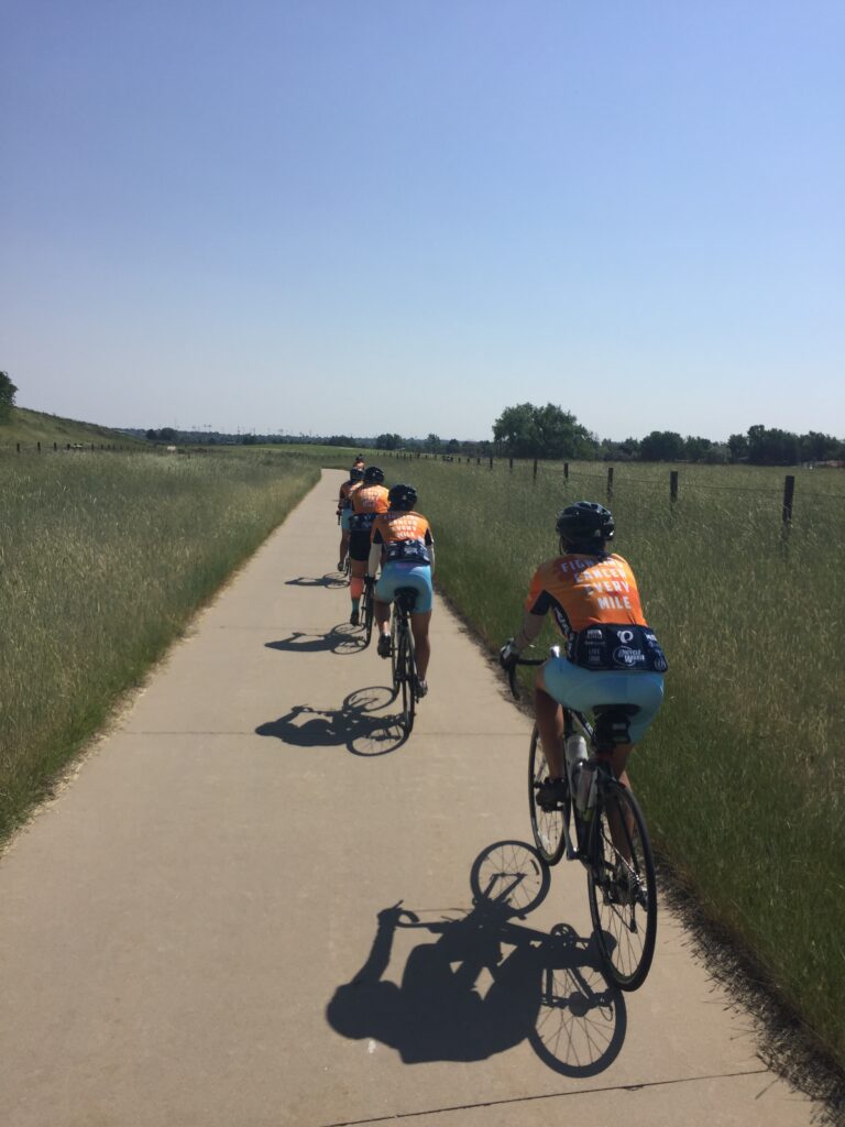
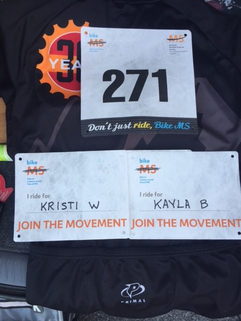
It was a good ride. I rode carrying a name on my back – I RIDE FOR _______*  – and only two people asked me about my name. My take is this is mostly a local ride well supported by riders, but many without an MS connection. In that way it was much different than my cancer riders. I had hoped for more of a discussion but oh well. It is a great cause and I’m glad I rode.

__________
* There was a name on my back. But I am not displaying it on the Internet. If you really need to know, come ride with me.


DAY 1


DAY 2


Ohiopyle

MARKLETON, PENNSYLVANIA

I was here in October for what would be my last ride with my dad. However, on that day we rode from the Markleton to Harnedstown trail heads, not quite making it to Confluence or Ohiopyle.  Today would be a solo effort to Ohiopyle.

I put on some arm warmers for what looked to be a beautiful day. But it was cool. Leaving Markleton, I was in a thick forest. And I was way down in a valley formed by the Casselman River so no sunshine yet permeated the trail.

I came to the Pinkerton Trestles. Trestle. Tunnel. Trestle. This place is beautiful. No picture can really capture how beautiful it is.

Ohiopyle_01
Pinkerton Low Trestle looking towards the tunnel

Approaching Confluence I was crossing a trestle, not at high speed, when a boy not quite in control of his Golden Retriever, let her cross in front of me stretching the leash. I stopped. The parents were horrified and apologetic. I laughed. I told them they must let me meet their dog.

Ohiopyle_02
Always stop and meet the dogs

At Confluence I was on the original GAP rail trail. It may be just as popular today as it was in 1985. It is beautiful.

Ohiopyle_03
Youghiogheny River at Confluence

This may be the prettiest 10-mile stretch of the 335 miles between Pittsburgh and D.C. The trail hugs the Youghiogheny River. But it was also crowded with casual cyclists (think rental bikes – it’s what they do at Ohiopyle).

Ohiopyle_04
Youghiogheny River at Ohiopyle

The trail has nice restrooms at Ohiopyle. It is a hub of activity including restaurants and outfitters (both rafts and bikes).

Ohiopyle_09
Ohiopyle

The bridge over the Yough was crowded with inexperienced cyclists. Good for them as the kids are learning to love riding their bikes! But just 1/2 mile farther to the loop bridge and the trail was empty.

Ohiopyle_06
Youghiogheny River from the Loop Bridge at Ohiopyle

The ride back was mostly uneventful. A stop in Confluence for some ice cream. And one detour by choice. At the Pinkerton Tunnel I chose not to ride 800′ through the tunnel but to take the “bypass” as it is now signed. For years the tunnel wasn’t open and one had to follow the river. It is an additional mile and one half of solitude. No riders on this section.

Ohiopyle_07

It was just a beautiful day on the bike. Trails are not my preferred method of biking but for a couple of days I have really enjoyed riding off road.

Ohiopyle_05


Cumberland by Dust

CUMBERLAND, MARYLAND

Fifteen years ago I was all about riding these great rail trails. They are still fun, for a change, but not generally my preferred riding.

Cumberland_08
Canal Place, Cumberland, Md.

The last time I was here with a bike the trail wasn’t open from Cumberland to Frostburg. Andrew and I took the train, the Western Maryland Scenic Railway, and put our bikes on the train. And that was cool.

But the rail trail has been open for years now. It is one of a handful in the country where a rail trail shares the right of way with an active railroad. Plus it also shares a tunnel.

I started at Mile 0 at Canal Place where the Great Allegheny Passage (GAP) and the C&O Canal Towpath meet. From here is it 184 miles to Washington, D.C. and 150 miles to Pittsburgh.

Cumberland_05

The first two and one half miles are paved. I brought the mountain bike and was starting to wonder if this is now a paved route. (It should be.) The pavement ends once one reaches the bridge at the Narrows.

Cumberland_04

The trail opens up, following the Western Maryland Scenic Railroad. Before 1975 this was a two track right of way. Today it is one track for the train and a crushed limestone path for bikes. And walkers.

Cumberland_15

At Mile 5.5 (I think) I came to the Brush Tunnel. I believe this was the big hang up in completing the trail from Cumberland to Frostburg. The lawyers for the railroad didn’t want anyone close to the tracks, especially in a tunnel. In the end, the tracks and trail both go through the tunnel, separated by a cable guard rail. And a warning sign not to be in the tunnel when a train approaches.

Cumberland_01

Although this was my first time on a bike, I have been up this trail before. Almost two years ago we took, Andy, Aiden, and Annabelle on a steam train ride up to Frostburg. And years earlier Andrew and I took our bikes up to Frostburg on the train.

Cumberland_16

The train had too much crushed limestone for my liking. Snap. Crackle. Pop. Every revolution sounded like Rice Krispies. And the dust was something else. My bike was covered in dust as was the water bottle.

Cumberland_20

About two miles from Frostburg the train tracks turn up towards the town and station while the “main line” continues straight. When I reached the Frostburg I was planning to turn around. But I checked the map and saw the Borden Tunnel was only a couple miles up the road. That was my new goal.

Cumberland_19

After reaching the Borden Tunnel I kept going. How far was the Mason Dixon line? A new goal.

Cumberland_02

I reached the Mason Dixon line. It is now a small park instead of just a sign which it was the last time I had been through here on my bike four years ago. Then I turned around.

Cumberland_18
Mason Dixon Line

At Frostburg I took the road up to the train station. There wasn’t much happening because the train has been closed since spring due to a landslide above two miles east of here. So no trains make it to Frostburg.

Cumberland_17
Near the site of the landslide closing the train

Back on the trail I was just shaking the lactic acid from my legs and adjusting my Garmin on my bike. A couple passed me. That shouldn’t have happened. Didn’t they see I was merely adjusting things and then going to ride?

Cumberland_13

I decided I would pass them back and they would never see me again. I did and they didn’t. I took off and rode @ 20 mph for most of the next hour. On limestone. On a mountain bike. It was a dusty day but otherwise very pleasing day on the bike.


Mount Evans

IDAHO SPRINGS, COLORADO

Nine years ago I flew in from San Diego to attend a sports officials conference in Denver. I rented a bike in Idaho Springs and rode to the summit of Mount Evans. My legs were like Jello and I said I would never do this ride again. Once was enough. Until today.

RTR16_8_17

The last couple of years I was curious what the effect of riding a week about 10,000 feet may do to my ability. So this year I did it.

RTR16_8_08
The section from Idaho Springs to Echo Lake

I went to Idaho Springs with this new found fitness level. And my own bike. I remember in 2007 that I could not drink enough water. Although my plans were to include bringing a Camelbak, I forgot that at home. But I did throw two extra bottles of water in a backpack which I wore.

RTR16_8_09
The section from Idaho Springs to Echo Lake

It was near 70 degrees (20 C) when I left the parking lot at Idaho Springs at 8:00 a.m. The first 14 miles are relatively easy, well the first seven miles are definitely easy. And I was taking it easy. I was reliving the events of last week’s Ride the Rockies when I was startled by Mike from Kansas City passing me at Mile 8. Initially going as far as Mile 11, I convinced him to ride to Echo Lake (Mile 14) and we chatted the whole way.

RTR16_8_18
Entrance to Mount Evans Road at Echo Lake

There was a line of cars waiting to enter the Mount Evans Auto Road. I joined two other cyclists talking about the admission fee ($3) when a ranger came and told us that we didn’t have to wait and just to go on in. Sweet deal.

RTR16_8_10
14 Miles to the Summit

We started up the road together but after taking one photo I pulled over. My phone said that memory was full and I stopped to delete photos to free up some space. I would be rewarded for that.

About two miles up the road I saw a bear amble across the road. I could not react quickly enough to photograph him but the road cut through a hillside. The bear came from the lower section, crossed the road, then continued up the hillside into the trees.

Echo Lake
Echo Lake

I did not have the benefit of a Garmin tracking my ride nine years ago. I would be curious to know how this ride compared. Maybe not well.

I wanted to keep my heart rate low. I did. About three hours in Zone 1, 23 minutes in Zone 2, and I never went into Zones 3, 4, or 5. To say I didn’t push myself would be an understatement.

RTR16_8_04

But I just kept my pace steady. I tried at times not to look too far in the distance because all I could see was the road cutting through the rocks ahead. I won’t say I remember every turn from nine years ago but much of it was familiar.

RTR16_8_12
Switchbacks near the summit

However, one section I misremembered was Summit Lake. When I approached it it was nothing like I had pictured except it was still on my right. The road dipped down more than I remembered and the lake wasn’t at all how I pictured it.

RTR16_8_05
Summit Lake

The climb is a slog. It just keeps going and going. Above the tree line the road is paved but the freezing caused whole sections to buckle. It’s not bad going up because of the low speed but makes for a rough ride coming down.

RTR16_8_01
Mountain goats at the summit

Nine years ago I tried to pedal out of the saddle (standing up) and immediately sat down. I got dizzy quickly. Today I could stand with no issues. I think one week of riding at altitude made that easier for me. But yet, I think I was slower. One week at altitude may not offset 20 pounds and nine years.

RTR16_8_02

At the summit I took a couple of pictures then left. I had intended of staging my arrival by handing my phone to a stranger then going back down 200 yards or so then coming back up. But really, there is no great summit moment. Just a parking lot that people are trying to get into.

RTR16_8_13

Nine years ago I went hypothermic on the descent. Today I carried a vest and arm warmers and that was enough. I was glad to have them but would have been okay without.

RTR16_8_15
Tried to capture how steep the drop off is but I didn’t. Trust me. It’s steep.

Leaving the summit, the first five miles aren’t a lot of fun. Visually it’s hard to see how steep the road descends. At times it looks like it may go down 1-2% but is probably 6-7%. The bike wanted to fly. But every 50-100 yards was a big crack in the road. Those aren’t fun hitting at 25-30 mph.

At Summit Lake there is a bit of a climb. It was no problem this time although a 28 mile downhill uninterrupted would have been nice. The farther you descend the better the road gets.

RTR16_8_16
Beautiful Idaho Springs

Once back to Echo Lake I had a 14 mile descent on beautiful pavement. I took off my vest and warmers because the temperature at 10,600′ was a balmy 75 degrees. From there I let it roll all the way back to Idaho Springs.

Nine years ago this was a major accomplishment. Today, it was just another ride. But a ride in which I saw a bear.


Texas 4000

GREENWOOD VILLAGE, COLORADO

Seven years ago I received a message from a 17 year-old referee wanting to officiate in the WAGS Tournament. Thus my friendship began with Vanessa Beltran. When she was in DC she told me about the Texas 4000.

My affection for and affiliation with the Texas 4000 has grown from that day. Today was the day for me to ride from Denver to Boulder with the Texas 4000.

I arrived before their dedication circle. I met my “Bicycle Buddy,” Ayesha Kang. Or I met her again, since I actually met her in October in Austin at the Livestrong Challenge.

T4K_01
Dedication Circle

I dedicated my day to Jacob Grecco, Alex Shepherd, and Jamie Roberts.

I was assigned an all womens’ group, Ayesha’s group. Out of the 20 riders, 13 were women and only seven were men.

T4K_03

They had the turn by turn directions and I was only along for the ride. We stopped a lot. And we stopped at stop signs, even when it was visibly clear to roll through. One of the riders made it a point to state that the Texas 4000 stops at stop signs. I can also state that they have extensive safety training, have to ride a timed century and ride at least 2000 miles before they ride their first mile with the Texas 4000. This group does it right.

T4K_04
Ayesha now rides for Team Jacob

We meandered. Back tracked. But it was all good. We only had gone 15 miles when we came to their rest stop. One of the riders, Alex Lawrence, had family in Denver and brought out a big lunch. Her family was very proud of her to to serve the Texas 4000.

T4K_06
Alex Lawrence’s family

After lunch, I wanted to keep riding with the group but I knew there was no way I would ever find my way back. I said goodbye to Ayesha and the rest of her team. We had two alumni riders and two friends who rode out with us so I jumped in their group to ride back.

We did not back track. Maybe that was impossible. But we found a new, longer way. Life is good. At the Cherry Creek Dam in Denver, we stopped to wait for our riders. The Denver Century was being held and there was an Aid Station right where we stopped. We got some fresh cold water for our bottles, needed on this hot day. They didn’t seem to mind that we weren’t part of the Denver Century.

Riding with the Texas 4000 in Colorado

For one day I joined this cancer fighting team. It was a great day. Godspeed my friends.


Fort Collins

FORT COLLINS, COLORADO

On its sixth and final day, RTR will return to Northern Colorado with their eyes set on Devils Gulch and Horsetooth Reservoir; a stage originally planned for 2012 but rerouted by the High Park Fires. Cyclists will enjoy a 55-mile trek through Larimer County, touring the vibrant communities that not long ago were hammered by relentless rain and devastating floods. Now, standing tall as ever; a testament of community, will and grace; these towns are primed and ready for a parade of cyclists. The week will draw to a close as 2,000 friends – new and old –reflect and rejoice at Odell Brewing Company in a little town we fondly call Fort Fun!

One week goes by too fast. Hard to believe this is the last day of Ride the Rockies.

I left the Comfort Inn and went back to RTR headquarters. I noticed a number of riders were just jumping on course and going without going back to RTR headquarters, and who could blame them? But I rode uphill and went to the official start line, not to be pure in my ride but simply to meet my riding partners.

David and Christine were at the start. I sort of ignored the actual profile believing, as I told them, that we had a 20 mile downhill followed by a mostly flat run-in to Fort Collins. I was partly right. We had a 20 mile downhill.

RTR16_6_01
Looking at Estes Park with the Rocky Mountain National Park in the background.

We rolled down through Big Thompson Canyon. It was here in 1976 that a flash flood killed 143 people. The canyon is gorgeous and made for a nice descent to Loveland.

It was a perfect ride except when we were in the lowest part of the canyon. At first it appeared the highway department was doing some road work but it became more apparent that a truck hauling asphalt came by and was dropping asphalt. There was a stream of asphalt in the west bound lane. Although we were going east, the cars were trying to avoid it and black tar covered pebbles were flying towards us in our lane. Yuck.

RTR16_6_02
Big Thompson River

We turned on Buckhorn Road for a back road ride to Fort Collins. I expected a flat or maybe “lumpy” finish. This was anything but that. We stopped at Aid Station 2 where Christine caught up with her brother, Don, who joined us for a bit.

RTR16_6_08

We came to the Horsetooth Reservoir. There were three sections that appeared to be spillways but I think they were just dam retaining walls. All were close to the water and then featured a neat little climb up away from the water.

The last climb of the week

These were some of the steepest grades we had all week. Many people were walking. (Not us, of course.)

RTR16_6_03

But what comes up .. must come down. On the last hill, I saw a really nice descent. I let it go. I was quickly up to 51 mph, my top speed of the week when I saw a 35 MPH speed limit sign and two policemen. Oh well. If they were busting cyclists on this descent they had me. I just got down lower in my tuck and rolled by. And waved.

Random finishers

The roll in through Fort Collins was nice. This is a very pretty city. We continued to O’Dell’s Brewery where the finish line festivities were being held.

RTR16_6_05
This guy was on a bike all week (hand-cycle). Impressed!

My car was in a lot next to the finish. Had I had my keys with me I could have put the bike away. Instead, I had to retrieve my luggage from Alpine Cycling and take all of it to the car. Then I went back for Terry Moran’s bike. He had gone home on Tuesday but Alpine moved his bike to Fort Collins so I could take it home.

RTR16_6_10
A hotdog, or bratwurst, to celebrate

After the ride I searched out the Smoothie folks for one last Smoothies. I found a Polish Sausage to celebrate then waited for the closing ceremonies. I didn’t win the bike but heard some facts about the ride: Youngest rider was nine; Oldest was 82. Every state except West Virginia was represented. Ten countries were represented as well.

RTR16_6_11
We crossed the finish line together

Throughout the week we passed some amazing cyclists. I saw a blind cyclist – hopefully he was stoker on a tandem. There are always some hand cyclists, often with Ride to Recovery. There is a guy I met two years ago who has no hands – just prosthetic hooks. Since he can’t brake using hands, he has a “butt brake” where he slides back on the saddle and it applies pressure on a bar connected to a braking system. Then there was “Tim.” He rode a recumbent hand-trike. No legs, and one functioning arm plus as prosthetic arm. Absolutely amazing.

RTR16_6_06

It was a good week and a good ride to end the week. Let’s do this next year!


Estes Park

ESTES PARK, COLORADO

It’s the shortest day of the week at 49 miles and the day that cyclists will fall hard; hard in love with the majestic state of Colorado. West to East, across the Continental Divide, Trail Ridge Road hugs high alpine ridges with stunning views near and far. Cyclists will be treated to 11 miles above 11,000 ft. with many scenic overlooks and beautifully maintained roads all the way to Estes Park. Rocky Mountain National Park affords the most iconic ride in our Centennial State; and one you’ll treasure for a lifetime.

I left Daven Haven Cabins and rolled out to the Ride the Rockies headquarters. It was 59°. I assumed a vest for Trail Ridge Road with arm warmers would be enough.

RTR16_5_01
Rolling out of Grand Lake

Almost immediately after turning onto U.S. 34 to go into the Rocky Mountain National Park, the temperature dropped 25 degrees. That is, if it ever was 59° this morning. We could see our collective breath as we rolled into the park.

RTR16_5_02
Switchback on Trail Ridge Road

Admission was free to the park if they could see the RTR wrist band or bike tag. I rolled through the gate. Freezing. The temperature had dropped to 34 degrees. My fingers were freezing. I regretted not bringing along long-fingered gloves.

RTR16_5_03
Trail Ridge Road

I pulled into the Aid Station #1. The line for Flippin Flapjacks was incredibly long as was the line for the porta-johns. I left.

RTR16_5_05
View from top of the world

I began the climb up Trail Ridge Road in earnest. I was getting warm. I unzipped the vest and let it dangle. I was feeling good.

RTR16_5_06
Trail Ridge Road

When I reached Medicine Bow Curve, a sharp right-hander above the tree line, I turned into the wind. It almost blew me over. It was strong (estimated by me to be 40 mph) and cold (mid 30s). I pulled over simply to put my vest back on. I had to turn my back to the wind to get it zipped. Then I was off pedaling into the wind.

RTR16_5_07
Barry on Trail Ridge Road

It was harder pedaling into the wind than climbing. Reaching the Gore Range Overlook many people thought we were at the summit. We weren’t. I turned the corner and was hit with a wicked cross wind. I’d rather have the head wind than the cross wind. It was hard to control the bike even while going uphill.

RTR16_5_13
Rocky Mountain National Park, Estes, Co.

The next couple of miles could best be described as rollers. And then the descent began. A very dangerous descent. The winds made it wickedly dangerous. The bike had the wobbles.

RTR16_5_09
Trail Ridge Road

I wanted to let the bike go (which means go really fast) but it was prudent to proceed down with caution. Darn it. Once reaching the tree line the winds were mostly blocked. Then I could ride more freely (think: no brakes). I stopped to watch a group on horses cross the road. Then made my way to Estes Park.

RTR16_5_10
Trail Ridge Road

At the RTR Headquarters I spent a bit of time with Clare from the Hot Shot display. She explained to each and every rider who approached that what we think about cramps is completely wrong. She introduced us to her product which was part cinnamon and part chili pepper. It will fool the nervous system and make the cramps go away.

RTR16_5_11
Trail Ridge Road

While there I won a T-shirt. The DJ who appears at one Aid Station every day found it too windy up on Trail Ridge Road. He was in the parking lot at the end. And he offered one of his Tour T-shirts to “the male with the longest hair.” There were already two guys there. One, a 12-year-old boy, but his hair wasn’t very long. But there was a 20-something who did have longer hair. I sort of felt bad for winning. But not.

RTR16_5_12
Rocky Mountain National Park

The afternoon cycling session was Allen Lim, PhD. He is a sports nutritionist and founder of Skratch Labs. He spoke about where cramps came from. What he said, an error in the nervous system, tracked what Clare has said earlier.

RTR16_5_14
Clare, from Team Hot Shot

After the session I met with Allen. I told him I had two questions. The first was about Floyd Landis on Stage 17 in 2006. Was it the Jack Daniels? Damn, you had good oatmeal? Or holy s–t?

RTR16_5_15
Allen Lim, Barry Sherry

To his credit Allen told me, along with Ron and Erlinda Kiefel, everything about that day in France (and not repeating it here). I also asked about cramps and he confirmed, without endorsing, what Hot Shot was offering. I’ll be carrying that with me.

RTR16_5_16
Riding Partners – but not today. Barry, Christine, David

Grand Lake

GRAND LAKE, COLORADO

The day will start fast as cyclists spin along the Summit County and Dillon Dam Rec Path from Copper Mountain to Silverthorne. Once past the reservoir, cyclists will head north en route to Ute Pass Rd.; a moderate climb with panoramic views of the Gore Mountain Range. At the bottom of the pass, cyclists will test their handling skills on a 13-mile stretch of compacted dirt as they navigate their way through the open range of Grand County. Once on US 40, cyclists will roll through Byers Canyon and Hot Sulphur Springs before finishing in Grand Lake; the Gateway to Rocky Mountain National Park and a first time-host community of Ride The Rockies.

Everything is relaxing once you get on the bike. Getting going was the tough part for me. Staying in a condo with a Jacuzzi, I didn’t get a chance to use it until … I woke up at 2:00 a.m. What a perfect time for a two hour Jacuzzi, no?

After going back to bed at 4:00 a.m., I was up at 5:30 a.m. I washed clothes in the condo last night and had the added task of repacking everything. I didn’t have as much time as I thought.

Christine Currie, told me her group was rolling out at 7:00 a.m. and invited me to join them. Time flew by too quickly and it was almost 7:00 a.m. I finished writing two Father’s Day cards for my dad then went to close up the condo. I took my bike down to the lobby and was shocked to see that Alpine Cycling was picking up our bags at 7:00 a.m. instead of 7:15 a.m. It was 7:00 a.m.

I saw most bags were picked up and I rushed back to the fourth floor to get my bags. I was in my socks. I left the condo key in the condo, grabbed the bags and took them to the lobby. Then it hit me. My cycling shoes were in the condo. And so was the telephone number of the property management company. I asked a couple of folks if they had the number to call and they did not. And Alpine was coming for my bags.

I thought I might have to ride 1/2 mile to check-in in my socks, get a new key, then go back to the condo to rescue my shoes. Before my bags left I thought I should grab some sunscreen. I opened my cycling bag and there were my shoes. What a disaster it would have been had I ridden off in my socks and sent my shoes with Alpine. Crisis averted but not without a lot of angst. Way too much angst.

The clock was running. I already missed my cycling group. I rode to the check-in lodge and handed them two cards to mail for my dad. I was told they couldn’t take mail as though their property doesn’t receive any mail ever. Ridiculous. They gave me directions to where I could find a blue mailbox to mail them myself. Back up in the village In the opposite direction. Geez!

By the time I found the mailbox and mailed the cards it was 7:30 a.m. I was well behind.

We left via a bike path, the same path that came off of Vail Pass yesterday. It was also the same trail we followed two years ago from Avon to Breckenridge.

te It was gorgeous. It was narrow. And it was no place to try to take back time on riders already down the road. But I tried. A long line of 15-20 riders at a time was riding single file. And I was the guy trying to pass them all, but always calling out “on your left” and “thank you.”

RTR16_4_12
Barry going up Ute Pass

I made great time to Aid Station 1. Still, I can’t imagine making up more than 6-7 minutes over those first 20 miles. I pulled into the Aid Station, didn’t see anyone I knew, then left. I texted Christine and told her I was past Station 1 and she told me they were still there. At Flippin’ Flapjacks. I was three miles down the road and turned back.

Reaching Aid Station 1 again, I did not see anyone familiar. So I left. I assumed I would be riding solo today, which was OK.

RTR16_4_01
Ute Pass

There was a water stop at the base of the Ute Pass climb. Many people were pulled over, if not to refill their water bottles, but to take off their cold-weather gear they had on when they rolled it. It was 34° when we rolled out. Garmin was registering 30° about six miles in.

RTR16_4_05
Christine Currie

I started the climb and was feeling very good. It was a five-mile climb and halfway up the temperature was 70°. I was sweating. I passed a woman with a headcover on under her helmet and thought how hot she must be. Then I remembered. I had a headcover on too.

RTR16_4_02
Riders climbing Ute Pass

Between not remembering I packed my shoes this morning and then forgetting to remove the headcover, it was a forgetful day. I did a U-turn to take off my helmet to remove my headcover. It also made for a nice picture. And just then Christine and David came riding by. So I jumped back on and we rode together the rest of the day.

RTR16_4_03
View at Ute Pass

Ute Pass, at 9600′, was a low one on this trip, but was a nice climb. I was prepared for a dirt road on the descent but was surprised with pavement for the first 3.5 miles. David and I took off chasing 50 mph. I looked down and saw 49.2 which was my high for the trip so far.

We found the 13 mile dirt road which wasn’t a true dirt road. Not quite chip and tar, it was pretty solid or hard although rough in spots. But one could roll pretty easily on it and no one really had to worry about gravel.

We met up with Christine’s brother, Don Currie. But we never found her two uncles.

Once off the dirt what remained was a 44-mile ride up to Grand Lake. We went through the picturesque Byers Canyon, one I went through in the opposite direction two years ago from Winter Park to Steamboat Springs.

RTR16_4_04
Byers Canyon

At a rest stop we were by a grand lake. I was informed that it was Lake Grandby. We rode for a while past the lake and climbed a little. As we approached Grand Lake there was a lake to the right. That was Shadow Mountain Lake. Apparently the smallest lake of all in Grand Lake, is Grand Lake.

RTR16_4_06
Daven Haven Cabins

It was an 85-mile ride but I already added six extra miles in the morning, maybe more since I rolled about and forgot to start my Garmin. I stayed at Daven Haven Cabins and my luggage hadn’t arrived. With no clean clothes to change into, I thought I would explore the town and complete a century. Except, there aren’t a lot of roads here. At least paved ones.

RTR16_4_07
Grand Lake from the Adams Tunnel

I followed one, West Portal Road, looking for Adams Falls. Instead I ended back at the lake and discovered that much of the water for Grand Lake leaves via a tunnel under the Continental Divide to provide water to Denver. That’s pretty neat engineering.

RTR16_4_08

I spent some time at the local summer stock theater talking to the young lady in the box office. We were two days too early before they opened. Little Mermaid was opening on Friday.

RTR16_4_09
Bridge connecting Shadow Mountain Lake with Grand Lake

I finished off the century and went and showered. Dinner would be a pasta dinner at the cabins. They had erected a tent and featured three kinds of pasta for $15. It was a pleasant evening and a good dinner.

RTR16_4_10
Dinner at Daven Haven

I powered up the toys and checked my data for the day. I was very surprised to see 50.27 mph. I hit 50 after all.

RTR16_4_11
Made it. Average speed is total time, not moving time.

Copper Mountain Loop

COPPPER MOUNTAIN, COLORADO

It’s another big day in the saddle with stunning scenery and three notable climbs. This 79-mile stage, made famous by our good friends at Copper Triangle, will take cyclists back over Fremont; past the Tenth Mountain Division Memorial; across Red Cliff Bridge; with a quick and punchy climb up Battle Mountain. With Fremont and Tennessee Pass in the rearview mirror, a stroll through Minturn and Vail await; followed by a slow and steady grind over Vail Pass – a first-time feature of Ride The Rockies.

RTR16_3_01
Morning at Copper Mountain Village

Arriving Copper Mountain last night my legs were sore. They didn’t quite reach the Jello stage but they were sore. I can imagine that many riders were in the same situation.

RTR16_3_02
Headed up towards Fremont Pass

It’s a new morning and I am ready to tackle the Copper Triangle. Yesterday’s 11-mile descent from Fremont Pass to Copper Mountain is now today’s warm-up and a bit daunting. We would need a warm-up because it was 37° at wheels-down (7:30 a.m.).

RTR16_3_03
Flippin’ Flpajacks

Christine Currie, riding with two uncles and her brother, met me and told me they were riding a less ambitious schedule. So we started out and headed up the pass. At the top I found Flippin’ Flapjacks, my first time eating here in four years. Usually, there is a long line but today I just walked up and paid the $6 for all you can eat. It’s well worth it.

RTR16_3_05
A blind cyclists at Aid Station 1 – Hopefully a stoker on a tandem.

After my hearty breakfast, we headed down off Fremont Pass. I thought I might get a good speed going but there was a curve at the bottom of the descent and one above-average cyclist was hogging the left lane. I did not want to pass him by crossing the yellow line So I settled on 47 mph.

RTR16_3_06
Red Cliff Bridge

We rode to Leadville then turned right towards Tennessee Pass. As we approached the bottom of Tennessee Pass, Christine told me that two years ago she had spread some of her father’s ashes here. I wish we would have stopped but I rode ahead and let her have her private moment.

RTR16_3_07
Christine Currie riding beside Eagle River

We did a brief photo-op at Red Cliff Bridge. The climb up Battle Mountain was nice but the descent down was even nicer. Beautiful vistas and many curves. Not sure if I prefer one steep straight descent or a winding curved road like this one. It was fun.

RTR16_3_08
Railroad tracks in Minturn

From Copper Mountain to Minturn, just before Avon, these 55 miles were a repeat of two years ago when we rode from Avon to Breckenridge. In the opposite direction. Of course the first 23 miles from Copper Mountain to Leadville were a repeat of yesterday’s ride from Leadville.

RTR16_3_09
Lower Section of bike trail near Minturn

We followed the beautiful Eagle River to Minturn then turned up Vail Pass. Here we turned on a bike path which I tracked on Saturday while riding the bus to Carbondale. I was thinking I’m sure glad I don’t have to bike up that path. And now I was.

RTR16_3_10
Vail

Interstate-70 crosses Vail Pass. It’s a grind for vehicles with its 6-7% grade most of the way. Parallel to the interstate is a bike path. But it doesn’t have even grades. It follows the contour of the mountain, sometime 2-3% and sometimes 12-15%. It would be much easier to stay on the highway, minus all the traffic, of course.

RTR16_3_11
Vail

At an Aid Station just slightly up the climb, I stopped for a Smoothie. Two, in fact, as I poured them into my water bottle. I overheard the one piece of intel for the climb. Right after crossing a bridge (it was actually going under I-70), there is a sharp left turn and a steep hill. If you are in the big ring you will be stuck in the big ring. I shared that with Christine and we had no problem.

RTR16_3_12
Climbing Vail Pass

We climbed, getting passed by a few riders but passing many. This section was one of the harder ones. There was about 2500′ of climb over 10 miles, at altitude. And not graded like the highway was.

RTR16_3_13
Entering Copper Village

Reaching the top we decided we would pass the last Aid Station except we were held at the top. There had been an accident on the bike path on the descent and the trail was closed. We were held for 25 minutes then, once released, the state highway patrol released us just like we were on an alpine slide – two or three at a time with 30 seconds in between.

RTR16_3_14
Copper Mountain Village

Not to worry, after seeing and hearing the emergency vehicles, no one was of the notion to bomb the descent on a bike path. We rode a comfortable pace, passing just one super cautious rider.

RTR16_3_16
Scott Mercier

The afternoon seminar featured Scott Mercier. You probably never heard of Scott although he was in the Barcelona Summer Olympics in 1992. When he turned pro and signed with US Postal Cycling, he was offered a training program which consisted of EPO. He made a decision to walk away from pro cycling.

RTR16_3_17
Ron Kiefel, Barry Sherry, Scott Mercier

Scott was humorous and serious. His message was ultimately about integrity. He holds no bitterness to the hundreds who joined the European peloton in the 1990s and 2000s and accepted the team doctors’ training plans consisting of performance-enhancing drugs. In my four years of attending Ride the Rockies it was clearly the best seminar I attended. Well done Scott!

RTR16_3_15
Red Cliff Bridge in background

Copper Mountain

COPPER MOUNTAIN, COLORADO

Nothing screams Colorado quite like Independence Pass; the fourth highest paved roadway in the U.S., streaming with wildflowers and high alpine pools. The grade is tough and the road is narrow, but the views are well worth the grind. Once at the summit, cyclists will be rewarded with fast straights and brake-burning curves as they approach Twin Lakes. After touring the famous mining community of Leadville, it’s one last punch over Fremont Pass – home of the Climax Molybdenum Mine – before a fantastic descent to Copper Mountain Resort.

Riding through Leadville

I went to breakfast at the Limelight Hotel. I proudly wore my Pittsburgh Penguins jersey (cycling) in celebration of the Pens winning the Stanley Cup last night. While I was downstairs a woman saw me and told me she was a Sharks fan from San Jose. Sorry (not).

RTR16_2_01
Independence Pass

I rolled out of Aspen shortly after 7:00 a.m. Almost immediately the climb up Independence Pass began. I rolled past Aid Station 1 (too crowded). I passed many people saying “On your left, and Let’s Go Pens!” I wasn’t pushing myself but neither was I completely lazy when three women passed me. One was the Sharks fan from the hotel, Christine Currie.

RTR16_2_07
Independence Pass

The three of them broke up and I found myself riding with Christine. We rode together to the summit of Independence Pass. There we went our separate ways although not by design.

RTR16_2_05
Independence Pass

After 15 minutes I began the descent off Independence Pass. I am always chasing 50 mph and I figured if Christine had ridden ahead I might catch her. And I did. We talked all the way to Aid Station 3 then rolled out together to Leadville.

RTR16_2_02
Leadville

Once in Leadville, the trek up Fremont Pass was a repeat of two years ago. And I remembered it well.

RTR16_2_03
Climax, Colorado

From the top of Fremont Pass it was an 11-mile descent to Copper Mountain. I was chasing 50 mph but there was a pretty formidable headwind. I only hit 48 mph.

RTR16_2_04
Ron Keifel and Barry Sherry

We arrived at Copper Mountain. I helped Christine check-in. She thanked me for supporting her and told me that she didn’t think she would have made it today without me. Ron Kiefel was coming out and we talked with him briefly. I found my condo, at the Mill Club, then got a slice of pizza for dinner.

Christine Currie, Barry Sherry

I was dead tired. I wasn’t sure if I wanted to ride Copper Triangle tomorrow or just stay in my condo and rest for a day.


Verified by MonsterInsights