Pissed in Zürich

ZÜRICH, SWITZERLAND

I arrived yesterday and quickly built my bike. Something was wrong. I felt a rattle in the fork although things were tight. I caught up to a cyclist at a light and asked for a bike shop.

Unknown cyclist but nice guy who towed me to Cyclone Bikes

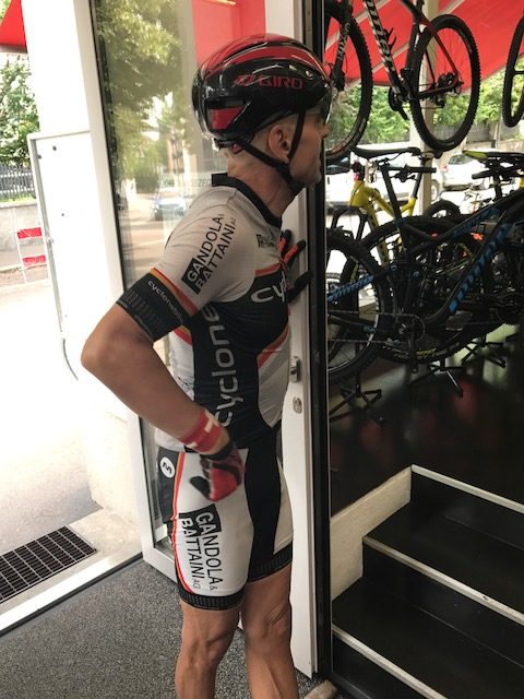
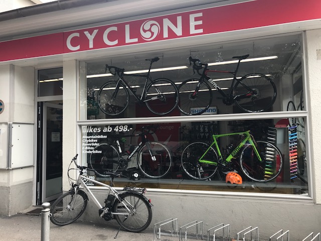
He took me to Cyclone Bikes where a young woman wrench (that’s cyclist talk for a mechanic) told me I simply had tightened the screws on the fork before the top. I just needed to reverse the order. I did and felt ready for the Alps. I also bought a CO2 cartridge.

Things worked perfectly after that and my exploring and warmup would be finished for the day. I went back to the apartment of [Friend] who graciously let me store my stuff while I biked across Switzerland.

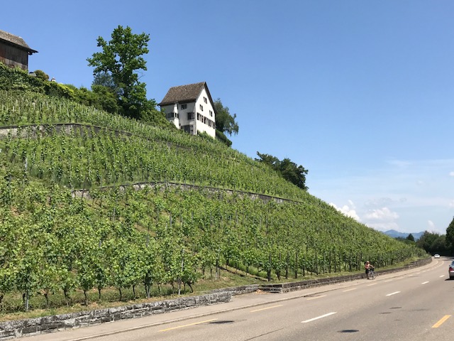
Today was a beautiful day, I tried to map a ride which would do more than circumvent the lake although that looked like a nice ride. I added some of the hillier terrain in town.

My plan was to head up to the zoo which is next door to FIFA headquarters. From there I would stay north of lake before coming back to it at its southeastern end.

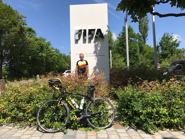
From downtown I started climbing immediately. It’s about two miles all uphill all the way to the zoo. I visited the FIFA HQ then could not have Garmin pick up the way out of there. With the lake as a landmark, I started back towards the lake, although sooner than I wanted to.

Hotel Restaurant Erlibacherhof

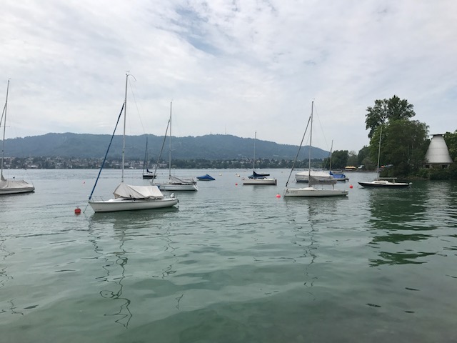
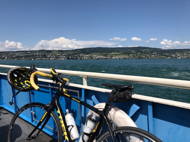
But the route along the lake is nice. I came to a ferry, which took me by surprise. I should have adjusted but I didn’t.

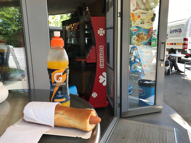
I went to the Kiosk concession stand by the ferry and had a nice conversation with the woman making me a hot dog. I admired the ferry and she said I should take it. I told her I was going around the lake and that would cut my workout short. What she should have done is what I thought of as I rode back towards Zürich.

She should have suggested that I cross the lake on the ferry then ride south back up to the ferry on the east side. Take it back over and complete a figure eight. In other words, I was going clockwise and could cross the lake then go counterclockwise back to the ferry and cross again, finishing clockwise. A perfect figure eight.

Instead I crossed at south end as planned and as I was riding up the west side of the lake I thought about the ferry more. When I got there I went to the front of the line and never made my final decision until the ferry worker waved me on. So I did an over and back. Same distance but not as sexy as if I had one a figure eight.

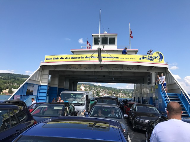
I really enjoyed the time crossing the lake but it would have been better one quarter of the way across and again at three quarters of the way.

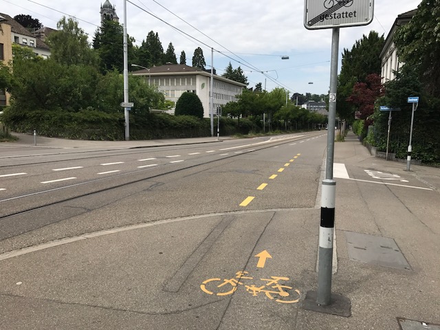
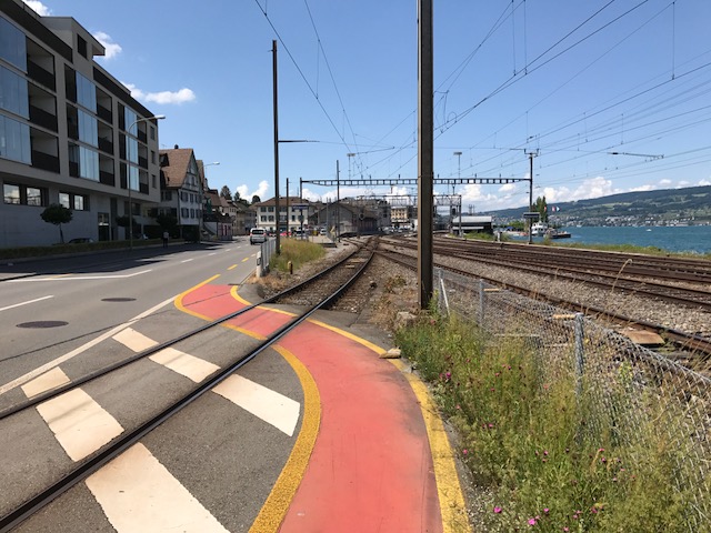
When you ride on the streets in Zürich there are sometimes bike lanes which is basically 1/4 of the full lane. Sometimes the lane ends abruptly and directs you up onto a sidewalk for a few meters or a couple hundred. Some are marked better than others.

Transition from walk to bike lane

[Friend] had told me horror stories her cyclist-boss had said about the police. They set up traps and wait. I found one.

Going uphill on the lake road, I came to a construction zone. There was a red light and I was first at the light. To go, I would be first and slow up a hill, holding up traffic. There was no bike lane because of the construction.

To the right was a bike path. So I thought. There was nobody on it as far as I could see and it looked like any of the many bike lanes I had seen. I rode up it when I heard someone calling. It was a policeman. I suspect I could have ignored him (not heard him) but I went over to him.

He started speaking Swiss-German which I did not understand. When it was apparent, and I was wearing my AUSTIN, TEXAS Livestrong jersey, he switched to English to tell me I was on a sidewalk. I apologized, told him I truly didn’t know, and hoped that would be end of it.

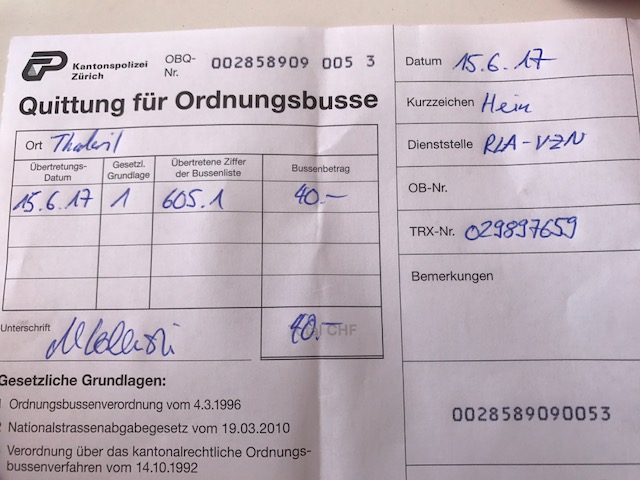
Instead he said that would cost me 40 CHF and asked if I had cash. I did not. But he would take a credit card. He explained how on a bike I might hit people. I started to ask “what people?” (there were none) but thought better of it.

I was pissed. I tried to do everything right and police should have some discretion to educate and not just punish. But he was young and perhaps hadn’t learned when to bend. He got his 40 CHF and left me with a negative feeling about biking in Zürich.

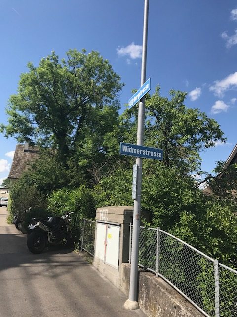
Nearing the apartment I turned on Widmerstrasse (or the street leading to it). I went under some tracks and there was a couple walking bikes. Strange, I thought. The road kicked up a little for 25 meters.

Couple pushing their bikes up the street with steps

And then it turned hard right. And straight up. I couldn’t even look down at Garmin. My guess is more than 25%. On my left the sidewalk was steps. Steps!

I think DO NOT ENTER except Bikes and Buses. I think.

I was less than two km from the apartment then went and sent [Friend] a text about my adventure. Told her that I told the cop I knew a good lawyer but they didn’t know her. She laughed at me.

The week can only go better.


A Mountain and a Rail Trail

HOPEWELL, PENNSYLVANIA

Probably eight years ago I asked some riders from Altoona what the hardest climb in the area was. I was thinking Blue Knob or Horseshoe Curve. One rider told me to find Henrietta Mountain Road. And today I did.

Parking at Hopewell

This was was tough. Although it wasn’t too long, just two miles. It’s always hard to compare climbs but I can compare it to some other two mile climbs or sections I have done.

That’s pretty good company, I would say.

I started my ride in Hopewell (Bedford Co.) on the H&BT rail trail. More on that later.

At Saxton I found the infamous Henrietta Mountain Road. I did no research and instead, just rode. It seemed to kick up to 7-8% right away. But after a quarter-mile just past an intersection, the real climb began.

Henrietta Mountain Road and intersection with Rte 164

It seemed to kick to 12% then went even higher. I have no real pictures because I wasn’t stopping although my body wanted me to. The road was winding but with only one sharp turn I hesitate to call a switchback. It was heavily wooded on both sides. It was beautiful. But it offered no panoramic views because it was so wooded.

Summit of Henrietta Road looking back towards Saxton (the tough side)

I tried to not look up the road because every time I did I could see it was going higher. After two miles, although I had no idea at the time, I could see the top. And here I made a mistake by not researching the climb. I assumed the road went over the top and down the other side. So I simply turned around.

A barn on Rte 26

The descent back was steep. Rough pavement. And windy if not sharp turns. It wasn’t fun. I couldn’t let the bike roll. What I learned after the fact was I should have kept going. I could have gone another 3-4 miles where I would have joined Rte 164 coming out of Martinsburg. Then It looks like a straight descent back to Saxton. In other words, a fun descent. Oh well, next time.

Crushed limestone at Hopewell

I rode back to Hopewell and explored the trail a little more. At Hopewell going north for two miles, the trail is crushed limestone in great shape. A road bike is fine although I wouldn’t want to ride 20 miles on this.

Gravel road headed south from Hopewell

Going south the trail was a road. A gravel road that led to a camping area. That was harder on the bike. I rode a couple of miles then decided I had had enough. Wrong bike for this surface.

H&BT trail near Cypher

The signature landmark on the trail seemed to be the trestle over the Juniata River. I had decided the surface wasn’t right to pedal to it.

Bridge over Juniata River near Cypher

The trail head seemed to be on my way back to Somerset where I was headed. So I drove to Cypher to bike that section.

I don’t know if it was good or bad but the trestle was probably no more than a quarter mile away. But it was gorgeous. Maybe even more gorgeous was the cut in the hillside. The trail here was crushed limestone, again.

Bridge over Juniata River near Cypher

It’s a beautiful trail. If there wasn’t the section by the recreational area which was a gravel road, I’d have no problem recommending a road bike for the surface. But this trail needs wide tires. I may ride this on a mountain bike.

Cut in the hillside by Cypher

______________________

Atlas

LAMPASAS, TEXAS

The event was the Texas 4000 Atlas Ride, the official first day of the Texas 4000. Riders had the option of riding 25, 50, or 70 miles, often determined by the friends and family that came to the Atlas Ride.

I drove to Cedar Park and met Will, who brought along a Garmin mount since my BarFly mount broke yesterday. I made it to the start with five minutes to spare.

After the National Anthem, the current 2017 team of Texas 4000 riders were the first to depart. They were followed by alumni riders. Then the rest of us.

I had no expectations for the ride. At first, I was sitting in with a group then decided to go faster and bridged up to the next group on the road. A “train” came by with about 10 riders and I jumped in. We were flying until we came to rest stop one. I stopped but no one else did.

Back on the road, I kept my own pace until another group came by. We had a good pace until we came to a rest stop. They all turned right (rest stop). I turned left (70-mile route). I was all alone.

I soloed for about two miles then pulled over to fix my handlebars which were misadjusted. Eventually, another group came by. One of the riders was Scott Towle from the 2004 group – the original group. The official story was that Chris Condit, the founder of the Texas 4000, was in San Francisco when the Hopkins 4K was just finishing. And that brief moment was the inspiration for the Texas 4000.

Later I saw a Hopkins 4K jersey from 2006. I did not get the rider’s name but he shared stories of the early years. He offered his opinion that the Texas 4000 does a much better job at building community within the teams than the 4K for Cancer does.

The 50-mile and 70-mile rides followed the same course except the 70-mile ride diverted to the west, probably 10 miles, and found some wonderful grazing areas protected by many cattle guards. It was a free message on the bike.

For much of the ride, it was overcast but humid. I was drenched. There were some raindrops but nothing of significance until safely in the food tent.

Will and I rode together the last 30 miles. We integrated with a group of 2017 riders and I started talking with Trey Curran, a rider with the Sierra route. As we got close I remembered the Silent Mile. Surprisingly Trey, nor his teammates had heard of it. When we came to the last mile, I slowed and looked for the signs. Jake. Alex. Amelia. I even doubled back to make sure I didn’t miss them. Found them all.

I ended and was greeted by name. I think that helmet sticker (and number) was a clue. I turned into the main area and saw Ayesha, my Bicycle Buddy from last year.

I got food and sat with the Rockies 2016 team, having met them last year.  Then Vanessa found me. I moved to sit with her 2014 Ozarks team. While eating the skies opened up and poured. It lasted about 20 minutes but sent water throughout the tent we were sitting under.

I also got to meet my bicycle buddy from this year – Luis Salazar. Luis is a bright and athletic young man. I also learned that he will not make it all the way to Alaska as he will have to return on Day 48 to start medical school. Well done my friend!

Luis and Barry

After the rain we sought out the signs from the Silent Mile. We then found Amelia Schmidt’s bicycle buddy, Lauren Nix. She wrote a note on the sign for Amelia – to be delivered to her front yard on Tuesday.

As I was leaving, Trey came over to say goodbye. That was actually very touching.

The Texas 4000 does it right. A wonderful event where friends and family can ride with this year’s team – 25, 50, or 70 miles. And very well attended by alumni. I just wish we didn’t need cancer rides.

_____________________

A view of the ride using Relive.

Verified by MonsterInsights