
THURMONT, MARYLAND
It’s like Happy Happy Pain Pain but with half the pain.

The need for more mountain training became obvious when on Sunday I rode from Myersville on my Happy Happy Pain Pain ride. I had one metric that day I wanted to improve on. That was the two-mile climb from Pen Mar to High Rock. And I failed. Miserably.

We didn’t time segments back in 2009, but I had the segment loaded on my bike computer on Sunday. I started out 1-2 seconds ahead of my 2009 self. After 3-4 minutes, I was behind the pace. I fell off dramatically and finished at 17:08. I lost 3.5 minutes in 15 years. France is not looking good.
Today’s ride was planned for 45 or 57 miles but from Thurmont, Md., and not from Myersville. But the destination again was High Rock. I rode with my friend, Tim, and told him I would ride with him except at High Rock. There I had to go for a PR (personal record). This assumed that he couldn’t or wouldn’t want to stay with me as I went all out.

It was a gorgeous day as we arrived at Thurmont Community Park. The temperature would hover in the low 70s (25 ℃) most of the day with bright sunshine obscured by forested roads for most of the route.
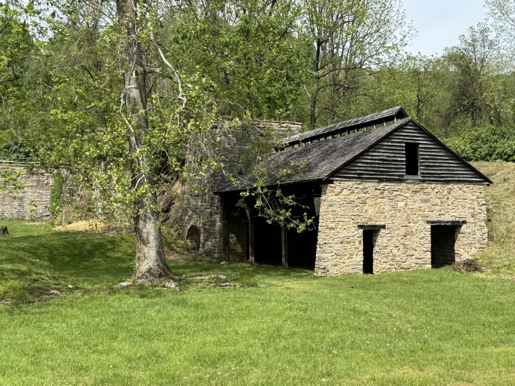
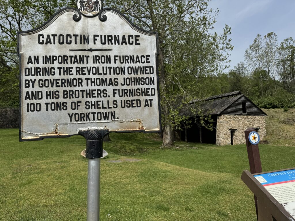
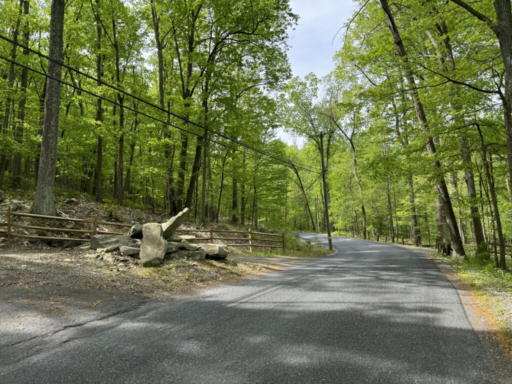
We rode on some flat country roads for about eight miles before starting the climbing portion of the day up Catoctin Hollow Road. I have ridden this road at least twice before, once in 2009 and once in 2012. Has it really been 12 years since I last climbed this?
I designed this route using a route ridden by three cyclists I met at High Rock on Sunday. They had ridden from Walkersville so I wasn’t going to duplicate their exact route as I wanted to ride out of Thurmont. But we would follow their route from Catoctin Hollow Road to High Rock and back to Thurmont.
The roads are beautiful. Most were shaded in the forest and it was hard to resist stopping on the climb for photos. We made our way over to Fort Ritchie and the beginning of the climb to High Rock. We went through an intersection at the High Rock Park. And I took off.

I wasn’t sure where the segment on the climb began, although Wahoo would show START. But from history, I also know that there is a delay in actually passing the start location, and by the time it shows up on the bike’s computer. So it was good to have some speed going at that point. In a few hundred meters, I hit the start and was immediately up on my personal record (PR) by 2-3 seconds.
My goal, and it would change frequently over the next 15 minutes, was to set a PR. For that I needed to beat my 2009 time of 13:26. The time ahead went up to 20 seconds and then 30 seconds. Then my goal was to go under 13:00. At one point, I was 0:48 ahead, and Wahoo also predicted a finishing time. That time was 13:28. Even Wahoo didn’t believe that I could hold a 48-second lead to the finish.

I unzipped my jersey. The winds felt like headwinds but were cooling and weren’t hated. My wind map would show that those were crosswinds.
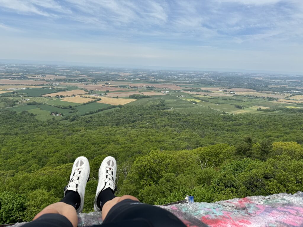
At 400 meters to go, I could see the opening at High Rock in the road ahead. I still had a 45-second lead. As I crested the summit, it showed I still had 60 meters to go. But where? There was only a parking lot and an access road to the left. I stayed on the road. And then the display switched to my course map. There was no indication that I finished a Strava segment. I knew I was ahead. Does it count if it’s not on Strava?
I turned around. I descended 800 meters (0.5 miles) to find Tim, turn around, and ride the last section with him. He asked me if I got it (PR), and I told him I didn’t know. I mean, I killed it, but Strava may not have it. I thought about descending and riding it again, but doubted my second effort would match the first.
We took some photos. Saw some Methodists. I found a dad with his son and took their photo. Another woman climbed on the rock, and I asked for her phone to take her photo. And then we left.
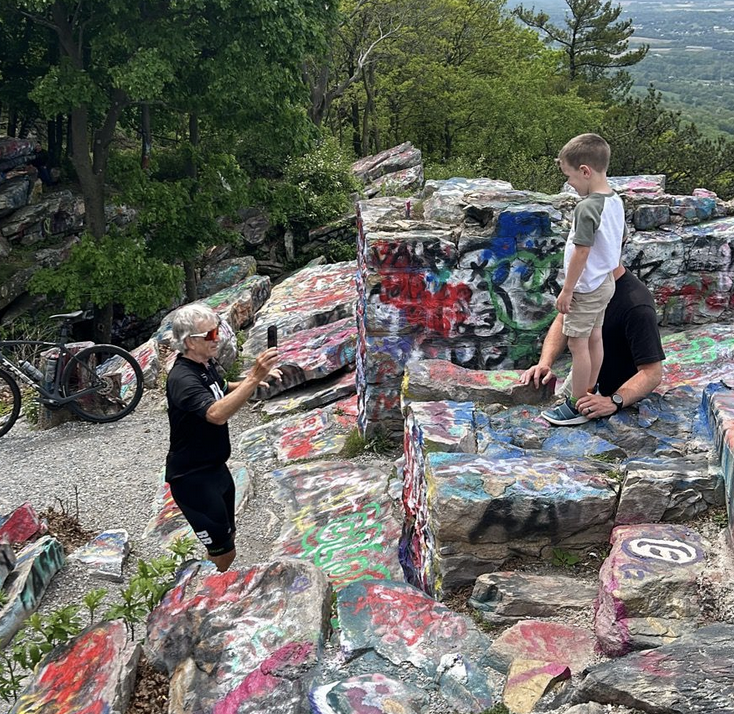
Photo Credit: Tim
I missed a planned turn in Blue Ridge Summit, Pa., and we improvised. We found the Sunoco/Convenience store, and Tim bought some Gatorade. The road out of Blue Ridge Summit was one I’d ridden 4-5 times during the Civil War Century, and I should have recognized the sweet descent on Gladhill Road. I did, but not until it was too late to get some real speed. I did hit 45 mph (72.4 kph), though.

We made our way over to Sabillasville Road, which trends downhill to Thurmont. Unlike most Maryland highways, there are no shoulders on this road, but Tim and I would pull over when we passed an intersection to allow any following cars to pass. We’re nice.
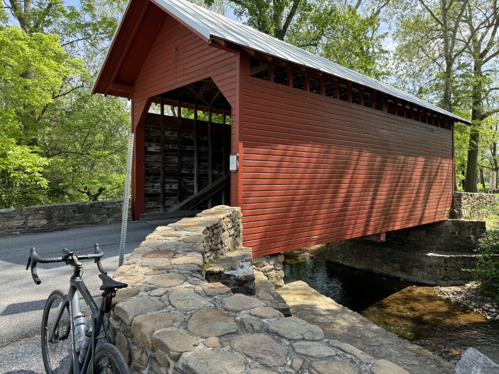
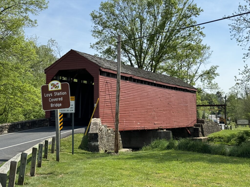
The Roddy Road covered bridge became our decision point. At 43 miles, we were two miles from where we parked. Or we could add a second covered bridge and 12 more miles. We pushed forward. We made a late decision to avoid Creagerstown Road, and that added 3-4 miles.
I showed Tim their Trolley Trail, and we were only 1-2 miles from a Metric Century. When we got to the parking lot, I told Tim we could ride the park’s loop road, and he agreed. I only needed two laps to get my 100 km, but I rode a third one with Tim, and he completed four laps. Metric complete.

Recent Comments