CHARLES TOWN, WEST VIRGINIA
It has been a long time since I have ridden in this area. Rather than spend all day in the pool, I thought I would do a version of the three-state ramble which I have done in the past. This one would be clockwise.
I left Bethany’s place and headed out Old Country Club Road. Crossing U.S. 340 it becomes a Cattail Run Road, a country road. At the end it dead ends into the Old Rte 9 where one crosses the Shenandoah River. At the end of the bridge I followed a road down to the river’s edge which was a perfect place to start the climb.
The road is a “mid-major” road. It used to be the main route over the mountain but it very windy and hilly with no shoulders. The bypass has been in for two years so it was surprising the number of cars still using this road. I assume they’re all locals.
The only decision point on the route was when the road turned for the last 3/4 mile up the mountain. Straight ahead was a road, Hostler Road, which I guessed continued under the bypass. I was right. The road was very “lumpy.” When it was build years ago there was no grading, just paving. And it showed. There were lots of little rises that were like punches to the gut.
Eventually, after a couple miles of teasing, the road turned down. I crossed a crosswalk, a painted crosswalk, out in the woods, which I knew to be the Appalachian Trail. Hostler Road had ended and became Chestnut Hill Road which ended at U.S. 340 across the Shenandoah River from Harpers Ferry.
This stretch of road is not fun. No shoulders and impatient traffic. I was in Virginia for just 0.6 miles but was glad to leave as fast as I entered.

I eyed up the long bridge over the Potomac River on U.S. 340 and decided the only place for a bike was on the road. A two lane road. I think I timed the last of the traffic from the light and took off with no traffic and got 3/4 of the way across before any traffic caught me. I took the middle of the lane so not to allow or encourage someone to try to pass where there was no room.

At the end of the bridge I climbed up towards Brunswick, Maryland, and when I saw Sandy Hook Road, knew I was supposed to follow it. It’s a narrow two lane road which goes down to the river’s edge, separate by the C&O Canal and two tracks of CSX Railroad. I heard a train coming through Harper’s Ferry and waited for it to come out of the tunnel. Then followed the road until I found a bridge over the canal.

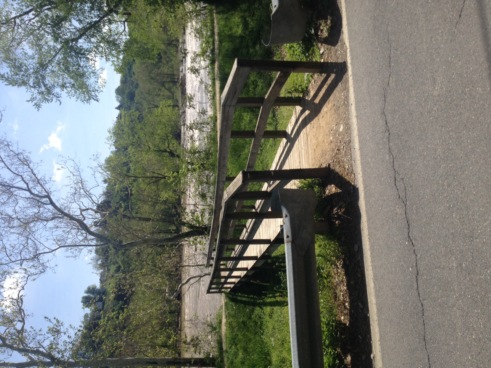
Bridge over C&O Towpath
I rode on the towpath for about 1/4 mile then climbed the stairs up to the railroad bridge. Once in Harpers Ferry there is a half-mile hill, at times pushing 12%. A couple of guys near the top yelled to me “only five miles to the top.” I laughed. “I know this hill well,” I responded. Jerks.
I looked for an alternative to 340, went through Halltown, then found my way back. It was only 27 miles but my legs said it was much longer.
Recent Comments