Climb to Conquer Cancer

RICHMOND, VIRGINIA

I came to Richmond wanting to set a PR on Libby Hill. And if it was good enough, maybe win my age group (fat chance). I failed. I tied. Ugh.

Parking at Great Shiplock Park in Richmond

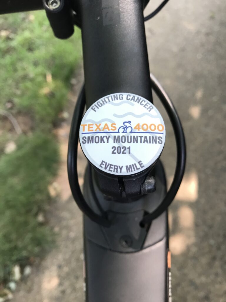
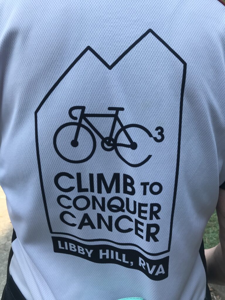
The Climb to Conquer Cancer is an event run by Amy’s Army of Cancer Warriors benefitting the Massey Cancer Center at Virginia Commonwealth University. I first did this event two years ago. In that event, I climbed Libby Hill three times, one pre-race, and twice during the race. Today I climbed it to get to registration and then during the event. I also did the climb once when I rode from Williamsburg to Richmond. So this was my sixth time.

Timing Chip – Climb to Conquer Cancer

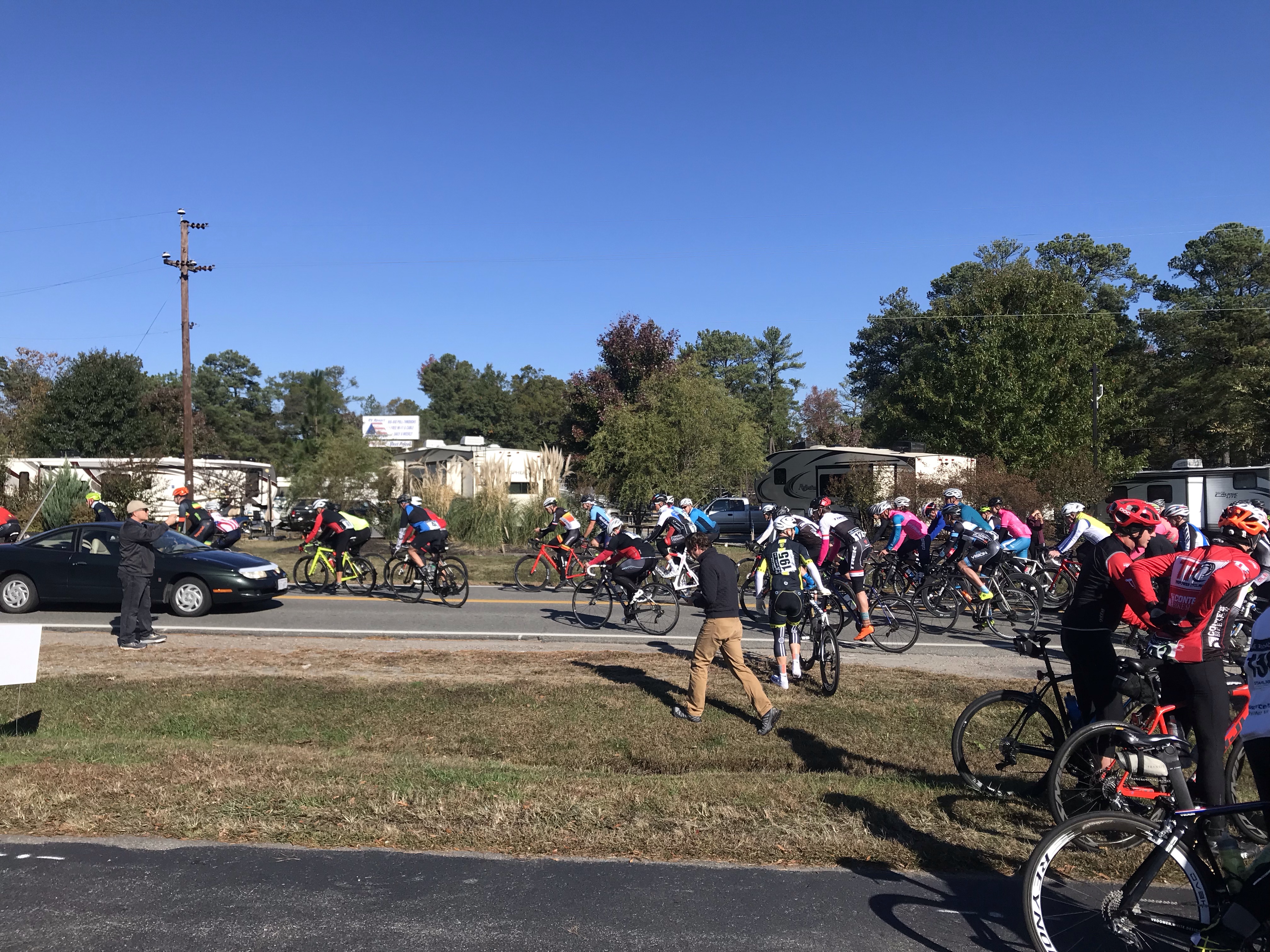
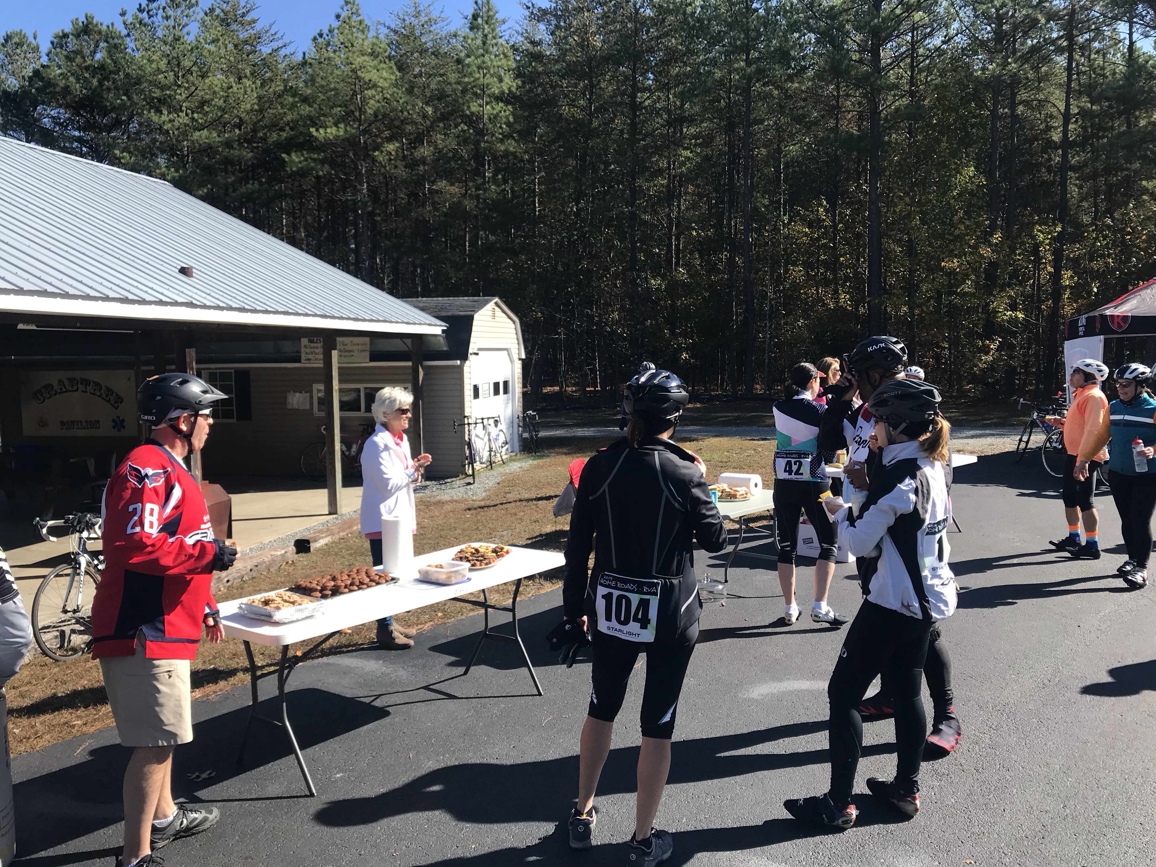
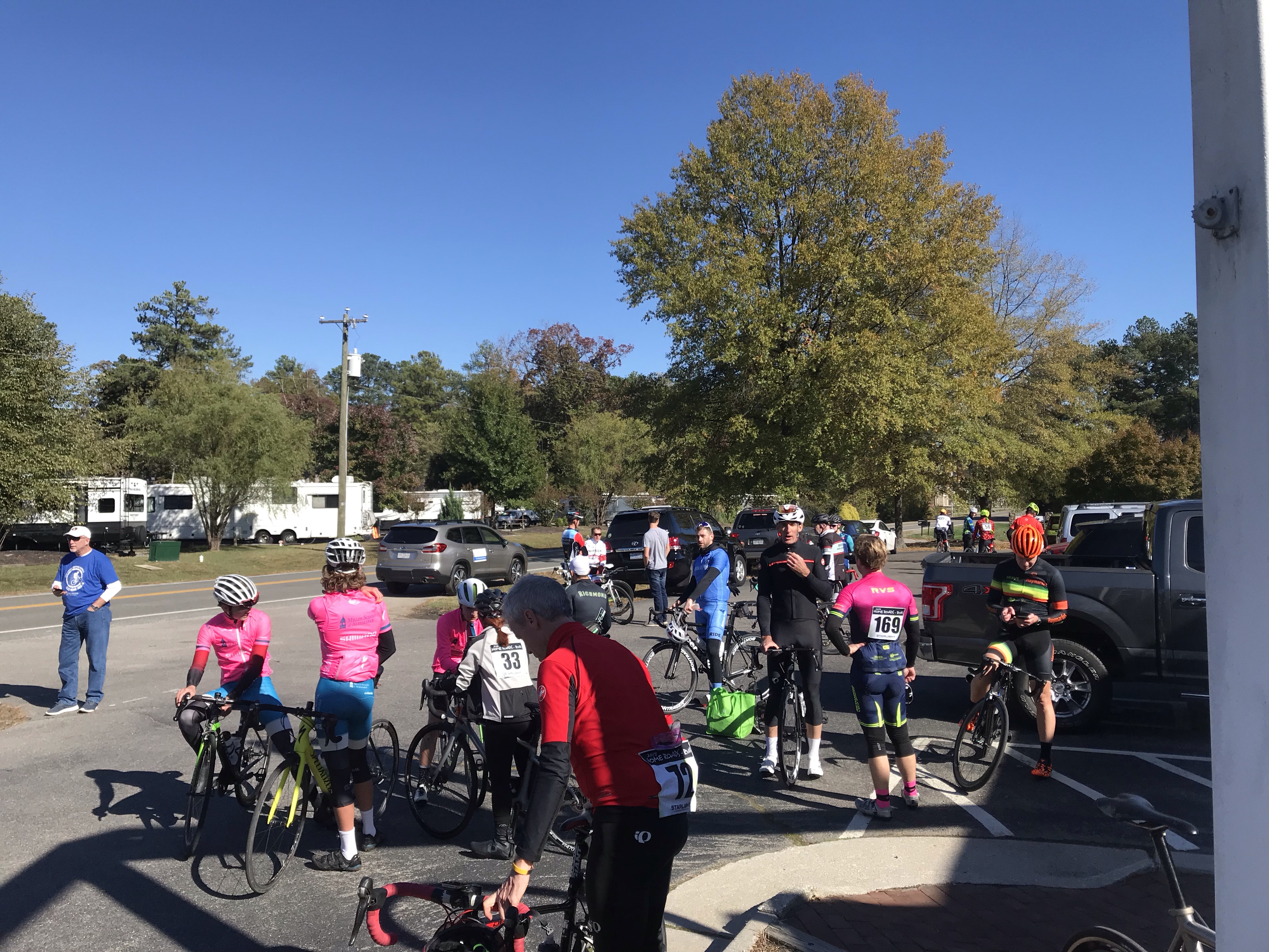
In the COVID era, some events haven’t come back (Livestrong-Austin is canceled next month). Others are modified with smaller fields. This was an extreme modification. They offered no rest stops. None. Nada. I would have to carry everything I needed with me or stop along the route.

Survivor Bib – Climb to Conquer Cancer

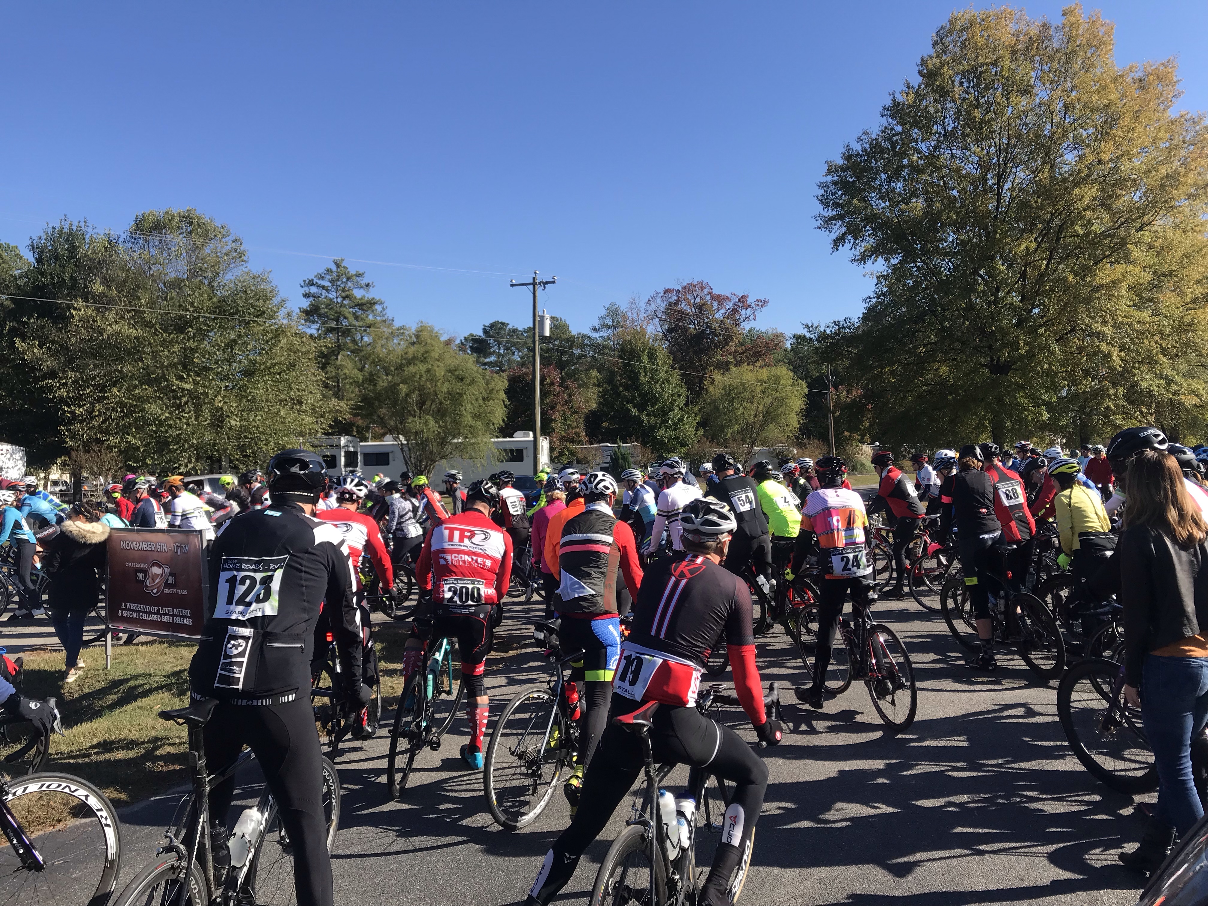
Unlike past years where there was a small ceremony, National Anthem, then a police-escorted roll-out, today was “show and go.” For me, it meant not forming up with any other riders.

Registration Tent

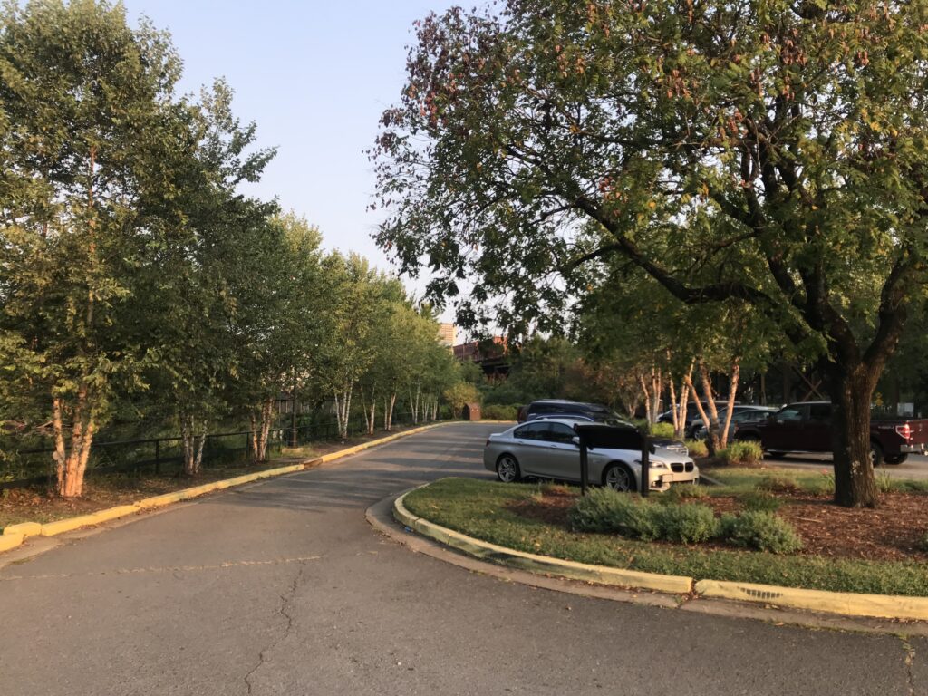
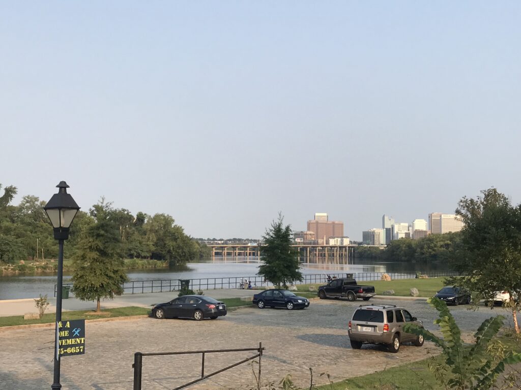
I left the house around 6:15 a.m. which was a little late. My ETA was 7:45 which was later than I wanted to arrive. I parked at Great Shiplock Park which is convenient enough. I had iced my bottles and took Skratch mix with me. Added that to one bottle, poured ice water in both. Grabbed two packs of entry chews from Skratch and one gel. And that would be my nutrition and hydration for the day.

Libby Hill Cobbles.

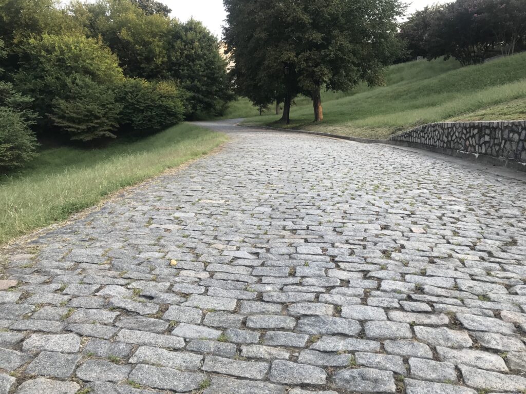
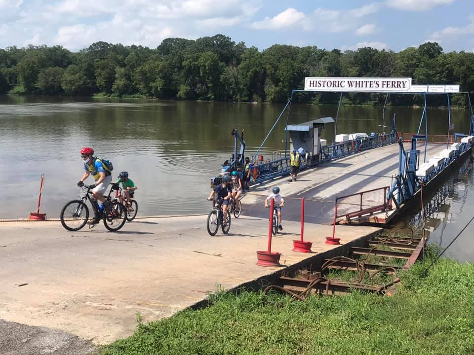
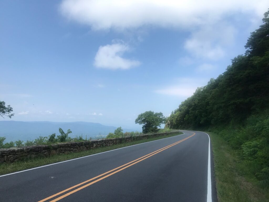
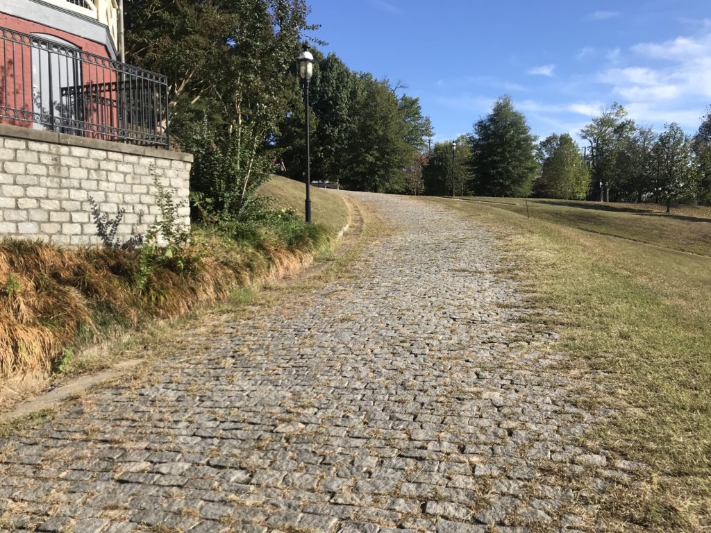
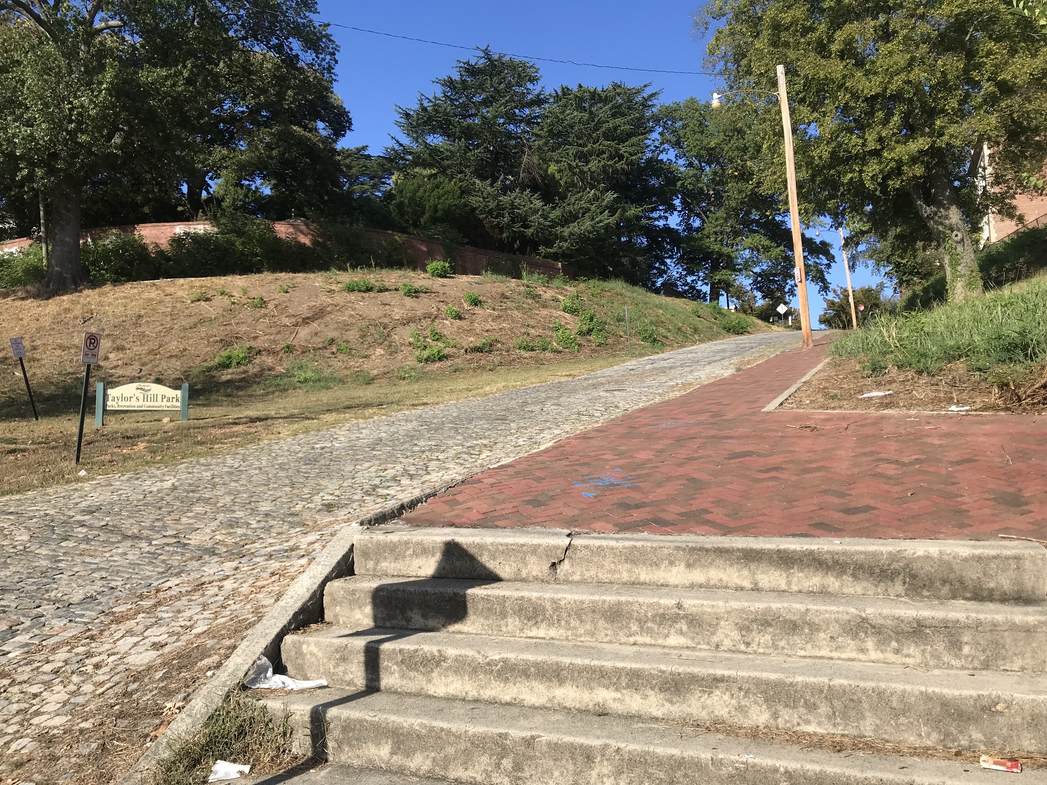
I rode up Libby Hill, even stopping to take a picture of the cobbled route. It is much bumpier than I remembered.

Monument Libby Hill Richmond

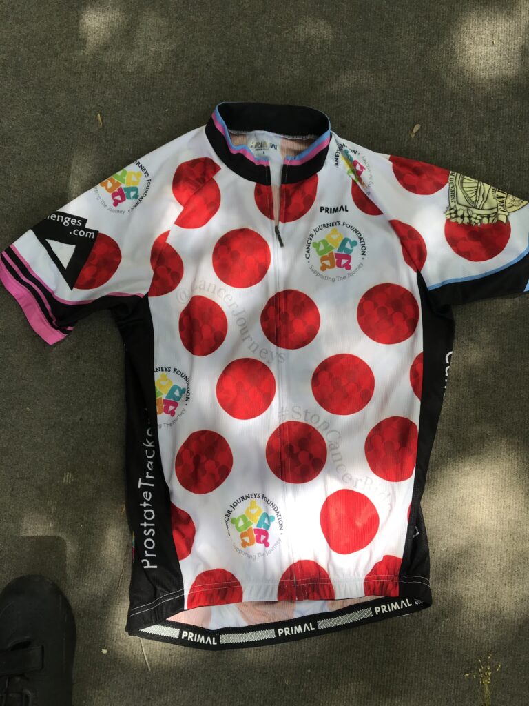
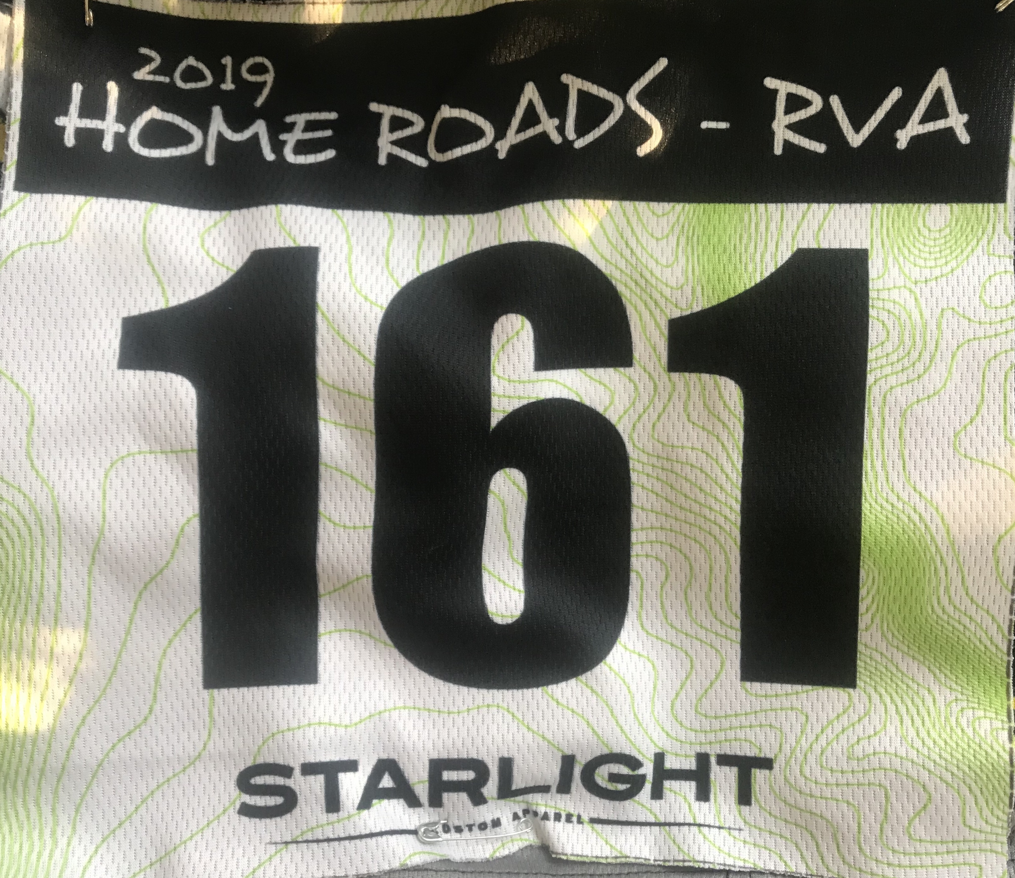
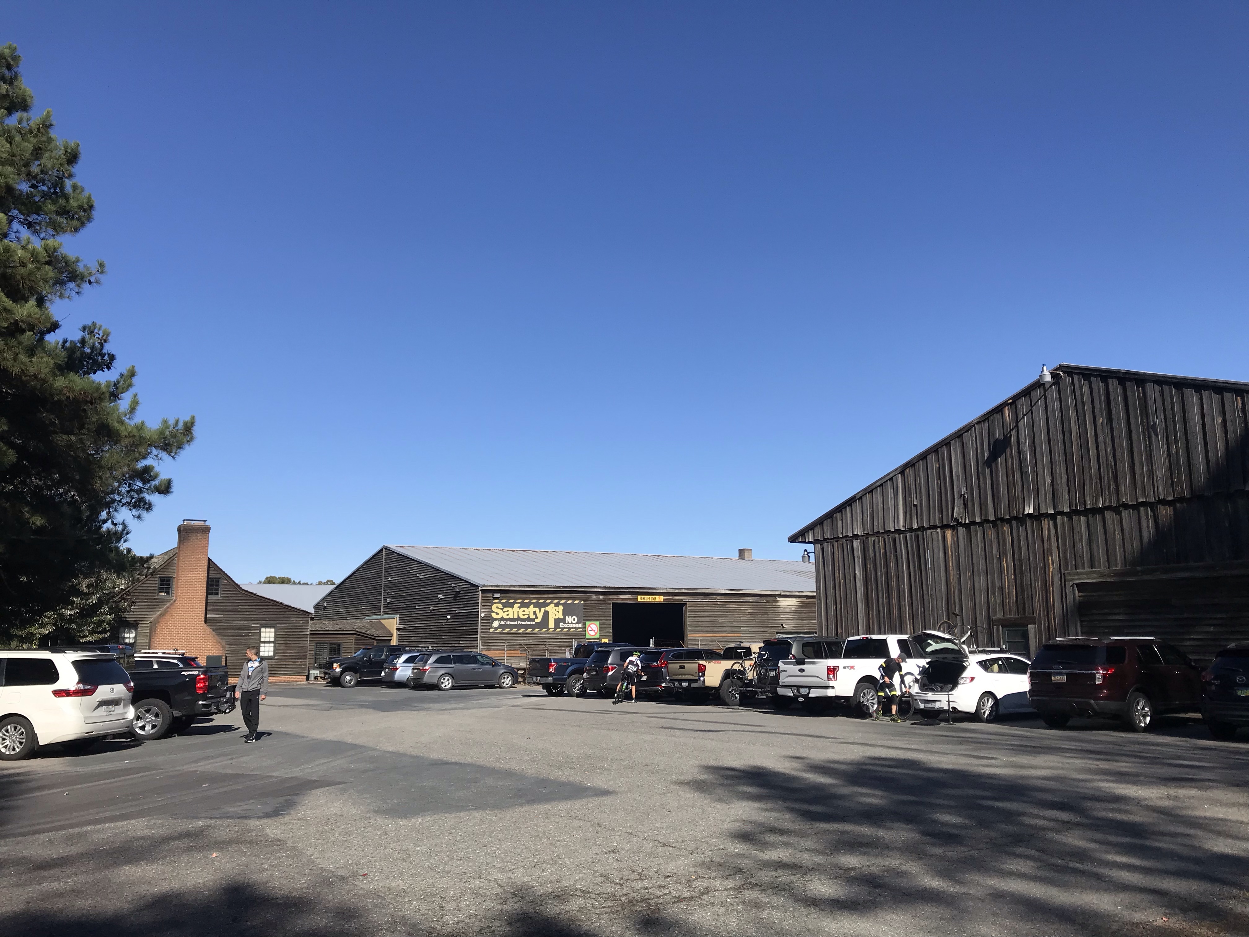
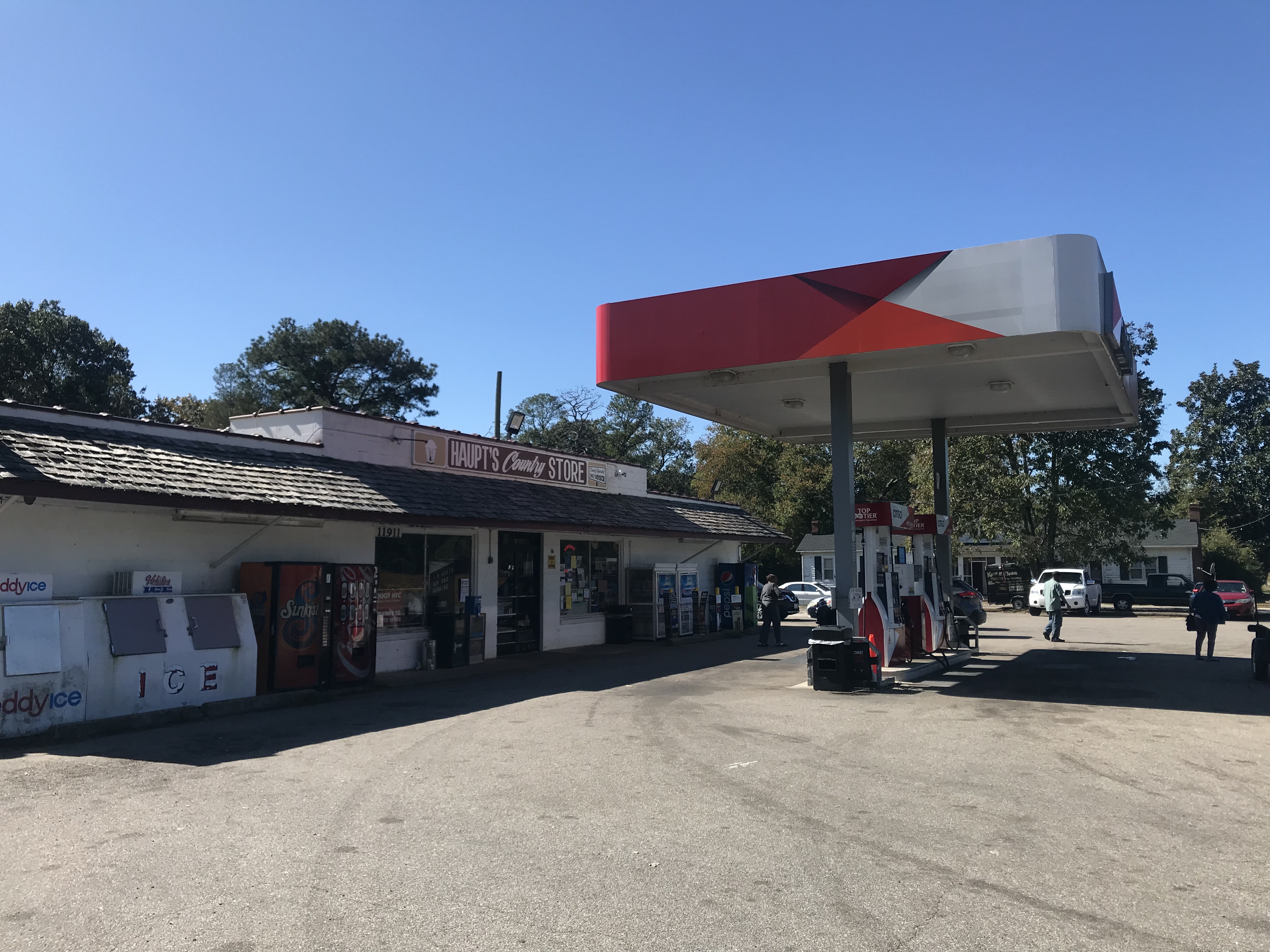
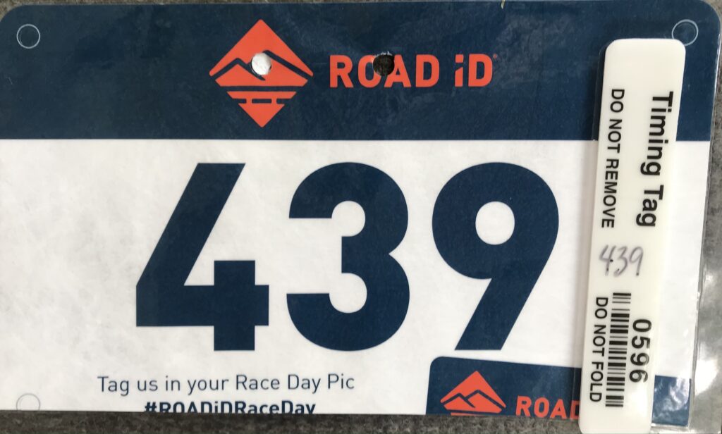
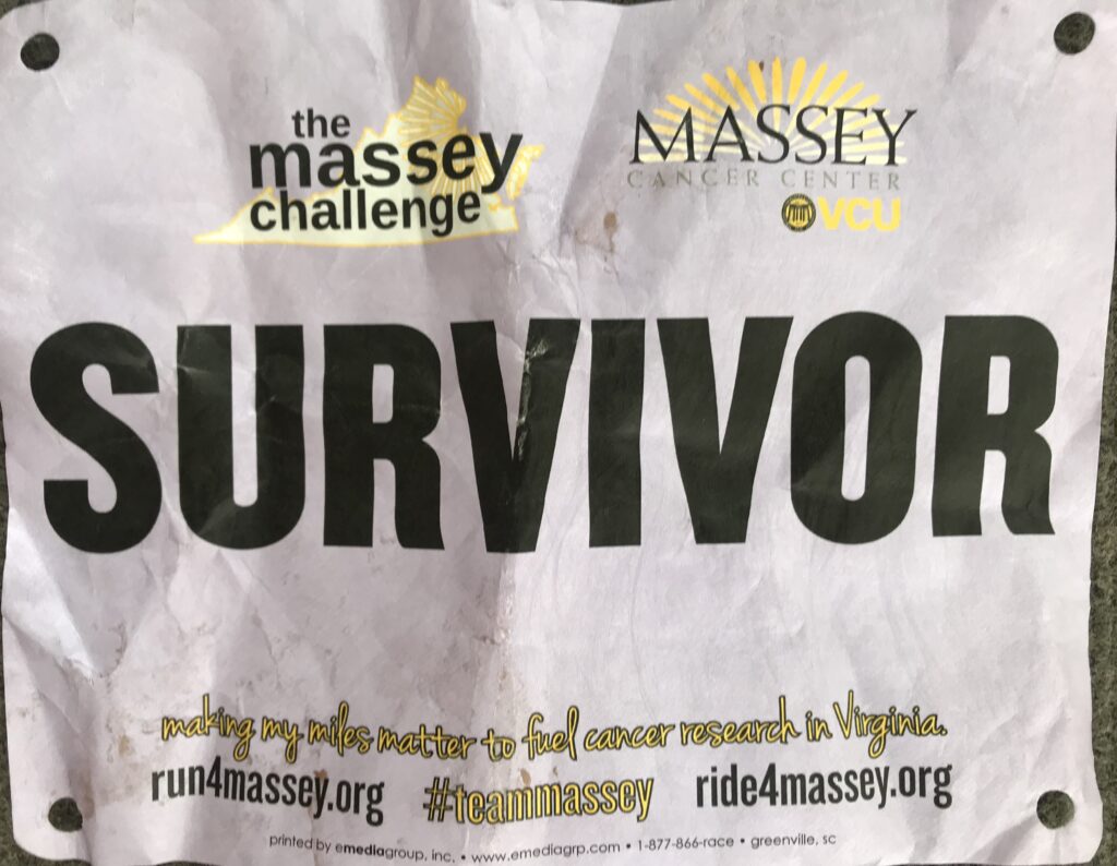
Registration was giving your name and being handed a timing chip plate for the bike. With one zip tie, it never fit well on the bike. I should have forced the issue and used two ties. There were “bibs” for survivors, in honor of, and in memory of. But there were no Sharpies to write names on them. And there were no safety pins to attach and wear them.

Was this Amy?

I signed up knowing this would be a “lite” version. I was OK with not having support. But I wasn’t prepared for not having a Sharpie or safety pins. I had those in my car. I would have taken some to registration. But this was a major disappointment.

James River, Richmond

On a cancer ride, there is great community among the riders when they wear the names of others or even themselves. These are talking points. Connecting with others. And today, this ride missed that.

Battlefield Park Road

It was a beautiful day. The temperature at registration was 65º. There were some riders milling around and I wasn’t sure if they were waiting to register or not. I leaned my bike against a tree and registered. Then I rolled out by myself.

My Wahoo GPS seemed slow in drawing the route for me so I navigated from memory, a little, before it picked up the track. I only missed one turn but knew it right away. And then I was off and riding.

Virginia Capitol Trail

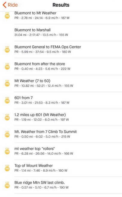
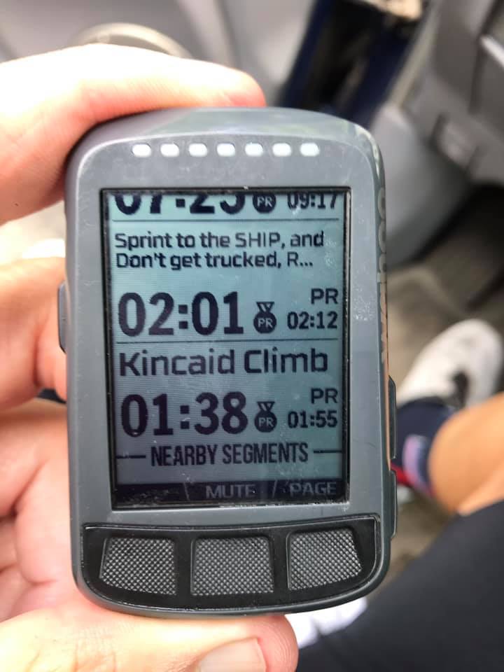
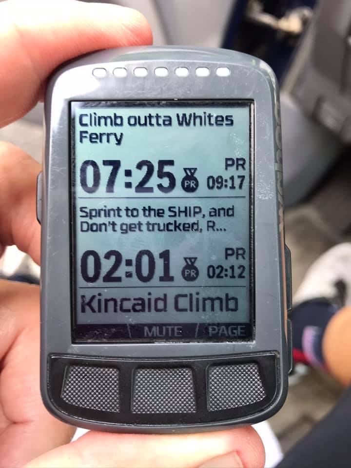
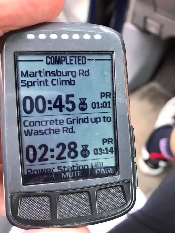
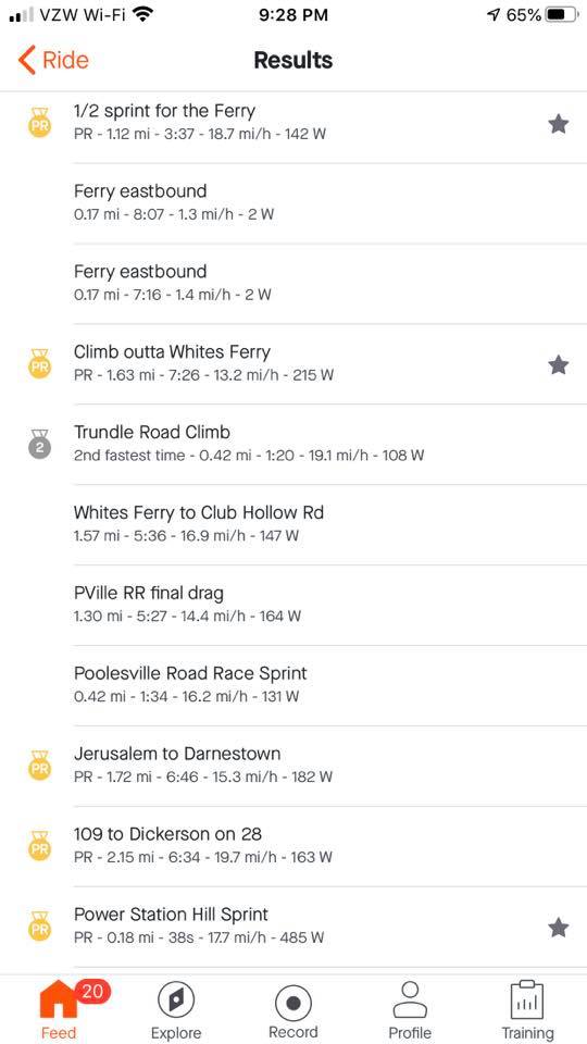
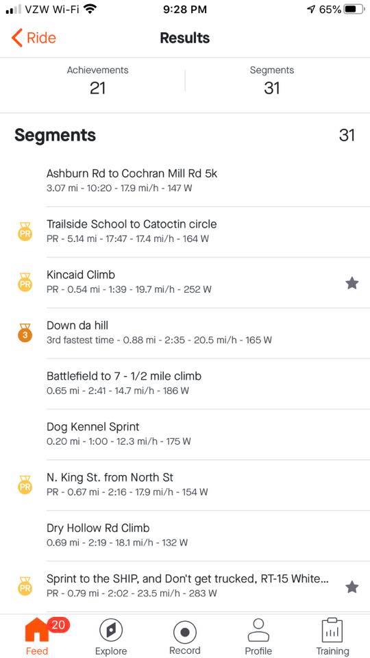
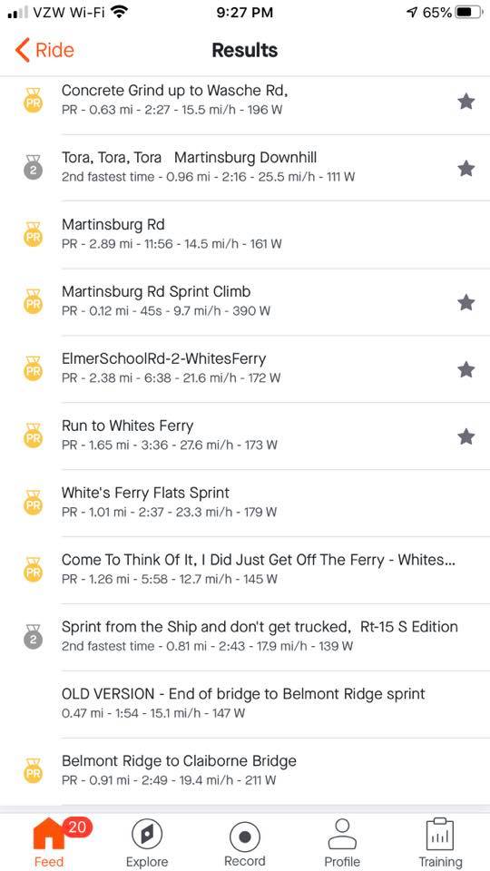
I had marked a number of segments, most were in the first half of the route, that I would compete for PRs. And they started coming just one after another. And each one was a PR. I caught and passed some riders. Twice I was passed by a paceline but it was actually once. After having been passed the paceline took a break at the 7-Eleven while I kept going.

Osborne Turnpike, Richmond

I rationed my food and water and never stepped off the bike. I put a foot down in the first block at a traffic light, then again crossing Rte 5, and finally, I took a natural break on a deserted side road (in the woods). No riders went by. I literally was by myself all day long only occasionally seeing riders up the road and passing them.

East Main Street, Richmond

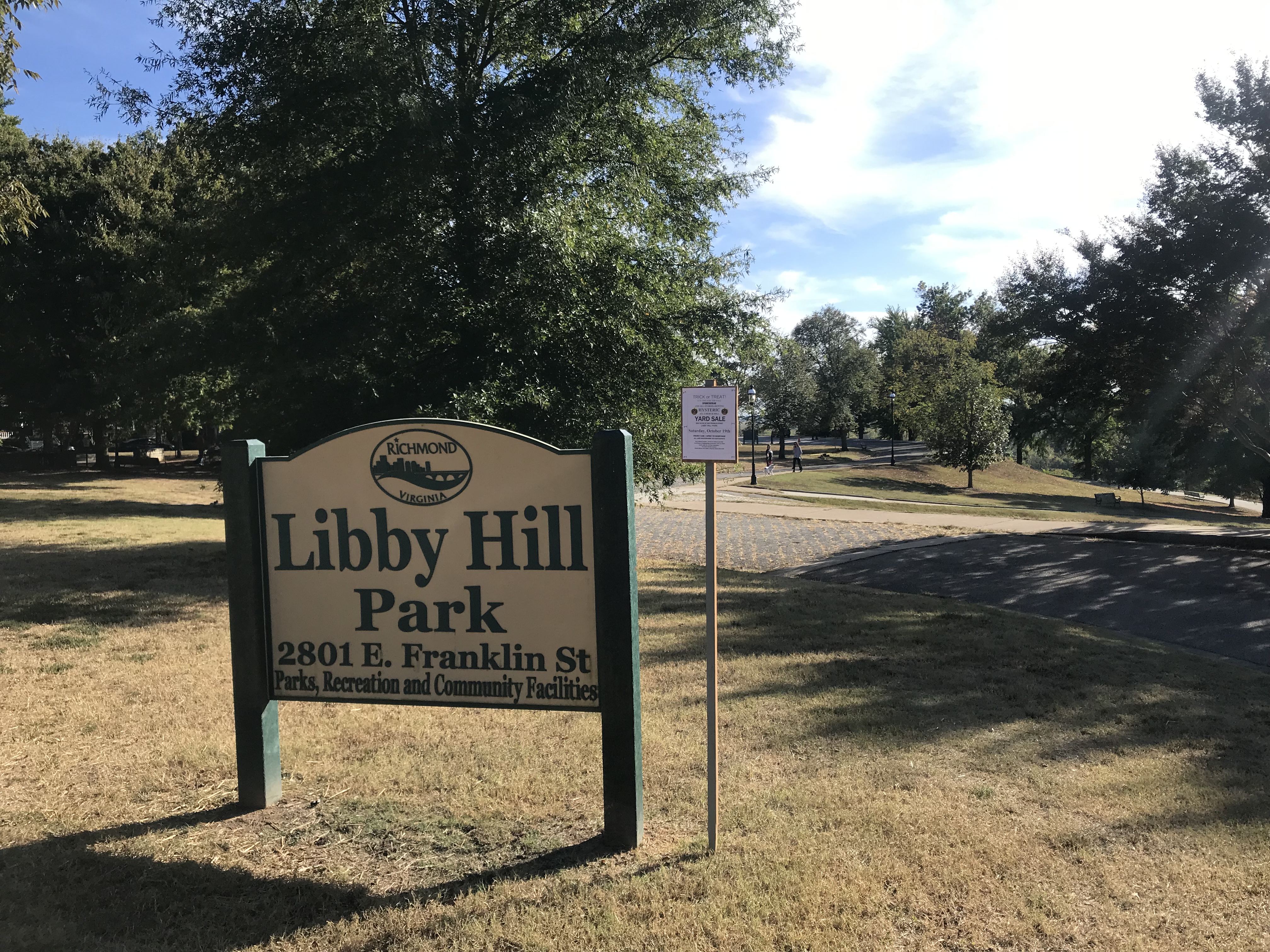
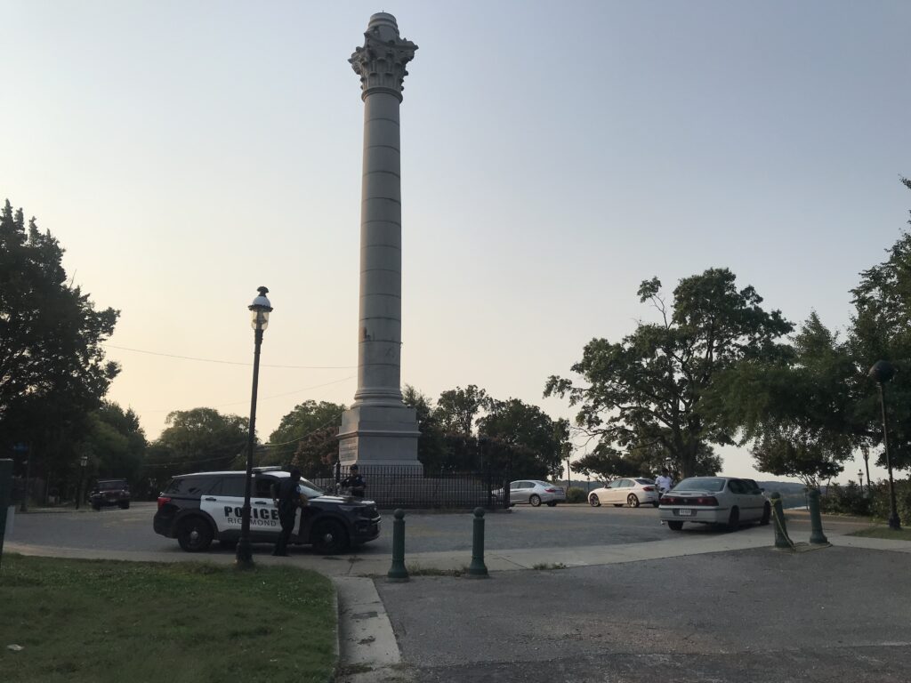
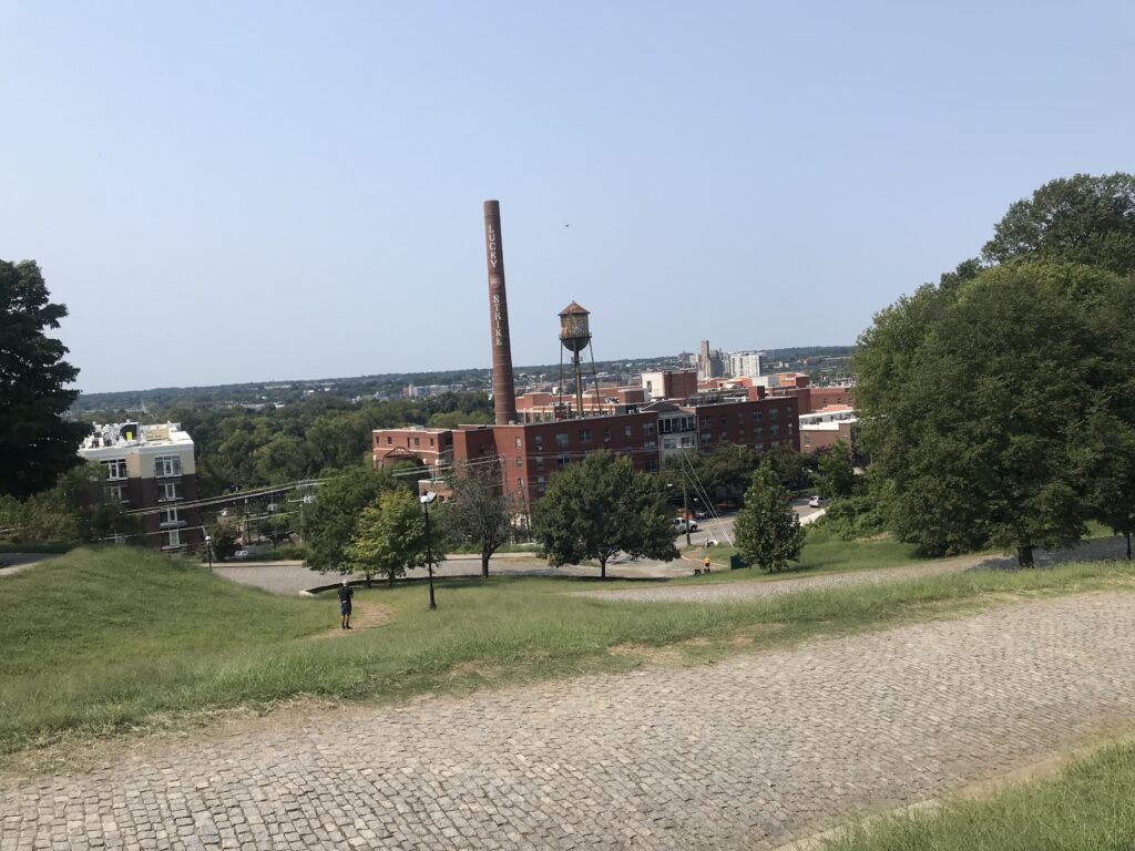
Around Mile 50, with no additional food or hydration, my Wahoo tempted me with GO! I decided not to contest any more PR segments, waiting instead for the finish. I came to Libby Hill. There were a couple of volunteers at the base. I turned onto the cobbles.

Looking down Libby Hill

I have a bike better equipped for climbing the cobbles this year than I did two years ago. And I have a body better equipped. I should have set a PR. I looked for the gutter where I could ride the concrete instead of the cobbles. When that ended I turned the last corner. I saw a photographer so I naturally stood because standing photos are so much better than seated. But I quickly took a seat. It was too rough to be standing.

Finish line on Libby Hill

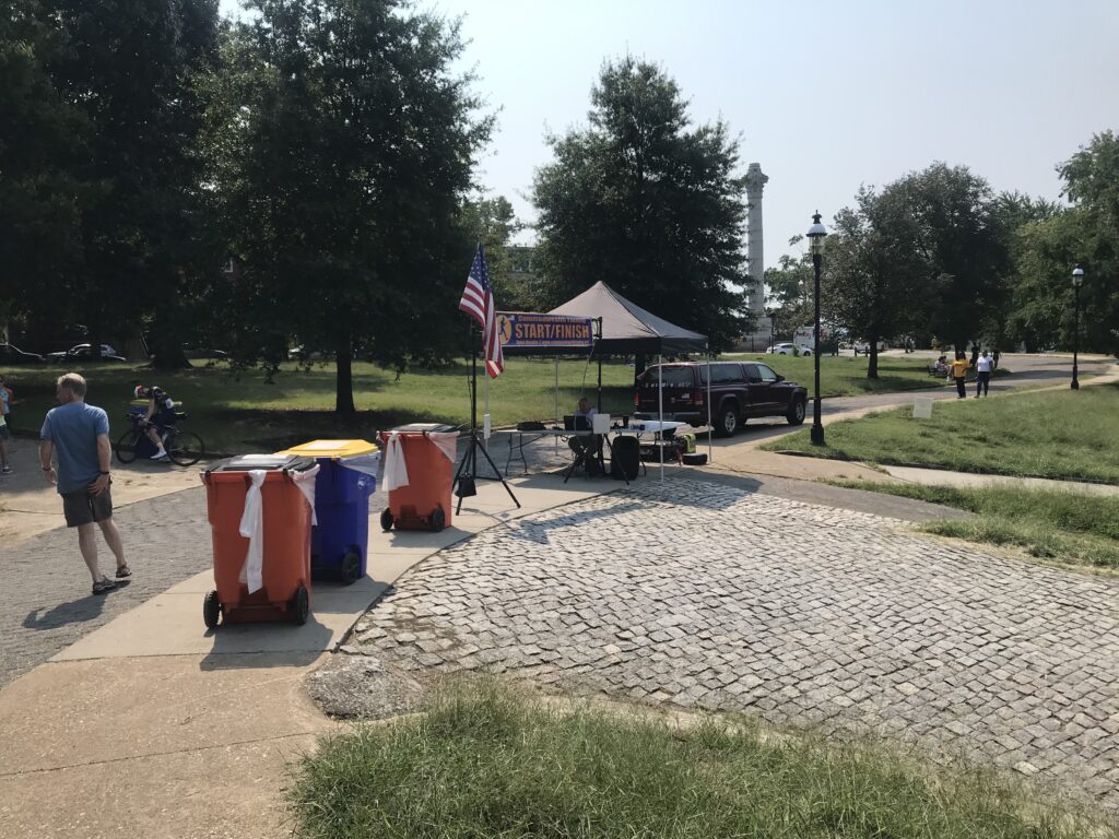
I finished. I asked about the timing chips and was told I could keep mine. There was nothing at the end. I wanted to take a photo of someone finishing. No one came. I left.

Capitol Trail coming back into Richmond

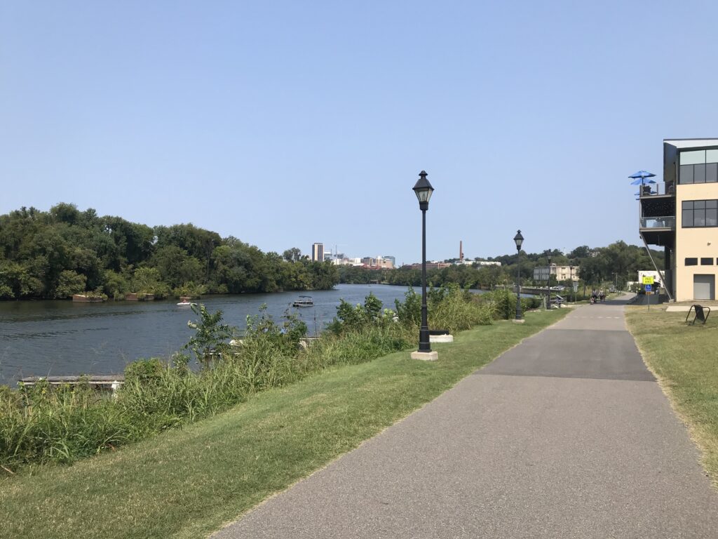
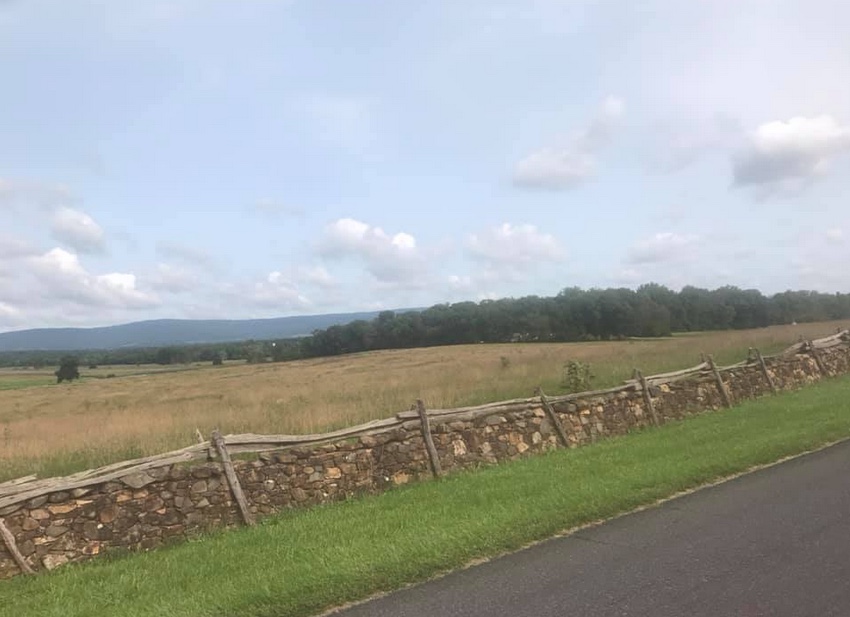
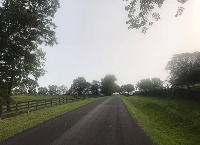
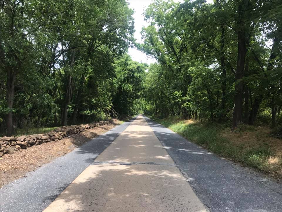
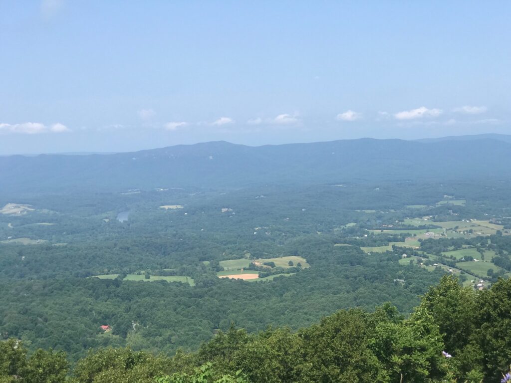
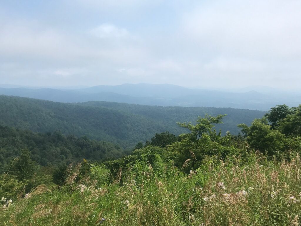
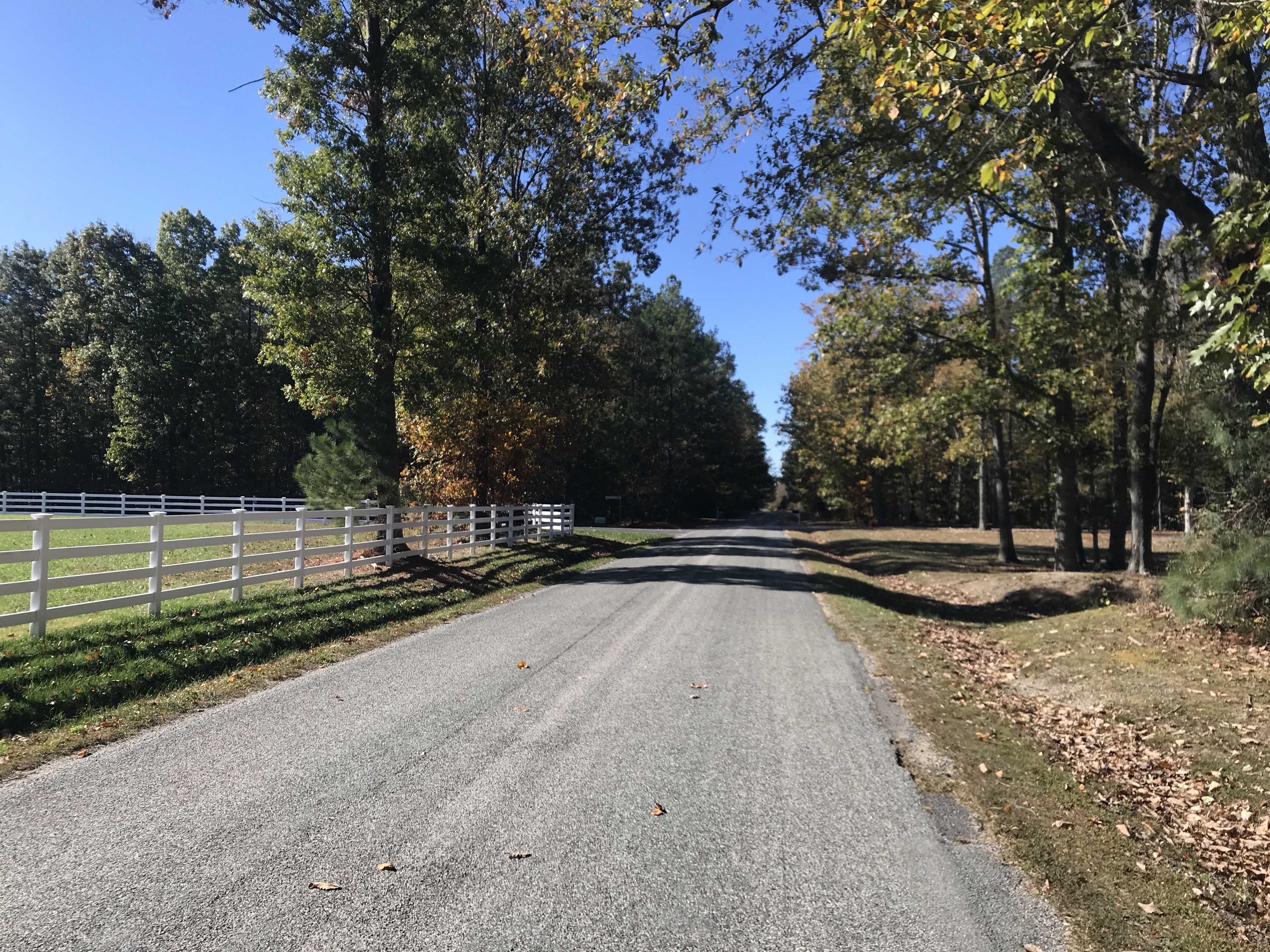
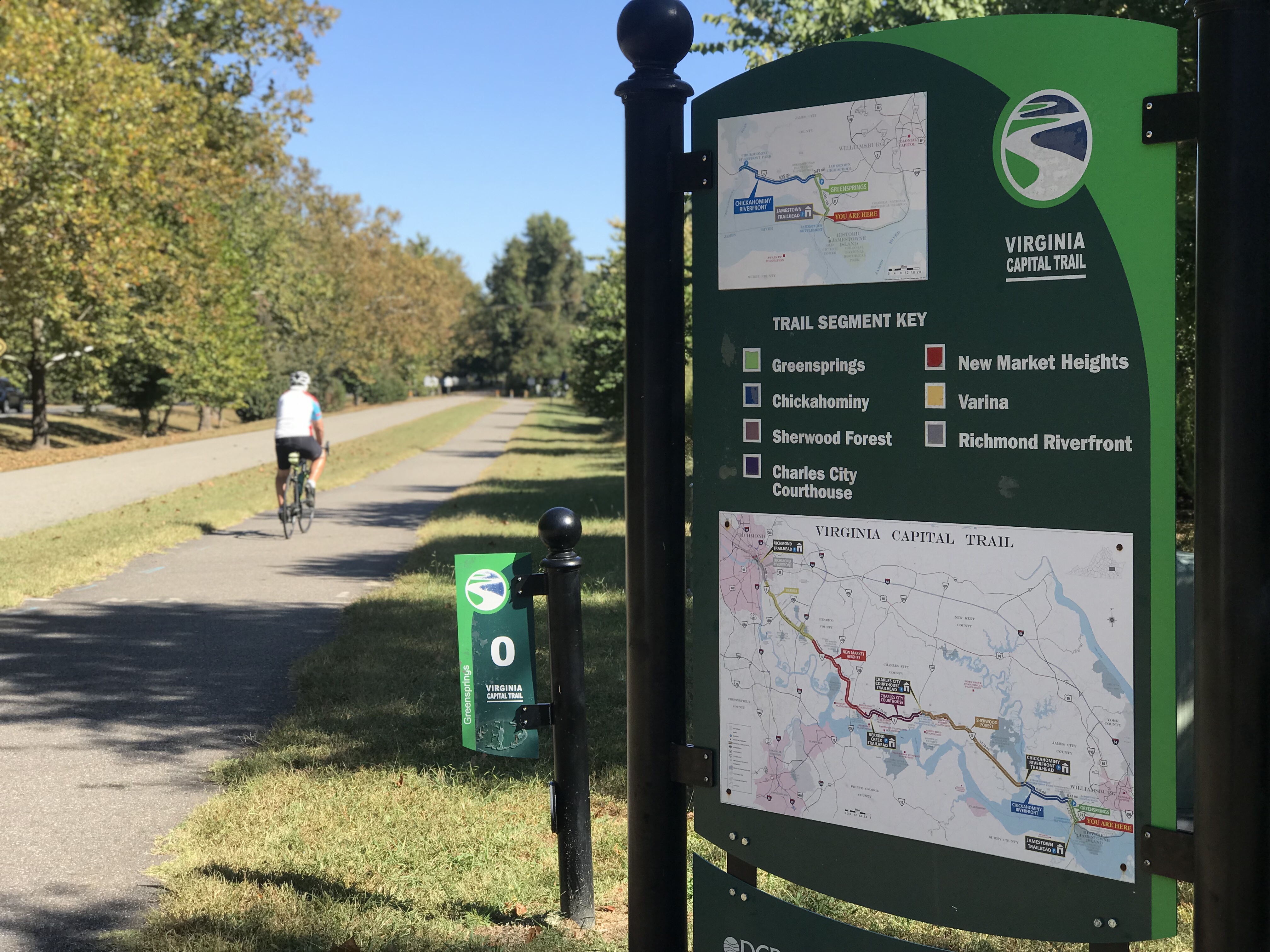
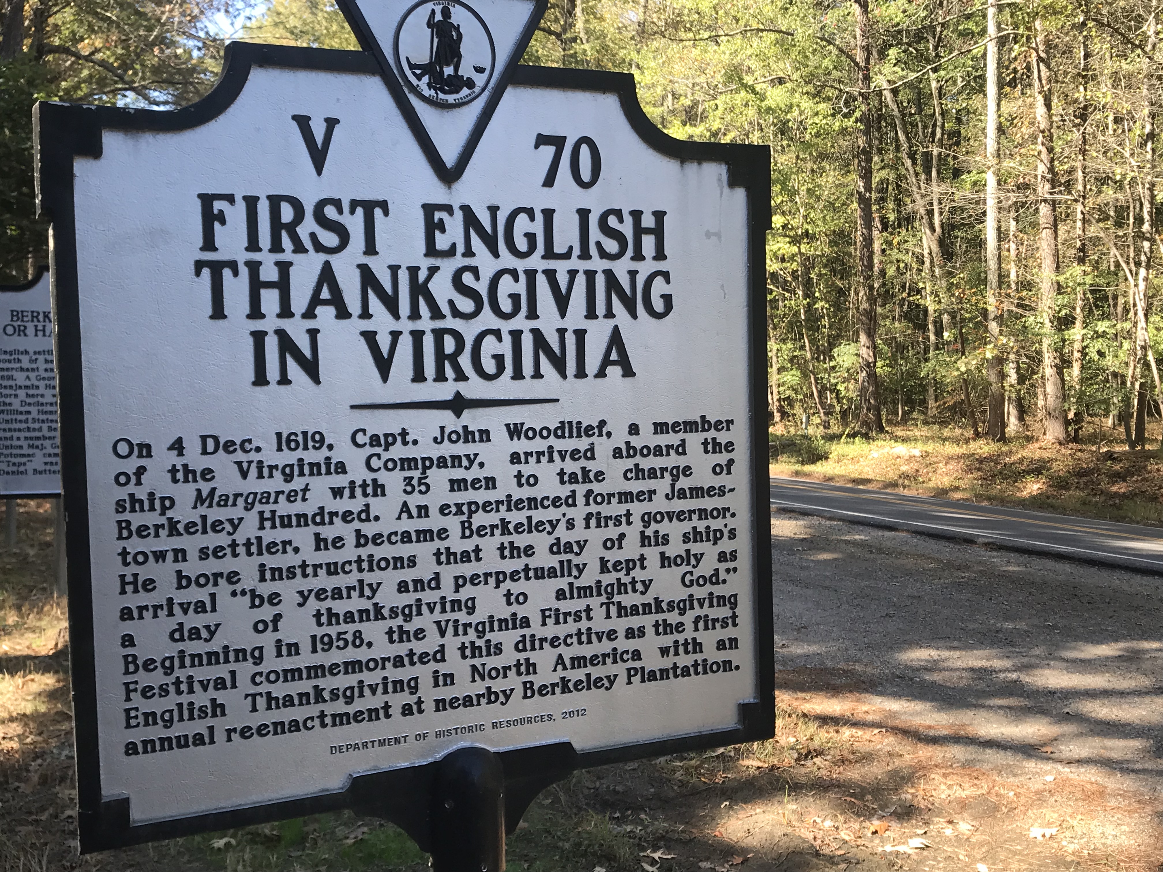
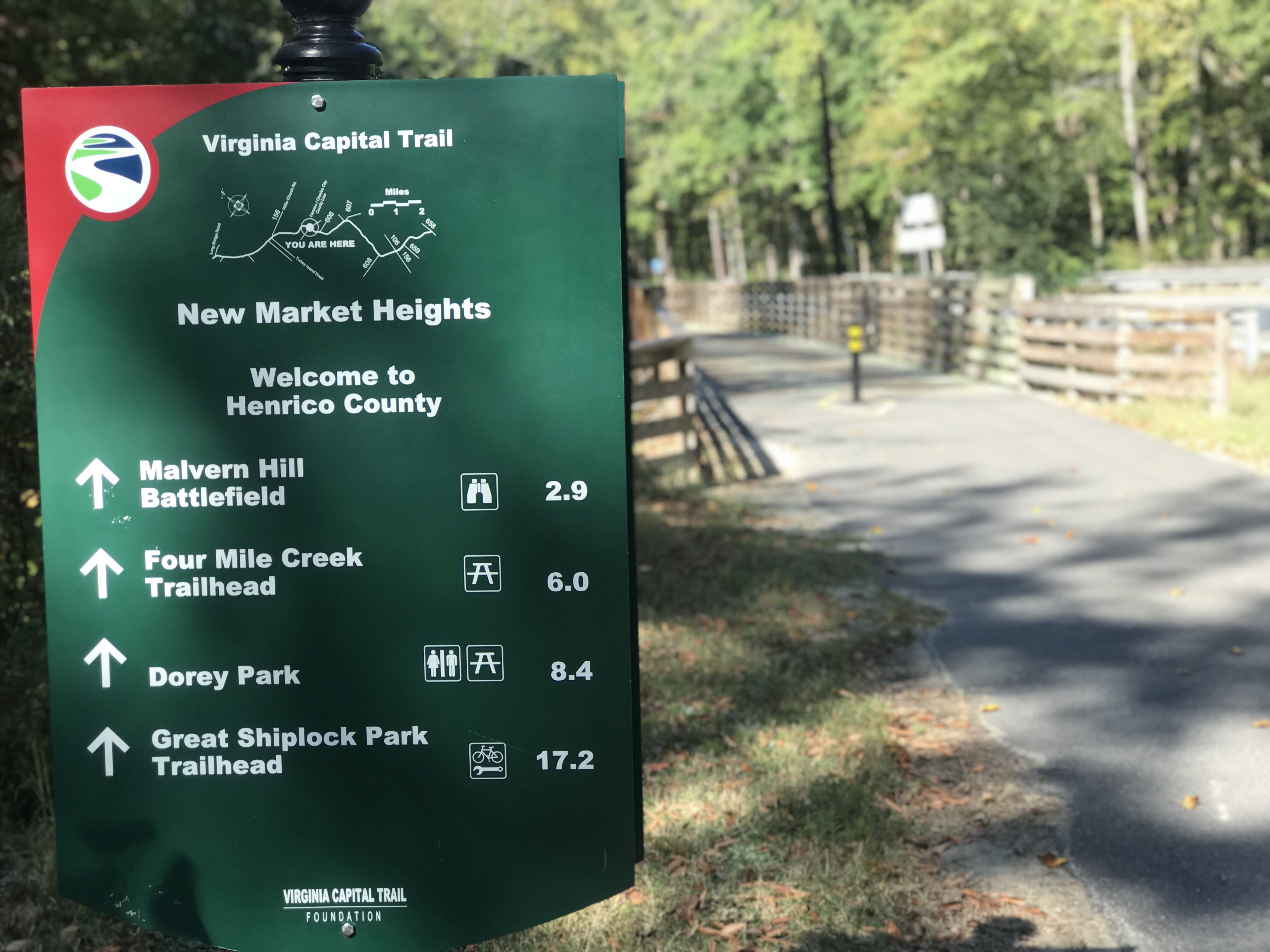
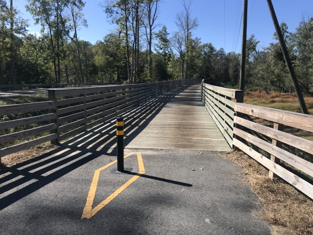
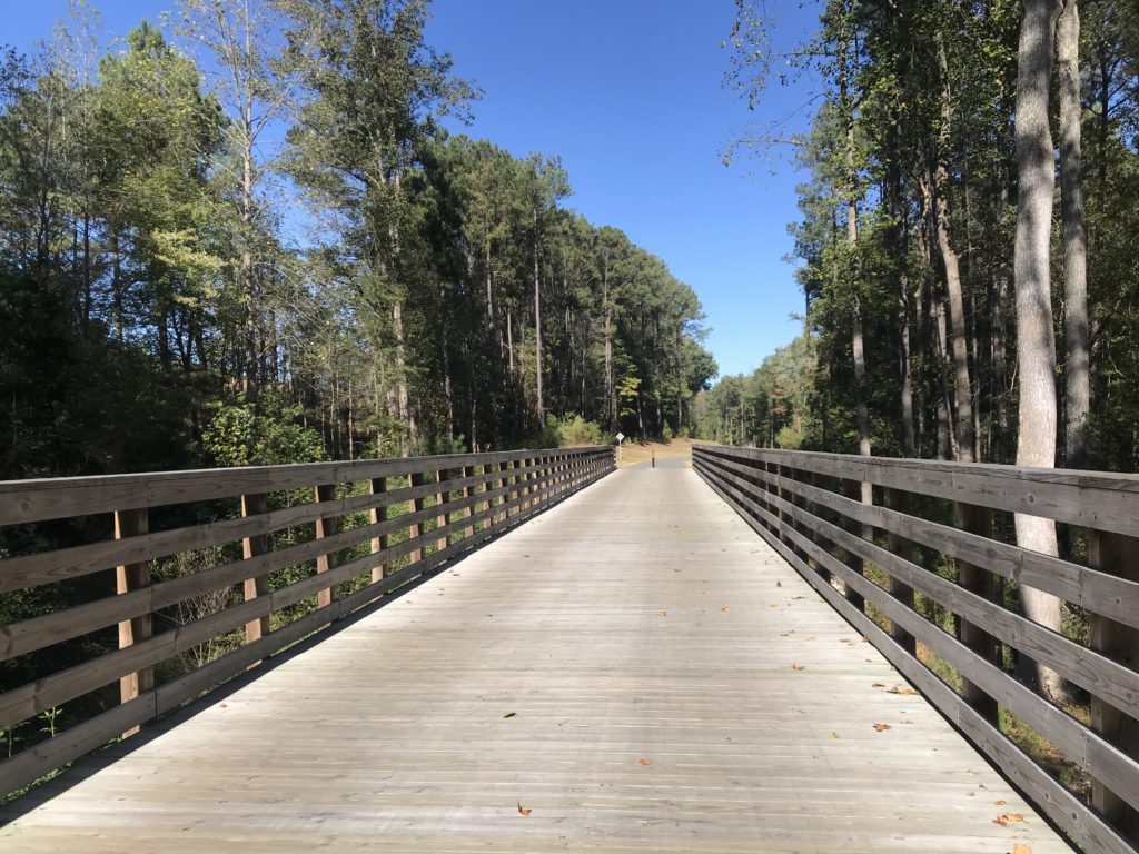
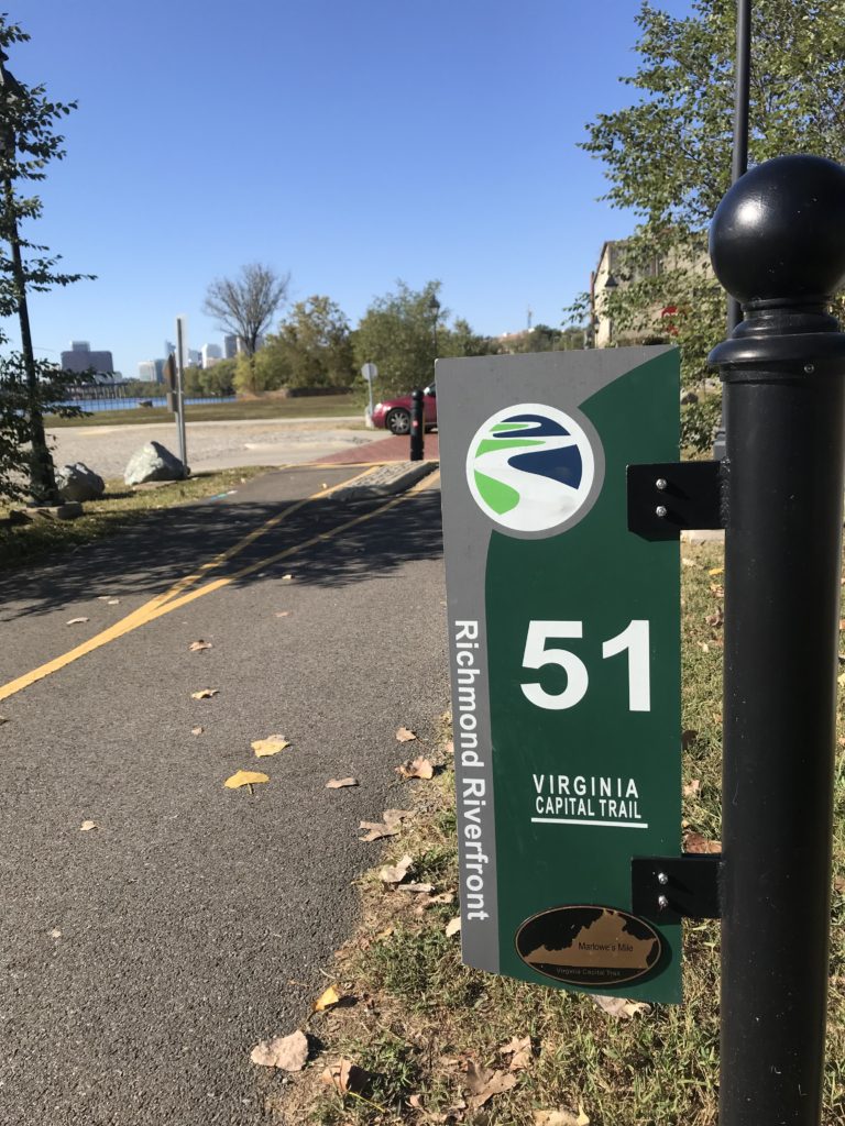
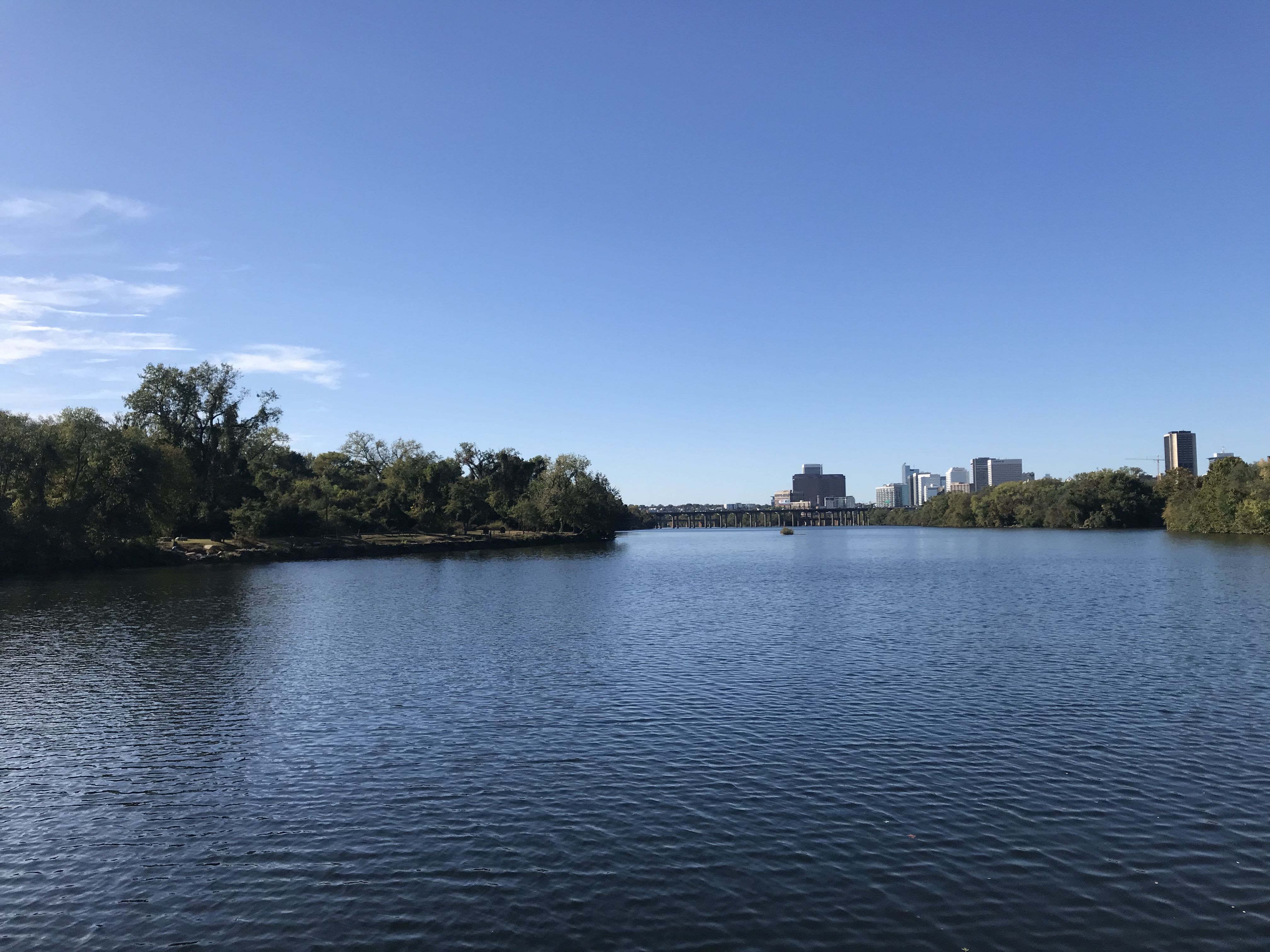
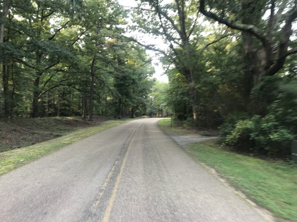
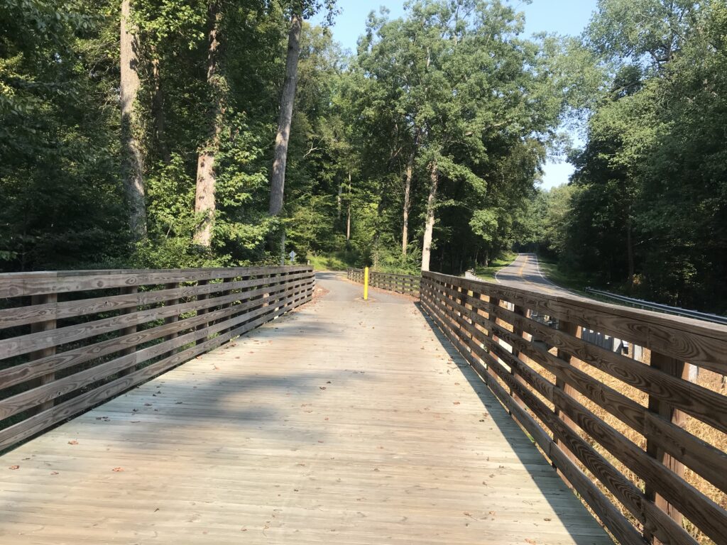
Other than Libby Hill, I’d say there are no hills on route at least after the first five miles. It’s a rolling country route, mostly roads but some on the Virginia Capital Trail. It’s neat to finish on Libby Hill. And it’s a good cause. I hope they can get back to a fully supported ride. With safety pins.


I don’t know about the timing on the climb. I sort of trust Strava uploads more than the chips on our bikes. I do not know what triggered the start of my climb. I did not see any timing mechanism at the start, only at the finish.

I don’t know what age groups the event has. If they use what Strava (and Mount Washington Auto Road Hillclimb) uses, I would be in the 65-69 age group. I was 9th overall, all-time, in my age group and five of those were done on Zwift in the comfort of their homes. And no one today was faster. But there may be someone who doesn’t use Strava. Or timing – maybe mine didn’t record for the event. I don’t know. And maybe they use a 60-69 age group and I can’t see the 60-64 age group. But it does look like maybe, just maybe, I won that age group today.

Overall, of people who uploaded to Strava, I was 16th out of 40.

Lunch with Texas Friends

LINDEN, VIRGINIA

Planning for this day began weeks ago, accelerated last week, then almost blew up today.

Welcome Texas 4000

At 3:00 a.m. my alarm went off. I ignored it but never really got back to sleep. I had offered to provide lunch today for the Texas 4000. With everything in place I received a text at 10:00 p.m. last night that the location I worked hard to secure would not work because the satellite view showed there was not enough room to turn their van and trailer around.

Ready to roll with a pocket full of Twizzlers

We would leave the house without knowing where we would be setting up. All of us, lunch providers and the Texas4000, would have to be very flexible about where we met.

Apple butter cinnamon donuts from The Apple House Restaurant

Cheri and I left home around 7:00 a.m. to set up the lunch stop. Our destination was Linden which was around Mile 75 of their 150-mile day. We were still on the road at 8:15 a.m. when I got a text that the first group was way ahead of schedule and would be in for lunch at 9:00 a.m. It was “lunch” because they ate at 3:30 this morning in preparation for a 4:00 a.m. rollout.

My Texas 4000 Stem Cap

Rather than take Interstate-66 to Linden, we took Watermill Road which is a beautiful backcountry road as I knew the roads they would be riding today. I didn’t know how many groups were on the roads (I figured three or four – answer: three) and whether they would be ahead of us or behind us on Watermill as they came down Mountain Road.

We came upon four riders for the T4K. I have a T4K jersey that I bought in 2016 and we gently passed going wide very lightly tapping repeatedly on the horn. Cheri waved the jersey out the passenger window. We heard a shriek. “That is so cool!!!”

As we continued to drive on Watermill we came upon a second group. Again, a gentle pass of the group with a multiple light horn tap, enough to let them know we were friendly and that they should look. This time it evoked a louder reaction. Both groups would say that was a real pick-me-up as they were already on Mile 50 of a 150-mile day.

Still unsure of where we would meet them and set up lunch, we stopped at the Apple House restaurant in Linden. I would be quick and left my wife, my phone, and the keys in the car as I went inside for donuts. The manager had promised that they would donate donuts but since I was unsure of who was working, I grabbed my Texas4000 jersey as a way of explanation.

Austin, Autusa, Kirsten, Morgan

Aaliyah, the cashier, disappeared for a second and went to get two dozen donuts. I opened the door to the restaurant and motioned for my wife to come in “but leave the car unlocked” and she did. The car had power-locked behind her. A sick feeling instantly hit me.

The keys and my phone (which could unlock the car) were in the car. We were at least one hour from home and our extra key and no way to get there. I felt sick to my stomach. Minutes earlier I had been texting with Adrian from the Texas4000 about where to meet and now my phone was in the car.

Austin, Autusa, Barry, Kirsten, Morgan
And there is my Texas4000 jersey

Still in my hand, I hung my Texas4000 jersey on the rear of the car facing James Monroe Highway (Rte 55). Almost immediately Lindsey and Serena from the T4K popped in driving one support vehicle.

Texas 4000 van and trailer

Shortly thereafter the van and trailer with Adrian came into the lot. Adrian had been my point of contact the past month and we were looking forward to meeting. But I felt like crying. All the food was locked in our car. Striking out on calling a locksmith, Aaliyah suggested calling 911. Cheri did. We only needed to have a child, pet, or life-saving medication in the car which needed extraction. So we did.

Deputy sheriffs from Warren Co., Va.

Two deputy sheriffs from Warren Co. showed up within 6-7 minutes. While it seemed like hours, they were able to get their super coat-hanger into the car and press the unlock button.

Riding through beautiful downtown Front Royal

With both support vehicles of the Texas4000 and still nowhere to go, I went back into the restaurant and got permission to use their picnic tables. And we hurriedly started setting up.

The rest stop was short since the riders were on a long day. A Challenge Day they call it and today would be 150 miles and about 15,000′ of climbing. And most of the climbing was in the second half of the ride.

Austin, Kirsten, Autusa, Morgan (crashed by Barry) at the Skyline Drive entrance

Two groups came and went while the third, “The Renegades” were still on the road. What I had hoped to do initially, I finally could. I jumped on my bike and rode east for almost two miles until I found them so I could bring them in. I had hoped that we would be set up early enough I could ride against their route for 20 miles then bring them to the stop. Two miles would have to do.

I rode until I saw Austin, Autusa, Kirsten, and Morgan. As soon as they passed I did a U-turn and took them to the lunch stop. Once refueled, they got ready to ride. They invited me to roll with them. I had some cleanup to do but told them to go ahead and I would catch up.

Morgan

Once I was rolling I wondered if that was a good idea to send them ahead. Maybe I messed up. But after 4-5 minutes I saw their orange and white jerseys up the road.

Morgan told me that their hosts almost never rode with them and they really enjoyed having new people jump in. And she added, “especially a professional.” If I had milk in my mouth I would have spewed it all over her laughing.

We had to cross through a closed construction area

I was able to ride with them until their first rest stop in Shenandoah National Park on Skyline Drive. I would have ridden all day in a perfect world but my wife was up the road waiting and I wasn’t going to ask her to leapfrog with the T4K all day just for more miles for me. She had done enough preparing and setting up the lunch stop for which I was grateful.

Austin, Autusa, Kirsten, Morgan

To my new friends of the Texas4000, thank you for your fight against cancer. Be safe and godspeed as you continue your ride. #fightingcancereverymile


Mayberry to Mabry

MOUNT AIRY, NORTH CAROLINA

Mayberry. The home of Sheriff Andy Taylor. Aunt Bee. Opie. All on the Andy Griffith show. Andy Griffith grew up here in Mount Airy and I came for a bike ride. I had no expectations and had done very little research. I just arrived.

Downtown Mount Airy

My ride was planned from Mount Airy, Riverside Park, to the famous Mabry Mill on the Blue Ridge Parkway. I found a ride on RidewithGPS by user, Adrian, and downloaded it to my Wahoo bike computer. Adrian elected to keep his profile private so I cannot publicly thank him for the suggestion.

At the Hampton Inn, Mount Airy

Although I was to ride north out of town, I was close to Main Street and started out by going into downtown Mount Airy. That is by going UP into downtown. It was quite a sizeable climb although probably no more than a quarter-mile.

Downtown Mount Airy

The downtown was only a few blocks long but was very vibrant. Not so much at 9:00 a.m. but by 1:30 p.m. it was teeming with people. It was hard to see an empty parking space. Many of the store fronts had a Mayberry theme from Floyd’s Barber Shop to Barney’s Cafe.

Barney’s Cafe

Although I should have headed out of town then I swung by my car to pick up some cycling food (gels) which I had forgotten to put in my pockets. And then I headed north.

Floyd’s Barber Shop

It was eight miles on a two-lane road, no shoulders, to the Virginia state line. And then it was about four miles to the turn up the mountain. The course profile was not complicated. Go straight until Rte 614, Squirrel Spur Road. Then turn left and be prepared for climbing. What a great road this was.

Going north – Virginia state sign. There was no North Carolina sign going south.

It was six miles to Blue Ridge Parkway and three of that was on a steep portion with switchbacks. The pavement was good but there weren’t many great vistas. But at one, on a sharp curve, there was a picnic area. I really enjoyed this climb.

Rough surface on the BRP

I came to the Blue Ridge Parkway and jumped on it. I left behind the beautiful pavement of Squirrel Spur Road and picked up a very rough chip and seal road on the parkway. It was quite rough. Not potholes, but just a rough-riding surface. Or a “heavy” road in cycling terms.

At U.S. Rte 59 in Meadows of Dan

The parkway is a two-lane road, signed for 45 mph, so no traffic takes it for speed. On a chilly November morning, there were only a handful of cars that passed me in either direction.

Only yesterday in a weak attempt at “research,” I read that Mabry Mill closed for the season five days ago. Was it worth riding to it if it wasn’t open? I decided it was. I could still get a photo op and would not take advantage of the amenities like a gift shop.

After a brief stop, I would have normally just retraced my route since this wasn’t a loop ride but an out-and-back (or an up-and-down). But in the tiny hamlet of Meadows of Dan I followed the Wahoo and took the Squirrel Spur Road which is parallel to the parkway. I was greeted with beautiful pavement instead of the rough chip and seal on the parkway. I was also greeted with screaming downhills and leg-killing uphills. The parkway would have been easier, much easier, but in tourist season this alternative makes sense. Today, I wish I would have stayed on the parkway.

Mabry Mill – the non-photographed angle

The descent down Squirrel Spur Road through the switchbacks was great. But I was facing a pretty strong headwind. I was also running on empty. The climb up Mount Mitchell yesterday left me a little tired. And while I remembered to stop at the car in Mount Airy for food, I forgot my Skratch drink mix for my water bottle and was only drinking water.

Downtown Mount Airy

Uncharacteristically, I changed Wahoo to display miles to go on the computer. And I was counting them down. When I reached zero I decided I would go to Barney’s Cafe for a quick bite before my long drive home. It would have so much easier to go through a drive-through anywhere and get food to eat in the car. But I was in Mayberry and that deserved to sample the local cuisine and atmosphere.

Downtown Mount Airy

It was a good ride. But with yesterday’s effort, I was tired.

Barney’s for lunch

Distance: 53 miles
Average Speed: 13.2 mph
Weight: 167

Alpine Loop Gran Fondo – Virtual

HARRISONBURG, VIRGINIA

An annual event that I look forward to attending is the Alpine Loop Gran Fondo in Harrisonburg. But with the Coronavirus (COVID-19) pandemic in full force, the Gran Fondo was canceled as an outdoor event but it was still run as a virtual event.

The event itself would normally feature a ride, some friendly climbing competition, and food. The outdoor ride was off. The food was out. But the friendly competition was on.

Unfortunately (for me), it was a Zwift competition. If you had an indoor trainer and the Zwift app, you could compete on certain courses and post your time versus others. The problem for me is I do not have a trainer. I ride outdoors – period. Outdoors is free.

But they also introduced a quasi-outdoor competition. It involved Strava and local KOMs or PRs. And I was on a roll. I had snagged some KOMs in northern Va. after going years with none. And, not to be underestimated, I had changed age groups. Moving on up.

Bib 1 – Alpine Loop

September was a good riding month. I had snagged a couple of KOMs and lots of PRs. And to be sure, I was certainly aided by weak participation. While I embraced the outdoor competition, I am sure many did not and some may have participated only in the Zwift competition.

The Minnieville KOM. I am most proud of this one.
Former had been 5:23 and I smoked it in 4:56. No one has been close since.

One thing going in my favor is that Strava KOMs including climbing and sprinting or sprint/climbing. I will never be a great climber. I am built more like a sprinter. But this competition fit my strengths whereas being first up Shenahdoah Mountain or Reddish Knob never will.

Polka-dot jersey for the 65-69 year age group, Alpine Loop Gran Fondo

At the end of the competition, I was announced as the KOM for the 65-69 age group. And that earned me a polka-dot jersey. A virtual polka-dot jersey. Wait, the jersey is real.

The Awards Ceremony. I am recognized at 21:40 in this video.

A New BlueRidger

MARSHALL, VIRGINIA

Oh how Strava Live Segments change everything. I came to ride the BlueRidger Proper (counter-clockwise). The weather was mostly sunny at the start but with a strong wind which would be cross-head or just a headwind for much of the ride. The temperature was 70°.

A few weeks ago I had ridden on Rectortown Road and found a segment I liked: Frogtown Road to Atoka Road. My goal for today: PR on that segment.

Rokeby Road, Upperville, Va.

I am loving my Live Segments but not every segment I sat seems to show up on my Wahoo. Once it’s there it stays but I never no until the next time I approach a segment if it will be a Live Segment. I rode off into a very strong headwind. Part of me said to just pedal through it while another part said to go for it. I listened to the bad me.

It did not show up as a Live Segment. Nor do I think that it would have done any good. I changed my time display to see elapsed time and went passed Frogtown at 8:48. As I approached Atoka Road I could see I was around 11:24. I knew I needed 2:24 and not 2:36. I was way off. And it was the wind. Well, at Atoka a woman looked at me and pulled out right in front of me causing me to sit up. I didn’t have to brake but I could no longer keep the pedals moving. So I settled for 3rd best of my time which was really tied for the second-best of my times. But way off the mark.

General Store at Airmont

The rest of the ride was uneventful. On Rectortown Road the road “bottoms out” as it crosses Goose Creek. I wanted to hit 40 mph here and I did. And then I got a Live Segment – GO! This was for Rectortown Test Climb. And even though I was riding into a strong wind, I decided to see if I could PR it. I was happy when 3:53 (New PR!) popped up. Old PR had been 4:15. Then I could rest the rest of the way.

House on Snickersville Turnpike near Bluemont

Fighting the wind, I averaged 16.1 mph out to Airmont. Without doing a deep search, I found a ride from 11 years ago where I averaged 18 mph on this part. But that was in a group; I didn’t fight winds in my face; and I was 11 years younger.

Bluemont, Va.

Passing through Bluemont, it appeared to me that some new construction has taken place since the last time I rode through here. There was a building on the left and then I saw the E. E. Lake General Store. Apparently it is a welcome center but has the old General Store facade.

General Store, Bluemont, Va.

The climbs were pretty much as I remembered them. Moderately hard. There is a steep climb out of Bluemont on Snickersville Turnpike. It has a 180° switchback at the top and is flat over to Rte. 7. Rte 7 has a wide should as it climbs to the top of the pass. This is the easiest of the three sections here. And turning on Blue Ridge Mountain Road is a pretty steep climb with no end in sight. I still don’t know where it finally ends and dips down.

Ashbys Gap, US Rte 50, Paris, Va.

The ride off the mountain is nice. When I got to U.S. 50 I found it was too windy to descend without braking. That may have been the first time I rode here using brakes. But there were cross-wind gusts hitting me making it hard to control the bike.

Paris, Va.

Once on Leeds Manor Road I expected and received, a Live Segment for Naked Mountain. Once it starts the Wahoo displays the elapsed time, a contour map of the climb, your estimated time, and your PR time. My PR coming in was 9:06. Today I went through in 7:44.

Ashby Inn, Paris, Va.

There is pavement on this road but it is rough. I wanted to descend faster but didn’t trust the pavement. Rounding a corner on a downhill the road turned up and a GO! appeared. This was for Naked Mountain Winery. It’s a short climb but I had no legs. Pretty much left everything I had a few minutes ago on the Naked Mountain climb. Wahoo disagreed. My old PR was 2:21 and I lowered it today to 1:41. I would like to see what I could do when I didn’t fight the winds.

Naked Mountain Winery

The last 10 miles from Markham I had great pavement and crappy pavement. I thought I had a tailwind but my speed was only 16 mph – the same as the first 20 miles into the wind. Maybe my legs were fried at this point.

I wanted to beat four hours and came in at 3:47. Goal accomplished. It was a good solo ride fighting the winds. Wish I could do better but Strava thinks I had a good day.

Strava PRs


Distance: 55.2 miles
Time: 3:45
Average: 14.7 mph
Weight: 180

Skyline Drive to Big Meadows

THORTON GAP, VIRGINIA

Two weeks ago Tim Casebere and I were riding out near Remington when we ran into another cyclist. The cyclist, David Thatcher, is from Gainesville and we exchanged numbers for a future ride.

Tunnel

Yesterday David texted me and told me he planned to do a 40-mile ride on Skyline Drive and invited me to join him. I agreed.

Old Rag Mountain

The only hiccup in our plans was where to meet. David said first parking south of the US 211 entrance at Thorton Gap. I saw the area known as Panorama or the tunnel overlook. When I questioned him he told me it was Mary’s Rock Trailhead, “within 1000 yards of 211.”

Looking west

I entered Skyline Drive and passed Panorama and went to the tunnel overlook. Didn’t see David or Mary’s Rock. I knew I went too far so I turned around. I figured I would go back to Panorama and ride by myself if that was the case.

Skyline Drive at Thorton Gap

Somewhere outside of Warrenton all cellular service is lost. I doubted I would be able to contact David by text. But returning to Panorama, which has a very large sign, is a small sign or Mary’s Rock Trailhead. I was in the right place.

Looking west

We hadn’t ridden together except for a little bit in Fauquier Co. near Remington. And he was on a bonk that day. I did not know what to expect from David.

Big Meadows

It was a perfect morning, probably 65°. If I would have been riding on the flats I probably would have opted for arm warmers. But knowing there was a climb immediately, I went with nothing additional. We started out of the parking lot. I was matching David’s pace but after half a mile or so, he was about five meters in front of me. We went through the tunnel, stopping at the end for a quick photo, then continued up the hill.

Same tunnel – different view

I stayed with David early on but he was clearly the stronger rider going uphill. Using my friend, gravity, I was the faster rider going downhill.

David Thatcher

Our first climb lasted about 4.5 miles followed by a three-mile downhill then a three-mile uphill, passing Skyland, the high point on the trail. There was construction in this section which actually made riding more pleasant. The pave was perfectly smooth asphalt.

Looking west

Four of five times we came to a flagman where we had to stop and wait for a pilot car to come by and lead us, and waiting cars, through. We just tucked onto the back behind the cars. And even going uphill, they held all oncoming traffic until we cleared. No oncoming traffic. No following traffic. It was a beautiful ride.

Skyline Drive Tunnel

Other than a garter snake sunning on the new asphalt, I didn’t see any wildlife. No deer. No bear. But plenty of beautiful vistas.

The distance wasn’t far but we had more than 100′ of climbing per mile. Arriving back to our cars I congratulated David on winning all the hillclimb points on course. He said that’s what he does best. And he did well today.


Distance: 40.1 miles
Average Speed: 13.0
Weight: 183

A Most Satisfying Ride

POOLESVILLE, MARYLAND


Until November 2019, I was running the Garmin 510 bike computer which was not one of the newer ones capable of live Strava segments. I bought the Wahoo Elemnt Bolt and slowly made a transition to running the Wahoo.

There was a learning curve for advanced features although the basic stuff of speed, time, and distance, were ready immediately. I rode through spring and then in late spring, upgraded to a paid subscription for Strava.

Before subscribing, I would check known segments after each ride. Sometimes I would set a new PR (personal record). Usually not. Nowhere was this more evident than in the summer of 2019 when I was chasing a segment in Prince William Forest Park.

Each day I would go to the segment and go full out for 45-50 seconds. Sometimes I thought it felt good. Other times I knew I didn’t have it. Then one day I got home and uploaded my ride and found I had the KOM.

Live Strava Segments are just that. As I approach a segment I am notified. Then the big GO! appears on my screen. Throughout the segment, I can see my progress.

Looking back on those Prince William Forest Park segments, I always went as hard as I could. So seeing that I was one second down may not have been enough to find that one second. But when I’m on the 3-5 or 10-minute segments, one can find the energy to push it a little harder to match the last time when you are getting feedback.

Live Segments have changed the way I ride. I do a lot of LSD (Long, Slow, Distance) rides. I also know that interval training is necessary to improve. Live Segments give me those intervals that require me to go hard.

Nowhere was that better shown than today’s ferry ride. The W&OD was crowded but I came to the Kincaid Climb just before Leesburg. I was worried about getting a good time here because there was a slight headwind and there were lots of people. If I had to slow while waiting to pass I knew I was toast. But bad luck avoided me and my computer said 1:38 which was down from my previous PR of 1:55. My actual Strava time was 1:39.

Without Live Segments, this is one I would normally just roll through with no effort. In fact, my last ten rides, before today, were: 2:27, 2:17, 2:43, 2:28, 1:55 (old PR), 2:18, 2:24, 2:31, 2:44, and 2:23. I went hard and was rewarded. It’s not great – I am 33rd overall but that’s out of 16,292 athletes. So in that regard, this old cyclist is in the top 99% – 99.8% to be exact. And I am number one in my age group.

I even hesitated to go for a PR on Kincaid. Part of me wanted to save myself for the next climb. And that, too, is the beauty of Live Segments. Had I seen that I was down even 5-6 seconds I probably would have just sat up and soft-pedaled to the end.

I was expecting to compete for four segments today. The ones that show on my Wahoo are the ones that I have selected (starred). I was on the shoulder of US 15 North when I got the GO for Sprint to the SHIP and don’t get TRUCKED. Instant feedback – I went through in 2:01, lowering my time from 2:12 three weeks ago. My Strava time was actually 2:02. But I was two for two. I was on a roll.

A family exiting the ferry

I came today to improve my time on the climb after leaving Whites Ferry. Three weeks ago I did this climb and had a PR (9:17). I waited at the top for my friend, Tim Casebere, at what I thought would be the “finish” line. I was actually short of the finish which was located over the top of the climb and about halfway down the next dip in the road.

When I got home I saw that I was second on the day – beaten only by Tim by three seconds. I laughed. I guess the clock was ticking while I waited. So I knew that if I simply didn’t stop at the top today I would improve my time on Climb Outta Whites Ferry. I went hard, saw that I was 45 seconds up, and then saw the PR on the screen (7:25). Wow! Almost two minutes. Note the “official” Strava time was 7:26 – I’ll still take it.

Climb Outta Whites Ferry

I was happy. I was riding well and I headed next over towards Edwards Ferry then back into Poolesville. There was one segment remaining, that I knew of. It was a climb on Martinsburg Road. And I was three for three and drenched with sweat. And it felt great.

I made my way over to Beallsville and decided if Rt 28 was closed five miles ahead (there was a bridge out at the Monocacy River two weeks earlier when I rode it) that I would take the road which now would be less traveled. It was closed ahead and as I hoped, I had no traffic for the next two and 1/4 miles to the turn onto Martinsburg Road.

Immediately I was smacked in the face with a GO! I was on Power Station Hill Sprint. I could see it wasn’t long and went through in 0:39 – down from my previous best, 1:07. (Actual Strava time was 0:38). I was four for four.

I turned on the beautiful concrete Martinsburg Road and again, GO! I got into a big gear and watched my advantage over my PR increase. I went through the Concert Grind up to Wasche Rd. in 2:28, lowering my PR from 3:14. (Actual time was 2:27.). I was five for five and knew at least one more segment remained.

Martinsburg Road

The reason it was one more is that three weeks ago the Martinsburg Rd Spring Climb popped up while I was riding with Tim. My PR was 1:01 that day and I knew it was ahead. But would I have anything left after going five for five in previous segments?

These Live Strava segments have been wonderful but not perfect. Some that I have starred and are supposed to show up on my Wahoo, haven’t. And I had starred some segments before today and they did not show up as race segments. Yet. So I knew one remained but thought there could be more.

I hit the downhill portion of Martinsburg Road pretty hard then started up the climb. Then came the GO! and I dug deep. I finished in 0:45 which surprised me. And now I was six for six.

It was a good workout and I was prepared for more segments. I didn’t know how much more I could find if there were more segments to pop up. But that would be it.

Without Live Segments, I probably would have ridden “medium-hard.” But I never would have dug deep for six segments on this ride. I can’t see not being a premium member of Strava simply for this benefit. It has changed my riding for the better.

In the end, I had 17 PRs on this ride. For some of those I wasn’t even aware of but I got them because I went hard on the segments. Because of Live Segments.

The Remaining PRs

Trailside School to Catoctin Circle (17:47)
N. Kind St. from North St. (2:16)
1/2 Sprint to the Ferry (3:37)*
Jerusalem to Darnestown (6:46)
109 to Dickerson on 28 (6:34)
Martinsburg Road (11:56)
ElmerSchoolRd2 – Whites Ferry (6:38)*
Run to Whites Ferry (3:36)*
Whites Ferry Last Sprint (2:37)
Come to Think of it I Did Just Get Off the Ferry (5:58)
Belmont Ride to Clairborne Bridge (2:49)**

__
*These are starred segments in Strava but did not show up on my Wahoo to race. But I still did OK.

__
**I didn’t know this segment existed but two dicks went flying by me at the light at Catoctin Circle. It was a red light that another cyclist and I was waiting for. Just as it turned white (for pedestrians and cyclists), they had a head of steam and went flying by us dangerously close. I thought what dicks but then I caught them. I wanted to follow but they passed a couple of people dangerously close. When it was finally clear, I went by never to look back at them. I kept my speed up simply to get away from them. No one likes to ride near dicks.


Miles: 43
Average Speed: 16.5 mph
Weight: 194

Skyline Drive – Front Royal

FRONT ROYAL, VIRGINIA

Without looking, and I’m not, it has been a while (years) since I have ridden on Skyline Drive. The forecast looked favorable enough, which simply meant – no rain.

GO!

I was going to park at the library but saw a park – Burrell Brooks Park – and it was nearly perfect. It had a port-a-john, a clean one, in fact. But there was no shade. It did give me an opportunity to take a shortcut over to Skyline Drive but I guess you’re not supposed to use it. At least cars.

Entrance Station

I waited in line at the entrance station in among cars. The ranger had pleasant words for me as I handed her my senior pass for free admittance.

Dickey Ridge

And then it was pedal and sweat. The temperature was a reasonable 84°. Who wouldn’t take that for a July day in Virginia? But the humidity must have been close to 100%. The sweat was pouring off me.

View from Dickey Ridge Visitor Center

I wanted to rub my eyes, or at least my right eye which was burning, but that often makes it worse. I just kept pedaling.

View looking west

I reached the Dickey Ridge Visitor Center at MP 4. I pulled in. I went in the restroom and found some tissue and water. I cleaned my (1) eyes; (2) glasses; and (3) camera lens. I was soaked including my shoes. I had squishy feet.

Indian Run Overlook

My plan today was simple. Ride until climbing stopped. Then turn around and coast back home. But at MP 6 the road goes downhill. And that was too early to turn around. So I enjoyed a 1.5 mile downhill before I started climbing again.

Indian Run Overlook

I came to an Indian Run Overlook at MP 9.5. Took some photos and decided that was a good turn around point. I wish it was all downhill from there but there was the 1.5 descent I enjoyed on the way up and I got to climb that back. But once reaching Dickey Ridge Visitor Center it truly was all downhill from there.

Skyline Drive at Indian River Overlook

Great roads. Great pavement. Sweeping curves. No shoulders but, generally, this is tourist traffic and drivers respect speed limits and cyclists.

Skyline Drive headed north

My max speed going back (or going up on the one descent) was just 42 mph. Would have liked to have gone faster but what a great ride. Need to come back here soon.

Indian Run Overlook


Temperature: 84°
Weight: 205

Home Roads RVA

ASHLAND, VIRGINIA

Professional cyclist, Ben King, and his wife, Jenna, hosted a ride to benefit Qubecca, the bike project of Dimension Data. At a little more than one hour door to door to Ashland, I was all set to arrive one hour early. Today I planned to arrive one hour early and not be rushed.

The ride was scheduled for 10:00 a.m. I left my house at 8:15 a.m. My rear (car) tire was very low and I went looking for a service station to add air. The first one I came to did not have an air pump. The second one did. It was a slow pump and cost $1.50. Now it was 8:25 a.m.

Roll out

I was on U.S Rte 1 and saw a McDonalds. I thought I’d get a Diet Coke in the drive-thru. Ultimately, that took 17 minutes and it was Diet Dr. Pepper. I dumped it out. It was 8:42 a.m.

I still had one hour to go on I-95. I stopped at the rest area near Ladysmith to change into my riding bib shorts. My ETA moved to 9:42 a.m. I arrived at 9:45 a.m. but there was no close-in parking. A policeman directed my 1/4 mile up the road.

Roll out – three minutes early

I got the bike down from the roof, changed my shirt to a jersey, grabbed a vest, and hustled to registration. It was 9:55 a.m. I was handed a bib to pin on and the ride took off. It was 9:57 a.m. I’ve never been to a ride that left early. I put the bib in my vest pocket.

There were two routes – a full metric (62 miles) and a shorter 48-mile route. My granddaughters came to visit this weekend so I thought I would take the shorter route. I rolled out at the start, dead last. Kept an easy pace and saw the split up ahead with the cool kids picking up the pace.

At the split of routes I went short. I passed a few people and arrived second at the rest stop. A number of riders I passed all showed up as I made sure to thank each of the volunteers. So about six of us left together, I was on the front. Eventually, a couple passed me but I stayed 50-150 yards behind them for the next 20 miles.

Restrooms were in the firehouse. Cool.

And then I passed them, catching and passing the only two riders ahead of me. I was having a good day.

Rest Stop

A car passed me followed by a motorbike who said, “keep right.” I was right and I thought it was a warning not to be all over the road. Instead, he should have said, “stay right, we’re passing.” But he probably didn’t have time. About 10 seconds later a small peloton of about 20 riders, led by Ben and Jeremiah Bishop, came flying by. Ben said, “keep up the good work.” They had caught me. They rode 15 (or more miles) farther and they passed me.

Oh well. I was only 2-3 minutes behind them arriving at the end. I saw Ben and Jeremiah briefly but went inside to pick up my ride swag which I did not have time to take to my car beforehand. When I came out they were gone. Maybe they just put their bikes away.

I had granddaughters at home. I was happy with my ride. I left.

The ride was a fun ride. It especially looked like it had a nice meal plus there were items to be auctioned for charity. I missed the social part as I rushed home. I don’t regret missing out but I hope Ben does this ride next year and I can bring some friends.


Cap to Cap

RICHMOND, VIRGINIA

The goal: Park in Richmond, take a train to Williamsburg and ride back on the Virginia Capital Trail.

I was thinking Union Station in D.C. with its six-level parking garage. In Richmond, I found nothing other than a mostly vacant lot near the train station which needed a parking app. I drove a few blocks away and found on-street parking. After all, I was riding a bike today so it really didn’t matter how far away I parked.

Richmond Main Train Station

The area where I parked seemed a little sketchy. Next time: I will park at the trailhead at the bottom of Pear St. then bike to the station.

Inside Richmond station

Like so many U.S. train stations, the Richmond Main Station is a treasure. What a beautiful building. It was, however, lacking in signage. I had no idea which track my train was arriving on or how late it would be. It was scheduled at 10:03 a.m. but had not arrived by then.

I had made a bike reservation so someone should have known that I was boarding with a bike. The baggage car was at the front of the train. There was one boarding area, in the middle, where the conductor checked our tickets.

Richmond Main

I had to enter the middle of the train. When I asked the conductor where I should put my bike he said “anywhere.” I was expecting two hooks per car but found none. One we got rolling he walked it through two cars to the baggage car and hung it on a hook.

The train ride could have been enjoyable The windows were filthy dirty and it seemed the engineer loved blowing that train whistle. Seems to me that there should be better ways in 2019 to warn people of an oncoming train rather than a whistle. I’m not sure I ever heard a train in Switzerland use one.

Dirty windows

With the glare of the sun hitting those windows, it was hard to see any scenery. But mostly it was a forested area from Richmond to Williamsburg.

The seats were much better than the last time I rode a train. Only the constant whistle kept it from being truly enjoyable.

At the Williamsburg station, I had to exit from the middle of the train then walk back up to the front to pick up my bike. Seems the two cyclists would have been better served to exit with their bikes.

Colonial Williamsburg

I had no clue where I was but then – I was in Colonial Williamsburg. I rode the traffic-free streets for a few minutes then found Rte. 5 towards Jamestown.

Arriving at Jamestown Settlement, I met Terry Moran. We would ride together the first 13 miles of the Virginia Capital Trail before he would turn around and go back to his Williamsburg home.

Terry Moran

The trail begins here and is a 51-mile bike trail from Richmond to Jamestown. It is 98% trail with two small portions at Charles City diverted to the street as well as one section of about 1/4 mile near Richmond.

If you love wooden boardwalks this is the trail for you. Every mile it seems you cross one of the bridges. All are in great shape now but wonder if they will hold up in 10-15 years. But enjoy them now. They are great!

Terry rides into the distance

The eastern section is pancake flat. It is situated in the Middle Peninsula section. It is wooded with its share of wooden bridges as it follows Rte 5.

Chickahominy River

At MP 6 (or 7) the trail crosses the Chickahominy River. There is a separate bike lane on either side or the cool kids can ride on the shoulder on the highway.

Crossing the Chickahominy River

Once over the bridge, the trail continues with Charles City being the next landmark. Charles City Courthouse is at MP 21. There are little to no amenities on the trail so grab them when you see them.

Chickahominy River

Terry had turned around at MP 13. He suggested to me that I stop at the Citgo service station at Charles City – for their fried chicken. I came to Haupt’s Country Store and at first, kept going. But then I smelled the chicken and went inside. Chicken by the piece was $2.65 for a breast and roll. It was good but there was no seating area, not even a bench outside.

Haupt’s Country Store

At Charles City, the trail disappeared into the street for a couple hundred yards. I passed Cut’s Courthouse Grille and saw some bicycles parked outside. That is your restaurant option if you want sit-down. At the Citgo Station, I stood next to a trash can.

Did you know this?

After Charles City, I entered the plantation area. Shirley. Berkeley. Sherwood Forest.

Once in Henrico County, the trail went from flat to rolling. The rustle of dried leaves cracked beneath my tires. It was still wooded in many sections and the Fall leaves were covering the trail.

Another bridge – all are in great shape

Fueled by my piece of chicken, I averaged 17 mph from Charles City to Richmond. My time at either end, Williamsburg and Richmond, slowed my average speed as I was site-seeing in Williamsburg and climbing Libby Hill in Richmond.

Four-Mile Creek Park

As I got closer to Richmond the trail became familiar to me. I stopped here in April and had ridden part of this before.

The trail goes under I-295 and is the only place there is considerable road noise.

Mile 51 in Richmond

As I got close to Richmond, I remembered some of this trail from having ridden it four years ago when I volunteered at the UCI World Championships. But some of it was also new to me.

James River, Richmond

Rather than finish the last quarter-mile of the trail, I turned off it to go up Libby Hill and find where I was parked. At Libby Hill, there was a chain across the entrance. After 10-15 seconds of thought, I decided that was for automobiles. There was an opening for a bike and I rode up the famous Libby Hill – as I did three times last month.

The cobbles on Libby Hill

At the top I needed to find my way to my car. I was on Richmond Hill and the street where I parked, Grace Street, did not continue because of a cliff.

sN. 23rd St is a cobbled street that looks to be 12% grade going down. I decided not to ride down it, afraid of my traction while bouncing on the cobbles. The sidewalk presented a good option and I carefully went down the sidewalk. However, at the bottom, it becomes steps.

Richmond Hill – It’s steep – need steps

It was a 60-mile day. It was a beautiful day. I would recommend this again although I would think I would like to add the Jamestown Ferry as an option and ride on the south side of the James to Rte 156.


Verified by MonsterInsights