
My early season riding began with a climb to the top of Blue Knob Ski Resort and included back-to-back weekends in August climbing Horseshoe Curve’s 18% “wall.” It is simply one of my favorite places to ride. But my cancer diagnosis made these mountains even more special. It was here where I could get away from cancer and find peace on my bike.
With Fall approaching and my season hitting the “wall” quicker than when climbing it, I took the opportunity to go to East Freedom, Pa. for one last ride in the mountains as I fully fight this cancer battle.
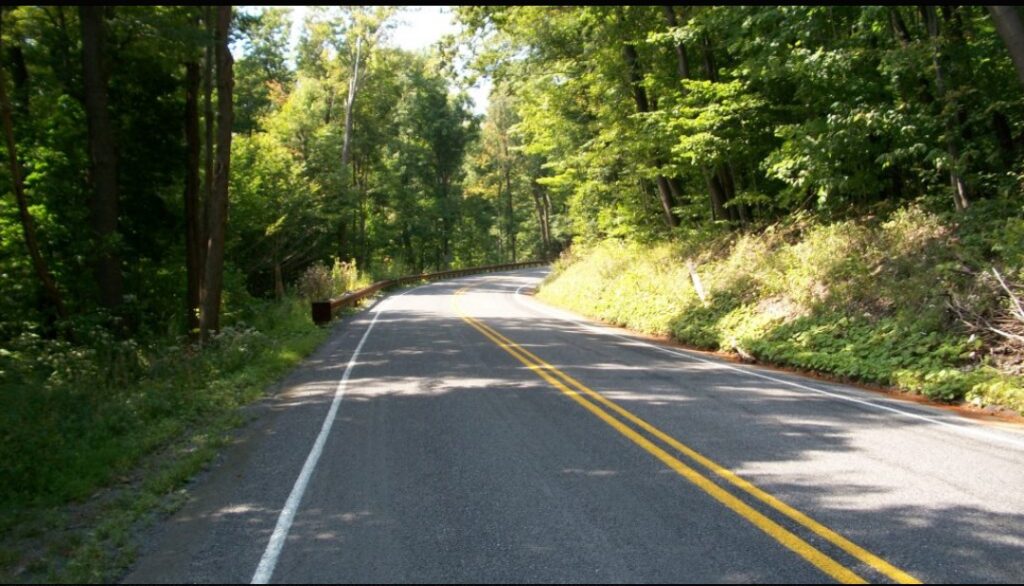
My ride took me up Pa. Rte 164 to the crossroads at Blue Knob. This was a seven-mile climb with long sections of 8% grade. It is a two-lane road with no shoulder but not heavily traveled either. And every single car gave me a wide berth when passing.
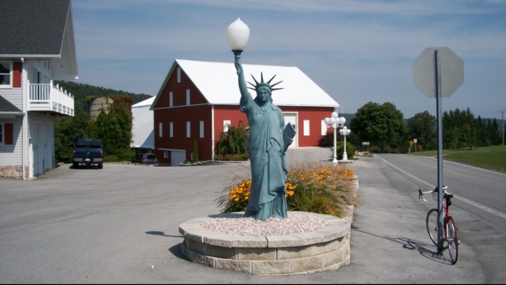
At the summit, I found a taste of New York. Their very own Statue of Liberty. Who knew?
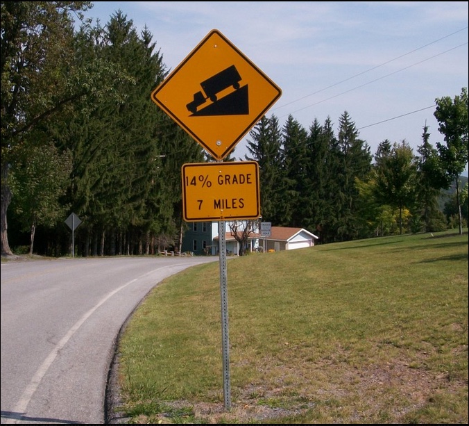
I spotted a sign — “14% grade (next) 7 miles.” It was heaven! Nowhere can I find an equivalent grade to Mount Washington — 7.6 miles at 12% average. But this held promise. At last, a training ground for Mount Washington.
I braced for my descent because 14% can be quite dangerous on a bike. But it wasn’t to be. By my calculation, there may have been a section that was 10% but it didn’t last long. And it soon flattened out. Who makes these road signs anyhow? It was just a tease.
Also by my calculation, and my gut feel on the bike, from Blue Knob to Puzzletown was 4.5 miles at a 5% grade.
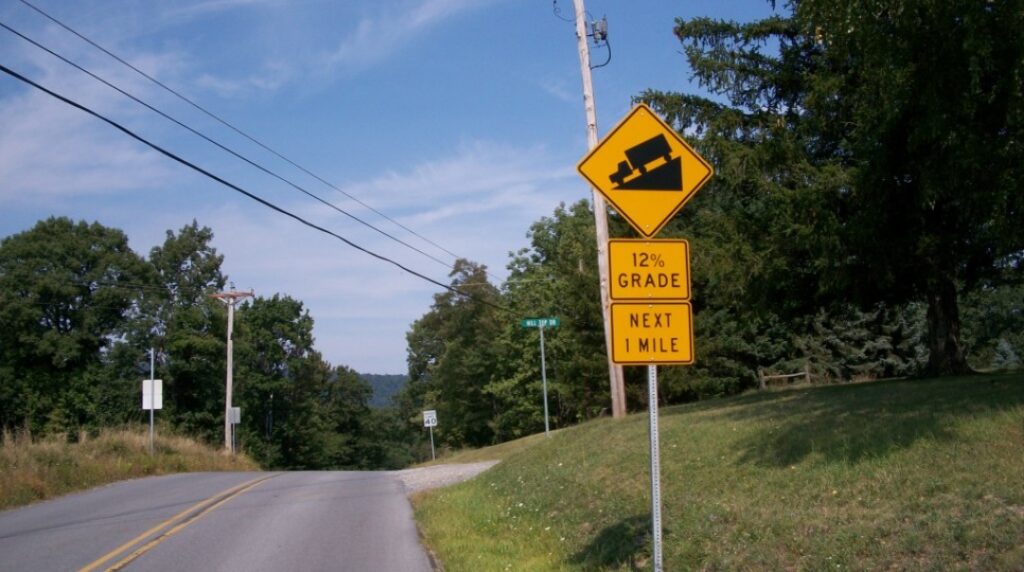
From Puzzletown (can anyone figure out what they do there?) I traveled Valley Forge Road and found a sign for a 12% downgrade was close to an actual 12% which led to a 12% climb. Or more. But only for a mile down and a mile back up.
Reaching Old U.S. 22 I had a 5½ mile climb to the summit. For much of the climb, there were two lanes upward, divided, which meant that cars could easily move to the left lane to avoid getting too close to me. I rode on the right side of the white line but for a long stretch, there was very little shoulder. Yet more often than not cars gave me no berth and two idiots honked their horns at me like there was somewhere I could go. Into the woods, perhaps.
For about 30 minutes my mind was playing games trying to analyze why most drivers on a two-lane road would give me wide berth and cross into the oncoming lane and these drivers wouldn’t move over to the empty lane that was going in the same direction. Old US 22 would be used mostly by locals — locals who may believe it was faster and should remain faster than getting on the new US 22. Locals who believe the road belongs just to them. I just don’t know. Maybe people are jerks. A revelation.
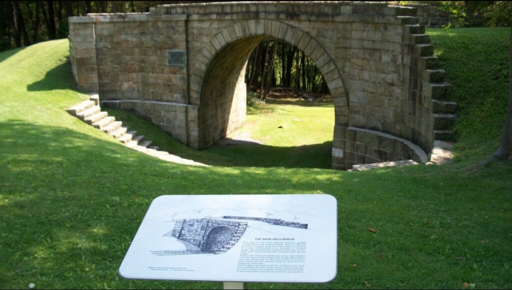
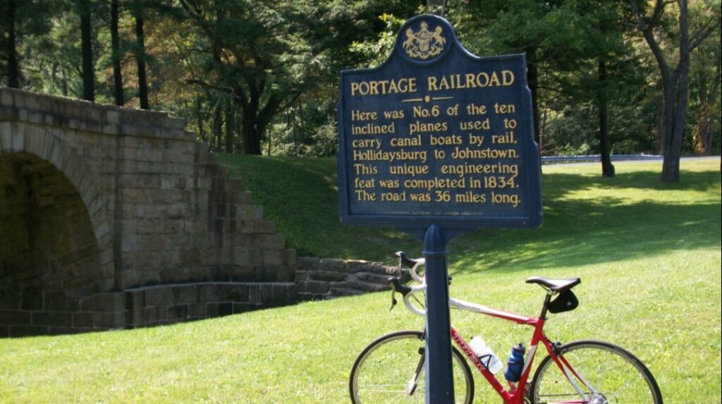
I never visited the Allegheny Portage Railroad Historic Site and always wanted to. And today I could. I am always intrigued by old-time engineering marvels and this was one of them.
Operating from 1834 to 1854 it was built to carry barges from Johnstown to Hollidaysburg which connected river traffic between the Ohio and Susquehanna Rivers. It consisted of 10 inclined planes (think of the Inclined Plane in Johnstown or the Duquesne or Monongahela inclines in Pittsburgh).
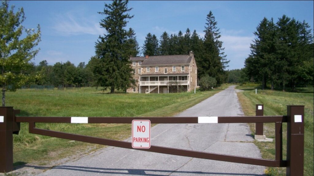
At the summit I was looking for a road over to Gallitzin but never found one. I saw a truck with U.S. Government Plates and stopped it and asked for directions to Tunnelhill. When I balked at the park ranger’s first suggestion, riding on U.S. 22, she told me to cut through the Allegheny Portage Railroad Park. Even though it was gated, she assured me that I could and I was surprised at the site and delighted in that it did take me to Tunnelhill Street.
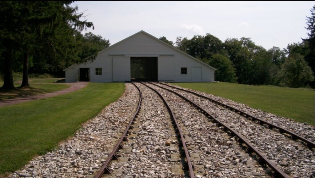
I was glad I did. I would have never seen the Lemon house, other than from the road, or the tracks of Incline Number 6.
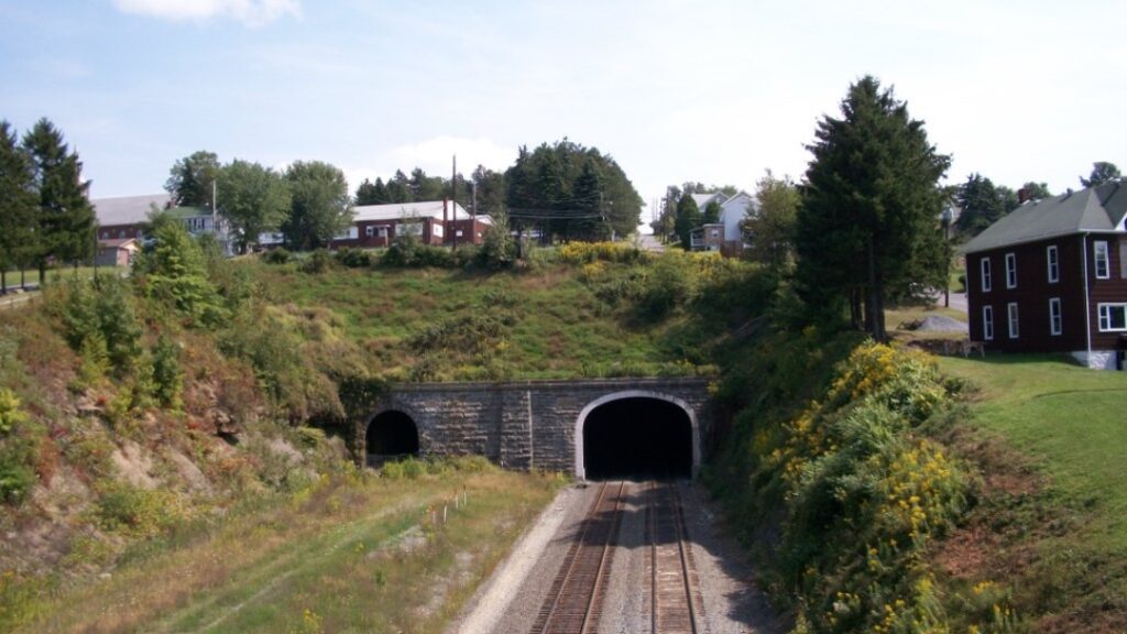
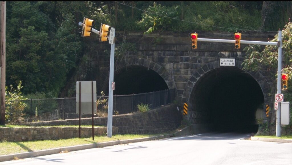
In Gallitzin, I met a local who encouraged me to go to the Gallitzin tunnels. He didn’t tell me the road to them was straight down. But it was. One can stand on a bridge and see the trains coming through the mountain. I wonder what’s it’s like to live above the tunnel?
The climb back up to Tunnelhill Street was a neat 14-16% grade. But at 27 miles, that would be the last real climbing of the day.
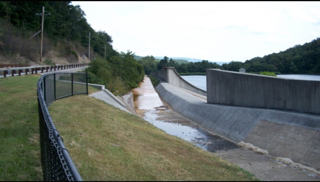
From Gallitzin, it was a straight shot down Horseshoe Curve Road (Glenwhite Road) past the famous landmark and three reservoirs.
I’m not complaining because every ride up Horseshoe Curve is a good ride but who the heck thought of a process called chip and tar? The descent down to Horseshoe Curve can be screaming, especially when coming down off The Wall but the upper portion of this road had recently been chipped. Or tarred. Maybe just chipped. Without tar.
There were no line markings. Descending was tricky because with the loose gravel, er, I mean “chips,” one could easily slide out. Once I got to the good pavement I could let it roll.
The rest of the ride was simple exploring as was all but the Gallitzin to Horseshoe Curve portion. I wrote down some simple directions and followed those but was unsure when I was in Hollidaysburg where I should travel to next. There was a service station with a store and I needed to replenish my water.
I walked into the convenience store and it reeked of cigarette smoke. All I could see was shelves of cigarettes and chewing tobacco. I turned to the sales clerk and asked “do you sell anything healthy in here?” I’m a jerk.
When she asked what I meant I simply asked for water. Outside was a visibly pregnant mother smoking, waiting with the dog while her husband bought more cigarettes. I wanted to scream at her “GIVE YOUR CHILD A CHANCE!” But would good would have it done? I am reminded that this is still Appalachia and a cyclist with shaved legs wearing Lycra is the stranger here.
I will miss riding in Altoona. Each of my trips involved meeting special people. On the first, I met John Griffin who lives in a house where I lived 50 years ago. He invited me in. On the second and third I met and rode with riders from Spokes and Skis — Joel, Richard, Bryan, and Stacey. Also there was Stephanie from Panera. And today I had a park employee let me cut through the park, a local send me to the tunnels, and two others point me in the right direction when I was unsure. Really unsure.
I’m afraid this is the end for a while. I have hit the wall.
Recent Comments